The primary purpose of Fort Williams may have been for coastal defense, yet many men, women, and children also called it home. This self-sustaining community featured many of the buildings and services typical of an American town of the time . . . — — Map (db m25389) HM
This building was constructed in 1914 by the Quartermaster Corps for use as the Artillery Engineer Storehouse of Fort Williams. The structure housed the tools, equipments, and supplies used by the artillery engineer in maintianing and repairing the . . . — — Map (db m186112) HM
This building was constructed in 1914 by the Quartermaster Corps for use as the Artillery Engineer Storehouse of Fort Williams. The structure housed the tools, equipments, and supplies used by the artillery engineer in maintianing and repairing the . . . — — Map (db m186113) HM
This building was completed in 1909 for use by unmarried officers of the Coast Artillery Corps stationed at Fort Williams. Visiting officers or married officers without their families might also reside in the quarters. The structure was built to . . . — — Map (db m186117) HM
THis building was completed in 1909 for use by unmarried officers of the Coast Artillery Corps stationed at Fort Williams. Visiting officers or married officers without their families might also reside in the quarters. The structure was built to . . . — — Map (db m186116) HM
At the outbreak of World War II in Europe, the US Army authorized four new gum batteries for Portland Harbor. Two were located on Peaks Island and one each on Jewell Island and here at Two Lights.
This battery was designated as Battery 201 (the . . . — — Map (db m259675) HM
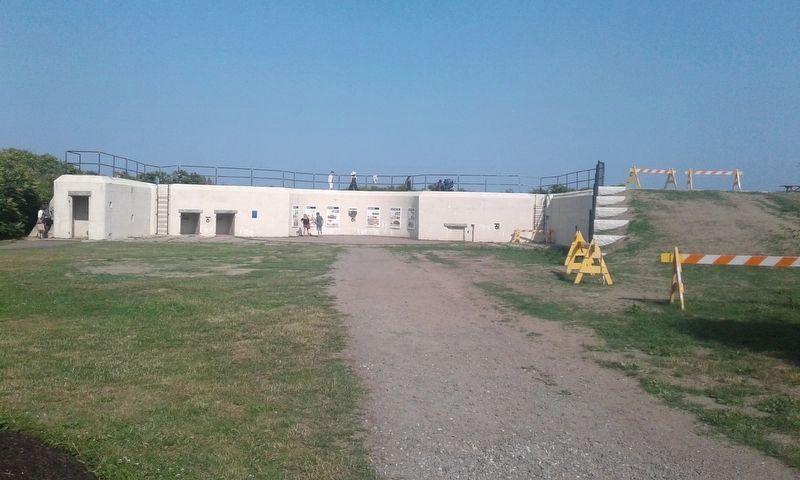
Battery Blair was completed in 1903. It was named for Francis P. Blair, Jr., a veteran of the Mexican and Civil Wars who rose to the rank of major general and later represented Missouri in the U.S. Senate. The battery consisted of two twelve-inch . . . — — Map (db m25378) HM
You are standing at the site of the
largest of six gun batteries built at
Fort Williams. Named for Francis P.
Blair, Jr., a veteran of the Mexican
and Civil wars, Battery Blair was
manned during World War I and the
early years of World War II. . . . — — Map (db m161815) HM
Battery Erasmus Keyes was completed In 1905 and named for Erasmus D. Keyes, a Maine resident and graduate of the U.S. Military Academy who rose to the rank of major general during the Civil War. The battery mounted two three-inch, rapid fire guns to . . . — — Map (db m161825) HM
Battery Hobart was built in 1898 and named for Lieutenant Henry A. Hobart, one
of the first Maine graduates of the U.S. Military Academy, who was killed in action
during the War of 1812. The battery mounted one British-built six-inch gun, . . . — — Map (db m161822) HM
One of Franklin Delano Roosevelt's New Deal programs, the Civilian Conservation Corps hired unemployed young men during the Great Depression. The CCC provided training to men between the ages of 18 and 25 for work on conservation projects including . . . — — Map (db m25390) HM
This building was completed in 1905 as the central powerhouse for Fort Williams by the Quartermaster Corps. The structure was built of reinforced concrete and sited in this sheltered spot to protect it from the fire of hostile vessels. Inside, . . . — — Map (db m186101) HM
This plaque was dedicated by Chapter 111 Alumni by former members of the Civilian Conservation Corps in memory of Franklin Delano Roosevelt and the members, who served at this post and other C.C.C. camps in Maine and throughout the United States . . . — — Map (db m50361) HM
In this bicentennial year, 1765-1965, of Cape Elizabeth, Maine, the town dedicates this plaque in honor of the United States Coast Guard on the 175th anniversary of its founding and the commissioning of the light by the President of the United . . . — — Map (db m161818) HM WM
After World War I, Fort Williams
was placed on caretaker status as a
coast artillery post, and became
home to the 5th Infantry Regiment
upon its return from occupation
duty in Germany in 1922. The 5th
remained at the fort until 1939,
longer . . . — — Map (db m161812) HM
This building was completed in 1911 under the direction of the Quartermaster Corps of the U.S. Army for use by a field officer (colonel, lieutenant colonel, or majro) of the Coast Artillery Corps and his family stationed at Fort Williams. It was . . . — — Map (db m186114) HM
This building was completed in 1911 under the direction of the Quartermaster Corps of the U.S. Army for use by a field officer (colonel, lieutenant colonel, or majro) of the Coast Artillery Corps and his family stationed at Fort Williams. It was . . . — — Map (db m186115) HM
This building was completed in 1911 by the U. S. Army Quartermaster Corps as a fire station for Fort Williams at a cost of $3,586. It was constructed of brick on a concrete foundation and the roof and tower, used for drying hoses, are slated. The . . . — — Map (db m205625) HM
This former military installation, begun in 1873 and known as The Battery at Portland Head, was a sub-post of Fort Preble until 1898 when it became a separate independent fort. It was designated Fort Williams in honor of Brevet Major General Seth . . . — — Map (db m23389) HM
From the 1750s, Portland Harbor was of economic importance as the closest American harbor to Europe and of strategic importance as a protected anchorage for the navy. As part of an upgrading of the harbor defenses in 1873, construction began on a . . . — — Map (db m25385) HM
This former military installation, begun in 1873 and known as The Battery at Portland Head, was a sub-post of Fort Preble until 1898 when it became a separate independent fort.
It was designated Fort Williams in honor of Brevet Major General . . . — — Map (db m247501) HM
The Goddard Manson was completed in 1858 for John Goddard (1811-1870) to an Italianate villa design prepared by Portland architect Charles Alexander, who planned other prominent buildings in the area. It was built of native stone and was one of the . . . — — Map (db m161828) HM
In the mid 1800’s, Cape Elizabeth became a haven for vacationers seeking warm sunshine, cool summer breezes, rocky coasts, fresh produce, and shore dinners. It was then (1853) that John Goddard purchased 25 acres which included the Grand Cape . . . — — Map (db m304105) HM
This building was completed in 1934 for the 240th Coast Artillery Regiment of the Maine National Guard by the Quartermaster Corps. The shed was used to house two of the regiment's four mobile 155mm guns and the large Holt crawler tractor used to . . . — — Map (db m186105) HM
This building was completed in 1934 for the 240th Coast Artillery Regiment of the Maine National Guard by the Quartermaster Corps. The shed was used to house two of the regiment's four mobile 155mm guns and the large Holt crawler tractor used to . . . — — Map (db m186106) HM
Henry Wadsworth Longfellow often
walked from Portland to visit this
Lighthouse. The Keepers were his
friends and it is believed he sat
here for inspiration for his poem
"The Lighthouse"
"Sail on; Sail on ye stately ships;
And with your . . . — — Map (db m161820) HM
John Goddard made his fortune in the lumber and timber trade in Orono, Maine. In 1853, Goddard purchased the Cape Cottage Horel and the surrounding 23 acres for $12,000 (about $500,000 in 2925 dollars). Originally opened in 1836, the Cape Cottage . . . — — Map (db m304236) HM
"Keepers of the Light"
1791 John K. Greenleaf •
1796 Dave Duncan •
1976 Barzillai Delano •
1820 Joshua Freeman •
1840 Richard Lee •
1849 John F. Watts •
1853 John W. Coolidge •
1854 James S. Williams •
1854 James Delano • . . . — — Map (db m186104) HM WM
[Header Information]
Population: 65,000
Surrounding Population: 250,000
Number of Languages Spoken in the Portland Public Schools: 40
Visitors Per Year: 3,750,000
Average Summer Temperature: 82°
Miles from Boston: 100
Amount of office . . . — — Map (db m50362) HM
Hannaford Bros. Co.: The supermarket chain was founded in 1883 to sell the vegetables and fruits grown on a farm in Cape Elizabeth.
Farming: Cape Elizabeth-grown cabbage was considered the best in the state, bringing . . . — — Map (db m50384) HM
The Militia Storehouse was built in 1915 by the Quartermaster Corps and was assigned to the Maine National Guard. The concrete building was used by the 240th Coast Artillery Regiment for storage of tents, bunks, and other equipment required during . . . — — Map (db m186107) HM
The Militia Storehouse was built in 1915 by the Quartermaster Corps and was assigned to the Maine National Guard. The concrete building was used by the 240th Coast Artillery Regiment for storage of tents, bunks, and other equipment required during . . . — — Map (db m186111) HM
This Mining Casemate was constructed in 1891, but it was rebuilt in 1903, enlarged in 1907, and modernized during World War II. The function of the casemate was to control the minefield in the main channel, which was laid during the Spanish-American . . . — — Map (db m186118) HM
The 240th Coast Artillery Regiment
of the Maine National Guard was
created to assist the 8th Coast
Artillery Regiment in time of war.
In 1930, a formal National Guard
camp was laid out at the fort with
mess halls and concrete slabs for
tents. . . . — — Map (db m161816) HM
After the World Wars and the decline of its relevant military capabilities, Fort Williams fell into disrepair before it was finally closed in 1962. The Town of Cape Elizabeth brought the 100-adre property for $200,000 in 1964. John Goddard’s ornate . . . — — Map (db m304346) HM
Since its commission by George Washington in 1790, Portland Head Light remains an enduring symbol of the rugged, solid characteristics of a magnificent coastline and proud people weathering the challenges of nature and time.
In observance of . . . — — Map (db m41841) HM
American
Society of
Civil
Engineers
1852
Portland Head Light
Portland Head Light was the first lighthouse completed and put into
service by the Federal Government under the Lighthouse Act of 1789
Completed 1791
Designated 2002 — — Map (db m161819) HM
Portland Head Light was the first lighthouse completed and put into service by the Federal government under the Lighthouse Act of 1789.
Completed 1791
Designated 2002 — — Map (db m259677) HM
In 1873, the U.S. Army began acquiring land (at $200 per acre) between the Portland Head Light and the Goddard Mansion to protect the vibrant trade and strategic harbor of Portland, Maine. The threat of war with Spain prompted the military to . . . — — Map (db m303905) HM
Officers Killed in Action
Lt. James G. Early (Commander) • Lt. John R. Laubach • Lt. Ambrose O. Vanderheiden • Ens. Seth E. Chapin • Ens. Roy F. Swan
Enlisted Crew Killed in Action
John J. Alexander F2c •
James O. Brown CGM • . . . — — Map (db m186103) WM
In memory of the officers and crewmen of the U.S. Navy's Eagle Class Sub-Chaser U.S.S. Eagle-56 (PE-56) torpedoed and sunk by the German U-boat U-853 approximately nine miles southeast of this location on Monday, 23 April 1945 with the loss of . . . — — Map (db m50332) WM
For close to a century this building housed Freeport’s public library. It was one of over l ,600 libraries built in the US with money donated by the industrialist and philanthropist, Andrew Carnegie. The Carnegie organization donated a total of . . . — — Map (db m204677) HM
Derosier's Market, the oldest continually run in Freeport, opened in 1904 as a grocery store. The same family has operated it ever since then. In 1890, Augustus Derosier, his wife Delia, and their first born son, Philip, emigrated from the Gaspe . . . — — Map (db m233300) HM
Before the reconstruction of Depot Street in 2008, this stone was one of many that
were used in a stone box culvert located about 15 feet under the road. The stone
culvert was built before the street became a public way in October, 1886, at . . . — — Map (db m285079) HM
Harrington House, the headquarters of the Freeport Historical Society, was built in 1830 by Freeport merchant Enoch Harrington for his bride, Eliza. It was once part of a 14-acre parcel that included extensive gardens and orchards across the . . . — — Map (db m204674) HM
In the 1880s, the shoe factory, quarry and
- stone works, grist mill, and other enterprises established by businessman E.B. Mallet created many job opportunities in Freeport. However the subsequent growth in the workforce led to a scarcity of . . . — — Map (db m285080) HM
Mast Landing is one of the four original villages in Freeport, including Porter’s
Landing, South Freeport, and the village center (or "Freeport Corner," as it was originally
known). The name refers to the area's use in the eighteenth century as . . . — — Map (db m285109) HM
The Desert of Maine was once a productive farm. The first patch of sand appeared about 100 years ago, and has continued to spread over the years, and now covers several hundred acres. — — Map (db m104986) HM
Dedicated to the past
present and future as
open space
Town founded 1786
Acquired 1973
Erected 1976
by concerned
private citizens and
Gorham civic groups
(nearby bench)
In memory of Harry Fancis who raised this flag for . . . — — Map (db m276150) HM
In memory of
Capt. John Phinney
First settler in Gorham, Maine
In memory of
Dana Estes
who gave the Town of Gorham
twenty-five hundred dollars
the income to be used at
centennial periods
as specified in his will . . . — — Map (db m186446) HM
(south side)
This town was incorporated by the name of Gorham, Oct. 30, 1764.
(west side)
Gorham is one of the seven townships granted by Gen. Court in the year 1732, to the Narragansett settlers. On a division of the . . . — — Map (db m258099) HM
Erected by descendants of
Rev. Soloman Lombard
1702 - 1781
First settled minister of Gorham
Pastor Congregational Church 1750-1764
Graduate of Harvard College 1723
Representative to the General Court
Delegate to the Provincial . . . — — Map (db m276151) HM
(Front/southeast face)
Capt. Almon L. Fogg, 17th Me. Regt. Mortally wounded at Gettysburg, Pa. July 3d, 1863, died July 4th, aged 24.
Capt. Oliver H. Lowell, 16th Me. Regt. Mortally wounded at Gettysburg, Pa. July 1, 1863, died July 2, . . . — — Map (db m267472) WM
Dedicated to the honor and sacrifice of our men and women who served our country from Gorham Maine in World War II • the Korean Conflict • and Vietnam
★ ★ ★
Let none forget
They gave their all
And faltered . . . — — Map (db m186447) WM
Plaque 1 National Historic Civil Engineering Landmark
Bailey Island Bridge
Harpswell, Maine
Presented 1984
Plaque 2
This 1150 ft. bridge is an exceptional
engineering solution to meet unusual
conditions and is the only one of . . . — — Map (db m108111) HM
Dedicated to the following named
men and women of Orr's Island
who served in the Armed Forces of our
country and in the Merchant Marine
during World War II, 1941 - 1945
U.S. Army
Baker, Kenneth E. · Bangs, George H. Jr. · Chase, . . . — — Map (db m258929) WM
"Those Who Serve Are They
Who Are Immortal"
This Memorial is Erected
in Honor of These Who Served
in the World War
Albert W. Black · Chester E. Doughty · Hartley L. Doughty · Avery M. Fides · Herman Green · Horace Green · Everett Huff · . . . — — Map (db m258927) WM
Harrison Honor Roll
1917 ✦ World War I ✦ 1918
Albert Brackett • Lawrence Briggs •
Howard Buck • Percy Buck •
Philip Chute • Windsor Chute • Bert Davis • George Davis • Clifford Denison •
Hobart Denison • Lawrence . . . — — Map (db m264025) WM
In appreciation of The Men of Naples who served in the World War 1917-1919 *Leon E. RichardsonEdward M. Barker • Hartley G. Batchelder • Frank R. Brooks • Urban L. Cannell • Guy Edes • Robert Edes • Alonzo L. Edwards • Charles F. Elliot • . . . — — Map (db m155166) WM
This lock, originally built of stone masonry in 1830, was a vital link in the 50 mile long waterway from Portland Harbor to Harrison at the head of Long Lake until the advent of the railroad in 1869. At one time 100 “canal boats” were . . . — — Map (db m59436) HM
Placed in honor of and with thanks to all Cliff Island veterans of the United States Armed Forces - past present and future. Thank you for protecting our freedoms and the way of life we enjoy. From a grateful community. — — Map (db m186396) WM
You have landed on one of the fourteen Main Coastal Island which have year-round communities with public schools. Once there were three hundred such communities.
Cliff Island lies at a Latitude of 43° 42' North and a Longitude of 70° 8' . . . — — Map (db m186394) HM
In memory of
Asa Clapp
A seaman of the American Revolution
Merchant, an upbuilder of Portland
1762 ✠ 1848
Asa William Henry Clapp
Citizen of Portland
A conservator of its interests
Member of
the Congress of . . . — — Map (db m185934) HM WM
First Parish Church, Unitarian Universalist 425 Congress Street. A memorial plaque inside First Parish honors Prentis Mellen. Pews within the church are marked for the abolitionist Fessenden and Thomas families.
In 1832 William Lloyd . . . — — Map (db m96519) HM
The hack stand of Reuben Ruby, corner of Temple and Federal Streets. Ruby (1798-1878) was Portland's foremost African American Anti-Slavery activist and underground railroad conductor.
In 1826, Ruby helped publish a protest in the newspaper . . . — — Map (db m96610) HM
A national and local landmark, The J.B. Brown Memorial Building, designed by Fassett and Stevens, was completed in 1883. Here, at #529, since 1884, stood Rines Bros. Company, until Oct. 21, 1977. Rines finally closed its doors ten days after the . . . — — Map (db m259670) HM
More than four thousand men were enrolled from Portland in the army and navy for the War of the Rebellion. More than three hundred were killed in battle or died in service. Honor and grateful remembrance to the dead, equal honor to those who, daring . . . — — Map (db m256609) WM
To perpetuate the memory of these men of the City of Portland who with unfaltering loyalty gave their lives in the 1914 World War 1919
67 Names are listed
They sought not glory but their country's good — — Map (db m96523) WM
Publisher Guy P. Gannett commissioned this building to serve as the headquarters for the media empire he founded in 1922.
For its time, it was a state-of-the-art production facility where reporters, photographers and editors put together . . . — — Map (db m185936) HM
Has been designated a Registered National Historic Landmark Under the provisions of the Historic Sites Act of August 21, 1935 This site possesses exceptional value in commemorating and illustrating the history of the United States U. S. . . . — — Map (db m25391) HM
The walkways that extend from this point are part of the original configuration of Lincoln Park as laid out in 1866. The park was once significantly larger than it is today, extending to what is now the far side of Franklin Arterial's grassy . . . — — Map (db m186148) HM
Third Sergeant Company H
Fifth Regiment
Maine Volunteer Infantry
Aged 19 Years
Killed First Battle Bull Run
July 21st 1861
Sergeant Stinson was the first
volunteer soldier from
Portland
to give his life for
the preservation of . . . — — Map (db m50433) WM
This memorial is dedicated to the survivors of the Armenian Genocide 1915 - 1923, who settled in Bayside by the early twentieth century over 250 Armenian families lived in Portland where they established businesses and a vibrant social . . . — — Map (db m256607) HM
Explore Baxter Trail, a 3.25 mile walking trail from here to Evergreen Cemetery. Discover how the many contributions of two wealthy visionaries, Mayor James Phinney Baxter and his son Governor Percival Proctor Baxter, continue to . . . — — Map (db m186460) HM
Cathedral of the
Immaculate Conception
Built 1869
has been placed on the
National Register
of Historic Places
by the United States
Department of the Interior
— — Map (db m186403) HM
Declared a National Historic Site January 1974
Here lie the hardy courageous early settlers, the men and women who founded and defended this area, who made history in civil life, government, law, the arts, education, religion, in the state and . . . — — Map (db m50432) HM
The Eastern Cemetery is the resting place of some of Portland's noted abolitionist, who campaigned against slavery, provided safe-houses and assisted runaways on their journey to freedom.
Charlotte Thomas 1822-1920 •
Sophia . . . — — Map (db m96267) HM
Landing spot for many passengers on the Underground Railroad and embarkation point for their transit to Canada and England.
Anti-slavery sympathizers were well-organized to greet stowaways from Southern cargo vessels, find them safe housing . . . — — Map (db m20614) HM
Hack stand of Charles H.L. Pierre, 29 Middle Street. Charles H.L. Pierre led the African American men, who rescued the stowaway aboard HMS Albion Cooper in the Fall of 1857.
In the mid-1800s, professional opportunities for freed Blacks were . . . — — Map (db m185939) HM
1214 entries matched your criteria. Entries 101 through 200 are listed above. ⊲ Previous 100 — Next 100 ⊳