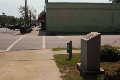
Erected to honor
Solomon Blatt Sr.
who was born in Blackville February 27, 1825
The son of Nathan and Mollie Blatt
A courageous gentleman and statesman who loves Blackville
and all its citizens.
No other Blackville citizen has been . . . — — Map (db m46977) HM
[Marker Front]:
Boiling Springs Academy was founded by the Boiling Springs Academical Society in 1823, with trustees Hansford Duncan, John Fowke, James Furse, William Gillette, Gideon Hagood, Frederick Hay, Lawrence Hext, James . . . — — Map (db m8666) HM
This church was organized by Rev.
James H. Thornwell on authority
from Charleston Presbytery; F.J.
and W.A. Hay were its first elders.
By 1846 Rev. Samuel H. Hay preached
on alternate Sundays here and at a
new church in Barnwell; this . . . — — Map (db m8715) HM
(Front text)
The grave of Tarlton Brown (1757 - 1845),
militia officer, state representative, and
state senator, is located here. Brown, a
native of Virginia, moved to S.C. at an
early age and settled in what was then
Orangeburg . . . — — Map (db m8791) HM
[Front text]
By tradition, Healing Springs got its name during the Revolutionary War. In 1781 after a bloody battle at nearby Windy Hill Creek, four wounded Tories sent inland from Charleston by General Banastre (the Butcher) Tarleton . . . — — Map (db m8798) HM
According to tradition the Indians reverenced
the water for its healing properties as a gift
from the great spirit.
They led the British wounded to their secret
waters during the American Revolution and
the wounded were healed.
This . . . — — Map (db m8799) HM
Deeded
To Almighty God
To Be Used By The Sick
And Afflicted
By
L.P. Lute Boylston
July 21, 1944
"The most precious piece of earth
I have ever owned" — — Map (db m8800) HM
God's Acre
By tradition, Healing Springs got its name during the Revolutionary War. In 1781 after a bloody battle at nearby Windy Hill Creek, four wounded Tories sent inland from Charleston by General Banastre "The Butcher" Tarleton were . . . — — Map (db m46928) HM
Hilda, in the "Sleytown"
section of Barnwell County,
was chartered in 1910. It
grew up around a depot
built here in 1903, soon
after the Atlantic Coast
Line R.R. extended its line
through the area in 1897.
H.C. Hutto was its first . . . — — Map (db m8501) HM
Originally Barnwell County was part of Granville County, later a part of Orangeburg District. Winton County was created by an act of the legislature on March 12, 1785. Justices William Robertson, John Parkinson, Thomas Knight, Richard Treadway, . . . — — Map (db m8749) HM
(Front text) This church, originally located 8/10 mi. W on the old Augusta-to-Charleston road, was founded in 1789 by twelve charter members, with Rev. Nathaniel Walker as its first pastor. Lower Three Runs was a mother church to at least . . . — — Map (db m27603) HM
This Greek revival house was built between 1833 and
1850 and features a wide gable- front form unusual
for the period. John Ashley and then Elijah Willis
owned this land before 1850: the house was likely
built by the Ashley family. Williston, . . . — — Map (db m19640) HM
Throughout the ages, good transportation has been vital in setting one area apart from another. Whether for communication, industrial growth, or simply visitation, the people well knew the necessity of quick and easy travel. What began as a mere . . . — — Map (db m9674) HM
The skirmish which took place here at Alexander's Old Fields, now Beckhamville, on June 6, 1780, was the first victory for S.C. Patriots after the fall of Charleston. A band of Whigs under the command of Captain John McClure attacked and routed . . . — — Map (db m13688) HM
In memory of
Burrel Hemphill
killed by
Union Soldiers
Feb. 1865
although a slave
he gave his life
rather than betray
a trust
He was a member of Hopewell — — Map (db m81337) HM
Divergent Presbyterian groups held services in this area as early as 1759. Rev. William Richardson, active in the area, is credited with unifying and naming them in 1770. The cemetery contains many graves of Revolutionary and Confederate . . . — — Map (db m13687) HM
Rev William Martin 1716-1806 •
Col. John Nixon 1780 Capt. John Steel 1750-1810 •
Capt. Hugh Knox 1755-1821 Capt. Benj. Land 1780 •
Robert Archer 1748-1818 John Corder •
William Anderson 1744-1780 John Lee 1760 •
John Bailey David McCalla . . . — — Map (db m245568) WM
Main Text
When people look for a home, one consideration is convenience to a grocery store. The bald eagles that nest here had something similar in mind: access to their favorite food - fish - in the Catawba River. When keen eyes on a handy . . . — — Map (db m95437) HM
Canal Trail (orange) This trail is an easy 1.25 miles one way, starting from either the Park Office parking or the south entrance parking area. Total round-trip time is about 2 hours. The trail follows Landsford Canal, which was built in the . . . — — Map (db m95432) HM
As a boat approached the canal traveling south on the Catawba River, the patroon, or river boat pilot, first saw the diversion dam. The dam consisted of piles of loose stone on the river bottom. The dam projected from the bank at roughly forty . . . — — Map (db m13722) HM
Landsford Canal is located along the banks of the Catawba River in the South Carolina Piedmont. Because this region sits atop a fall line, it features changes in elevation that produce shoals and rapids. In the 19th century, merchants bypassed . . . — — Map (db m95431) HM
In 1806
Aaron Burr, while passing
through Chester a prisoner,
dismounted on this rock and
appealed in vain to the
citizens for help. — — Map (db m14273) HM
Black Rock Baptist Church formally
organized by 1874 and was originally
part of the Gethsemane Baptist
Association. The church traces its
roots to the early ministry of its
first pastor, Leroy Featherstone
(c. 1836-1919), believed to . . . — — Map (db m278082) HM
The following jewelry stores have occupied the lower floor of this building; Brandts, Robinsons, Royals, & Runyans. The original clock tower has been removed. From 1820 to 1853, two courthouses (one wooden & one rock) stood in front. The town . . . — — Map (db m94952) HM
This institute grew out of an 1866 school for freedmen; it became Brainerd Institute in 1868 when the Board of Missions of the Presbyterian Church in New York appointed Rev. Samuel Loomis to help establish churches and schools among the blacks near . . . — — Map (db m14280) HM
[South Side]
C.S.A.
This monument guards the memory
of the men of Chester District
who obeying the call of their state
died for the Confederate cause.
U.D.C.
Time may crumble this marble into dust
but time can not dim their . . . — — Map (db m14269) WM
This courthouse, built in 1852, was designed by Edward Brickell White (1802-1888) of Charleston, whose work was greatly influenced by Robert Mills. Additions by Alfred D. Gilchrist of Rock Hill in 1896 and 1928 included three-story rear wings and a . . . — — Map (db m14276) HM
Chester County's fifth courthouse replaced three others in the city & the first courthouse was located (1785-1791) at John Walker's House in the Lewis Community.
In 1928, the 3-story rear wings were added, & in 1975 interior renovation[s] . . . — — Map (db m94944) HM
Chester County's World War I Veterans
Manuel Able •
Robert L. Atkinson •
Israel Boyd •
Edmund Brown •
Walter Campbell •
King Castle •
William F. Cauthen •
William Chapple •
John R. Cockerell •
Ernest Coleman •
Claud Craig • . . . — — Map (db m292468) WM
The chief hotel, was in operation as early as 1835 & stood on this site. Other hotels have been located here. Portions of this building date as early as 1854. — — Map (db m94951) HM
Proudly we pay tribute to the
members of our organization who
answered the call to the colors
in World War II
Jake S. Colvin, Jr.
T.W. Barrett, Horace R. Harris
Charles M. Bell, Robert R. Ritchie
John A. Crosby, Dewey O. Snead . . . — — Map (db m94954) WM
About Chester State Park
Chester State Park has been a local haven for retreat and recreation since it was built by the men of the Civilian Conservation Corps in the late 1930s during the Great Depression. Nestled in 523 secluded acres . . . — — Map (db m94827) HM
SC Militia under General Thomas Sumter
Justice of the Peace
Tax Inquirer & Collector
Member Committee of Elections
Member, 1st & 2nd Provincial Congresses
Member, General Assemblies — — Map (db m13767) HM
This War Between the States era cannon is one of four similar cannon discovered February 1986, on the grounds of Calvary Baptist Church, Chester, S.C. All four cannon were spiked with shells and each had the trunnions and cascabel knobs broken . . . — — Map (db m94942) HM
This War Between the States era cannon is one of four similar cannon discovered February 1986, on the grounds of Calvary Baptist Church, Chester, S.C. All four cannon were spiked with shells and each had the trunnions and cascabel knobs broken . . . — — Map (db m94946) HM
Finley High School opened
In 1923. It was originally
known as Chester Colored
High School and located
¼ mi. N on McClure St.
In 1927 the school was
renamed in honor of its
founding principal Samuel
Louis Finley who came to
Chester in 1905 . . . — — Map (db m278081) HM
Presbyterian church reportedly est. 1752. Present building, enclosed with brick in 1958, dates from 1785. Cemetery contains pioneer settlers and veterans of many wars. — — Map (db m121921) HM
Historic downtown Chester, established as the county seat in 1971, features the Confederate Monument, Cistern, Civil War Cannon, and Aaron Burr Rock landmarks. This area, listed on the National Register of Historic Places, still serves as a hub . . . — — Map (db m14267) HM
Old Zion Church formally organized by 1873. It was originally located 2 mi. E on Goings Rd. where it shared a cemetery with St. Paul Baptist Church. Around 1890, Old Zion moved to this site on land conveyed by Martha Wise to church trustees John . . . — — Map (db m292461) HM
[Front Side]
In Memory of
The Reverend John Simpson
1740-1808
Wife
Mary Remer
1743-1812
Minister
Educator
Soldier
Patriot
Married 1765- New Jersey
Graduated Princeton College with high honors 1768
Studied . . . — — Map (db m13799) HM
St. Paul Baptist Church at Halsellville. This congregation, originally known as St. Paul Colored Baptist Church, was formally organized by 1884 on nearby Goings Road. The church moved to this location in 1901. Members acquired the land for . . . — — Map (db m246066) HM
Dedicated
November 11, 1932
to the memory of
the boys who entered the
service of their country
from Chester County
and who gave their lives
in the World War
Robert L. Atkinson • Walter . . . — — Map (db m14279) WM
At several points along its path, the canal crossed natural streams flowing toward the river. To avoid damage to the fragile canal bed, the streams were channeled under the canals through culverts. This arch culvert consisted of a wing wall on the . . . — — Map (db m13740) HM
Not far from the Guardlock, the canal passed under a wooden bridge. Cut stone abutments on each bank supported the simple wooden truss structure. This was the first of four bridges that crossed the canal on it two mile path beside the river. The . . . — — Map (db m13739) HM
The most heavily traveled road in Colonial America passed through here, linking areas from the Great Lakes to Augusta, GA. Laid on ancient animal and Native American Trading/ Warrior Paths. Indian treaties among the Governors of NY, PA, & VA and the . . . — — Map (db m13719) HM
Two miles south, at Cedar Shoals on the south side of Fishing Creek, was the home of John Gaston, Esq., Justice of the Peace under both the Royal and State governments. Though advanced in years, he was the leading spirit in arousing resistance to . . . — — Map (db m13758) HM
[Front Side]
Located about 4 mi. E., this ford, an early Indian crossing, was probably named for Thomas Land who received a nearby land grant from the Crown in 1775. Used by Patriot and British armies during the American Revolution. Later . . . — — Map (db m13757) HM
A vital link in South Carolina's internal improvements program of the 1820's, the canal stands as a monument to the following men who typified the South Carolina spirit during this first great era of public works building: William R. Davie, . . . — — Map (db m13720) HM
Near its halfway point, the canal passed the mill complex built by William Richardson Davie around 1810. This mill sawed lumber and ground grain, both by use of water power. A waste weir at the entrance to the complex regulated the level of water in . . . — — Map (db m13744) HM
It is this upper section of the canal that has best survived periodic flooding in tact. The canal bed is not always straight but curves in several places to follow the contour of a natural hill. By cutting into the hill along a constant level and . . . — — Map (db m13745) HM
During the Nineteenth Century the rivers of South Carolina Piedmont were notorious for flooding. This lock was used to safely lower boats into the canal when high river levels threatened to damage the banks and structures. During periods of normal . . . — — Map (db m13723) HM
At this site on August 18, 1780 General Thomas Sumter camped with captured booty and 800 men. He was surprised and defeated by Lt. Col. Tarleton and 160 soldiers. The disaster followed only two days General Gate's defeat by Lord Cornwallis at . . . — — Map (db m13690) HM
Here in 1780-81
was the British post
Rocky Mount
Unsuccessfully
attacked by
Gen. Sumter
Aug. 1, 1780.
Col. Andrew Neel
and 7 privates killed. — — Map (db m228191) HM WM
An inspiring leader. A profound
teacher. Dynamic coach. Compassionate.
He strove simply and honestly to
prepare his students for the larger
battles and games of life.
Organized first football program 1925. Coached all boys sports. Won first . . . — — Map (db m253486) HM
On the east side of Broad River by an old Indian fish dam, General Thomas Sumter's camp was attacked before dawn on November 9, 1780 by the British 63rd Regiment and a detachment of the Legion, led by Major James Wemyss. The American campfires . . . — — Map (db m13685) HM
Front The state of Pennsylvania authorized the “Thirteen Original Colonies Bicentennial Covered Wagon Train” as an official Bicentennial project. It was one of five such trains that traveled across the country to reach Valley . . . — — Map (db m55707) HM
Engine No. 5 nicknamed The Dummy
built by H.K. Porter of Pittsburgh, PA.
0-4-OT type with Const No. 5980
in Nov. 1917 for Watertown arsenal in Mass.
Acquired by E&M Ry. in 1942 from dealer Birmingham Rail & Locomotive Co.
Edgemoor & . . . — — Map (db m253506) HM
Dedicated by resolution of the Commission in recognition of the work and service of Senator Wilbur G. Grant in making possible this Reservoir and water system, for the people of Chester County.
E.J. Fowler, Chairman; Robert H. King, Secretary; . . . — — Map (db m55723) HM
From its earliest history, Edgefield developed a reputation for violence. The bloody fighting of the Cherokee War of 1760 was followed by years of lawlessness and retribution during the Regulator period. period. During the American Revolution . . . — — Map (db m12534) HM
In the 18th century, Edgefield County had largely a subsistence economy in which the settlers consumed what they raised. Beginning around 1800, following the invention of the cotton gin, planters began to grow cotton, which became an extremely . . . — — Map (db m12587) HM
The son of General Andrew Pickens, he served as a Colonel in the War of 1812. During his term as Governor, there was considerable focus on building roads and canals in the state. His son, Francis W. Pickens, was also Governor of our State. — — Map (db m12877) HM
(Front text) Edgefield was founded in 1785 as the county seat and site of the new courthouse and jail for Edgefield County, created out of the old Ninety-Six District. Also called Edgefield Village or Edgefield Court House, it was described . . . — — Map (db m47517) HM
Present-day Edgefield County was first settled in the 1750's, then a portion of a vast unsettled region of virgin forests, abundant wildlife and Indian tribes. From the time of the first settlements through the period of the American Revolution, . . . — — Map (db m12583) HM
[Front]:
Dedicated
in grateful tribute
to the men and women
of Edgefield County
who served in the armed
forces of our country
during World War I-II
and Korean War in
preserving our freedom
and our way of life.
. . . — — Map (db m12631) WM
Erected by the Edgefield Daughters
of the American Revolution in memory
of the men from Edgefield County
who gave their lives in the War with
Germany; and to all who answered
their country's call in service and
sacrifice and still live . . . — — Map (db m12621) HM
Edgefield United Methodist Church
By 1841, this congregation was established and was a member of the Edgefield circuit. The present structure was dedicated in November of 1892 by Bishop W.W. Duncan. The Reverend Joseph Moore sold to the church . . . — — Map (db m12656) HM
First Baptist Church
Founded in 1823 as Edgefield Baptist Church, with Basil Manly, Sr., Pastor, Matthew Mims, Clerk, and Arthur Simkins, Moderator, this church led in the establishment here in 1826 of Furman Academy and Theological . . . — — Map (db m12671) HM
From 1858 to 1860 he was U.S. Minister to Russia. As Governor, his order to fire on a Union Ship in Charleston Harbor led to the start of the War Between the States. He lived at Edgewood, one of Edgefield's greatest homes. He is buried in . . . — — Map (db m12905) HM
McDuffie was a strong advocate for the right of states to nullify or void acts of Congress within their borders. He developed and promoted the Nullification Theory & also served in the U.S. House and U.S. Senate. — — Map (db m12878) HM
A tribute to the Governers
and Lieutenant Governors of South
Carolina who were
natives of or at one time
residents of Edgefield
District or County.
Governors
Andrew Pickens II (1816-18)
George McDuffie (1834-36)
Pierce Mason . . . — — Map (db m12645) HM
This Federal house with a later Classical Revival porch was the home of two governors of S.C. It was built ca. 1824 for planter Daniel Bird, who sold it in 1829 to Francis Wilkinson Pickens (1807-1869), then a lawyer and planter. Pickens lived here . . . — — Map (db m207416) HM
In 1856 Henry Christian, a young "unoffending mechanic," was shot and killed in the Planters' Hotel on this site by George Dionysius Tillman (1826-1901) over a game of faro, a type of card game popular during the 19th century. Tillman was a . . . — — Map (db m269496) HM
(Front)
Holly Hill sits on a tract of land originally granted to James Robeson in 1768 as part of England’s expansion into the S.C. backcountry. Robeson sold this property in 1778 to Sarah and Jenkin Harris, whose sons, Jenkin Jr., John and . . . — — Map (db m238606) HM
About 1810, Dr. Abner Landrum developed Edgefield's first major industry, a pottery factory at "Pottersville." The most famous potter in Edgefield's history was an African American slave named "Dave."
In the 1820's, Henry Schultz, a native of . . . — — Map (db m12592) HM
Prior to the fire of 1881, this was the site of the store and barroom of A.A. Clisby (1848-1916) where the infamous Booth-Toney Shootout of 1878 occurred. (See the that marker for further information.) The present building was built in 1891 by . . . — — Map (db m12494) HM
Native of Edgefield Born 1902
County Supt. of Education 1929-1933
State Senator 1933-1938
Circuit Judge 1938-1946
U.S. Army - World War II 1942-1946
Governor of South Carolina 1947-1951
United States Senate 1954-
Chairman - Senate . . . — — Map (db m12653) HM
[Front]:
J. Strom Thurmond, by mid-1997 the longest-serving U.S. Senator in history, was born here to J. William and Gertrude Strom Thurmond Dec. 5, 1902. educated at Clemson College, he taught high school 1923-29, was county . . . — — Map (db m12408) HM
In addition to serving in the U.S. Congress and Senate, Hammond was a very successful planter and agricultural entrepreneur. He coined the phrase "Cotton is King" while in the Senate. "Redcliffe", his plantation home at Beech Island, is now a state . . . — — Map (db m12897) HM
The longest serving and oldest Senator in American history, he began his public service as Edgefield County Superintendent of Education in 1929. A decorated soldier and circuit court judge, he was elected in the U.S. Senate as a write in candidate . . . — — Map (db m12933) HM
He served a Speaker of the South Carolina House and was elected Lieutenant Governor in 1882 and 1884. Sheppard was a leader of the Conservative movement of the 1890's in opposition to Tillman. He is buried in Willowbrook Cemetery in Edgefield. — — Map (db m12912) HM
The youngest Governor in South Carolina history, Evans served in the House and Senate before being elected Governor. He was a veteran of the Spanish-American War and is buried in Willowbrook Cemetery in Edgefield. — — Map (db m12923) HM
This is the site of W.E. Lynch & Company, a drug store form 1877 until 1969. The business was founded by William Edward Lynch (1851-1896), and continued by his wife, Kate Holstein Lynch (1854-1923), and son, W. Charlton Lynch (1882-1924) for nearly . . . — — Map (db m12441) HM
The M60A3 was designed in 1956 and entered service in 1960. The M60 is a big, tall tank with a rounded turret and heavy armor for its time. The A1 and A2 versions both fought in Vietnam. The A3 version has improved night sights, laser rather than . . . — — Map (db m80343) HM
This building is dedicated to Martha M. Rich for her long and faithful service to Edgefield County.
County Council Members
C. Monroe Kneece - Chairman
Samuel B. Speight - Vice Chairman
Betty Ann Butler
Norman Dorn
Hazel M. Kitchens . . . — — Map (db m12629) HM
This building was built in 1892 immediately following the fire of that year by W.T. Hoffman, a German merchant who operated a bakery and sold fancy groceries and heavy dry goods. At that time the building was just a single story building, much . . . — — Map (db m197206) HM
Bonham was a Colonel in the Palmetto Regiment in the Mexican War, a brigadier general during the War Between the States and served in the C.S.A. Congress prior to being elected Governor. He was the second consecutive Governor from Edgefield during . . . — — Map (db m12909) HM
Oakley Park was built in 1835 by a prosperous Edgefield planter, Daniel Bird. In 1841, Bird's son was tragically killed in a shoot-out in front of the Edgefield County Courthouse. Suffering great sorrow at his loss, Bird sold his home and left town . . . — — Map (db m12410) HM
Site of law offices of
Eldred Simkins
Congressman, Lt.-Governor
George McDuffie
Congressman, Governor,
U.S. Senator
Francis W. Pickens
Congressman, Governor,
Minister to Russia
Francis H. Wardlaw
Author of . . . — — Map (db m12657) HM
1/2 mile west, on "Ceder Fields" plantation, is buried the family of Captain Arthur Simkins, soldier in the American Revolution and a founder of Edgefield. Born in Virginia on Dec. 10, 1742, he died Sept. 29, 1826. He was a county court judge, a . . . — — Map (db m12333) HM
1490 entries matched your criteria. Entries 201 through 300 are listed above. ⊲ Previous 100 — Next 100 ⊳