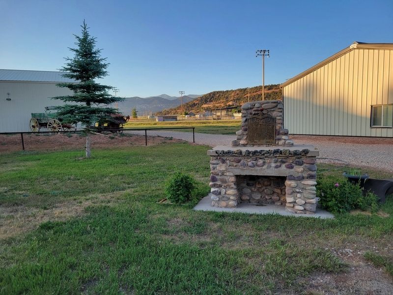
In 1865 a treaty was signed requiring the Indians to move to the Uintah reservation, which had been established by Brigham Young in 1851. Lt. Pardon Dodds, the first official Indian agent, built a log cabin and fort in 1867 on the upper Duchesne . . . — — Map (db m277142) HM
First called Lake Fork, this area was homesteaded 1905. Settlers platted sites for Mountain Home, Boneta and Talmage, hauled water from Lake Fork River, dug irrigation canal, built homes, threshed first crops of wheat with flail for seed and flour, . . . — — Map (db m277141) HM
Responding to a call from Brigham Young, Orange Seeley organized groups in Sanpete County to settle Castle Valley. Sheep and cattle men had been here earlier. In 1879 the first settlers located in Castle Dale building their first dugouts under a . . . — — Map (db m147917) HM
In 1884 Henry H. Oviatt, Sr. and Samuel N. Alger with their families homesteaded here. When others came, they built a 15 mile irrigation canal, surveying by spirit level and using hand tools. Cleveland Canal & Agricultural Co. organized 1889, to . . . — — Map (db m147925) HM
In 1908 the townsite of Elmo was laid out. Each summer a bowery was erected east of
this site where social events were held. In 1911 a group of men purchased the Cleveland
schoolhouse, dragged it with teams and logs to the bowery lot. It was . . . — — Map (db m147941) HM
Before 1890 Thomas E. Davis filed on land in this vicinity. Others followed, erected homes, a schoolhouse and meeting place. June 16, 1912, a branch of The Church of Jesus Christ of Latter-day Saints was organized, George H. Oviatt presiding elder. . . . — — Map (db m147940) HM
From 1885 to 1889, the pioneers who located on the Muddy three miles north east from the town of Emery, built in their poverty a tunnel 1200 feet long through blue slate rock to bring water to the town. Their only tools were pick and shovel and . . . — — Map (db m147840) HM
The first permanent settlers of Ferron arrived Dec. 6,1877. They were Swen Larsen and son Niels Christian Larsen, Nicholas Larsen and wife Helena, Peter F. Peterson and wife, Caroline. The first woman with a family of children, Ann Singleton . . . — — Map (db m147842) HM
In 1875 Leander Lemmon and James McHadden seeking a good range for their horses, found feed plentiful at the mouth of Huntington Canyon and vicinity. Mr. Lemmon brought sheep and cattle from Cottonwood, Salt Lake County. In the autumn of 1876,he . . . — — Map (db m240517) HM
January, 1879, Orange Seeley, Presiding Valley Bishop, appointed Elias Cox to preside over the
Latter Day Saints who had settled on Huntington Creek. In October a ward was organized. Logs were
hauled from the canyon and a meeting house erected by: . . . — — Map (db m147922) HM
The bell came from the old Relief Society Building . It was cracked by townspeople ringing it at the news of Armistice, 10 October 1918, and was given to the DUP by the Bishop. — — Map (db m155258) HM
This building, erected in 1909 at Bear Creek site was originally the first Ranger Station in Huntington Canyon. John P. Brockbank served as ranger from November, 1909, until November, 1917. Later it was used as summer headquarters by the forest . . . — — Map (db m147920) HM
On this site in December 1880, a primitive meeting house was built - a log building which served the community for church, school, dramatic and recreational purposes. Orangeville had been a part of Castle Dale, but in 1882 it was organized as a Ward . . . — — Map (db m147919) HM
In 1883 the men and boys of this community brought material from the mountains and built a hall on this spot of ground. They formed a company and rented the hall. The L.D.S. Church purchased the building when Jasper N. Robertson was first Bishop. It . . . — — Map (db m147918) HM
In 1866, a group of Mormon Cavalrymen noted this valley, while in pursuit of Indians during the Black Hawk War.
In February, 1875, a company of men came from Beaver, Utah and explored the valley. The first permanent settlers came from Beaver, . . . — — Map (db m74744) HM
In 1876-77 Escalante Pioneers erected a log building, 36 x 18 feet, located 20 feet west of this marker. The logs 18 inches in diameter came from Cyclone Lake Mountain by ox team. They were hewn by hand, fastened with oak pins, morticed ends and . . . — — Map (db m74745) HM
This structure, the second public building in Escalante, was erected in 1884 of native stone by Mormon pioneers under the direction of Bishop Andrew P. Schow, Edwin Twitchell and Thomas Heaps. The stone mason was Morgan Richards. It was used to . . . — — Map (db m74746) HM
The isolated trails between Boulder and Escalante, Utah, were important in the history of the two towns. The foot trail, used by Indians for centuries, connected the two areas and was known as the Death Hollow Trail. Mules, horses, or people . . . — — Map (db m74759) HM
In 1904 the Hatch L.D.S. Ward building was erected on this lot. A vestibule was added in 1910 and the bell was purchased with donations from ward members. For many years it hung in the tower and rang out for all civic, social and church activities. . . . — — Map (db m74679) HM
In 1872 Meltiar Hatch settled at the head of the Sevier River, near the junction of Mammoth and Asay Creeks. He engaged in stock raising and operated a water-power saw mill. Soon other settlers came. Land was surveyed and irrigation ditches dug. . . . — — Map (db m74677) HM
In March, 1864, about fifty pioneers under the leadership of Jens Nielson settled Panguitch. They built a fort of logs, enclosing their homes and a building used for church, school and recreation. The town was abandoned in 1867, because of Indian . . . — — Map (db m27020) HM
Panguitch stake of the L.D.S. Church was organized in 1877 with James Henrie as president. In March 1880, plans were made for a stake house with George Dodds, architect, and M.M. Steel, Sr., chairman of the building. The following men were prominent . . . — — Map (db m27040) HM
During the first settlement of Panguitch, between 1864 and 1867, members of The Church of Jesus Christ of Latter-day Saints paid tithes with produce and cattle, which were kept on this lot and disbursed as needed. Barns and corrals were constructed . . . — — Map (db m74680) HM
The Panguitch Social Hall was built during the years between 1890-1900. Fredrick Judd made the bricks and slacked the lime for the laying of the brick. The walls were three bricks thick, and the building had wide double-doors on either side of the . . . — — Map (db m74682) HM
Clifton (Loseeville) was situated in East Valley one mile east of the Pahreah River and four miles North of Cannonville. The first settlers were Ebenezer Bryce in 1876 and Daniel Goulding in 1878. They built a ditch to bring water to the valley . . . — — Map (db m74743) HM
One room of this building, formerly the L.D.S. Church, was erected in 1888. Two years later a second room was added. The bishop was Randolph Stewart; building committee: O.W. Warner, who donated the land, Henry Holyoak, and O.D. Allen; supervisors . . . — — Map (db m95092) HM
In April 1855, forty one men under the leadership of Alfred N. Billings were called to establish a mission in the Elk Mountains. They left Salt Lake City May 7, 1855, arrived at Grand River June 11, and selected the site for a settlement. By July . . . — — Map (db m95090) HM
A tabernacle was erected in 1885 on the adjoining corner of Main and Center Streets and was demolished in the spring of 1932. In 1872 Bishop Christopher J. Arthur suggested that this Tabernacle be built to replace the Social Hall.
Mayhew . . . — — Map (db m59540) HM
In 1866 Louis R. Chaffin, at the request of Apostle Erastus Snow, placed a gristmill in Cedar City. His son, Henry, ran it until 1868 when Louis returned from "The Muddy." Adjoining land was purchased in 1875. Excavation by Alva Matheson proved the . . . — — Map (db m59538) HM
Iron ore having been discovered at Iron Springs, Brigham Young called missionaries to Iron County to make iron. A militia of 35 men was organized in Parowan, Nov. 5, 1851, under Captain Henry Lunt. Part of the company left Nov. 10th in 11 wagons and . . . — — Map (db m59546) HM
In November 1851, thirty-five men from Parowan settled Cedar City. A unique temporary encampment, composed of their wagon boxes and sage brush walls, sheltered them through the first winter. In 1853, a fort 100 rods square was built on this site. . . . — — Map (db m59515) HM
In 1852 Peter Shirts located a ranch on Sidon Creek, later known as Shirts Creek. He offered John Hamilton half the water to come and settle there. Hamilton came with his family and Peter Fife. When Walker Indian War broke out they moved to Cedar . . . — — Map (db m59513) HM
This is the oldest log cabin in Southern Utah. It was built in 1851 in Parowan by George Wood, one of the founders of Iron County, who later moved it to the Old Fort in Cedar City and then to his lot on North Main Street. Through the years it was . . . — — Map (db m239742) HM
The Cedar City Pioneers had made their homes in the Old Fort and had built an adobe schoolhouse 28 feet by 60 feet when, in May 1855, President Brigham Young advised them to move to higher ground. By 1859, the majority of the people had moved to the . . . — — Map (db m59542) HM
Schoolhouse - The second schoolhouse in Enoch was a two-story structure built on this site in 1917-1918. It was a brick building containing two classrooms, two libraries, two bathrooms and a furnace room. Only one room served as a classroom, and . . . — — Map (db m59568) HM
During the summer of 1851, a small company of men was exploring this area and discovered the springs on the bench one-fourth mile to the east. Joel H. Johnson was so impressed with the spot, that he sought and received permission from George A. . . . — — Map (db m59571) HM
Tithing Lot - Pioneer William Robb Jr. built a rock house, consisting of two rooms with a cellar, diagonally across the street from this location. It was later sold to the Church of Jesus Christ of Latter-day Saints and became a Tithing Office . . . — — Map (db m59622) HM
This building, erected in 1866, served the community of Parowan for 52 years as a religious and cultural center. Later it was given by the L.D.S. Church to the Daughters of Utah Pioneers, who in 1939-40 restored the old edifice and in 1949-50 . . . — — Map (db m59614) HM
"I commenced a grammar school in my wickiup by the light of the fire and only one grammar book." Diary of George A. Smith, February 25, 1851.
The first school house, 18 x 24 feet, was built west of the Council House and dedicated December 25, . . . — — Map (db m59611) HM
The Parowan Dramatic Association was organized in 1851 with Edward Dalton president, Jessie V. Smith, Joseph, Jane and Annie Fish, David and Wm. Cluff, Wm. C. McGregor and Ed Ward, members. Plays were produced in Log Council House and Rock Church . . . — — Map (db m59615) HM
This church built of sandstone brought from Parowan Canyon, started in 1863 and completed about 1876, was the religious center of Parowan Valley. The large amusement hall in the basement was used for school and dances. A stage was erected in the . . . — — Map (db m59613) HM
At Parowan, a pioneer industrial center was settled in 1851. Water for manufacturing and industry was carried by wooden flume from the canyon to the fort. Along this water line industries were established known as the Public Works. Among these were . . . — — Map (db m59574) HM
The discovery of the outcrop of the Sunbeam Lode and the subsequent organization of the Tintic Mining District on December 13, 1869, was the beginning of a mining district which ultimately became world-famous. The name is in honor of the Ute . . . — — Map (db m75338) HM
Spring 1867, Church leader Erastus Snow helped select a new site for Chicken Creek Settlement, relocated due to unfavorable living conditions. Brigham Young named it Levan. Snow appointed Wm. Morgan and James Wilson as supervisors. Early in 1868, . . . — — Map (db m75457) HM
In July 1853, a trade of fish for flour between an Indian and Mrs. James Ivie, ended in a skirmish; one Indian died, Chief Walker refused peace offer of ponies, beef, flour and blankets unless Mr. Ivie stood trial by Indians; raids began. Colonel . . . — — Map (db m75456) HM
This monument is erected in memory of the pioneers buried here. There are about 20, whose resting place surrounds this monument.
The first grave was that of Nancy Maria Biglow Love, who died November 27, and was buried November 28, 1852.
. . . — — Map (db m75292) HM
Burraston Ponds was the campsite of the Escalante Expedition, 27 September 1776, from Santa Fe to the Utah Basin. Father Escalante mapped this area and named this spring "Ojo de San Pablo" or Eye of Saint Paul.
The great Indian chiefs before . . . — — Map (db m75277) HM
The first settlers arrived here in 1851. A one room building was erected and used for Church and School in 1852. Candice Smith and George Spencer and wife were teachers. In 1855 a schoolhouse was erected inside the fort and early teachers were: . . . — — Map (db m75271) HM
This building has two markersDaughters of Utah Pioneers Marker
Prisoners from Juab county were first held in the basement of the Social Hall that stood on the corner of Center Street and Second East in Nephi. The next jail . . . — — Map (db m75270) HM
This monument replaces one previously erected (that crumbled through weather conditions) by Langley A. Bailey, Sr., Jacob Bowers and Henry Knowles in memory of the following pioneers: Jens Jergensen and wife, Jens Terkelsen and Christian E. Kjerulf . . . — — Map (db m75247) HM
Completed in November 1854 by the Pioneers of Salt Creek (Nephi) for protection against Indians. The inclosure was 3 blocks square, from 1st West to 2nd East and from 1st North to 2nd South Streets. Markers have been placed at the corners. The . . . — — Map (db m75272) HM
In 1859, John Hoile established a flour gristmill at First South between First and Second East. The mill consisted of a small one-story frame building. On June 20, 1870, the mill was bought by John Hague who operated it until he died in 1900. The . . . — — Map (db m75269) HM
In 1864 John, Joseph and Robert Berry, their families and others settled in Berryville. The church called more families in 1865. The town was abandoned because of Indian depredations in 1886 when Robert, his wife, Isabell, and Joseph Berry were . . . — — Map (db m74644) HM
Built in the spring of 1882, the woolen factory was in operation until 1890. It was built under the direction of the United Order Board. Thomas Chamberlain, Bishop and President of the Board.
The machinery was run by waterpower. Yarn, batting and . . . — — Map (db m74675) HM
From 1877 to 1927, members of the Church of Jesus Christ of Latter-day Saints traveled this route to be united in eternal marriage in the St. George Utah Temple. Thus, the route was named the “Honeymoon Trail.”
Families came from . . . — — Map (db m95008) HM
From 1870 to 1876 Major Wesley Powell and assistant Almon H. Thompson of the U.S. Colorado River Explorations, established headquarters at Kanab. On this spot they erected a stone foundation and raised a tent which housed a telescope, by which means . . . — — Map (db m94948) HM
Settlement of Long Valley and Mt. Carmel
The first written account of the exploration of Long Valley was given by John D. Lee in 1852. Coming from Parowan, the explorers were under the direction of Bishop John R. Smith. James Lewis kept the . . . — — Map (db m40584) HM
In 1886-1887 after the United Order terminated, a public building was erected of native limestone and lumber from the canyon sawmill. It was used for school and church purposes. In 1938 a new schoolhouse was built and the Old Rock Building given to . . . — — Map (db m74642) HM
On December 17, 1901, the first church in Orderville was dedicated by Apostle A. O. Woodruff of the Church of Jesus Christ of Latter-day Saints. This bell hung in the tower and was used each Sunday to call people to church. It was also used to warn . . . — — Map (db m74643) HM
On March 20, 1874, the Church of Jesus Christ of Latter-day Saints organized a modern Order of Enoch, called the United Order, Israel Hoyt, first president. A community dining hall with bakery was constructed, also a garden house for seeds and . . . — — Map (db m274786) HM
In 1865 Peter Shirts made the first settlement in this area. Other pioneers followed but were forced to vacate because of Indian raids. The town was resettled upstream in 1870; church and school buildings were erected under the direction of William . . . — — Map (db m40379) HM
The Relief Society in Deseret was first organized in September of 1877. This group of women met in each other's homes until 1878, when they had a large, one-room adobe hall built. In 1894 the members of the Relief Society decided they should . . . — — Map (db m69541) HM
Father Escalante camped here October 2, 1776. His exploring party of ten men headed by Father Francisco Dominguez and map-maker Pacheco preached to the Indians and charted a northern route between Santa Fe, New Mexico and Monterey, California. They . . . — — Map (db m1439) HM
Erected as a defense against Pahvant Indians in the Black Hawk War, completed in 18 days by 98 men. Wm. S. Hawley and Isaac W. Pierce, foremen; John W. Radford, Supt. Opening celebration July 25, 1865. The fort was 550 feet square, bastions at . . . — — Map (db m69542) HM
In 1853, Captain John W. Gunnison was selected to lead an expedition to find a trans-continental railroad route. He followed the Old Spanish Trail through Salina Canyon, over the mountains to Pahvant Valley, and upon reaching Fillmore, visited . . . — — Map (db m69536) HM
This pioneer cabin was built in December 1907 by Henry J. McCullough and was the second house in the town of Melville. One month later January 18, 1908, the first Post Office was established and the name changed to Burtner. Adjoining this cabin, on . . . — — Map (db m69546) HM
This marks the Southwest corner of the Fort, built in October and November 1851 as protection from Indians, by first 17 families under direction of Anson Call, Jesse W. Fox, surveyor. About 2 city blocks in size, the front wall 8 to 10 feet high was . . . — — Map (db m69583) HM
These stones, quarried in Chalk Creek and hauled by oxen in 1854, were used in the foundation of the two-storied 30 x 40 adobe church building located in the Pioneer Fort one half block east of Main Street. Remodeled into one 30 x 60 hall with oval . . . — — Map (db m69580) HM
There are three markers on this kioskCenter Marker
The Ute Domain
First described by Spanish explorers as the YUTA Indians (pronounced Ute-ah), the ancestors of the Ute people are thought to have migrated from the . . . — — Map (db m75470) HM
Fillmore was settled in 1851. Before the close of the first year the Pioneers had erected a log school room inside the fort. It had split logs for seats, a dirt roof and floor. In 1854 an adobe church was built which also served as school. In 1867 . . . — — Map (db m69581) HM
Creating Fillmore City and Millard County the Territorial Legislature of Utah selected Pahvant Valley, as Capitol site October 29, 1851. This spot was selected by Governor Brigham Young. Construction work began in 1852. Truman O. Angell, architect . . . — — Map (db m1277) HM
In 1889 the first school was held in the Benjamin W. Scott home located a mile south of the Hinckley Park. It was often referred to as "The Old Mud Temple." In 1934 this monument was placed on the site of the building by the Boy Scouts and the . . . — — Map (db m69540) HM
Erected 1855-56, was 150 feet long north and south by 75 feet wide. Facing each other and standing 30 feet apart were two rows of adobe houses. The gateways were in the north and south walls.
Richard Johnson and William Stevens, Sr. and families . . . — — Map (db m69575) HM
This town was named after the Indian Chief C'nos. Born in 1821 in California, he was a stately, intelligent and loving ruler of the Indians of Pahvant Valley. He died in 1884. — — Map (db m75516) HM
The townsite of Kanosh selected by Brigham Young was surveyed in 1867. The first settlers were Noah Avery, William Penney and Baldwin Watts. Upon advice from Brigham Young, families from Petersburg, Corn Creek, added strength to the new settlement. . . . — — Map (db m75517) HM
The first settlers, James and Janet Duncan with four other families came in 1857, lived in dugouts on the ridge one mile west. In 1859 a culinary water problem caused them to move east where ten families began the settlement of Meadow, so named for . . . — — Map (db m75515) HM
Marker A:
Oak City
Oak City was named after Oak Creek, a sparkling mountain stream meandering through scrub oak and gray sagebrush. It provided water, the lifeblood of this community.
Founded in 1868 by pioneers who had formerly . . . — — Map (db m69573) HM
In 1860, thirteen Latter-day Saint families settled Round Valley. Brigham Young visited them in May, 1863, and advised, because of Indians, they move their settlement away from the mountain area. He accompanied the men to the center of the valley, . . . — — Map (db m75459) HM
In pioneer days the block on which this building stands was used for all community
out door gatherings. On the northwest corner the first school house in south Morgan was
built, when in 1866 the people taxed themselves to erect the building. In . . . — — Map (db m276654) HM
In 1867-68 a building used for church and school was erected. Morgan Stake, of the Church of Jesus Christ of Latter-day Saints, organized July 1877, in a bowery built for that purpose, Willard G. Smith, Stake President. In 1878 John K. Hall helped . . . — — Map (db m276657) HM
This log cabin is the birthplace of Charles R. Stevens, the first white boy born in Morgan County, Sept. 23, 1857. The cabin was moved from its original site in Peterson by the Morgan County Chapter of the Daughters of Utah Pioneers. It was . . . — — Map (db m276656) HM
Porterville was settled by the members of the Porter Family. Sanford Porter Jr., while on duty as a scout in the winter of 1857-58, rode into a canyon so rocky and difficult to travel that he named it Hardscrabble. Here he found a stream of water . . . — — Map (db m48980) HM
Circleville was settled in 1864 by a group of pioneers from Sanpete County. The
Church of Jesus Christ of Latter-day Saints organized a branch, William J. Allred,
Presiding Elder. Land was cultivated and homes erected. In 1865 the Black Hawk . . . — — Map (db m74778) HM
In 1864 several families of Latter-day Saints settled in this valley but were forced to evacuate because of Indian troubles. Here in 1868 miners discovered precious metal, and took possession of the area. April 15, 1883, a branch of the L.D.S. . . . — — Map (db m74781) HM
Meadowville, a small valley in the extreme northeast part of Utah's Rich County, is noted for its abundant wild hay, watered by melting snows. The
high altitude of this area makes it subject to deep snow and very cold winters.
In the early . . . — — Map (db m276586) HM
On March 14, 1870, the first pioneers arrived to establish a settlement in Bear River Valley. The townsite was surveyed in the summer of 1870 and named in honor of Randolph H. Stewart, the first Bishop. Heavy snows, early frosts and Indian troubles . . . — — Map (db m149615) HM
Bluffdale, named for its twenty-five square miles of bluffs and dales, extends from Herriman on the west to Riverton on the north, Draper on the east and the Utah County line on the south. Originally it was part of West Jordan, first settled in . . . — — Map (db m294524) HM
A short time after the pioneers arrived in the Salt Lake Valley in 1847, many began settling other areas of the Territory of Deseret. In 1858 Orrin Porter Rockwell bought sixteen acres of land near Crystal Hot Springs, south of Salt Lake City, which . . . — — Map (db m223829) HM
Big Cottonwood Lumber Co. organized in 1854 by Brigham Young, Daniel H. Wells and others, erected two waperpowered sawmills in Silver Fork. Log homes, stores and post office were built to accommodate families. Silver Springs Branch of L.D.S. . . . — — Map (db m275927) HM
In the 1860's miners, granite quarry freighters and stagecoach drivers used a halfway camping ground 333 yards to the So. West on Little Willow Creek. Others built homes, boarding houses, 2 stores, 3 saloons, slaughter yard, blacksmith shop, . . . — — Map (db m272810) HM
The north wall of the "Old Meeting House" stood near this monument. Here (1861-1869) Dr. John R. Park began his career as an educator in Utah. This school produced many of the state’s leaders and left an indelible love for education in Draper. . . . — — Map (db m224607) HM
This monument marks the site of Fort Herriman built in 1855 by Thomas Butterfield, Henry Herriman, Samuel Egbert, Robert Petty, and John Stocking, as protection against the Indians.
The Fort was abandoned in 1858, under instructions from . . . — — Map (db m35032) HM
This wooded area, named for the Cottonwood trees, was originally located between Big and Little Cottonwood Creeks, from 13th East to the foothills of the Wasatch Mountains. The
Big and Little Cottonwood Canyons were identified by a large Cottonwood . . . — — Map (db m254741) HM
In a deep hollow south of 3900 South, Uriah Nephi Smart built his tannery in 1880. This two story building was thirty feet wide and one hundred feet long. It was built of adobe bricks, which were made from clay taken from a bank north of the . . . — — Map (db m273350) HM
This mill was established on this site in 1878, by Rasmus Christian Knudsen, a millwright and master joiner from Alborg, Denmark. In 1864, he immigrated to Utah with his wife and two small children, walking across the plains, so that his family . . . — — Map (db m272805) HM
From 1881 to 1893 Garfield Beach was the most famous and finest recreation resort on the shores of Great Salt Lake, with its railroad station, lunch stand, restaurant, bath houses and pier leading to the dance pavilion, and with the pioneer . . . — — Map (db m254733) HM
Settlers came to this part of the valley around 1850 to farm and stock range. It was known as Pleasant Green and was part of the Brighton Ward of the Salt Lake Stake.
Traveling so far to meetings presented a problem, so members met in private . . . — — Map (db m35086) HM
In 1876 President Brigham Young called the women of the Relief Society to gather and store wheat to be used in times of need. Pleasant Green Relief Society was organized in 1879, Charlotte Hirst, President. June 24, 1885, a rock granary built on . . . — — Map (db m35076) HM
546 entries matched your criteria. Entries 201 through 300 are listed above. ⊲ Previous 100 — Next 100 ⊳