286 entries match your criteria. Entries 201 through 286 are listed.⊲ Previous 100
South Carolina Historical Markers
Administered by the South Carolina State Historic Preservation Office (SHPO), South Carolina’s official state historical marker program was established in 1936 and is one of the oldest programs of its type in the country. Since the program’s creation, more than 2,000 historical markers have been approved.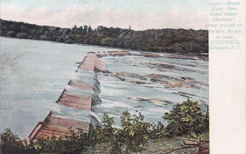
circa 1915
Broad River...
201 ► South Carolina, Richland County, Columbia, Midtown - Downtown — 40-50 W-8 — Broad River —  |
| On River Drive, on the right when traveling east. | |||
| 202 ► South Carolina, Richland County, Columbia, Midtown - Downtown — 40-195 — Canal Dime Savings Bank / Bouie v. City of Columbia (1964) — |
| On Main Street south of Taylor Street, on the left when traveling south. | |||
| 203 ► South Carolina, Richland County, Columbia, Midtown - Downtown — 40-140 — Carver Theatre — |
| On Harden Street, on the right when traveling south. | |||
| 204 ► South Carolina, Richland County, Columbia, Midtown - Downtown — 40-88 — Church of the Good Shepard — |
| On Blanding Street, on the right when traveling east. | |||
| 205 ► South Carolina, Richland County, Columbia, Midtown - Downtown — 40-67 — College Street — |
| On Main Street. at College Street, on the right when traveling north on Main Street.. | |||
| 206 ► South Carolina, Richland County, Columbia, Midtown - Downtown — 40-139 — Columbia Bible College, 1937-1960 / Westervelt Home, 1930 - 1937 — |
| On Blanding Street, on the right when traveling east. | |||
| 207 ► South Carolina, Richland County, Columbia, Midtown - Downtown — 40-37 S-6 — Columbia Canal — |
| On Gervais Street (U.S. 1) near Gist Street, on the left when traveling east. | |||
| 208 ► South Carolina, Richland County, Columbia, Midtown - Downtown — 40-196 — Columbia Civil Rights Sit-Ins / Barr v. City of Columbia (1964) — |
| On Taylor Street. | |||
| 209 ► South Carolina, Richland County, Columbia, Midtown - Downtown — 40-38 — Congaree River Bridges — |
| On Gervais Street (U.S. 1/378), on the right when traveling west. | |||
| 210 ► South Carolina, Richland County, Columbia, Midtown - Downtown — 40-53 — Court House Square — |
| On Washington Street near Main Street, on the right when traveling east. | |||
| 211 ► South Carolina, Richland County, Columbia, Midtown - Downtown — DuPre Building — 807 Gervais Street — West Gervais Street Historic District — |
| On West Gervais Street (U.S. 1/378) east of Gadsden Street, on the right when traveling west. | |||
| 212 ► South Carolina, Richland County, Columbia, Midtown - Downtown — 40-6 — Former Site of Columbia Theological Seminary — |
| On Blanding Street, on the right when traveling east. | |||
| 213 ► South Carolina, Richland County, Columbia, Midtown - Downtown — 40-41 — Friday’s Ferry |
| On Bluff Road (State Highway 48) at Rosewood Drive on Bluff Road. Reported missing. | |||
| 214 ► South Carolina, Richland County, Columbia, Midtown - Downtown — 40-99 — Gladden Home Site — |
| On Wheat Street, on the right when traveling east. | |||
| 215 ► South Carolina, Richland County, Columbia, Midtown - Downtown — 40-7 — Hampton-Preston House — |
| On Blanding Street. | |||
| 216 ► South Carolina, Richland County, Columbia, Midtown - Downtown — 40-111 — Howard School Site — |
| On Laurel Street near Williams Street, on the left when traveling west. | |||
| 217 ► South Carolina, Richland County, Columbia, Midtown - Downtown — 40-64 — Huger Street — |
| On Gervais Street (U.S. 1/378) at Huger Street (U.S. 321), on the right when traveling east on Gervais Street. | |||
| 218 ► South Carolina, Richland County, Columbia, Midtown - Downtown — 40-130 — Jefferson Hotel — |
| On Main Street, on the right when traveling south. | |||
| 219 ► South Carolina, Richland County, Columbia, Midtown - Downtown — 40-79 — Lady Street — |
| On Main Street at Lady Street on Main Street. | |||
| 220 ► South Carolina, Richland County, Columbia, Midtown - Downtown — Lever Building — |
| On Main Street north of Taylor Street, on the left when traveling north. | |||
| 221 ► South Carolina, Richland County, Columbia, Midtown - Downtown — 40-76 — Lincoln Street — |
| On Gervais Street (U.S. 1/378) at Lincoln Street, on the right when traveling east on Gervais Street. | |||
| 222 ► South Carolina, Richland County, Columbia, Midtown - Downtown — 40-218 — Mainigault's Funeral Home / Congaree Casket Company — |
| On Main Street south of Greene Street, on the right when traveling north. | |||
| 223 ► South Carolina, Richland County, Columbia, Midtown - Downtown — 40-126 — Mann-Simons Cottage |
| On Richland Street near Marion Street, on the left when traveling east. Reported permanently removed. | |||
| 224 ► South Carolina, Richland County, Columbia, Midtown - Downtown — 40-126 — Mann-Simons Site — |
| On Richland Street. | |||
| 225 ► South Carolina, Richland County, Columbia, Midtown - Downtown — 40-155 — Matilda A. Evans House — |
| On Taylor Street (State Highway 12) west of Harden Street, on the right when traveling west. | |||
| 226 ► South Carolina, Richland County, Columbia, Midtown - Downtown — 40-5 — Original Site of Winthrop College — |
| On Henderson Street, on the right when traveling south. | |||
| 227 ► South Carolina, Richland County, Columbia, Midtown - Downtown — 40-133 — Randolph Cemetery — |
| On Frontage Road, on the right when traveling west. | |||
| 228 ► South Carolina, Richland County, Columbia, Midtown - Downtown — 40-74 — Richland Street — |
| On Main Street at Richland Street, on the right when traveling north on Main Street. | |||
| 229 ► South Carolina, Richland County, Columbia, Midtown - Downtown — 40-115 — Seibels House — |
| On Richland Street, on the right when traveling west. | |||
| 230 ► South Carolina, Richland County, Columbia, Midtown - Downtown — 40~159 — Sidney Park C.M.E. Church — |
| On Blanding Street, on the left when traveling west. | |||
| 231 ► South Carolina, Richland County, Columbia, Midtown - Downtown — 40-8 — Site of Columbia Male Academy — |
| On Pickens Street near Laurel Street, on the left when traveling south. | |||
| 232 ► South Carolina, Richland County, Columbia, Midtown - Downtown — 40-2 — Site of Parade Ground — |
| On Greene Street, on the right when traveling east. | |||
| 233 ► South Carolina, Richland County, Columbia, Midtown - Downtown — 40-225 — Southeastern Freight Lines / Columbia Truck Terminal — |
| On Gervais Street (U.S. 1/378) west of Pulaski Street, on the right when traveling east. | |||
| 234 ► South Carolina, Richland County, Columbia, Midtown - Downtown — 40-83 — Sumter Street — |
| On Gervais Street (U.S. 1/378) at Sumter Street, on the right when traveling east on Gervais Street. | |||
| 235 ► South Carolina, Richland County, Columbia, Midtown - Downtown — 40-81 — Taylor Street — |
| On Main Street at Taylor Street (South Carolina Highway 12), on the right when traveling north on Main Street. | |||
| 236 ► South Carolina, Richland County, Columbia, Midtown - Downtown — The Palmetto Building — 1400 Main Street — |
| On Main Street near Washington Street, on the right when traveling north. | |||
| 237 ► South Carolina, Richland County, Columbia, Midtown - Downtown — 40-51 — Thomas Taylor / Taylor Cemetery — |
| On Richland Street near Barnwell Street, on the right when traveling west. | |||
| 238 ► South Carolina, Richland County, Columbia, Midtown - Downtown — 40-1 — Trinity Episcopal Church — |
| On Sumter Street, on the left when traveling south. | |||
| 239 ► South Carolina, Richland County, Columbia, Midtown - Downtown — 40-222 — U.S.C. During Reconstruction — |
| On Sumter Street south of College Street, on the right when traveling north. | |||
| 240 ► South Carolina, Richland County, Columbia, Midtown - Downtown — 40-27 — University of South Carolina — |
| On Sumter Street near College Street, on the right when traveling north. | |||
| 241 ► South Carolina, Richland County, Columbia, Midtown - Downtown — 40-71 — Washington Street — |
| On Main Street at Washington Street, on the right when traveling north on Main Street. | |||
| 242 ► South Carolina, Richland County, Columbia, Midtown - Downtown — 40-62 — Williams Street / Gist Street — |
| On Gervais Street (U.S. 1) near Williams Street, on the right when traveling east. | |||
| 243 ► South Carolina, Richland County, Columbia, Olympia-Granby — 40-199 — Olympia Cemetery — |
| On Granby Lane, on the right when traveling south. | |||
| 244 ► South Carolina, Richland County, Columbia, Rosewood — 40-173 — Curtiss-Wright Hangar — |
| On Jim Hamilton Blvd near Airport Blvd, on the right when traveling east. | |||
| 245 ► South Carolina, Richland County, Columbia, Shandon — 40-192 — Tree of Life Synagogue — |
| On Woodrow Street at Heyward Street, on the right when traveling north on Woodrow Street. | |||
| 246 ► South Carolina, Richland County, Columbia, University Hill — 40-217 — Woman's Club of Columbia — |
| On Blossom Street (U.S. 21/76) at Henderson Street, on the right when traveling west on Blossom Street. | |||
| 247 ► South Carolina, Richland County, Columbia, Waverly — 40-152 — Allen University — |
| On Harden Street, on the right when traveling north. | |||
| 248 ► South Carolina, Richland County, Columbia, Waverly — 40 211 — Cyril O. Spann Medical Office — |
| On Hampton Street west of Oak Street, on the left when traveling west. | |||
| 249 ► South Carolina, Richland County, Columbia, Waverly — 40-190 — First Calvary Baptist Church — |
| On Pine Street at Washington Street, on the left when traveling south on Pine Street. | |||
| 250 ► South Carolina, Richland County, Columbia, Waverly — 40-205 — Gonzales Gardens — |
| On Forest Drive (Route 12) at Lyon Street, on the right when traveling east on Forest Drive. | |||
| 251 ► South Carolina, Richland County, Columbia, Waverly — 40-154 — Good Samaritan-Waverly Hospital — |
| On Hampton Street 0.1 miles east of Harden Street, on the right when traveling east. | |||
| 252 ► South Carolina, Richland County, Columbia, Waverly — 40-143 — Heidt-Russell House / Edwin R. Russell — |
| On Heidt Street at Lady Street, on the right when traveling north on Heidt Street. | |||
| 253 ► South Carolina, Richland County, Columbia, Waverly — 40-142 — James M. Hinton House — |
| On Heidt Street at Lady Street, on the right when traveling north on Heidt Street. | |||
| 254 ► South Carolina, Richland County, Columbia, Waverly — 40-141 — Matthew J. Perry House — |
| On Washington Street, on the right when traveling east. | |||
| 255 ► South Carolina, Richland County, Columbia, Waverly — 40-134 — Visanska-Starks House — |
| On Hampton Street, on the right when traveling east. | |||
| 256 ► South Carolina, Richland County, Hopkins — 40-168 — Harriet Barber House — |
| On Lower Richland Blvd. near Barberville Loop Road, on the right when traveling north. | |||
| 257 ► South Carolina, Richland County, Hopkins — 40-169 — Hopkins — |
| On Lower Richland Blvd. at Hopkins Road-Back Swamp Road, on the right when traveling north on Lower Richland Blvd.. | |||
| 258 ► South Carolina, Richland County, Killian, Blythewood — 40- 136 — Killian School — |
| On Clemson Road, on the right when traveling east. | |||
| 259 ► South Carolina, Richland County, Killian, Blythewood — 40-127 — Skirmish at Killian's Mill |
| On Farrow Road (State Highway 555) near Killian Road, on the right when traveling south. Reported permanently removed. | |||
| 260 ► South Carolina, Richland County, Minervaville — 40-167 — Minervaville — |
| On Minervaville Road (State Highway 40-1159) at Cabin Creek Road (State Highway 40-66), on the right when traveling south on Minervaville Road. | |||
| 261 ► South Carolina, Union County, Union — 44-15 — Fair Forest Plantation / Emslie Nicholson House — |
| On Cross Keys Highway (State Highway 49) 0.5 miles west of Riley Road, on the right when traveling west. | |||
| 262 ► South Carolina, Union County, Union — 44-2 — Rose Hill Mansion — |
| On Sardis Road, on the right when traveling north. | |||
| 263 ► South Carolina, York County, Brattonsville — 46-48 — Bethesda Presbyterian Church — |
| On McConnells Hwy. (State Highway 322), on the right when traveling north. | |||
| 264 ► South Carolina, York County, Clover, Bethel — 46-53 — Bethel Presbyterian Church — |
| On State Highway 557 at Bethel Church Road, on the right when traveling east on State Highway 557. | |||
| 265 ► South Carolina, York County, McConnells — 46-81 — Mt. Zion School — |
| On McConnells Highway (South Carolina Route 322) south of Brattonsville Road ( Route 165), on the right when traveling north. | |||
| 266 ► South Carolina, York County, McConnells — 46-61 — William Bratton Plantation / Battle of Huck's Defeat — |
| On Brattonsville Road (State Highway 165) 0.1 miles north of Percival Road (State Highway S-46-38), on the right when traveling north. | |||
| 267 ► South Carolina, York County, Rock Hill — 46-36 — Andrew Jackson Hotel / Vernon Grant — |
| On East Main Street (State Highway 1) near North Oakland Avenue (U.S. 21), on the right when traveling east. | |||
| 268 ► South Carolina, York County, Rock Hill — 46-69 — Carroll Rosenwald School — |
| On Mobley Store Road (Route 101) at Williamson Road ( Road 46-560), on the left when traveling west on Mobley Store Road. | |||
| 269 ► South Carolina, York County, Rock Hill — 46-34 — Clinton Junior College — |
| On Crawford Road at Heckle Boulevard ( Highway 901), on the left when traveling south on Crawford Road. | |||
| 270 ► South Carolina, York County, Rock Hill — 46-7 — Columbia Seminary Chapel — |
| On Oakland Avenue (U.S. 21). | |||
| 271 ► South Carolina, York County, Rock Hill — 46-79 — Durkee Training Institute / Chisolm Training Institute — |
| On Saluda Street (South Carolina Route 72/901) south of Tigler Court, on the right when traveling south. | |||
| 272 ► South Carolina, York County, Rock Hill — 46-27 — Emmett Scott School — |
| On Crawford Road 0.1 miles south of Tim Street, on the left when traveling south. | |||
| 273 ► South Carolina, York County, Rock Hill — 46-26 — First Associate Reformed Presbyterian Church / Dr. Arthur Small Rogers — / (1869 - 1964) — |
| On South Oakland Avenue at East White Street ( Highway 245), on the right when traveling north on South Oakland Avenue. | |||
| 274 ► South Carolina, York County, Rock Hill — 46-50 — Hermon Presbyterian Church — |
| On South Dave Lyle Boulevard south of West Moore Street, on the right when traveling south. | |||
| 275 ► South Carolina, York County, Rock Hill — 46-80 — Jewish Merchants of Rock Hill / A. Friedheim & Bro. — |
| On East Main Street east of Dave Lyle Boulevard ( Route 122), on the left when traveling east. | |||
| 276 ► South Carolina, York County, Rock Hill — 46-55 — Laurelwood Cemetery — |
| On West Main Street east of Black Street, on the left when traveling east. | |||
| 277 ► South Carolina, York County, Rock Hill — 46-59 — Mount Prospect Baptist Church — |
| On West Black Street at Allen Street, on the right when traveling south on West Black Street. | |||
| 278 ► South Carolina, York County, Rock Hill — 46-54 — Oakland Avenue Presbyterian Church — |
| On Oakland Avenue south of Aiken Avenue, on the right when traveling south. | |||
| 279 ► South Carolina, York County, Rock Hill — 46-85 — Rock Hill Academy — |
| On Pendleton Street west of North Confederate Avenue, on the right when traveling west. | |||
| 280 ► South Carolina, York County, Rock Hill — 46-23 — Rock Hill Buggy Company / Anderson Motor Company |
| On North Wilson Street at West White Street, on the right when traveling south on North Wilson Street. Reported permanently removed. | |||
| 281 ► South Carolina, York County, Rock Hill — 46-38 — Rock Hill Cotton Factory — |
| On W. White Street at Chatham Avenue, on the right when traveling north on W. White Street. | |||
| 282 ► South Carolina, York County, Rock Hill — 46-46 — Rock Hill Depots / Rock Hill Street Railway |
| On E White Street at Dave Lyle Boulevard ( Highway 122) on E White Street. Reported permanently removed. | |||
| 283 ► South Carolina, York County, Rock Hill — 46-41 — Rock Hill High School — |
| On North Spruce Street at Gladstone Court, on the left when traveling south on North Spruce Street. | |||
| 284 ► South Carolina, York County, Rock Hill — 46-86 — St. Mary Catholic Church — |
| On Crawford Road west of Carroll Street, on the right when traveling east. | |||
| 285 ► South Carolina, York County, Rock Hill — 46-10 — White Home — |
| On Elizabeth Lane at East White Street, on the left when traveling south on Elizabeth Lane. | |||
| 286 ► South Carolina, York County, Sharon — 46-33 — Dickey - Sherer House — |
| On Wilson Chapel Road at Hoodtown Road, on the right when traveling north on Wilson Chapel Road. | |||
286 entries matched your criteria. Entries 201 through 286 are listed above. ⊲ Previous 100