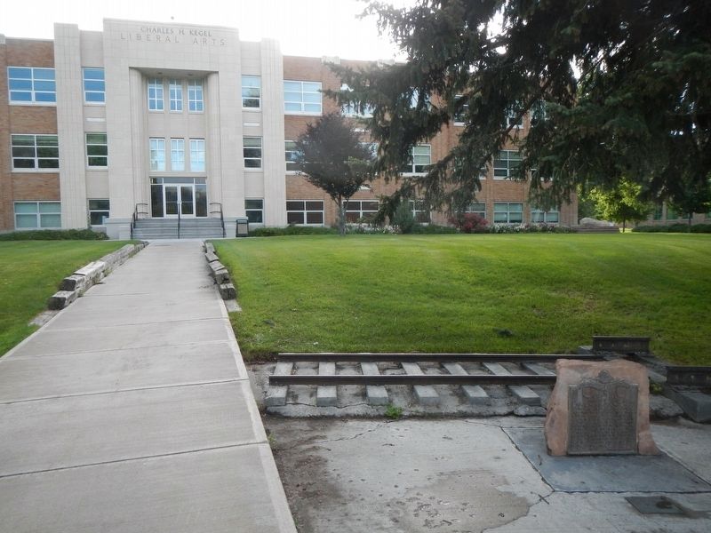
By Barry Swackhamer, May 14, 2018
Utah & Northern Railroad Marker
| On 5th Avenue near East Terry Street, on the right when traveling west. |
| On South 5th Avenue (Old U.S. 91) at West Blackrock Road, on the right when traveling west on South 5th Avenue. |
| On Martin Luther King Junior Way (East Terry Street) just east of South 9th Avenue, on the right when traveling east. |
| On Martin Luther King Junior Way (East Terry Street) just west of East Oak Street, on the right when traveling west. |
| Near South Arthur Avenue at Center Street, on the right when traveling south. |
| On South 5th Avenue (Old U.S. 91) 0.3 miles west of North Blackrock Canyon Road, on the right when traveling west. |
| On West Canyon Street at West 1st Street, on the right when traveling west on West Canyon Street. |
| On National Park Highway/Oregon Trail (U.S. 89), on the right when traveling south. |
| On U.S. 89 at milepost 2.2 near Loveland Lane, on the left when traveling south. |
| On U.S. 89 near Fish Haven Canyon Road, on the right when traveling south. |
| On Main Street (U.S. 30) near Stringtown Road, on the right when traveling north. |
| On West 3rd Street near U.S. 30, on the right when traveling west. |
| On West 3rd Street near U.S. 30, on the left when traveling west. |
| On State Highway 36 at Church Street, on the left when traveling south on State Highway 36. |
| On Washington Street (U.S. 89) near South 10th Street, on the left when traveling west. |
| On Washington Street (U.S. 89) near North 10th Street, on the right when traveling west. |
| On Washington Street near North 9th Street. |
| On Crow Creek Road (Forest Road 111) near Caribou National Forest 147 (Forest Road 147), on the right when traveling north. |
| On U.S. 30 at milepost 441.7 near Hunters Lane, on the right when traveling west. |
| On U.S. 30 at milepost 441.7 near Hunters Lane, on the right when traveling west. |
| On U.S. 30 at milepost 441.7 near Hunters Lane, on the right when traveling west. |
| On Washington Street (U.S. 89) near North 9th Street, on the right when traveling west. |
| On Crow Creek Road (Forest Road 111) near 114, on the left when traveling north. |
| On Washington Street (U.S. 89) near North 9th Street, on the right when traveling west. |
| On Washington Street (U.S. 89) near South 9th Street, on the left when traveling west. |
| On Crow Creek Road (Forest Road 111) near Forest Road 147, on the left when traveling north. |
| On U.S. 30 at milepost 441.7 near Hunters Lane, on the right when traveling west. |
| On U.S. 30 at milepost 441.7, on the right when traveling west. |
| On U.S. 30 at milepost 441.7 near Hunters Lane, on the right when traveling west. |
| On Washington Street (U.S. 89), on the right when traveling west. |
| On Washington Street (U.S. 89) near South 9th Street, on the left when traveling west. |
| On Crow Creek Road (Forest Road 111) near Forest Road 740, on the right when traveling north. |
| On Clay Street near Kelle Street, on the left when traveling east. |
| On U.S. 30 at milepost 441.7 near Hunters Lane, on the right when traveling west. |
| On Washington Street (U.S. 89) near 5th Street, on the right when traveling east. |
| On Washington Street (U.S. 89) near South 8th Street, on the left when traveling west. |
| On Washington Street (U.S. 89) near South 9th Street, on the left when traveling west. |
| On Washington Street (U.S. 89) near North 9th Street, on the right when traveling west. |
| On U.S. 30 at milepost 440.1 near Bench Road, on the left when traveling west. |
| On Crow Creek Road (Forest Road 111) near Road 239, on the left when traveling north. |
| On Washington Street (U.S. 89) near South 9th Street, on the right when traveling west. |
| On U.S. 30 at milepost 441.7 near Hunters Lane, on the right when traveling west. |
| On U.S. 30 at milepost 454.5 near Walter Lane, on the right when traveling west. |
| On Crow Creek Road (Forest Road 111) near Forest Road 146. |
| On Ovid Road (U.S. 89) at State Highway 36, in the median on Ovid Road. |
| On Ovid Road (Highway 89) at State Highway 36, in the median on Ovid Road. |
| On Ovid Road (U.S. 89) at State Highway 36, in the median on Ovid Road. Reported damaged. |
| On South Main Street (U.S. 89) near East 1st South Street, on the right when traveling south. |
| On South Main Street (U.S. 89) at East 1st South Street, on the right when traveling south on South Main Street. |
| On South Main Street (U.S. 89) near East 1st South Street, on the right when traveling south. |
| On South Main Street (U.S. 89 at milepost 15.8) near East 1st South Street, on the right when traveling south. |
| On South Main Street (U.S. 89) near East 2nd South Street, on the left when traveling south. |
| On North Main Street (U.S. 89) near Center Street, on the right when traveling south. |
| On North Main Street (U.S. 89) near 100 North Street, on the right when traveling south. |
| On U.S. 95 at milepost 381 at Old Sanders Road, on the left when traveling north on U.S. 95. |
| On Skyline Drive near U.S. 95, on the left when traveling west. |
| On Skyline Drive near U.S. 95, on the right when traveling west. |
| On U.S. 95 at milepost 381 at Old Sanders Road, on the left when traveling north on U.S. 95. |
| On Chatcolet Road 6.5 miles east of U.S. 95, on the right when traveling west. |
| Near Trail of the Coeur d'Alenes. |
| On State Highway 5 0.1 miles west of North 23rd Street, on the right when traveling west. |
| On State Highway 5 0.1 miles west of North 23rd Street, on the right when traveling west. |
| On North 23rd Street (State Highway 5) at North 23rd Street, on the right when traveling west on North 23rd Street. |
| On Main Avenue at North Sixth Street (State Highway 5) on Main Avenue. |
| On North 23rd Street (State Highway 5) at North 23rd Street, on the right when traveling west on North 23rd Street. |
| On Main Avenue at North Sixth Street, on the right when traveling north on Main Avenue. |
| On State Highway 5 near Pedee Creek Road, on the left when traveling east. |
| On State Highway 3 at milepost 92 near Round Lake Road, on the right when traveling south. |
| On Main Avenue near North Sixth Street (State Highway 5), on the right when traveling east. |
| On Main Avenue near South 6th Street, on the right when traveling east. |
| On State Highway 3 at milepost 96 at State Highway 97, on the right when traveling south on State Highway 3. |
| On East College Avenue at South First Street, on the right when traveling west on East College Avenue. |
| On 675 East Street near 825 North, on the left when traveling north. |
| On U.S. 20 at Twin Buttes Road, on the right when traveling east on U.S. 20. |
| On West Bridge Street at South Meridian Street, on the left when traveling west on West Bridge Street. |
| On Interstate 15 at milepost 101.3, on the right when traveling north. |
| Near Northwest Main Street, on the right when traveling north. |
| On U.S. 20 at Twin Buttes Road, on the right when traveling east on U.S. 20. |
| On Shoshone - Bannock 92 near Sheepskin Road. |
| On U.S. 91 near Agency Drive, on the right when traveling north. |
| Near Ross Fort (Simplot) Road near Interstate 15, on the left when traveling west. |
| On Ross Fort (Simplot) Road near Interstate 15, on the left when traveling west. |
| On U.S. 91 near Agency Drive, on the left when traveling north. |
| Near Ross Fort (Simplot) Road near Interstate 15, on the left when traveling west. |
| On Russell Street at Cedar Street, on the left when traveling south on Russell Street. |
| On West 175 North (Center Street) near North 725 West, on the right when traveling west. |
| Near Such Milton Avenue near East Pine Street. |
| On U.S. 20 at milepost 170 near Rock Creek Road, on the left when traveling west. |
| Near U.S. 20 at State Highway 75, on the left when traveling west. |
| On North Main Street (State Highway 75 at milepost 113) near Kirtley Road, on the right when traveling north. |
| On U.S. 20/26, on the right when traveling west. |
| On U.S. 26, on the right when traveling west. |
| On South Main Street at Bullion Street, on the left when traveling north on South Main Street. |
1248 entries matched your criteria. Entries 201 through 300 are listed above.
⊲ Previous 100 —
Next 100 ⊳
