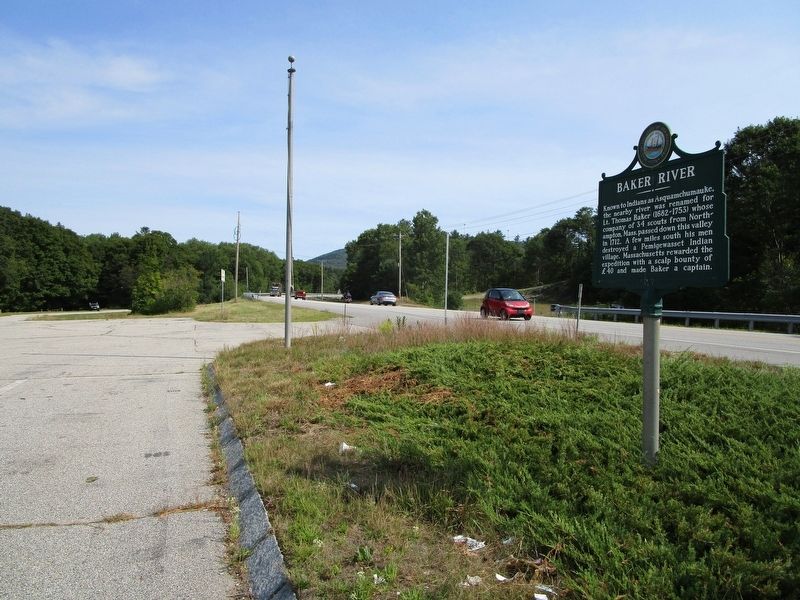
Known to Indians as Asquamchumauke, the nearby river was renamed for Lt. Thomas Baker (1682-1753) whose company of 34 scouts from Northampton, Mass. passed down this valley in 1712. A few miles south his men destroyed a Pemigewasset Indian village. . . . — — Map (db m97232) HM
In 1929, on the slopes of the hill to the east, Austrian-born Sig Buchmayr established the first organized ski school in the United States. Sponsored by Peckett's-on-Sugar Hill, one of the earliest resorts to promote the joys of winter vacationing . . . — — Map (db m77666) HM
About five miles north of
Amherst is the birthplace of
Horace Greeley (1811-1872),
founder of the New York
Tribune, member of Congress,
and candidate for
President in 1872. — — Map (db m301702) HM
This is considered to be the site of Colonel John Goffe's log dwelling. In 1744 Goffe build a gristmill on Bowman's Brook, later run by his son, Major John Goffe (1727–1813), and his grandson, Theodore Atkinson Goffe (1769–1860). The . . . — — Map (db m88052) HM
Born in Francestown, this ardent Jacksonian rose to hold some of the nation's highest offices. After serving his state as legislator, judge, and Governor, he became
U. S. Senator, Secretary of Navy, Secretary of Treasury, and U.S. Supreme Court . . . — — Map (db m225997) HM
Built in 1889, the Grasmere Town Hall was
designed by noted Manchester architect
William W. Ireland, who created it in the
Queen Anne style popular at the time.
It was built not only as a meeting hall but
also a school (Schoolhouse #9). For . . . — — Map (db m162622) HM
"There they are boys!
We beat them today
Or Molly Stark sleeps
A widow tonight!
Design by John Rogers - 1889
Sculpture by Robert Shure
Gift of John Brooks Threfall - 1999 — — Map (db m117677) WM
This 30 acre tract along the Merrimack River was the family farm of Revolutionary War hero General John Stark and his wife Molly. When soldiers were stricken with smallpox at Ticonderoga, the General sent them here to his farm to recover. General . . . — — Map (db m307162) HM
One of three New Hampshiremen to sign the Declaration of Independence, Matthew Thornton, physician, soldier, patriot, agitated against the Stamp Act of 1765, presided over the Provincial Congress in 1775, served in the State Senate and as an . . . — — Map (db m74577) HM
On January 25, 1960 this City Hall Plaza
was John F. Kennedy's first campaign stop
in the nation for the Presidency of
the United States of America
—————————————
"Let the word go forth from this time and place,
to friend and foe . . . — — Map (db m230594) HM
Here were buried most of first settlers in Temple including Rev Samuel Webster, Patriot-Preacher. Francis Blood-Moses Child whom Gen. Washington sent on spy mission to Nova Scotia - Ebenezer Edwards who fought at Concord Bridge - First Burial in . . . — — Map (db m235451) HM
In 1960 their beautiful community was
sacrificed for the Everett Flood Control
Project. Their village was the home for over
60 families and was a self supporting thriving
community. Farming and lumbering was the way
of life for the . . . — — Map (db m132346) HM
The Bear Brook Civilian Conservation Corps (CCC)
Camp was one of 28 work camps established in
N. H. between 1933 and 1942. President Franklin D.
Roosevelt started the program after the Depression
to put young unemployed men to work in . . . — — Map (db m131328) HM
The Old Burying Ground is enclosed within the stone walls across the road. Judge Hall Burgin donated land for a meeting house and burying ground about 1807, and both parcels have always been conveyed together. There are five known graves in the . . . — — Map (db m286342) HM
Famous symbol of frontier heroism.
A victim of an Indian raid in 1697
on Haverhill, Massachusetts, whence
she had been taken to a camp site
on the nearby island in the river.
After killing and later scalping
ten Indians, she and the two . . . — — Map (db m129625) HM
Concord Memorial Field
Dedicated to the Men and Women
Who Served in the World War.
1936
( large plaque )
In Honor of Those
Who Died in the World War
Thomas H. Abbott · Dante J. Baratelli · Sydney W. Beauclerk, Jr. · Robert C. . . . — — Map (db m141241) WM
John E. Davis
1899 - 1918
Enlisted - Feb. 5, 1918 - Concord, N.H.
Killed - May 2, 1918 - Fort Omaha, Neb.
14th Corp, Balloon Co.
In Honor of Those Who Served
in
1917 The World War 1918 — — Map (db m141253) WM
For
God and Country
To
Honor Our Fathers
The Grand Army
Of The Republic
Originally Dedicated
April 9, 1942
We Live In Deeds, Not Years — — Map (db m117569) WM
While living at her "Pleasant View" home (1892 - 1908) once on this site, Mrs. Eddy founded The First Church of Christ, Scientist in Boston, Mass., headquarters of the Christian Science movement. From "Pleasant View" some six miles from her . . . — — Map (db m77803) HM
This Field
Dedicated to the Memory of
Sydney W. Beauclerk Jr.
First Lieutenant 12TH. Aero
Squadron, 4TH. Army Corps
Killed in Action Oct. 29TH. 1918
At Champignuelle, France. — — Map (db m130098) WM
Andrew McClary served in the famed Rogers Rangers. He participated in the December 1774 raids on the British Fort, William & Mary in New Castle, at which time powder and munitions were seized. Learning of the pending conflict at Bunker Hill while . . . — — Map (db m96960) HM
Built in 1889 on the granite abutments of an older span, this is the world's oldest surviving covered railroad bridge. It was probably designed by Boston & Maine Railroad engineer Jonathan Parker Snow (1848–1933) and built by carpenter David . . . — — Map (db m88024) HM
Guyette Pool
In Memory of Joseph N. Guyette
Co. E 103 Inf 26th Div.
Enlisted April 1, 1917 Concord, N.H.
Killed In Action June 16, 1918 Xivray, France — — Map (db m141245) WM
1917 1919
Erected by the
American Legion Auxiliary
Penacook Unit No. 31
In Memory and Recognition of
Those Who Served in the
World War
★Made The Supreme Sacrifice
Bassett Harry · Clark Richard · Holland Roy · Lambrukas . . . — — Map (db m141268) WM
Born in a house bordering this common, he migrated to Minneapolis in 1855. There, he, his brother George, and his nephew Charles, established the famous Pillsbury flour milling business. Three times elected Governor of Minnesota and noted . . . — — Map (db m88015) HM
Three miles from here looms Mt. Kearsarge, elev. 2,937 ft. Since the Civil War, four U.S. Naval vessels have been named "Kearsarge." The first, a 1,550-ton sloop of war built largely of oak timber from the Mt. Kearsarge foothills, earned fame . . . — — Map (db m312942) HM
Candia is the birthplace of the well-known poet, journalist and publisher, Sam Walter Foss. Son of Dyer and Polly Foss, he was born on June 19, 1858. His homespun verse and country poems were great favorites. “The House by the Side of the Road,” . . . — — Map (db m242922) HM
Directly across the Squamscott river stands the storehouse for the towns powder used during the American Revolution and the War of 1812. Powder captured from the British at New Castle was stored here and later used at the Battle of Bunker Hill. — — Map (db m41158) HM
In 1928, the Exeter News-Letter printed an eye-witness account of Fremont's July 4, 1861 Civil War riot, written by 77-year-old Alden F. Sanborn. After Fremont's loyal citizens raised a 150-foot "liberty-pole" at nearby Liberty Square and had run . . . — — Map (db m115811) HM
(side 1)
Historic Black Rocks Village
Settled in the 1720's this section of Poplin, (now Fremont) between Scribner Road & Rowe's Gas Station at 225 Main Street, gradually grew into a thriving settlement called "Black Rocks . . . — — Map (db m115780) HM
Local lumbermen illegally cut Mast Trees reserved for the King's Royal Navy.
When David Dunbar, Surveyor General, visited nearby Copyhold Mill to inspect fallen lumber, local citizens assembled, discharged firearms and convinced Dunbar to . . . — — Map (db m115793) HM
A Little Band of Pioneers
Under the Leadership of
Rev. Stephen Bachiler
of Southampton, England
Seeking a Larger Liberty
In October 1638
Settled in the Wilderness
Near This Spot to Plant a Free Church
In a Free Town
They . . . — — Map (db m162682) HM
This was the roadway. from the ancient landing on Hampton River taken on October 14, 1638 by Rev. Stephen Bachiler and his small band of followers, when they made the first settlement of Hampton, originally named Winnacunnet Plantation. For the . . . — — Map (db m162681) HM
Stray farm animals were confined here by elected pounders or reeves until ransomed by their owners. In 1730, David Dickey kept the first pound in the West Parish. When the current boundaries of Londonderry were established in 1836, David Gilcreast . . . — — Map (db m286339) HM
Boundary disputes among the early river
settlements caused this area to be called
Bloody Point. By 1640 Trickey's Ferry
operated between Bloody Point and Hilton's
Point in Dover. In 1712 the meeting house was erected and the parish set off, . . . — — Map (db m224489) HM
The Town of Nottingham was created by a Royal Charter in 1722. A plan of the town was completed in 1724; at that time the design of the Nottingham Square was laid out with house lots and the intersecting streets Bow, Fish, King and North. The . . . — — Map (db m235102) HM
The town of Portmouth purchased this land in 1753 for 150 pounds from Col. John Hart, Commander of the N.H. Regiment at Louisburg. General William Whipple, signer of the Declaration of Independence, Gov. John Langdon, signer of the Constitution, . . . — — Map (db m74579) HM
The Oracle House is one of the oldest houses in New England. it was built by the Honorable Richard Wibird, an officer in the British Royal Navy, wealthy merchant, member of The King's Council and a benefactor of Harvard College. — — Map (db m23380) HM
The Portsmouth Navy Yard was established in 1800 when the federal government perceived a need to expand the Navy in order to counter French privateer attacks against merchant shipping.
It has served varied functions over the years, first . . . — — Map (db m115967) HM
The receiving station for the first Atlantic cable, laid in 1874, is located on Old Beach Road opposite this location. The remains of the Sunken Forest (remnants of the Ice Age) may be seen at low tide. Intermingled with these gnarled stumps is the . . . — — Map (db m74580) HM
About six miles offshore, these nine rocky islands served Europeans as a fishing station before the first mainland settlements were made in 1623. Capt. John Smith (1580-1631) named the group "Smiths Isles" in 1614. The codfish that "shoaled" or . . . — — Map (db m165413) HM
The reinterred graves of two members of the Balch Household are in Pine Grove Cemetery. Rev. Benjamin Balch (1743-1815) was the first chaplain of the Continental Navy and earned the title of “Fighting Parson,” then served as the pastor of the local . . . — — Map (db m235105) HM
In November 1983, while living in Dover, Kevin Eastman and Peter Laird created a cast of Ninja weapon-wielding turtles during a late-night drawing session. Amused by the absurdity of the idea the duo developed the story of four teenage turtle . . . — — Map (db m235874) HM
A Revolutionary patriot, soldier, and adopted son of Durham, N.H., Alexander Scammell served with distinction through six years of the war from Bunker Hill to Yorktown, where he was wounded, captured, and died six days later, Oct. 6, 1781. Born . . . — — Map (db m74582) HM WM
Packer's Falls
These scenic falls, 1.6 miles west of here on the
Lamprey River, once provided waterpower and industry for the early settlers. A deed dated April II, 1694, shows that Capt. Packer, Jonathan Woodman, James Davis, Joseph Meder, and . . . — — Map (db m224730) HM
Born in Farmington February 16, 1812, Jeremiah Jones Colbath, this self-educated farm boy changed his name when of age to Henry Wilson. He became a teacher, member of Congress, United States Senator and took office as Vice President under President . . . — — Map (db m151943) HM
The New Durham Meetinghouse was built by settlers from Durham and nearby towns in 1770 as their house of worship and seat of government until 1819 when the town's first church was built. This area was the town center until the 1850's when the . . . — — Map (db m96748) HM
(west/front inscription)In commemoration of The valor and patriotism of the volunteers of Rochester, who in the War of 1861 gave their lives for the maintenance of the Union. Erected by the Town AD 1885. (south inscription) Lieut. . . . — — Map (db m152151) HM WM
When Rollinsford split from Somersworth In 1849,
Somersworth had to establish a new public.
nonsectarian burial ground. A site near the
geographic center of the city was purchased
and Forest Glade Cemetery was established in 1851.
The . . . — — Map (db m250711) HM
In 1744 the settlers at No. 4 (now Charlestown) built a great log fort enclosing many of the town's dwelling. The fort, northernmost in the Connecticut Valley, was besieged in 1747 by a large force of French and Indians, who were beaten off by . . . — — Map (db m298330) HM WM
On June 11, 1995, President William Jefferson Clinton and Speaker of the U.S. House of Representatives Newt Gingrich met at the invitation of the Congress of Claremont Senior Citizens, Inc. to debate issues affecting senior citizens. During the . . . — — Map (db m109337) HM
Located easterly on Old Church Road, this wood-frame structure, built 1771–1773, is the oldest standing Episcopal church in the State, serving the second oldest parish. The parish began in 1768 as a mission of the Society for the Propagation . . . — — Map (db m109370) HM
In this house was born Salmon P. Chase, U.S. Senator from Ohio (1849-55), Governor of Ohio (1855-59), a founder of the Republican Party and leader in the anti-slavery movement. After serving as Secretary of the Treasury in Lincoln’s Cabinet, he . . . — — Map (db m74587) HM
The Cornish Colony (1885–1935) was a group of artists, sculptors, writers, journalists, poets, and musicians who joined the sculptor Augustus Saint-Gaudens in Cornish and found the area a delightful place to live and work. Some prominent . . . — — Map (db m109373) HM
This school, known first as Union Academy, was chartered June 16, 1813 "to train young men for leadership in the ministry." The original building, located about 1,000 feet west of here and dedicated to January 9, 1815, was destroyed by fire in . . . — — Map (db m109402) HM
In April 1842, a group of citizens in this town banded together to form "the first Christian Society." In the Adventist movement of 1842-43, they espoused the Advent hope. In January 1842, these Washington Sabbathkeepers, after meeting for many . . . — — Map (db m73224) HM
Local poet William (Bill) Bronk was born in Fort Edward, New York to William M. Bronk and Ethel Funston Bronk. He was a descendant of Jonas Bronck, for whom the Bronx was named. William Bronk grew up in nearby Hudson Falls and lived in the . . . — — Map (db m229506) HM
Honoring the men
who gave their lives in Lebanon
1982 - 1984
May we always remember
those who are ready
to protect our freedom
Commissioned by
the people of Jacksonville
North Carolina
Dedicated
October 23, 1986
On the . . . — — Map (db m24019) WM
(Front):3rd Maine Inft'y 2nd Brigade 1st Division 3rd Corps Strength of regiment morning of July 2nd 14 officers and 196 men (Left): Detached from the Brigade. Fought here in the afternoon of July 2nd, 1863. Having been engaged in the . . . — — Map (db m13074) HM WM
Army of the Potomac Second Corps First Division First Brigade Col. Edward E. Cross, Col. H. Boyd McKeen 5th. New Hampshire 61st. New York 81st. 148th. Pennsylvania Infantry July 2 Arrived about 7 a.m. and was massed in woods at left and rear of . . . — — Map (db m15771) HM
He lies buried in this cemetery. He walked 64 miles to recruit men to aid Ethan Allen in the capture of Fort Ticonderoga, May 10, 1775. — — Map (db m136470) HM
The expedition led by Lieut. Col. Baum sent to seize military stores here, was defeated by volunteer American militia forces from New Hampshire, Massachusetts and Vermont, commanded by General John Stark, aided By Colonels Warner and Herrick, of . . . — — Map (db m13649) HM
White River Junction, a natural transportation center, is where highways, rivers and railways converge. In 1759 the rapids at the confluence of the White and Conn. Rivers nearly brought death to Robert Rogers and 3 Rangers. Vermont’s first train ran . . . — — Map (db m32193) HM
East Side of Monument:
Virginia Company of London Chartered April 10, 1606 Founded Jamestown and sustained Virginia 1607 – 1624
North Side of Monument:
Jamestown The first permanent colony of the English people. The birthplace . . . — — Map (db m11467) HM
George Washington's Ferry Farm, seen here from the opposite side of the river, was in the middle of the Union lines during the Battle of Fredericksburg in December 1862. On December 11th Union engineers began building a pontoon bridge at the ferry . . . — — Map (db m14458) HM
“The Generals have Fix’d on a spot . . . to be fortified.” - Lt. Col. Matthias Ogden, July 19, 1776 On July 5, 1777, Thomas Anburey, who was traveling with British Lt. Gen. John Burgoyne on Lake Champlain, observed as they . . . — — Map (db m19480) HM
Army of the Potomac Third Corps Second Division Third Brigade Col. George C. Burling 2d. New Hampshire 5th. 6th. 7th. 8th. New Jersey 115th Pennsylvania Infantry. July 2 Arrived between 9 and 10 a.m. and joined the Division. Between 2 and 3 p.m. . . . — — Map (db m15647) HM
Joseph W. Harris of New Hampshire, received appointment to the Military Academy at West Point at the age of 17 and graduated in 1825. He was assigned to accompany a group of 750 Cherokees aboard the steamboat Yeatman. They were forced to land at . . . — — Map (db m97914) HM
In 1777, the Continental Army was in desperate need of more field artillery. When 31 Swedish-style 4-pounders arrived in New Hampshire in April, Commander-in-Chief George Washington directed that “they will be forwarded to Camp, as fast as . . . — — Map (db m8972) HM
At various times during Washington's stay in Philadelphia, nine enslaved Africans were known to have lived and worked here at the President's House. They were dynamic participants in the daily life of the presidential household and the . . . — — Map (db m179614) HM
General John Stark with New Hampshire, Vermont and Massachusetts Militia defeated and captured an expeditionary force sent by General Burgoyne and commanded by Colonel Baum. This was one of the first decisive victories in the War of the Revolution. — — Map (db m13918) HM
“ . . . some of the officers have good framed houses.” - Dr. Lewis Beebe, September 30, 1776 This fifteen-foot square, well-defined stone foundation may be the remains of quarters for one or more American officers in the . . . — — Map (db m17863) HM
The Whittemore House
1526 New Hampshire Avenue, N.W.
(202) 232-7363
Museum Tours by Appointment
Designed by Washington architect Harvey L. Page (1859-1934), the house was built between 1892 and 1894 for Sarah Adams Wilcox Whittemore . . . — — Map (db m88744) HM
Central (Lower) Square, just after the turn of the 20th century, shows the bustling business activity at the intersection of Central Avenue and Washington Street. On the right is the Masonic Temple housing, among many other businesses, Frank . . . — — Map (db m152208) HM
State of New Hampshire
Franconia Notch
Forest Reservation and Memorial Park
Acquired with funds appropriated by the legislature of 1925 and the donations of Fifteen thousand contributors secured through The Society for Protection of New . . . — — Map (db m105993) HM WM
General Arnold had sent the 1st New Hampshire Regiment to bolster the scattered riflemen. They battled the British 62nd Regiment of Foot here.
The Americans lost so many men that they were "obliged to retreat." The 3rd New Hampshire and Colonel . . . — — Map (db m253865) HM
Army of the Potomac Third Corps First Division First Brigade Brig. Gen. Charles K. Graham Col. Andrew H. Tippin 57th. (8 Cos.) 63rd. 68th. 105th. 114th. 141st. Pennsylvania Infantry July 1 Arrived between 5 and 6 p.m. July 2 The Corps having . . . — — Map (db m17421) HM
One of the earliest students at Governor Dummer Academy in Massachusetts, Cheswill was among Newmarket’s best-educated and most prosperous citizens. He was entrusted with many offices, including justice of the peace, selectman, town clerk, . . . — — Map (db m113341) HM
Daniel Pratt CemeteryFinal resting place of early Alabama industrialist Daniel Pratt, 1799-1873, and wife Esther Ticknor Pratt, 1803-1875. He was from New Hampshire and she, Connecticut. Married 1827 at Fortville, Jones County, Georgia. . . . — — Map (db m168941) HM
You are standing at the heart of the Dupont Circle Neighborhood, roughly bounded by 16th St., M St., Florida Ave. and Swann St. Early on, as the westernmost circle on L'Enfant's 1792 plan, the large park was called Pacific Circle. Like other . . . — — Map (db m96431) HM
No visible evidence remains of Fort Slocum, which stood here and across Kansas Avenue to your left. Cannon mounted at Fort Totten helped repulse a Confederate attack on Fort Stevens, July 11-12, 1864. — — Map (db m110283) HM
[front (north) face of statue base:]To the brave men
who perished
in the wreck
of the Titanic
April 15, 1912.
They gave their
lives that women
and children
might be saved.
[reverse (south) face of statue . . . — — Map (db m100951) HM
On 23 May 1939, USS Squalus (SS-192) flooded and
sank 240 feet to the floor of the Atlantic Ocean off the
coast of New Hampshire. Twenty-six men drowned,
but 33 took refuge in the forward compartment and
banged out Morse code on the . . . — — Map (db m292213) HM
The Maine Forest service erected Mount Hope Fire tower in 1962 after being moved from Sabattus, Maine.
The tower was a replacement for a wooden tower on Ridley Hill in Springvale. The state had lost its lease on Ridley Hill and because of the . . . — — Map (db m261063) HM
The rail fence and grass line of protection formed after the British troops landed was six hundred feet in the rear at the base of Bunker Hill — — Map (db m18659) HM
Two photos show the station at very different times. The one above is early on when the area was still called Mill Village and taken perhaps even before 1900 when the station first housed the Post Office. In 1892 the PO was subsequently moved across . . . — — Map (db m152101) HM
This one room dwelling housed many “tramps” who passed through town during the first half of the 20th century. Severe economic conditions and high unemployment caused hundreds of thousands of people to take to the roads and railroads . . . — — Map (db m152108) HM
This church occupies the site of the Town Hall and Meeting House which was destroyed by fire Sept. 12, 1909 after having been the home of the First Universalist Society for more than a century. The present edifice was built in 1912 as a memorial to . . . — — Map (db m154891) HM
Built by Charles H. Lane in 1883, this
building was originally three stories
high. The first floor contained business
establishments including Henry
Osgood's furniture store. His famous
photographic studio was located on part
of the second . . . — — Map (db m260904) HM
People of African origin or descent have been part of Portsmouth since at least 1645. This waterfront was an entry port for enslaved people arriving in New Hampshire during the 1600s and 1700s. Ships brought black children and adults . . . — — Map (db m298168) HM
947 entries matched your criteria. Entries 301 through 400 are listed above. ⊲ Previous 100 — Next 100 ⊳
Thin black lines indicate changes in relevance. Between each pair of lines entries are ordered geographically but all have the same relevance.
* Inflectional forms of words are their plurals, singulars, and possessives as well as gramatical tenses and similar variations.