Marker Logo
THE HISTORICAL
MARKER DATABASE
“Bite-Size Bits of Local, National, and Global History”


1433 entries match your criteria. Entries 301 through 400 are listed. ⊲ Previous 100 — Next 100 ⊳


North Carolina Division of Archives and History Historical Markers

These markers can be found along the roadside in North Carolina and have been erected by the North Carolina Division of Archives and History and predecessor agencies.
 
By Judith Barber, October 11, 2012
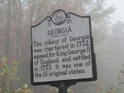
Georgia North Carolina Marker
301 ► North Carolina, Cherokee County, Murphy — Q-33 — North Carolina / Georgia —
On Murphy Highway (State Highway 60).
Georgia. The colony of Georgia was charted in 1732, named for King George II of England, and settled in 1733. It was one of the 13 original states. North Carolina. Colonized, 1585 – 87, by first English settlers in America; . . . — — Map (db m60255) HM
302 ► North Carolina, Cherokee County, Murphy — Q-3 — Tsali —
Near Peachtree Street north of Alpine Street, on the right when traveling north.
Cherokee brave, surrendered to Gen'l Scott to be shot near here, 1838, that remnant of tribe might remain in N.C. — — Map (db m301393) HM
303 ► North Carolina, Chowan County, Edenton — A-55 — Barker House —
On N Broad St. at Queen Street, on the right when traveling south on N Broad St..
Home of Thomas Barker, N.C. agent to England, and his wife Penelope, reputed leader of the Edenton "Tea Party," 1774. Stands 3 blocks south. — — Map (db m34810) HM
304 ► North Carolina, Chowan County, Edenton — A-11 — Chowan County Courthouse —
On South Broad Street (Business U.S. 17) at East Queen Street, on the right when traveling north on South Broad Street.
Oldest courthouse in use in North Carolina. Built about 1767. Whig centre in Revolution. Stands 3 blocks S.E. — — Map (db m56983) HM
305 ► North Carolina, Chowan County, Edenton — A-34 — Dr. Hugh Williamson —
On South Broad Street (Business U.S. 17) at East Queen Street, on the right when traveling north on South Broad Street.
Signer of the Federal Constitution, member of Congress, historian. Home was 4 blocks S.E. — — Map (db m56985) HM
306 ► North Carolina, Chowan County, Edenton — A-22 — Edenton Tea Party
On West Queen Street west of South Broad Street, on the left when traveling west. Reported missing.
Fifty-one women met at Mrs. Elizabeth King's home, which stood 1100 ft. S.E., and resolved, Oct. 25, 1774, to support the American Cause. — — Map (db m34850) HM
307 ► North Carolina, Chowan County, Edenton — A-22 — Edenton Tea Party —
On West Queen Street west of South Broad Street, on the left when traveling west.
Women in this town led by Penelope Barker in 1774 resolved to boycott British imports. Early and influential activism by women. — — Map (db m225212) HM
308 ► North Carolina, Chowan County, Edenton — A-25 — First Post Road —
On Virginia Road (State Highway 32) at Badham Road, on the left when traveling south on Virginia Road.
The road from New England to Charleston, over which mail was first carried regularly in North Carolina, 1738-39, passed near this spot. — — Map (db m79793) HM
309 ► North Carolina, Chowan County, Edenton — A-69 — Francis Corbin — (d) 1767 —
On N Broad St. at Queen Street on N Broad St..
Granville agent, jurist, legislator. Provoked "Enfield Riot." Home, "the Cupola House," 2 blks. S. — — Map (db m34801) HM
Paid Advertisement
310 ► North Carolina, Chowan County, Edenton — A-72 — Harriet Jacobs — c. 1813 - 1897 —
On North Broad Street (State Highway 32) at Gale Street, on the right when traveling north on North Broad Street.
Fugitive slave, writher & abolitionist. Incidents in the Life of a Slave Girl (1861) depicts her early life. Lived in Edenton. — — Map (db m34773) HM
311 ► North Carolina, Chowan County, Edenton — A-73 — Henderson Walker — c.1660~1704
On N. Broad St. Reported missing.
Acting governor, 1699-1703; attorney general, judge, and vestryman. Grave is 75 feet west. — — Map (db m226509) HM
312 ► North Carolina, Chowan County, Edenton — A-5 — James Iredell —
On North Broad Street close to East Church Street.
Justice of U.S. Supreme Court, 1790-99, Attorney-General of N.C. during Revolution. Home stands 200 ft. East. — — Map (db m34844) HM
313 ► North Carolina, Chowan County, Edenton — A-50 — James Iredell, Jr — 1788~1853 —
On W. Queen St.
Governor, 1827~28; U.S. Senator; and legislator. Compiler of revisal of N.C. laws. His home two blocks south; grave at Hayes one mile S.E. — — Map (db m34851) HM
314 ► North Carolina, Chowan County, Edenton — A-4 — Joseph Hewes —
On North Broad Street near West Church Street, on the right when traveling south.
Signer of Declaration of Independence, leader in Continental Congress, merchant. His store was three blocks S. — — Map (db m34797) HM
315 ► North Carolina, Chowan County, Edenton — A-27 — Mackeys Ferry —
On West Queen Street at South Broad Street, on the right when traveling east on West Queen Street.
Established 1735 over Albemarle Sound, succeeding Bells Ferry. Discontinued in 1938. Northern Terminus was four blocks south. — — Map (db m34966) HM
316 ► North Carolina, Chowan County, Edenton — A-89 — Rosenwald Schools —
On Virginia Road (North Carolina Route 32) at Luke Street, on the right when traveling west on Virginia Road.
Julius Rosenwald and Booker T. Washington established fund in 1912 to provide grants to African American communities to improve education. In N.C. the fund assisted with 817 projects in 93 counties. The first one was Warren Grove School, a . . . — — Map (db m225206) HM
317 ► North Carolina, Chowan County, Edenton — A-9 — Samuel Johnston —
On W. Church Street at N. Broad St, on the right when traveling south on W. Church Street.
Revolutionary Leader, Governor, U.S. Senator. His Home "Hayes," and Grave are one mile S.E. — — Map (db m34793) HM
318 ► North Carolina, Chowan County, Edenton — A-1 — St Paul's Episcopal Church
On North Broad St north of West Church Street, on the left when traveling north. Reported permanently removed.
Parish formed in 1701, present structure begun in 1736, succeeding two earlier wooden buildings. — — Map (db m34776) HM
319 ► North Carolina, Chowan County, Edenton — A-1 — St. Paul's Episcopal Church —
On North Broad Street north of West Church Street, on the left when traveling north.
Built beginning in 1736 to serve first parish in N.C., est. by the 1701 Vestry Act. Succeeded two earlier buildings. — — Map (db m225211) HM
Paid Advertisement
320 ► North Carolina, Chowan County, Edenton — A-94 — State v. Mann —
On North Broad Street (North Carolina Route 32) at East Freemason Street, on the right when traveling north on North Broad Street.
N.C. Supreme Court, 1830, reinforced power of slaveholding regime by overturning conviction of Mann (lived nearby) for shooting Lydia, enslaved. — — Map (db m276344) HM
321 ► North Carolina, Chowan County, Edenton — A-67 — Thomas C. Manning — 1825-1887 —
On East Church Street (State Highway 32) at Court Street, on the right when traveling west on East Church Street.
U.S. Minister to Mexico; chief justice, La. Supreme Court.; La. adjutant gen., 1863-65; taught at Edenton Academy. Lived here. — — Map (db m56991) HM
322 ► North Carolina, Chowan County, Edenton — A-53 — Thomas Child —
On West Queen Street (Business U.S. 17) at South Granville Street, on the right when traveling east on West Queen Street.
Attorney-General of Colony, 1745-1761. Leader of faction which opposed Governor Dobbs. Secretary to Lord Granville. Home was 2 blocks S. — — Map (db m56988) HM
323 ► North Carolina, Chowan County, Edenton — A-46 — Weapemeoc —
On West Queen Street (Business U.S. 17) at Dickinson Street, on the right when traveling east on West Queen Street.
The principal town of the Weapemeoc Indians, visited by Ralph Lane and his colonists in 1585-1586, stood near present-day Edenton. — — Map (db m56986) HM
324 ► North Carolina, Clay County, Hayesville — Q-15 — Fort Hembree —
On Main Street at Hiawasee Street, on the right when traveling north on Main Street.
One of the forts where General Winfield Scott's United States Forces gathered the Cherokee before moving them west, stood 3/4 mi. N. W. — — Map (db m41936) HM
325 ► North Carolina, Clay County, Hayesville — Q-37 — George W. Truett —
On Hiawasee Street (Business U.S. 64) at Pass Street, on the right when traveling north on Hiawasee Street.
Pastor First Baptist Church, Dallas, Texas, 1897-1944, president of Baptist World Alliance. His birthplace stands one mile northwest. — — Map (db m41938) HM
326 ► North Carolina, Cleveland County, Boiling Springs — O-43 — Gardner-Webb University —
On South Main Street 0.1 miles south of Cliffside Road, on the right when traveling south.
Baptist. Founded 1905 as Boiling Springs High School; junior college, 1928-1971. University since 1993. — — Map (db m23547) HM
327 ► North Carolina, Cleveland County, Grover — O-6 — Cornwallis —
On M H Camp Highway (U.S. 29).
Entered North Carolina near here, January, 1781, on his second invasion of the state, pursuing Morgan and Greene. — — Map (db m252521) HM
328 ► North Carolina, Cleveland County, Grover — O-59 — Graham's Fort —
On Cleveland Avenue (State Highway 226) 0.1 miles north of Garden Lane, on the right when traveling north.
Home of Col. William Graham. Site of Tory raid, 1780. Served as Revolutionary War fort. Site is 300 yds. N.E. — — Map (db m23528) HM
329 ► North Carolina, Cleveland County, Grover — O-22 — North Carolina / South Carolina —
On M H Camp Hwy (U.S. 29).
North Carolina. Colonized, 1585-87, by first English settlers in America; permanently settled C. 1650; first to vote readiness for independence, Apr. 12, 1776. South Carolina. Formed in 1712 from part of Carolina, which was chartered . . . — — Map (db m252523) HM
Paid Advertisement
330 ► North Carolina, Cleveland County, Grover — O-13 — Patrick Ferguson —
On M H Camp Highway (U.S. 29) north of Interstate 81, on the left when traveling north.
Tory force led by Col. Ferguson camped nearby Oct. 4-5, 1780. Two days later Ferguson died in major British defeat at Kings Mountain, 5 mi. SE. — — Map (db m49964) HM
331 ► North Carolina, Cleveland County, Kings Mountain — O-1 — Battle of Kings Mountain —
On E King Street (U.S. 74) at S Battleground Avenue, on the left when traveling west on E King Street.
Overmountain Men from Tenn., Va., & N.C. led patriots to victory over British, Oct. 7, 1780. Site 7 miles south. — — Map (db m252537) HM
332 ► North Carolina, Cleveland County, Kings Mountain — O-1 — Kings Mountain Battleground
On South Battleground Avenue (North Carolina Route 216) near West King Street ( Route 74). Reported permanently removed.
Scene of Decisive British defeat, Oct. 7, 1780. Seven miles south in S.C. National Park — — Map (db m252539) HM
333 ► North Carolina, Cleveland County, Kings Mountain — O-5 — Kings Mountain Battleground —
On South Battleground Avenue (U.S. 29) at Battleground Road (State Highway 216), in the median on South Battleground Avenue.
Site of decisive British defeat on Oct. 7, 1780. National Military park located 5 mi. southeast in South Carolina. — — Map (db m17659) HM
334 ► North Carolina, Cleveland County, Polkville — O-75 — Mount Harmony United Methodist Church —
On Polkville Road (State Highway 226) at Mt. Harmony Church Road (County Road 1379), on the right when traveling north on Polkville Road.
Congregation organized by 1791. Cemetery and present building, the church's fourth, are one mile west. — — Map (db m252545) HM
335 ► North Carolina, Cleveland County, Shelby — O-48 — Clyde R. Hoey —
On West Dixon Boulevard (Bypass U.S. 74) at Mark Drive, on the left when traveling west on West Dixon Boulevard.
United States Senator, 1945-54, congressman, governor, N.C. legislator, lawyer, editor. Home is 1 mi, grave 1.2 mi, N.E. — — Map (db m23529) HM
336 ► North Carolina, Cleveland County, Shelby — O-27 — O. Max Gardner — 1882-1947 —
On West Marion Street at North Martin Sreet, on the right when traveling west on West Marion Street.
Governor, 1929-33; under Secretary of U.S. Treasury; appointed Ambassador to Great Britain, 1946. Birthplace stands here, grave 300 yds. N. — — Map (db m23533) HM
337 ► North Carolina, Cleveland County, Shelby — O-24 — Plato Durham —
On East Warren Street at South Washington Street, on the right when traveling east on East Warren Street.
Confederate captain; legislator; member of conventions of 1868, '75; conservative leader in Reconstruction period. His home was 100 ft. S. — — Map (db m23535) HM
338 ► North Carolina, Cleveland County, Shelby — O-72 — Thomas Dixon, Jr. — 1864-1946 —
On West Marion Street at North Martin Sreet, on the right when traveling west on West Marion Street.
Minister, politician, & author. Film "Birth of a Nation" was based on his novel The Clansman. Grave is 1500 ft. N. — — Map (db m23531) HM
339 ► North Carolina, Cleveland County, Shelby — O-71 — W. J. Cash — 1900-1941 —
On West Marion Street at North Martin Sreet, on the right when traveling west on West Marion Street.
Author of The Mind of the South. Editor & journalist. His grave is located 1600 ft. N. — — Map (db m23534) HM
Paid Advertisement
340 ► North Carolina, Columbus County, Riegelwood — D-21 — Cornwallis —
On Old Stage Highway (State Highway 87) just south of Cornwallis Road, on the right when traveling north.
Retreating after Battle of Guilford Courthouse, en route to Wilmington, passed near here with his army in April 1781. — — Map (db m101314) HM
341 ► North Carolina, Columbus County, Whiteville — D-74 — Millie-Christine McKoy —
On Business U.S. 74/76 just north of Flynn Cemetery Road (County Highway 1715).
Black Siamese twins born near here, 1851. exhibited in U.S. and Europe. Died in 1912. Grave is five miles N. — — Map (db m20458) HM
342 ► North Carolina, Craven County, Dover — C-78 — Ervin T. Rouse — 1917-1981 —
On State Highway 55 at Wintergreen Road (County Route 1256), on the right when traveling north on State Highway 55.
Fiddler and songwriter. Penned widely-recorded "Orange Blossom Special," bluegrass standard (1938). He was born ¼ mile S.E. — — Map (db m76943) HM
343 ► North Carolina, Craven County, Fort Barnwell — C-32 — Fort Barnwell —
On State Highway 55 near Belltown & Biddle Roads, on the right when traveling south.
Constructed by Colonel John Barnwell of South Carolina in campaign against the Tuscarora Indians in April, 1712. Remains are 2 mi. N. E. — — Map (db m65699) HM
344 ► North Carolina, Craven County, Fort Barnwell — C-17 — Washington's Southern Tour —
On State Highway 55 near Belltown & Biddle Roads, on the right when traveling east.
President Washington, on April 20, 1791, was a guest at the home of Col. John Allen, which was 5 mi. E. — — Map (db m64980) HM
345 ► North Carolina, Craven County, Havelock — C-68 — Cherry Point —
On Fontana Boulevard (North Carolina Route 101) at Cunningham Boulevard, on the right when traveling west on Fontana Boulevard.
U.S. Marine Corps Air Station activated 1941 as Cunningham Field for first USMC aviator A.A. Cunningham. MCAS Cherry Point since May 1942. — — Map (db m225996) HM
346 ► North Carolina, Craven County, James City — C-25 — Fort Point —
On Old Cherry Point Road (County Route 1113) at Green Springs Road (County Route 1129), on the right when traveling north on Old Cherry Point Road.
Site of Fort Caswell, built by N.C., 1775-76, to protect New Bern, renamed Fort Lane by Confederacy. Taken by U.S., Mar., 1862. ½ mi. E. — — Map (db m77005) HM
347 ► North Carolina, Craven County, New Bern — C-10 — Baron Christoph von Graffenried —
On East Front Street just north of Broad Street, on the right when traveling north.
Was a citizen of Bern, Switzerland. Led Swiss and Palatine immigrants to N.C. where in 1710 he founded New Bern. — — Map (db m92398) HM
348 ► North Carolina, Craven County, New Bern — C-51 — Batchelder's Creek —
On State Highway 55 0.5 miles east of Hyman Road (County Route 1244), on the left when traveling east.
Site of Union outpost captured by Confederate Generals Hoke & Pickett on February 1, 1864. The earthworks are 300 yards North. — — Map (db m76944) HM
349 ► North Carolina, Craven County, New Bern — C-11 — Battle of New Bern —
On U.S. 70 at Taberna Way, on the right when traveling south on U.S. 70.
The victory of Union General Ambrose Burnside here on March 14, 1862, caused the fall of New Bern. — — Map (db m77008) HM
Paid Advertisement
350 ► North Carolina, Craven County, New Bern — CC-2 — Battle of New Bern —
Near Battlefield Parkway south of Taberna Way, on the right when traveling south.
The above map is self-explanatory. For a detailed account of the battle please read the large map-marker "Battle of New Bern" on U.S. Highway 17 at New Bern, 5¼ miles west of this road. The Croatan Earthwork, an extensive fortification not used . . . — — Map (db m207889) HM
351 ► North Carolina, Craven County, New Bern — C-20 — Bayard v. Singleton —
On Broad Street (Business U.S. 17) at Middle Street, on the right when traveling west on Broad Street.
American precedent for judicial review of legislation set nearby, 1787, by Samuel Ashe, Samuel Spencer, John Williams. — — Map (db m76990) HM
352 ► North Carolina, Craven County, New Bern — C-20 — Bayard vs Singleton —
On Broad Street (Business U.S. 17) at Middle Street, on the right when traveling west on Broad Street.
Early American precedent for judicial review of legislation, was decided nearby, 1787, by Judges Samuel Ashe, Samuel Spencer, John Williams. — — Map (db m23502) HM
353 ► North Carolina, Craven County, New Bern — C-70 — Bayard Wootten — 1875-1959 —
On East Front Street just north of Change Street.
Pioneer photographer of N. C. and the South. An advocate of equal rights for women. Began career ca. 1904 in this house where she was born. — — Map (db m92394) HM
354 ► North Carolina, Craven County, New Bern — C-60 — Caleb Bradham — 1867-1934 —
On Pollock Street at Middle Street, on the right when traveling east on Pollock Street.
"Brad's Drink," which he created in pharmacy here, was marketed as Pepsi-Cola after 1898. — — Map (db m23507) HM
355 ► North Carolina, Craven County, New Bern — C-42 — Christ Church —
On Broad Street (Business U.S. 17) at Craven Street, on the right when traveling east on Broad Street.
Episcopal. Craven Parish created 1715. First church erected 1750, this one in 1875. Communion service, given by George II, 1752, still in use. One block S. — — Map (db m76988) HM
356 ► North Carolina, Craven County, New Bern — C-30 — F. M. Simmons — 1854 - 1940 —
On East Front Street just south of New Street.
U. S. Senator, 1901-1931. Chaired Senate Finance Committee during World War I. U.S. House 1887-1889. Lived here. — — Map (db m92396) HM
357 ► North Carolina, Craven County, New Bern — C-22 — First Post Road —
On East Front Street just south of New Street.
The road from New England to Charleston, over which mail was first carried regularly in North Carolina, 1738-39, passed near this spot. — — Map (db m92397) HM
358 ► North Carolina, Craven County, New Bern — C-3 — First Printing Press In N.C. —
On Broad Street (Business U.S. 17) west of Craven Street, on the right when traveling west.
Est. 1749 by James Davis who published the first book and newspaper in colony. Shop was nearby. — — Map (db m76987) HM
359 ► North Carolina, Craven County, New Bern — C-50 — First Provincial Congress —
On Broad Street (Business U.S. 70) near Craven Street, on the right when traveling west.
In America to be called and held in defiance of British orders met in this town, Aug. 25-27, 1774, with 71 delegates present. — — Map (db m23503) HM
Paid Advertisement
360 ► North Carolina, Craven County, New Bern — C-12 — Fort Totten —
On Trent Boulevard (State Highway 1278) at Second Street, on the right when traveling west on Trent Boulevard.
Here stood one of the forts built around New Bern by Union forces after they took the town in March, 1862. — — Map (db m23555) HM
361 ► North Carolina, Craven County, New Bern — C-14 — George E. Badger —
On Broad Street (Business U.S. 17) at Middle Street, on the right when traveling east on Broad Street.
Secretary of the Navy, 1841; United States Senator, 1846-55; judge of the superior court; staunch nationalist. Birthplace was 80yds S. — — Map (db m76991) HM
362 ► North Carolina, Craven County, New Bern — C-53 — George H. White — 1852 - 1918 —
On Broad Street (Business U.S. 70) at Metcalf Street, on the left when traveling east on Broad Street.
Lawyer; member of N.C. legislature, 1881 & 1885. U.S. Congressman, 1897-1901. Born into slavery. Home stands 2 blocks N. — — Map (db m23512) HM
363 ► North Carolina, Craven County, New Bern — C-74 — Graham A. Barden — 1896-1967 —
On Broad Street (Business U.S. 70) near Craven Street, on the right when traveling west.
Congressman, 1935-61. Secured military bases for eastern N.C.; advocated Taft-Hartley labor relations act. Grave 4 blocks northwest. — — Map (db m23505) HM
364 ► North Carolina, Craven County, New Bern — C-64 — James City —
On U.S. 70 at Brown Drive on U.S. 70.
Community founded here in 1863 as resettlement camp for freed slaves. Named for Horace James. Union Army chaplain. — — Map (db m31206) HM
365 ► North Carolina, Craven County, New Bern — C-33 — James Walker Hood —
On Broad Street (U.S. 17) at George Street, on the right when traveling west on Broad Street.
Asst. Superintendent Public Instruction, 1868-70; a founder Livingstone College, 1885; Bishop A.M.E. Zion Church; founded St. Peters, 1864. One blk. N. — — Map (db m24053) HM
366 ► North Carolina, Craven County, New Bern — C-1 — John Wright Stanly House —
On George Street just north of Pollock Street, on the right when traveling south.
Home of Revolutionary War leader; and his son John, Congressman & state legislator. House moved and restored 1966-70 by the Tryon Palace Commission. — — Map (db m23508) HM
367 ► North Carolina, Craven County, New Bern — C-81 — King Solomon Lodge —
On Howard Street near Queen Street, on the right when traveling north.
First African American Masonic lodge in N.C.; est. 1865. Erected in 1870, the building was moved here in 1920s. — — Map (db m76973) HM
368 ► North Carolina, Craven County, New Bern — C-61 — New Bern Academy —
On Hancock Street at New Street on Hancock Street.
First school chartered in N.C. Assembly levied a tax for its support in 1766. Present building was built in 1810. — — Map (db m23658) HM
369 ► North Carolina, Craven County, New Bern — C-39 — Political Duel —
On Johnson Street east of Hancock Street, on the right when traveling east.
John Stanly killed Richard Dobbs Spaight, former Governor of North Carolina, in a duel near this spot, September 5, 1802. — — Map (db m76974) HM
Paid Advertisement
370 ► North Carolina, Craven County, New Bern — C-66 — Rains Brothers —
On East Front Street north of Johnson Street, on the left when traveling north.
Brig. Gen. Gabriel Rains and Col. George Rains, graduates of West Point, inventors of explosives for Confederacy. This was their boyhood home. — — Map (db m76975) HM
371 ► North Carolina, Craven County, New Bern — C-82 — Samuel Cornell — 1730 - 1781 —
On East Front Street just north of Broad Street, on the right when traveling north.
Merchant, Loyalist, and Governor's Councilor. He financed construction of Tryon Palace & campaign against Regulators, 1771. House stood 2 blocks S. — — Map (db m92399) HM
372 ► North Carolina, Craven County, New Bern — C-2 — Tryon Palace —
On Broad Street (Business U.S. 17) at George Street, on the right when traveling east on Broad Street.
Historic Capitol and Governor's residence of N.C., 1770-1794. Burned 1798, and restored in 1952-1959. Open to the public. One block south. — — Map (db m76997) HM
373 ► North Carolina, Craven County, New Bern — C-67 — USRC Diligence —
On East Front Street (Business U.S. 70) at South Front Street, on the right when traveling south on East Front Street.
U.S. Reserve Cutter built in N.C. 1791. Ship was commissioned in 1792 by Revenue Marine (now U.S. Coast Guard), ¼ miles west. — — Map (db m62235) HM
374 ► North Carolina, Craven County, New Bern — C-19 — Washington's Southern Tour —
On Pollock Street at Eden Street, on the right when traveling west on Pollock Street.
President Washington visited in the Stanly home two nights, April 20-21, 1791. — — Map (db m23509) HM
375 ► North Carolina, Craven County, New Bern — C-6 — William Gaston — 1778-1844 —
On Broad Street (Business U.S. 17) at Craven Street, on the right on Broad Street.
Justice of N.C. Supreme Court, 1833-44; lawmaker. An advocate for state's Catholics. Wrote state song. "The Old North State." Lived 1 block N. — — Map (db m76978) HM
376 ► North Carolina, Cumberland County, Dunn — I-73 — "Oak Grove" —
On Burnett Road (State Highway 82), on the right when traveling south.
Plantation home of John Smith, used as a Confederate hospital during the Battle of Averasboro, March 16, 1865. — — Map (db m160946) HM
377 ► North Carolina, Cumberland County, Dunn — I-72 — Confederate First Line —
On Burnett Road (State Highway 82), on the left when traveling south.
Gen. W. B. Taliaferro’s division occupied trenches crossing the road at this point, March 15-16, 1865. — — Map (db m160942) HM
378 ► North Carolina, Cumberland County, Dunn — I-74 — Federal Artillery —
On Burnett Road (State Highway 82) 0.8 miles north of Overcreek Lane, on the right when traveling south.
From a point 50 yards west three batteries of artillery under Major J. A. Reynolds shelled the Confederate first line of earthworks. — — Map (db m31600) HM
379 ► North Carolina, Cumberland County, Dunn — I-75 — Federal Hospital —
On Burnett Road (State Highway 82) at Ross West Road (State Highway 1801), on the left when traveling north on Burnett Road.
The 1865 home of Wm. Smith, 100 yds E., was used as a hospital for Union troops in the Battle of Averasboro, March 15-16, 1865. — — Map (db m211814) HM
Paid Advertisement
380 ► North Carolina, Cumberland County, Dunn — I-71 — Rhett’s Brigade —
On Burnett Road (State Highway 82) 0.3 miles south of West Thornton Road, on the right when traveling south.
The brigade of Colonel A.M. Rhett was repulsed 300 yds. W. on March 16, 1865, by Union troops under Col. Henry Case. — — Map (db m211815) HM
381 ► North Carolina, Cumberland County, Fayetteville — I-4 — James C. Dobbin —
On Raeford Road, on the right when traveling east.
Secretary of United States Navy, 1853-57. Helped found State Hospital for Insane. Home one block north. — — Map (db m24330) HM
382 ► North Carolina, Cumberland County, Fayetteville — I-79 — John England — 1786 - 1842 —
On Village Drive at Owen Drive, on the right when traveling west on Village Drive.
Bishop of Charleston. He organized Roman Catholics in N.C. at Fayetteville Convention, & consecrated St. Patrick Church, 1829. Present church 4/10 mi. E. — — Map (db m24634) HM
383 ► North Carolina, Cumberland County, Fayetteville — I-12 — Lafayette —
On Gillespie Street at Franklin Street, on the right when traveling south on Gillespie Street.
On March 4-5, 1825, was guest of Fayetteville (named for him 1783), staying at home of Duncan McRae, on site of present courthouse. — — Map (db m24377) HM
384 ► North Carolina, Cumberland County, Fayetteville — I-13 — MacPherson Church —
On South MacPherson Church Road near Raeford Road (Business U.S. 401), on the left when traveling south.
Presbyterian. Founded by early Scottish settlers. Graves of Alexander MacPherson and T. H. Holmes, a Confederate general, 1½ miles N. — — Map (db m121984) HM
385 ► North Carolina, Cumberland County, Fayetteville — I-14 — Old Town Hall —
On Green Street at Market Square, on the right when traveling north on Green Street.
Built on site of the "State House," burned 1831, where the North Carolina Convention of 1789 ratified the Federal Constitution. — — Map (db m24397) HM
386 ► North Carolina, Cumberland County, Fayetteville — I-89 — Omar ibn Said — ca. 1770-1863 —
On Murchison Road just south of Patina Court.
Muslim slave & scholar. African born, he penned autobiography in Arabic. 1831. Lived in Bladen County and worshipped with local Presbyterians. — — Map (db m94902) HM
387 ► North Carolina, Cumberland County, Fayetteville — I-21 — Plank Roads —
On Green Street north of Person Street, on the right when traveling north.
Fayetteville was the focal point for five plank roads, chartered 1849-52. The longest was built to Bethania, 129 miles northwest. — — Map (db m24395) HM
388 ► North Carolina, Cumberland County, Fayetteville — I-18 — Sherman's Army —
On Hay Street, on the right when traveling west.
Invading North Carolina, Sherman's army occupied Fayetteville, Mar. 11-14, 1865, destroying the Confederate Arsenal, which stood 1 mile W. — — Map (db m57295) HM
389 ► North Carolina, Cumberland County, Fayetteville — I-2 — U.S. Arsenal —
On Hay Street at Bradford Avenue, on the right when traveling east on Hay Street.
Authorized by Congress 1836. Taken over by Confederacy, 1861. Destroyed March 1865, by Sherman. Ruins stand 2 blocks S.W. — — Map (db m24328) HM
Paid Advertisement
390 ► North Carolina, Cumberland County, Fayetteville — I-65 — Warren Winslow — 1810 - 1862 —
On Grove Street (State Highway 24/210) at Cool Spring Street, on the left when traveling west on Grove Street.
Acting Governor, 1854; Congressman, 1855-1861. Negotiated surrender of local U.S. arsenal in 1861. Grave 40 yds. SE. — — Map (db m30871) HM
391 ► North Carolina, Cumberland County, Fayetteville, Cape Fear — II-1 — The Battle of Bentonville — March 19, 20, and 21, 1865 —
Near Interstate 95 at milepost 48, 1 mile south of Cedar Creek Rd ( Highway 53), on the right when traveling north.
At Bentonville, General William T. Sherman's Union Army, advancing from Fayetteville toward Goldsboro, met and battled the Confederate Army of General Joseph E. Johnston. General Robert E. Lee had directed the Confederates to make a stand in . . . — — Map (db m20535) HM
392 ► North Carolina, Cumberland County, Fayetteville, Douglas Byrd — I-61 — The Fayetteville Observer —
On Whitfield Street at Camden Road ( Highway 1003), on the right when traveling west on Whitfield Street.
Oldest N.C. newspaper still being published. Begun 1816 as weekly; daily since 1896. E. J. Hale, editor, 1824-1865. — — Map (db m24635) HM
393 ► North Carolina, Cumberland County, Fayetteville, East Fayetteville — I-29 — Confederate Breastworks —
On Ramsey Street (Business U.S. 401) 0.1 miles south of Cochran Avenue, on the left when traveling south.
Thrown up early in 1865 to protect Fayetteville from Sherman's army. Remains are here. — — Map (db m291888) HM
394 ► North Carolina, Cumberland County, Fayetteville, East Fayetteville — I-26 — Robert Strange —
On Ramsey Street (Business U.S. 401) at Kirkland Drive, on the right when traveling north on Ramsey Street.
U.S. Senator, 1835-40; author of "Eoneguski, or Cherokee Chief," first novel about North Carolina (1839). Home and grave are 350 yds. east. — — Map (db m291887) HM
395 ► North Carolina, Cumberland County, Fayetteville, Methodist University — I-55 — Methodist University —
On Ramsey Street (U.S. 401) at Lowdermilk Drive, on the right when traveling north on Ramsey Street.
Chartered 1956 as four-year liberal arts college. Opened September 1960. University since 2006. — — Map (db m30572) HM
396 ► North Carolina, Cumberland County, Fayetteville, Terry Sanford — I-33 — Babe Ruth —
On Gillespie Street at Transportation Drive, on the right when traveling south on Gillespie Street.
Hit his first home run in professional baseball, March, 1914, 135 yds. N.W. In this town George Herman Ruth acquired the nickname "Babe." — — Map (db m243848) HM

397 ► North Carolina, Cumberland County, Fayetteville, Terry Sanford — I-80 — Bank of the United States —
On Gillespie Street at Halliday Street, on the right when traveling north on Gillespie Street.
Second national bank opened branch in 1818 in Fayetteville. Bank operated, 1820-1835, in house one block east. — — Map (db m30882) HM
398 ► North Carolina, Cumberland County, Fayetteville, Terry Sanford — I-63 — C. M. Stedman — 1841 - 1930 —
On Ramsey Street, on the left when traveling north.
Last Confederate officer in Congress, 1911-1930; lawyer & lt.-governor. Grave is 2 blks. east. — — Map (db m30905) HM
399 ► North Carolina, Cumberland County, Fayetteville, Terry Sanford — I-54 — Campbelton —
On Person Street at Broad Street, on the right when traveling east on Person Street.
Colonial river port, incorporated in 1762. Later merged with Cross Creek to form the town of Fayetteville. — — Map (db m30872) HM
400 ► North Carolina, Cumberland County, Fayetteville, Terry Sanford — I-32 — Charles W. Chesnutt — 1858 - 1932 —
On Gillespie Street, on the left when traveling north.
Negro novelist and short story writer, teacher and lawyer. Taught in a school which stood here. — — Map (db m30892) HM

1433 entries matched your criteria. Entries 301 through 400 are listed above. ⊲ Previous 100 — Next 100 ⊳
 
 
CeraNet Cloud Computing sponsors the Historical Marker Database.
This website earns income from purchases you make after using our links to Amazon.com. We appreciate your support.
Paid Advertisement
Nov. 19, 2026