1456 entries match your criteria. Entries 401 through 500 are listed.⊲ Previous 100 — Next 100 ⊳
National Historic Landmarks Historical Markers
Nationally significant historic places designated by the Secretary of the Interior because they possess exceptional value or quality in illustrating or interpreting the heritage of the United States. Today, fewer than 2,500 historic places bear this national distinction.
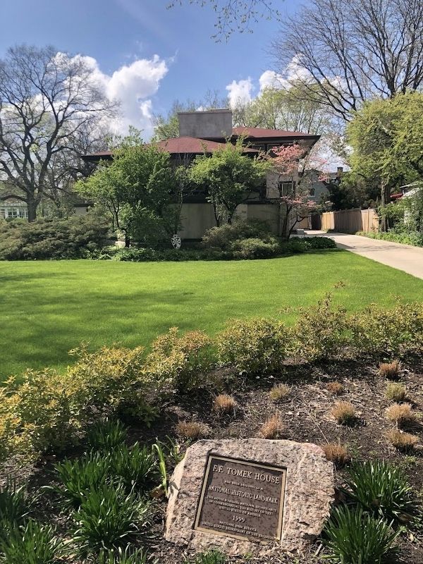
F.F. Tomek House
has been designated a
National Historic Landmark
This house possesses national significance in commemorating the history of the United States of America — — Map (db m245386) HM
The Riverside Historic District/Riverside Landscape Architecture District is an area recognized for its significance as one of the first planned communities in the United States. The district includes most of the Village of Riverside and is bounded . . . — — Map (db m233695) HM
Nauvoo has been designated a Registered National Historic Landmark under the provisions of the Historic Sites Act of August 21, 1935. This site possesses national significance in commemorating the history of the United States. — — Map (db m244020) HM
Two miles north of here, religious dissident immigrants from Sweden founded the communal society of Bishop Hill in 1846. The charismatic Erik Jansson lead the society spiritually and temporally until 1850 when he was murdered. By 1854, a total of . . . — — Map (db m177481) HM
Bishop Hill Colony Historic District has been designated a National Historic Landmark This site possesses national significance in commemorating the history of the United States of America 1984 National Park . . . — — Map (db m177484) HM
Has been designated a
Registered National
Historic Landmark
Under the provisions of the
Historic Sites Act of August 21, 1930
This site possesses exceptional value
in commemorating and illustrating
the history of the United . . . — — Map (db m72330) HM
This U.S. Army Post was named after Civil War Cavalry General Philip Sheridan, to honor his many services to Chicago (1868-1883).
The Commercial Club of Chicago, concerned since 1877 with the need for a military garrison, was motivated by the . . . — — Map (db m55515) HM
has been designated a
National Historic Landmark
This home possesses national significance because
of its architect, W. W. Boyington; its interior designer,
August Fiedler; and as the birthplace of Open Court
Publishing Company, an . . . — — Map (db m185188) HM
[Front]
Born at Laon France June 1 1637 he died near
Ludington Michigan May 18 1675
Devoted missioner and heroic priest-explorer
he offered the Holy Sacrifice of the Mass near
this spot Maundy Thursday and Easter Sunday 1675
and . . . — — Map (db m185190) HM
Between 1000 and 700 years ago, the first people to practice large-scale agriculture in southern Illinois established Kincaid Mounds as the seat of their Chiefdom. These Native Americans were of the Mississippian culture and occupied Kincaid from . . . — — Map (db m233636) HM
John Deere Home and Shop has been designated a Registered National Historic Landmark under the provisions of the Historic Sites Act of August 21, 1935.
This site possesses exceptional value in commemorating and illustrating the history of the . . . — — Map (db m230809) HM
New Philadelphia
Townsite
has been designated a
National Historic Landmark
Founded in 1836 by Frank McWorter, New Philadelphia is the first known town planned and legally registered by an African American in the United States. . . . — — Map (db m134869) HM
The layered sediments at the base of this bluff preserve a record of repeated use of two rock shelters by Native Americans groups from 9000 to 4000 years ago. The earliest groups camped here for short periods of time. By 8,000 years ago, some . . . — — Map (db m283757) HM
Abraham Lincoln's Tomb
has been designated a Registered National Historic Landmark Under the provisions of the Historic sites Act of August 31, 1935 This site possesses exceptional value in commemorating and illustrating the history of . . . — — Map (db m49003) HM
The present Allen County Courthouse is the fourth to serve the county's judicial needs. Its cornerstone was laid on November 17, 1897, in the largest public ceremony held in Fort Wayne to that time. Louis Peltier, who had been born in the fort in . . . — — Map (db m162792) HM
has been designated a
National Historic Landmark
This building is an important work associated
with Modernism in architecture and possesses
national significance in commemorating the
history of the United States of America.
2001 . . . — — Map (db m251092) HM
Logansport was founded in 1838, the same year the Dentzel name first became associated with carousel manufacturing in Germany. A circuitous series of events. eventually brought what is perhaps the most famous name in carousel carving to . . . — — Map (db m224663) HM
Originally called Forest Hill, Hillforest was completed in 1855 for local industrialist and steamboat owner Thomas Gaff and his family. Emigrants from Scotland in 1811, the six Gaff children moved with their mother to Aurora in the 1840s and . . . — — Map (db m22125) HM
Hillforest
Following the Panic of 1837, Philadelphia Distiller Thomas Gaff and his brothers James and John sought new opportunity in southern Indiana, where in 1843 they established T. & J.W. Gaff & Co. Distillery in Aurora, Indiana. Soon . . . — — Map (db m201095) HM
Auburn Cord Duesenberg Automobile Facility
has been designated a
National Historic Landmark
This industrial complex is a rare surviving example of an independent
specialty automobile company that manufactured . . . — — Map (db m185856) HM
One of Madison’s most prominent citizens was James Franklin Doughty Lanier. He was a pioneer and respected banker/financier. Lanier hired the talented architect Francis Costigan to design his magnificent mansion on the Ohio River, where it shines . . . — — Map (db m180800) HM
Madison Historic District has been designated a National Historic Landmark Madison’s Historic District is nationally significant for its extraordinary collection of nineteenth century residential and commercial architecture, for . . . — — Map (db m180845) HM
built 1846-1849
Francis Costigan, architect
has been designated a
National Historic Landmark
This building possesses national significance
in commemorating the history of the
United States of America
1994
National Park Service . . . — — Map (db m187665) HM
Welcome to
"Grouseland"
Built 1803 - 1804
Home of
William Henry Harrison
Governor Indiana Territory 1800 - 1812
President of the United States 1840
Mansion owned and restored by
Francis Vigo Chapter
Daughters of the . . . — — Map (db m167023) HM
Butler Fieldhouse, noted for its design and size, anchored campus sports upon its 1928 opening. During WWII, it served as a military training center. The fieldhouse hosted legendary high school games, such as the 1954 Milan Miracle, which . . . — — Map (db m238472) HM
Oldfields
has been designated a
National Historic Landmark
Developed primarily between 1909 and the mid 1920's, Oldfields was built for Hugh McKennan Landon in 1932. Landon sold the property to J. K. Lilly Jr., businessman, . . . — — Map (db m291381) HM
Madam C.J. Walker built a business empire designed to empower Black women. Born Sarah Breedlove, the daughter of formerly enslaved parents developed a line of hair care products that cured her own hair line. With her booming business, she became the . . . — — Map (db m259942) HM
1867
Born Sarah Breedlove on December 23 in Delta, Louisiana
1882
Moves to Vicksburg, Mississippi with siser, Louvenia
1882
Marries Moses McWilliams
1885
Gives birth to daughter, Lelia
1887
Widowed when McWilliams . . . — — Map (db m132762) HM
Side one:
Built for German societies of Indianapolis including Socialer Turnverein: east wing 1893-1894, west wing 1897-1898. Designed in German Renaissance Revival Style by Indianapolis firm of Vonnegut and Bohn. Sculpted terra cotta and . . . — — Map (db m86962) HM
From its construction in 1902 to its closure as a resort hotel casino after the stock market crash of 1929, West Baden Springs Hotel's 200' free-span atrium dome was known as the Eighth Wonder of the World. After 1929 it housed a multitude . . . — — Map (db m195000) HM
The Indiana Cotton Mill is remarkable in many ways. Its presence in the town might be compared to a medieval Gothic cathedral towering over a European village. It was built between 1849-1851 under the direction of Charles T. James with land donated . . . — — Map (db m171728) HM
Lincoln Boyhood National Memorial represents an important expression of the nation’s respect and reverence for Abraham Lincoln. The park includes the farm of Thomas Lincoln, Abraham’s father; the marked gravesite of Lincoln’s mother, Nancy Hanks . . . — — Map (db m72345) HM
In tribute to Major Joseph Hamilton Daviess, Grand Master of Masons in Kentucky, who fell in battle here, and to the many Freemasons of General Harrison's command whose valor is held in grateful remembrance. — — Map (db m36281) HM
Here, on this site, military forces commanded by General William Henry Harrison, engaged in battle with the Indians of the Wabash country led by The Prophet, brother of the great Indian leader, Tecumseh. This battle destroyed forever the hope of . . . — — Map (db m36205) HM
Panel One
American Forces.
Men engaged. 910.
General Wm. Henry Harrison Commanding attacked at 4: O’Clock A. M. Indian forces led by Prophet. Number engaged about the same as Americans
Loss. Americans. Killed 37.
“ . . . — — Map (db m36233) HM
Site of a palisaded Middle Mississippi Indian village occupied circa 1500 A. D. This 450-acre site includes eleven man-made mounds, town plaza and village area for a population of about 1,000. Excavated by the Indiana Historical Society, 1939-1965. — — Map (db m227024) HM
Angel Site was a large prehistoric town that flourished between 1000-1450 C.E.
With towering earthworks, a broad plaza and well-built homes, Angel was an important regional center for people living along the Lower Ohio.
At its peak, around . . . — — Map (db m227028) HM
Debs (1855-1926) was leading pioneer in industrial unionism, social reformer, and peace advocate.
Founded American Railway Union, 1893; cofounded American Socialist Party, 1900; and ran five times for United States Presidency.
Home built in . . . — — Map (db m8928) HM
Levi Coffin (1798-1877), a Quaker abolitionist, lived in Newport (now Fountain City) with his family 1826-1847. Moved from North Carolina because he and his wife, Catharine, opposed slavery. Advocated, and sold in his store, free-labor products . . . — — Map (db m4480) HM
Rev. George B. Hitchcock House
has been designated a
National Historic Landmark
This site possesses national significance
in commemorating the history of the
United States of America
This property is listed in the
National . . . — — Map (db m93862) HM
As you gaze across the highway, imagine there is no road. Instead the stately, brick home you see is sited in the midst of three acres including Weaver Park where you are standing. The home is surrounded by native maple and elm trees, and there . . . — — Map (db m276035) HM
Has been designated a Registered National Historic Landmark Under the provisions of the Historic Sites Act of August 21, 1935 This site possesses exceptional value in commemorating or illustrating the history of the United States U.S. Department . . . — — Map (db m229165) HM
This building the last Capitol of Iowa Territory became the first Capitol of the State of Iowa December 28, 1846 and was given to the University by and Act of the First General Assembly signed by Governor Ansel Briggs February 25, 1847 This . . . — — Map (db m194000) HM
Builded by the Territory of Iowa out of stone quarried from the banks of the Iowa River Occupied by the Government of the Territory of Iowa from 1842 to 1846 and by the Government of the State of Iowa from 1846 to 1857 This tablet is the . . . — — Map (db m193999) HM
George M. Verity Has been designated a National Historic Landmark This site possesses National significance in commemorating the history of the United States of America. — — Map (db m178292) HM
has been designated a
National
Historic Landmark
This site possesses national significance
in commemorating the history of the
United States of America — — Map (db m87512) HM
Built by General Grenville M. Dodge in 1869 and designated a National Historic Landmark by the United States Department of Interior of the National Park Service in 1963.
Acquired as a museum through public donations and restored by the . . . — — Map (db m249839) HM
Merchants' National Bank has been designated a National Historic Landmark This site possesses national significance in commemorating the history of the United States of America 1976 National Park Service United States Department of . . . — — Map (db m291300) HM
The Farm House has been designated a Registered National Historic Landmark Under the provisions of the Historic Sites Act of August 21, 1935 this site possesses exceptional value in commemorating or illustrating the History of The United . . . — — Map (db m276729) HM
Has Been Designated a
Registered National Historic Landmark
Under the Provisions of the
Historic Sites Act of August 21, 1935
This Site Possesses Exceptional Value in Commemorating
and Illustrating the History of the United States of . . . — — Map (db m177303) HM
Look at the structures around the parade ground. Fort Scott’s appearance is largely the work of one man, Captain Thomas Swords, post quartermaster from 1842 to 1846. Shortly after the army assigned Swords to Fort Scott, he vowed that he would . . . — — Map (db m36185) HM
has been designated a
National
Historic Landmark
This site possesses
national significance in
commemorating the history
of the United States of America — — Map (db m49497) HM
has been designated a
National Historic Landmark
This site possesses national significance in commemorating the history of the United States of America — — Map (db m64846) HM
Has been designated a
National
Historic Landmark
This site possesses national significance
in commemorating the
history of the United States of America — — Map (db m32851) HM
has been designated a
Registered National
Historic Landmark
under the provisions of the
Historic Sites Act of August 21, 1935
This site possesses exceptional value
in commemorating or illustrating
the history of the United . . . — — Map (db m65494) HM
"Nicodemus was growing into a busy little town. New houses were being built by people coming in. Different enterprises began to originate. Conditions began to improve."— Nettie Craig Teacher 1886
Main Street Nicodemus grew out of hard . . . — — Map (db m131531) HM
Cuisine Good Food, Great TraditionGood food and small cafes have long been a tradition in Nicodemus, although most businesses are now gone. Ernestine’s Bar-B-Q is the last restaurant in town. The legendary Ernestine VanDuvall’s . . . — — Map (db m312227) HM
Established in 1827, Fort Leavenworth is the oldest army post in continuous operation west of the Missouri River. Serving as the army's chief base of operations on the Central Plains, the fort furnished troops and supplies for military operations . . . — — Map (db m63183) HM
This unique chapel was built in 1893. Architect Louis Curtis[s] of Kansas City designed the structure after an old gothic chapel he had seen in England.
It has served veterans of all wars from the Mexican War (1848) on. The beautiful stained . . . — — Map (db m50912) HM
has been designated a
National Historic Landmark
This site possesses national significance as
a representation of the first national system
of medical and residential benefits for disabled
veterans. The National Home was the first . . . — — Map (db m286873) HM
has been designated a
National
Historic Landmark
This site possesses
national significance
in commemorating the
history of the
United States of America — — Map (db m49780) HM
has been designated a
Registered National
Historic Landmark
under the provisions of the
Historic Sites Act of August 21, 1935.
This site possesses exceptional value
in commemorating and illustrating
the history of the United . . . — — Map (db m44979) HM
For travelers arriving on the Santa Fe Trail, Fort Larned must have looked more like a small town than a fortified place. In the early years, about 150 soldiers lived here in the summers. During the Indian Wars, as many as 400 troops called Fort . . . — — Map (db m40157) HM
Reconstructed here are the remains of a seven-room pueblo believed to have been built by Pueblo Indians from New Mexico. According to Spanish records Indians from Taos and Picuris Pueblos, fleeing Spanish rule, joined their Apache allies at a . . . — — Map (db m65952) HM
has been designated a
National
Historic Landmark
This site possesses
national significance
in commemorating the
history of the
United States of America — — Map (db m47007) HM
This corner stone
preserved by
P-T-A. & Past Patrons
of
Sumner School
Erected 1901 - Replaced 1936
Board of Education
W. H. Wilson, President F. E. Mallory Vice President.
J. F. Buck, J. W. . . . — — Map (db m127685) HM
This building, constructed in 1857 by G.H. Hollenberg on his ranch here on the Oregon Trail, was a station on the Pony Express route in 1860-1861. It is believed to be the only such station which has remained unaltered on its original site. — — Map (db m53293) HM
From this discovery well the field spread first west then south to the Gulf of Mexico. The Norman No. 1 was dirlled in November 1892 by O L Bloom of Independence for William Mills of Osawatomie on land owned by T. J. Norman of Neodesha. The hole . . . — — Map (db m57722) HM
Perryville Battlefield has been designated a Registered National Historic Landmark Under the provisions of the Historic Sites Act of August 21, 1935 this site possesses exceptional value in commemorating and illustrating the history of the United . . . — — Map (db m21450) HM
Fort Boonsborough Site has been designated a National Historic Landmark. This site possesses national significance in commemorating the history of the United States of America. — — Map (db m210654) HM
Old Morrison
An early Greek Revival design by Kentucky architect Gideon Shryock. Trustee and teacher Henry Clay guided construction supported by bequest of Col. James Morrison. Work on building slowed by cholera epidemic of 1833. Dedication . . . — — Map (db m136933) HM
has been designated a
National Historic Landmark
This site possesses national significance as an exceptional distillery complex with the associated post-prohibition expansion of the distilled spirits industry. The district contains a diverse . . . — — Map (db m203015) HM
Has been designated a
Registered National
Historic Landmark
Under the provisions of the
Historic Sites Act of August 21, 1935
this site possesses exceptional value
in commemorating or illustrating
the history of the United . . . — — Map (db m194239) HM
Liberty Hall A National Historic Landmark This Georgian mansion was begun 1796, by John Brown and named for Lexington, Virginia academy he attended. His wife Margaretta and Elizabeth Love began first Sunday School west of Alleghenies in . . . — — Map (db m84387) HM
Old State House has been designated a Registered National Historic Landmark under the provisions of the Historic Sites Act of August 21, 1935. This site possesses exceptional value in commemorating or illustrating the history of the United . . . — — Map (db m194253) HM
~Front~ Louisville Water Co. incorporated in 1854. Its first pumping station, in Classical Revival style, blends beauty and utility. The classic structures were designed and built by Theodore R. Scowden and his assistant, Charles Hermany. . . . — — Map (db m71979) HM
Designed and built by Gideon Shryock, father of Greek Revival architecture in Kentucky. Bank was chartered by General Assembly in 1832 and building completed in 1837. — — Map (db m161202) HM
Soon after the first shots of the battle were exchanged at Timmy's Branch, Confederate surgeons set up a field hospital in a small log house that stood here. Some of the wounded found their own way here; friends carried others. One of the last . . . — — Map (db m137141) HM
Mistaken Identity
About seven o'clock the morning of January 19, 1862, Confederate General Felix Zollicoffer rode across the road to your left. Near here, in the dim light and fog, he saw a mounted officer, Union Colonel Speed Fry. Both men . . . — — Map (db m137077) HM
In November 1861, the Confederate army commanded by General Felix Zollicoffer arrived in Mill Springs, Kentucky, on the south side of the Cumberland River. A month later, Zollicoffer had moved 6,000 men to the north side of Cumberland and . . . — — Map (db m88447) HM
Alfred Edward Mathews, a renowned illustrator, created this drawing. We don't know if he participated in the battle, but it is obvious he was here. You are standing approximately where Mathews stood to sketch this scene. Compare the image to the . . . — — Map (db m137102) HM
Union General George H. Thomas placed cavalry here, at Timmy's Branch, on the road between his army and the Confederates. These men acted as an early warning system in case of a surprise attack. It was here that the first shots of the Battle of . . . — — Map (db m137142) HM
You are near the center of the battlefield east of the road. Union and Confederate forces clashed violently here Sunday morning, January 19, 1862.
The Union line stood to your left, behind a split-rail fence at the edge of the woods (now part of . . . — — Map (db m137114) HM
After the battle, Union soldiers hastily buried the dead. They interred many of the Confederates in shallow mass graves near where they fell. Some graves were so shallow that the bodies began surfacing just days afterward. With the army gone, local . . . — — Map (db m137098) HM
Shortly before daylight on January 19, 1862, the lead elements of the Confederate column encountered Union pickets—a guard detachment—at Timmy's Branch about a mile south of here. The Confederates fired on the Union troops, who retreated . . . — — Map (db m137097) HM
It was midmorning and the battle was raging when directly across the road Union Colonel Robert McCook ordered the 9th Ohio Infantry to charge the enemy. It was one of the few successful bayonet charges of the Civil War and was instrumental in . . . — — Map (db m137109) HM
Colonel Speed Fry, commanding the 4th Kentucky Infantry (U.S.), pulled his men back to a split-rail fence on a hill east of the road. As the Union soldiers deployed, the Confederates regrouped in the ravine. They had learned that Confederate General . . . — — Map (db m137112) HM
The evening of January 19, 1862, Union forces pursuing the beaten Confederates halted at a small log school nearby. The Confederates had used the school as a headquarters for their pickets before the battle. Union soldiers rested here as they . . . — — Map (db m137143) HM
Rutledge's Battery, a Confederate artillery unit, fired from this position during the Battle of Mill Springs. This gun is a reproduction of those the battery used—1841 model six-pounder smoothbore cannons.
Captain Arthur M. Rutledge, a . . . — — Map (db m137119) HM
The Confederate army arrived in Mill Springs in November 1861. For some time, Confederate General Felix K. Zollicoffer's pleas for more men and supplies were ignored. Finally, his superior sent the steamboat Noble Ellis up from Nashville . . . — — Map (db m156154) HM
George Henry Thomas
Virginian George H. Thomas commanded the Union army at the Battle of Mill Springs. Because he was from a prominent slave-holding family many, including President Abraham Lincoln, initially questioned his loyalty. His . . . — — Map (db m137104) HM
The Confederates west of the road fled in disarray after the 9th Ohio Infantry executed a successful bayonet charge. The pursuing Federals turned the tide on the east side of the road and the entire Confederate line broke. The 16th Alabama Infantry . . . — — Map (db m137140) HM
After Confederate General Felix Zollicoffer was fatally wounded at the Battle of Mill Springs on January 19, 1862, his men placed his body under a white oak tree. In the years that followed, the tree became known as the "Zollie Tree."
Forty . . . — — Map (db m137096) HM
The Last Minutes of the Battle
Union commander General George H. Thomas described the last minutes of the battle: "The 12th Kentucky . . . and the Tennessee brigade reached the field to the left of the Minnesota regiment, and opened fire on . . . — — Map (db m137115) HM
The Brown-Lanier House in the Civil War
In late 1861 and early 1862, Union and Confederate armies occupied this area as they vied for control of Kentucky. This house, then owned by Thompson Brown, served at various times as a headquarters for . . . — — Map (db m137065) HM
1456 entries matched your criteria. Entries 401 through 500 are listed above. ⊲ Previous 100 — Next 100 ⊳