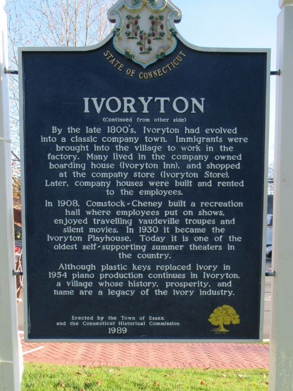
Originally part of the Saybrook colony, the area now known as Ivoryton was annexed with the newly formed Essex in 1859. Thought of as the “wild country,” it soon developed into a prosperous manufacturing village. In the late 1700’s Phineas Pratt . . . — — Map (db m100239) HM
Town of East Haddam Conn
Roll of Honor
Steven E. Adams • Donnie Bartunek • Charles A. Brandt • George S. Heil • John M. Kananowicz • John R. McGhie • Douglas Smith • Edward Ramsdell • William J. Rose • Gary A. Soja • John S. Wadsworth • Robert . . . — — Map (db m84009) WM
For all those who gave their lives for us. you will not be forgotten
Revolutionary War (1775-1783)
Stephon Ackley • Gideon Brainerd • Ichabod Champion • Daniel Ebenezer Cone 3rd • Joseph Cone • Ely Crosby • Chauncey Estabrook • Thomas Lyon • . . . — — Map (db m84017) WM
The British Raid on Essex
On April 7-8, 1814, a British raiding force of 136 sailors and marines rowed six miles up the Connecticut River from warships anchored in Long Island Sound to attack American shipping in Essex, then known as . . . — — Map (db m183087) HM
At the end of the 18th century and the beginning of the 19th century, this area served as the village center. The well-equipped general store owned by Ebenezer Hayden and the surrounding businesses of the Pratt Smithy, a bake house two doors up . . . — — Map (db m69410) HM
Originally called Potopaug by local Indians, Essex was named after England’s Essex County, whence some of its early settlers had come. As a part of Saybrook colony, the Essex area was first settled in 1648 by John Lay, William Pratt, and William . . . — — Map (db m65666) HM
Essex Square as we know it today did not exist until after the British attack on Essex harbor on April 8, 1814 when 28 ships were destroyed. A change in the configuration of the streets leading to the river, thanks to the building of a large, new . . . — — Map (db m183085) HM
Essex was beginning to come into its own in 1832 when this building, known as Hills Academy, was built. Twelve years before, the new Borough of Essex, previously known as Potapoug Quarter, was set apart from the town of Saybrook. A letter dated . . . — — Map (db m69413) HM
While a lot has changed since this 1881 “Birds-Eye-View” of Essex, a lot has remained the same including most of the houses along Main Street. Originally known as Pettipaug, Essex was first settled in 1648. It became a colonial seaport . . . — — Map (db m69414) HM
The Onrust is a replica of one of the first sailing ships built in the New World and the first European vessel to explore the Connecticut River and Long Island Sound. On his fourth voyage to the New World (1613–1614), Dutch explorer Adriaen . . . — — Map (db m183090) HM
These lands were first settled in 1664 after
the Connecticut General Assembly had approved
establishment of a plantation on the east
side of the Connecticut River in 1663. The
"Loving Parting" between Saybrook and East
Saybrook was signed on . . . — — Map (db m281302) HM
Baborsky, William •
Beebe, M. Arthur •
Blackwell, Elmer H. •
Butler, William •
Clark, Ansel Carl •
Clark, Harold F. M. •
Cone, Leslie B. •
Cunningham, Niles F. •
Czikowsky, William •
Damen, Peter •
Ely, Ernest S. •
Ely, Julian . . . — — Map (db m280815) WM
Commemorating the
Tercentenary Celebration
August 5-7, 1965
of the
ancient town of Lyme,
now the towns of Old Lyme, Lyme,
parts of East Lyme and Salem.
Originally a part of Saybrook, Lyme
became a new town by the articles
of agreement . . . — — Map (db m281309) HM
In honor of the men & women of Lyme who served their country in the armed forces in
World War II & Korea and in memory of those who gave their lives — — Map (db m281434) WM
State Historic Landmark
For over two hundred years the Chester-Hadlyme Ferry has provided public transportation at this site. The first crossing was initiated by Johnathan Warner of Chester in 1769. Known as Warner's Ferry, it was privately . . . — — Map (db m83888) HM
This Viewpoint extends the museum sites of the Connecticut Impressionist Art Trail – Connecticut’s Millennium Legacy Trail – to the outdoor settings that artists portrayed at the turn of the 20th century in a manner that came to be . . . — — Map (db m83999) HM
William Gillette's Secretary and Confidante
A Japanese expatriate who exemplified the Connecticut state motto, "He who transplants sustains," Yukitaka Osaki came to the United States with his elder brother, Yukio, in 1888. The Ozaki family . . . — — Map (db m266480) HM
Anadromous fish live most of their adult lives in marine
waters and return to their freshwater streams to spawn.
Juvenile fish hatched on the spawning grounds remain
in these protected nursery areas. At a certain age these
fish begin migrating . . . — — Map (db m268188) HM
Boxwood
Built 1842
This property has been
placed on the
National Register
of Historic Places
by the United States
Department of the Interior — — Map (db m268060) HM
The British Raid on Essex
On April 7-8, 1814, a British raiding force of 136 sailors and marines rowed six miles up the Connecticut River from warships anchored in Long Island Sound to attack American shipping in Essex, then known as . . . — — Map (db m272239) HM
You are standing about three miles from the mouth of the Connecticut River, the longest river in New England. It measures over 400 miles from its source -- a series of linked, small lakes in northern New Hampshire, almost on the Canadian Border -- . . . — — Map (db m268368) HM
Dr. Roger Tory Peterson - A True Conservationist
8/28/08 - 7/28/96
This Wildlife Area at Great Island has been dedicated to the memory of Dr. Roger Tory Peterson, an Old Lyme resident and renowned naturalist, educator, author and artist. . . . — — Map (db m268283) HM
Florence Griswold House
has been designated a
National Historic Landmark
This property possesses national significance
in commemorating the history of the
United States of America
1993
National Park Service
United . . . — — Map (db m308865) HM
On August 22, 1824, General Lafayette had breakfast across the road at Richard McCurdy's home on his way from New York to Boston. — — Map (db m266054) HM
Sawmill worker
Enslaved nearby
by Edward Dewolf
Petition attested to his
good character 1704
"Industrious in his
master's business" — — Map (db m268107) HM
As early as the 1640’s settlers from Saybrook cleared and planted land on the east side of the Connecticut River in what is now Old Lyme. The first recorded grant of land, in 1649, was to Matthew Griswold in the Black Hall quarter. By 1665 the . . . — — Map (db m302005) HM
The osprey is one of Connecticut's wildlife success stories.
The overuse of pesticides, primarily DDT, caused a
dramatic decline in osprey numbers and, by 1974, there
were only 9 active nests in Connecticut. The use of DDT
has been banned in . . . — — Map (db m268281) HM
Soldier, mariner, fiddler
Enslaved
by Gov. Matthew Griswold
Baptized 1755, sold 1775
Served in
Revolutionary War
to gain his freedom — — Map (db m280542) HM
Born a short distance from this place, he later practiced law here
Responded to the Lexington Alarm as a colonel in April, 1775. Retired as a major general in July, 1782. Charter member, American Union Lodge, and master thereof, 1779. Elected . . . — — Map (db m268089) HM WM
Also called Tempy
Daughter of Jenny
Born here enslaved
by William Noyes
Passed to Rev. Matthew Noyes
Gravestone Old Durham Cemetery — — Map (db m280810) HM
As a buffer between the Griswold family's farm
fields and Lyme Street, this area of the property was
historically somewhat overgrown. Photos from the
Museum's archives show that artists set their easels
up in the woodland for a good view of . . . — — Map (db m280814) HM
Home of suffrage leader Katharine Ludington, 1869-1953. President of Connecticut Woman Suffrage Assn. & leader of Natl. League of Women Voters. — — Map (db m266058) HM
Across Lyme Street
Enslaved
by Dr. John Noyes
Willed 1733
to Mary Hudson Noyes
Freed by Mary Noyes Ely 1743
"to be his own man" — — Map (db m268184) HM
Between 1670 and 1820 more than 200 enslaved African Americans and Native Americans labored
in the historic town of Lyme. Today, small bronze plaques mark sites of enslavement on Lyme Street
and serve as memorials to those once held here in . . . — — Map (db m280568) HM
Dedicated and opened to traffic
May 25, 1993
The Honorable Lowell P. Weicker, Jr.
Governor
Emil H. Frankel
Commissioner of Transportation
Parsons Brinckerhoff Quade & Douglas
Designer
Parsons Brinckerhoff Construction Services, . . . — — Map (db m271249) HM
Welcome to the Old Saybrook Stupa
The stupa is one of the most ancient monuments in the world. It is a Buddhist symbol of the enlightened mind and a path to its realization. It is believed to radiate peace, harmony and healing.
To receive . . . — — Map (db m260435) HM
Designed and supervised by the Connecticut Highway Department
Ground Broken - March 30, 1947
Completed - December 4, 1948
Governors
Hon. Raymond E. Baldwin
Hon. Wilbert Snow
Hon. James L. McConaughy
Hon. James C. Sharon
Old . . . — — Map (db m271241) HM
Captain Adriaen Block was a Dutch trader and privateer who journeyed to the Hudson River and Manhattan Island in 1611 to trade for fur with the Lenape people who lived there. Between 1611 and 1614, Block made four voyages during which he explored . . . — — Map (db m227279) HM
Adrian Block was an attorney and an explorer from the Netherlands that had an eye for profitable enterprise. The market for furs in Europe was tremendous in the early 17th century and Block was looking to make his fortune by selling beaver pelts . . . — — Map (db m182714) HM
The first African-American female pharmacist in Connecticut, proprietor of the James Pharmacy and beloved member of the community for generations of residents and visitors. Known to all as "Miss James," she represented the humanitarian spirit that . . . — — Map (db m227270) HM
The Pequot War was the first major conflict between Native Americans and Europeans in northeastern North America. It began in September 1636, lasted eleven months, and involved thousands of Native and English peoples who fought several major . . . — — Map (db m181051) HM WM
The Pequot War was the first major conflict between Native Americans and Europeans in northeastern North America. It began in September 1636, lasted eleven months, and involved thousands of Native and English peoples who fought several major . . . — — Map (db m181994) HM
The Pequot War was the first major conflict between Native Americans and Europeans in northeastern North America. It began in September 1636, lasted eleven months, and involved thousands of Native and English peoples who fought several major . . . — — Map (db m182310) HM
The Pequot War was the first major conflict between Native Americans and Europeans in northeastern North America. It began in September 1636, lasted eleven months, and involved thousands of Native and English peoples who fought several major . . . — — Map (db m182709) HM
The Pequot War was the first major conflict between Native Americans and Europeans in northeastern North America. It began in September 1636, lasted eleven months, and involved thousands of Native and English peoples who fought several major . . . — — Map (db m183079) HM
Saybrook and the Collegiate School English settlers arrived in Saybrook in 1635 and for the next several years endured warfare with the native peoples, the loss of approximately half the population to settle Norwich, and the hardship of . . . — — Map (db m182035) HM
Connecticut Valley Railroad
Roundhouse & Turntable Site
has been placed on the
National Register
of Historic Places
by the United States
Department of the Interior
April 28, 1994 — — Map (db m182038) HM
History of Saybrook Colony
Saybrook Colony was established at the mouth of the Connecticut River, about 1/2 mile from this location, by English Puritans in 1635 under the leadership of Lieutenant Lion Gardiner who built a fort and laid out a . . . — — Map (db m182001) HM
This Property has been
Placed on the
National Register
of Historic Places
by the United States
Department of the Interior
Doctor
Samuel Eliot
House
c 1737 — — Map (db m181997) HM
Because of the combination of fresh and saltwater habitats at the river's mouth, a wide variety of fish species have the opportunity to feed, reproduce and/or establish populations.
The Native American diet depended on this variety and . . . — — Map (db m227284) HM
The first fort at Saybrook Point, built in 1630, was similar to other English coastal settlements. Lion Gardiner designed the fort in the European tradition as a square, palisaded fortification containing several structures, surrounded by an . . . — — Map (db m182723) HM
On August 21, 1824, General Lafayette reached Saybrook where he spent the night while traveling from New York City to Boston, MA. — — Map (db m227271) HM
The shifting sand bar at the mouth of the river made it difficult for large ships to negotiate the shallow harbor. The first Lynde Point Lighthouse built in 1803, a wooden octagonal tower 35 feet high, warned ships of the sandbar that blocked much . . . — — Map (db m182307) HM
In 1635 Lieutenant Lion Gardiner, a tall redheaded military engineer, was engaged by Governor John Winthrop, Jr. to build a fort and lay out a town for the Warwick Patentees. His contract was for a period of four years at an annual salary of 100 . . . — — Map (db m182730) HM
Dedicated to Preserving, Protecting and Promoting the History of Old Saybrook
Frank Stevenson Archives
Frank Stevenson (1912-1997) Frank Stevenson, a lifelong Saybrook resident, tended the lawns, plants, houses and people of the North . . . — — Map (db m181142) HM
General William Hart House, 1767 The General William Hart House, 1767, on the National Register of Historic Places, is a Living Symbol of our American Heritage. This Georgian colonial was built by a young man of means from a prominent family . . . — — Map (db m239187) HM
295 entries matched your criteria. The first 100 are listed above. Next 100 ⊳