[First plaque]
1924
Martin County Historic Register
Martin County Historical Preservation Board
March 9, 2015
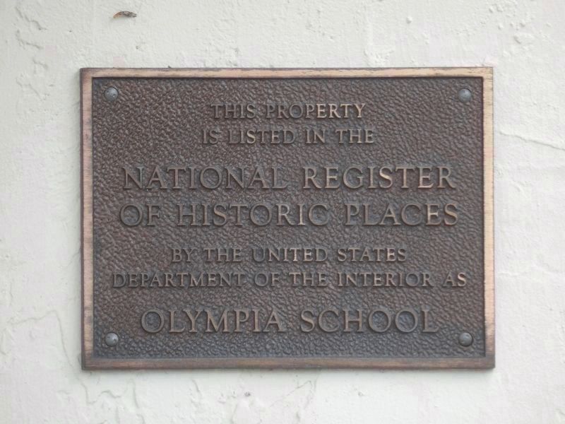
[Second plaque]
This property
is listed in the
National Register
of Historic Places . . . — — Map (db m193623) HM
In 1942 the federal government opened Camp Murphy. It was the home of the Southern Signal Corps School during World War II and served as a U.S. Army base for instruction in radar operation in the early course of the war. The post was named in honor . . . — — Map (db m14314) HM
Three miles to the east on September 23, 1696, the British barkentine Reformation foundered off Jupiter Island. The 24 survivors included a party of Quakers bound from Jamaica to Pennsylvania. Leader of the Quakers was Jonathan Dickinson who . . . — — Map (db m14311) HM
This Property is listed in the National Register of Historic Places by the United States Department of the Interior as Olympia School — — Map (db m226370) HM
When he arrived from New Jersey in the early 1930s, Vincent Natulkiewicz, also known as Vince “Trapper” Nelson found the area still teeming with wildlife. For decades he lived off the land, supplementing his diet of raccoon, gopher tortoise, and . . . — — Map (db m106565) HM
Born in 1923, Betty Mae Tiger Jumper was the first Chairwoman of the Seminole Tribe of Florida, elected in 1967. She spent her early life with her parents, Ada Tiger and Abe Partan, at the Seminole camp in Indiantown. Tribal medicine men threatened . . . — — Map (db m148906) HM
From 1900 until the late 1950s, the Jupiter Indiantown Road connected the communities of Jupiter and Indiantown, giving residents access to resources. Dade County governed the area in 1899, when the new road was cut. In Indiantown about that time, . . . — — Map (db m96931) HM
In 1893, a community of Episcopal worshippers began to emerge in this area. With the property donated by Charles H. and Mary Racey, the congregation established the All Saints' Episcopal Church and All Saints' Cemetery in 1898.
The All Saints' . . . — — Map (db m112175) HM
Dedicated To The Recipients Of The Nation's Oldest Military Decoration "The Purple Heart" Combat Wounded Veterans Military Order of the Purple Heart 1782 - 1932 My stone is red for the blood they shed. The . . . — — Map (db m213496) WM
A Marker for Millennia
A recognizable landmark on the west bank of the Indian River, the prominent rise we know today as Mount Elizabeth, is actually a collection of debris from a Late Archaic village over 4,200 years old. The Archaic . . . — — Map (db m150970) HM
Mount Elizabeth Mound was constructed approximately 4,000 years ago during the Late Archaic Period by Florida bands who selected this site for a ceremonial shell midden-mound. It was occupied 4,000-800 years ago by ancient peoples who first . . . — — Map (db m106567) HM
This Mediterranean Revival style monument typical of the pre-Depression Florida Boom was designed by Nat C. Hodgdon of Pfeiffer and O'Reilly Architects, constructed by A. L. Doenges and completed on February 20, 1926. The arch was built to celebrate . . . — — Map (db m83286) HM
Mt. Elizabeth and the surrounding property were purchased by explorer William Henry Racey in the late 1850's. In 1891, his son, Charles Racey, built a three-story wood-frame house on the mound for his family and started a pineapple and citrus . . . — — Map (db m117570) HM
The mansion at
Tuckahoe
1938
Restored 2009
Listed on the National Register
of Historic Places by the United States
Department of the Interior — — Map (db m112168) HM
Across the Intracoastal Waterway is Jupiter Island. It was part of an ancient offshore sand bar which became exposed when the sea level dropped.
Protected from salt spray and yet close enough to the ocean to receive its warming effects, the island . . . — — Map (db m226874) HM
This 10-minute walk up to the top of the Hobe Mountain Observation Tower will give you a view of the Atlantic Ocean, Intracoastal Waterway, and the entire expanse of the park. As you walk through the Sand Pine Scrub (Vanishing plant Community) . . . — — Map (db m226371)
The plant community located around the tower is called sand pine scrub and is found on the higher elevations in the park. It is two-layered, with the sand pine occupying the top layer, and various oaks and shrubs making up a thick understory. This . . . — — Map (db m226873) HM
On September 16, 1928, a hurricane came ashore near the Jupiter Lighthouse and traveled west across Palm Beach County to Lake Okeechobee. This deadly hurricane destroyed hundreds of buildings and left millions of dollars of property damage. Many of . . . — — Map (db m114784) HM
Sewall's Point, with high fertile hammocks situated between the St. Lucie and Indian rivers, attracted this area's earliest settlers. These pioneers cleared the land, planted pineapples, and citrus, and traveled to Titusville by sailboat for . . . — — Map (db m112170) HM
Dr. William H. Baker and his family settled here in 1880 and named the place Waveland. Their home was the first permanent residence in what is Martin County today, and Waveland was prominent on Florida maps for many years. The section line that . . . — — Map (db m112169) HM
In 1889, Capt. Henry Seawall and his wife, Abbie, settled on the peninsula that bears their name. Previously, the Sewall family inherited a third of the 16,000-acre Miles-Hanson Grant, awarded by the king of Spain in 1823. Within the grant were the . . . — — Map (db m127508) HM
It was New Year's Day 1916 and many locals took the ferry to the big Palm City picnic. They were soon called back when someone looked across the St. Lucie to see smoke billowing on the horizon and yelled, "Stuart is burning down!"
And sure . . . — — Map (db m193628) HM
The Salerno Colored School was dedicated by the Martin County Board of Public Instruction on February 22, 1934. A Civil Works Administration project, the one-room, 25'x 31 frame elementary school was one of the first public schools in Martin . . . — — Map (db m272770) HM
Have you ever had a vacation that was so great you didn't want to go home? That's what happened to President Grover Cleveland when he visited Stuart in 1899. The President had such a good time fishing here that he bought a lot just north of where . . . — — Map (db m193644) HM
Back in the 1900s, Stuart locals were a healthy lot, and thanks to balmy temperatures, endless sunshine, and salty air, visiting northerners often found they regained their good health too. No wonder the entire region came to be known as “a healing . . . — — Map (db m193671) HM
A lasting monument to the original settlers and
early pioneers of Potsdam (now Stuart) Florida
Annie (Speirs) and Albert Krueger
This property has been listed in the
National Register of Historic Places
by the United States . . . — — Map (db m193689) HM
Visible behind you, Stuart's water tower rises above the tree line as you gaze down historic Osceola Street.
The water tower was constructed in 1959. The American flag first appeared encircling the tank as suggested by the Martin County High . . . — — Map (db m193648) HM
Thee pilings are the remains of the Florida East Coast Railway freight dock, once a center of local commerce for many years. Fish and pineapples were shipped from Stuart by the boxcar load.
In 1918, when the first auto-bridge spanned the St. . . . — — Map (db m226363) HM
Listed on the Stuart Historic Register on December 4, 2018.
Certificate of Designation-Resolution No. 13-2018 (CRA)
Geo. W. Parks General Merchandise was constructed by George Washington Parks in 1901, when Stuart (originally named . . . — — Map (db m226358) HM
Built in 1901, this is one of the best examples of early 20th century wood frame vernacular style commercial buildings left in south Florida.
The second story served as the Parks family home in later years. The store evolved into a hardware . . . — — Map (db m226367) HM
The iron-hulled Italian bark Georges Valentine was built in 1869 at Liverpool, England. She was wrecked here in a storm on October 16, 1904, while bound from Pensacola to Buenos Aires with a load of lumber. Five members of her twelve-man crew . . . — — Map (db m112173) HM
Only one remaining of nine on Florida east coast commissioned in 1875 for the U.S. Life-Saving Service. Keepers provided shelter, food, clothing, and transportation to survivors of shipwrecks and storms at sea. In U.S. Coast Guard Service through . . . — — Map (db m112172) HM
Europeans arriving at Hutchinson Island in the 16th century found the island populated by hundreds of Native Americans living in settlements bordering both the Atlantic Ocean and the Indian River.
The rich marine environment provided these . . . — — Map (db m106588) HM
Built in 1925 by R.l. Robb Construction Co. for the Golden Gate Development Company, this building is one of Martin County's most distinctive historical structures. The two-story, trapezoidal building was designed in the Mission/Mediterranean . . . — — Map (db m136029) HM
Travelers arriving in Stuart in the late 1800's knew they had reached a civilized town when they saw the steeple of Stuart's first church standing next to the railroad in the Potsdam Subdivision. Built in 1895, the 12-member congregation represented . . . — — Map (db m193635) HM
The Peter Montague & Lord Baltimore
Chapters of the National Society Colonial Dames XVII Century mark this Martin County Court House to commemorate the historical significance of this site to Martin County, Florida and its people. Built in . . . — — Map (db m193667) HM
In 1903 Noah parks built this house for his family shotly after his brother George Parks constructed the General Merchandise Store.
In November of 1908 Noah Parks contracted a fatal illness and died, leaving his widow Mildred and seven children . . . — — Map (db m226359) HM
Look behind you. The two-story building with the elaborate faux stone exterior is the Feroe Building. Built in 1913, this was the home of the Stuart Drug Company – and Stuart's first pay phone!
Installed on April 9, 1915, calls from the phone . . . — — Map (db m193656) HM
Dedicated to the Brave Veterans of the Armed Forces of the United States who were killed of wounded in combat while serving and protecting our Great Country. — — Map (db m226361) WM
In Memory of those men and women who honorably and faithfully served their country in the armed forces of the United States of America, in the preservation of freedom and justice for all; their sacrifices, faith in God and country, shall be . . . — — Map (db m226415) WM
This statue is to honor the early Glades pioneers and the more than two thousand persons who lost their lives in the disastrous 1928 hurricane. — — Map (db m277265) HM
The Everglades Experiment Station was established on this site in 1921 to help families deal with the challenges of living and working in the area. Soil nutrient deficiencies and two major hurricanes in 1926 and 1928 hindered early research. UF . . . — — Map (db m114917) HM
Side 1
In the 1940s, during the era of segregation, children of color living in Belle Glade attended Everglades Vocational High School, which served grades 1-12. In 1955, the school was renamed Lake Shore High School and served grades 7-12. . . . — — Map (db m228457) HM
(side 1)
The Boca Raton Army Air Field (BRAAF), established in 1942, included land bordered by Palmetto Park Road to the south, Dixie Highway to the east, Yamato Road to the north, and Military Trail to the west. It totaled 5,820 acres and . . . — — Map (db m174877) HM
Boca Raton Fire Engine No. 1, “Old Betsy,” is a 1925 American LaFrance Type 75 Triple Combination fire engine, built in Elmira, New York. The Boca Raton Town Council approved funds for a fire engine on October 21, 1925. On April 20, 1926, studies . . . — — Map (db m272174) HM
Designed in the Mediterranean Revival style by the architect Addison C. Mizner and completed by the architect William E. Alysmeyer, the Boca Raton Town Hall opened in April 1927 as the city's first municipal building, fire station and police . . . — — Map (db m94687) HM
The rails of Henry Flagler’s Florida East Coast Railway first reached Boca Raton in 1895 providing an essential link in the extension of the railroad system south to Miami and the Florida Keys, and fostering the tourism and agricultural . . . — — Map (db m96926) HM
In October 1925, architect Addison Mizner announced construction of houses for his company’s executives and his brother, the Reverend Henry Mizner, in the subdivision now known as Old Floresta. The Robinson Company, a New York contractor building . . . — — Map (db m41667) HM
In the early 1950s, the site directly across from Boca Raton’s Old Town Hall, formerly a bus station, sat empty.
In 1953, owner of the land Eleanor Sanborn, graciously allowed the town‘s annual holiday celebrations to take place there. By 1955, . . . — — Map (db m161133) HM
Circa 1917 • Circa 1928 • Circa 1968
Boca Raton residents and visitors have enjoyed the pavilion since the early 1900s. The existing pavilion was renovated in 2003 for future generations to enjoy. — — Map (db m269008) HM
Along this beach in the 1880’s and early 1890’s walked United States mailmen on their sixty-six mile journey between Palm Beach and Miami. The trip required three days each way and they passed this spot the second day. They walked barefoot at the . . . — — Map (db m96964) HM
On this spot in June 1942, spies from German U-boats landed and occupied Dr. William Sanford’s home built on this site in 1937. The subs, deployed during WWII as part of Hitler’s Operation Drumbeat, torpedoed tankers and freighters traveling the . . . — — Map (db m114951) HM
Boynton Elementary School/Boynton School, designed by West Palm Beach architect William Maughlin, is of the masonry vernacular style, has two floors, six classrooms and attic space leading to the belfry. The original staircase and floors were built . . . — — Map (db m129300) HM
The Barton Memorial Park Cemetery, originally known as Cherry Hill, was the original burial ground in Boynton for the African-American community. As very few records exist it cannot be established when the first burial took place or who exactly is . . . — — Map (db m159163) HM
The area surrounding this site was first settled in the late 1890s. For six decades, a handful of doctors and midwives provided rudimentary medical care to area residents. With the nearest hospital located 18 miles away in West Palm Beach, critical . . . — — Map (db m96494) HM
The Boynton Woman’s Club was designed in Mediterranean Revival style by the famous Palm Beach architect Addison C. Mizner. The Woman’s Club is significant for both its architectural merit and contributions to the cultural development of Boynton . . . — — Map (db m96653) HM
A school for black children was established before 1900 by members of the St. Paul AME Church. In 1907, the congregation petitioned the Dade County School Board for a teacher and built a small building on donated land. The school received its most . . . — — Map (db m223346) HM
The South Lake Worth Inlet was constructed between 1925 and 1927 to improve water quality and circulation between the south end of Lake Worth and the Atlantic Ocean. The first inlet to Lake Worth was cut in the mid-19th century at the north end of . . . — — Map (db m209133) HM
Prior to 1923, travel into or out of the Lake Okeechobee Area was accomplished only by boat or canoe. In the early 1920’s, W. J. Conner, a New York winter visitor bought 4000 acres of undeveloped muck land near this site. Development required that . . . — — Map (db m91951) HM
Evolving out of late rock gardens, flat gardens make liberal use of plant material and often incorporate open space by relying on the design technique called “borrowed scenery” (shakkei). — — Map (db m292680) HM
浄土庭園
Paradise Garden
(Kamakura and early Muromachi Periods, 13th–14th centuries)
An earthly representation of the Pure Land, or Buddhist heaven. Such gardens exhibited the first step toward abstraction in . . . — — Map (db m292676) HM
Atlantic Avenue’s crossing of the Florida East Coast Canal (now the Intracoastal Waterway) played an important role in the early history of Delray Beach. Civil engineer Burslem Thomson drew the first plat of “Linton,” now Delray Beach, . . . — — Map (db m96884) HM
Sara Gleason, Belle G. Dimick Reese and Ella M. Dimick Potter dedicated this beach to the public in 1899. In 1895 Sarah Gleason and her husband’s business partner, W.H. Hunt, sold a parcel of land containing the beach area to William S. Linton for . . . — — Map (db m96920) HM
In 1899 the Tasker family purchased this block and built a house on the southwest corner. Phoebe A. Verrill bought the house in 1909 and sold it to the Cason family in 1921. The Casons converted the house into apartments and c.1924 built a second . . . — — Map (db m96763) HM
In recognition of these Organizations’ contributions to the cultural development of Delray Beach, the City Commission designated these locations as historic sites on April 11, 1989.
• 1895 School No. 4 Delray Colored, located at this site
• . . . — — Map (db m96880) HM
The Asian-American Federation of Florida
The Japan-America Society of South Florida
respectfully dedicate this lantern to the memory of
Col. Ellison Shoji Onizuka
and his Challenger crewmates
Jan. 25, 1987
in cooperation with . . . — — Map (db m292682) HM
Recorded in 1923, Del-Ida Park was one of Delray Beach’s earliest planned neighborhoods. Del-Ida Park’s unusual diagonal arrangement of streets, triangular lots, and public parks are unique when contrasted with the grid pattern layout of the . . . — — Map (db m96970) HM
The Del-Ida Park subdivision was first recorded on September 18, 1923. Motivated by patriotic spirit and the optimism of Florida’s land boom, Del-Ida Park originally contained streets named after six U. S. Presidents. Mr. J. C. Secord of Miami . . . — — Map (db m96971) HM
The Delray Beach Hotel was constructed on this site in 1939. Engineered by William Victor Peterson and built by Taylor Construction, the Mediterranean style hotel featured a Cuban tile roof, high ceilings with exposed beams, and large glass windows . . . — — Map (db m96888) HM
After the Civil War, the population in the Confederate States declined dramatically as a result of the mass exodus of freed slaves. In Florida, however, the population increased from around 140,000 in 1860 to 530,000 in 1900. Half of these early . . . — — Map (db m96882) HM
A landscape design which expresses nature in a more abstract manner by eliminating water but suggesting its presence. Such gardens were inspired by the newly imported sect of Zen Buddhism, and were in imitation, not of nature directly, but of . . . — — Map (db m292678) HM
An orange grove, once located at this site, played a role in the early development of Delray Beach. Until 1876, an old, sour orange grove was the only distinguishable characteristic within 60 miles of a sparsely inhabited subtropical wilderness . . . — — Map (db m96885) HM
This 40’ freight section is all that remains of the old railroad station constructed in 1896 by the Florida East Coast Railway Company. The station originally stood on the east side of the tracks, one block south of Atlantic Avenue. The original . . . — — Map (db m96973) HM
The Sandoway House Nature Center was designed as a home by Samuel Ogren, Sr., in 1936 for early Delray Beach winter resident J. B. Evans, a retired produce broker. It is one of the last remaining Resort Colonial Revival houses in Delray Beach. . . . — — Map (db m41839) HM
A completely abstract garden space enclosed by walls and composed principally of rock arrangements and coarse gravel as an aid to meditation in a Zen Buddhist discipline.
Funded by the Homer & Martha Gudelsky Family Foundation — — Map (db m292679) HM
Primarily developed between 1922 and 1943, the Marina Historic District displays a variety of architectural styles including Mediterranean and Mission Revival, Monterey, Minimal Traditional, Frame Vernacular and Art Moderne. The prominent . . . — — Map (db m41818) HM
The Marina Historic District, a historically small-scale neighborhood, was primarily developed from 1922 to 1943 and showcases many irreplaceable architectural resources. Later development of the 1940s, 1950's, and beyond provides prime examples of . . . — — Map (db m41704) HM
Nassau Park, Delray Beach’s first locally designated historic district, spans two blocks along Nassau Street from South Ocean Boulevard to Venetian Drive. In 1935, a newspaper ad for Ray-Del Realty Co. described Nassau Park as “West Indian . . . — — Map (db m96886) HM
The Old School Square site is the namesake of the locally and nationally designated Old School Historic Districts. It is also Individually listed to the National Register of Historic Places as the “Delray Beach Schools”. The adjacent buildings on . . . — — Map (db m269009) HM
Old School Square Historic District is named for its focal point, the Old School Square Complex at 51 North Swinton Avenue which is made up of the circa 1913 Vernacular style Delray School designed by J.M. Cromer, the city’s first separate high . . . — — Map (db m96972) HM
One of several built by Treasury Department between Cape Canaveral and Cape Florida for rescue and sustenance of shipwrecked. Named for wild sour orange grove nearby, H.D. Pierce, first keeper, arrived with family May 1876. Here August 15, 1876, was . . . — — Map (db m96919) HM
The old shipwreck know as the Delray Wreck rests at the bottom of the ocean in 25 feet of water about 150 yards offshore the south end of Delray’s municipal beach. The wreck is broken and scattered into five sections and has long been one of the . . . — — Map (db m41819) HM
The Wakodahatchee Wetland Boardwalk was created to inspire and educate people about the importance of water conservation. Palm Beach County Water Utilities Department has recognized the need to recycle water in order to conserve this most . . . — — Map (db m297769) HM
Established in 1894, the West Settlers area is the site of the first African-American settlement in Delray Beach. African-Americans from the north and west Florida, Georgia and South Carolina were the first non-Native Americans in the area, laying . . . — — Map (db m96807) HM
The West Settlers community, established in 1894 as Delray Beach’s first African-American community, was self-sufficient with commercial buildings and churches serving its residents. Originally N Blackmer Street, NW 5th Avenue was the hub of . . . — — Map (db m96808) HM
A bonsai (pronounced BONE-SIGH) is a tree that has been pruned and trained and is growing in a container or on a slab rather than in the ground. The word bonsai also signifies the art of dwarfing such trees through pruning . . . — — Map (db m292681) HM
In 1992, North Ocean Boulevard (State Road A1A) in the Town of Gulf Stream, was designated as a State Historic Scenic Highway to preserve the last remaining Australian Pine Canopy and the original character and beauty of the 1920s A1A in Florida. . . . — — Map (db m96891) HM
In 1992, North Ocean Boulevard (State Road A1A) in the Town of Gulf Stream, was designated as a State Historic Scenic Highway to preserve the last remaining Australian Pine Canopy and the original character and beauty of the 1920s A1A in Florida. . . . — — Map (db m97421) HM
The U.S. Star Mail Route provided the first regular direct communication between this area and Miami. The mail carriers walked barefoot on the wet hard-packed sand along the ocean’s edge. Boats were rode or sailed on Lake Worth and Biscayne Bay and . . . — — Map (db m166005) HM
As a memorial to the pioneers of this section of Florida. On this spot the Celestial Railroad, once connecting Jupiter with Juno, is crossed by the Federal Highway.
Juno, at the north end of Lake Worth was the county seat of Dade County, then . . . — — Map (db m97052) HM
• The 7½-mile Celestial Railroad, officially named the Jupiter and Lake Worth Railway (J.& L.W.), operated from 1889 to 1895.
• In those days, ocean-going ships had no navigable access to Lake Worth and its towns, such as West Palm Beach. . . . — — Map (db m245263) HM
Eleanor Fletcher came to Juno Beach as a real estate agent in the 1970s. She loved the beach and every beach walk became a journey of discovery. Fascinated by sea turtles, Eleanor learned everything she could about their behavior and was eager to . . . — — Map (db m297715) HM
A tribute to Gold Star Families whose loved ones paid the ultimate price defending the United States of America; their sacrifice will not be forgotten. — — Map (db m297714) WM
-On this site, a Standard Oil gas station built around 1949 became Juno Beach's first Town Hall in 1961, when the population was approximately 250.
-The Town leased the building for $1 per year until it took ownership in 1974. Three . . . — — Map (db m255174) HM
These shipwrecked iron cannons and anchor were uncovered in July of 1987, just 2000 yards east of this spot in 10 feet of water off Jupiter Inlet.
Archives and research link these maritime remains to the Spanish "Aviso" vessel named "San Miguel . . . — — Map (db m83342) HM
The inlet has always been a mosaic of freshwater, saltwater and upland ecosystems providing a rich diversity of aquatic life, animals and plants. The presence of pottery, food remains of seeds and animal bones, burnt charcoal and hunting and . . . — — Map (db m213655) HM
268 entries matched your criteria. The first 100 are listed above. Next 100 ⊳