The John C. Ashmore Relay Station in northwest Christian County stood in Polk Township, 152 ½ miles from the Tipton Terminus. It was the only station in the county. — — Map (db m99690) HM
McCullock assigned Brig. Gen. James S. Rains and his six mounted companies of the 8th Division of the Missouri State Guard along with a company of Arkansans, about 400 men, to take the lead in the southern advance. Rains was given the task . . . — — Map (db m258752) HM
On this approximate spot on May 10, 1889 three members of the Baldknobbers were hanged for murder.
The name came from the Bald Knob hilltops on which the Taney County group met.
After the Civil War justice on the area was minimal. In the . . . — — Map (db m59918) HM
Deep in the Missouri Ozarks, Christian County, organized 1859, was one of last 3 of the State’s 114 counties to be formed. At the request of pioneer “Mrs. Thomas Neaves” it was named for her native Ky. county honoring Rev. War Col. . . . — — Map (db m99716) HM
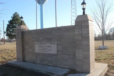
Dedicated to all veterans
of Christian County
November 11 1992
In Memory of
All American Veterans
This memorial honors all American veterans who, although separated by generations, shared a common, undeniable goal - to valiantly . . . — — Map (db m59920) WM
Built in 1848 A.D. by Levi Beckner this is the only brick building to survive the Civil War. It housed mercantile, newspaper, the first bank 1884-1910, abstract, cafe, and insurance businesses. — — Map (db m62540) HM
Dallas County, organized 1841, was first called Niangua for the river flowing within its borders, but the name proved difficult and it was changed to Dallas in 1844 for U.S. Vice Pres. George M. Dallas. Settled in the early 1830's by pioneers . . . — — Map (db m62544) HM
In honor of the men and women who served our country in Operation Desert Shield and Desert Storm 1990 — 1991 from Dallas County Ahart, Mac • Barker, Craig • Bradley, Terry • Brown, Arthur • Carpenter, Chad • Cooksey, . . . — — Map (db m297187) WM
This memorial is dedicated to all who fought
for the freedom and the principles of our country
They sought no glory
but their country's good — — Map (db m62542) WM
Upton setting up his four-cannon battery near here, Lieutenant John V. Dubois noticed movement across the creek.
"On our left, four companies of regulars drove the enemy across a cornfield to the timber beyond. The enemy drove us back in turn. . . . — — Map (db m256247) HM
I ordered Lieutenant Sokalski to move forward with his section … saving the Kansas regiments from being overthrown.... James Totten, captain, Second Artillery, Company F
On this high ground the men . . . — — Map (db m255721) HM
This Northern spur of Bloody Hill saw the beginning and end of the battle. In the days proceeding the fight, the field before you was the camp of the 1,200 cavalrymen of Colonel James Cawthorne's Missouri State Guard Brigade. At dawn on August . . . — — Map (db m35241) HM
Fierce changes and countercharges led to heavy casualties on Bloody Hill. Considering the numbers of troops engaged, it was one of the bloodiest fights in the war. Union artillery batteries on this hill dueled with opposing batteries in the . . . — — Map (db m255206) HM
So cried General Lyon as he led Kansas troops into battle to drive back the rebels' second attack. A volley of fire exploded in front of him. A bullet tore through both lungs and his heart. Moments later, Lyon slid from his horse and died.
The . . . — — Map (db m258184) HM
After intense fighting, Confederate troops drove Captain Joseph Plummer's Union soldiers from the Ray Cornfield. To save Plummer's men, Union artillerymen on Bloody Hill fired on the Confederates and forced them to retreat. When part of the 3rd . . . — — Map (db m255201) HM
From this spot one can imagine the challenge which faced the Confederate army. Further up the hill in front of you, over 4,000 Union soldiers and 10 pieces of artillery were positioned to repulse any Southern effort to regain the high ground. On a . . . — — Map (db m35233) HM
Nathaniel Lyon was the first Union general to be killed in the Civil War. At the end of the day the outcome of the battle was in favor of the South. But as Missouri remained in the Union the value of Lyon's actions materialized. "He had given the . . . — — Map (db m256852) HM
Commanders from both sides were not prepared to properly bury the 535 soldiers who lost their lives. As the Union troops retreated to Rolla, the Southern soldiers were left to do the grueling work of digging graves for the dead. William Watson of . . . — — Map (db m257109) HM
These words were commanded by John Q. Burbridge, colonel in the Missouri State Guard, as he fell from his horse, wounded from severe minie-ball fire.
Covering this low valley on Bloody Hill, the taking of these guns was key for a Southern . . . — — Map (db m255953) HM
The Civil War was more than a conflict between the North and South, abolitionists and slave owners. It was complicated. John Ray, originally from Tennessee, was pro-Union and a postmaster. He and his wife Roxanna listed an enslaved woman named Rhoda . . . — — Map (db m255557) HM
Within these narrow confines hidden by the foliage of the stunted oaks called black-jack,... dense brush, or thorny thickets—men fought doggedly against each other...
Hans Christian Adamson, Rebellion in Missouri: 1861 . . . — — Map (db m257164) HM
Public reaction to the Battle of Wilson's Creek was almost immediate. Soon this area became a well-known sacred spot. Veterans returned at the end of the war. In early 1880s the first reunion was held in conjunction with the unveiling of a monument . . . — — Map (db m257335) HM
...he [Gen. Sterling Price] would gladly have given his life to have taken Totten's battery in that fight and that he had vainly endeavored by three distance charges to capture the said battery ... As recalled by Lucien J. Barnes, . . . — — Map (db m255724) HM
In early August, 1861 the Missouri State Guard under the command of Major General Sterling Price was camped along Wilson's Creek preparing to march into Springfield, Missouri ten miles northeast of their encampment. Shortly after 5:00 A.M. they . . . — — Map (db m35141) HM
Battlefield accounts of the Wilson's Creek landscape describe a varied terrain—here ridges of exposed rock and oak savannah were open enough to move artillery through. Nearby ravines were hidden beneath scrub oak and thick undergrowth. Due to large . . . — — Map (db m257520) HM
Lieutenant DuBois's 12 pounder was the biggest cannon on the battlefield. Weighing in at almost 3,800 pounds it could hurl 12 pound shot about a mile. At this range, shot can easily reach targets in the Ray Cornfield and at the Ray House. . . . — — Map (db m256774) HM
Imagine, in the heat of battle, being told that the general is dead and you're now in charge of what has become a defensive operation.
Because the enemy pulled back their troops, Major Samuel D. Sturgis had time to assess the situation. . . . — — Map (db m257245) HM
(Left Side): A Union Plan From this spot on August 10, 1861 the complicated fury of the battle of Wilson's Creek would have unfolded before your eyes. The large field in front of you is the south slope of Bloody Hill. Union troops . . . — — Map (db m35215) HM
At or near this spot fell Brigadier General Nathaniel Lyon. Born Ashford, Conn. 1818. Graduated U.S Military Academy, 1841. Commander of the Federal forces in the Battle of Wilson Creek August 10, 1861. This marker is erected by The University . . . — — Map (db m8113) HM WM
John Ray watched the first stage of the Union defeat from the porch behind you. At 6:30 in the morning, August 10, 1861, soldiers appeared in his cornfield. The cornfield is the fenced high ground in front of you, just beyond Ray's springhouse. . . . — — Map (db m35199) HM
An archaeological study is a lot like a detective story. In 1966 an archeological investigation uncovered many bits of evidence from the area in front of you - the remnants of John and Martha Gibson's home. Bone handled dinner service, pewter . . . — — Map (db m35146) HM
The mill and house of John Gibson once stood in the valley in front of you along Wilson Creek. On August 9, 1861, the day before the battle the Gibson family and their neighbors found themselves surrounded by more than 12,000 Confederate soldiers . . . — — Map (db m35142) HM
In the summer of 1861, the small mill of John Gibson stood here. Although Confederate soldiers camped nearby and Union soldiers forded the stream here, the mill escaped the heavy fighting that raged just downstream. In 1966 archeologists discovered . . . — — Map (db m35147) HM
Since August 6, 1861, thousands of Confederates had been camping in this area surrounding Major General Sterling Price's headquarters, waiting to attack the Union Army in Springfield. On the night of August 9, the long-awaited orders were issued. . . . — — Map (db m35213) HM
From this position the four cannon of the Pulaski Arkansas Battery supported Confederate infantry during the Battle of Wilson's Creek. Two artillerists were killed by opposing cannon shot here, and one was wounded by a minie ball. Despite the . . . — — Map (db m35204) HM
In the opening moments of the battle, Union infantry swept back Southern cavalry, over-running two camps and topping the crest of Bloody Hill. Nothing stood in the Federals' way. At the bottom of Bloody Hill lay the main Southern camp, virtually . . . — — Map (db m35210) HM
In the valley just below is a stone springhouse, part of the historic property of John Ray, whose house stands on the hill above you. The springhouse provided water, and also a cool place to store milk, eggs, butter, vegetables, and other . . . — — Map (db m35182) HM
Here on the southern end of the battlefield, Union soldiers commanded by Col. Franz Sigel mounted a surprise attack on the Confederate camps. The battle plan called for Sigel to attack from the south, while General Lyon attacked from the north. On . . . — — Map (db m35223) HM
The surrounding young forest can tell us much. Agriculture has long dominated the landscape. Nearby, John Gibson's horsedrawn plow broke ground for an oat field. Later, tractors would shape and alter the countryside. In the course of this evolution . . . — — Map (db m35144) HM
On August 6, 1861, the Southern army entered this valley from your left on the Wire Road, the restored historic road in front of you. The soldiers camped on both sides of the creek for a mile or more upstream and downstream from this point. Here, . . . — — Map (db m35207) HM
The Ray House is the only park structure on its original site that dates back to the Battle of Wilson's Creek. Postmaster and farmer John Ray built it in the 1850s. For ten years it served as the Wilson's Creek Post Office, a stopping place on the . . . — — Map (db m35198) HM
Many before you... have traveled the path to the mill. Although our reasons have changed, the way to the mill has always been popular. In the days before supermarkets and, pre-packaged "ready-made" foods, families depended on small mills such as . . . — — Map (db m35143) HM
Built in 1883 and operated until 1969. It has significantly contributed to the history of Fair Grove and Greene County.
Greene County Historic Sites Board
April, 1987 — — Map (db m64399) HM
In everlasting honor to the men and women who have served and are now serving in the Armed Forces of our great nation to help preserve the freedoms we hold so dearly. — — Map (db m224656) WM
This memorial is dedicated to the men and women who served in the Armed Forces of the United States of America.
Dedicated May 17, 1997 by Veterans of Foreign Wars of the United States
John C. Cox Post 4593, Republic, MO — — Map (db m63004) WM
(Front): Queen City of the Ozarks, settled in 1830 by Tennessee pioneers on what had been a Kickapoo, Osage, and Delaware Indian camping ground. Springfield was first called Campbell and Fulbright Springs after its first settlers. Rivalry . . . — — Map (db m35247) HM
This monument is respectfully dedicated to the men of the Missouri State Guard. The legally established militia of the state who first took up arms in 1861, and marching and fighting under the blue battle flag of their beloved Missouri. Did their . . . — — Map (db m61751) HM
Nationally renowned sports artist Amadee Wohlschlaeger of the St. Louis Post-Dispatch in St. Louis, Missouri, conceptualized and designed "The Boy and The Man" in the form of a drawing in 1963 that was unveiled to the public in the August 18th . . . — — Map (db m72165) HM
Civil War Dead
An estimated 700,000 Union and Confederate soldiers died in the Civil War between April 1861 and April 1865. As the death toll rose, the U.S. government struggled with the urgent but unplanned need to bury fallen Union . . . — — Map (db m162222) HM
This memorial depicts an AH-IG "Cobra" in full battle configuration as used in Vietnam. This memorial is dedicated to all veterans. Let us never forget. "God bless the United States of America. Together then together now. — — Map (db m246172) WM
In the early 1950s, Alberta Ellis was determined to provide lodging for
African-Americans who traveled through Springfield on iconic Route 66.
She purchased an old city hospital building on North Benton Avenue
at an auction for $10,000.
. . . — — Map (db m251302) HM
Born October 4, 1944 in Tampa, FL
To Tony and Oliva (Cuervo) La Russa
Brother to Eva
Married Elaine Coker on December 31, 1973
Father to Bianca and Devon
Made big-league debut with Kansas City Athletics May 10, 1963
Played six . . . — — Map (db m173438) HM
As the Confederates advance neared town, Union Brig. Gen. Egbert B. Brown belatedly realized that a dozen houses south and west of Fort No. 4 would block his fire. He immediately ordered the houses burned to deprive the enemy of cover, allowing . . . — — Map (db m170780) HM
Born in St. Louis, MO in 1918 to
Robert and Alice Broeg
Attended Cleveland High School and
the University of Missouri - Columbia
Married to the late Dorothy Carr
Married to Lynette Anton since 1977
Associated Press Sportswriter in . . . — — Map (db m72135) HM
Born in Shelby, NC in 1940 to
Pink and Zannie Bell
Attended Cleveland High School
and the University of Minnesota
Father to Tracie, Bobby, Jr., and Joshua
Two-time All-American Linebacker/Defensive End
at the University of Minnesota . . . — — Map (db m72110) HM
Born June 23, 1939
Father to Jay & Stephen
Married Vicki Korner August 7, 1987
Died February 1, 2012
College basketball coach with 578-265 record including 373-202 in 19 NCAA seasons & directed his teams to 12 NCAA Division I . . . — — Map (db m173550) HM
Born June 13, 1958 in Centralia, Missouri
Daughter of Harold and Shirley Burnett
Sister to Greg Burnett and Jeanne (Burnett) Dorr
Aunt to Joy (Dorr) Bittle, Dustin Dorr and Holly (Dorr) Hopson
Graduated from Centralia High School in . . . — — Map (db m173544) HM
The southern area of the Church Square includes Pitts Chapel United Methodist
Church constructed in 1865 after an arsonist burned the log cabin church along
Jordan Creek. Fleming McCullah donated the land for the church that also housed
the . . . — — Map (db m251303) HM
Norman Stewart was born January 20, 1935 in Shelby County, Missouri. In 1952, he enrolled at the University of Missouri, becoming a standout in both basketball and baseball for the Tigers. Stewart was a two-time team captain, and all-Big Seven . . . — — Map (db m173442) HM
The Confederate Cemetery
After the Civil War, women's groups in the South, known collectively as Ladies' Memorial Associations (LMA), undertook efforts to consolidate the remains of Confederate soldiers. In 1866, a group of women in . . . — — Map (db m162236) HM
Confederate Cemetery
Established 1870
by private contributions
Sui regendi causa dimicaverunt
Confederates
Of the 501 originally buried here 238
were killed in the Battle of Wilson Creek
August 10th 1861. Most of the . . . — — Map (db m272080) HM
Born June 29, 1949 in Canton, Ohio
to John and Evelyn Dierdorf
Married to Debbie Grzywacz on November 2, 1979
Father to Dan, Kristen, Dana and Katherine
Played at the University of Michigan where he was named to seven All-American Teams . . . — — Map (db m72214) HM
Born in Mountain Grove, MO, in 1902 to
Frederick W. and Charlotte Faurot
Attended Mountain Grove High School
and University of Missouri-Columbia
Married to Mary Davidson
Father to Jane, Aileen, and Julie
Blue-Gray Game Hall of Fame . . . — — Map (db m72211) HM
Born November 9, 1931 in New Athens, IL
to Edgar and Lietta (Fanke) Herzog
Married to Mary Lou Sinn on February 8, 1953
Father to Debra, David and Jim
Batted .285 while playing for the New York Yankees' Minor League club, the Joplin . . . — — Map (db m72158) HM
Born December 24, 1931 in Hartville, Missouri
To William Thomas and Tina (Russell) Wynn
Sister to Jewell, Virginia, Marie, Lena, Tom Jr. and Russell
Graduated from Hartville High School in 1949, Southwest Missouri State College (now . . . — — Map (db m173449) HM
Born in 1941 in Haddonfield, New Jersey
Son to William and Edwina Reynolds
A brother to Bill and Jack
Father to Stephanie Hasse, grandfather to Jacob and Sylvia Hasse
First appeared on TV at age 14 on NBC's "The Today Show" . . . — — Map (db m173441) HM
Born June 7, 1929 in St. Joseph, MO
to Harold and Fern Filbert
Married to Glenda Hall on March 26, 1983
Father to Scott, Laura, Lisa, Preston, Lydia,
Brian and Brent Filbert, Michael and Terry
Dodson, and Chris Boettcher
Lettered in . . . — — Map (db m72166) HM
Born on April 27, 1952 in Akron, Ohio
Son of George and Gay (Robbins) Pinkel
Father to Erin, Geoff and Blake
Married Missy Martinette on June 27, 2015
Kenmore High School - Akron, Ohio, graduate and All-City wide receiver
1969 Kenmore . . . — — Map (db m173552) HM
Born March 3, 1935 to Hobson and Maude (Cramer) Bess
Married to Nelda (McCann) Bess on May 27, 1961
Father to Garron, Janell and Brian
Grandfather to Taylor, Kolby, Kiley and Bryelle
1953 graduate of Oak Ridge H.S., where he played . . . — — Map (db m173546) HM
Born in Glen Dale, WV in 1953 to
Jack and Ethel Brett
Attended El Segundo (CA) High School
Married Leslie Davenport in 1992
Father to Jackson, Dylan, and Robin
Spent his entire 21-year Major League
career in Kansas City
Only . . . — — Map (db m72136) HM
Four score and seven years ago our fathers brought forth on this continent, a new nation, conceived in Liberty, and dedicated to the proposition that all men are created equal.
Now we are engaged in a great civil war, testing whether that . . . — — Map (db m79808) HM WM
In 1932, Zelma and James Graham opened The Rib Station at the corner
of Washington Avenue and Chestnut Street. The restaurant was
open 11 a.m.-2 a.m., seven days a week until it closed in 1967. In the 1940s,
the Grahams had six stone cottages . . . — — Map (db m251304) HM
Born in Chicago, IL in 1923 to
Henry and Nellie Wilszek
Attended Lew Wallace High School
and Purdue University
Married Phyllis Persha in 1953
Father to Hank Jr., Dale, Stu, Julia
Gary, and Mary Nell
Head Coach and Vice President . . . — — Map (db m72130) HM
Born in Holyoke, MA, in 1924 to
Earle and Kathleen Buck
Attended Lakewood High School and
Ohio State University
Married to Carole Lintzenich
Father to Beverly, Jack Jr., Christine, Bonnie,
Dan, Betsy, Joe, and Julie
St. Louis . . . — — Map (db m72090) HM
Born in Kansas City, Kansas
to Pat and Pam Stiles
Attended Claflin High School, Claflin, KS and
Southwest Missouri State University,
Springfield, MO
USA Today and Parade High School All-American First Teams - 1997
Missouri Valley . . . — — Map (db m72108) HM
Born February 12, 1949 in Boonville, MO
To Jim Frank and Eleanor (Smith) Hughes
Married to Victoria (Dinkel) Hughes December 26, 1992
Father to Greg, Chad, Parker, and Ashley
Three-year golf letterman for University of Central . . . — — Map (db m173451) HM
Born in Carrabelle, FL in 1911 to
John Sr. and Luella O’Neil
Attended Edward Waters College
Married Ora Lee Owen in 1946
Played for the Kansas City Monarchs from 1938-1943
Managed for the Kansas City Monarchs from 1948-1955
Served . . . — — Map (db m72094) HM
Born October 23, 1928 in St. Louis, MO
to Frank and Lillian (Onder) Kadlec
Married to Mary Agnes “Dolly” Jacobi on February 3, 1951
Father to Judy, Peggy, John and Joan
Graduated from St. Mary’s Catholic High School, earning . . . — — Map (db m72215) HM
Born in Fairview, MO in 1919 to
James O. and Hortense (Bass) Hammons
Attended Fairview Schools and
Southwest Missouri Teachers College
Married Juanita K. Baxter in 1949
Entered into hotel development in 1958 by
purchasing 10 Holiday . . . — — Map (db m72091) HM
Born September 9, 1924 in Wellsville, Missouri
To John and Myrtle (Frisbie) Adkins
Married Lorraine (Fenner) on June 12, 1948
Father to Mike, Terry and Danny
Served in the U.S. Navy from 1943-1946
Earned undergraduate degree from . . . — — Map (db m173433) HM
Born July 2, 1961
Son of Robert & Rachel (Quien) Sundvold
Married to Tamara Gilmore, June 28, 1986
Father to Wilson, Caroline, Anna Kate
1979 graduate of Blue Springs High School
6-foot-2 guard scored 2,157 points for Blue Springs . . . — — Map (db m173445) HM
Southwest Missouri State University used a college housing loan from the United States Department of Education to purchase Kentwood Hall, formerly the Kentwood Arms Hotel, from the Kentwood Arms Hotel Company. The SMSU Board of Regents authorized . . . — — Map (db m173595) HM
From approximately 1812 to 1832 a Kickapoo Indian village occupied the site bounded on the north by Madison, west by Campbell, south by Grand and east by Jefferson. 100 wigwams clustered around a spring formerly situated 250 feet southwest of this . . . — — Map (db m43126) HM
Born in Eldorado, Ar. in 1932 to
Lyda Bunker Hunt and Haroldson Layfayette [sic] Hunt
Graduated from the Hill School in Pottstown, Pa.
and Southern Methodist University
Married Norma Lynn Knobel in 1964
Father of Lamar, Jr., Sharron . . . — — Map (db m72115) HM
Born in Alliance, OH, in 1935 to
James and Annie Dawson
Attended Alliance High School
and Purdue University
Married to Linda
Father to Lisa and Lenny
Missouri Sports Hall of Fame – 1994
Pro Football Hall of Fame – 1987 . . . — — Map (db m72210) HM
From before the Civil War to the end of the Jim Crow era in the 1960s,
African-Americans were buried only in designated sections of Springfield's public
cemeteries that were fenced off to separate the graves of African-Americans from
the other . . . — — Map (db m251210) HM
In 1872 a two-story brick building, the Washington Avenue Colored
Public School, was opened. Sampson Lewis was the first principal. In 1884,
the School Board swapped buildings with Drury University, and the school was
re-named Lincoln Colored . . . — — Map (db m251224) HM
Born in El Dorado, AR in 1939 to
Maud and Paralee Brock
From Age Two grew up in Collonston, LA
Attended Union High School and Southern University
Married to Jacqueline Gaitor
Father to Wanda, Lou, Jr., Emory and Daniel
Led Southern . . . — — Map (db m72157) HM
Built as a bandstand and shelter for public speakers, this gazebo long has been an ornamental Springfield landmark. The Maple Park Cemetery Association was organized in 1876. The gazebo was built late in the 19th century. — — Map (db m170816) HM
(Side 1)
To the memory of the Missouri Soldier in the army
of the
Confederate States of America
Major General Sterling Price
(Side 2)
Those who die for a right principle do not die in vain.
(Side 3)
Erected . . . — — Map (db m162226) WM
214 entries matched your criteria. The first 100 are listed above. Next 100 ⊳