Temple-Ryan Farmhouse c. 1750
Has Been Placed on the
New Jersey Register of Historic Places
By the New Jersey
Department of Environmental Protection
May 6, 1971
And on the
National Register of Historic Places
By the United States . . . — — Map (db m36491) HM
Dedicated to the memory of General High Mercer
a distinguished officer in the Continental Army who died from wounds received in the Battle of Princeton, January 3, 1777. From him, Mercer County, created in 1838, received its name. . . . — — Map (db m10623) HM
Near this site, in the early morning hours of December 26, 1776, General George Washington divided his Continental Army of 2,400 men for a two-pronged, surprise attack on the Hessian garrison in Trenton. One column under the command of General . . . — — Map (db m9877) HM
This wall encloses a portion of a plot of two acres whereon was erected in 1704 the first Christian church within the present confines of Mercer County.
Early records refer to it as “Hopewell Church” and “Christ Church”.
It was built . . . — — Map (db m4073) HM
In Memory of their Revolutionary Ancestors these Oak Trees were Planted by the Members of General Mercer Chapter, D.A.R.
Trenton, N.J.
In Cooperation with the Shade Tree Commission of Mercer County — — Map (db m241913) WM
Erected in grateful memory
and honor to the men and women
of this community who served their
country faithfully in World War II
and with special tribute to the
following who in addition
gave their lives
Raymond E. Warner 32067335 . . . — — Map (db m35990) HM
In honor of the citizens of this vicinity
who served our country in the great
World War of 1914-1918
——————————
H. Dallas Fogg • Foster H. Van Ness • Joseph R. Williams • William P. . . . — — Map (db m35991) HM
The I-295 Scenic Overlook is an excellent place from which to set off exploring the marshland's ecology and history.
It is a short walk from the northbound parking lot to the Delaware & Raritan Canal State Park Towpath Trail. The . . . — — Map (db m270760) HM
This memorial is dedicated to the memory of our 2,403 comrades in arms who made the supreme sacrifice during the Japanese attack on Pearl Harbor and the surrounding installations December 7, 1941
May all who come here to rest remember their . . . — — Map (db m193669) WM
To the memory of the heroic volunteers of East Windsor Township who gave their lives as a sacrifice for their country and humanity in the suppression of the Great Rebellion of 1861-65. — — Map (db m5431) HM
We are grateful to these Hightstown area men who gave their lives in the service of their country John F. Campbell • Robert W. Cutinelle • George F. Dennis • Franklin Ely • Martin Greenberg • William Hoffman • George Huber • Edward Hutchinson • . . . — — Map (db m88555) HM
Since the early 1700s, agricultural mills have occupied this area along the waterfront. That all changed on May 29, 1920, when a fire began in the Gross Brothers Flour Mill. When it was over, almost all the wooden buildings up to Stockton Street . . . — — Map (db m307759) HM
The Camden and Amboy Railroad was the first railroad in New Jersey. The first section was completed between Bordentown and Hightstown in October 1832. The first service used horse drawn carriages that were similar to stagecoaches. The first freight . . . — — Map (db m307756) HM
Hightstown’s oldest house. Part used as a store, 1770. In 1819 became the first postoffice. R. M. J. Smith State Treasurer lived here. — — Map (db m307745) HM
Highland Cemetery is the final resting place for veterans of every war. Among the more than 700 veterans buried at Highland is Charles Wilson. Sgt. Wilson won the Congressional Medal of Honor during the Civil War, and was best known for having 2 . . . — — Map (db m305587) HM
Erected by Hopewell Post, American Legion, in honor of those of Hopewell and vicinity who responded to the Nation's call to duty. — — Map (db m37207) HM
Sunday, April 23, 1775,
news of the Battle of Lexington reached Hopewell. While the people were worshiping in the First Baptist Church, at the close, Joab Houghton, standing on this block, inspired the men with love of liberty and desire for . . . — — Map (db m31800) HM
Farmstead site of the signer, who lived here 1742-1779. Without formal education, consulted by many, respected by all, "Honest John Hart" gave his property and his life for the cause of liberty. Farmer, miller, judge, speaker of the first New . . . — — Map (db m229676) HM
Perhaps you noticed, the going has been a little tougher and hillier along this section of the LHT. From this point, winding eastward to the Province Line, the trail traverses the rocky southern flank of an upland landform known as the Mount Rose . . . — — Map (db m307696) HM
Here, in the heart of Hopewell's Stony Brook valley, the soils are deep and fertile, perfect for raising crops and livestock. Following the displacement of the Native American Lenape people living here around the turn of the 18th century, European . . . — — Map (db m307732) HM
The impressive range of white frame farm buildings before you – the immense barn and silo complex to the left; the wagon houses and corn crib in the center; and the spacious farmhouse at the right – evoke Hopewell farming at its most prosperous . . . — — Map (db m305711) HM
This brick building and its associated archaeological site were entered into the National Register of Historic Places in 1996. The township acquired the property in 1998 through a land gift from Toll Brothers, the developer of nearby Hopewell . . . — — Map (db m305860) HM
The County of Mercer boasts close to a dozen parks and other recreational facilities, all geared to support the health and well-being of residents and visitors. The Lawrence Hopewell Trail wends its way through Mercer Meadows which, at more than . . . — — Map (db m305783) HM
The Watershed Reserve spans nearly 1,000 acres of forest, wetlands, meadow and farmland, and is traversed by more than 10 miles of hiking trails. The Reserve is home to The Watershed Institute (previously known as the Stony Brook-Millstone . . . — — Map (db m305771)
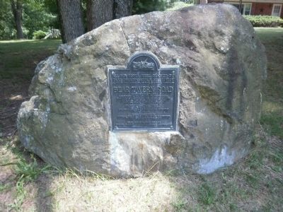
Bear Tavern Roa2qd Although much of the surrounding countryside has changed over the course of the more than two centuries that have passed since George Washington and the Continental Army made their famous march to Trenton in late December of . . . — — Map (db m229685) WM
Early Development Attracted by rich soils, farmers began settling in the area around Jacobs Creek as early as the late 17th century. The agricultural landscape and heritage they established defined the region’s unique identity.
Prior to . . . — — Map (db m185271) HM
On Christmas night, 1776, the Continental Army, under the command of General George Washington, crossed the Delaware River and began what is known as the Ten Crucial Days of the American Revolution. A few hundred feet from where you now stand, . . . — — Map (db m237180) HM
Henry Phillips was a third generation Phillips family member in Pleasant Valley; his grandfather arrived in 1737. Ca, 1805, Henry constructed the stone section of the house on the land he inherited from his father. Ca, 1830, he added the large frame . . . — — Map (db m94714) HM
This farmhouse is the only existing structure within the park that witnessed the Crossing of the Continental troops on December 25-26, 1776. It was built around 1740 by Rutger Jansen, a Dutchman from Flatbush, Long Island, on a tract of 490 acres . . . — — Map (db m10374) HM
You might well imagine that General George Washington stood where you are now stand as he patiently watched his force of 2400 troops march up from the boats on the river over the road in the immediate foreground. Through his officers he would direct . . . — — Map (db m166092) HM
[Marker Front]:
View of the Delaware River at the site where Washington crossed from Pennsylvania to New Jersey, Christmas Night, 1776, with 2400 men, artillery and supplies. The troops marched nine miles to attack the Hessians stationed at . . . — — Map (db m10379) HM
“The troops marched with the most profound silence and good order. They arrived by two routes at the same time, about half an hour after daylight, within one mile of the town. The storm continued with great violence …”
Colonel . . . — — Map (db m10450) HM
General George Washington and 2400 Continental soldiers crossed the icy Delaware River from Pennsylvania and landed at this spot on Christmas night 1776 on their way to attack the British mercenary force of Hessian soldiers at Trenton. The last . . . — — Map (db m253017) HM
School teacher John Harbourt built this stone building as a school house or a store, thus founding the village of Harbourton. A village store operated here from at least 1814 to 1963, with a post office included. — — Map (db m192382) HM
Howell Living History Farm depicts family farm life during the first years of the 20th Century, when both crops and livestock, were raised from livelihood. The farmhouse on the property, while dating back to the early 1800’s, is used to illustrate . . . — — Map (db m94717) HM
The Pole Farm was the outcome of experiments by AT&T Bell Labs scientists using radio shortwave to transmit telephone calls to other parts of the world. On June 1, 1929, radiomen in Lawrenceville connected with London, England, making it possible . . . — — Map (db m304178) HM
When World War II broke out in Europe, the Pole Farm's international telephone service was used by world leaders as one of the few means of direct, voice-to-voice communication. British Prime Minister Winston Churchill was able to call President . . . — — Map (db m304387) HM
Two centuries ago this was a remote spot. Stony Brook flowed swiftly down the narrow, winding, wooded valley. There was no bridge, no mill and no indication in the landscape that this was where the Province Line had been surveyed through the . . . — — Map (db m305652) HM
The story of the corporate campus around you, headquarters educational testing organization in the world, began on a crisp autumn day in 1954. Henry Chauncey, the first president of ETS, was taking a hike with his wife Laurie. After exiting the . . . — — Map (db m305642) HM
Today, LHT users crossing U.S. Route 206 need to stay alert to traffic, crosswalks and stoplights. There is not much time to reflect on this unassuming intersection with Province Line Road. Stepping onto the pavement, however, is to walk onto one . . . — — Map (db m303847) HM
Economic growth and greater levels of international communication fueled the Pole Farm’s rapid development after World War II. By 1948, the facility had 46 rhombic antennas beaming to 26 countries. In 1955, the station handled one million calls and . . . — — Map (db m304390) HM
The earliest community of people of African descent in Lawrence Township formed on Lewisville Road in the 1840’s. Before the Civil War, Black and White residents lived here together. The Mt. Pisgah AME Church, located near this site, formed the . . . — — Map (db m302986) HM
Ranged along this stretch of roadway is the small village of Lewisville, Lawrence Township's earliest African American community, founded by former enslaved persons and their descendants from Lawrence and the surrounding townships. They began . . . — — Map (db m303279) HM
The concrete foundations are all that remain of AT&T's London Tower Array. The towers supported giant steel mesh curtains that were the actual antennas. They were built in a precise alignment to aim the powerful shortwave radio signals at a . . . — — Map (db m304392) HM
Long before Mercer Meadows became a park, the southern half was commonly referred to as the “Pole Farm”. This 800-acre tract of land was selected in 1929 for use as the American Telephone & Telegraph (AT&T) International Radio Telephone . . . — — Map (db m304394) HM
As you hike or bike the LHT alongside Province Line Road, you are following in the footsteps of Surveyor-General George Keith. For two months in the spring of 1687, Keith surveyed a line through the wilderness of colonial New Jersey in an attempt . . . — — Map (db m305618) HM
Under the command of Colonel Edward Hand a successful delaying action, fought at the Shabakunk Creek, prevented British forces fron reaching Trenton before nightfall where the Second Battle of Trenton took place at the Assunpink Creek January 2, . . . — — Map (db m9888) HM
"Spring Grove"
Birthplace of
David Brearley
Born June 11, 1745 Died August 16, 1790
Lt. Col. American Revolutionary War
Chief Justice of New Jersey
1779 - 1789
Master of Arts College of New Jersey
Vice President New Jersey . . . — — Map (db m303072) HM
The “Pole Farm” is what people called this place before it became part of Mercer Meadows. If you'd been here in 1950, you would have seen hundreds of timber poles, many as tall as a 10-story building, supporting antenna wires beaming telephone . . . — — Map (db m304075) HM
Between 1943 and 1948, AT&T produced a map (right) of the Pole Farm. Now faded and in the AT&T Archive, the map documents the locations of the diamond-shape antennas, known as rhombic antennas, covering the 820-acre property. By the time this map . . . — — Map (db m304176) HM
This Georgian brick farmhouse was constructed for James Brearley, a member of one of the founding families of old Maidenhead (now Lawrence). Its size, style, and materials speak to the prosperity of the Brearley family.
Archaeological . . . — — Map (db m298173) HM
The AT&T Pole Farm has a rich communications history in Lawrenceville dating back to 1929 when a new service was introduced providing transatlantic telephone service. Below is a timeline of the significant events and contributions made to our . . . — — Map (db m304426) HM
The background story to the road in front of you, today known as Bergen Street, is part of our region’s ongoing love-hate relationship with highways. Believe it or not, Bergen Street was planned during the late 1920s as part of Arctic Highway, a . . . — — Map (db m303557) HM
No one knows for sure the age of the Brearley Oak. With a trunk circumference of 258 inches, a height of 110 feet, and a crown of 148 feet (as measured in 2019), estimates of its age are anywhere from 255 to 410 years old. This magnificent tree is . . . — — Map (db m303418) HM
This public pathway was built upon the bed of the “Johnson Trolley Line” (Trenton-Princeton Traction Company) that began operation on November 17, 1901. It went from Witherspoon Street in Princeton to West Hanover Street in Trenton and included . . . — — Map (db m303066) HM
LHT follows a segment of the former Johnson Trolley Line in Lawrenceville, and most trail users probably don’t recognize it. After all, there are no rails, no ties, cinders or grit, like with most railroads. The Johnson Trolley began operating in . . . — — Map (db m303687) HM
Organized during 1698, this Presbyterian congregation was among the earliest in America. Part of this church was built in 1764. — — Map (db m122268) HM
The very straight road behind you has been carrying traffic between Trenton and Kingston, by way of Princeton, since 1807. The Princeton and Kingston Turnpike, Princeton Pike for short, is one of New Jersey's oldest toll roads, among a flurry of . . . — — Map (db m305647) HM
In 1664, the Duke of York sold New Jersey, or "Nova Caesaria" to Lord Berkley and Sir George Carteret.
East Jersey: Carteret's Trustees sold a "Half" in 1682 to twelve associates, thereafter proprietors of East Jersey.
West Jersey: Berkley . . . — — Map (db m16862) HM
Originally known as Stout's Corner, Mount Rose emerged as a village in the 1820s. By 1880 it boasted a school, post office, sawmill and several shops. It was perhaps best known as a center of applejack whiskey production. Two distilleries operated . . . — — Map (db m18264) HM
To commemorate
The Bicentennial of the Birth of
George Washington
Two hundred American Elms were planted
on this Historic Highway by
The Trenton Chapters
Daughters of the American Revolution
and
The Children of the Elementary . . . — — Map (db m300178) HM
On this site, the allied American and French troops of Generals Washington and Le Comte de Rochambeau encamped August 29 to September 1, 1781 enroute to their Victory at Yorktown American independence was assured there in Virginia by the defeat . . . — — Map (db m64117) HM
In the nation’s service. In the service of all nations. On the occasion of its 250th anniversary Princeton University here records its gratitude to its alumni for their devotion to the University and its mission of education, scholarship and . . . — — Map (db m44846) HM
On the occasion of the 250th anniversary of Princeton University, the area communities express appreciation to the University for its contribution to their cultural, intellectual and economic vitality. — — Map (db m44851) HM
The terraced garden of Annis Boudinot Stockton (1736-1801) included a grotto. While traveling in England in 1766, her husband, Richard, investigated the gardens at Twickenham, the estate of poet Alexander Pope, for inspiration. He also brought . . . — — Map (db m208141) HM
Betsey Stockton (1798-1865) began life as a slave for the prominent Stockton family in Princeton. When she gained her freedom at the age of 20, she became a missionary, traveling to Hawaii (Sandwich Islands), Canada and Philadelphia, teaching school . . . — — Map (db m94762) HM
Near here lie buried the
American and British officers
and soldiers
who fell in the Battle of Princeton
January 3rd, 1777
Here freedom stood by slaughtered friend and foe, and ere the wrath paled or that sunset died, looked through the . . . — — Map (db m149806) HM
Originally built in 1772, the Thomas Clarke House is the only surviving building in the Park that dates to the Battle of Princeton. In the aftermath of the battle, the Clarke family transformed their home into a field hospital, providing aid and . . . — — Map (db m263707) HM
A Patriot of considerable distinction, Colonel John Haslet was the Commander of Delaware's first Continental Regiment. A native of County Londonderry, Ireland, he emigrated to America in 1757. Haslet was a graduate of the University of Glasgow, and . . . — — Map (db m5380) HM
This colonnade was originally part of Mathew Newkirk’s home in Philadelphia, Pennsylvania. Later called St. George’s Hall. The house was designed by Thomas U. Walter, who later designed the dome on the U.S. Capitol Building in Washington, D. C. In . . . — — Map (db m10153) HM
When the D&R Canal was finished in 1834, the D&R Canal Company had built a total of 19 pivot bridges along the 44-mile canal to carry roads over the hand-built waterway.
The Washington Road bridge was one of these original bridges: a timber, . . . — — Map (db m301363) HM
These six beds are used as a demonstration garden with a changing horticultural theme each year. Their layout recalls the kitchen garden that existed on the side of the current parking lot. In the 1920s, a cousin who had visited the Stocktons as . . . — — Map (db m208133) HM
The Garden Club of Princeton a founding member of the Garden Club of America established the French Markets during World War I for French War Relief and later for The Club’s Civic Projects These markets have been held in the Spring and Autumn for . . . — — Map (db m10620) HM
Following the Christmas night crossing of the Delaware River and the First Battle of Trenton on December 26, 1776, George Washington’s army re-crossed the river back into Pennsylvania. The British and German troops reacted to their defeat at Trenton . . . — — Map (db m149799) HM
997 entries matched your criteria. The first 100 are listed above. Next 100 ⊳