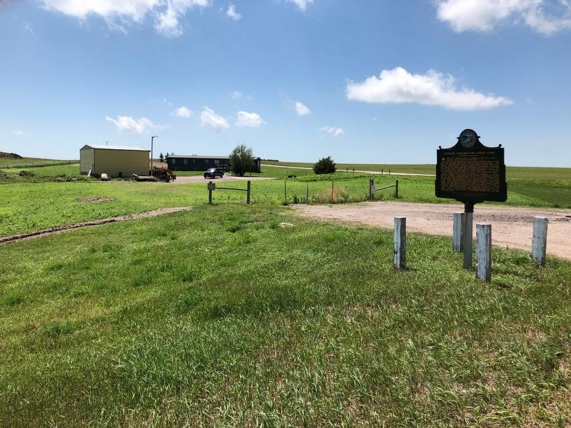
Camp BF-3: located 1 mile E, 4 miles S, 1 mile W & 5 miles S
Company: 4723 May 1937-Fall 1939
The Civilian Conservation Corps was a federal relief program during 1933-1942 that gave jobless men work renovating abused lands. The Army . . . — — Map (db m137082) HM
The prairie town of De Smet was the childhood home of children's book author, Laura Ingalls Wilder. The town was the backdrop for several of Wilder's books. Each July, a live, outdoor pageant is held to depict one of her books. — — Map (db m161869) HM
On May 24, 2012, the South Dakota DOT's Transportation Commission officially declared Interstate 90 from the Minnesota border to the Wyoming border as South Dakota's segment of the National Purple Heart Trail. The Purple Heart Trail was . . . — — Map (db m113087) HM
Tom Berry was the first of three Governors elected from West of the Missouri River since statehood in 1889.
Berry with his wife, Lorena McLain, (1879-1963), are buried in the family plot in the Belvidere Cemetery ½ mile north of this marker. . . . — — Map (db m184634) HM
This trail features seven types of animals that once lived in the area now known as Badlands National Park. Each of these lineages met a different fate as the climate changed. Some moved, some adapted to the changes, and some are now extinct. . . . — — Map (db m114175) HM
In the days when oreodonts walked this land, the rock layer before you was not rock but the muddy bottom of a streambed. Over time, those sediments hardened into the thick horizontal band of grayish red stone you see here.
Thin ribbons of . . . — — Map (db m137007) HM
Water is scarce in the Badlands, which get less than 16 inches of precipitation per year. The bowl-like Cliff Shelf where you stand provides more moisture than commonly found in this desolate land.
Drawn to this spot for more than 11,000 . . . — — Map (db m137125) HM
Rock layers in Badlands National Park contain fossils that show a dramatic cooling and drying of global climate over millions of years. The oldest rock layers contain marine fossils, roughly 70 million years old, from when this area was . . . — — Map (db m113124) HM
Oredonts were common throughout the Badlands, but became extinct. Their fossil remains provide evidence of their lives and habitat. Fossils can develop over time when animal or plant remains are quickly covered in sediment and replaced by . . . — — Map (db m113122) HM
Dogs have changed and adapted over millions of years. Members of the dog lineage gradually evolved in to the wolf by growing longer, stronger legs and a shorter tail. This increased size led to increased strength and power to hunt food and . . . — — Map (db m113177) HM
Mako sica - Lakota
Les mauvaises terres
The Badlands
When the Lakota looked on the land around you, they saw the Paha ska (white hills)-a place of bountiful hunting. Historically used for transitory camps, the Paha . . . — — Map (db m137121) HM
These rocks were deposited millions of years ago when rivers and wind spread silt, sand, and ash across the landscape. About 500,000 years ago, ancient rivers began eroding this area, leading to the present day landscape. Modern rivers, rain, . . . — — Map (db m113126) HM
Prehistoric alligators lived in swampy conditions, as they do today.
Physically, alligators have changed mostly in size over the last several million years. Modern alligators are larger, growing up to 14 feet long. Ancient alligators grew . . . — — Map (db m113092) HM
The Badlands Wall constantly retreats north as it erodes and washes into the White River Valley below. The Wall, an intricately carved cliff, divides the upper from the lower prairie.The wall is more than sixty miles long. It is the geologic feature . . . — — Map (db m45289) HM
A few hundred yards to the west, turn left on the sage Creek Rim Road for Roberts Prairie Dog Town and the Sage Creek Primitive Campground. Wildlife, particularly bison, is often seen near this gravel road.
The Sage Creek Rim Road . . . — — Map (db m113127) HM
Here you stand between wilderness and civilization. In the distance before you lie Interstate 90 and a neighboring ranch. Behind you, beyond the Loop Road, Badlands Wilderness Area stretches out across 64,000 acres.
The prairie around you was . . . — — Map (db m282002) HM
The discovery of this specimen led to the golden age of paleontology in North America. After acquiring this fossil from fur traders, Dr. Hiram Prout wrote about it in 1846. His description captured the attention of scientists. At that time, . . . — — Map (db m113176) HM
Ammonite fossils found in the park are evidence that this area was under water 75 million years ago. Some ammonites could grow to more that three feet across and served as a food source for giant mosasaurs and other predators.
The Western . . . — — Map (db m113115) HM
Your fossil discovery begins a scientific process. Every detail is important, even the area around the find. A fossil and its surroundings reveal what types of plants and animals existed and how they lived, died, and changed.
The . . . — — Map (db m113123) HM
Finding the pass too steep and rough for wagon traffic, homesteaders on the way to Interior parked their rigs at the top—then walked or coaxed their horses down.
How steep is Saddle Pass Trail?
Find out for yourself. Half an hour will . . . — — Map (db m237670) HM
...for years, countless travellers had driven across Interstate 90 in western South Dakota, en route to Mt. Rushmore National Memorial, or Yellowstone National Park,...within sight of nearly a dozen nuclear missile sites.... Tim Pavek, . . . — — Map (db m34295) HM
Camps NP-2: 8 miles S of Wall on SD 240, 13 miles W (1 mile W of Sage Creek); and NP-3: 3/4 mile S. of Cedar Pass Visitor Center. Company: 2754 (NP-2) -- 11/1/39 - 10/24/41; (NP-3) -- 10/24/41 - 3/25/42. The Civilian Conservation Corps was a . . . — — Map (db m45287) HM
Fossils can reveal how animals lived and died, and what their environment was like. Evidence from one of the park's nimravid fossils offers crime-scene clues. The size and location of the holes in the forehead of this fossil match the knife-like . . . — — Map (db m113121) HM
Horses have adapted in North America over millions of years. As woodlands changed to grasslands, the dog-sized, primitive horses gradually evolved into the lineage that led to the modern-day horse.
Mesohippus was the first three-toed . . . — — Map (db m113091) HM
Mighty few towns have one of them hi-faluting, swank Rolls-Royce type of hyphenated names. In 1904, Murdo Mackenzie, head of the Matador brand, with herds from Mexico to Canada, shipped trainload after trainload of Texas steers to Evarts to graze on . . . — — Map (db m134517) HM
Reading Brands
Two old cowpokes reading twenty brands wont agree on all of them but generally speaking this is how to read a brand.
A letter like this (image of backwards letter F) is a reverse F. But this (image of letter F leaning . . . — — Map (db m134569) HM
East 1/2 mile from this point on the old Cherry Creek - Pine Ridge Trail, Chief Big Foot (Spotted Elk) and his Minneconjou, wagon Horse band, with some forty braves and Sitting Bull's Hunkpapa band was intercepted and surrended on December 28, 1890 . . . — — Map (db m179956) HM
This monument erected by surviving relatives and other Ogallala and Cheyenne River Sioux Indians in memory of the Chief Big Foot Massacre December 29, 1890. Col. Forsyth was in command of the U.S. Troops. Big Foot was a great chief of the Sioux . . . — — Map (db m122747) WM
Dec. 29, 1890, Chief Big Foot, with his Minneconjou and Hunkpapa Sioux Band of 108 warriors, 250 women and children were encamped on this Flat, surrounded by the U.S. 7th Cavalry (470 soldiers) commanded by Col. Forsythe.
The "Messiah Craze" . . . — — Map (db m40643) HM
The Harney Peak fire lookout, dam
and pumphouse were built by the
CCC in 1939 and are listed in the
National Register of Historic
Places. Harney Peak Elevation is
2207 meters (7242 ft). The peak is
the highest point east of the . . . — — Map (db m125087) HM
The B-1A was initially developed in the 1970s as a replacement for the B-52. Four prototypes of his long –range, high speed strategic bomber were developed and tested but the program was canceled in 1977 before going into production. The B-1B . . . — — Map (db m70966) HM WM
This memorial dedicated to
the young men of the
Civilian Conservation Corps
1933-1942
Made possible by a grant from
”Sarge”
Melvin B. Hermanson
2008 — — Map (db m120159) HM
Engine #7 turned 100 in 2019. This engine was in service at the 1880 Train until 2012, when it was retired and placed here for all to enjoy and photograph.
Built by the Baldwin Locomotive Works in 1919, this historic 2-6-2 (wheel arrangement) . . . — — Map (db m202718) HM
This signal was retired from service on the Burlington Northern Santa Fe Railway, Powder River Division, Butte Subdivision, Milepost 400 in Marsland, Nebraska on August 10, 2011. The Butte Subdivision is part of BNSF Railway's coal loop which . . . — — Map (db m202702) HM
Camp F-2 (DF-2) Horse Creek: Located 2 miles W on Horse Creek. Companies: 791--5/22/33-4/30/34 2752--7/30/34-10/21/35 2761--10/25/35-01/36 2748--01/36-5/25/36
The Civilian Conservation Corps was a federal relief program during 1933-1942 that . . . — — Map (db m184419) HM
Camp F-15 Tigerville: Located 1/4 mile S of here.
Companies: 765--10/26/33-Spring 1934 757--4/21/34-10/20/34
2748--10/21/34-1/36 793--5/25/36-6/13/39
The Civilian Conservation Corps was a federal relief program during 1933-1942 that . . . — — Map (db m184461) HM
When Burlington Northern abandoned their railroad right of way between Deadwood and Custer in 1983, a group of citizens recognized the historic value of the rail line and saw the opportunity to create a recreational trail. They formed an . . . — — Map (db m309699) HM
First laid out as a gold camp in February 1876 by Thomas Harvey, John Miller and Hugh McCullough, the rich strikes in the Northern Hills made it a deserted village by May 1876. Its deserted cabins had many transient occupants and the cabin that . . . — — Map (db m177389) HM
The Hill City Depot was built in 1889 by the Burlington and Missouri River Railroad (B&M.R.) an early subsidiary of the Chicago Burlington and Quincy Railroad (C.B &Q). This depot was originally two stories with living quarters for the station agent . . . — — Map (db m202705) HM
The George S. Mickelson trail follows the old railroad of the abandoned Edgemont to Deadwood line of the Chicago, Burlington, and Quincy Railroad (CB&Q). The railroad was converted to the Mickelson Trail in the Fall of 1998 as part of the Rails to . . . — — Map (db m162782) HM
This young Ponderosa Pine forest was thinned by the Civilian Conservation Corps in 1935 to improve the growth of the remaining trees[.] The first commercial harvest was made in 1959 when the area was thinned again for posts and poles. From now on a . . . — — Map (db m37116) HM
This F-9 Hill City Civilian Conservation Corps CCC) Camp was established in March 1933. Congress began the program to address severe unemployment and poverty during the Great Depression and later terminated it in 1942, during World War II. The CCC . . . — — Map (db m155899) HM
The George S. Mickelson trail follows a raised railroad right-of-way that is the abandoned Chicago, Burlington, and Quincy Railroad (CB&Q). In 1849, construction of the CB&Q began in Aurora, Illinois and by 1864, the CB&Q spanned the 400 miles . . . — — Map (db m155900) HM
It was an exciting time in the late nineteenth century, as people in eastern states became fascinated with business and recreational opportunities in the West. Railroads expanded into vast, new areas and opened them for unprecedented development. . . . — — Map (db m309698) HM
Samuel Finley Breese Morse, an American, developed the telegraph system, which consisted of one wire. A further development called the Highton Signal System, introduced in 1837, employed the Morse code, transmitted from a device know as a . . . — — Map (db m202698) HM
Sheridan, located 1/2 mile NE, now 30 feet under water, was named for General Philip Sheridan and founded in 1875 on Cheyenne-Deadwood Trail, as Golden, in the belief that fabulous placer gold existed here. Still Indian Country and everybody a . . . — — Map (db m184420) HM
The Black Hills Central Railroad has been placed on the National Register of Historic Places by the United States Department of the Interior 1893 — — Map (db m70976) HM
The Little White Church was built in 1889 of lumber sawed at the mill of the Harney Peak Mining Company which was located four miles east of Hill City on County Road 323. The sawyer was Charlie Clifford; the Chief Carpenter, Joe Hare with three . . . — — Map (db m234793) HM
The strength of the steam engine is its ability to convert raw heat into mechanical work. The first Steam Locomotive Engine was designed by George Stephenson in 1814 at the age of 20. The diagram shows major components of a piston steam engine, . . . — — Map (db m202710) HM
This building is listed on the National Register as the oldest commercial hand-hewn log building in continuous use in South Dakota.
Built in 1885 by the German immigrant Camillo Von Woehrman as a saloon and sleeping quarters; in 1890 he began . . . — — Map (db m119999) HM
This water tank has a capacity of 3000 gallons. The water tank has been reconstructed, but it is on the original footings. Water tanks were placed along railroad lines to fill steam engines with water. Steam engines were the first engines widely . . . — — Map (db m288427) HM
Journey to Wounded Knee-December 24, 1890 a bitter Christmas Eve wind rattled the wagon in which Minneconjou Chief Big Foot lay waiting while his people cleared a pass down the Badlands Wall. Several hours of hard work with axes and spades made the . . . — — Map (db m62104) HM
Camp F-4: Pactola Campsite inundated by Lake Pactola. Companies: 1789--6/8/33-10/35 2748--5/25/36-1940
The Civilian Conservation Corps was a federal relief program during 1933-1942 that gave jobless men work renovating abused lands. The Army . . . — — Map (db m184423) HM
Construction of Pactola Dam began in 1952 and was completed in 1956. At times nearly 200 men worked on the dam. Unskilled workers earned $1.25 an hour and skilled workers $2.75 an hour. The men placed 2,163,251 cubic yards of impervious earthfill . . . — — Map (db m37064) HM
By the mid-20th century, water in the West did more than irrigate 160 acre patches of alfalfa. Water flowed as the life blood of cities, private industries, and military bases. Droughts during the 1930s illustrated that Rapid City could not depend . . . — — Map (db m37070) HM
The westward encroachment of settlers to the Plains radically impacted Tribal Nations as part of a series of events
that would forever change their traditional lifestyles, culture, and access to homelands. Among these changes was the . . . — — Map (db m277226) HM
1923 • Colossal sculpture in the Black Hills first suggested by Doane Robinson.
1924 • Gutzon Borglum's first visit to the Black Hills.
1927 • Address by President Calvin Coolidge at Mount Rushmore and first actual drilling.
1929 • Senator . . . — — Map (db m89492) HM
Born: February 12, 1809, in a log cabin in Harden (now Larue) County, Kentucky
Married: Mary Todd (1818-1882), November 4, 1842
Children: Robert Todd, Edward Baker, William Wallace, and Thomas "Tad"
Died: April 15, 1865, Washington, D.C., . . . — — Map (db m89398) HM
The Galena Fire consumed 16,788 acres, mostly within the borders of Custer State Park. More than $2.1 million was spent fighting the fire, and about $4.4 million worth of timber burned. None of Custer State Park's buildings were damaged, no people . . . — — Map (db m45351) HM
Ancient stone circles can be found across the landscapes of North America. Often the "spokes" are aligned with the cardinal directions, significant locations, or constellations. These structures act as astronomical clocks, denoting significant . . . — — Map (db m277206) HM
For Native Peoples in the Black Hills region, celestial and earthly locations are inextricably intertwined. Every year, from the Vernal Equinox to the Summer Solstice, spiritual leaders follow a map of the Black Hills located amongst the stars, . . . — — Map (db m277245) HM
Born: February 22, 1732, Westmoreland County, Virginia
Married: Martha Danbridge Curtis, (1732-1802), January 6, 1759
Children: John and Martha Curtis (adopted)
Died: December 14, 1799, at Mount Vernon, Virginia
Education: No formal . . . — — Map (db m89399) HM
His birthplace was Idaho. California first taught him art. Then France, who first gave him fame. England welcomed him. America called him home. His genius for the exquisite as for the colossal, gave permanence on canvas, in bronze, in marble, to . . . — — Map (db m49105) HM
His birthplace was Idaho. California first taught him art. Then France, who first gave him fame. England welcomed him. America called him home. His genius for the exquisite as for the colossal gave permanence on canvas, in bronze, in marble, to . . . — — Map (db m134568) HM
Almighty God, from this pulpit of stone the American people render thanksgiving and praise for the new era of civilization brought forth upon this continent. Centuries of tyrannical oppression sent to these shores, God-fearing men to seek in freedom . . . — — Map (db m89493) HM
Called “Paha Sapa,” “hills that are black” by the Oglala Sioux, this forested island rises 4,000 feet above the surrounding plains. From the prairie, these distant hills appear black. Covered with thick stands of ponderosa pine on the hills, and . . . — — Map (db m258981) HM
Norbeck Wildlife Preserve
Created by Act of Congress, 1949
Peter Norbeck 1870 – 1936
Well driller, Statesman, first native Governor of South Dakota, U.S. Senator, founder of Custer State Park, sponsor of Mount Rushmore . . . — — Map (db m4395) HM
George Washington's powerful profile is so
perfectly placed here that you might assume sculptor Gutzon Borglum planned it. But like many great events and feats, it was purely accidental.
Borglum intended to put Thomas Jefferson on . . . — — Map (db m277203) HM
1927–1941
Anderson, Dorothy ·
Anderson, Norman E. "Hap" ·
Anderson, Oscar A. ·
Anderson, Otto E. "Red" ·
Anderson, Peter "Pete" ·
Andrew, Cecil M. ·
Anton, Edward "Tony" "Pee-Wee" ·
Aronson, J. A. ·
Arundel, Russell · . . . — — Map (db m2114) HM
The Black Hills and the surrounding area are spiritually and emotionally significant to numerous Native nations as sites of historical and continued importance.
Buffalo Gap
Buffalo Gap, carved by the hooves of bison, serves as . . . — — Map (db m277210) HM
Doane Robinson (1856-1946) was the South Dakota state historian from 1901 to 1926. Speaking to the Black and Yellow Trail Association in January 1924, Robinson proposed his idea to carve legendary figures of the American West into the Black Hills . . . — — Map (db m184424) HM
Contributing Factors For several months prior to the Galena Fire, weather conditions were unusually hot and dry. Average annual precipitation for this region is 18 inches. In the 12 months before the fire only 11 inches fell in the Park.The . . . — — Map (db m45350) HM
Over 450,000 tons of rock were removed from Mount Rushmore to bring out the four presidential faces. Although about 90% of the rock was removed with dynamite, the remaining rock was removed by drilling with jackhammers and wedging the rock off the . . . — — Map (db m89491) HM
Born: October 27, 1858, New York, New York
Married: Alice Hathaway Lee (1861-1884), October 27, 1880; Edith Kermit Carow (1861-1848), December 2, 1886
Children: Alice, Theodore, Jr., Kermit, Ethel, Archibald, Quentin
Died: January 6, . . . — — Map (db m89459) HM
Thomas Jefferson
“I have learnt to expect that it will rarely fall to the lot of imperfect man to retire from this station with the reputation & the favor which bring him into it.” - First Inaugural Address, March 4, 1801
Born . . . — — Map (db m181435) HM
Traditional Ecological Knowledge (TEK) refers to insights and land management practices developed over generations in
relation to one's surrounding environment.
These practices help to guide natural processes in a way that creates desirable . . . — — Map (db m277213) HM
It would seem that a large forest fire would destroy an area for wildlife. However, the Galena Fire has improved much of the Park's wildlife habitat. The fire created many open meadows where grasses and shrubs are now growing. The mixture of meadow . . . — — Map (db m45352) HM
Castle Creek was named by General Custer when he and his troops traveled through its headwaters in 1874.
Gold was discovered in this valley to the west in 1875. A mining camp soon developed into the town named Castleton with a population of . . . — — Map (db m184801) HM
Camp F-1 Mystic: Located at this spot
Companies: 760--6/29/33-10/20/34 2753--10/20/34-10/30/35
2763--10/30/35-1/20/36 1790--1/20/36-1/6/38
The Civilian Conservation Corps was a federal relief program during 1933-1942 that gave jobless . . . — — Map (db m184462) HM
Walter Dale Miller was born October 5, 1925 near Viewfield. He graduated from New Underwood High School and spent his life ranching in Meade County.
Miller served in the State House of Representatives from 1967 to 1987. He is the only person in . . . — — Map (db m183905) HM
…(for) people who are on alert at the launch missile control centers it's very much an invisible thankless job.…nobody sees what they do, nobody cares about it. I see them as almost invisible warriors, the security police that are there, the . . . — — Map (db m113088) HM
For 49 years, Berlin, former capital of Adolf Hitler's Nazi Germany, was occupied by the victorious allies of World War II--the United States, Great Britain, France and the Soviet Union. For much of that time an ugly wall divided the city . . . — — Map (db m136630) WM
On June 9, 1972 a storm system approximately 80 miles long and 12 miles wide stalled on the eastern slope of the Black Hills with rainfall from 12 to 14 inches at its center. This system produced total rainfall of more than 800,000 acre feet of . . . — — Map (db m276816) HM
Berlin Wall Segment A.
This Berlin Wall Segment, located between the Brandenburg Gate and Checkpoint Charlie from 1961 - 1989, is donated in gratitude to all Military Chaplains, who in time of war and peace, faithfully served God and . . . — — Map (db m136418) WM
World War I 1914 - 1918
Our object now is to vindicate the principles
of peace and justice in the life of the world as
against selfish and autocratic power and to
set up amongst the free and seit-governed
peoples of the world such concert of . . . — — Map (db m190720) HM
Panel A.
On November 9, 1989, to stem the flow of refugees, desperate Communist leaders announced amid chaos that they would issue passports to all East Germans, allowing them to come and go as they pleased. That evening hundreds of . . . — — Map (db m136631) HM
Because of the Four-Power Agreements, the Allies had insisted upon free access to Berlin at any time. In 1958, Premier Nikita S. Khrushchev of the Soviet Union demanded that the Allies leave West Berlin and Berlin be made a "demilitarized free . . . — — Map (db m136629) HM
Early on August 13, 1961, the East German Army, with Soviet support, began constructing a barrier of barbed wire, cinder blocks and mortar between East and West Berlin. The barrier was intended to stop the exodus of citizens fleeing from . . . — — Map (db m136408) WM
Rufus "Pap" Madison's Cabin
As seen in George Mansfield's drawing. The original cabin stands at the Journey Museum.
Rapid City High School
Located on school land where Dakota Middle School sits today. The fencing and hay bales in . . . — — Map (db m187542) HM
Mr. Nielsen was born in 1843. He came
to the Black Hills to prospect for
gold in 1876. This log cabin was built
by him in Palmer Gulch. In 1925 he
died and was buried in Hill City. The
cabin was purchased at an auction,
dismantled and moved in . . . — — Map (db m300576) HM
In Founders Park Plaza the history of the first developed part of Rapid City is literally written in concrete. The Plaza shows the town (in colored concrete) skewed on its foundation (in uncolored concrete), orienting the town toward magnetic north . . . — — Map (db m187541) HM
A one time member of Buffalo Bill Cody's Wild West Show, Madison came to Dakota Territory in 1886 and the history of South Dakota Rodeo began. Russ won the Champion Relay Race in Sioux City, Iowa, in 1907 and then began building his bucking horse . . . — — Map (db m113149) HM
George B. Mansfield's drawing of Rapid City, Dakota Territory, 1876. Mansfield went on to become an executive with Dakota Power Co., organized 1883.
1. John W. Allen and Jake Claussen
2. John R. Brennan and Oscar Nicholson
3. Reddy Johnson . . . — — Map (db m187539) HM
The adjacent graph reflects the water levels in height of feet of Rapid Creek under certain events — average winter stage flows, average summertime stage flows during the irrigation season, and the stage flow of June 9, 1972. It must be noted . . . — — Map (db m277972) HM
Dr. Valentine McGillycuddy with his wife Fannie, at home at 727 South St. McGillycuddy was Mayor, Indian Agent, Dean of the School of Mines and South Dakota's first State Surgeon.
Joseph and Alice Gossage
Publishers of the city's most . . . — — Map (db m187540) HM
Near a perpendicular sandstone cliff a short distance North of here and across Rapid Creek (a marker denotes the site) was the first camp of those hardy pioneers who founded Rapid City. Here John R. Brennan, Martin Persinger, Thomas Ferguson, W. P. . . . — — Map (db m184409) HM
John Richard Brennan
From John Brennan's Journal
February 23, 1876
A party consisting of W.P. Martin, J.W. Allen, Mart Persinger, William Marston, John R. Brennan, Tom Ferguson, and Dick King left Palmer Gulch with a view . . . — — Map (db m187538) HM
128 entries matched your criteria. The first 100 are listed above. The final 28 ⊳