372 entries match your criteria. Entries 101 through 200 are listed.⊲ Previous 100 — Next 100 ⊳
Historical Markers and War Memorials in Ireland
By William Fischer, Jr., February 5, 2024
IUNVA House and memorial / Teach agus Cuimneachan CÉINA Marker
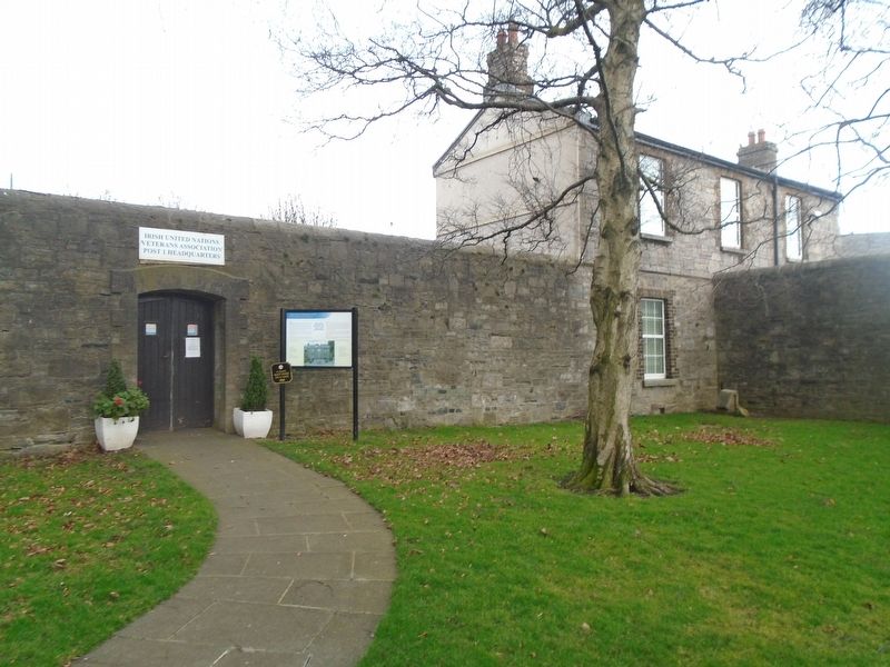
| 101 ► Ireland, Leinster, County Dublin, Dublin, Stoneybatter — IUNVA House and memorial / Teach agus Cuimneachan CÉINA — |
| 102 ► Ireland, Leinster, County Dublin, Dublin, Stoneybatter — Ludwig Wittgenstein — 1889 - 1951 — Philosopher — |
| On Parkgate Street just west of Temple Street West, on the right when traveling west. | |||
| 103 ► Ireland, Leinster, County Dublin, Dublin, Stoneybatter — The 1916 Rising memorial area / Limistéar Cuimhneacháin 1916 — |
| 104 ► Ireland, Leinster, County Dublin, Dublin, Stoneybatter — The Arms of the Bakers' Guild of Saints Clement and Anne — Armas Cheardchuallacht Bháicéirí Naomh Cléimeans agus Naomh Anna — |
| 105 ► Ireland, Leinster, County Dublin, Dublin, Stoneybatter — The burial plot of the leaders of the 1916 Rising — Láthair uaighe cheannairí Éirí Amach 1916 — |
| 106 ► Ireland, Leinster, County Dublin, Dublin, Stoneybatter — The Croppies Acre Memorial Park — 1798 — |
| On Wolfe Tone Quay (Route R148) just east of the Frank Sherwin Bridge over the River Liffey, on the left when traveling east. | |||
| 107 ► Ireland, Leinster, County Dublin, Dublin, Stoneybatter — The Croppy's Acre — Ar Dheis Ḋe Go Raibh A Anam — |
| On Wolfe Tone Quay (Route R148) 0.2 kilometers east of the Frank Sherwin Bridge over the River Liffey, on the left when traveling east. | |||
| 108 ► Ireland, Leinster, County Dublin, Dublin, Stoneybatter — Theobald Wolfe Tone — 1798 - 1898 — [Rebellion Centenary] — |
| 109 ► Ireland, Leinster, County Dublin, Dublin, Temple Bar — Frederick Douglass — |
| On Eustace Street just north of Dame Street (Route R137), on the left when traveling north. | |||
| 110 ► Ireland, Leinster, County Dublin, Dublin, Temple Bar — James Clarence Mangan — |
| On Christchurch Place (Route R137) at Lord Edward Street, on the right when traveling east on Christchurch Place. | |||
| 111 ► Ireland, Leinster, County Dublin, Dublin, Temple Bar — Liffey Bridge — (Ha'penny Bridge) — Built in 1816 — |
| On Wellington Quay (Route R148) at the bridge, on the right when traveling west on Wellington Quay. | |||
| 112 ► Ireland, Leinster, County Dublin, Dublin, Temple Bar — Sergeant Stephen Kelly and Constable Patrick Keena — In Memory of — |
| On Essex Street East at Eustace Street, on the right when traveling east on Essex Street East. | |||
| 113 ► Ireland, Leinster, County Dublin, Dublin, Temple Bar — Sir William Temple — (1555-1627) — |
| On Temple Bar at Temple Lane South, on the right when traveling east on Temple Bar. | |||
| 114 ► Ireland, Leinster, County Dublin, Dublin, Temple Bar — St. Winifred's Well — |
| On Eustace Street at Eustace Street, on the right when traveling north on Eustace Street. | |||
| 115 ► Ireland, Leinster, County Dublin, Dublin, Temple Bar — The Norseman — |
| On Essex Street East at Eustace Street, on the right when traveling east on Essex Street East. | |||
| 116 ► Ireland, Leinster, County Dublin, Dublin, The Liberties — Last sailing of a Guinness Barge — |
| On Victoria Quay (Route R148) 0.3 kilometers west of Watling Street/Rory O'More Bridge, on the left when traveling west. | |||
| 117 ► Ireland, Leinster, County Dublin, Dublin, The Liberties — Mendicity Institution Garrison / Garastún Institiúid Deirciochta — The Easter Rising 1916 / Éirí amach na cásca 1916 — We Remember / Is cuimhin linn — |
| On Usher's Island (Route R148) just west of Bridgefoot Street/Mellows Bridge (Route R804), on the left when traveling west. | |||
| 118 ► Ireland, Leinster, County Dublin, Dublin, Wood Quay — Site of St Olave's Church / Láthair Eaglais Amhlaoibh — 12th century / de chuid an 12ú haois — |
| On Fishamble Street just north of Christchurch Place (Route R137), on the left when traveling north. | |||
| 119 ► Ireland, Leinster, County Fingal, Howth — Balscadden House — |
| On Balscadden Road, on the left when traveling west. | |||
| 120 ► Ireland, Leinster, County Fingal, Howth — Howth Abbey, St. Marys / "Mainistir" Bhinn Éadair — |
| 121 ► Ireland, Leinster, County Fingal, Howth — Howth The Village / Binn Éadair ______ — The Fingal Way / Sli Fhine Gall — |
| On Harbour Road (Road 105) at West Pier Entrance, on the left when traveling east on Harbour Road. | |||
| 122 ► Ireland, Leinster, County Fingal, Howth — Lost At Sea — |
| 123 ► Ireland, Leinster, County Fingal, Howth — St Mary's Church / Eaglais Mhuire — |
| 124 ► Ireland, Leinster, County Fingal, Howth — The Lord Killanin — |
| On Harbour Road (Road 105) 0.05 kilometers west of Abbey Street (Road 105), on the right when traveling east. | |||
| 125 ► Ireland, Leinster, County Fingal, Howth — The Ready Boat Pillar — Sculpted by Seán O'Dwyer — |
| On Harbour Road (Road 105) at West Pier, on the left when traveling east on Harbour Road. | |||
| 126 ► Ireland, Leinster, County Fingal, Malahide — Malahide / Mullach Íde — |
| On Church Road (R124) at Main Street / The Mall (R106), on the left when traveling south on Church Road (R124). | |||
| 127 ► Ireland, Leinster, County Fingal, Portmarnock — The Southern Cross Monument — By Rachel Joynt & Remco DeFouw — |
| On Strand Road (Road 106) 0.3 kilometers south of Wendell Avenue, on the left when traveling south. | |||
| 128 ► Ireland, Leinster, County Fingal, Portmarnock — The Velvet Strand / An Trá Chaoin — Portmarnock / Port Mearnóg — |
| On Strand Road (Road 106) 0.3 kilometers south of Wendell Avenue, on the left when traveling south. | |||
| 129 ► Ireland, Leinster, County Kildare, Celbridge — St Patrick's Church, Celbridge — |
| On Main Street (Leinster Route R405) 0.2 kilometers south of Maynooth Road (Leinster Route R405), on the right when traveling south. | |||
| 130 ► Ireland, Leinster, County Kildare, Celbridge — A Brief History of Celbridge Poor Law Union — Celbridge Poor Law Union Burial Ground — |
| On Maynooth Road (Leinster Route R405) at Shackleton Road, on the left when traveling south on Maynooth Road. | |||
| 131 ► Ireland, Leinster, County Kildare, Celbridge — Arthur's Way / Cosán Arthur — In the footsteps of Arthur Guinness — Celbridge to Hazelhatch — |
| On Main Street (Leinster Route R405) just west of Maynooth Road (Leinster Route R405), on the left when traveling south. | |||
| 132 ► Ireland, Leinster, County Kildare, Celbridge — Castletown — |
| 133 ► Ireland, Leinster, County Kildare, Celbridge — Celbridge Abbey — Historic Buildings of Celbridge — |
| On Clane Road (Route R403) just west of Tea Lane, on the left when traveling west. | |||
| 134 ► Ireland, Leinster, County Kildare, Celbridge — Celbridge Union Workhouse Cemetery — Is talamh naofa i seo — [This Is Sacred Ground] — |
| On Maynooth Road (Route R405) at Shackleton Road, on the left when traveling south on Maynooth Road. | |||
| 135 ► Ireland, Leinster, County Kildare, Celbridge — Celbridge Union Workhouse Cemetery Gate — Geata na marbh — [The Gate of the Dead] — |
| On Maynooth Road (Leinster Route R405) at Shackleton Road, on the left when traveling south on Maynooth Road. | |||
| 136 ► Ireland, Leinster, County Kildare, Celbridge — Edward Bridgeman — |
| On Main Street (Leinster Route R405) 0.2 kilometers south of Maynooth Road (Leinster Route R405), on the left when traveling south. | |||
| 137 ► Ireland, Leinster, County Kildare, Celbridge — Kildrought House — 1719 — |
| On Main Street (Leinster Route R405) 0.1 kilometers south of Maynooth Road (Leinster Route R405), on the left when traveling south. | |||
| 138 ► Ireland, Leinster, County Kildare, Celbridge — Sir Gerald Dease, K.C.V.O. — |
| On Main Street (Leinster Route R405) 0.2 kilometers south of Maynooth Road (Leinster Route R405), on the right when traveling south. | |||
| 139 ► Ireland, Leinster, County Kildare, Celbridge — Welcome to Celbridge — Our Story — |
| On Main Street (Leinster Route R405) close to Maynooth Road (Leinster Route R405), on the left when traveling south. | |||
| 140 ► Ireland, Leinster, County Kildare, Leixlip — The Wonderful Barn — |
| 141 ► Ireland, Leinster, County Kildare, Maynooth — Caisleán mhagh nuadhad / Geraldine Castle — |
| On Main Street (Leinster Route R408) just west of Mill Street (Leinster Route R148), on the right when traveling west. | |||
| 142 ► Ireland, Leinster, County Kildare, Maynooth — James, Duke of Leinster — |
| On Parson Street (Leinster Route R408) just west of Mill Street (Leinster Route R148), on the right when traveling south. | |||
| 143 ► Ireland, Leinster, County Kildare, Maynooth — St. Mary's Church (Anglican) — |
| On Parson Street (Leinster Route R408) just west of Mill Street (Leinster Route R148), on the right when traveling south. | |||
| 144 ► Ireland, Leinster, County Kildare, Maynooth — St. Mary's Church of Ireland East Window — |
| On Parson Street (Leinster Route R408) just west of Mill Street (Leinster Route R148), on the right when traveling south. | |||
| 145 ► Ireland, Leinster, County Kilkenny, Collegepark — Kilkenny Historic Sites — |
| On Rose Inn Street at The Parade, on the left when traveling south on Rose Inn Street. | |||
| 146 ► Ireland, Leinster, County Kilkenny, Freshford — St. Lachtain's Old Graveyard — |
| On Kilkenny Street (Leinster Route R693) at Church Street (Leinster Route R694), on the left when traveling east on Kilkenny Street. | |||
| 147 ► Ireland, Leinster, County Kilkenny, Kilkenny — Halla an Bhaile / The Tholsel — |
| On High Street at William Street, on the right when traveling north on High Street. | |||
| 148 ► Ireland, Leinster, County Kilkenny, Kilkenny — Ireland's Medieval Mile — |
| On The Parade just east of Butler Street/Rose Inn Street, on the left when traveling east. | |||
| 149 ► Ireland, Leinster, County Kilkenny, Kilkenny — Kilkenny Historic Sites — |
| On High Street at Poyntz Lane, on the right when traveling north on High Street. | |||
| 150 ► Ireland, Leinster, County Kilkenny, Kilkenny — Smithwick's — 300 Years — 1710 - 2010 — |
| On John's Bridge at the River Nore Bridge (Leinster Route R887), on the left when traveling north on John's Bridge. | |||
| 151 ► Ireland, Leinster, County Kilkenny, Kilkenny — STATHAM-FORD Special — |
| On Patrick Street, 0.1 kilometers south of High Street/The Parade, on the left when traveling south. | |||
| 152 ► Ireland, Leinster, County Kilkenny, Kilkenny — STATHAM'S By Pembroke Kilkenny — |
| On Patrick Street, 0.1 kilometers east of High Street/The Parade, on the left when traveling south. | |||
| 153 ► Ireland, Leinster, County Kilkenny, Kilkenny — Teach Archer / Archer House — |
| On High Street at St. Mary's Lane, on the left when traveling north on High Street. | |||
| 154 ► Ireland, Leinster, County Kilkenny, Kilkenny — Teach Déirce Shee / Shee Almshouse — |
| On Rose Inn Street (Leinster Route R887) just south of St Kieran's Street, on the right when traveling south. | |||
| 155 ► Ireland, Leinster, County Kilkenny, Kilkenny — The Colles Horse Trough — |
| On Rose Inn Street (Leinster Route 887) at The Parade, on the left when traveling south on Rose Inn Street. | |||
| 156 ► Ireland, Leinster, County Kilkenny, Kilkenny — The Tholsel Renovation — |
| On High Street at William Street, on the right when traveling north on High Street. | |||
| 157 ► Ireland, Leinster, County Kilkenny, Kilkenny — Thomas Moore — |
| On The Parade just west of Kilkenny Castle, on the left when traveling west. | |||
| 158 ► Ireland, Leinster, County Kilkenny, Kilkenny — War and Peacekeeping Memorial — |
| On the River Nore Bridge (Leinster Route R887) at John's Bridge, on the left when traveling west on the River Nore Bridge. | |||
| 159 ► Ireland, Leinster, County Kilkenny, Kilkenny — William F. Roe — 1904-1982 — |
| On Patrick Street, 0.1 kilometers south of High Street/The Parade, on the right when traveling south. | |||
| 160 ► Ireland, Leinster, County Laois, Borris In Ossory — Millenium Fountain — |
| On Main Street (National Road 7) at Rock Road, on the left when traveling east on Main Street. | |||
| 161 ► Ireland, Leinster, County Longford, Kenagh — fáilte go Kenagh — |
| On McHugh Park (Local Road 397) at Cartron Road, on the left when traveling south on McHugh Park. | |||
| 162 ► Ireland, Leinster, County Longford, Lanesborough — fáilte go Lanesborough — |
| On Main Street (National Road 63), on the left when traveling west. | |||
| 163 ► Ireland, Leinster, County Longford, Lanesborough — Lanesborough / Béal Átha Liag History 500 - 1900 AD — |
| 164 ► Ireland, Leinster, County Longford, Longford — County Longford Great War Memorial — 1914 - 1918 — |
| On Ballymahon Street (National Road 63) at New Street, on the left when traveling north on Ballymahon Street. | |||
| 165 ► Ireland, Leinster, County Louth, Monasterboice — Monasterboice / Mainistir Bhuithe — |
| 166 ► Ireland, Leinster, County Louth, Monasterboice — 98 — Round Tower / An Cloigtheach — |
| 167 ► Ireland, Leinster, County Louth, Monasterboice — 98 — The North Church / An Teampall Thuaidh — |
| 168 ► Ireland, Leinster, County Louth, Monasterboice — 98 — The South Church / An Teampall Theas — |
| 169 ► Ireland, Leinster, County Meath, Bective — Bective Abbey / Mainistir Bheigtí — |
| 170 ► Ireland, Leinster, County Meath, Crossakiel — Jim Connell — |
| On Local Road 154, on the right when traveling south. | |||
| 171 ► Ireland, Leinster, County Meath, Culmullen — Culmullen & 1798 — They Gave Their Lives For Their Cause — |
| On Road 126 at Pelletstown Road, on the left when traveling north on Road 126. | |||
| 172 ► Ireland, Leinster, County Meath, Donaghmore — Donaghmore Church and Round Tower — Domhnach Mór agus Cloightheach — |
| 173 ► Ireland, Leinster, County Meath, Duleek — Connell's House — Duleek Heritage Trail — |
| On Church Street at Main Street, on the left when traveling west on Church Street. | |||
| 174 ► Ireland, Leinster, County Meath, Duleek — Duleek 1916 - 1981 Hunger Strike Monument — and Memorial Garden — |
| On Kingsgate at Station Road, on the right when traveling west on Kingsgate. | |||
| 175 ► Ireland, Leinster, County Meath, Duleek — Duleek Courthouse — Duleek Heritage Trail — |
| On Main Street (Road 150), on the right when traveling west. | |||
| 176 ► Ireland, Leinster, County Meath, Duleek — Parochial House — Duleek Heritage Trail — |
| On Church Street, on the right when traveling west. | |||
| 177 ► Ireland, Leinster, County Meath, Duleek — St Mary's Abbey — Duleek Heritage Trail — |
| On Church Lane at Dawe's Lane, on the left when traveling west on Church Lane. | |||
| 178 ► Ireland, Leinster, County Meath, Duleek — The Lime Tree — Duleek Heritage Trail — |
| On Main Street (Road 150), on the right when traveling north. | |||
| 179 ► Ireland, Leinster, County Meath, Fordstown — Girley / Fordstown — Meath Villages — |
| On Kells Road (Local Route 164) at Navan Road, on the right when traveling north on Kells Road. | |||
| 180 ► Ireland, Leinster, County Meath, Kells — Catherine Dempsey — |
| 181 ► Ireland, Leinster, County Meath, Kells — Headfort Place — Kells Heritage Trail — |
| On Headfort Place (Local Road 163) 0.05 kilometers east of Navan Road (National Road 3), on the right when traveling west. | |||
| 182 ► Ireland, Leinster, County Meath, Kells — Kells Courthouse — |
| On Headfort Place (Local Road 163) at Navan Road (National Road 3), on the right when traveling east on Headfort Place. | |||
| 183 ► Ireland, Leinster, County Meath, Kells — Kells Round Tower — Kells Heritage Trail — |
| On Cannon Street (Local Road 163), on the right when traveling west. | |||
| 184 ► Ireland, Leinster, County Meath, Kells — Market Cross — Kells Heritage Trail — |
| On Headfort Place (Local Road 163) at Navan Road (National Road 3), on the right when traveling east on Headfort Place. | |||
| 185 ► Ireland, Leinster, County Meath, Kells — St Columba's Church — Kells Heritage Trail — |
| On Church Street at Market Street, on the left when traveling north on Church Street. | |||
| 186 ► Ireland, Leinster, County Meath, Kells — Suffolk Street — Kells Heritage Trail — |
| On Cannon Street (Road 163) at Suffolk Street, on the left when traveling west on Cannon Street. | |||
| 187 ► Ireland, Leinster, County Meath, Kells — The Churchyard Wall — Kells Heritage Trail — |
| On Cannon Street (Road 163) at Suffolk Street, on the right when traveling west on Cannon Street. | |||
| 188 ► Ireland, Leinster, County Meath, Loyd — Kells Union Workhouse Paupers' Graveyard — |
| 189 ► Ireland, Leinster, County Meath, Loyd — Spire of Loyd — Kells Heritage Trail — |
| 190 ► Ireland, Leinster, County Meath, Newgrange — Knowth / Cnogbha — |
| 191 ► Ireland, Leinster, County Meath, Newgrange — The Woodhenge/Pit circle / The Winter Soltice — |
| 192 ► Ireland, Leinster, County Meath, Slane — Saint Patrick on the Hill of Slane — |
| 193 ► Ireland, Leinster, County Meath, Slane — Slane Abbey — Mainistir Shláine — |
| 194 ► Ireland, Leinster, County Meath, Tara — Welcome to Tara of the Kings — Hill of Tara — |
| 195 ► Ireland, Leinster, County Meath, Trim — Newtowntrim Cathedral / Ardeaglais an Bhaile Nua — Cathedral of Saints Peter and Paul — Ardeaglais nPheadair agus nPhóil — |
| 196 ► Ireland, Leinster, County Offaly, Birr — John Farrell's Field — |
| On National Route N52 just west of National Route 62, on the left when traveling south. | |||
| 197 ► Ireland, Leinster, County Offaly, Birr — Site of First All-Ireland Hurling Final — |
| On National Route N52 just west of National Route N62, on the left when traveling south. | |||
| 198 ► Ireland, Leinster, County Offaly, Birr — The world's first automobile fatality — happened here on 31 August 1869 — |
| On Emmet Street (National Route 52) at Oxmantown Mall, on the left when traveling north on Emmet Street. | |||
| 199 ► Ireland, Leinster, County Offaly, Tullamore — Tullamore Distillery — |
| On Patrick Street just west of Bridge Street (Leinster Route R421), on the left when traveling west. | |||
| 200 ► Ireland, Leinster, County Offaly, Tullamore — World Wars Memorial — |
| On High Street/Main Street (Leinster Route 421), on the right when traveling north. | |||
372 entries matched your criteria. Entries 101 through 200 are listed above. ⊲ Previous 100 — Next 100 ⊳