“In spite of everything, I still believe that people are really good at heart. – Anne Frank”
“Of the 6 million Jews murdered during the Holocaust, 1939-1945, 1.5 million were children. Anne Frank was one of them.”
“Children are the ultimate . . . — — Map (db m174633) HM WM
On Keizer Street just west of Heeren Street, on the right when traveling west.
This monument is in remembrance of the Surinamese Jewish men, women and children who were murdered in Europe during the Holocaust. The Holocaust was the genocide of six million Jews in the years 1939-1945 by the Nazi government of Germany . . . — — Map (db m151277) HM WM
Capt Isidore Newman, MBE
Jewish Secret Agent WW2
Special Operations Executive (SOE)
lived at 52/53 Hawthorn Terrace.
He was betrayed in France
and murdered in Mauthausen
concentration camp in 1944
Be strong and of good courage, . . . — — Map (db m222723) HM WM
In Memory of Philip Freeman/Friedman
Jewish Exeter Wartime Firewatcher
Age 67
Who was killed in the German bombing raid,
4 May, 1942.
Till 2022, his grave was unidentified
Hebrew Acronym v
(Samuel, 25:29, “May his soul be . . . — — Map (db m212023) WM
Mentioned in Despatches
Jewish secret agent of the Special Operations Executive (SOE)
lived at 9 Brownlow Court.
Captured and murdered in Mauthausen Concentration Camp, 1944.
Be strong and of good courage (Joshua 1:9) . . . — — Map (db m211224) HM WM
Marie Schmolka was the only Czechoslovak representative at the Evian conference of July 1938, which focused on the Jewish refugee crisis. After the Munich agreement of September 1938, together with Doreen Warriner, she organised the . . . — — Map (db m188406) HM
Chrystman was an evangelical Christian, a Polish Volksdeutsche, who managed the Kara-Hortensia Glass factory in Piotrkow-Trybunalski. He worked closely with Solomon Gomberg, a Jew from Lodz, to supervise the factory’s Jewish personnel. A large . . . — — Map (db m188414) HM
Holocaust Rescuer who saved tens of thousands of Jews
Wilfrid Berthold Jacob Israel was born into a liberal Jewish family of extreme wealth. His mother, Amy, the granddaughter of the Chief Rabbi of the U.K., Herman Adler, insisted he . . . — — Map (db m228001) HM
The son of Jewish immigrants, Simmon lived here from the 1920s till 1940. He was posthumously awarded this highest medal for bravery when attempting to save the lives of three men in a burning barracks in Mogadishu, December 1944. . . . — — Map (db m188335) HM
On the night of 17th September 1940 during The Blitz, at London Auxiliary Fire Station stood on this site when it was hit by a bomb Fireman Harry Ehrengott (Errington), son of Jewish immigrants living in Soho, won the George Cross the highest . . . — — Map (db m160254) HM
On Panton Street, 0.2 kilometers east of Haymarket, on the left when traveling west.
At 4 Panton Street was the Headquarters of the mostly Jewish Ex-Servicemen and Women's organisation.
The 43 Group
They confronted the British neo-fascist movement in 1946-50 and early 1960s to rid Britain of anti-Semitism and all . . . — — Map (db m216002) HM
On Brooke Road at Cottage Walk, on the right when traveling west on Brooke Road.
At 9 Brooke Rd., lived Air Raid Warden
BARNETT LEWIS
(GM) George Medal
Jewish War Hero
September 23, 1940, at extreme personal risk,
he saved many civilians during the Blitz.
Be strong and of good courage. (Joshua . . . — — Map (db m201654) HM WM
The Hackney Mortuary played an important role in a British military operation during the Second World War (1939-1945), which helped save the lives of thousands of soldiers.
In April 1943 Lieutenant Commander Ewen Montagu CBE KC RNVR, a British . . . — — Map (db m185958) HM
On Northwold Road at Geldeston Road, on the right when traveling east on Northwold Road.
Sir Arnold Wesker
famed Jewish playwrite and author,
lived many years in Hackney,
and attended
Northwold Primary School
1940-1943 — — Map (db m201679) HM
On Ridley Road at Kingsland High Road, on the right when traveling east on Ridley Road.
This Ridley Road plaque marks a key site where the mainly Jewish Ex-Servicemen and Women anti-Fascist organization The 43 Group Confronted the British neo-fascist movement in 1946-50 and early 1960s to rid Britain of anti-Semitism and all . . . — — Map (db m237802) HM
On Whitehead’s Grove at Sloane Avenue, on the left when traveling east on Whitehead’s Grove.
Commander of the Order of the British Empire, Croix de Guerre, Legion of Honour
[Star of David]
A Jewish pre-war British spy, Vera joined Special Operations Executive (SOE), as an Intelligence Squadron Officer, F Section, . . . — — Map (db m203193) HM
On Chance Street at Whitby Street, on the right when traveling north on Chance Street.
Jewish war hero and Radar expert of 1942 WW2 Dieppe Raid
Fl. Sgt. Jack Nissenthall, RAF
attended the Cambridge and Bethnal Green Jewish Youth Club located at 4, Chance Street, E2
Be strong and of good courage (Joshua 1:9) . . . — — Map (db m220762) HM
On Stepney Green, on the right when traveling west.
Mentioned in Despatches
lived at 66 Stepney Green Court/Buildings.
Killed in Action at Gallipoli, 1915, WWI,
refusing to abandon his cutter, gallantly rowing soldiers
ashore in full view of the enemy.
He has no known grave. . . . — — Map (db m211398) HM WM
On Adler Street at Coke Street, on the right when traveling north on Adler Street.
Whitechapel was the centre of Jewish immigrant life.
From 1889 to the 1980s, on this site were located many national offices and societies of the Jewish community, a Yiddish theatre and a synagogue. — — Map (db m201062) HM
Austrian born, Jewish, British Military Volunteer,
MI6 Secret Agent, WW2.
King's Commendation for Brave Conduct, 1944/1945.
while investigating and reporting on factories
where Nazis were thought to be developing
nuclear weapons, he . . . — — Map (db m232664) HM
Jewish Holocaust refugee and expressionist artist lived in this house until her death in 1965, after she was forced to flee Austria in 1938 — — Map (db m188400) HM
Admiral Sir Max Horton RN
Honoring British Commonality and Diversity
Commander-in-chief responsible for British participation in the Battle of the Atlantic, WWII.
Admiral Max Horton RN was of Jewish heritage born in Anglesey. . . . — — Map (db m174575) WM
On Westside Street south of West Northside Street, on the left when traveling south.
In 1957, local government officials in Tuskegee, Alabama sought to gerrymander the city's limits in an attempt to diminish the number of black votes in upcoming elections. Alabama state senator Sam Engelhardt sponsored Act 140, which transformed . . . — — Map (db m139876) HM
On West Montgomery Road east of Peyton Road, on the right when traveling west. Reported missing.
Churches within the African American community played an important role during the civil rights movement. They were places beyond control of white power structure, as well as locations where people could express themselves without reprisal. They . . . — — Map (db m139884) HM
On Cedar Street south of Railroad Avenue, on the right when traveling north.
Mount Olive Missionary Baptist Church developed out of the Tuskegee Baptist Church, originally organized in 1842. Although both whites and blacks (slaves) initially worshipped at the same location, the white congregants built a new facility in 1858, . . . — — Map (db m139880) HM
On West Martin Luther King Highway (U.S. 80) west of South Jericho Street, on the right when traveling east.
Rosa Louise McCauley Parks (1913 – 2005) was an iconic activist during the mid twentieth century civil rights movement. Born in Tuskegee, Parks later moved with her mother to Pine Level located near Montgomery, Alabama. She was encouraged by . . . — — Map (db m134670) HM
On East Martin Luther King Highway (U.S. 80) east of North Maple Street, on the left when traveling east.
Samuel "Sammy" Leamon Younge, Jr. (1944-1966), a civil rights and voting rights activist, was the first African American university student killed during the civil rights movement. A Tuskegee native, Younge was attending Tuskegee University when . . . — — Map (db m139875) HM
On South Main Street (U.S. 29) at East Price Street, on the right when traveling north on South Main Street.
In August of 1963, the United States District Court M. D. Alabama sided with the plaintiff in Lee v. Macon County Board of Education. This pivotal civil rights case involved the integration of, the all-white Tuskegee High School (located on . . . — — Map (db m139878) HM
On North Elm Street north of West Northside Street, on the left when traveling north. Reported missing.
Following World War II, Tuskegee's black population began to grow, and many sought to register to vote. Perceiving a threat to their political power, white politicians tried to control the black vote through a variety of techniques. These actions . . . — — Map (db m139877) HM
On Franklin Road near Boy Scout Circle, on the left when traveling north.
Amelia Boynton Robinson (1911 2015) was a voting rights activist and civil rights icon. Born on August 18, 1911, in Savannah, Georgia, she received her bachelor's degree in home economics from Tuskegee University in 1927. In 1934, Mrs. Boynton . . . — — Map (db m139890) HM
On Bibb Street, 0.2 miles north of Hudson Street, on the left when traveling north.
Charles Goode Gomillion (1900-1995) was born on April 1, 1900, in Johnston, South Carolina. He joined the faculty at Tuskegee University in 1928, where he served as dean of students and chair of the social sciences department. He was president of . . . — — Map (db m140006) HM
On NW Chambliss Street south of West Montgomery Road, on the left when traveling south.
Jessie Parkhurst Guzman (1898-1996) was born in Savannah, Georgia, educated at Howard University (BA, 1919) and Columbia University (MA, 1924), and worked at Tuskegee University for over forty years. During Guzman's time at Tuskegee University, she . . . — — Map (db m139885) HM
On Moton Drive at Booker T. Washington Boulevard on Moton Drive.
Julius Rosenwald (1862-1932) was a Jewish multimillionaire merchant and one of the founders (1906) of Sears, Roebuck, and Company, then the largest department store in the United States. Rosenwald was a member of the Tuskegee University Board of . . . — — Map (db m134671) HM
On University Avenue east of Booker T Washington Boulevard, on the right when traveling east.
The Tuskegee Institute Advancement League (TIAL) was a student-based organization started in 1963 and reorganized in 1965 during the school integration crises. It originally sought to gain a measure of academic freedom through input with the . . . — — Map (db m139886) HM
On West Montgomery Road at Chambliss Street, on the left when traveling west on West Montgomery Road.
The Tuskegee Civic Association, whose offices were located here, started out of The Men’s Meeting of the 1920s and the Tuskegee Men’s Club of the 1930s. On April 13, 1941, in order to increase its effectiveness and to embrace all segments of the . . . — — Map (db m139923) HM
On West 8th Street at Center, on the left when traveling west on West 8th Street.
Max Aronson was born at 713 Center Street, (a house formerly located across the street), on March 21, 1880, to Esther and Harry Aronson, a Jewish dry goods salesman. As a child, Max Aronson relocated to St. Louis, before moving to the . . . — — Map (db m120205) HM
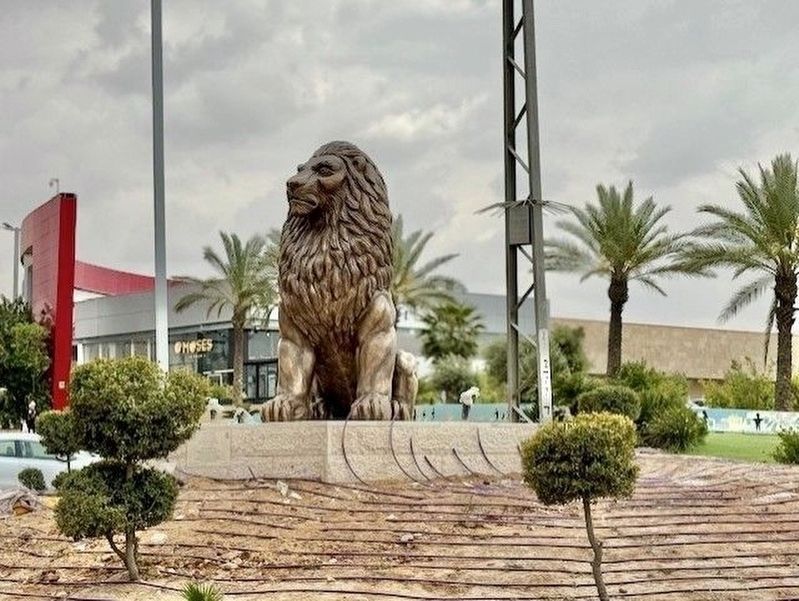
Near Point Lobos Avenue west of El Camino del Mar, on the right when traveling east.
Although the arched gateway is long gone, the
two lions still remain. This was the estate of Adolph Sutro—a Jewish-American immigrant, mining engineer and Mayor of San Francisco. After transforming the windswept sand dunes into a Victorian estate . . . — — Map (db m202194) HM
Near B Street (California Route 70), on the right when traveling south.
Founded by the Marysville Hebrew Benevolent Society in 1853 to provide “...relief to the poor, needy, sick and the burial of the Jewish persuasion in Marysville and the vicinity.”
The cemetery was originally described as “One . . . — — Map (db m65871) HM
The Hebrew Cemetery
The Hebrew Benevolent Association established the Hebrew Cemetery in January,1880, in the Southwest corner of Leadville’s Evergreen Cemetery with the transfer of 101,000 square feet from the Union Veteran’s Association. . . . — — Map (db m239342) HM
On West 4th Street at Pine Street, on the right when traveling east on West 4th Street.
The Jewish Settlement
The group of Jews in Leadville traced their roots to Germany. They tended to be assimilationists and practiced Reform Judaism, including worship services largely in English, women as members of the congregation, and the . . . — — Map (db m135817) HM
On South Maple Street at East 3rd Street, on the left when traveling north on South Maple Street.
Jews have been part of Trinidad's social, economic and political life since first arriving as traders along the Sante Fe Trail. Maurice and Isaac Wise opened a store on Main Street in 1867. The Jaffa Brothers' Trading Company was established in . . . — — Map (db m135690) HM
On North Grand Avenue, on the left when traveling north.
Jewish-Americans have contributed to the rich cultural, economic and political life throughout Colorado’s
history. Mr. Abraham Goldsmith and his brother Henry Goldsmith are the first known Jewish immigrants to
what was then the Territory of . . . — — Map (db m232622) HM
On Whalley Avenue (Connecticut Route 63) at West Park Avenue, on the left when traveling north on Whalley Avenue.
We Remember
The Six Million Jews Who Were
Murdered by the Nazis
During World War II – 1939 – 1945 (5699 – 5705)
Dedicated by The City of New Haven
The New Haven Jewish Federation
[ camp names inscribed on stones . . . — — Map (db m29050) HM
On Williams Street at Broad Street, on the left when traveling north on Williams Street.
Gratefully dedicated to those who gave their lives in the service of our country in order to preserve its ideals of liberty and democracy1961 — — Map (db m48649) HM
On North French Street north of East 8th Street, on the right when traveling north.
In memory of the 6,000,000 men, women, and children, victims of hatred whom the Nazi's brutally murdered only because they were Jews.....
and the world remained silent. — — Map (db m215951) WM
On G Street Northwest at 3rd Street Northwest, on the left when traveling east on G Street Northwest. Reported missing.
Listed on the United States Register of Historic Places and
an officially designated Landmark of the District of Columbia
Maintained by the Jewish Historical Society of
Greater Washington as the
Lillian and Albert Small
Jewish Museum . . . — — Map (db m29797) HM
Near Harbor Walk Drive, 0.1 miles north of Nesbit Street.
In honor of
the men and women
who served.
Jewish War Veterans of America
Oskar Schindler Post #404
Port Charlotte, Florida
100th Anniversary 1896-1996
— — Map (db m244052) WM
On 27908 Virgil Hawkins Circle, 0.1 miles south of North Quarters Raod, on the right when traveling south.
Julius Rosenwald was the chairman of Sears Roebuck and Co. in 1908. As a Jewish American, he believed the most serious problem of the United Stats was the plight of Black Americans. Rosenwald was a close friend of Booker T. Washington. . . . — — Map (db m185785) HM
On Seacrest Boulevard at 10th Avenue, on the right when traveling south on Seacrest Boulevard.
A school for black children was established before 1900 by members of the St. Paul AME Church. In 1907, the congregation petitioned the Dade County School Board for a teacher and built a small building on donated land. The school received its most . . . — — Map (db m223346) HM
On Cherry Street at Spring Street (Georgia Route 19), on the right when traveling east on Cherry Street.
Jewish-Americans have played a significant role in the economic,social and political life of Macon since the 1840s. To meet their growing religious needs, they established Orthodox Congregation Kahal Kadosh Beth Israel in 1859 in downtown Macon. The . . . — — Map (db m155592) HM
On Roswell Road at Larry McDonald Memorial highway (Interstate 75), on the right when traveling west on Roswell Road.
In respectful memory of the thousands
across America, denied justice by lynching;
victims of hatred, prejudice, and ignorance.
Between 1880-1946,
~570 Georgians were lynched. — — Map (db m136757) HM
On Roswell Road (Georgia Route 120) at Larry McDonald Memorial Highway (Interstate 75), on the right when traveling west on Roswell Road.
Near this location on August 17, 1915, Leo M. Frank, the Jewish superintendent of the National Pencil Company in Atlanta, was lynched for the murder of thirteen-year-old Mary Phagan, a factory employee. A highly controversial trial fueled by . . . — — Map (db m16574) HM
On Slaton Drive, NW near West Paces Drive, on the right when traveling south.
John Marshall Slaton was born in Meriwether County and graduated from the University of Georgia before practicing law in Atlanta. Slaton served in both houses of the Georgia legislature and two terms as governor (1911-12 and 1913-15). While in . . . — — Map (db m99371) HM
As manager of the Piotrkow Trybunalski Glass Factory, he saved over 700 Jews during the Holocaust while risking his own life. (Poland 1944)
Memoir of Alina Braun Rindler, A Survivor
Donated by the Jewish American Society for Historic . . . — — Map (db m134549) HM
On Elm Street south of West 1st Street, on the right when traveling north.
John Jacob Hays was born in New York circa 1770. His family emigrated to North America from the Netherlands in 1720. The Hays family belongs to Congregation Shearith Israel, the oldest Jewish Congregation in the United States.
John Jacob . . . — — Map (db m202482) HM
On South Broadway Street south of West State Street (Indiana Route 28), on the left when traveling south.
Diplomat James G. McDonald grew up in Albany and taught history at Indiana University by 1910. Representing the Foreign Policy Association, he met with Nazi officials in 1933, including Adolph Hitler who was quickly rising to power. McDonald . . . — — Map (db m203649) HM
On this site the first Jewish place of worship in the state of Kansas was built. After a large Jewish community established residence in Leavenworth City, Kansas Territory. Temple B'Nai Jeshurun was constructed in 1866. Initially, the first group of . . . — — Map (db m103870) HM
On Convention Center Boulevard near John Churchill Chase Street, in the median.
On this site in 1852, Jewish American philanthropist, Judah Touro, a distinguished veteran of the Battle of New Orleans, established Touro Infirmary to care for seamen, immigrants, slaves, and the indigents of all races and religions. Touro . . . — — Map (db m40487) HM
Site of the first permanent Jewish house of worship in the State of Louisiana, Gates of Mercy Synagogue, 1845; located at 410-420 N. Rampart St. Gates of Mercy, chartered by the State in 1827, confirmed the abolition of the Code Noir, which had . . . — — Map (db m13167) HM
On West Union Street just east of South Centre Street, on the right when traveling east.
Jewish citizenry in Cumberland can be documented back to 1816. By 1853 twelve Jewish families had taken residence in this growing city of 6150 people. It was this small group which applied to the Maryland General Assembly for an Act incorporating . . . — — Map (db m134329) HM
On East Lombard Street at Gay Street on East Lombard Street.
The Holocaust, the German attempt to annihilate European Jewry between 1933 and 1945, took the lives of six million Jews. Although genocide was not unprecedented, the Holocaust was unique not just in its numerical magnitude. Never before had a . . . — — Map (db m103226) HM WM
On East Pratt Street at Commerce Street, on the right when traveling east on East Pratt Street.
Near this spot, the Baltimore steamer President Warfield began her epic voyage into history. Built in 1928 as the flagship of the Old Bay Line, she ran nightly cruises between Baltimore and Norfolk. In 1943 she was given to Britain under . . . — — Map (db m59809) HM
On Potomac Street (Maryland Route 65) 0.1 miles south of Memorial Boulevard, on the left when traveling south.
The Maryland Constitution in 1818 maintained religious test requirements that effectively prohibited Jews from being elected to state office. Kennedy, a Scottish Presbyterian immigrant, was elected to the House of Delegates in 1817 from Washington . . . — — Map (db m134330) HM
On Grove Street, on the left when traveling north.
On this site stood the Shick house and farm. Jacob and Mary Shick were two of the first Jewish settlers in Watertown, becoming an integral part of the ethnic and religious diversity that marks its history. The Shicks made their home here for nearly . . . — — Map (db m201382) HM
On Phillips Street west of Garden Street, on the left when traveling west.
Founded in the West End in 1893, this Eastern European
immigrant synagogue moved to the north slope of Beacon
Hill in 1906, and finally, in 1919 to this location. It is the last remaining original synagogue building of the once thriving West . . . — — Map (db m177137) HM
On Union Street north of North Street, on the left when traveling north.
Carmen Park is named in recognition of William Carmen's service to the community and his vision and leadership in creating the New England Holocaust Memorial.
Welcome to the New England Holocaust Memorial
This site is in memory of . . . — — Map (db m215601) HM WM
On South State Street at South Street, on the right when traveling north on South State Street.
Jackson's Jewish congregation was organized in 1861. While not the first congregation in Mississippi, Beth Israel was the first to build a temple. In 1867-1868 a wood frame structure was built on this site. Used as both a school and a house of . . . — — Map (db m134332) HM
On East Van Dorn Avenue (Mississippi Route 4/178) at South Market Street, on the right when traveling west on East Van Dorn Avenue.
Union General Ulysses S. Grant, frustrated by illegal smuggling of cotton for war materials conducted by Northern and Southern speculators, issued General Order #11 from Holly Springs. The order explicitly focused on Jews, anywhere within Tennessee, . . . — — Map (db m169021) HM
On East College Street at South Market Street, on the right when traveling west on East College Street.
Born the eldest child to Elizabeth and James Wells, she grew up in Holly Springs, and attended Shaw University, now Rust College. She was a reformer who insisted on economic and political resistance to oppression. She became head of a household at . . . — — Map (db m136680) HM
This resting place of Comstock Pioneers was vandalized in the 1960s. Research, historic photographs, and ground radar made some rehabilitation possible.
"How wonderful it is that nobody need wait a single moment before starting to improve the . . . — — Map (db m207281) HM
On State Street at Penhallow Street on State Street.
First Permanent Jewish House of Worship in New Hampshire Star of David New Hampshire's Jewish community dates back to the pre colonial ear. Temple Israel, established as a formally organized community in 1910, affirmed the American principles . . . — — Map (db m76462) HM
On Capner Street, on the right when traveling west.
געדענק (Yiddish: Remember)
Remember the
6,000,000
who perished during the
Nazi Holocaust 1934-1945
לא תשכח (Hebrew: Do not forget)
Bergen-Belsen
Buchenwald . . . — — Map (db m101358) HM
On North Rochdale Avenue (County Route 571), on the right when traveling south.
Front Organized as an agro-industrial Jewish cooperative community by the Provisional Commission for Jewish Farm Settlements in the United States, led by Benjamin Brown (1885-1939), Jersey Homesteads was one of approximately 100 communities . . . — — Map (db m95997) HM
Tribute to
Emma Lazarus
Poet Patriot
author of The New Colossus,
the sonnet inscribed on the Statue of Liberty
The New Colossus
Not like the brazen giant of Greek fame
with conquering limbs astride from land to land . . . — — Map (db m29387) HM
On Old Falls Road near Route 42, on the right when traveling north.
Borscht Belt - Fallsburg
The story of the tourism industry in Sullivan County, particularly in the Town of Fallsburg, is vast and vibrant. Fallsburg was a major hub of the Borscht Belt. This segment of Route 42, known as "Hotel Row," led to . . . — — Map (db m231203) HM
On Old Route 17, on the left when traveling north.
In the early 20th century, Livingston Manor was a community of farms, bowling pins, tanning, and acid factories. Max Schwartz was the first Jewish Settler followed by a wave of Jewish families that
became merchants and shop owners. They . . . — — Map (db m230329) HM
On Broadway (New York State Route 42) near Prince Street, on the right when traveling east.
During the heyday of the Borscht Belt, Monticello had about 65 hotels and 133 bungalow colonies. Kutscher's Country Club was known for its sports and entertainment scene. It hosted Muhammad Ali, while additional boxers trained at other hotels. . . . — — Map (db m223722) HM
On Post Hill Road, on the left when traveling north.
Borscht Belt - Mountain Dale
The arrival of the New York and Oswego Midland Railroad in 1871 opened Mountain Dale to tourism and influx of Jewish immigrants. This transformed the rural farming hamlet, originally known as Sandburg, into a . . . — — Map (db m230794) HM
On Briscoe Road, on the right when traveling west.
Borscht Belt - Swan Lake
Swan Lake boasted some of the most iconic vacation destinations during the Borscht Belt's "Golden Age" of the 1920s-1970s, many built by Jewish proprietors Henry Siegel and Jacob Kretchmer. Originally . . . — — Map (db m231202) HM
Born in Cleveland, Ohio to German Jewish immigrants, Hiram Halle bought his first house in Pound Ridge on Trinity Pass Road, February 1929. From 1916-1944 he was head of the petrochemical giant, Universal Oil Products. From 1933 through the onset . . . — — Map (db m134062) HM
On U.S. 117 at Murphy Road, on the left when traveling north on U.S. 117.
Jewish refugees from Nazi Germany lived, 1939-46, at agricultural colony founded in 1909 and revived by Alvin Johnson. Two mi. SW. — — Map (db m134334) HM
On Valley City Memorial Park, on the right when traveling north.
Born in Germany in 1887, Herman Stern immigrated to America in 1903, where he took work at the Straus Clothing store in Carrington. Stern later managed the Straus’ North Dakota businesses from his store in Valley City, where he lived for the . . . — — Map (db m99291) HM
Jews have been part of North Dakota's social, economic, agricultural and political life since territorial days. Between the 1880's and the 1920's, aided by the Jewish Agricultural and Industrial Society, primarily Russian and Romanian Jews came to . . . — — Map (db m134335) HM
On Triskett Road, 0 miles east of West 144th Street, on the left when traveling east.
Here in 1963 congregants of Beth Israel-The West Temple, led by Louis Rosenblum, Herb Caron, and Rabbi Daniel Litt, founded the Cleveland Committee (later Council) on Soviet Anti-Semitism, the first American organization created to advocate for . . . — — Map (db m230146) HM
On North Chestnut Street south of East 10th Avenue, on the right when traveling north.
Julius Rosenwald Fund. In 1912, Tuskegee Institute President Dr. Booker T. Washington invited Jewish-American philanthropist Julius Rosenwald to serve on the Tuskegee board of directors to help African American education, where rural, . . . — — Map (db m232470) HM
On W. Orange St. at N. Queen Street, on the right when traveling west on W. Orange St..
Jewish pioneer and merchant, Simon played a significant role in the development of central and western PA. He participated in expeditions as far as the Mississippi and helped establish Lancaster as a center for exploration, trade & settlement. . . . — — Map (db m147204) HM
Near Arch Street just east of North 5th Street (County Road 2003), on the right when traveling east.
The highest-ranking Jewish officer in the Continental Army and member of the American diplomatic service. He died on October 7, 1793 at age 53 in the Yellow Fever Epidemic. While being wheeled to the Strangers' Burial Ground (now Washington Square), . . . — — Map (db m212547) HM
On South 5th Street (County Road 2003) at Market Street (County Road 2004), on the right when traveling north on South 5th Street.
Religious Liberty.
Dedicated
to the
People of the United States
by the
Order B'nai B'rith
and
Israelites of America.
In commemoration
of the
Centennial Anniversary
of
American Independence. . . . — — Map (db m146641) HM
On Greenville Street Northwest at Barnwell Avenue Northwest, on the right when traveling north on Greenville Street Northwest.
(Front)
Aiken’s permanent Jewish community dates to 1890, when immigrants from Eastern Europe, many of them from Knyszyn, Poland, began to settle here. Adath Yeshurun Congregation (Congregation of Israel) held its first services in private . . . — — Map (db m239015) HM
On Summit Drive, 0.2 miles north of Meyers Court, on the left when traveling north.
(front)
Around 1910 a group of Jewish families began to meet for Orthodox services in their homes and rented halls around Greenville. Within two years these recent Eastern European immigrants hired Charles Zaglin as their rabbi and . . . — — Map (db m198230) HM
On Christian Road (Old State Highway 72) at Laurens Highway (State Highway 221), on the right when traveling south on Christian Road.
This young English Jew settled near Coronaca in 1774, representing Ninety Six District in the provincial congresses of 1775-1776, and died in defense of his adopted home on Aug. 1, 1776. He was the first South Carolinian of his faith to hold an . . . — — Map (db m11117) HM
On Assembly Street, on the right when traveling north.
Israelite Sunday School
The Israelite Sunday School, the first Jewish religious school in Columbia and the seventh in the United States, met in a building on this site until 1865. Founded in 1843 to give the city's Jewish children "an . . . — — Map (db m21925) HM
1156 entries matched your criteria. Entries 201 through 300 are listed above. ⊲ Previous 100 — Next 100 ⊳
* Inflectional forms of words are their plurals, singulars, and possessives as well as gramatical tenses and similar variations.