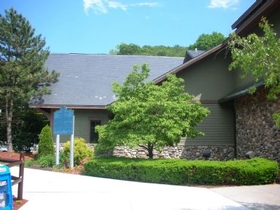
The rugged shore of the Hudson River and the rocky hills north of Manhattan did not encourage early settlement. Patents were issued in 1639 to Jonas Bronck (Bronx) and in 1646 to Adriaen Van der Donck (Yonkers). After the overthrow of Dutch rule in . . . — — Map (db m310620) HM
This flagpole is dedicated to the volunteers and staff of the American Red Cross in Westchester County who have served members of our Armed Forces since the Spanish American War in 1898. These dedicated people have demonstrated Red Cross’ caring and . . . — — Map (db m47291) HM
For several hundred years the Irish suffered religious, political, and ethnic persecution, and through expropriation and exploitation had become totally dependent on the potato.
During "An Gorta Mor", The Great Hunger of 1845-1851, the potato . . . — — Map (db m258421) HM
Near This Spot Was Born June 21st 1774
Daniel D. Tompkins
Governor Of The State Of New York 1807-1817
Vice-President Of The United States 1817-1825
This Site Is Marked By
The Westchester County Historical Society
Through The Generosity . . . — — Map (db m42511) HM
Wayside Inn
For many years, before and after the Revolutionary War, a country tavern.
During that long struggle for independence, a meeting place for Scarsdale patriots and the scene of repeated attacks by British soldiers.
Erected by
The . . . — — Map (db m42524) HM
In Memory of The
Black Soldiers of The
1st Rhode Island Regiment
Who Died In The
Battle of Pines Bridge
In Defense of America's
Freedom
May 13, 1781
Sponsored By
Afro-American Cultural Foundation
Westchester County, New York . . . — — Map (db m104651) WM
This property was originally settled by John Kipp, a Quaker who came up from Pennsylvania after the War of 1812, at the urging of Jonathan Doan. He began this home between 1819 and 1820. Early Quaker Meetings were held here and at Elias Moore's home . . . — — Map (db m260361) HM
The first chief justice of the United States and the governor of New York state, inherited this land from his mother, Mary Van Cortlandt Jay.
Here in 1800 he built Bedford House, his home for the last years of his life. — — Map (db m159227) HM
This house was headquarters of Major General Sir William Howe, Commander in Chief of British forces in America, after the Battle of White Plains, October 28, 1776. — — Map (db m310589) HM
In 1801, after a distinguished career in public service, John Jay retired to Bedford where until his death in 1829, he enjoyed spending time with his family and improving his farm. Four succeeding generations of the Jay family resided here until . . . — — Map (db m24700) HM
Stood on this site. In 1777 Alexander Hamilton lay ill here for 2 weeks. The court martial that tried General Lee met here July 15, 1778. — — Map (db m47277) HM
On this spot the 23rd day of September 1780 the spy Major John André Adjutant General of the British Army was captured by John Paulding, David Williams and Isaac Van Wart, all natives of this county. History has told the rest.
The people of . . . — — Map (db m8608) HM
Davenport House
c 1750
Only surviving structure in Westchester County which was held by General Washington's Troops continuously throughout the War for Independence serving as a command post
Westchester County Tricentennial
1683 . . . — — Map (db m37074) HM
General George Washington created a domestic network of spies, appointing Major Benjamin Tallmadge of Setauket as the head of the Long Island based Culper Spy Ring. Tallmadge appealed to Robert Townsend, a Manhattan merchant, to join him as a spy . . . — — Map (db m42812) HM
After WW II Army Air Corps
service on Guam, this
Ossining-born son of a
beloved local doctor graduated from
Columbia College and Columbia
Law School. He practiced law in the
White Plains firm of Bleakley Platt and
served as Ossining . . . — — Map (db m258933) HM
Ruth A. Smith was born in Mount Kisco, N.Y. and was educated in Westchester County, N.Y. She furthered her education by earning a B.S. in Management at Maryville University in St. Louis. Smith is the first female African American to serve as . . . — — Map (db m219719) HM
"The travellers were struck with those stern, sombre rocks, and the flood falling in fantastic wreaths of white foam about them. While in the caverns, one of the gentlemen...observed to Mr. Cooper that here was the very scene for a romance.... . . . — — Map (db m273788) HM
Aqueduct History
Built between 1837 and 1842, the Croton Aqueduct profoundly changed New York City by providing abundant clean water from the Croton River in northern Westchester County. Local wells, springs and ponds had gradually become . . . — — Map (db m272759) HM
The grounds of the Pelham Memorial High School were part of the farm
belonging to Colonel Philip Pell 1753 – 1811 Judge Advocate Continental Army Member of the New York State Assembly Regent of the University of the State of New York . . . — — Map (db m32023) HM
Born in Chicago in 1949, Gil Scott-Heron moved to Jackson in 1950, which remained his home until he was thirteen years old. In 1962, he was one of three African Americans to desegregate Tigrett Junior High School. That same year, he moved to New . . . — — Map (db m210467) HM
In 1837 Hachaliah Bailey (1774-1845) from Westchester County, New York, purchased 526 acres in the northeast quadrant formed by the intersection of Leesburg and Columbia Pikes. Here he built his home, known as "Moray," which was destroyed by fire in . . . — — Map (db m632) HM
Under the jurisdiction of the New Haven Colony, the first settlers in 1640 purchased land from the Siwanoy Indians. Under New Amsterdam’s protection, this settlement was a dutch manor during 1642–56. In the years 1656–65, it was combined with the . . . — — Map (db m2484) HM
Front of Monument: Upon this spot on October 22, 1777 Colonel Christopher Greene of the First Rhode Island Continentals with four hundred officers and men of the First and Second Rhode Island regiments successfully defended Fort Mercer . . . — — Map (db m13409) HM
These stone blocks protruding from the ground beyond this sign are remnants of the western wall of the receiving reservoir, a critical component of the original Croton Aqueduct water supply system. Largely completed in 1842, the aqueduct delivered . . . — — Map (db m172111) HM
The Honorable John Watts
1749-1836
Politician and jurist
Watts was a member of the Third United States Congress (1793-1795). He later served as a judge in Westchester County and co-founded the Leake and Watts Orphan House, an organization . . . — — Map (db m148096) HM
This property has seen many changes. Over 2,200 years ago, Native Americans lived and hunted here. As the family’s tenanted farm in the 1700s, it produced wheat, rye, corn, and other grains. After Jay’s retirement and the development of the farm . . . — — Map (db m24701) HM
On this site on July 5, 1781, after a forced march from Newport, Rhode Island, Comte de Rochambeau arrived with 5,000 men, sent by the French government to aid in the American struggle for independence.
Gen. George Washington met with Gen. . . . — — Map (db m258566) HM
Long before there was a
fictional spy code-named
“007” there was a real
one called “H.” Elijah Hunter led an
eventful life, particularly during the
Revolutionary War. He served as a 1st
lieutenant and later as captain of a
company of . . . — — Map (db m259157) HM
The Bronx River is 23 miles long, beginning in Westchester County and flowing to the Long Island Sound. It is the only freshwater river in New York City. Before European settlement, the Lenape people lived in this area. The Bronx River had many . . . — — Map (db m275086) HM
In addition to being an energy source and a means of transportation for generations of people, the Bronx River also serves as a refuge for a great variety of plant and animal species.
The Bronx River flows 23 miles from Valhalla, near . . . — — Map (db m278254) HM
Lockheed T-33
This T-33, known as the “T-Bird,” is on loan from the United States Navy and was once on display at the Intrepid Sea-Air-Space Museum in New York City. It commemorates Westchester County Airport’s history as home to the 105th Flying . . . — — Map (db m24437) HM
United States Congresswoman
Nita M. Lowey
Community Green
A devoted public servant whose selfless, effective leadership and commitment to Westchester County and the Nation touched countless lives.
May her legacy of service continue to . . . — — Map (db m310522)
Fritz Pollard
Frederick Douglass "Fritz" Pollard was the first African American head coach in the National Football league and he and Bobby Marshall were the first two African American players in the NFL in 1920. Sportswriter Walter . . . — — Map (db m270793) HM
One of the little known marvels of the New York City landscape, the 23-mile Bronx River descents more than 400 feet as it winds its way from the Kensico dam in Westchester County to its mouth in the Bronx where it joins the East River. It is the . . . — — Map (db m274921) HM
This man-made waterfall once helped to power the Stone Mill downstream.
The Bronx River flows 23 miles from Valhalla, near the Kensico Reservoir in Westchester County in New York, to its mouth at the East River. It is the only freshwater . . . — — Map (db m278172) HM
The Old Croton Aqueduct is a brick and stone conduit, built between 1837 and 1842, to carry water from the Croton River into New York City. Since it is a gravity flow system, a gradual decline had to be maintained throughout the Aqueduct's . . . — — Map (db m193184) HM
Timothy Knapp's house, built between 1667 and 1680, is thought to be the oldest house in Westchester County. The house initially had just two rooms: a keeping room with a bedchamber above. Knapp farmed the land and served as the town constable . . . — — Map (db m193144) HM
Early settlers of Johnson County included patriots of the Revolutionary War. With this Historical Marker we commemorate the following veterans.
Daniel Chapman - Born July 25, 1756 in Westchester County, New York. Daniel Chapman served the . . . — — Map (db m146585) HM WM
Aqueduct History
Between 1837 and 1842, the Croton Aqueduct profoundly changed New York City by providing abundant clean water from the Croton River in northern Westchester County. Local wells, springs and ponds had gradually become . . . — — Map (db m278362) HM
This nearly 20-acre recreational facility was once the Williamsbridge Reservoir. In May 1887 the City of New York acquired the property northeast of Bainbridge Avenue and East 207th Street, opening the reservoir two years later. Measuring 925 . . . — — Map (db m275748) HM
“Perfect Service and Perfect Food”
There have been three prefabricated diners at this location since Charlie Simonson brought the first one to Millbrook from Westchester County in 1929. Acquired in 1931 by Carmine Nardone, it was . . . — — Map (db m140043) HM
High Bridge, Manhattan
The Old Croton Aqueduct brought water across the Harlem River via the High Bridge, the most spectacular and technically advanced feature of New York City's first public water supply system. The original bridge, . . . — — Map (db m283178) HM
Today, Glen Island is a Westchester County Park just off the shore of New Rochelle. From 1879 to 1904 it was known as Starin's Glen Island — the brain child of shipping magnet John H. Staring. Starin's purpose was to make the island the . . . — — Map (db m271234) HM
Lower Main Street Ossining
From the mid-1800s to the early 1900s Downtown Ossining was one of the most important merchant and shipping towns on the Hudson River, supplying Westchester County and New York City with produce and . . . — — Map (db m193229) HM
Village of Ossining Community Center - Weskoria Hotel
The Joseph G. Caputo Community Center is home to the Ossining Heritage Area exhibit, showcasing the history of the first chartered municipality in Westchester County. The . . . — — Map (db m193226) HM
has been placed on the
National Register
of Historic Places
by the United States
Department of the Interior
Richard Upjohn, architect
1854 — — Map (db m258882) HM
has been erected by his grandson William Hamilton Merritt of the City of Toronto, son of William Hamilton Merritt Jr. of St. Catharines as a tribute to the father of Canadian transportation who through initiatory steps in first waterways and . . . — — Map (db m283519) HM
High Bridge, Bronx
The greatest engineering challenge in constructing the Old Croton Aqueduct was designing the best method for bringing the water across the Harlem River. To accomplish this, the engineers built the High Bridge, the most . . . — — Map (db m283188) HM
Barretto Point Park, a popular waterfront park in Hunts Point, opened in 2006. The park is named after Francis J. Barretto, a 19th century merchant and State Assemblyman of Westchester County who owned an estate in the area.
The neighborhood . . . — — Map (db m274948) HM
This Red Oak was moved here from the Westchester County Homestead of
John Jay
First Chief Justice of the United States
as a memorial to
Walter R. Mansfield
1911-1987
who twice parachuted behind enemy lines to organize partisan . . . — — Map (db m131333) HM
This Flag Staff
raised in memory of the
valorious young patriot,
Ephraim Elmer Ellsworth
Born 1837 - Died 1861
and his Fire Zouaves whose
members enlisted in 1861 for
military service in The War
Between the States.
Colonel . . . — — Map (db m98752) HM WM
The Calvary Baptist Church and Annex
The Calvary Baptist Church and Annex, formerly St. Paul's Episcopal Church were built during Ossining's 19th century industrial boom. As the population grew, the local Episcopalians organized in . . . — — Map (db m193246) HM
Born in Pennsylvania in 1824, Margaret Greenawalt was raised in the Greencastle area. By the Civil War, she lived with her sister and brother-in-law, George and Catharine Bowman, in Hagerstown. The Bowmans operated a confectionary (bakery and candy . . . — — Map (db m256130) HM
The background story to the road in front of you, today known as Bergen Street, is part of our region’s ongoing love-hate relationship with highways. Believe it or not, Bergen Street was planned during the late 1920s as part of Arctic Highway, a . . . — — Map (db m303557) HM
What was here before?
This site was once part of the estate of Jonas Bronck (1600-1643), for whom the Bronx is named. During the Revolutionary War, a group of Loyalist military refugees camped here. Years later, the land was held by the . . . — — Map (db m275852) HM
What was here before?
The rolling terrain of Tremont, named for three local hills—Fairmont, Mt. Eden and Mt. Hope—was once rural countryside and part of Westchester County. Later annexed to New York City, this property was long occupied by . . . — — Map (db m311639) HM
The New York State Bridge Authority (NYSBA) operates five bridges over the Hudson River: the Bear Mountain, Newburgh-Beacon, Mid-Hudson, The Kingston-Rhinecliff, and Rip Van Winkle Bridge, and owns and maintains the structure of the Walkway Over . . . — — Map (db m164465) HM
A native of Leeds, England,
Benjamin Brandreth immigrated to New York City in
1835 with his wife Harriot, four children
and his grandfather's formula for an
herbal laxative pill that he billed as a
cure-all for various ills. These . . . — — Map (db m258962) HM
Aaron Ward led an exemplary
life of service that began
at home in Sing Sing
(Ossining), where he was one of six
children born to settlers Colonel
Moses Ward (1753-1812) and his wife
Ann Sherwood Ward. Aaron followed his
father's example in . . . — — Map (db m258979) HM
Marlborough Churchill was
born in Bristol, Rhode
Island, to a family for
whom military service was a
tradition. Upon his graduation from
West Point in 1836, Churchill was
appointed to the rank of Second
Lieutenant, but poor health precluded . . . — — Map (db m259130) HM
The Lockwood family
was originally from
Greenwich, Connecticut.
Stephen Ingersoll Lockwood and
his wife Sarah had eight children,
five boys and three girls, of whom
Munson was the youngest, The family
moved to this area in 1821, to a . . . — — Map (db m259159) HM
Welcome to Historic Ossining
The Village of Ossining can trace its beginnings to 1685, when the Sint Sinck Indians sold their land along the east side of the Hudson River to Frederick Philipse, who established a large manor. After . . . — — Map (db m193182) HM
The grave of Samuel
Youngs has the singular
distinction of being
Dale Cemetery's first interment in
1851. His remains were transferred
from the Old Dutch Church cemetery in North Tarrytown (Sleepy
Hollow), New York, by General Aaron Ward, . . . — — Map (db m259120) HM
[ upper plaque ]
1750
Abraham Bush Homestead
Reputed Headquarters of General Israel Putnam
[ lower plaque ]
Bush Homestead
Headquarters
General Israel Putnam
1777 – 1778
A Landmark of the
Revolutionary War . . . — — Map (db m38312) HM
This is one of some 230 markers erected on the Boston Post Road in 1763
Their locations were fixed by Benjamin Franklin the Deputy Postmaster General who for that purpose drove a chaise with a distance recorder over the route.
Restored to this . . . — — Map (db m34587) HM
Pre-Revolutionary place of interment of one of Rye's early families. This tract of land was purchased by Joseph Purdy from John Budd in 1685. — — Map (db m34583) HM
The Global Context
"His Majesty, Sir, has entrusted me with the command of the naval forces which he has destined to protect his possessions in America and those of his allies in North America. The forces which I command, Sir, are . . . — — Map (db m289288) WM
Robert Moses, (1888-1981), was responsible for more building than any single person since the pharoahs ruled Egypt. Between 1924 and 1968, Moses was the dominant and sometimes controversial force in the creation of extraordinary public work in . . . — — Map (db m125762) HM
On this site stood the stone residence of Peter Disbrow, designated by the Rye colonists as the "Rye Fort" when it was offered for protection from the Indian attack during "King Philip's War" of 1675.
Around 1728 the present frame (North) . . . — — Map (db m34485) HM
Has been designated a National Historic Landmark. This District possesses national significance in commemorating the history of the United States of America. 1993. National Park Service United States Department of the Interior. — — Map (db m34540) HM
Thin black lines indicate changes in relevance. Between each pair of lines entries are ordered geographically but all have the same relevance.
* Inflectional forms of words are their plurals, singulars, and possessives as well as gramatical tenses and similar variations.