Near Mission Road (Provincial Highway 101) just east of Trans-Canada Highway (Provincial Highway 17), on the left when traveling north.
In recognition And In Tribute To The Men and Women Of The Mining Industry Who Developed The Gold Mines, And Our Community To What It Is Today. — — Map (db m218198) HM
Near Mission Road (Provincial Highway 101) just east of Trans-Canada Highway (Provincial Highway 17), on the left when traveling north.
Wawa's first town historian was Mrs. Agnes Turcott. Born Agnes Lindgren in Goren, Missouri in 1909, she spent her youth on the family homestead at Biggar, Saskatchewan. At the age of 18 she was a pioneer teacher earning $400 a year. Her marriage . . . — — Map (db m218197) HM
On Broadway Avenue just north of Mackey Street, on the left when traveling north.
Born in Sault Ste. Marie, Ontario in August, 1907, Joseph Ernest Aime Breton was raised in a large family whose parents were involved in the hotel industry. Aime loved the wilderness and people. He could run a hotel just as easily as he could trap, . . . — — Map (db m218502) HM
Near Mission Road (Provincial Highway 101) just east of Trans-Canada Highway (Provincial Highway 17), on the left when traveling north.
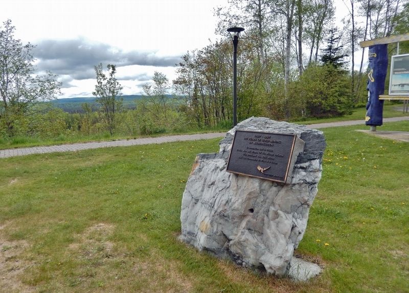
Born in Cape Breton, Nova Scotia, Alex Ross was attracted to the Michipicoten area with hundreds of other fortune seekers after the cry of gold echoed through the hills in 1897. Alex first worked as a cook at the Minto Mine in 1898. Never one to . . . — — Map (db m218193) HM
On Broadway Avenue just north of Mackey Street, on the left when traveling north.
Born in Sault Ste. Marie in 1929, Atillio (Tillio) was the oldest of 8 children of Reno and Pauline Berdusco. The family first settled at the Parkhill Mine where Reno worked as a gold miner and Pauline operated a dry goods store. When the gold . . . — — Map (db m218298) HM
Near Mission Road (Provincial Highway 101) just east of Trans-Canada Highway (Provincial Highway 17), on the left when traveling north.
Born in 1907, Al Turcott came to Wawa in 1939 with the idea that he would be employed for 6 months assisting with the construction of the crushing plant at the New Helen Mine. Deeply attracted to the area, Al soon sent for his wife Agnes and two . . . — — Map (db m218196) HM
On Mission Road (National Highway 101) 0.5 kilometers north of Trans-Canada Highway (National Highway 17), on the left when traveling north.
It was erected to commemorate the completion of the last link of the Trans-Canada Highway. A Wawa Goose Statue has stood at the intersection of Highways 17 and 101 since September 1960.
The Idea
An innovation of long tíme Wawa resident B.A. . . . — — Map (db m195914) HM
On Mission Road (National Highway 101) 0.5 kilometers north of Trans-Canada Highway (National Highway 17), on the right when traveling south.
[English] This highway's construction from St. John's to Victoria between 1949 and 1970 was a great feat of engineering, linking the provinces of this vast country. Here, in 1960, near the halfway point of the 7,821 kilometre-long . . . — — Map (db m199454) HM
On Broadway Avenue just north of Mackey Street, on the left when traveling north.
Francis Hector Clergue was the visionary who recognized that Wawa's resource rich wilderness was the fuel to feed an industrial empire in Sault Ste. Marie. Born in Brewer, Maine in 1856, Clergue was a dynamic man with boundless energy, . . . — — Map (db m218375) HM
Near Scenic High Falls Road (Pinewood Drive), 3.6 kilometers west of Trans-Canada Highway (Provincial Highway 17).
[east side] Glenn Gould is the iconic Canadian and internationally renowned piano virtuoso who revolutionized the way the world listens to the classics. Born in Toronto in 1932, Gould had perfect pitch at age 3, and appeared with the Toronto . . . — — Map (db m218599) HM
Near Scenic High Falls Road (Pinewood Drive), 3.6 kilometers west of Trans-Canada Highway (Provincial Highway 17).
During the winter months mail was handled by dog sled. The "Hudson's Bay Trail" from Sault Ste. Marie to Michipicoten followed a well-worn path to Batchawana, skirted the shore at Mamainse Harbour, travelled overland to Agawa, then headed north in . . . — — Map (db m218602) HM
Near Mission Road (Provincial Highway 101) just east of Trans-Canada Highway (Provincial Highway 17), on the left when traveling north.
Joe Ball is one of Wawa's more colourful pioneers. Born in Michigan in 1864, Joe was one of many prospectors who found himself attracted to the lure of gold in the rugged hills around Wawa at the end of the 19th century. Joe worked as a caretaker . . . — — Map (db m218192) HM
Near Mission Road (Provincial Highway 101) just east of Trans-Canada Highway (Provincial Highway 17), on the left when traveling north.
Born in Saginaw, Michigan in 1920, Keith earned his private pilot’s license at the age of 20. He joined the U.S. Navy during World War II and was first stationed in Alaska. He flew OS2U Kingfishers and learned the hard way what the brutal Northern . . . — — Map (db m218191) HM
Near Mission Road (Provincial Highway 101) just east of Trans-Canada Highway (Provincial Highway 17), on the left when traveling north.
Lady Dunn was born Marcia Anastasia Christoforides in Sutton, England in 1909. During the Second World War, Marcia became the personal secretary for Sir James Dunn, a wealthy Canadian financier who was responsible for the rebirth and development of . . . — — Map (db m218190) HM
Near Mission Road (Provincial Highway 101) just east of Trans-Canada Highway (Provincial Highway 17), on the left when traveling north.
Louise Towab and her husband William Teddy are memorialized in Wawa's history books as discovering gold on Wawa Lake and forever changing the rugged landscape of this corner of Lake Superior country. Born in 1857, Louise represents the virtually . . . — — Map (db m218194) HM
Near Scenic High Falls Road (Pinewood Drive), 3.6 kilometers west of Trans-Canada Highway (Provincial Highway 17).
The Michipicoten Ojibway have a long history on the eastern shore of Lake Superior and Wawa area. Michipicoten is an Ojibway word which some say translates to "landing place" or "place of large hills". At the time of first contact with European . . . — — Map (db m218179) HM
On Broadway Avenue just north of Mackey Street, on the left when traveling north.
Mention Northern Ontario diamonds, log cabins or the Wawa Goose and the name Mickey Clement will quickly follow. Clifford Claude "Mickey" Clement was born with the prospecting bug. He learned the rules and tools of the trade while panning and . . . — — Map (db m218299) HM
Near Mission Road (Provincial Highway 101) just east of Trans-Canada Highway (Provincial Highway 17), on the left when traveling north.
Mountains of Minerals The town of Wawa is surrounded by some of the world's oldest rock. These ancient Precambrian mountains were formed some 2.7 billion years ago. Within these mountains is a melting pot of minerals that have . . . — — Map (db m218199) HM
On Broadway Avenue just south of Algoma Street, on the right when traveling north.
The Joy Super Heavyweight Champion Rotary Blast Hole Drill was utilized by Algoma Ore Division first at the Sir James Open Pit Mine which operated from 1958-1967 and later at the Lucy Open Pit Operation from 1967 to 1970. More than 8,500,000 gross . . . — — Map (db m218300) HM
Near Mission Road (Provincial Highway 101) just east of Trans-Canada Highway (Provincial Highway 17), on the left when traveling north.
You are standing at the site of the completion of the last link of the Lake Superior section of the Trans-Canada Highway. It was officially opened for traffic on September 17, 1960. A Town Without a Road Out Prior to 1960 and the . . . — — Map (db m218201) HM
On Broadway Avenue just north of Laurier Street, on the right when traveling north.
I think you would agree that the Wawa town site is situated in the perfect spot — a level plain on the shores of a picturesque lake of crystal green water surrounded by rolling mountains of natural abundance. Wawa's Ojibway ancestors, early . . . — — Map (db m218362) HM
Near Scenic High Falls Road (Pinewood Drive), 3.6 kilometers west of Trans-Canada Highway (Provincial Highway 17).
Born in Chalut, France in 1813, Père Dominic Chardon du Ranquet became an ordained Deacon in 1838. He joined the Jesuit priesthood like his three older brothers before him. Instead of following them on their missionary work to India, he volunteered . . . — — Map (db m218601) HM
On Broadway Avenue just north of Mackey Street, on the left when traveling north.
Rod Morrison Sr. and the Algoma Ore Athey Wagon go hand in hand. Roderick F. Morrison was born in the Muskokas in 1917. He followed his brother Neil to work in the gold mines of Matechewan in 1936. In 1940 the newly constructed Sinter . . . — — Map (db m218399) HM
Near Scenic High Falls Road (Pinewood Drive), 3.6 kilometers west of Trans-Canada Highway (Provincial Highway 17).
This site is dedicated to the members of the Rotary Club of Wawa who helped to develop, maintain and preserve the scenic beauty of Magpie High Falls for all to see and enjoy. 1963-1989 In 1989 this area was expanded into a permanent recreational . . . — — Map (db m218665) HM
Near Mission Road (Provincial Highway 101) just east of Trans-Canada Highway (Provincial Highway 17), on the left when traveling north.
Sir James Dunn was a major Canadian business icon who was instrumental in the rebirth and growth of Wawa and Sault Ste. Marie in the first half of the 20th century. James Hamet Dunn was born in Bathhurst, New Brunswick in 1874. He was an articulate . . . — — Map (db m218195) HM
Near Mission Road (Provincial Highway 101) just east of Trans-Canada Highway (Provincial Highway 17), on the left when traveling north.
The famous Wawa Goose gazes out over the Trans-Canada Highway as it carries traffic through the Magpie River Valley. Some sections of this roadway follow old native trails and wagon paths leading from Lake Superior, along the Magpie River to the . . . — — Map (db m218328) HM
Near Trans-Canada Highway (National Highway 17) 1.4 kilometers south of High Falls Road, on the right when traveling south.
The nearby Michipicoten River formed an important link in the canoe route from Lake Superior to James Bay via the Michipicoten, Missinaibi and Moose Rivers. The route was probably explored at an early date by the French Fur traders who maintained a . . . — — Map (db m199496) HM
On Broadway Avenue just north of Mackey Street, on the left when traveling north.
For Wawa residents, the name Surluga instantly conjures images of an overgrown gravel road, abandoned headframes rusted mining equipment and forgotten ghost towns. Tom Surluga was born in Krizisce, Croatia in 1907. As a teenager he found himself . . . — — Map (db m218397) HM
Near Mission Road (Provincial Highway 101) just east of Trans-Canada Highway (Provincial Highway 17), on the left when traveling north.
Wawa is just one of those place names that stands out. It is one of those names you will never forget. Where did this town get such a unique name and what does it mean? Ojibway Country When the first Europeans traveled to the Wawa . . . — — Map (db m218200) HM
On Broadway Avenue just south of Algoma Street, on the right when traveling north.
Wawa's Forest Fire Rangers — A massive forest fire in 1920 destroyed many of the buildings in Wawa City which were located further from the Lakeshore. In 1930 the Department of Lands and Forests established a Deputy Chief Ranger office on Wawa . . . — — Map (db m218582) HM
On Broadway Avenue just south of Algoma Street, on the right when traveling north.
Gold and Iron! What more could a mining town possibly want? The cry of "GOLD" in 1897 transformed the quiet fur trading country of Michipicoten into a bustling miniature Klondike. The Michipicoten Ojibway couple of Louise Towab and William Teddy . . . — — Map (db m218400) HM
Near Scenic High Falls Road (Pinewood Drive), 3.6 kilometers west of Trans-Canada Highway (Provincial Highway 17).
Wawa's economy is based on our abundance of natural resources. Fur, fish, iron, gold, water and trees. The jumble of logs found at the base of Scenic High Falls are the remnants of Wawa's important logging history. Wood was first harvested along . . . — — Map (db m218600) HM
Near Mission Road (Provincial Highway 101) just east of Trans-Canada Highway (Provincial Highway 17), on the left when traveling north.
William Teddy was an Ojibway/Cree native Canadian born in 1855 in the Missinabie/Moose River region of Northern Ontario. Records show that William worked as a native guide for tourists, recreational fishermen and prospectors travelling thru the . . . — — Map (db m218189) HM
On Magpie Road just north of George Street, on the right when traveling north.
In memory of all who fell in honour of all who served in Freedom’s Cause 1914-1918 1939-1945 ”At the going down of the sun, and in the morning we will remember them.” — — Map (db m218401) WM
On Michipicoten Harbour Road, 1.5 kilometers west of Queen Street, on the left when traveling west.
Born in Montreal in 1882 A.Y. Jackson took to painting at a young age. During his formative years, his passion took him to the streets of Chicago and the battlefields of Europe during World War I. His true attraction however was to the remote . . . — — Map (db m218291) HM
On Government Dock Road, 1 kilometer west of Michipicoten Harbour Road.
The weekly arrival of Captain Batten and the S.S. Caribou at Government Dock Beach at the mouth of the Michipicoten River was the highlight of early residents during the shipping season. Launched from her home port of Owen Sound in July 1904, the . . . — — Map (db m218556) HM
On Government Dock Road, 1 kilometer west of Michipicoten Harbour Road.
This beach received men & supplies for construction of the Canadian Pacific Railway in the 1880’s. In 1910 the Dominion Government & C.P.R. built a wharf and warehouse which were destroyed in the 1960’s. — — Map (db m218487) HM
On Michipicoten Harbour Road, 0.8 kilometers west of Queen Street, on the left when traveling west.
The life and legacy of Louisa MacKenzie represents the important role of women in Canada's early frontier and the evolution of the fur trade industry. Louisa was the daughter of Honourable Roderick Mackenzie and a Chipewyan woman. Louisa was born . . . — — Map (db m218188) HM
Near Michipicoten Harbour Road, 1 kilometer west of Queen Street, on the right when traveling west.
Once the main cemetery used by residents of Michipicoten River Village. It includes families of both Ojibway and European descent. The earliest headstone dates back to 1901. — — Map (db m218482) HM
On Michipicoten Harbour Road, 1.5 kilometers west of Queen Street, on the left when traveling west.
From this high bluff, on a clear northern day, you can see the vast expanse of Lake Superior and the dramatic coastline of Michipicoten Bay. This is one of the only accessible lookouts with a fantastic view of pristine Lake Superior, mysterious . . . — — Map (db m218668) HM
On Government Dock Road, 1 kilometer west of Michipicoten Harbour Road.
Born in Toronto in 1903, Morley Callaghan was a critically acclaimed writer and novelist. Recipient of the Governor Generals Award for his literary masterpieces, Morley Callaghan was a celebrated Canadian author who was commonly categorized with . . . — — Map (db m218488) HM
Near Superior Avenue, 0.6 kilometers west of Michipicoten River Village Road.
Michipicoten can be found on some of the earliest European maps created by early explorers of North America. One of the first official cartographers to put Michipicoten on the map was the English surveyor Philip Turnor. Born in the English . . . — — Map (db m218634) HM
On Michipicoten Harbour Road, 1.5 kilometers west of Queen Street, on the left when traveling west.
Born in Fribourg, Switzerland in 1807, Jean Louis Rodolphe Agassiz was a renowned scientist who studied medicine, philosophy, fossils, fish, rocks, plants and glaciers. During the height of his career, Professor Agassiz was one of the best known . . . — — Map (db m218293) HM
Near Superior Avenue, 0.6 kilometers west of Michipicoten River Village Road.
Reverend James Evans was a Methodist missionary credited with translating the Cree language and creating the first Ojibway-Cree alphabet. Reverend Evans spent the winter of 1838-1839 at Michipicoten Post. Born in England in 1801, Evans emigrated . . . — — Map (db m218646) HM
On Michipicoten Harbour Road, 0.8 kilometers west of Queen Street, on the left when traveling west.
Welcome to the centre of Canada's dynamic fur trade history for nearly 200 years. The Michipicoten First Nation's introduced the first European explorers to the rich fur-bearing forests of their home in the 1600's. Michipicoten was the ideal . . . — — Map (db m218187) HM