107 entries match your criteria. The first 100 are listed. The final 7 ⊳
History Colorado Historical Markers
Markers of the Colorado state historical markers program administered by History Colorado, a self-described 21st century historical society, charitable organization, and state agency under the Department of Higher Education.
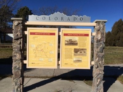
The Rocky Mountains proved a formidable barrier to early aviation, leaving Colorado in a familiar position: bypassed. As with the railroads fifty years earlier, transcontinental air traffic went through Wyoming; Colorado had to make do with a . . . — — Map (db m70525) HM
High-Five Plains Towns
Watkins, Bennett, Strasburg, Byers, Peoria, Deer Trail, Agate, Godfrey, Cedar Point, Riverbend—most of these Colorado high plains towns were founded around the time when the Kansas Pacific Railroad arrived in . . . — — Map (db m70522) HM
Near South Prince Street south of West Alamo Avenue, on the left when traveling south.
The evolution of mass transit in Denver has resembled a cross-town commute — a long stop-and-go journey. It began in 1871, when the Denver Horse Railroad Company started running horse-drawn coaches over tracks laid in the middle of downtown’s dirt . . . — — Map (db m177560) HM
Near South Prince Street south of West Alamo Avenue, on the left when traveling south.
At various points in its history, the Rough and Ready Mill churned out flour, lumber, and livestock feed. But the end product was always the same: growth for Littleton. Built in 1867 by pioneers Richard Little, Joseph Bowles, and John Lilley, among . . . — — Map (db m177558) HM
Near South Prince Street south of West Alamo Avenue, on the left when traveling south.
Colorado CannibalAside from his conviction for cannibalism, Alfred Packer was a fairly commonplace frontier character: He came West to find his fortune but found trouble instead. Packer, like most, brought his woes upon himself. A . . . — — Map (db m177559) HM
On U.S. 160 at milepost 136.9, just west of Hersch Avenue, on the right when traveling west.
Rising from a 90-million-year-old seabed. Chimney Rock's twin towers stand 300 feet above the surrounding mesa. The Europeans who first saw them probably approached from due east, obscuring their view of the westernmost spire. As a result, Spanish . . . — — Map (db m293894) HM
On U.S. 160 at milepost 136.9, just west of Hersch Avenue, on the right when traveling west.
Geothermal Energy Early settlers in Pagosa Springs took full advantage of the comforts afforded by the mineral waters. Many built special bathing rooms attached to their homes, the better to soak in privacy; others (beginning in the 1900s) . . . — — Map (db m293893) HM
On U.S. 160 at milepost 136.9, just west of Hersch Avenue, on the right when traveling west.
The Old Spanish Trail was neither entirely Spanish nor Particularly old. But the name seemed to fit this rugged road, which passed about thirty miles south of here as it stretched from Santa Fe to California. Franciscan pathfinders Dominguez and . . . — — Map (db m293895) HM
On East Baseline Road (Colorado Route 7) 0.3 miles east of Mountain View Boulevard, on the right when traveling east.
Front
Colorado's Northern Coal Field: Lest We Forget
Colorado's immense northern coal field, centered beneath these rolling hills, contributed to the early development and growth of Colorado and to the birth of nearby towns. . . . — — Map (db m119521) HM
On U.S. 285 5 miles north of U.S. 50, on the left when traveling north.
Frustrated in their attempt to climb Pike’s Peak on November 27, 1806, Zebulon Pike and his party of 15 trudged on through South Park looking for the Red River, southern boundary of the Louisiana Purchase. After crossing Trout Creek Pass, the . . . — — Map (db m127876) HM
On U.S. 40 at milepost 463.5, on the left when traveling east.
Smoky Hill Trail
The Smoky Hill Trail was the most direct route to Denver and the goldfields of the central Rockies. Immigrants heading west through central Kansas followed the Kansas River, then headed up its Smoky Hill River branch into . . . — — Map (db m77898) HM
On U.S. 287 at milepost 130, on the right when traveling west.
Named for the great western scout, guide, trapper, and Indian fighter. Located on famous trails – at the junction of the Smoky Hill stagecoach route and the Texas – Montana, Potter and Bacon, and Chisum cattle trails. On the old Kansas . . . — — Map (db m88444) HM
On County Road 13 just south of County Road G6, on the right when traveling south.
This tract was selected by Bishop Machebeuf, for the first permanent church in Colorado. Here was built a jacal (picket) church, later replaced by a larger church. The first parish of Colorado was erected 100 years ago with Our Lady of Guadalupe as . . . — — Map (db m281594) HM
On Poplar Street at East Main Street, on the left when traveling south on Poplar Street.
District Number 1Organized January 25, 1915, for the betterment of rural education. The first consolidated school in the San Luis Valley. ——— This tablet is the property of the State of Colorado ——— Monument erected by The State Historical . . . — — Map (db m281581) HM
On Main Street (State Highway 142) just east of North 4th Street, on the left when traveling east.
In 1878, Mormon pioneers came from the southern states and Utah, settling first at Los Cerritos. In 1879, they organized the town of Manassa, built homes, a school house, and place of worship from native logs. Settlements of Ephraim (1879) and . . . — — Map (db m281593) HM
On County Road 24 0.8 miles south of County Road Y, on the right when traveling east.
Near here, on the banks of the Conejos River, Zebulon M. Pike built a log stockade in early February, 1807, and for the first time raised an American flag over what is now Colorado. Pike's trek of 1806-07 was the second official United States . . . — — Map (db m22701) HM
On State Highway 159 0.2 miles south of State Highway 160, on the right when traveling south.
This property was presented to the State Historical Society by the Fort Garland Historical Fair Association, which saved the fort for posterity. Established November 30, 1945, as a memorial to the first Colorado settlers, and the U.S. Army troops . . . — — Map (db m281275) HM
On State Highway 159 0.2 miles south of U.S. 160, on the left when traveling north. Reported permanently removed.
This memorial is the
Property of the State of Colorado
———
Fort Garland
United States military outpost
to protect settlers from
hostile Indians. Named for
Brig. Gen. John Garland . . . — — Map (db m22731) HM
Near State Highway 159, on the right when traveling south.
Front
The Soldier’s Life
Fort Garland housed infantry and cavalry units. During the 1870’s the famed Buffalo Soldiers—African-American cavalrymen—were also posted here. For all soldiers—and their families—life at Fort Garland was . . . — — Map (db m71032) HM WM
On Main Street (State Highway 159) 0.2 miles north of 9th Street, on the right when traveling north.
Hispano pioneers founded Colorado's first permanent settlements. Settlers began pushing northward from Taos toward present Colorado in the early 1800s, and in 1844 the Mexican government gave the Sangre de Cristo land grant to two Taos residents. . . . — — Map (db m281598) HM
On Main Street (State Highway 159) at 1st Street, on the right when traveling north on Main Street.
The oldest continuously used ditch in Colorado, with court decree priority No. 1, and dating from April 10, 1852. Dug by the pioneer settlers of Colorado. Colorado's greatness is built upon irrigation. ——— This tablet is the property of . . . — — Map (db m281600) HM
On Main Street (State Highway 159) just north of State Highway 142, on the left when traveling north.
Colorado's earliest non-Indian occupants were Hispanos. Migrating north from present-day New Mexico in the mid-1800s. These colonists battled the Ute Indians for control of the San Luis Valley while the United States and Mexico warred over the . . . — — Map (db m293599) HM
On Main Street (State Highway 159) just south of Archie Street, on the left when traveling south.
Commemorating the historical importance of the pioneers who were responsible for the first permanent settlement in Colorado.1851 ——— This tablet is the property of the State of Colorado ——— Erected by the State Historical Society of Colorado . . . — — Map (db m281599) HM
On Colorado Route 69 0.7 miles south of Verdemont Road (County Road 182), on the right when traveling south.
Mining and Ranching
For a time, the Wet Mountain Valley appeared destined for mining glory. Silver strikes at Rosita (about fifteen miles southeast of here) in 1872, Querida (about twelve miles southeast) in 1877, and Silver Cliff (six . . . — — Map (db m120228) HM
On North Palmer Street 0.1 miles north of Confluence Drive, on the right when traveling north.
Western Slope Agriculture
According to an 1888 U.S. Department of Agriculture report, western Colorado's thin soils, high altitude, and lack of rainfall rendered the region totally unfit for cultivation. The document’s author apparently . . . — — Map (db m120123) HM
On Blake Street at 14th Court, on the left when traveling west on Blake Street.
Immediately north-east of this point and covering much of Block 18 East Denver stood the famous Elephant Corral camp ground, immigrant headquarters and stock yards of pioneer Denver.
Begun early in 1859 by Blake & Williams with their Denver . . . — — Map (db m203481) HM
This tablet is the
Property of the State of Colorado
On this site stood the original home of
Rocky Mountain News
First newspaper established in
the Pike's Peak Gold Region
Founded by Wm. N.Byers, April 23, 1859, . . . — — Map (db m5780) HM
The controversy surrounding this Civil War Monument has become a symbol of Coloradans' struggle to understand and take responsibility for our past. On November 29, 1864, Colorado's First and Third Cavalry, commanded by Colonel John Chivington, . . . — — Map (db m6755) HM
Near 15th Street near Arapahoe Street, on the right when traveling west.
At this location on April 23, 1865, assassins shot and killed 1st Colorado Cavalary Officer Capt. Silas S. Soule. During the infamous Sand Creek Massacre of November 29, 1864, Soule had disobeyed orders by refusing to fire on Chief Black Kettle's . . . — — Map (db m67133) HM
This plaque was presented to the City of Denver by the Colorado State Historical Society and the American Pioneer Trails Association on June 3, 1951, the day street cars were retired and the city's transit system was converted to rubber-tired . . . — — Map (db m4679) HM
On Brighton Boulevard (State Highway 265) at York Street, on the right when traveling north on Brighton Boulevard.
This memorial is the property of the State of Colorado ——— Commemorating the route of the Platte River Trail principal route of Colorado pioneers trail of Major S.H. Long in 1820 trappers’ trail of 1830s and 1840s the . . . — — Map (db m203494) HM
On West 8th Avenue at Vallejo Street, on the left when traveling east on West 8th Avenue.
This tablet is the property of the State of Colorado ——— This is the southwest corner of Camp Weld Established September 1861 for Colorado Civil War Volunteers. Named for Lewis L. Weld, first Secretary of Colorado . . . — — Map (db m203499) HM
Here was the end of the famous Smoky Hill Trail immigrant and stage road extending from the Missouri River to Denver. Traversed by pioneers in 1858. Surveyed by W.G. Russell in 1860. Route of Butterfield's Overland Despatch and Wells Fargo . . . — — Map (db m4678) HM
Near Sheridan Boulevard (Colorado Route 95) just north of West 49th Avenue, on the left when traveling north.
This tablet is the property of the State of Colorado ——— One mile north of this point Gold Was Discovered on June 22, 1850, by a party of California-bound Cherokees. The discovery was made by Louis Ralston, whose name . . . — — Map (db m203500) HM
Near West Jewell Avenue at South Huron Street, on the right when traveling west.
Most historical of Denver’s municipal parks. Created in 1882. This site was homesteaded in 1862 by “Potato” Clark. Jim Beckwourth, Mulatto “Daredevil”, erected a home in 1860 .6 mile northeast. Sam Brown’s toll bridge of 1859 located 4 miles . . . — — Map (db m203446) HM
Near West Byron Place just east of Wolff Street, on the right when traveling east.
This tablet is the property of the State of Colorado ——— On the northwest shore of Sloan’s Lake was Manhattan Beach popular amusement park of the Gay Nineties, with a theater, boating, dancing, and specialties. Opened . . . — — Map (db m203490) HM
On State Highway 83 0.1 miles south of State Highway 86, on the right when traveling south.
This tablet is the
property of the State of Colorado
——
Franktown
Named for J. Frank Gardiner, a
pioneer who settled here in 1859.
First known as "California Ranch,"
it was a way . . . — — Map (db m96174) HM
On State Highway 83 at Lost Lake Drive, on the right when traveling south on State Highway 83.
Panel 1
Russellville
For a few exciting months, Russellville felt like Colorado's gold-rush capital. The town rose five miles southeast of here in late 1858, after William Green Russell discovered a few gleaming . . . — — Map (db m97969) HM
On Mainstreet at Victoria Drive, on the right when traveling east on Mainstreet.
This tablet is the
property of the State of Colorado
— —
Due West ¼ mile stood the
TWENTY MILE HOUSE
(Twenty miles from Denver)
First house built in Parker, 1864.
On the . . . — — Map (db m96176) HM
On U.S. 24 at Tennessee Pass Road, on the right when traveling north on U.S. 24.
Across Continental Divide between Arkansas and Eagle Rivers Altitude 10,424 feet Named from the Tennessee Fork of the Arkansas Explored by Fremont and Kit Carson 1845 Railroad constructed 1881 ——— This memorial is the property of . . . — — Map (db m281597) HM
On Manitou Avenue (Business U.S. 24), on the right when traveling north.
This memorial is the
Property of the State of Colorado
Ute Pass
Named from the old Ute Trail
which led from South Park
through Manitou to the Plains.
Traversed by the Utes on
hunting and war expeditions.
Improved highway built . . . — — Map (db m32663) HM
On Colorado Street (County Route 86), on the right when traveling west.
Frontier Communication.
Kiowa was originally named after its postmaster, Henry Wendling. Such identifications were common among Colorado’s frontier hamlets, where the post office often was the town. Widely dispersed settlers would congregate . . . — — Map (db m45754) HM
On Colorado Street (County Road 86) west of Pawnee Street, on the right when traveling west.
Trail Under Siege Indians of Colorado’s High Plains
Kiowa and Comanche Indians migrated to these prairies in the 1700s, followed by Cheyennes and Arapahos in the early 1800s. The region’s vast grasslands, thick bison herds, and brisk fur . . . — — Map (db m275518) HM
On County Road 3A 4.5 miles south of U.S. 24, on the right when traveling south.
Lt. Zubulon M. Pike and his men, who traveled through this area in November and December 1806, were the first American explorers to view the Arkansas River Canyon now known as the Royal Gorge. A small party from the Maj. Stephen H. Long . . . — — Map (db m34858) HM
[Side A:]
Rainbow Route
Completion of this road opens up a scenic paradise unequalled in any other state of the Union and unsurpassed by the scenic gems of the Wild West.
Governor George A. Carlson on the opening of the . . . — — Map (db m55639) HM
On Park Avenue (U.S. 40) at 2nd Street, on the right when traveling west on Park Avenue.
Auspiciously located at the junction of Muddy Creek and the Blue and Colorado Rivers, present-day Kremmling never lacked for through traffic, but it did lack for gold — and, thus, for settlers. Hopeful town builders laid out a plat here as early as . . . — — Map (db m291387) HM
On Park Avenue (U.S. 40) at 2nd Street, on the right when traveling west on Park Avenue.
For early settlers in these isolated mountains, medicine was generally a do-it-yourself business. The nearest doctor often lived a day's travel or more away, leaving patients to depend on folk treatments, Indian herbal cures, and the unsure . . . — — Map (db m291296) HM
On Park Avenue (U.S. 40) at 2nd Street, on the right when traveling west on Park Avenue.
“I often wonder how long all the game is going to last,” wrote market hunter Frank Mayer in 1878. “You can’t have wild animals and civilization side by side.” Permanent settlement had only recently come to this area, ushered in by gold . . . — — Map (db m291285) HM
On Gunnison Avenue (State Highway 149) at Henson Street, on the right when traveling north on Gunnison Avenue.
Gold strike in the San Juans! Word spread like wildfire that summer of 1874, and the following spring prospectors crowded into this hidden mountain valley. They pitched tents and crafted log cabins with dirt floors and sod roofs. In August 1875 the . . . — — Map (db m298157) HM
On Gunnison Avenue (State Highway 149) at Henson Street, on the right when traveling north on Gunnison Avenue.
Ute Indian Museum. This Colorado Historical Society museum interprets history of the Utes, Chief Ouray and his wife Chipeta, who lived and farmed on this site. The high-country Alpine Loop tours ghost towns such as Capitol City, Sherman, . . . — — Map (db m298179) HM
On Gunnison Avenue (State Highway 149) at Henson Street, on the left when traveling south on Gunnison Avenue.
This land once belonged to the Utes — “the mountain people” — who hunted and lived here for generations. Their footpaths wound over the slopes and through the valleys. But in 1858, gold was found near present-day Denver, and the rush to the Rockies . . . — — Map (db m298072) HM
On Interstate 25 at milepost 59, 0.3 miles north of County Road 103, on the right when traveling north.
Here, in the shadow of the Spanish Peaks and the Wet Mountains, stands El Huerfano - "the orphan." This stark and lonely volcanic outcrop, named in the late 1700s by an unknown Spanish trader, had for centuries guided earlier Hispanos and . . . — — Map (db m97717) HM
On John F. Kennedy Memorial Highway (Interstate 25), on the right when traveling north.
The isolated cone-shaped butte, east of this point and 10 miles north of Walsenburg, was named El Huerfano, “The Orphan,” by early Spaniards. The name appeared in Spanish records as early as 1818. This butte was near the Trappers’ Trail . . . — — Map (db m64793) HM
On State Highway 14 at milepost 64.9, on the left when traveling east.
Highway 14 The first highway over Cameron Pass, completed in 1882 by the Cache la Poudre and North Park Toll Road Company, ran more than one hundred miles from Fort Collins to the silver camp of Teller. Travelers paid three dollars per wagon, . . . — — Map (db m289782) HM
On State Highway 14 at milepost 64.9, on the left when traveling east.
Linking Fort Collins to the North Park Valley along a centuries-old trail, the Cache la Poudre-North Park Scenic and Historic Byway offers outstanding recreational opportunities for campers, rafters, kayakers, and anglers. The byway takes its . . . — — Map (db m289790) HM
On State Highway 14 at milepost 64.9, on the left when traveling east.
Pingree Park During construction of the transcontinental railroad in the late 1860s, the timber fell almost continuously in Pingree Park. Named for legendary tie hack George Pingree (who supposedly could cut a hundred railroad ties a day), the . . . — — Map (db m289784) HM
On State Highway 14 at milepost 64.9, on the left when traveling east.
Tie Drives Tie hacks were as raw as the lumber they cut. They worked endlessly through the freezing winter, earning ten cents per railroad tie — about three to four dollars a day. The hacks stacked the timber on the banks of the Cache la Poudre . . . — — Map (db m289788) HM
On W 44th Ave (County Route 58) 0.1 miles west of McIntyre Street, on the left when traveling west.
In this immediate area once stood
Arapahoe City
A pioneer placer mining camp the earliest town in Jefferson County. Named for the Arapaho Indians. Town company organized Nov. 29, 1858. From here went George A. Jackson and John H. Gregory . . . — — Map (db m82878) HM
Near E 15th Street (U.S. 287) 0.1 miles east of Maine Street, on the left when traveling east.
Plains Indian Life
By the nineteenth century, Colorado’s southeastern plains country was home to many native peoples, including Comanches, Kiowas, Plains Apaches, Arapahos, and Cheyennes. Although vastly different in language and . . . — — Map (db m107178) HM
On Harrison Avenue at East 10th Street on Harrison Avenue.
Erected 1878, by August R. Meyer, builder of Leadville’s first reduction works. Given to Leadville Association, 1936, by Nellie Healy, agent for the heirs of Daniel Healy.
Presented to the State of Colorado by said association, 1947, and . . . — — Map (db m51812) HM
On U.S. 287 near High Lonesome Road, on the left when traveling north.
What a welcome sight Virginia Dale must have been to nineteenth-century travelers. It was one of the largest stagecoach stations on the Overland Trail, offering hot meals and other conveniences to weary passengers - the equivalent, for its day, of . . . — — Map (db m89639) HM
On N County Road 19E, on the right when traveling north.
This Memorial Is the
Property Of The State Of Colorado
Namaqua
Home, trading post and fort of
Mariano Modena, early trapper,
scout and pioneer.
First settlement in the
Big Thompson Valley.
Station on Overland . . . — — Map (db m51194) HM
On Interstate 25 at milepost 0, on the right when traveling north.
"Raton" is Spanish for "Mouse".
On mountain branch Santa Fe Trail.
Crossed by Kearny's Army of the
west in the Mexican war and by
first regiment, Colorado Volunteers
in the civil war. "Uncle Dick"
Wooten's toll road built 1865.
Railroad . . . — — Map (db m77853) HM
Near Interstate 25 Frontage Road when traveling north.
Panel 1
Road to Santa Fe
"...for it begins upon the outside line of the outside State (Missouri) and runs directly toward the setting sun..." - Sen. Thomas Hart Benton, following the Santa Fe Trail survey, 1825
For . . . — — Map (db m97715) HM
Near El Moro Road (at milepost 18) at Linden Avenue (County Road 71.1).
Panel 1
The Ludlow Massacre
By April 1914, the striking coal miners encamped at Ludlow (ten miles northwest of here) had nothing to lose but their lives. Poor, powerless, largely immigrant, they had held out for . . . — — Map (db m97716) HM
On Nevada Avenue at North Animas Street, on the right when traveling south on Nevada Avenue.
Panel 1
Welcome to Colorado
Colorado's vast plains, rugged mountains and grand plateaus, so magnificent in their beauty and variety seem at times to overshadow the state's history and people. But look closely. The . . . — — Map (db m97739) HM
Panel 1
Arriba
In frontier Arriba (locally pronounced "AIR-uh-buh"), the only thing
more scarce than water was whiskey. Charles Creel, who founded
the town in 1888 to greet the advancing Chicago, Rock Island &
Pacific . . . — — Map (db m89381) HM
Near 4th Street (U.S. 287) west of 7th Avenue, on the right when traveling west.
Sand Creek Massacre
At dawn on the morning of November 29 I was still in bed when I heard shouts and the noise of people running about the camp. I jumped up and ran out of my lodge. From down the creek a large body of troops was . . . — — Map (db m107245) HM
On Grand Army of the Republic Highway (State Highway 6) at County Road 2.5, on the right when traveling east on Grand Army of the Republic Highway.
Due west 940 feet stood
“Fort Wicked"
Originally Godfrey’s Ranch
Famous Overland Stage Station
One of the few posts withstanding the Indian uprising of 1864 on the road to Colorado.
Named from the . . . — — Map (db m61998) HM
On Colorado Route 63 north of County Road 16, on the left when traveling north.
3 miles southeast from this point is the site of the Battle of Summit Springs
Last engagement with Plains Indians in Colorado, July 11, 1869. Cheyennes who raided western Kansas were attacked by General E. A. Carr with the Fifth U.S. Cavalry . . . — — Map (db m61997) HM
In November 1864, in southeastern Colorado, U.S. Volunteers troops attacked Black Kettle’s peaceful band of Cheyenne Indians at Sand Creek. In retaliation for the massacre and mutilation of 163 Cheyenne men, women, and children, Cheyenne warriors . . . — — Map (db m51217) HM
Call it the Pikes Peak Trail, the Denver Road, Overland Trail, or the South Platte River Trail – by any name, it dominated the movement of people and goods in Colorado between 1858 and 1867 and ranks with the great trails of American history. . . . — — Map (db m51215) HM
This tablet is the Property of the State of Colorado
3.8 miles north along county road is the site of Valley Station, built in 1859 as a stagecoach station of the Leavenworth and Pike Express. Station on the Overland Trail to California, . . . — — Map (db m51214) HM
Near Chipeta Road north of U.S. 550, on the right when traveling north.
The Dominguez-Escalante Expedition
Just south of here on August 27, 1776, the Spanish explorers Dominguez and Escalante met a Ute Indian whom they called El Surdo (The Deaf One). They were seeking a route west, the two Spaniards . . . — — Map (db m120219) HM
On Chipeta Road north of U.S. 550, on the left when traveling north.
The Utes
An Abundant Earth
The bountiful food resources of the Uncompahgre Valley normally allowed the Tabeguache Utes a life free from hunger. Elk and deer ranged through the valley in profusion, as did antelope, mountain sheep, beaver, . . . — — Map (db m120289) HM
On State Highway 52 0.1 miles north of Interstate 76, on the right when traveling north.
Junction Station, the first settlement at this site, suffered numerous Indian attacks similar to those that raged all along the South Platte during the mid 1860s. To protect the crucial crossroads, which joined the South Platte River Trail with its . . . — — Map (db m47322) HM
On State Highway 52 0.1 miles north of Interstate 76, on the right when traveling north.
Sugar beets didn't become Colorado's first major cash crop by accident. Scientists, businessmen, and newspapers spent thirty years singing the praises of this starchy root, which as early as the 1860s was found to be perfectly suited to Colorado's . . . — — Map (db m47321) HM
On Sherman Street (State Highway 62) at North Railroad Street, on the right when traveling west on Sherman Street.
History of Ridgway The San Juan Mountains — a land of towering mountains, deep canyons, and shadowed valleys. Native peoples have lived here for thousands of years, an occupation that ended in this region only when the Utes ceded the . . . — — Map (db m282794) HM
On Grand Army of the Republic Highway (U.S. 6) at County Road 63, on the right when traveling west on Grand Army of the Republic Highway.
The last major Indian-white conflict on Colorado’s eastern plains took place on July 11, 1869, at Summit Springs Battlefield, south of Sterling. The U.S. Fifth Cavalry defeated Chief Tall Bull’s Cheyenne Dog Soldiers, killing Tall Bull and . . . — — Map (db m289498) HM
On Grand Army of the Republic Highway (U.S. 6) at County Road 63, on the right when traveling west on Grand Army of the Republic Highway.
Colorado's vast plains, rugged mountains, and grand plateaus, so magnificent in their beauty and variety, seem at time to overshadow the state's history and people. But look closely. The story of Colorado is every bit as dramatic as the physical . . . — — Map (db m289399) HM
Near Santa Fe Trail Scenic Byway (U.S. 50/400 at milepost 467.4), 0.5 miles west of the Colorado/Kansas state border, on the left when traveling west.
For centuries the Arkansas was a divided river. Indian nations waged ongoing battles over this life-sustaining resource, vying for access to its water and its fertile hunting grounds. Over time an uneasy balance emerged — the Kiowas, Comanches„ and . . . — — Map (db m289599) HM
Near Santa Fe Trail Scenic Byway (U.S. 50/400 at milepost 467.4), 0.5 miles west of the Colorado/Kansas state border, on the left when traveling west.
At frontier towns where are centered many cattle… there are always to be found a number of bad characters, both male and female; of the very worst class in the universe, such as have fallen below the level of the lowest type of the brute . . . — — Map (db m289598) HM
Near Main Street (U.S. 50) at East Beech Street, on the right when traveling north.
Welcome to Colorado
Colorado’s vast plains, rugged mountains, and grand plateaus, so magnificent in their beauty and variety, seem at times to overshadow the state’s history and people. But look closely. The story of Colorado is every bit . . . — — Map (db m106936) HM
Near Interstate 25 at milepost 115, 1 mile north of Young Hollow Road (Exit 114) when traveling north.
Panel 1
A Highway for the Ages
Though less famous than the trails that brought American pioneers westward, the north-south route along the foot of the Rockies covers far greater distances in space and in time. This . . . — — Map (db m97734) HM
On North Union Avenue at South Elizabeth Street, on the right when traveling north on North Union Avenue.
Panel 1
Borderland
The 1819 Adams-Oñis Treaty fixed the boundary between the U.S. and Spain at the Arkansas River, formalizing a centuries-old convention - the Arkansas had always been a border. Neighboring Indian tribes . . . — — Map (db m168584) HM
On South Joplin Avenue (State Highway 227) at Damson Street, on the right when traveling south on South Joplin Avenue.
This tablet is the
Property of the State of Colorado
——
The hill one block east is
Jacob Fowler's Lookout.
Later called Sugar Loaf Hill.
Near it in a log house Fowler
and his trappers . . . — — Map (db m96053) HM
Near Interstate 25 at milepost 111.6, 2.5 miles south of Young Hollow Road when traveling south.
Panel 1
Pueblo
El Pueblo
El Pueblo never achieved great commercial success, but one could make a living there. Built in 1842 by traders George Simpson, Matthew Kinkead, Robert Fisher, Jim Beckwourth, and several others, . . . — — Map (db m89335) HM
On Stanton Avenue at Locust Street, on the right when traveling north on Stanton Avenue.
This memorial is the
Property of the State of Colorado
____
A detachment of United States Soldiers of
The Mormon Battalion
in the Mexican War spent the
winter of 1846-47 near this site. . . . — — Map (db m96068) HM
On Lane 36 (State Highway 231) at Santa Fe Drive (U.S. 50), on the left when traveling north on Lane 36.
By 1700 Comanches moved south from the northern Rockies onto the plains of southern Colorado and northern New Mexico. They raided the Apaches and Spanish settlements from the late 1600s until 1779 when the Governor of New Mexico, Don Juan Bautista . . . — — Map (db m64775) HM
Near Main Street at 6th Street, on the right when traveling west.
Following the Meeker Massacre, Gen. Wesley Merritt established at this site his “Camp on White River,” 1879. After withdrawal of the garrison in August, 1883, the town of Meeker was founded by the following pioneers: George S. Allsebrook, Charles . . . — — Map (db m163871) HM
On East Main Street (Colorado Route 64) at Escalante Drive, on the right when traveling east on East Main Street.
Discovered White River (which they called the San Clemente) and crossed it near here on Sept. 9, 1776. Seeking a route from Santa Fe to California, these Spanish explorers were the first white men to examine much of western Colorado. This . . . — — Map (db m163890) HM
On 8th Street (State Highway 285) north of Pitkin Avenue, on the right when traveling north.
This park is dedicated to Otto Mears, Russian-born Colorado Pioneer, know as “The Pathfinder of the San Juan”, who came to the San Luis Valley in 1865. In Saguache (A Ute Indian word meaning “blue earth”), Otto Mears was married in 1870, . . . — — Map (db m120163) HM
On 8th Street (State Highway 285) at Christy Avenue, on the right when traveling north on 8th Street.
The land around Saguache (pronounced “sah-WATCH”) has been inhabited for thousands of years – first by unnamed nomads, later by the Utes (who camped here seasonally), and later still by Mexican traders bound for California on the . . . — — Map (db m120166) HM
On County Road 28 at Jenkins Street, on the left when traveling west on County Road 28. Reported permanently removed.
From the eastern prairie to the Rocky Mountains and the western plateau country beyond, Colorado enjoys a rich abundance of wildlife. Protecting this heritage has been a challenge, and Colorado's success is due to the efforts and cooperation of . . . — — Map (db m306451) HM
On Interstate 76 at U.S. 385, on the right when traveling north on Interstate 76. Reported permanently removed.
For thousands of years, these grasslands have supported tens of millions of buffalo, from the giant species of ancient times to the smaller version of today. As North America's largest land animal, buffalo dominated life on the Great Plains. In . . . — — Map (db m306452) HM
On County Road 28 6 miles west of U.S. 385, on the right when traveling west.
This Memorial is the
Property of the State of Colorado
Due North 1235 Feet is the Original Site of
Old Julesburg
named for Jules Beni, whose trading post was established at the "Upper Crossing" of the Platte prior to . . . — — Map (db m47348) HM
On Interstate 76 at U.S. 385 on Interstate 76. Reported permanently removed.
Colorado's vast plains, rugged mountains, and grand plateaus, so magnificent in their beauty and variety, seem at times to overshadow the state's history and people. But look closely. The story of Colorado is every bit as dramatic as the physical . . . — — Map (db m306453) HM
On U.S. 138 east of 2nd Street, on the right when traveling east.
This Memorial is the
Property of the State of Colorado Established in September, 1864, as a United States Army Post. Called Camp Rankin and Post Julesburg Name changed in November 1865, to honor General John Sedgwick, who was . . . — — Map (db m47365) HM
On State Highway 9 0.3 miles south of County Road 670, on the left when traveling south.
The Utes For many centuries, Hoosier Pass served as a link between two important Ute hunting grounds — South Park and Middle Park — the heart of the tribe's mountain domain. By the 1400s or 1500s these hunter-gatherers occupied territory from . . . — — Map (db m282086) HM
On State Highway 9 0.3 miles south of County Road 670, on the left when traveling south.
Hoosier Pass lies on the Continental Divide, the lofty meandering spine of mountains that separates the Atlantic and Pacific watersheds. Nineteenth-century pioneers dreaded the barrier, particularly its high, difficult Colorado stretches; for that . . . — — Map (db m282092) HM
107 entries matched your criteria. The first 100 are listed above. The final 7 ⊳