By Mark Hilton, November 29, 2013
Front Range Flight Marker
GEOGRAPHIC SORT Title Sort Marker Number Sort Marker Number Sort N Marker Number Sort T Publication Order Sort Publication Order Sort A Erected Year Sort Most Viewed Sort Most Recent-Interest Sort Most Recently Changed Sort SEE FAQ #33 FOR DESCRIPTIONS
Near 15th Avenue at East Colfax Avenue.
Near 15th Avenue at East Colfax Avenue.
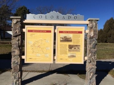
Near South Prince Street south of West Alamo Avenue, on the left when traveling south.
Near South Prince Street south of West Alamo Avenue, on the left when traveling south.
Near South Prince Street south of West Alamo Avenue, on the left when traveling south.
On East Baseline Road (Colorado Route 7) 0.3 miles east of Mountain View Boulevard, on the right when traveling east.
On U.S. 285, 5 miles north of U.S. 50, on the left when traveling north.
On U.S. 40 at milepost 463.5, on the left when traveling east.
On U.S. 287 at milepost 130, on the right when traveling west.
On County Road 24, 0.8 miles south of County Road Y, on the right when traveling east.
On State Highway 159, 0.2 miles south of U.S. 160, on the left when traveling north. Reported permanently removed.
Near State Highway 159, on the right when traveling south.
On Colorado Route 69, 0.7 miles south of Verdemont Road (County Road 182), on the right when traveling south.
On North Palmer Street, 0.1 miles north of Confluence Drive, on the right when traveling north.
On Blake Street at 14th Court, on the left when traveling west on Blake Street.
Paid Advertisement
On Market Street at 14th Street on Market Street.
On West Colfax Ave near Broadway.
Near 15th Street near Arapahoe Street, on the right when traveling west.
On Broadway at Colfax on Broadway.
On Brighton Boulevard (State Highway 265) at York Street, on the right when traveling north on Brighton Boulevard.
On West 8th Avenue at Vallejo Street, on the left when traveling east on West 8th Avenue.
Near Sheridan Boulevard (Colorado Route 95) just north of West 49th Avenue, on the left when traveling north.
Near West Jewell Avenue at South Huron Street, on the right when traveling west.
Near West Byron Place just east of Wolff Street, on the right when traveling east.
On State Highway 83, 0.1 miles south of State Highway 86, on the right when traveling south.
On State Highway 83 at Lost Lake Drive, on the right when traveling south on State Highway 83.
On Mainstreet at Victoria Drive, on the right when traveling east on Mainstreet.
On Manitou Avenue (Business U.S. 24), on the right when traveling north.
On Colorado Street (County Route 86), on the right when traveling west.
On Colorado Street (County Route 86), on the right when traveling west.
Paid Advertisement
On County Road 3A, 4.5 miles south of U.S. 24, on the right when traveling south.
On U.S. 50, on the right when traveling west.
On Interstate 25 at milepost 59,, 0.3 miles north of County Road 103, on the right when traveling north.
On John F. Kennedy Memorial Highway (Interstate 25), on the right when traveling north.
On W 44th Ave (County Route 58) 0.1 miles west of McIntyre Street, on the left when traveling west.
Near E 15th Street (U.S. 287) 0.1 miles east of Maine Street, on the left when traveling east.
On Harrison Avenue at East 10th Street on Harrison Avenue.
On U.S. 287 near High Lonesome Road, on the left when traveling north.
On N County Road 19E, on the right when traveling north.
On Interstate 25 at milepost 0, on the right when traveling north.
Near Interstate 25 Frontage Road when traveling north.
Near El Moro Road (at milepost 18) at Linden Avenue (County Road 71.1).
On Nevada Avenue at North Animas Street, on the right when traveling south on Nevada Avenue.
Near County Road 63 at Interstate 70.
Near 4th Street (U.S. 287) west of 7th Avenue, on the right when traveling west.
On Grand Army of the Republic Highway (State Highway 6) at County Road 2.5, on the right when traveling east on Grand Army of the Republic Highway.
Paid Advertisement
On Colorado Route 63 north of County Road 16, on the left when traveling north.
On County Road 370 near U.S. 6.
On County Road 370 at U.S. 6 on County Road 370.
On Overland Trail close to U.S. 6.
Near Chipeta Road north of U.S. 550, on the right when traveling north.
On Chipeta Road north of U.S. 550, on the left when traveling north.
On State Highway 52, 0.1 miles north of Interstate 76, on the right when traveling north.
On State Highway 52, 0.1 miles north of Interstate 76, on the right when traveling north.
Near Main Street (U.S. 50) at E. Beech Street, on the right when traveling north.
Near Interstate 25 at milepost 115,, 1 mile north of Young Hollow Road (Exit 114) when traveling north.
On North Union Avenue at South Elizabeth Street, on the right when traveling north on North Union Avenue.
On South Joplin Avenue (State Highway 227) at Damson Street, on the right when traveling south on South Joplin Avenue.
Near Interstate 25 at milepost 111.6,, 2.5 miles south of Young Hollow Road when traveling south.
On Stanton Avenue at Locust Street, on the right when traveling north on Stanton Avenue.
On Lane 36 (State Highway 231) at Santa Fe Drive (U.S. 50), on the left when traveling north on Lane 36.
On 8th Street (State Highway 285) north of Pitkin Avenue, on the right when traveling north.
Paid Advertisement
On 8th Street (State Highway 285) at Christy Avenue, on the right when traveling north on 8th Street.
On Interstate 76 at U.S. 385 on Interstate 76.
On Interstate 76 at U.S. 385, on the right when traveling north on Interstate 76.
On County Route 28, 6 miles west of U.S. 385, on the right when traveling west.
On Interstate 76 at U.S. 385 on Interstate 76.
On U.S. 138 just east of 2nd Street, on the right when traveling east.
On Shrine Pass Road (County Road 16) near Interstate 70.
On Shrine Pass Road (County Road 16) near Interstate 70.
On Shrine Pass Road (County Road 16) near Interstate 70.
Near Interstate 25 Frontage Road south of State Road 119.
On CanAm Highway (U.S. 85) 1.2 miles south of County Route 18, on the right when traveling south.
On U.S. 34, 0.2 miles west of County Road 15, on the right when traveling west.
On CanAm Highway (U.S. 85) 0.6 miles south of County Road 30, in the median.