On Danner Circle west of Confederate Drive, in the median.
Born in Winchester, Virginia, he moved to Missouri where at age 17 he enlisted in the State Guard. In 1861 he became a Private in the Confederate States Army, was captured during the Battle of Wilson's Creek and escaped.
Captain Danner . . . — — Map (db m100880) HM
On County Road 388 at County Road 267, on the right when traveling west on County Road 388.
Pat Garrett and Billy the Kid
As sheriff of Lincoln County, Pat Garrett was charged with tracking down and arresting Billy the Kid, a friend from Garrett's saloon keeping days in Fort Sumner, New Mexico. He was captured in December 1880 . . . — — Map (db m83262) HM
On Sidney E Manning Blvd (U.S. 29) at Houston Street, on the right when traveling north on Sidney E Manning Blvd.
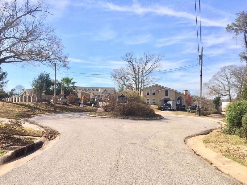
Front As railroads were reconstructed following the Civil War, a junction of north-south and east-west lines was established along the Alabama-Florida border near the confluence of Big Escambia Creek and the Conecuh-Escambia River. A . . . — — Map (db m47484) HM
On East Magnolia Avenue, 0.1 miles east of North College Street (Alabama Route 15), on the right when traveling west.
Side 1
Auburn
1865~Present
Only one house was built in the village in the decade after the Civil War, and though the state took over the bankrupt college in 1872, the institution received no state appropriation until 1883. . . . — — Map (db m79947) HM
On Poplar Avenue NW at Yukon Street NW, on the right when traveling west on Poplar Avenue NW.
After the Civil War, the future of African-Americans in the United States Army was in doubt. In July 1866, Congress passed legislation establishing two cavalry and four infantry regiments to be made up of African-American soldiers. The mounted . . . — — Map (db m75092) HM WM
Near Montevallo Road (Alabama Route 119) 0.3 miles south of Alex Mill Road, on the right when traveling south.
(side 1)
The President's Oval Office
In this building is a full-scale replica of the White House Oval Office.
When John and Abigail Adams first moved into The White House in 1800, it contained three oval rooms, inspired by . . . — — Map (db m101531) HM
John Weatherford, who was raised in Weatherford, Texas, came to Flagstaff in 1886. He decided to stay here because he fell in love with the San Francisco Peaks at first sight. He tried his hand in several occupations, everything from saloon keeper . . . — — Map (db m59507) HM
In the early 1890s (exact date unknown) Buckey O'Neill built a log cabin here on Grand Canyon's south rim. It stands in front of you; it is Grand Canyon's oldest surviving historic structure.
Grand Canyon's modern era began with people like . . . — — Map (db m39545) HM
On Apache Trail (Route 88 at milepost 241), on the left when traveling east.
"The Apache Trail combines the grandeur of the Alps, the Glory of the Rockies, the magnificence of the Grand Canyon and then adds an indefinable something that none of the others have. To me, it is the most awe-inspiring and most sublimely . . . — — Map (db m34066) HM
On General Crook Street, on the left when traveling east.
A classic Victorian mansion, this building clearly represents some of the Army's architectural motivations. Recognizing the difficulties for officers and their families of being assigned to remote posts, the Army built homes such as this one to . . . — — Map (db m36782) HM
On South Main Avenue, on the right when traveling south.
Carrillo School was named for the prominent Tucson businessman, Leopoldo Carrillo. During the 1880's, the site contained the Carrillo Gardens, the city's first park with eight acres of spring-fed artificial lakes, gardens and a recreational center. . . . — — Map (db m83016) HM
On South Montezuma Street, on the right when traveling south.
The cornerstone of historic "Whiskey Row", the Hotel St. Michael, represents the coming of age of Prescott's hostelries. Constructed on the site of the modest Hotel Burke, which burned in 1900, the new three-story hotel was designed by D. W. Millard . . . — — Map (db m33065) HM
In 1859, steamboat entrepreneur George Alonzo Johnson built a riverside home for his bride, Estefana Alvarado. Now known as the Commanding Officer's Quarters, the home is believed to be Arizona's oldest Anglo-built adobe building. In the . . . — — Map (db m28999) HM
[Written on the initial marker, provided for context]
Our Constitution names the President of the United States the Commander in Chief of all the Armed Forces. Presidents who have served in our military are displayed on the following . . . — — Map (db m92421) HM WM
On October 25, 1905, Theodore Roosevelt became only the second sitting president to visit our state. His visit was a key stop on a southern tour following the election of 1904 in which he was elected easily but failed to win any states of the former . . . — — Map (db m116375) HM
On Scenic Avenue north of Hearst Avenue, on the right when traveling south.
City of Berkeley Landmarks
designated in 1986
When prominent educator Benjamin Ide Wheeler became president of the University of California in 1899, he and his wife built this spacious home. They entertained many dignitaries here, including . . . — — Map (db m53890) HM
On Flightline Street, on the left when traveling west.
Far better it is to dare mighty things...even through checkered by failure, than to rank with those timid spirits who neither enjoy nor suffer much because they live in the gray twilight that knows not victory nor defeat.
Theodore . . . — — Map (db m53128) HM
The Long Beach Navy Memorial pays tribute to the city’s naval heritage
Long Beach's naval history dates back to 1908 with the arrival of President Theodore Roosevelt's 16-ship Great White Fleet. By the 1920s Long Beach established itself . . . — — Map (db m157406) HM WM
On Spring Street south of 3rd Street, on the right when traveling south.
Wall Street of the West
In Northern California, they panned gold in the mountain canyons. In Southern California, they made gold, in the concrete canyons of Spring Street. — — Map (db m121038) HM
On North Figueroa Street, 0.4 miles north of Avenue 43.
The Adventures Begin
Charles Fletcher Lummis was a journalist, adventurer, preservationist, librarian, poet, and life-long activist on behalf of Native Americans. He was born in Lynn, Massachusetts, in 1859. His mother died of . . . — — Map (db m135777) HM
On South Pacific Avenue south of Meyler Road, on the right when traveling north.
Juan Rodriquez Cabrillo, exploring for Spain, discovered Alta California and named San Pedro Bay, “Bahia de los Fumos” (Bay of Smokes), October 1542. The smoke on the Bay shore came from the native Suang-Na Indian Fires. Sebastian . . . — — Map (db m127129) HM
Historic way-station on the old stage road, Raymond to Wawona. The tavern was built by William Sell in the late 1880's lunch was served to
many notable people such as: President Theodore Roosevelt, Susan B Anthony, Andrew Carnegie, John D . . . — — Map (db m149057) HM
On Grub Gulch Road, on the right when traveling north.
John C Shay settled in Grub Gulch at the turn of the 20th century to mine gold. When his mining efforts failed he homesteaded the land, built this shop and started blacksmithing. He serviced the numerous wagons, stages and horse travelers that . . . — — Map (db m147957) HM
Near Mariposa Grove Road, 2.1 miles east of Wawona Road (California Route 41).
Trees Worthy of a Nation's Protection, June 30,1864 In the midst of the Civil War President Abraham Lincoln signed the Yosemite Grant Act. This established Yosemite Valley and the Mariposa Grove as the first federally protected wild places in . . . — — Map (db m160408) HM
On Southside Drive south of El Portal Road /Northside Drive, on the right when traveling east.
On this site President Theodore Roosevelt sat beside a campfire with John Muir on May 17, 1903 and talked forest good. Muir urged the President to work for preservation and priceless remnants of America’s wilderness. At this spot one of our . . . — — Map (db m62853) HM
On Lincoln Way at Elm Avenue, on the right when traveling north on Lincoln Way.
The Auburn depot is the fourth depot constructed (1902) on this hill. The original depot was constructed in 1865 when the Transcontinental Railroad came through Auburn. It burned down and was replaced in 1870. The second depot was sold and . . . — — Map (db m81586) HM
Moreton Bay Fig
(Ficus Macrophylla native to Australia)
In 1904 the House of Representative legislated protection of this tree. Requested by President Theodore Roosevelt after a visit of the area.
This tree is now over 200 years old. — — Map (db m70319) HM
In 1907, President Theodore Roosevelt sent America's battleships, called the Great White Fleet, on a world cruise. Dispatched largely as a goodwill gesture to Japan, the Fleet was scheduled to make San Francisco its first U.S. stop.
Led by . . . — — Map (db m114833) HM
On Post Street at Powell Street, on the right when traveling east on Post Street.
(Panel 1)
On the night of April Thirtieth 1898 Commodore Deweys squadron entered Manila Bay and undaunted by the danger of submerged explosives reached Manila at dawn of May First 1898 • Attacked and destroyed the Spanish fleet of ten war . . . — — Map (db m15075) HM
On Powell Street, on the right when traveling north.
1839 Jean Vioget laid out the first plan of Yerba Buena (later San Francisco), showing the Union Square site as a future park.
1847 Jasper O’Farrell created a second, more accurate plan for the blocks of San Francisco, designating . . . — — Map (db m71915) HM
Early in the Casino’s history a concert band played on the beach bandstand on summer afternoons and changed into tuxedos for evening dances in the ballroom.
In 1924 Isham Jone’s band brought jazz to the Cocoanut Grove.
1932 introduced . . . — — Map (db m62791) HM
Near Gateway Road, 0.7 miles north of Prairie Parkway (East 64th Avenue), on the left when traveling east.
Rocky Mountain Arsenal National Wildlife Refuge
Located just eleven miles northeast of downtown Denver, the Refuge is the largest contiguous open space in the Denver metropolitan area. A major environmental restoration program will be . . . — — Map (db m119390) HM
Near Lion's Park Circle, 0.6 miles west of State Route 13.
Rifle
During the U.S. Geological Survey of 1876, A.C. Peale wrote the word "rifle" on his map to mark the location of a misplaced firearm. The gun was never found, but the name stuck. Founded in 1882, Rifle attracted a steady flow of . . . — — Map (db m120749) HM
Near 4th Street (U.S. 287) west of 7th Avenue, on the right when traveling west.
Welcome to Lincoln County, Home of Pioneer Hospitality!
With its cowboy and homesteader heritage, Lincoln County is infused with an old-time spirit of hospitality. The discovery of gold in the Colorado mountains brought large cattle . . . — — Map (db m107246) HM
On West Main Street at Townsend Avenue, on the right when traveling north on West Main Street.
The Tunnel That Made the Desert Bloom
Early settlers in the Uncompahgre Valley found getting water to the fertile but arid soil an ongoing challenge. Originally, irrigation water from the Uncompahgre River was diverted onto the land through . . . — — Map (db m120134) HM
Near Noble Avenue north of Crown Street, on the left when traveling north.
Size: up to 12.5 feet in length[;] up to 6.5 feet at the shoulders
Weight: up to 2,500 lbs[;] males larger than females
Lifespan: 15-20 years in the wild[;] up to 40 years in captivity
Habitat: grasslands . . . — — Map (db m230894) HM
On Atlantic Street at Main Street, on the right when traveling north on Atlantic Street.
Freedom Shrine
Created by the National Exchange Club
to strengthen citizen appreciation
of our American heritage
Presented by the Exchange Club of Stamford
Dedicated June 14, 1979
[ Reproductions of historic American documents are . . . — — Map (db m38610) HM
On Academy Hill, 0.1 miles east of Main Street (Route 113), on the left when traveling east.
Planted in Memory Of
Theodore Roosevelt
On the 100th Anniversary Of
His Birth October 27, 1958
Capt. David Hawley Society C.A.R. — — Map (db m53238) HM
On Hopmeadow Street (Route 10) at Jim Gallagher Way, on the right when traveling south on Hopmeadow Street.
Gifford Pinchot Birthplace
Gifford Pinchot (1865 – 1946)was for more than 50 years a staunch advocate of forestry and conservation in the United States. He was born on this site on August 11, 1865 to James Wallace Pinchot and Mary Jane Eno; . . . — — Map (db m88140) HM
On Hartford Road (Route 185) at Nod Road (Route 185), on the right when traveling west on Hartford Road.
circumference 23 feet 7 inches
Dedicated May 1, 1965
in memory of Gifford Pinchot
1865--1946
Born in Simsbury, Connecticut, co-founder of the Yale School of Forestry, first chief of
the U.S. Forestry Service, Conservation Advisor . . . — — Map (db m92161) HM
On Main Street (Connecticut Route 100) at Chidsey Avenue, on the right when traveling east on Main Street.
This area, purchased by the Reverend John Davenport and Theophilus Eaton in 1638, was later known as East Farms. It was obtained from Indian sachems Momaugin and Mantowese. In 1639 Thomas Gregson, the first landowner, purchased Solitary Cove, . . . — — Map (db m35312) HM
On Main Street (Connecticut Route 100) at Hemingway Avenue (Connecticut Route 142), on the right when traveling east on Main Street.
This is the Site Of
The Theodore Roosevelt Oak
Given by The
President of The United States
To the Town of East Haven
On May 1, 1908
Erected by
The East Haven Women's Club
1965 — — Map (db m35580) HM
On W. Main Street at Elm Street, on the left when traveling east on W. Main Street.
First settled by families from East Windsor in 1716 and originally a part of East Windsor and Bolton, the Town of Vernon was incorporated in 1808 by division of the Town of Bolton. In 1889 the City of Rockville, named from the Rock Mill, was . . . — — Map (db m111842) HM
Near Maryland Avenue Northeast (Alternate U.S. 1) at 3rd Street Northeast.
This residence was designed by architect Appleton P. Clark, Jr. and built in 1891 for Daniel Birtwell. In 1900, George Bruce Cortelyou occupied the house when he became secretary to President McKinley. Cortelyou continued to serve in public office . . . — — Map (db m69292) HM
On Chesapeake Street Northwest at River Road Northwest, on the right when traveling west on Chesapeake Street Northwest.
By 1900, 12 large families — often intermarried — came to dominate the village that was Tennallytown: the Burrows, Chappell, Harry, Hurdle, Paxton, Perna, Poore, Queen, Riley, Robey, Shoemaker, and Walther clans.
This is Harry country, . . . — — Map (db m184982) HM
On Pennsylvania Avenue Northwest at 17th Street Northwest, on the right when traveling east on Pennsylvania Avenue Northwest.
Originally State, War, and Navy Departments Constructed 1871-1888 South Wing Ground broken June 1871 Completed December 1875 East Wing Ground broken July 1872 Completed April 1879 North Wing Ground broken July 1879 Completed December 1882 West . . . — — Map (db m71253) HM
On N Street Northwest west of Connecticut Avenue Northwest, on the left when traveling east.
Theodore Roosevelt resided in a number of houses in Dupont Circle. Two still standing are 1215 19th St. and 1820 Jefferson St. In 1898, he lived at 1810 N St. (below, since razed). That year he led a volunteer cavalry called the Rough Riders . . . — — Map (db m96038) HM
On 20th Street Northwest north of Massachusetts Avenue Northwest, on the left when traveling north.
"Only he can become a good citizen who remains true to the heritage of his native land."
This plaque is dedicated in gratitude to the memory of:
Theodore Roosevelt
the 26th President of the United States, signer of the . . . — — Map (db m113912) HM
On 14th Street Northwest north of Constitution Avenue Northwest (U.S. 1/50), on the right when traveling north.
The Ronald Reagan Building and International Trade Center honoring the 40th president, filled the last open space in the Federal Triangle. When former First Lady Nancy Reagan dedicated it in 1998, the redevelopment of this area of . . . — — Map (db m57205) HM
Near D Street Northwest east of 18th Street Northwest, on the right when traveling west.
Generations of Americans have given themselves to help others at home and around the world through the American Red Cross, generously donating time, money and blood. They have helped feed, shelter, and clothe those in need—from thousands of . . . — — Map (db m131073) HM
On 15th Street Northwest north of O Street Northwest, on the right when traveling north.
Theodore Roosevelt
worshiped here regularly
from 1901 to 1909
while Vice President and President
of the United States.
On July 1, 1902 he
laid the cornerstone and
on June 7, 1903 delivered
an address at the dedication
of this . . . — — Map (db m70144) HM
On Woodley Road Northwest west of 35th Street Northwest, on the right when traveling east.
Pierre L'Enfant's plan for the Federal City in 1791 included a church, “for national purposes,” but it was not until 1893 that the Protestant Episcopal Cathedral Foundation was given a charter to establish a cathedral. Located on Mount . . . — — Map (db m87907) HM
On Oakwood Terrace Northwest at 17th Street Northwest, on the left when traveling north on Oakwood Terrace Northwest.
This was the western edge of Samuel P. Brown's Mount Pleasant Village. Across the street and a few steps ahead at 3423 Oakwood Terrace is "Oakwood," an original village house built in 1871 for city politician J.W. Buker. Brown reserved the . . . — — Map (db m130870) HM
On F Street Northwest at 15th Street Northwest, on the right when traveling west on F Street Northwest.
Built in 1799, in the hope that the new capital would become a great city.
Opened as a tavern and inn by William Rhodes, 1801.
Washington's first 'town hall,' where White House architect James Hoban and other citizens met to petition . . . — — Map (db m39618) HM
On Western Ridge Trail, on the right when traveling west.
The granite bench before you commemorates the scholarship, wisdom and skilled diplomacy of Jean Jules Jusserand, French Ambassador to the United States from 1902 to 1925. The memorial's inscription, "Personal Tribute of Esteem and . . . — — Map (db m177624) HM
On 39th Street Northwest at Albemarle Street Northwest, on the right when traveling north on 39th Street Northwest.
Step back into the 19th century with a walk down Grant Road, ahead and to your left. This winding byway recalls Tenleytown’s farming past. In fact Grant Road’s undisturbed quality earned it National Historic District and DC Historic District . . . — — Map (db m130920) HM
In 1931 the Roosevelt Memorial Association purchased this island to create a living tribute to the former president. Congress designated funds for the project in 1960, and architectural designs were approved in 1961. President Lyndon B. Johnson . . . — — Map (db m127122) HM
On Swamp Trail just north of Upland Trail, on the right when traveling north.
"The nation behaves well if it treats its natural resources as assets which it must turn over to the next generation increased and not impaired in value."
—Theodore Roosevelt, 1910
As a young man, Theodore Roosevelt realized . . . — — Map (db m213569) HM
Near Swamp Trail, on the right when traveling south.
A curious youth growing up in New York City, Theodore Roosevelt enjoyed observing nature. His early passion for birds led him outdoors to a lifelong pursuit of exploration, adventure, and scientific discovery. Later, as a young man living in the . . . — — Map (db m127157) HM
On Upland Trail at Swamp Trail, on the right when traveling north on Upland Trail.
Union troops occupied this island one month after the Civil War broke out in April 1861. Following the Emancipation Proclamation in 1863, African Americans that enlisted in the Union Army trained to fight here.
Once prepared for battle, . . . — — Map (db m150051) HM
Theodore Roosevelt: 1858-1919
[Quotations, Panel 1]:
NATURE
There is delight in the hardy life of the open. There are no words that can tell the hidden spirit of the wilderness, that can reveal its mystery, its melancholy, and its . . . — — Map (db m10738) HM
On Upland Trail, 0.2 miles north of Swamp Trail, on the right when traveling north.
"...the edges of the wilderness lie close behind the roads of present travel."
—Theodore Roosevelt, 1916
Plentiful fish, waterfowl, animals, and plants attracted American Indians to this island hundreds of years ago. Greatly . . . — — Map (db m244280) HM
On 12th Street Northwest north of T Street Northwest, on the right when traveling south.
The Thurgood Marshall Center for Service and Heritage occupies the historic Italian Renaissance-style building of the 12th Street YMCA, known after 1972 as the Anthony Bowen YMCA.
The 12th Street YMCA was the first African American YMCA . . . — — Map (db m130788) HM
On Independence Avenue Southwest near 14th Street Southwest, on the left when traveling west.
James Wilson Memorial Arch
So named by the Congress, in Resolution approved by
President Franklin D. Roosevelt, June 16, 1934,
to honor the memory of
James Wilson
1835-1920
Secretary of Agriculture 1897-1913
. . . — — Map (db m110425) HM
On 17th Street Southwest at Independence Avenue Southwest, on the right when traveling north on 17th Street Southwest.
"Every officer in our navy should know by heart the deeds of John Paul Jones,"
President Theodore Roosevelt.
The American Revolution
A bold captain—fearless even when facing the superior British . . . — — Map (db m17764) HM
On State Road A1A at Old Florida Trail, on the left when traveling north on State Road A1A.
Under the United States Government Homestead Act of 1862, brothers Robert Toombs Smith and Charley Smith laid claim to 158.79 acres on Mullet Creek in 1887. They discovered the property while searching the Indian River Lagoon shoreline by sailboat . . . — — Map (db m102830) HM
Theodore Roosevelt, the 26th president of the United States (1901-1909) is known as the "conservationist president" for creating the Division of Forestry and protecting 230 million acres of federal land. He was a member of Florida Audubon during . . . — — Map (db m164912) HM
On East Wright Street at North Tarragona Street, on the right when traveling west on East Wright Street.
June 1, 1898, Col. Theodore Roosevelt and 170 of his Rough Riders (Indians, cowboys, policemen, clubmen, millionaires, etc.) welcomed here en route to Spanish-American War. There were 6 trains with men, horses and equipment of 1st U.S. Volunteer . . . — — Map (db m72270) HM
Near U.S. 301, 0.2 miles south of East Dr. Martin Luther King Jr. Boulevard, on the right when traveling south.
The Philippine-American War, also known as the Philippine War of Independence or the Philippine Insurrection (1899 -1902), was an armed conflict between the United States and Filipino revolutionaries. The conflict arose from the struggle of the . . . — — Map (db m194588) HM WM
On North Howard Avenue at West Gray Street, on the left when traveling north on North Howard Avenue.
Benjamin Field
In 1896, this land was gifted to the City of West Tampa as a public park by George N. Benjamin, a prominent entrepreneur & early West Tampa leader. The park was built & 2 year later it was used by Theodore Roosevelt & the . . . — — Map (db m136019) HM
On South Ferdinand Avenue just north of West Tacon Street, on the left when traveling north.
Theodore Roosevelt was the Assistant Secretary of the Navy when the battleship U.S.S. Maine was sunk in Havana Harbor. After the United States declared war on Spain in April 1898, initiating the Spanish American War, Roosevelt resigned his . . . — — Map (db m111049) HM
On North Howard Avenue north of West Gray Street, on the left when traveling north. Reported missing.
At the outbreak of the Spanish-American War, this area, a sand flat without a tree, but surrounded by an extensive forest, was the camp site of Theodore Roosevelt's Rough Riders, the most unusual regiment in the history of the U. S. Army. . . . — — Map (db m130109) HM
On South West Shore Boulevard at Interbay Boulevard, on the right when traveling north on South West Shore Boulevard.
From April to June, 1898, Tampa served as port of embarkation for U.S. troops on their way to Cuba. Some 30,000 troops arrived in Tampa and 16,000 embarked from Port Tampa on June 7. The Tampa Bay Hotel was headquarters for the force's leaders . . . — — Map (db m13635) HM
On June 14, 1898, Lt. Col. Theodore Roosevelt
and the First United States Volunteer Cavalry,
known as the Rough Riders, embarked from Port
Tampa for victory in the Spanish-American War.
The Tampa Bay Hotel was used as headquarters
for . . . — — Map (db m20160) HM
On West Kennedy Boulevard near University Drive, on the right when traveling west.
Henry B. Plant built this ornate Moorish structure at a cost of $3 million. Opened in 1891, it became the social and cultural center of early Tampa. During the Spanish American War it was headquarters for troops going to Cuba and housed such . . . — — Map (db m20020) HM
On 9th Avenue near 14th Street. Reported permanently removed.
The second brick building erected in Ybor City. The Cherokee Club was a popular rendezvous for the elite in the 1890's. Later became known as El Pasaje Restaurant. Its fame spread throughout the Americas.
Jose Marti slept here on his first . . . — — Map (db m152236) HM
On North Franklin Street just north of East Kennedy Boulevard (State Road 60), on the right when traveling south.
On June 3, 1898, when Tampa was a
cluster of old weather beaten houses
floating on an ocean of sand, Teddy
Roosevelt and the Rough Riders
disembarked from their seven train
convoy in Ybor City, five miles from
Tampa City Hall.
They . . . — — Map (db m15569) HM
On East 7th Avenue (La Séptima) west of North 22nd Street, on the right when traveling east.
The intersection of Seventh Avenue and Twentysecond Street was a sandy cross-road connecting three army encampments in the Ybor City area during the Spanish-American War.
At this cross-road was located a water-trough where the Rough Riders . . . — — Map (db m33805) HM
Near North Bay Boulevard, 0.3 miles north of Pine Avenue.
Less than a mile to the north lies Passage Key, marking the southerly entrance into Tampa Bay. Since Ponce de Leon explored this coast in 1513, this island has served to guide ships into the great bay beyond, called by early Spanish explorers . . . — — Map (db m72420) HM
On Truman Avenue (U.S. 1) at Elizabeth Street, on the right when traveling north on Truman Avenue.
(side 1)
In April of 1898 it was graciously offered and converted to a 400 bed United States Army Hospital for the treatment of soldiers and sailors, ill with dangerous tropical diseases or wounded in battle, during Cuba's War of . . . — — Map (db m101295) HM
Near Willing Street, 0.1 miles west of Caroline Street.
February 15, 1898
Sinking Of The USS Maine
April 19, 1898
U.S. Adopts Joint Resolution For War
April 25, 1898
U.S. Declares War On Spain
May 1, 1898
Battle Of Manila Bay
. . . — — Map (db m152467) WM
On South Elm Avenue just south of West 6th Street, on the left when traveling south.
1 • Helen Keller Southern Magnolia Planted on July 9, 2000 by family in honor of Venus Guess a devoted mother and grandmother. The towering Helen Keller Southern Magnolia may have been one of the trees Helen Keller climbed in the yard . . . — — Map (db m214868) HM
Near Old Allatoona Road, 2 miles east of Interstate 75, on the left when traveling east.
Some 200 yards behind this marker was an earthen redoubt that protected the Federal defenses and the Star Fort. The redoubt was commanded by Colonel Richard Rowett and manned by the 39th Iowa, 7th Illinois, five companies of the 93rd Illinois . . . — — Map (db m78099) HM
On Mimosa Boulevard at Bulloch Avenue, on the left when traveling north on Mimosa Boulevard.
Built in the early 1840's by Major James Stephen Bulloch. His second wife, married in 1832, was Martha Elliott. Their second daughter, Martha (Mittie) Bulloch and Theodore Roosevelt married here in 1853. Their son Theodore Roosevelt was the 25th . . . — — Map (db m55963) HM
On Sloan Street, 0.6 miles east of Walnut Street, on the left when traveling east.
This cemetery, the first in Roswell, was burying ground of the village from 1840 to 1860. Among the distinguished dead who rest here are Roswell’s founder, Roswell King; Major James Stephens Bulloch, grandfather of president Theodore Roosevelt and . . . — — Map (db m21712) HM
On Atlanta Street (Georgia Route 9) at Park Square Court, on the right when traveling south on Atlanta Street. Reported permanently removed.
For years called “The Park,” this area was set aside by Roswell’s founders. Present walks duplicate original paths. President Theodore Roosevelt spoke here from a bandstand in 1905. Historic Roswell Square Bicentennial Restoration . . . — — Map (db m112081) HM
On Mimosa Boulevard at Bulloch Avenue, on the right when traveling north on Mimosa Boulevard.
The Square was part of town founder Roswell King’s original town plan and is the center of the Roswell Historic District. The District was listed on the National Register of Historic Places in 1973. President Theodore Roosevelt visited Roswell, his . . . — — Map (db m112003) HM
On North Atlanta Street (Georgia Route 9) at Oak Street, on the right when traveling north on North Atlanta Street.
In this cemetery lie some of Roswell’s leading early citizens, most of whom came here from Georgia’s coastal counties: Francis Robert Goulding (1810-1881), clergyman, inventor, author of The Young Marooners and other juvenile classics; . . . — — Map (db m70425) HM
On North Jefferson Avenue at Harrison Street, on the left when traveling north on North Jefferson Avenue.
Here stood the small frame house in which Lazarus Straus and his family lived when they came to Talbotton in 1854. Seeking a new home in America after leaving Bavaria, Straus visited Talbotton during a “court week” and decided to make . . . — — Map (db m38249) HM
On Pearl Avenue near Pine Street, on the right when traveling west.
This County, created by Act of the Legislature Aug. 14, 1912, is named for Gen. Joseph Wheeler, famous Confederate Cavalry leader and Major General of Cavalry in the Spanish War. He twice saved Augusta from Kilpatrick's Union Cavalry, at . . . — — Map (db m23634) HM
On State Highway 21 at East Lake Forest Drive, on the right when traveling east on State Highway 21.
In 1906, at the age of seventy-five, Ezra Meeker began a journey east from his home in Puyallup, Washington, to retrace the route of the Oregon Trail over which he originally traveled in 1852 with his wife and young son. He traveled the route with . . . — — Map (db m118993) HM
On Chatcolet Road, 6.5 miles east of U.S. 95, on the right when traveling west.
The Coeur d’Alene people are the earliest inhabitants of this area.
The natural wealth of the forests, rivers, and lakes sustained their existence for countless generations on five million acres of ancestral land.
Their lifestyle was . . . — — Map (db m110383) HM
On East 2nd Street South (U.S. 30) near South Main Street, on the right when traveling west.
In 1958, Dr. Evan and Lois Kackley donated the Yellowstone Coach to the City of Soda Springs. According to Dr. Kackley's written letters to the city council he stated, "This particular coach was used to carry Pres. Theodore Roosevelt and the . . . — — Map (db m106694) HM
On State Highway 34 near Tincup Road, on the left when traveling west.
Caribou Mountain rises 9,800 feet with alpine snowfields feeding Tincup Creek, a tributary to the South Fork of the Snake River. Placer gold discoveries high on the mountain in 1871 led to a gold rush that lasted for two decades. In the 1880s sheep . . . — — Map (db m105963) HM
On Pine Street near U.S. 95, on the right when traveling south.
During the decade following the discovery of gold in the California mill race in 1848, restless bands of prospectors, lured by the hope of sudden wealth, arrived in what is now north-central Idaho. In 1860, gold was discovered on Canal Gulch of Oro . . . — — Map (db m141251) HM
Near State Street near Hewitt Street, on the left when traveling south.
A Rich Tradition Of Land Use
Gathering, Hunting, Trapping, Mining, Logging, Ranching, Farming, Recreation
Around 15 thousand years ago, groups of Native Americans started the long history of land use in this area. Today, the Nez . . . — — Map (db m119494) HM
On West Dakota Street (U.S. 6) just east of North Strong Avenue, on the right when traveling east.
Pioneer resident of Spring Valley. Achieved national prominence in the settlement of the Pennsylvania Anthracite Miners Strike in 1902 with the co-operation of President Theodore Roosevelt.
President of United Mine Workers, 1889-1908. Author . . . — — Map (db m164894) HM
386 entries matched your criteria. The first 100 are listed above. Next 100 ⊳