386 entries match your criteria. The first 100 are listed. ⊳
Former U.S. Presidents: #26 Theodore Roosevelt Historical Markers
By Mark Hilton, January 14, 2017
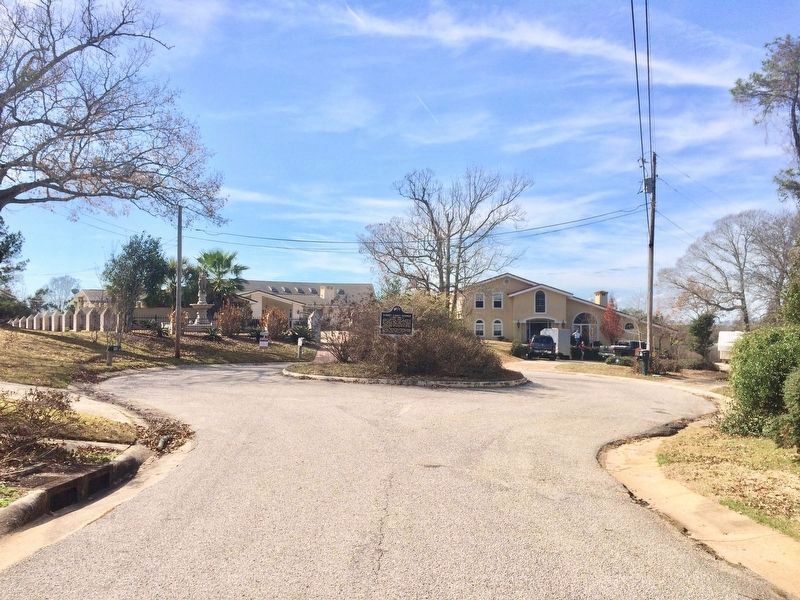
View west of the marker in the middle of the cul-de-sac.
| 1 ► Alabama, Baldwin County, Spanish Fort — Albert Carey Danner — 1843~1921 — |
| On Danner Circle west of Confederate Drive, in the median. | |||
| 2 ► Alabama, Chambers County, Cusseta — Pat Garrett and Billy the Kid / Pat Garrett, "The Man Who Shot Billy the Kid" — |
| On County Road 388 at County Road 267, on the right when traveling west on County Road 388. | |||
| 3 ► Alabama, Escambia County, Flomaton — Flomaton, Alabama — |
| On Sidney E Manning Blvd (U.S. 29) at Houston Street, on the right when traveling north on Sidney E Manning Blvd. | |||
| 4 ► Alabama, Lee County, Auburn — Auburn 1865~Present / The "Loveliest Village" — |
| On East Magnolia Avenue, 0.1 miles east of North College Street (Alabama Route 15), on the right when traveling west. | |||
| 5 ► Alabama, Madison County, Huntsville — Buffalo Soldiers — Huntsville, AL — |
| On Poplar Avenue NW at Yukon Street NW, on the right when traveling west on Poplar Avenue NW. | |||
| 6 ► Alabama, Shelby County, Montevallo — The President's Oval Office / The Glorious Burden — |
| Near Montevallo Road (Alabama Route 119) 0.3 miles south of Alex Mill Road, on the right when traveling south. | |||
| 7 ► Arizona, Coconino County, Flagstaff — Weatherford Hotel — 1898/1899 — |
| On North Leroux Street. | |||
| 8 ► Arizona, Coconino County, Grand Canyon National Park — Buckey O'Neill Cabin — Grand Canyon National Park — |
| 9 ► Arizona, Coconino County, Jacob Lake — Theodore Roosevelt — |
| On Arizona Route 67, 0.1 miles south of U.S. 89A, on the right when traveling south. | |||
| 10 ► Arizona, Maricopa County, Apache Junction — Welcome to the Apache Trail Historic Road — |
| On Apache Trail (Route 88 at milepost 241), on the left when traveling east. | |||
| 11 ► Arizona, Navajo County, Fort Apache — Commanding Officers' Quarters (104) — |
| On General Crook Street, on the left when traveling east. | |||
| 12 ► Arizona, Pima County, Tucson, Barrio Viejo — Carrillo Intermediate School — |
| On South Main Avenue, on the right when traveling south. | |||
| 13 ► Arizona, Yavapai County, Prescott — Hotel St. Michael — |
| On South Montezuma Street, on the right when traveling south. | |||
| 14 ► Arizona, Yuma County, Yuma — Commanding Officer's Quarters & Kitchen — |
| Near North 4th Avenue. | |||
| 15 ► Arkansas, Benton County, Bella Vista — United States Commanders in Chief — |
| 16 ► Arkansas, Pulaski County, Little Rock, Macarthur Park — Roosevelt Visits Little Rock — |
| Near East 9th Street. | |||
| 17 ► California, Alameda County, Berkeley, Northside — Benjamin Ide Wheeler House and Garden — Edgar A. Mathew, Architect, 1900 — Louis Hobart, Architect, 1911 — |
| On Scenic Avenue north of Hearst Avenue, on the right when traveling south. | |||
| 18 ► California, Kern County, Mojave — Rotary Rocket Roton ATV — First Rocket Powered Vehicle to Fly At Mojave Spaceport — 1999 A.D. — |
| On Flightline Street, on the left when traveling west. | |||
| 19 ► California, Los Angeles County, Long Beach, Waterfront — In Their Honor — |
| Near West Shoreline Drive near Aquarium Way. | |||
| 20 ► California, Los Angeles County, Los Angeles, Downtown Los Angeles — Spring Street — |
| On Spring Street south of 3rd Street, on the right when traveling south. | |||
| 21 ► California, Los Angeles County, Los Angeles, Northeast Los Angeles — Charles Lummis — |
| On North Figueroa Street, 0.4 miles north of Avenue 43. | |||
| 22 ► California, Los Angeles County, Los Angeles, San Pedro — Fort MacArthur / 500 Varas Square Historic District — Port of Los Angeles — |
| On South Pacific Avenue south of Meyler Road, on the right when traveling north. | |||
| 23 ► California, Madera County, Ahwahnee — Ahwahnee Tavern — |
| On Highway 49, on the right when traveling north. | |||
| 24 ► California, Madera County, Ahwahnee — Shay's Blacksmith Shop & Canary Cottage — |
| On Grub Gulch Road, on the right when traveling north. | |||
| 25 ► California, Mariposa County, Fish Camp — Celebrating the Mariposa Grove — Mariposa Grove of Giant Sequoias — Yosemite National Park — |
| Near Mariposa Grove Road, 2.1 miles east of Wawona Road (California Route 41). | |||
| 26 ► California, Mariposa County, Yosemite National Park — President Theodore Roosevelt & John Muir Meeting Site — Yosemite National Park — |
| On Southside Drive south of El Portal Road /Northside Drive, on the right when traveling east. | |||
| 27 ► California, Placer County, Auburn — 138 - 06 — Auburn Depot — |
| On Lincoln Way at Elm Avenue, on the right when traveling north on Lincoln Way. | |||
| 28 ► California, San Diego County, San Diego — Moreton Bay Fig — |
| On Front Street. | |||
| 29 ► California, San Diego County, San Diego — San Diego: Birthplace of Naval Aviation — The Promise 1908 - 1910 — |
| On N Harbor Dr, on the left when traveling north. | |||
| 30 ► California, San Francisco City and County, San Francisco, Union Square — Dewey Monument — |
| On Post Street at Powell Street, on the right when traveling east on Post Street. | |||
| 31 ► California, San Francisco City and County, San Francisco, Union Square — 623 — History of Union Square — |
| On Powell Street, on the right when traveling north. | |||
| 32 ► California, Santa Cruz County, Santa Cruz — The Cocoanut Grove — Dancing through the years — |
| Near Beach Street. | |||
| 33 ► Colorado, Adams County, Commerce City — Habitat for Wildlife - A Rich History — |
| Near Gateway Road, 0.7 miles north of Prairie Parkway (East 64th Avenue), on the left when traveling east. | |||
| 34 ► Colorado, Garfield County, Rifle — Rifle / The Rock That Burns / Colorado Wilderness / Rifle Country — |
| Near Lion's Park Circle, 0.6 miles west of State Route 13. | |||
| 35 ► Colorado, Lincoln County, Hugo — Welcome to Lincoln County — |
| Near 4th Street (U.S. 287) west of 7th Avenue, on the right when traveling west. | |||
| 36 ► Colorado, Montrose County, Montrose — The Gunnison Tunnel — |
| On West Main Street at Townsend Avenue, on the right when traveling north on West Main Street. | |||
| 37 ► Connecticut, Fairfield County, Bridgeport, Beardsley Park — American Bison — Bison bison — |
| Near Noble Avenue north of Crown Street, on the left when traveling north. | |||
| 38 ► Connecticut, Fairfield County, Stamford, Downtown — Freedom Shrine — |
| On Atlantic Street at Main Street, on the right when traveling north on Atlantic Street. | |||
| 39 ► Connecticut, Fairfield County, Stratford — Planted in Memory of Theodore Roosevelt — |
| On Academy Hill, 0.1 miles east of Main Street (Route 113), on the left when traveling east. | |||
| 40 ► Connecticut, Hartford County, Hartford, Downtown — President Theodore Roosevelt — 1858 - 1919 — |
| On Trumbull Street just south of Asylum Street, on the right when traveling south. | |||
| 41 ► Connecticut, Hartford County, Simsbury, Simsbury Center — Gifford Pinchot Birthplace — |
| On Hopmeadow Street (Route 10) at Jim Gallagher Way, on the right when traveling south on Hopmeadow Street. | |||
| 42 ► Connecticut, Hartford County, Simsbury, Weatogue — The Pinchot Sycamore — |
| On Hartford Road (Route 185) at Nod Road (Route 185), on the right when traveling west on Hartford Road. | |||
| 43 ► Connecticut, New Haven County, East Haven, The Centre — East Haven — |
| On Main Street (Connecticut Route 100) at Chidsey Avenue, on the right when traveling east on Main Street. | |||
| 44 ► Connecticut, New Haven County, East Haven, The Centre — Site of the Theodore Roosevelt Oak — |
| On Main Street (Connecticut Route 100) at Hemingway Avenue (Connecticut Route 142), on the right when traveling east on Main Street. | |||
| 45 ► Connecticut, Tolland County, Vernon, Rockville — Vernon — |
| On W. Main Street at Elm Street, on the left when traveling east on W. Main Street. | |||
| 46 ► District of Columbia, Washington, Northeast Washington, Capitol Hill — Cortelyou House — 1891 — Residence of George B. Cortelyou — |
| Near Maryland Avenue Northeast (Alternate U.S. 1) at 3rd Street Northeast. | |||
| 47 ► District of Columbia, Washington, Northwest Washington, American University Park — 11 — Harry Country — Top of the Town — Tenleytown Heritage Trail — |
| On Chesapeake Street Northwest at River Road Northwest, on the right when traveling west on Chesapeake Street Northwest. | |||
| 48 ► District of Columbia, Washington, Northwest Washington, Downtown — Executive Office Building — |
| On Pennsylvania Avenue Northwest at 17th Street Northwest, on the right when traveling east on Pennsylvania Avenue Northwest. | |||
| 49 ► District of Columbia, Washington, Northwest Washington, Dupont Circle — Theodore Roosevelt — Dupont Circle — Diverse Visions | One Neighborhood — |
| On N Street Northwest west of Connecticut Avenue Northwest, on the left when traveling east. | |||
| 50 ► District of Columbia, Washington, Northwest Washington, Dupont Circle — Theodore Roosevelt — 1858 - 1919 — |
| On 20th Street Northwest north of Massachusetts Avenue Northwest, on the left when traveling north. | |||
| 51 ► District of Columbia, Washington, Northwest Washington, Federal Triangle — 9 — Completing the Triangle — Make No Little Plans — Federal Triangle Heritage Trail — |
| On 14th Street Northwest north of Constitution Avenue Northwest (U.S. 1/50), on the right when traveling north. | |||
| 52 ► District of Columbia, Washington, Northwest Washington, Foggy Bottom — The American Red Cross — |
| Near D Street Northwest east of 18th Street Northwest, on the right when traveling west. | |||
| 53 ► District of Columbia, Washington, Northwest Washington, Logan Circle — Theodore Roosevelt Worshiped Here Regularly — Grace Reformed Church — |
| On 15th Street Northwest north of O Street Northwest, on the right when traveling north. | |||
| 54 ► District of Columbia, Washington, Northwest Washington, Massachusetts Heights — 10 — Washington National Cathedral — |
| On Woodley Road Northwest west of 35th Street Northwest, on the right when traveling east. | |||
| 55 ► District of Columbia, Washington, Northwest Washington, Mount Pleasant — 6 — Village Life — Village in the City — Mount Pleasant Heritage Trail — |
| On Oakwood Terrace Northwest at 17th Street Northwest, on the left when traveling north on Oakwood Terrace Northwest. | |||
| 56 ► District of Columbia, Washington, Northwest Washington, Penn Quarter — Site of Rhodes Tavern — 1799 - 1984 — |
| On F Street Northwest at 15th Street Northwest, on the right when traveling west on F Street Northwest. | |||
| 57 ► District of Columbia, Washington, Northwest Washington, Rock Creek Park — Jusserand — Banc Commeratif Erige a la Memoir de Jean Jule Jusserand Ambassadeur de France — |
| On Western Ridge Trail, on the right when traveling west. | |||
| 58 ► District of Columbia, Washington, Northwest Washington, Tenleytown — 2 — A Country Road — Top of the Town — Tenleytown Heritage Trail — |
| On 39th Street Northwest at Albemarle Street Northwest, on the right when traveling north on 39th Street Northwest. | |||
| 59 ► District of Columbia, Washington, Northwest Washington, Theodore Roosevelt Island — Making the Memorial — Theodore Roosevelt Island, George Washington Memorial Parkway — National Park Service, U.S. Department of the Interior — |
| 60 ► District of Columbia, Washington, Northwest Washington, Theodore Roosevelt Island — Natural by Design — Theodore Roosevelt Island — George Washington Memorial Parkway, National Park Service, U.S. Department of the Interior — |
| On Swamp Trail just north of Upland Trail, on the right when traveling north. | |||
| 61 ► District of Columbia, Washington, Northwest Washington, Theodore Roosevelt Island — Naturalist — Theodore Roosevelt Island — George Washington Memorial Parkway, National Park Service, U.S. Department of the Interior — |
| Near Swamp Trail, on the right when traveling south. | |||
| 62 ► District of Columbia, Washington, Northwest Washington, Theodore Roosevelt Island — Rough and Ready — Theodore Roosevelt Island — George Washington Memorial Parkway, National Park Service, U.S. Department of the Interior — |
| On Upland Trail at Swamp Trail, on the right when traveling north on Upland Trail. | |||
| 63 ► District of Columbia, Washington, Northwest Washington, Theodore Roosevelt Island — Theodore Roosevelt — Theodore Roosevelt Island National Memorial — |
| 64 ► District of Columbia, Washington, Northwest Washington, Theodore Roosevelt Island — Urban Wilderness — Theodore Roosevelt Island — George Washington Memorial Parkway, National Park Service, U.S. Department of the Interior — |
| On Upland Trail, 0.2 miles north of Swamp Trail, on the right when traveling north. | |||
| 65 ► District of Columbia, Washington, Northwest Washington, U Street Corridor — 6 — A Home Away From Home — City Within a City — Greater U Street Heritage Trail — |
| On 12th Street Northwest north of T Street Northwest, on the right when traveling south. | |||
| 66 ► District of Columbia, Washington, Southwest Washington, Southwest Federal Center — James Wilson — |
| On Independence Avenue Southwest near 14th Street Southwest, on the left when traveling west. | |||
| 67 ► District of Columbia, Washington, Southwest Washington, The National Mall — John Paul Jones Memorial — National Mall & Memorial Parks, Washington, D.C. — National Park Service, U.S. Department of the Interior — |
| On 17th Street Southwest at Independence Avenue Southwest, on the right when traveling north on 17th Street Southwest. | |||
| 68 ► Florida, Brevard County, Melbourne Beach — F-641 — Smith Family Homestead — |
| On State Road A1A at Old Florida Trail, on the left when traveling north on State Road A1A. | |||
| 69 ► Florida, Collier County, Naples — Landmark Cypress № 4 — "Roosevelt" — Corkscrew Swamp Sanctuary — |
| Near Sanctuary Road West at Rookery Lane. | |||
| 70 ► Florida, Escambia County, Pensacola — Rough Riders — |
| On East Wright Street at North Tarragona Street, on the right when traveling west on East Wright Street. | |||
| 71 ► Florida, Hillsborough County, East Lake-Orient Park — The Philippine-American War 1899 - 1913 — Hillsborough County Veterans Memorial Park — |
| Near U.S. 301, 0.2 miles south of East Dr. Martin Luther King Jr. Boulevard, on the right when traveling south. | |||
| 72 ► Florida, Hillsborough County, Tampa — Benjamin Field/George N. Benjamin b 1859 d 1926 — |
| On North Howard Avenue at West Gray Street, on the left when traveling north on North Howard Avenue. | |||
| 73 ► Florida, Hillsborough County, Tampa — Roosevelt Elementary School — |
| On South Ferdinand Avenue just north of West Tacon Street, on the left when traveling north. | |||
| 74 ► Florida, Hillsborough County, Tampa — Rough Riders — |
| On East 7th Avenue (La Séptima) east of Nuccio Pkwy., on the right when traveling east. | |||
| 75 ► Florida, Hillsborough County, Tampa — Rough Riders Encampment — June 1898 |
| On North Howard Avenue north of West Gray Street, on the left when traveling north. Reported missing. | |||
| 76 ► Florida, Hillsborough County, Tampa — F-42 — Tampa as Port of Embarkation for Spanish American War — |
| On South West Shore Boulevard at Interbay Boulevard, on the right when traveling north on South West Shore Boulevard. | |||
| 77 ► Florida, Hillsborough County, Tampa — Tampa Bay Hotel — |
| On University Drive near West Kennedy Boulevard. | |||
| 78 ► Florida, Hillsborough County, Tampa — F-31 — Tampa Bay Hotel — |
| On West Kennedy Boulevard near University Drive, on the right when traveling west. | |||
| 79 ► Florida, Hillsborough County, Tampa — The Cherokee Club — "El Pasaje" — 1888 |
| On 9th Avenue near 14th Street. Reported permanently removed. | |||
| 80 ► Florida, Hillsborough County, Tampa — The Rough Riders Passed By Here — |
| On North Franklin Street just north of East Kennedy Boulevard (State Road 60), on the right when traveling south. | |||
| 81 ► Florida, Hillsborough County, Tampa — The Rough Riders Rode By Here — 1898 — |
| On East 7th Avenue (La Séptima) west of North 22nd Street, on the right when traveling east. | |||
| 82 ► Florida, Manatee County, Anna Maria — F-253 — Passage Key — Gateway to Historic Tampa Bay — |
| Near North Bay Boulevard, 0.3 miles north of Pine Avenue. | |||
| 83 ► Florida, Monroe County, Key West — War of 1898 — On this site the Catholic Convent of the Holy Names of Jesus and Mary was located — |
| On Truman Avenue (U.S. 1) at Elizabeth Street, on the right when traveling north on Truman Avenue. | |||
| 84 ► Florida, Santa Rosa County, Milton — The Spanish – American War — 1898 — Santa Rosa Veterans Memorial Plaza — |
| Near Willing Street, 0.1 miles west of Caroline Street. | |||
| 85 ► Florida, Seminole County, Sanford — Hellen Keller Grove — Featured Tree — Hellen Keller Southern Magnolia — |
| On South Elm Avenue just south of West 6th Street, on the left when traveling south. | |||
| 86 ► Georgia, Bartow County, Cartersville — Rowett's Redoubt — |
| Near Old Allatoona Road, 2 miles east of Interstate 75, on the left when traveling east. | |||
| 87 ► Georgia, Fulton County, Roswell — 060-40B — Bulloch Hall — |
| On Mimosa Boulevard at Bulloch Avenue, on the left when traveling north on Mimosa Boulevard. | |||
| 88 ► Georgia, Fulton County, Roswell — Founders' Cemetery — |
| On Sloan Street, 0.6 miles east of Walnut Street, on the left when traveling east. | |||
| 89 ► Georgia, Fulton County, Roswell — Historic Roswell Square Bicentennial Restoration Project |
| On Atlanta Street (Georgia Route 9) at Park Square Court, on the right when traveling south on Atlanta Street. Reported permanently removed. | |||
| 90 ► Georgia, Fulton County, Roswell — Roswell Town Square — circa 1840 — |
| On Mimosa Boulevard at Bulloch Avenue, on the right when traveling north on Mimosa Boulevard. | |||
| 91 ► Georgia, Fulton County, Roswell — 060-121 — Roswell’s Distinguished Men — |
| On North Atlanta Street (Georgia Route 9) at Oak Street, on the right when traveling north on North Atlanta Street. | |||
| 92 ► Georgia, Talbot County, Talbotton — 130-6 — Straus Home Site — |
| On North Jefferson Avenue at Harrison Street, on the left when traveling north on North Jefferson Avenue. | |||
| 93 ► Georgia, Wheeler County, Alamo — 153-1 — Wheeler County — |
| On Pearl Avenue near Pine Street, on the right when traveling west. | |||
| 94 ► Idaho, Ada County, Boise — Ezra Meeker — The Oregon Trail — |
| On State Highway 21 at East Lake Forest Drive, on the right when traveling east on State Highway 21. | |||
| 95 ► Idaho, Benewah County, Plummer — Heyburn State Park — the Oldest State Park in the Pacific Northwest — |
| On Chatcolet Road, 6.5 miles east of U.S. 95, on the right when traveling west. | |||
| 96 ► Idaho, Caribou County, Soda Springs — Coach History — |
| On East 2nd Street South (U.S. 30) near South Main Street, on the right when traveling west. | |||
| 97 ► Idaho, Caribou County, Wayan — Tincup Creek — |
| On State Highway 34 near Tincup Road, on the left when traveling west. | |||
| 98 ► Idaho, Idaho County, Grangeville — Gold Pans and Whipsaws — |
| On Pine Street near U.S. 95, on the right when traveling south. | |||
| 99 ► Idaho, Valley County, McCall — The Idaho Forest — A Miracle at Work — Idahoans at Work — |
| Near State Street near Hewitt Street, on the left when traveling south. | |||
| 100 ► Illinois, Bureau County, Spring Valley — John Mitchell — 1870-1919 — |
| On West Dakota Street (U.S. 6) just east of North Strong Avenue, on the right when traveling east. | |||
386 entries matched your criteria. The first 100 are listed above. Next 100 ⊳