89 entries match your criteria.
Former U.S. Presidents: #15 James Buchanan Historical Markers
By William Fischer, Jr.
United States Commanders in Chief Markers
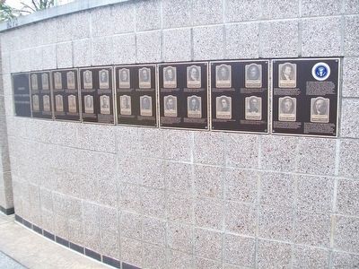
| 1 ► Arkansas, Benton County, Bella Vista — United States Commanders in Chief — |
| 2 ► Colorado, Sedgwick County, Julesburg — Colorado's Northeast Corner — |
| On County Road 63.2 at County Road 36, on the right when traveling north on County Road 63.2. | |||
| 3 ► District of Columbia, Washington, Northwest Washington, Columbia Heights — A Gathering Place for Washingtonians — Meridian Hill Park, National Historic Landmark — National Park Service, U.S. Department of the Interior — |
| Near 16th Street Northwest at W Street Northwest, on the right when traveling north. | |||
| 4 ► District of Columbia, Washington, Northwest Washington, Columbia Heights — Buchanan — |
| Near 15th Street Northwest at W Street Northwest, on the left when traveling north. | |||
| 5 ► District of Columbia, Washington, Northwest Washington, Columbia Heights — James Buchanan — Diplomat, Statesman, and Fifteenth President of the United States — Meridian Hill Park, National Historic Landmark — |
| Near 16th Street Northwest north of W Street Northwest, on the right when traveling north. | |||
| 6 ► District of Columbia, Washington, Northwest Washington, Columbia Heights — Park Designers — Meridan Hill Park, National Historic Landmark — National Park Service, U.S. Department of the Interior — |
| Near 15th Street Northwest north of Chapin Street Northwest, on the left when traveling north. | |||
| 7 ► District of Columbia, Washington, Northwest Washington, Georgetown — The Colonial — Erected 1820 · Restored 1953 — |
| On 30th Street Northwest north of N Street Northwest, on the right when traveling north. | |||
| 8 ► District of Columbia, Washington, Northwest Washington, Mount Vernon Square — 1 — Words and Deeds — Midcity at the Crossroads — Shaw Heritage Trail — |
| On Mount Vernon Place Northwest (U.S. 1) at 7th Street Northwest, on the right when traveling west on Mount Vernon Place Northwest. | |||
| 9 ► District of Columbia, Washington, Northwest Washington, Penn Quarter — The New Willard — Erected 1901 — |
| On Pennsylvania Avenue Northwest at 14th Street Northwest (Highway 1), on the right when traveling west on Pennsylvania Avenue Northwest. | |||
| 10 ► District of Columbia, Washington, Northwest Washington, Woodley Park — Redwood — |
| On Connecticut Avenue Northwest, 0.1 miles south of Devonshire Place Northwest, on the right when traveling south. | |||
| 11 ► District of Columbia, Washington, Northwest Washington, Woodley Park — Woodley Estate — |
| On Cathedral Avenue Northwest east of Woodley Road Northwest, on the right when traveling west. | |||
| 12 ► Georgia, Haralson County, Buchanan — 071-1 — Haralson County — |
| On Business U.S. 27 at Weatherly Street, on the left when traveling south on U.S. 27Business . | |||
| 13 ► Georgia, Richmond County, Augusta — 121-36 — Summerville Cemetery — |
| On Cumming Road at Johns Road, on the right when traveling east on Cumming Road. | |||
| 14 ► Georgia, Warren County, Jewells Mill — 149-4 — Shoals on the Ogeechee — |
| On State Highway 123 at Shoals Road, on the left when traveling south on State Highway 123. | |||
| 15 ► Illinois, Hancock County, Carthage — Historic Carthage Jail — Looking for Lincoln — |
| On Walnut Street near Fayette Street. | |||
| 16 ► Illinois, Sangamon County, Springfield — Curran's Jewelry Shop — Looking for Lincoln — |
| On E. Adams Street. | |||
| 17 ► Indiana, Wabash County, Wabash — Quarters of Lewis Cass — Governor of Michigan — |
| Near E. Market Street, 0.2 miles east of S. Allen Street. | |||
| 18 ► Kansas, Douglas County, Kanwaka — 40 — Lecompton — Capital of Kansas Territory — |
| On U.S. 40 at E 600 Road (County Route 1029), on the right when traveling west on U.S. 40. | |||
| 19 ► Kansas, Shawnee County, Tecumseh — Lecompton — Capital of Kansas Territory — |
| Near Interstate 70, 10 miles west of S Lawrence Trafficway (State Highway 10). | |||
| 20 ► Kentucky, Breckinridge County, Hardinsburg — 552 — Joseph Holt — |
| On U.S. 60 at Kentucky Road 144, on the right when traveling west on U.S. 60. | |||
| 21 ► Kentucky, Breckinridge County, Hardinsburg — 552 — Joseph Holt — |
| On State Road 144, on the right when traveling south. | |||
| 22 ► Kentucky, Breckinridge County, Hardinsburg — Joseph Holt and Abraham Lincoln — |
| On State Road 144, on the right when traveling west. | |||
| 23 ► Kentucky, Breckinridge County, Hardinsburg — Joseph Holt, Father of the Judge Advocates — |
| On State Road 144, on the right when traveling south. | |||
| 24 ► Kentucky, Hardin County, West Point — 1763 — Young's Inn — |
| On Elm Street at North 2nd Street, on the left when traveling east on Elm Street. | |||
| 25 ► Kentucky, Union County, Sturgis — 211 — U. S. Treasurer — |
| On Kentucky Route 109, 0.2 miles north of Kentucky Route 1508, on the right when traveling north. | |||
| 26 ► Louisiana, Lafourche Parish, Labadieville — Naquin Settlement — Established Sept. 10, 1785 — |
| On St. Mary Street (State Highway 1) 0.4 miles north of Welcome Road, on the right when traveling north. | |||
| 27 ► Louisiana, St. Tammany Parish, Slidell — John Slidell — |
| On First Street, on the right when traveling north. | |||
| 28 ► Maine, Kennebec County, Augusta — 6 — Majestic House / Une demeure majestueuse — Augusta, Maine — The Museum in the Streets® |
| On Cony Street at Bangor Street (U.S. 201/202), on the right when traveling west on Cony Street. Reported missing. | |||
| 29 ► Maryland, Cecil County, Elkton — Creswell Hall — |
| On Delaware Avenue (Maryland Route 7) 0.1 miles east of Creswell Ave., on the right when traveling east. | |||
| 30 ► Maryland, Frederick County, Frederick — The Dred Scott Decision |
| Near North Court Street at West Church Street, on the right when traveling south. Reported missing. | |||
| 31 ► Maryland, Washington County, Hagerstown — 1830-1850 — Western Expansion and Era of Reform — |
| On West Memorial Boulevard just west of South Potomac Street (Maryland Route 65), on the right when traveling west. | |||
| 32 ► Massachusetts, Hampden County, Springfield — Union House / Chandler Hotel / Edisonia Theater — Stop 5 • Springfield Experience Walk — |
| On Main Street at Crossett Lane, on the right when traveling east on Main Street. | |||
| 33 ► Michigan, Kalamazoo County, Kalamazoo, Vine — S569 — Epaphroditus Ransom — |
| On South Burdick Street near W. Cedar Street, on the right when traveling north. | |||
| 34 ► Minnesota, Lake County, Knife River — Buchanan — |
| On North Shore Drive (County Highway 61) 0.8 miles south of Old North Shore Road (County Road 290), on the left when traveling south. | |||
| 35 ► New York, Monroe County, Clarkson — Home of Simeon B. Jewett — |
| On Lake Road (New York State Route 19) 0.2 miles north of Lynnwood Drive, on the right when traveling south. | |||
| 36 ► North Carolina, Martin County, Williamston — Asa Biggs House — Home to a Politician & Jurist — |
| On East Church Street at North Smithwick Street, on the left when traveling east on East Church Street. | |||
| 37 ► Ohio, Hamilton County, Cincinnati, Central Business District — The Burnet House — |
| On Vine Street at Third Street East on Vine Street. | |||
| 38 ► Pennsylvania, Allegheny County, Pittsburgh, Downtown — On This Site — Protest Against Removing War Munitions — |
| Near Grant Street at Forbes Avenue, on the right when traveling north. | |||
| 39 ► Pennsylvania, Bedford County, Bedford, Bedford Township — Bedford Springs — |
| On Business Pennsylvania Route 220, on the right when traveling south. | |||
| 40 ► Pennsylvania, Clarion County, Clarion — Historical Sites in Clarion County — Welcome to the Clarion County Historical Society's Museum & Library — |
| On Grant Street west of 5th Avenue (Pennsylvania Route 68), on the left when traveling west. | |||
| 41 ► Pennsylvania, Cumberland County, Carlisle — Dickinson’s Historic Triangle — |
| Near N West Street west of Dickinson Avenue when traveling west. | |||
| 42 ► Pennsylvania, Cumberland County, Carlisle — West College: A National Historic Landmark — Walking Tour Stop 16 — |
| On W High Street (U.S. 11), on the right when traveling west. | |||
| 43 ► Pennsylvania, Franklin County, Chambersburg — Franklin County — |
| On Lincoln Way East (U.S. 30) east of Main Street (U.S. 11), on the right when traveling west. | |||
| 44 ► Pennsylvania, Franklin County, Cove Gap, Peters Township — A Quest for Honor — |
| On Stoney Batter Road, on the left when traveling north. | |||
| 45 ► Pennsylvania, Franklin County, Cove Gap, Peters Township — Birthplace of James Buchanan — |
| On Stoney Batter Road, on the left when traveling north. | |||
| 46 ► Pennsylvania, Franklin County, Cove Gap, Peters Township — James Buchanan — The Early Years — |
| On Stoney Batter Road, on the left when traveling north. | |||
| 47 ► Pennsylvania, Franklin County, Cove Gap, Peters Township — President James Buchanan — |
| On Stoney Batter Road, on the left when traveling north. | |||
| 48 ► Pennsylvania, Franklin County, Cove Gap, Peters Township — Stony Batter — Birthplace of a President — |
| On Stoney Batter Road. | |||
| 49 ► Pennsylvania, Franklin County, Mercersburg — Buchanan House — |
| On N. Main Street near Seminary Street, on the right when traveling north. | |||
| 50 ► Pennsylvania, Franklin County, Mercersburg — Col. Murphy's Hotel — |
| On S. Main Street at Seminary Street, on the right when traveling south on S. Main Street. | |||
| 51 ► Pennsylvania, Franklin County, Mercersburg — James Buchanan — 15th President of the United States 1857 - 1861 — |
| On S. Main Street near Seminary Street, on the right when traveling south. | |||
| 52 ► Pennsylvania, Franklin County, Mercersburg — Lane House — |
| On N. Main Street near Seminary Street, on the left when traveling north. | |||
| 53 ► Pennsylvania, Franklin County, Mercersburg — President Buchanan’s Home — |
| On N. Main Street (Pennsylvania Route 16) north of E Seminary Street, on the right when traveling north. | |||
| 54 ► Pennsylvania, Franklin County, Mercersburg, Montgomery Township — James Buchanan — Born April 23, 1791 — |
| On Mercerburg Academy Road south of McFarland Road, on the right when traveling south. | |||
| 55 ► Pennsylvania, Franklin County, Mercersburg, Peters Township — James Buchanan — |
| On Buchanan Trail (Pennsylvania Route 16) at Stoney Valley Road, on the right when traveling west on Buchanan Trail. | |||
| 56 ► Pennsylvania, Franklin County, Mercersburg, Peters Township — Stony Batter — |
| On Stoney Batter Road, on the right when traveling north. | |||
| 57 ► Pennsylvania, Fulton County, McConnellsburg — Traveling the Lincoln Highway — Lincoln Highway Heritage Corridor — |
| On Lincoln Highway East (Pennsylvania Route 16), on the left when traveling east. | |||
| 58 ► Pennsylvania, Lancaster County, Lancaster — First Presbyterian Church — American Presbyterian and Reformed Historical Site — |
| On Orange Street, 0.1 miles west of Lime Street, on the left when traveling west. | |||
| 59 ► Pennsylvania, Lancaster County, Lancaster — Frank E. and Eva L. Manning — Alumni Green — |
| On West Frederick Street east of Race Avenue, on the left when traveling south. | |||
| 60 ► Pennsylvania, Lancaster County, Lancaster — Franklin & Marshall College — Lancaster City — |
| On Harrisburg Avenue, 0.4 miles west of West Liberty Street, on the right when traveling west. | |||
| 61 ► Pennsylvania, Lancaster County, Lancaster — James Buchanan — |
| On S. Queen Street, on the right when traveling north. | |||
| 62 ► Pennsylvania, Lancaster County, Lancaster — James Buchanan — |
| On Buchanan Avenue at N West End Avenue, on the right when traveling west on Buchanan Avenue. | |||
| 63 ► Pennsylvania, Lancaster County, Lancaster — James Buchanan — |
| On South Queen Street at Penn Square. | |||
| 64 ► Pennsylvania, Lancaster County, Lancaster — Lancaster's Historic Diversity — Lancaster City — |
| On South Queen Street (Pennsylvania Route 72) south of West Vine Street, on the left when traveling north. | |||
| 65 ► Pennsylvania, Lancaster County, Lancaster — Penn Square — Lancaster City — |
| On North Queen Street (Pennsylvania Route 72) at East King Street (Route 462), on the left when traveling north on North Queen Street. | |||
| 66 ► Pennsylvania, Lancaster County, Lancaster — Robert Coleman — 1749 - 1825 — |
| Near Orange Street. | |||
| 67 ► Pennsylvania, Lancaster County, Lancaster — Union Fire Company No 1 — |
| On North Market Street at William Henry Place, on the right when traveling north on North Market Street. | |||
| 68 ► Pennsylvania, Lancaster County, Lancaster, Lancaster Township — James Buchanan Home — |
| On Marietta Avenue (Pennsylvania Route 23) at N President Avenue, on the right when traveling east on Marietta Avenue. | |||
| 69 ► Pennsylvania, Lancaster County, Lancaster, Lancaster Township — The Front (North Façade) of Wheatland — Stop 2 | Audio Tour at bit.ly/lhtour — |
| Near Marietta Avenue. | |||
| 70 ► Pennsylvania, Lancaster County, Lancaster, Lancaster Township — Wheatland — |
| On Columbia Avenue (Pennsylvania Route 462), on the right when traveling east. | |||
| 71 ► Pennsylvania, Lancaster County, Lancaster, Manheim Township — Wheatland — |
| On President Avenue at Harrisburg Pike, on the right when traveling south on President Avenue. | |||
| 72 ► Pennsylvania, Philadelphia County, Philadelphia, Torresdale — Glen Foerd on the Delaware — City of Philadelphia, Neighborhood of Torresdale — The King's Highway Foundation — |
| Near Milnor Street at Grant Avenue, on the right when traveling east. | |||
| 73 ► Pennsylvania, Philadelphia County, Philadelphia, Washington Square West — First Republican National Convention — |
| On Locust Street. | |||
| 74 ► Pennsylvania, Venango County, Franklin — Brigadier General Alfred B. McCalmont — (1825 - 1874) — |
| On Elk Street south of 12th Street, on the left when traveling south. | |||
| 75 ► South Carolina, Charleston County, Charleston — Star of the West — |
| 76 ► Tennessee, Fayette County, LaGrange — Lucy Petway Holcombe Pickens House — |
| On Pine Street north of Fourth Street, on the right when traveling north. | |||
| 77 ► Tennessee, Giles County, Pulaski — Aaron V. Brown — (1795-1859) — |
| Near South Rhodes Street north of East Cemetery Street, on the right when traveling north. | |||
| 78 ► Texas, Hutchinson County, Borger — 17949 — Beale Road — |
| On Marcy Trail, on the right when traveling south. | |||
| 79 ► Texas, Nueces County, Corpus Christi — 780 — Centennial House — |
| On North Upper Broadway south of Lipan Street, on the right when traveling south. | |||
| 80 ► Utah, Salt Lake County, Salt Lake City, Capitol Hill — Thomas L. Kane — |
| Near East Capitol Boulevard north of East 300 North, on the left when traveling north. | |||
| 81 ► Virginia, Buchanan County, Conaway — Z-288 — Buchanan County / Kentucky — |
| On U.S. 460 just east of the Kentucky State Line, on the left when traveling west. | |||
| 82 ► Virginia, Buchanan County, Honaker — Z-93 — Buchanan County / Russell County — Area 514 Square Miles / Area 496 Square Miles — |
| On Red Bud Highway (Virginia Route 80) just west of Chimney Rock Road, on the right when traveling west. | |||
| 83 ► Virginia, Loudoun County, Sterling — Sterling Station — |
| On Ruritan Circle at Ruritan Road, on the right when traveling west on Ruritan Circle. | |||
| 84 ► Virginia, Washington County, Abingdon — K-52 — Sinking Spring Cemetery — |
| On Russell Road NW (Alternate U.S. 58) at Valley Street NW (Alternate U.S. 58), on the left when traveling west on Russell Road NW. | |||
| 85 ► West Virginia, Gilmer County, Glenville — Samuel Lewis Hays — |
| On North Lewis Street (U.S. 33) at Factory Road (West Virginia Route 5), on the right when traveling east on North Lewis Street. | |||
| 86 ► West Virginia, Greenbrier County, White Sulphur Springs — President's Cottage — |
| Near W. Main Street (U.S. 60). | |||
| 87 ► Wisconsin, Polk County, Clear Lake — 569 — Bounty Land Warrant — |
| Near 25th Avenue at 5th Street, on the right when traveling east. | |||
| 88 ► Wyoming, Sweetwater County, Farson — Simpson's Hollow — |
| On State Highway 28, 9 miles west of U.S. 191, on the right when traveling west. | |||
| 89 ► Wyoming, Sweetwater County, Farson — The Utah War — |
| On State Highway 28, 9 miles west of U.S. 191, on the right when traveling west. | |||