By Richard E. Miller, May 19, 2012
The Road to Fort Duquesne Marker
GEOGRAPHIC SORT Title Sort Marker Number Sort Marker Number Sort N Marker Number Sort T Publication Order Sort Publication Order Sort A Erected Year Sort Most Viewed Sort Most Recent-Interest Sort Most Recently Changed Sort SEE FAQ #33 FOR DESCRIPTIONS
Near Wisconsin Avenue Northwest, 0.1 miles north of Massachusetts Avenue Northwest, on the right when traveling north.
On Braddock Road (Maryland Route 49) at Greene Street (U.S. 220), on the left when traveling west on Braddock Road.
On Canal Street, 0.1 miles north of West Harrison Street, on the left when traveling north.
On Great Allegheny Passage, 0.1 miles north of Baltimore Street, on the left when traveling north.
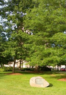
On Washington Street just east of Prospect Square, on the right when traveling east.
On Greene St. at Washington Street on Greene St..
On Historic National Road (Alternate U.S. 40), on the left when traveling west. Reported missing.
On National Highway (U.S. 40) at Maryland Route 36, on the right when traveling east on National Highway.
On Vocke Road (Maryland Route 53(658)) south of Exit 40 (Interstate 68).
On Old National Pike (Alternate U.S. 40) at Edgemont Road, on the right when traveling west on Old National Pike.
On The Old National Pike (U.S. 40-Alt), on the right when traveling east.
On Old National Pike (Alternate U.S. 40) 0.1 miles west of Ridge Road, on the left when traveling west.
Near South Court Street, on the right when traveling north.
On Old National Road (Alternate U.S. 40), on the left when traveling west.
On National Road (Alternate U.S. 40) at Finzel Road, on the right when traveling west on National Road. Reported missing.
Paid Advertisement
Near The National Pike (Alternate U.S. 40) west of Casselman Road.
On National Pike (U.S. 40) 0.8 miles east of the Pennsylvania state line, on the right when traveling west.
On National Pike (Alternate U.S. 40) west of Springs Road (Maryland Route 669), on the right when traveling west.
On National Pike (Alternate U.S. 40) east of Chestnut Ridge Road (U.S. 219), on the right when traveling east.
Near National Pike (Alternate U.S. 40) 0.3 miles Patton Lane, on the left when traveling east.
On Wisconsin Avenue (Maryland Route 355) at Montgomery Lane, on the right when traveling south on Wisconsin Avenue.
On North Frederick Road (Maryland Route 355) just south of Stringtown Road.
On South Frederick Avenue (Maryland Route 355) at South Summit Avenue on South Frederick Avenue.
On Courthouse Square near East Jefferson Street (Maryland Route 28), on the right when traveling south.
On West Main Street (State Highway 34) at South Mechanic Street, on the right on West Main Street.
On High Street (U.S. 11), on the right when traveling west.
On West King Street (U.S. 11) near Morris Street.
On Pennsylvania Route 230, 0.3 miles south of Franklin St., on the right when traveling south.
On U.S. 119, 0.1 miles south of Clair Street, on the right when traveling north.
Near N. Seventh St. at Torrence Ave..
On North 7th Street at Torrance Avenue, on the left when traveling north on North 7th Street.
Paid Advertisement
On North 7th Street at Torrance Avenue, on the left when traveling north on North 7th Street.
Near National Pike (U.S. 40) 1.2 miles east of Fayette Springs Road.
On National Pike (U.S. 40) 1.2 miles east of Fayette Springs Road.
On National Pike (U.S. 40) 1.2 miles east of Fayette Springs Road.
Near National Pike (U.S. 40) 1.2 miles east of Fayette Springs Road.
Near National Pike (U.S. 40) 1.2 miles east of Fayette Springs Road.
On Washington Parkway, 0.2 miles south of National Pike (U.S. 40), on the right when traveling south.
Near National Pike (U.S. 40) 1.2 miles east of Fayette Springs Road.
Near National Pike (U.S. 40) 1.2 miles east of Fayette Springs Road.
On Washington Parkway, 0.8 miles south of National Pike (U.S. 40), on the right when traveling south.
On National Pike (U.S. 40) at Jumonville Road (Pennsylvania Route 2021), on the right when traveling west on National Pike.
On Old Braddock Road, 0.1 miles east of Jumonville Road (County Route 2021), on the right when traveling east.
On Jumonville Road (Pennsylvania Route 2021) 1.2 miles north of National Pike (U.S. 40). Reported unreadable.
On Jumonville Road (County Route 2021) 1.2 miles north of National Pike (U.S. 40), on the right when traveling north. Reported unreadable.
On Jumonville Road (County Route 2021) 1 mile north of National Pike (U.S. 40), on the left when traveling north. Reported missing.
On Jumonville Road (Pennsylvania Route 2021) 3 miles north of National Pike (U.S. 40), on the right when traveling north.
Paid Advertisement
On National Pike (U.S. 40) west of Pike School Road, on the right when traveling west.
On Mudd School Road, 0.2 miles east of Gimlet Hill Road, on the right when traveling east.
On Lincoln Highway (U.S. 30) 0.1 miles east of Mercersburg Road, on the left when traveling east.
On Main Street west of National Pike (U.S. 40), on the right when traveling west.
On S Center Ave (Pennsylvania Route 3093) 2 miles south of Interstate 70, on the left when traveling south.
On Clay Pike at Robbins Station Road on Clay Pike.
On Reservoir Road, 0.8 miles west of Clay Pike, on the left when traveling south.
On East Daniel Morgan Avenue (State Highway 296) near North Pine Street, on the right when traveling east.
On North Fairfax Street just north of Ramsey Alley, on the right when traveling north.
On North Fairfax Street south of Cameron Street, on the left when traveling south.
On West Braddock Road at Russel Road, on the right when traveling west on West Braddock Road.
On Colvin Run Road (Virginia Route 743) east of Robindale Road, on the right when traveling west.
On Victoria Boulevard near Bridge Street, in the median.
On Old Wheatland Road (Virginia Route 698) at Milltown Road (Virginia Route 681), on the right when traveling east on Old Wheatland Road.
On Cork Street at Braddock Street (U.S. 11), on the right when traveling west on Cork Street.
On Berryville Avenue (State Highway 7) at Battle Avenue, on the right when traveling west on Berryville Avenue.
Paid Advertisement
On Williamsport Pike (U.S. 11) east of Ripple Way, on the right when traveling west.
On Charles Town Road (West Virginia Route 9) 1 mile west of Appalachian Trail, on the left when traveling west. Reported permanently removed.
On West Virginia Route 9 at Sir John Run Road, on the right when traveling west on State Route 9.