821 entries match your criteria. The first 100 are listed. ⊳
Historical Markers and War Memorials in Vermont
By William Fischer, Jr., October 7, 2017
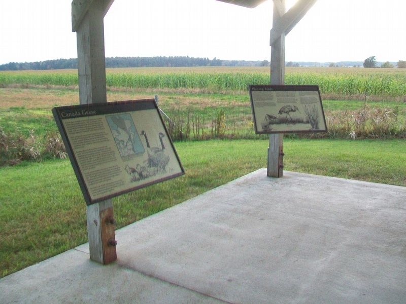
Canada Geese Marker
| 1 ► Vermont, Addison County, Addison — Canada Geese — |
| On Vermont Route 17W, 1.7 miles west of Vermont Route 22A, on the left when traveling west. | |||
| 2 ► Vermont, Addison County, Addison — Chimney Point — |
| On Vermont Route 125 at Vermont Route 17, on the right when traveling east on State Route 125. | |||
| 3 ► Vermont, Addison County, Addison — DAR John Strong Mansion — |
| On Vermont Route 17, 1.4 miles north of Vermont Route 125, on the left when traveling north. | |||
| 4 ► Vermont, Addison County, Addison — Northern Terminal of the Crown Point Military Road — |
| On Vermont Route 17, on the right when traveling north. | |||
| 5 ► Vermont, Addison County, Addison — Snow Geese — |
| On Vermont Route 17W, 1.7 miles west of Vermont Route 22A, on the left when traveling west. | |||
| 6 ► Vermont, Addison County, Addison — The Dead Creek Wildlife Management Area — |
| On Vermont Route 17W, 1.7 miles west of Vermont Route 22A, on the left when traveling west. | |||
| 7 ► Vermont, Addison County, Addison — War Memorial — Victory • Peace — |
| On Vermont Route 22A at Vermont Route 17W, on the right when traveling south on State Route 22A. | |||
| 8 ► Vermont, Addison County, Addison — Wetland Resources — |
| On Vermont Route 17W, 1.7 miles west of Vermont Route 22A, on the left when traveling west. | |||
| 9 ► Vermont, Addison County, Bridport — Hathorne School — Bridport District Schoolhouse #1 — |
| On Vermont Route 125 at Basin Harbor Road, on the left when traveling west on State Route 125. | |||
| 10 ► Vermont, Addison County, Bridport — War Memorial — |
| On Middle Road west of Vermont Route 22A, on the left when traveling west. | |||
| 11 ► Vermont, Addison County, Bristol — In Memory of Pvt. Norman E. Wasley — Bristol Falls — |
| On Lincoln Road south of Vermont Route 116, on the right when traveling south. | |||
| 12 ► Vermont, Addison County, Cornwall, Bread Loaf — Cornwall Remembers — 1861-1865 — |
| On Vermont Route 30 at Fisher Street, on the right when traveling south on State Route 30. | |||
| 13 ► Vermont, Addison County, Cornwall, Bread Loaf — William Slade / The Gag Rule — 1786–1857 / 1836–1844 — |
| 14 ► Vermont, Addison County, Ferrisburgh — "Rokeby" — Home of Rowland E. Robinson Writer of Vermont Folklore — |
| On U.S. 7, on the right when traveling north. | |||
| 15 ► Vermont, Addison County, Ferrisburgh — The Great Convention — |
| On U.S. 7 at Middlebrook Road on U.S. 7. | |||
| 16 ► Vermont, Addison County, Granville — The Corner School — Granville School District #10 — |
| On Post Office Hill north of Vermont Route 100, on the left when traveling north. | |||
| 17 ► Vermont, Addison County, Middlebury, Bread Loaf — Ancient Paths — |
| Near Main Street (State Highway 30) 0.1 miles south of Seymour Street, on the right when traveling south. | |||
| 18 ► Vermont, Addison County, Middlebury, Bread Loaf — Birthplace of Ray Fisher — |
| On Court Street (U.S. 7) at Creek Road, on the right when traveling south on Court Street. | |||
| 19 ► Vermont, Addison County, Middlebury, Bread Loaf — Charter House — |
| On North Pleasant Street (U.S. 7) at Main Street, on the right when traveling north on North Pleasant Street. | |||
| 20 ► Vermont, Addison County, Middlebury, Bread Loaf — Court Square — |
| 21 ► Vermont, Addison County, Middlebury, Bread Loaf — Emma Willard — Pioneer educator gave women first college training here — |
| On South Main Street (Vermont Route 30) 0.1 miles north of Porter Field Road, on the right when traveling north. | |||
| 22 ► Vermont, Addison County, Middlebury, Bread Loaf — Emma Willard Memorial — |
| On North Pleasant Street (U.S. 7) at Main Street, on the left when traveling north on North Pleasant Street. | |||
| 23 ► Vermont, Addison County, Middlebury, Bread Loaf — John Deere — Inventor of "The Plow that Broke the Plains" — |
| On Main Street, 0.1 miles south of Mill Street, on the right when traveling south. | |||
| 24 ► Vermont, Addison County, Middlebury, Bread Loaf — Marble Works Memorial Bridge — |
| Near Mill Street just west of Park Street, on the right when traveling west. | |||
| 25 ► Vermont, Addison County, Middlebury, Bread Loaf — Middlebury Civil War Memorial — |
| On Merchants Row at South Pleasant Street, in the median on Merchants Row. | |||
| 26 ► Vermont, Addison County, Middlebury, Bread Loaf — Middlebury War Memorial — |
| Near Court Street (U.S. 7) at Court Square, on the left when traveling west. | |||
| 27 ► Vermont, Addison County, Middlebury, Bread Loaf — Samuel Miller, Esq. — September 30,1798 — |
| On North Pleasant Street (U.S. 7) at Main Street, on the right when traveling north on North Pleasant Street. | |||
| 28 ► Vermont, Addison County, Middlebury, Bread Loaf — The Addison County Courthouse — |
| On Court Street (U.S. 7) near Washington Street, in the median. | |||
| 29 ► Vermont, Addison County, Middlebury, Bread Loaf — The Battell Block — |
| On Main Street at Merchants Row, on the left when traveling south on Main Street. | |||
| 30 ► Vermont, Addison County, Middlebury, Bread Loaf — Town & Gown — |
| On Cross Street at Main Street (Vermont Route 30), on the right when traveling west on Cross Street. | |||
| 31 ► Vermont, Addison County, Orwell — American Blockhouse – 1777 — Mount Independence State Historic Site — |
| Near Mount Independence Road, on the right when traveling south. | |||
| 32 ► Vermont, Addison County, Orwell — British Blockhouse - 1777 — Mount Independence State Historic Site — |
| Near Mount Independence Road, on the right when traveling south. | |||
| 33 ► Vermont, Addison County, Orwell — Burial Site — Mount Independence State Historic Site — |
| Near Mount Independence Road, on the right when traveling south. | |||
| 34 ► Vermont, Addison County, Orwell — Fort Ticonderoga and Mount Defiance — Mount Independence State Historic Site — |
| Near Mount Independence Road, on the right when traveling south. | |||
| 35 ► Vermont, Addison County, Orwell — Foundation -1776 or 1777 — Mount Independence State Historic Site — What do you think? - — |
| Near Mount Independence Road, on the right when traveling south. | |||
| 36 ► Vermont, Addison County, Orwell — General Hospital – 1777 — Mount Independence State Historic Site — |
| Near Mount Independence Road, on the right when traveling south. | |||
| 37 ► Vermont, Addison County, Orwell — German Hut – 1777 — Mount Independence State Historic Site — |
| Near Mount Independence Road, on the right when traveling south. | |||
| 38 ► Vermont, Addison County, Orwell — Heritage Travelers over the Years — |
| Near Mount Independence Road, on the right when traveling south. | |||
| 39 ► Vermont, Addison County, Orwell — Lake Champlain and the American Revolution — Mount Independence State Historic Site — |
| Near Mount Independence Road, on the right when traveling south. | |||
| 40 ► Vermont, Addison County, Orwell — Military Road — |
| On Mt. Independence Road, on the right when traveling west. | |||
| 41 ► Vermont, Addison County, Orwell — Mount Independence — Bastion of the Revolution — |
| Near Mount Independence Road, on the right when traveling north. | |||
| 42 ► Vermont, Addison County, Orwell — Mt. Independence Military Road — Route to Hubbardton, 1777 |
| On Vermont Route 22A at Main St (County Route 73), on the right when traveling south on State Route 22A. Reported permanently removed. | |||
| 43 ► Vermont, Addison County, Orwell — Mt. Independence Military Road — Route to Hubbardton - 1777 — |
| On Vermont Route 22A at Vermont Route 73, on the right when traveling south on State Route 22A. | |||
| 44 ► Vermont, Addison County, Orwell — Officers Quarters – 1776 — Mount Independence State Historic Site — |
| Near Mount Independence Road, on the right when traveling south. | |||
| 45 ► Vermont, Addison County, Orwell — Southern Battery – 1777 — Mount Independence State Historic Site — |
| Near Mount Independence Road, on the right when traveling south. | |||
| 46 ► Vermont, Addison County, Orwell — Southern Defense Trail — |
| On Mount Independence Road, on the left when traveling south. | |||
| 47 ► Vermont, Addison County, Orwell — Storehouse - 1776 — Mount Independence State Historic Site — |
| Near Mount Independence Road, on the right when traveling south. | |||
| 48 ► Vermont, Addison County, Orwell — The American Southern Defenses – 1776-1777 — |
| Near Mount Independence Road, on the right when traveling south. | |||
| 49 ► Vermont, Addison County, Orwell — Third Brigade Encampment – 1776 — Mount Independence State Historic Site — |
| Near Mount Independence Road, on the right when traveling south. | |||
| 50 ► Vermont, Addison County, Orwell — To Repel the Enemy — |
| Near Mount Independence Road, on the right when traveling south. | |||
| 51 ► Vermont, Addison County, Orwell — War Memorial — |
| On Vermont Route 73, on the left when traveling east. | |||
| 52 ► Vermont, Addison County, Orwell — World War Memorial — |
| On Main Street (Vermont Route 73), on the left when traveling east. | |||
| 53 ► Vermont, Addison County, Panton — Benedict Arnold — |
| On Arnold Bay Road, 0.2 miles north of Pease Road, on the right when traveling south. | |||
| 54 ► Vermont, Addison County, Ripton — Robert Frost — 1874 - 1963 — |
| On Vermont Route 125 just west of Frost Road, on the left when traveling east. | |||
| 55 ► Vermont, Addison County, Shoreham — Ethan Allen with Eighty-Three Green Mountain Boys — |
| On Route 74 at Smith Street, on the right when traveling south on Route 74. | |||
| 56 ► Vermont, Addison County, Shoreham — Larrabee’s Point — |
| On Vermont Route 74, on the right when traveling west. | |||
| 57 ► Vermont, Addison County, Shoreham — Levi P. Morton — Statesman and Banker lived early years in Vermont — |
| On School Road, 0.1 miles south of Main Street. | |||
| 58 ► Vermont, Addison County, Shoreham — Shoreham Covered Railroad Bridge — |
| Near Shoreham Depot Road. | |||
| 59 ► Vermont, Addison County, Vergennes — Commerce at the Crossroads — |
| On Main Street (Vermont Route 22A), on the left when traveling north. | |||
| 60 ► Vermont, Addison County, Vergennes — Commodore Thomas Macdonough — Born December 1783 — Died November 1825 — |
| On Main Street (Vermont Route 22A) at Park Street, on the right when traveling west on Main Street. | |||
| 61 ► Vermont, Addison County, Vergennes — Early Life Along Otter Creek in Vergennes — |
| Near Main Street (Vermont Route 22A), on the right when traveling north. | |||
| 62 ► Vermont, Addison County, Vergennes — Macdonough Shipyard — |
| Near Macdonough Drive, 0.3 miles west of Main Street (Vermont Route 22A). | |||
| 63 ► Vermont, Addison County, Vergennes — Site of Naval Shipyard — |
| On Trails End Road, on the right when traveling east. | |||
| 64 ► Vermont, Addison County, Vergennes — Stephen Bates Vermont’s Earliest Known Black Sheriff and Chief of Police — |
| On West Main Street (Vermont Route 22A) at Park Street, on the left when traveling north on West Main Street. | |||
| 65 ► Vermont, Addison County, Vergennes — The Bixby Memorial Free Library — |
| On Main Street (Vermont Route 22A) at Macdonough Drive, on the right when traveling west on Main Street. | |||
| 66 ► Vermont, Addison County, Vergennes — The Vergennes Pump House — "People of Vergennes at the mercy of the flames" — -H.C. Johnson, Editor, Vergennes Vermonter, October 18, 1867 — |
| Near Main Street (Vermont Route 22A), on the left when traveling north. | |||
| 67 ► Vermont, Addison County, Vergennes — Vergennes 150th Anniversary — 1788 • 1938 — Qui Patres Transtulit Nos Sustineat — |
| On Main Street (Vermont Route 22A) at Green Street, on the left when traveling north on Main Street. | |||
| 68 ► Vermont, Addison County, Vergennes — Veterans Memorial — |
| On Main Street (Vermont Route 22A) at Park Street, on the right when traveling west on Main Street. | |||
| 69 ► Vermont, Addison County, Vergennes — World War Memorial — 1917 • 1918 — Vergennes Vermont — |
| On Main Street (Vermont Route 22A) at Macdonough Drive, on the right when traveling west on Main Street. | |||
| 70 ► Vermont, Addison County, Weybridge, Bread Loaf — Silas Wright — 1795-1847 — |
| On Weybridge Road (Vermont Route 23) at James Road, on the right when traveling south on Weybridge Road. | |||
| 71 ► Vermont, Addison County, Weybridge, Bread Loaf — The U.S. Government Morgan Horse Farm — |
| Near Battell Drive. | |||
| 72 ► Vermont, Addison County, Whiting — Major Samuel Beach — 1752-1829 — The Paul Revere of Vermont — |
| On North Main Street (Vermont Route 30) north of Shoreham Whiting Road, on the right when traveling south. | |||
| 73 ► Vermont, Bennington County, Arlington — Norman Rockwell — 1894-1978 — |
| On River Road at Covered Bridge Road, on the right when traveling east on River Road. | |||
| 74 ► Vermont, Bennington County, Arlington — State Seal Pine Tree — |
| On Vermont Route 313, 0.8 miles west of Ethan Allen Highway (Alternate Vermont Route 7A), on the right when traveling west. | |||
| 75 ► Vermont, Bennington County, Arlington — Chittenden Home — |
| On Main Street (Alternate Vermont Route 7) at East Arlington Road, on the right when traveling north on Main Street. | |||
| 76 ► Vermont, Bennington County, Arlington — Dorothy Canfield Fisher — (1879-1958) — |
| On Main Street (Alternate Vermont Route 7) 0.1 miles south of Vermont Route 313, on the right when traveling north. | |||
| 77 ► Vermont, Bennington County, Bennington — Dimick Tavern — 1777 1927 — |
| On West Road (Vermont Route 9) west of Dermody Road, on the left when traveling west. | |||
| 78 ► Vermont, Bennington County, Bennington — Old Post Office — 1913 — |
| On South Street (U.S. 7) at Union Street, on the right when traveling north on South Street. | |||
| 79 ► Vermont, Bennington County, Bennington — Shaffe’s — c. 1850/1963 — |
| On Main Street (Vermont Route 9) at School Street, on the right when traveling east on Main Street. | |||
| 80 ► Vermont, Bennington County, Bennington — Town Offices — c.1844 — |
| On South Street (U.S. 7) at Union Street, on the right when traveling south on South Street. | |||
| 81 ► Vermont, Bennington County, Bennington — Vermont is a State I Love — |
| On Depot Street near River Street, on the left when traveling north. | |||
| 82 ► Vermont, Bennington County, Bennington — Vermont Veterans' Home — |
| Near North Street (U.S. 7) at Depot Street, on the right when traveling west. | |||
| 83 ► Vermont, Bennington County, Bennington, North Bennington — Park-McCullough House — |
| On Park Street at West Street on Park Street. | |||
| 84 ► Vermont, Bennington County, Bennington, Old Bennington — Battle of Bennington — |
| On Monument Circle, in the median. | |||
| 85 ► Vermont, Bennington County, Bennington, Old Bennington — Bennington Civil War Monument — |
| On Main Street (Vermont Route 9), on the left when traveling west. | |||
| 86 ► Vermont, Bennington County, Bennington, Old Bennington — Ethan Allen — |
| On W. Main St. (Vermont Route 9), on the right when traveling east. | |||
| 87 ► Vermont, Bennington County, Bennington, Old Bennington — John Stark — |
| 88 ► Vermont, Bennington County, Bennington, Old Bennington — The "Corkscrew" Railroad — |
| On West Main Street (Vermont Route 9), on the right when traveling east. | |||
| 89 ► Vermont, Bennington County, Bennington, Old Bennington — Vermont — Molly Stark Trail and Historic Old Bennington — |
| Near Main Street (Vermont Route 9) 0.1 miles west of Convent Avenue. | |||
| 90 ► Vermont, Bennington County, Bennington, Old Bennington — Vermont's Colonial Shrine — Vermont Legislature Joint Resolution December 11, 1935 — |
| Near Monument Ave., on the left when traveling south. | |||
| 91 ► Vermont, Bennington County, Bennington, Old Bennington — View of the Hill Top — |
| On Monument Avenue at Monument Circle, in the median on Monument Avenue. | |||
| 92 ► Vermont, Bennington County, Bennington, Old Bennington — William Lloyd Garrison — |
| On Monument Avenue south of West Road (Vermont Route 9), in the median. | |||
| 93 ► Vermont, Bennington County, Dorset — Cephas Kent’s Dwelling — Cephas Kent Inn — |
| On Dorset West Road at Nichols Hill Road, on the right when traveling south on Dorset West Road. | |||
| 94 ► Vermont, Bennington County, Dorset — Dorset — Here New Hampshire Grants First Voted Independence — |
| On Vermont Route 30 at Church Street, on the right when traveling north on State Route 30. | |||
| 95 ► Vermont, Bennington County, Dorset — Fenton Pottery Site — 1801-1810 — |
| On Dorset Hollow Road at Kirby Hollow Road, on the right when traveling south on Dorset Hollow Road. | |||
| 96 ► Vermont, Bennington County, Dorset — First Marble Quarry — Oldest Quarry in U.S., 1785 — |
| On Vermont Route 30 at Kelly Road, on the right when traveling north on State Route 30. | |||
| 97 ► Vermont, Bennington County, Dorset — The Dorset Field Club — Oldest Continually Operated Golf Course in the United States — |
| On Vermont Route 30, on the right when traveling south. | |||
| 98 ► Vermont, Bennington County, Dorset, East Dorset — Birthplace of William Griffith Wilson — 1895-1971 — Co-founder of Alcoholics Anonymous — |
| On Mad Tom Road at Village Street, on the right when traveling north on Mad Tom Road. | |||
| 99 ► Vermont, Bennington County, East Rupert — Harmon's Mint — East Rupert — |
| On Vermont Route 30, on the right when traveling north. | |||
| 100 ► Vermont, Bennington County, Manchester, Manchester Center — Lincoln’s "Hildene" — Summer Home of Son of Civil War President — |
| On Hildene Road, on the right when traveling north. | |||
821 entries matched your criteria. The first 100 are listed above. Next 100 ⊳