3965 entries match your criteria. The first 100 are listed. ⊳
Animals Topic
By Public Domain (PD-US)
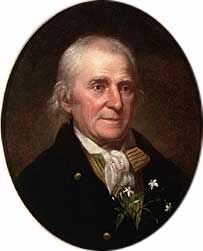
William Bartram (April 20, 1739 – July 22, 1823)
| 1 ► Alabama, Clarke County, Rockville — Bartram's Trail — |
| 2 ► Alabama, Coffee County, Enterprise — Boll Weevil Monument — December 11, 1919 — |
| 3 ► Alabama, Colbert County, Cherokee — Welcome! — Natchez Trace Parkway — |
| 4 ► Alabama, Colbert County, Cherokee — Wet, Wild, and Wonderful — |
| 5 ► Alabama, Colbert County, Muscle Shoals — Birds of North Alabama — |
| 6 ► Alabama, Colbert County, Muscle Shoals — Explore the River — |
| 7 ► Alabama, Colbert County, Muscle Shoals — Gulls Glorious Gulls — |
| 8 ► Alabama, Colbert County, Muscle Shoals — Home Sweet Home — Heron Rookery — |
| 9 ► Alabama, Colbert County, Muscle Shoals — Muscle Shoals National Recreational Trail — |
| 10 ► Alabama, Colbert County, Sheffield — Forest Elders — |
| 11 ► Alabama, Cullman County, Cullman — Alabama's Aquatic Biodiversity — |
| 12 ► Alabama, Cullman County, Cullman — Birds of Alabama — |
| 13 ► Alabama, Dallas County, Cahaba — Cahawba’s Current Residents — |
| 14 ► Alabama, Dallas County, Cahaba — Missing Pieces — Reported permanently removed |
| 15 ► Alabama, Houston County, Dothan — Marvin Holman — |
| 16 ► Alabama, Jackson County, Stevenson — Wet, Wild, and Wonderful — |
| 17 ► Alabama, Jefferson County, Birmingham — Lane Park — |
| 18 ► Alabama, Lauderdale County, Florence — Florence, Alabama — |
| 19 ► Alabama, Lauderdale County, Florence — Forks of Cypress — |
| 20 ► Alabama, Lauderdale County, Florence — James Jackson — City of Florence Walk of Honor — |
| 21 ► Alabama, Lauderdale County, Rogersville — Return of a Native — |
| 22 ► Alabama, Lauderdale County, Waterloo — A Gathering of Eagles — |
| 23 ► Alabama, Lauderdale County, Waterloo — Mud Glorious Mud — |
| 24 ► Alabama, Lawrence County, Moulton — A Significant Forest — |
| 25 ► Alabama, Lawrence County, Moulton — Birds of North Alabama — |
| 26 ► Alabama, Lawrence County, Moulton — Explore the Forest — |
| 27 ► Alabama, Lee County, Opelika — Municipal "Monkey" Park — |
| 28 ► Alabama, Limestone County, Capshaw — Nicholas Davis — |
| 29 ► Alabama, Madison County, Huntsville — Ala. Red-Bellied Turtle — Sweet Homegrown Alabama — Alabama State Reptile — |
| 30 ► Alabama, Madison County, Huntsville — Ms. Baker: Monkeynaut — |
| 31 ► Alabama, Mobile County, Dauphin Island — John F. Porter, Jr. Goat Tree Reserve / The Goat Tree — |
| 32 ► Alabama, Mobile County, Mobile — An Unheralded Breed of Soldier — |
| 33 ► Alabama, Montgomery County, Montgomery, Forest Park — Remount Depot / Keyton Station — |
| 34 ► Alabama, Sumter County, Gainesville — Woodbury — |
| 35 ► Alabama, Talladega County, Sylacauga — Hightower Brothers Livery Stable — |
| 36 ► Alaska, Anchorage — A Prickly World — Alaska Wildlife Conservation Center — |
| 37 ► Alaska, Anchorage — Brown Bears of AWCC — Alaska Wildlife Conservation Center — |
| 38 ► Alaska, Anchorage — Moose Calves — Alaska Wildlife Conservation Center — |
| 39 ► Alaska, Anchorage — Our Living National Symbol — Alaska Wildlife Conservation Center — |
| 40 ► Alaska, Denali Borough, Denali National Park — Ice Age Hunters — The Deadliest Predators — |
| 41 ► Alaska, Juneau Borough, Juneau, Downtown Juneau — Guard Islands — |
| 42 ► Alaska, Juneau Borough, Juneau, Downtown Juneau — Patsy Ann: her history — |
| 43 ► Alaska, Juneau Borough, Juneau, Downtown Juneau — Patsy Ann: her statue — |
| 44 ► Alaska, Matanuska-Susitna Borough, Wasilla — Balto — Iditarod Trail Sled Dog Race — |
| 45 ► Alaska, North Slope Borough, Barrow — Paġlagivsi! — Welcome to the Ancient Village of Ukpiaġvik — “The Place Where We Hunt Snowy Owls” — |
| 46 ► Alaska, Skagway — Three Thousand Pack Animals — |
| 47 ► Alaska, Valdez-Cordova Census Area, Copper Center — Ciisi nekeghalts´et — ´fishwheel´ — |
| 48 ► Arizona, Cochise County, Hereford — Lehner Mammoth Kill Site — |
| 49 ► Arizona, Cochise County, Sierra Vista — Carmichael House/Sierra Vista Realty — 301 North Garden Avenue — Built in 1927 — |
| 50 ► Arizona, Cochise County, Tombstone — 37 — Million Dollar Stope — |
| 51 ► Arizona, Coconino County, Flagstaff — Beale Road — Historic Site — |
| 52 ► Arizona, Coconino County, Flagstaff — Beale Wagon Road — 1857 - 1882 — |
| 53 ► Arizona, Coconino County, Flagstaff — Biology — |
| 54 ► Arizona, Coconino County, Flagstaff — Raymond Building — 1911 — |
| 55 ► Arizona, Coconino County, Flagstaff — The Historic Basque Handball Court — |
| 56 ► Arizona, Coconino County, Flagstaff — Verkamp Building — 1899 — |
| 57 ► Arizona, Coconino County, Grand Canyon National Park — Mules and the Canyon — |
| 58 ► Arizona, Coconino County, Jacob Lake — Kaibab Squirrel Area — |
| 59 ► Arizona, Coconino County, Jacob Lake — Theodore Roosevelt — |
| 60 ► Arizona, Coconino County, Sedona — Van Deren Ranch — |
| 61 ► Arizona, Coconino County, Williams — William Sherley Williams — Sculpture by B.R. Pettit — |
| 62 ► Arizona, La Paz County, Bouse — Bouse Homesite — |
| 63 ► Arizona, La Paz County, Bouse — 120 — In Memory of Eight Ball - Morale Officer — Equus asinus — Camp Bouse — |
| 64 ► Arizona, La Paz County, Quartzsite — Hi Jolly — |
| 65 ► Arizona, La Paz County, Quartzsite — The Last Camp of Hi Jolly — Camel Driver, Packer, Scout — |
| 66 ► Arizona, La Paz County, Salome — Salome — "Where She Danced" — |
| 67 ► Arizona, Maricopa County, Carefree — The Old Verde River Sheep Bridge — |
| 68 ► Arizona, Maricopa County, Chandler, Downtown — Dr. A. J. Chandler — 1859 – 1950 — |
| 69 ► Arizona, Maricopa County, Glendale — Corrals and Tack House — at Sahuaro Ranch… — |
| 70 ► Arizona, Maricopa County, Glendale — Dairy Barn — at Sahuaro Ranch… — |
| 71 ► Arizona, Maricopa County, Glendale — Stable / Granary — at Sahuaro Ranch… — |
| 72 ► Arizona, Maricopa County, Glendale — The Barnyard — at Sahuaro Ranch… — |
| 73 ► Arizona, Maricopa County, Phoenix, Camelback East Village — Hunt Bass Hatchery — |
| 74 ► Arizona, Maricopa County, Phoenix, Central City — Arizona's First Zoo — |
| 75 ► Arizona, Maricopa County, Wickenburg — Everett Bowman — All-Around Champion Cowboy of the World — Years 1935 & 1937 — |
| 76 ► Arizona, Mohave County, Kingman — Lt. Edward Fitzgerald Beale — 1822 - 1893 — |
| 77 ► Arizona, Mohave County, Oatman — Gold Mining Ghost Town, Oatman, Arizona — Route 66 Roadside Attraction — |
| 78 ► Arizona, Mohave County, Oatman — Oatman — Arizona Territory — "The Ghost Town that refuses to die!" — |
| 79 ► Arizona, Mohave County, Oatman — 80 — Oatman Arizona and its Burros — |
| 80 ► Arizona, Mohave County, Oatman — Oatman, Arizona — Elevation 2700 Feet — |
| 81 ► Arizona, Mohave County, Oatman — Oatman, Arizona — Elevation 2700 Feet — |
| 82 ► Arizona, Navajo County, Shonto — Roundleaf Buffaloberry — Shepherdia rotundifolia — |
| 83 ► Arizona, Pima County, Tucson, Red Hills — Desert Life — Saguaro National Park — |
| 84 ► Arizona, Pima County, Tucson, Rillito Park — AQHHMP #8 — Rillito Race Track — American Quarter Horse Historical Marker — |
| 85 ► Arizona, Pinal County, Red Rock — 2 — Red Rock Post Office — |
| 86 ► Arizona, Santa Cruz County, Sonoita — AQHHMP #27 — Sonoita Quarter Horse Show and Races — American Quarter Horse Historical Marker — |
| 87 ► Arizona, Yavapai County, Lake Montezuma — Historic Bell Trail — |
| 88 ► Arizona, Yavapai County, Montezuma Castle National Monument — Macaw Pen Stone? — |
| 89 ► Arizona, Yavapai County, Prescott — Our Creeks are Alive! — |
| 90 ► Arizona, Yavapai County, Prescott — Ruffner Plaza Stables — |
| 91 ► Arizona, Yavapai County, Prescott — Solon Hannibal Borglum America's First Cowboy Sculptor — 1866 - 1922 — |
| 92 ► Arizona, Yavapai County, Sedona — Little Horse Park/Chapel of the Holy Cross — Historic Sedona — |
| 93 ► Arizona, Yavapai County, Seligman — Beale Wagon Road — Seligman, Arizona — |
| 94 ► Arizona, Yuma County, Yuma — Yuma East Wetlands Today — A Return to Balance — |
| 95 ► Arkansas, Carroll County, Eureka Springs — The Railroad Depot — |
| 96 ► Arkansas, Desha County, Kelso — 64 — Skirmish at Amos Bayou — |
| 97 ► Arkansas, Garland County, Hot Springs — Happy Hollow Spring — |
| 98 ► Arkansas, Garland County, Hot Springs — Horse Racing in Hot Springs — Hot Springs Central Avenue Historic District — |
| 99 ► Arkansas, Independence County, Batesville — Sara Low Memorial Dog Park — |
| 100 ► Arkansas, Lawrence County, Walnut Ridge — The Legacy of John A. Rhea — |
3965 entries matched your criteria. The first 100 are listed above. Next 100 ⊳