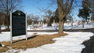
Founded in 1858 by Byron Reed, early Omaha real estate developer and financier, Prospect Hill is the final resting place for over 15,000 citizens. While burial permit #1 was issued for Territorial Legislator Alonzo Salisbury on October 4, 1858, . . . — — Map (db m53108) HM
Born in Virginia in 1824, James Megeath was the eldest of 10 children. By age 20, he had become a cattle and sheep trader. Struck by gold fever, he went to Calaveras County, California, in 1851, operating a general merchantise store for three . . . — — Map (db m58234) HM
Born in 1829 in Onondaga County, New York, Mr. Woolworth graduated with high honors from Hamilton College in 1849, and took up the study of law. After two years practicing in Syracuse, New York, he determined to go west and locate in the new . . . — — Map (db m58345) HM
Johan Ahmanson was born on April 7, 1827, in Smaland, Sweden. At age six he was taken to live with a farmer, for whom he worked until age eighteen. He became a master bookbinder and emigrated to Denmark in 1849. There he was recruited by the . . . — — Map (db m58207) HM
John Wesley Nichols was born January 28, 1839, in Crawford County, Pennsylvania, to Samuel and Katharine Maxwell Nichols. Little is known of his early years. In 1860 he married Sarah Elizabeth Dearborn, also born in Crawford County.
Nichols . . . — — Map (db m58277) HM
Born in Germany, Joseph Francis Bauman came to Omaha in the early 1860s. Like many others, he may have been escaping the wars that plagued Central Europe at that time. In 1863, with his partner John Green, he purchased a brewery from a Mr. McCombe . . . — — Map (db m58338) HM
William Brown is credited as Omaha's founder (although not its first settler). He operated a Missouri River ferry from Council Bluffs and was a principal in the company that first developed the Omaha townsite.
Mr. Brown came west as a young man . . . — — Map (db m58275) HM
The first settler in Exeter Township, Fillmore County was Warren Woodard, who built the first house in 1870. The Burlington and Missouri River Railroad, building westward, determined Exeter's location in 1871. The town was laid out by the railroad . . . — — Map (db m78010) HM
The first homesteads were filed in 1866 by William O. Bussard and William C. Whitaker along the West Fork of the Blue River. Mrs. E. A. Whitaker, the first white woman, came in 1867. The first white children, Emma Whitaker Hall and Arthur Dixon . . . — — Map (db m206666) HM
Many settlers in the area were Catholics of Czech and Irish descent. Services were held in homes before this small chapel was built on the farm of Joseph Kotas in 1874. It served as the first Catholic Church for pioneers in Fillmore and Saline . . . — — Map (db m206999) HM
Many immigrants in Glengary Township and the surrounding area were Catholics of Czech and Irish descent. During the early years few priests were available, so they visited the community whenever possible beginning in 1874. Local parishioners . . . — — Map (db m206996) HM
The Franklin Academy occupied this site from 1881 until 1922. It was one of six Congregational Church-affiliated academies in Nebraska. Others were located at Crete, York, Neligh, Weeping Water, and Chadron.
Over 2,500 students in college . . . — — Map (db m58998) HM
Present Franklin County was formerly a part of the buffalo hunting range of the Pawnee Indians, whose villages were at one time located further down the valley of the Republican River. Cheyenne and Sioux hunting parties also frequented the area . . . — — Map (db m59005) HM
When Frontier County was organized in 1872, Stockville became the county seat. During its first decade no real town existed, it being only a trading center for the ranchers of the region. It was not until the middle-eighties, when the county filled . . . — — Map (db m223453) HM
Faced with the great influx of white settlers after the Civil War, hostile Sioux and Cheyenne Indians retreated into the Republican River Valley. Here they found a nearly ideal location since the valley remained one of the great buffalo ranges of . . . — — Map (db m176855) HM
After 1854 the Oto and Missouri Indian village and agency were located near here. For many years the two tribes had been living along the lower portion of the Platte River, but when Nebraska became a territory they relinquished all claims to . . . — — Map (db m78011) HM
Across this footbridge you can walk through 100 acres of restored tallgrass prairie. As each year passes, this piece of ground will look more and more like what Daniel Freeman saw when he laid claim to a 160-acre homestead here in 1863.
As you . . . — — Map (db m47586) HM
These rambling acres of grass and greenery might not look like a carefully planned landscape. Yet they are part of an ongoing restoration effort begun in 1939 to undo the effects of 76 years of farming, restoring agricultural fields to a diverse . . . — — Map (db m47519) HM
The fenceless plains were vast and open when early homesteaders first came here. But the very nature of homesteading - the possibility of an individual owning 160 acres - meant that somebody had to legally divide and define limits for the land. . . . — — Map (db m47577) HM
George W. Palmer built this log cabin in 1867 in Logan Township, Nebraska, some 14 miles from Beatrice. He used oak, ash, and other hardwoods cut from the banks of Bear Creek for his cabin walls. He made the brick in the gable ends by hand. . . . — — Map (db m47527) HM
Daniel Freeman
Born Preble Co. Ohio Apr. 25, 1826
Filed on First Homestead in U.S.A.
Jan. 1, 1863 and lived on it until
his death Dec. 30, 1908
Soldier, Doctor, Sheriff & Farmer
A True Pioneer. . . . — — Map (db m47585) HM
The most important part of a living prairie is something you can't see without taking a shovel in hand. The dense, interlocking roots of prairie grasses make an underground structure unlike anything seen in the woodlands of the East. The insects, . . . — — Map (db m47596) HM
There’s a good chance you do – Homesteading reached three of every five states. Is yours among them?
The Homestead Act of 1862 offered people 160 acres of free land – if they were willing to live on it, farm it, and build a home. . . . — — Map (db m47512) HM
Dedicated to the Citizens of Beatrice
for all their efforts put forth in the
Beatrice Centennial Celebrations of 2007
Beatrice, Nebraska Territory
Founded on this site July 4, 1857
Time Capsule to be opened on July 4, 2057
200 . . . — — Map (db m47616) HM
Abraham Lincoln was called the Great Emancipator because his proclamation of 1862 gave freedom to the slaves. In that same year, he signed another extremely important document that gave land to free men. No single act had more effect on the Middle . . . — — Map (db m228353) HM
The Homestead Act of 1862 was one of the most significant and enduring events in the westward expansion of the United States. By granting 160 acres of free land to claimants, it allowed nearly any man or woman the chance to live the American dream. . . . — — Map (db m47619) HM
Look around you. The impact of the Homestead Act is clearly visible. Grain elevators, fertilizer plants, housing developments, state highways, modern farms – these and other features are tangible evidence of the Homestead Act’s success in . . . — — Map (db m47518) HM
Barbed wire proved invaluable for marking boundaries on the open prairie. Soon after its invention in 1874 there were over 570 different patents and thousands of variations. You can examine dozens of them on the fence nearby.
Why so many? Early . . . — — Map (db m47523) HM
Railroads played a key role in the development of the Heritage Highway corridor. Trains brought settlers and goods west to the new towns and took farm products back to market. As times have changed and transportation has evolved, many railroad . . . — — Map (db m47620) HM
Many Heritage Highway communities began as river settlements. Beatrice was founded in 1857 near the bend of the Big Blue River. The first building, known as Pap Towle's cabin, was constructed just north of the present Gage County Historical Society . . . — — Map (db m47627) HM
You are standing on an old road trace, lined with cottonwood trees, where freight was hauled by wagon. The ability to get goods to market is yet another reason Daniel Freeman homesteaded here, four miles from the town of Beatrice.
Freight roads . . . — — Map (db m47584) HM
Here, in the middle of this restored prairie, you can imagine what homesteaders experienced when they first came to their land - listen to the birds and insects, smell cottonwood in the air, feel the richness of the soil, see the variety nature has . . . — — Map (db m47580) HM
Byway 136 was designated the Heritage Highway in part because of the many historic trails that are now part of it. You are standing on the historic De Roin Trail. The De Roin Trail began at the Missouri River port town of Brownville on the eastern . . . — — Map (db m47623) HM
The Homestead Act of 1862 affected millions of lives in the United States and across the world. Homestead National Monument of America exists to document and present these powerful stories of transformation.
The Homestead Heritage Center keeps . . . — — Map (db m47513) HM
What was it like to be a homesteaders? To get an idea, take a walk. The flags around the parking lot enclose an acre.
It may not seem huge. But plowing an acre meant walking about 10 miles. Over uneven soil. Driving a team of oxen. In sun or . . . — — Map (db m47514) HM
Ash Hollow was famous on the Oregon Trail. A branch of the trail ran northwestward from the Lower California Crossing of the South Platte River a few miles west of Brule, and descended here into the North Platte Valley. The hollow, named for a . . . — — Map (db m2503) HM
Here, covered-wagon travelers faced the most difficult terrain since their departure from Missouri. One man said: “I cannot say at what angle we descend, but it is so great that some go so far as to say ‘the road hangs a little past the . . . — — Map (db m87335) HM
Travelers reached this point over the trail you see stretching out across the prairie to the southeast. They left the last real settlement at Westport Landing or at Independence, some 600 miles from here. Most of them took about 40 days to . . . — — Map (db m87332) HM
In 1854, the Federal Government hired contractors to carry the mail over the old trail to Salt Lake City and onto California. They built a mail station at Ash Hollow. Most of these mail stations became trading posts, carrying a small . . . — — Map (db m87326) HM
This ravine started as a set of wagon ruts cut through the grass and soil by heavy iron-shod wheels. It is but one example of the long interaction between man and the environment in this region. This walk to the top of the hill has . . . — — Map (db m87337) HM
The stones surrounding this marker are the remains of the homestead dwelling of Reverend Dennis B. Clary, a pioneer Methodist Minister, who received final patent for his homestead Mar 22, 1899. Mr. Clary was born September 1st 1822, in Maryland . . . — — Map (db m2501) HM
Fleeing heated religious and political hostility and persecution, many members of The Church of Jesus Christ of Latter-day Saints (widely known as Mormons) abruptly fled their homes in Nauvoo, Illinois in February 1846. Unprepared for the cold of . . . — — Map (db m3705) HM
It has been estimated that at least 20,000 persons died on the overland trail, between 1842 and 1859. This averages ten graves per mile over the 2,000 mile trail. Of the hundreds who died while crossing Nebraska, only seven identifiable graves . . . — — Map (db m231177) HM
Dedicated to the Charles H. Jones, Truman Freeland, and Thomas McClimans families, first settlers in Garfield County; and the many other pioneers who followed. — — Map (db m181897) HM
In 1872, settlement pioneered by Charles H. Jones in what is now Garfield County, followed the North Loup River northwestward to its junction with the Calamus River. In 1875, the post office serving the area near the confluence of the rivers was . . . — — Map (db m181898) HM
On September 29, 1875, Richard McClimans filed a timber claim on this site under the provisions of the Timber Culture Act of 1873. The original act, sponsored by Senator Phineas W. Hitchcock of Nebraska, enabled homesteaders to acquire up to a . . . — — Map (db m181986) HM
Burwell began as a post office named The Forks in 1875. The town was incorporated as a village and changed its name to Burwell in 1884. Three years later, the newly-incorporated Lincoln & Black Hills Railroad laid track from Central City to . . . — — Map (db m179191) HM
The source of the Calamus River is spring-fed Moon Lake, 60 miles northwest of here. The river was named after a common marsh plant eaten by muskrats. Archeological evidence indicates that prehistoric Indians camped in the valley as early as 3,000 . . . — — Map (db m189344) HM
One of the worst storms in Nebraska history struck without warning on Easter Sunday, April 13, 1873. Rain began to fall in the afternoon and evening, later changing to snow. By Monday morning heavy, wet snow, driven before howling northwesterly . . . — — Map (db m181900) HM
In 1872-73 white settlers were moving into the North Loup Valley. Their presence sparked occasional conflicts with Lakota Sioux wandering down from the north to hunt or raid the Pawnee Reservation near Genoa. On January 18, 1874, Sioux passing . . . — — Map (db m181899) HM
The fertile North Loup Valley provided food and construction materials for the early settlers of this region. When they came here in 1872 they were greeted by Jack Swearengen, a trapper, guide, and government scout. He lived near here in a dugout in . . . — — Map (db m77914) HM
Solon H. Borglum (1868-1922), son of Danish Mormon emigrants, was a world-famous sculptor. From 1885 until 1893, Solon ran his father’s cattle ranch located in the South Loup Valley just east of this marker. The Borglums moved from Utah to Omaha . . . — — Map (db m183294) HM
Nathaniel Martin, age 15, and Robert O. Martin, age 12, while fleeing from a war party of Sioux Indians were struck by two Indian arrows, one of which pinned the two boys together. They fell from their horse and were left for dead, but survived. . . . — — Map (db m30408) HM
You are near the Platte River's famous Grand Island. It is approximately forty miles in length and two miles at its widest. Providing abundant wood and water, it often served as a campsite for Pawnee Indians. Journalists for the expeditions of . . . — — Map (db m228357) HM
You are near the Platte River's famous Grand Island. It is approximately forty miles in length and two miles at its widest. Providing abundant wood and water, it often served as a campsite for Pawnee Indians. Journalists for the expeditions of . . . — — Map (db m79694) HM
Grand Island, in the Platte River, has given its name to the city of Grand Island. The island was formed by a narrow channel branching off the Platte River approximately 28 miles upstream from the present city of Grand Island and rejoining the main . . . — — Map (db m53258) HM
Religious freedom, An American ideal, has on occasion been denied certain sects because of prejudice. Mormons were once persecuted and forced from their homes. The north bank of the Platte River served as the exodus route for thousands of members of . . . — — Map (db m45171) HM
Wilhelm Stolley
April 6, 1831 - May 17, 1911
Wilhelmine F. Hagge Stolley
April 21, 1837 - Jan. 31, 1923
Born in Schleswig Holstein, Germany
Friederich, March 26, 1857 - Sept. 25, 1938
Anna H., June 123, 1859 - Apr. 15, 1929
Born in . . . — — Map (db m53264) HM
Pioneer Park, site of the first Hall County courthouse, honors the courageous settlers who peacefully inhabited this area in 1857 when only Pawnee lived here. In 1866 the Union Pacific reached Grad Island and in 1868 the railroad donated Block 19 . . . — — Map (db m45189) HM
This horse drawn tank wagon was used by Sinclair Oil beginning in 1917. The tank had an amazing 300 gallons of fuel or gasoline that was delivered to farmers and homesteads for numerous uses. In comparison, today's transport trucks hold 7,000 to . . . — — Map (db m53267) HM
The following settlers arrived here July 4, 1857
R.C. Barnard
Lorenz Barnard
Joshua Smith
David P. Morgan
William Seymour
Heinrich Schoel & Wife
Heinrich Joehnck & Wife
Wilhelm Stier & Wife
Friedrich Doll & Wife
Christian . . . — — Map (db m190217) HM
From 1847 to the 1860s, the Mormon migration along the Great Platte River Road marked a distinctive chapter in the history of westward expansion. In contrast to the random migrations of individual families or companies that characterized much of . . . — — Map (db m79695) HM
Between 1844 and 1866 thousands of emigrants, gold seekers, and Mormons moved west through the Platte Valley. The first settlers along Wood River 1858-60 operated road ranches to serve travelers. They included Patrick, Richard, and Anthony Moore; . . . — — Map (db m45282) HM
Culbertson was the county seat of Hitchcock for twenty years, and this marks the site of the first court house, used 1886-1893. Founded as a trading post in July 1873 by W.Z. Taylor, it became the county seat when Hitchcock County was organized . . . — — Map (db m79363) HM
The Early Years 1875-1881 Welcome to Atkinson — a city of 1,462 as of 2019 census and thank you for visiting Railroad Park. The Railroad played an important role in establishing our city. This picnic pavilion is on the west end of . . . — — Map (db m191594) HM
One of the most colorful leaders in the early development of Nebraska was General John O'Neill, founder of O'Neill. After leading several ill-fated raids against British military posts in Canada 1866-1871, O'Neill lost his leading position in the . . . — — Map (db m9632) HM
The Irish were a major immigrant group contributing to the settlement of Nebraska. Speaking the English language, they blended into the population and were found in many communities. However, due to ancient animosities with Britain, some of them . . . — — Map (db m179200) HM
The first Page School was a small sod building located ½ mile south of Page and was erected in 1883. It was open for seven years. In 1891, a large 2-story wooden schoolhouse was erected on the block west of the Page Park. In 1892, the students put . . . — — Map (db m181975) HM
The Grand Island and Wyoming Central branch of the Burlington railroad came through this area in 1887 and built a siding here named Mullen after a railroad contractor. In 1888 Trefren and Gandy platted the village of Mullen. Hooker County, named . . . — — Map (db m178920) HM
When the Burlington & Missouri River Railroad (now the Burlington Northern-Santa Fe) reached this point in 1887, it built a siding named Hecla after a volcano in Iceland. A post office was established the same year, and construction of stockyards . . . — — Map (db m180869) HM
The first homestead claim in Howard County was filed on March 11, 1871. St. Paul was appointed the county seat in May, and retained that title over Dannebrog in a close 1874 election. A wooden courthouse was built in St. Paul in 1877. By June 1912, . . . — — Map (db m181691) HM
The cemetery was established in 1876, one year after the first settlers of the Czech club “Slovania” arrived in the Warsaw vicinity. The plot was donated by Martin Slobodny. Initially, Sunday worship was held around a large wooden cross in the . . . — — Map (db m181795) HM
These were the four Pony Express Stations in Jefferson County. Big Sandy Station • Whiskey Run • Rock Creek Station • Otoe StationRock Creek Station was the site where Wild Bill Hickok shot and killed David McCanles, July 12, 1861. Russell, Majors . . . — — Map (db m177362) HM
The availability of suitable building material was of great importance to Nebraska’s pioneer settlers. Here in Jefferson County, native limestone was used for building and the stone was burned in kilns to produce lime for mortar and whitewash. The . . . — — Map (db m177301) HM
Pony Express riders and Oregon Trail emigrants used Virginia Station, once located near this site. Indians traded for whiskey at the station and harassed the emigrant trains. The whiskey was dumped in a near-by creek, thus dubbing the station . . . — — Map (db m177351) HM
Plymouth began in 1871 as a farming community 3 miles south and 1 1/2 miles west of the present town of Plymouth. D.E. Jones, a Congregational minister and land agent for the Burlington and Missouri Railroad, arrived to locate a site for a colony . . . — — Map (db m110644) HM WM
This region was once home to Oto and Missouri Indians, who ceded their land to the government before Nebraska Territory was created in 1854. White settlers arrived in 1857 and founded a town and post office named Helena about four miles west of . . . — — Map (db m177292) HM
Tecumseh, the county seat of Johnson County, was incorporated in 1856. It was first called Frances in honor of the wife of Colonel Richard M. Johnson, for whom the county is named. In 1857 the town was renamed for the famous Shawnee Indian chief, . . . — — Map (db m48209) HM
Following the 1848 establishment of Fort Kearny two miles east of here and the later expansion of overland commerce and emigration, the small commercial center of Kearney City was established here in 1859. The town's more common name, Dobytown, . . . — — Map (db m58979) HM
The trail which followed the south side of the Platte River was the main route to Oregon and California. Fur traders going to the Rocky Mountains took the first wagons over the trail in 1830. Oregon-bound missionaries followed in the mid-1830s, and . . . — — Map (db m53268) HM
Many emigrants to Oregon or California had to ford the South Platte River to continue their trek up the North Platte River to South Pass. The most important ford, known as the Old California Crossing, was a few miles west of present-day Ogallala. . . . — — Map (db m50790) HM
Named for the Oglala band of Dakota Sioux and located on the Union Pacific Railroad, Ogallala was a lusty cowtown of the Old West. From 1875 to 1886 it was a wild and woolly cowboy capital where gold flowed across the gaming tables, liquor across . . . — — Map (db m51222) HM
By 1878 more than 300 Northern Cheyennes were desperate to escape their hated reservation in Indian Territory (Oklahoma). Led by Dull Knife and Little Wolf, they headed for their homeland in the north, fighting their way across Kansas. At about . . . — — Map (db m178707) HM
One of the earliest cowboys of the many who rode the long trail north from Texas to Ogallala behind a herd of longhorns. Sanders first arrived here about 1869. He rode for William Paxton during the turbulent open range period of Western Nebraska. He . . . — — Map (db m51225) HM
A relay station on the Pony Express Route, 1860-61, often referred to as Gill’s Station located near here at the crossing of the Oregon and Texas Trails. Pony Express stations in Keith County were Alkali, Sand Hill and Diamond Springs.
. . . — — Map (db m122909) HM
When gold was discovered in 1848, California became the main destination. After 1849 many emigrants and gold seekers began traveling the trail on the north side of the Platte. Throughout the peak migration years, the trail to Oregon or California . . . — — Map (db m50783) HM
Before you is a settlement success story resulting from the Homestead Act of 1862 and the Timber Culture Act of 1873.
David A. and Kate E. (Blakely) Clopton came to Keya Paha county from Jefferson, Iowa in 1884. They homesteaded just south of . . . — — Map (db m237138) HM
Keya Paha County, organized at a special election January 20, 1885, was created from that part of Brown County lying north of the Niobrara River. Its name comes from “Ke’-ya Pa-ha’ Wakpi” or “Turtle Hill River,” the Lakota Indian designation for the . . . — — Map (db m237246) HM
For thousands of years our people depended upon the buffalo. We ate its meat, used its hides for our homes and clothing, its horns to make spoons, and our children even used the buffalo's ribs to make winter sleds. Every part of the animal was . . . — — Map (db m192600) HM
Thousands of oxen-drawn wagons passed here from 1860 to 1867, before completion of the Union Pacific Railroad across Nebraska. Carrying military and mining supplies, and emigrants moving west, they cut deep ruts across the tallgrass prairie and at . . . — — Map (db m223457) HM
The "Haymarket" name can be traced to Lincoln’s first decade. In the capital city’s original plat of 1867, a "market square" was identified, bounded by O and P, 9th and 10th streets. It served as an open-air market for produce and livestock, as well . . . — — Map (db m159097) HM
382 entries matched your criteria. Entries 101 through 200 are listed above. ⊲ Previous 100 — Next 100 ⊳