In November 1860, Abraham Lincoln's election as the nation's first Republican President ignited Southern fears that the country's new balance of political power threatened the institution of slavery in America. Within months, eleven Southern states . . . — — Map (db m153987) HM
In the Civil War, General John Logan's gallantry earned him mythical stature among the soldiers he led in battle. The memoir of a fellow Union officer depicts Logan's unique inspirational impact:
"When General Grant would ride down our . . . — — Map (db m153988) HM
No visible evidence remains of Fort Slocum, which stood here and across Kansas Avenue to your left. Cannon mounted at Fort Totten helped repulse a Confederate attack on Fort Stevens, July 11-12, 1864. — — Map (db m110283) HM
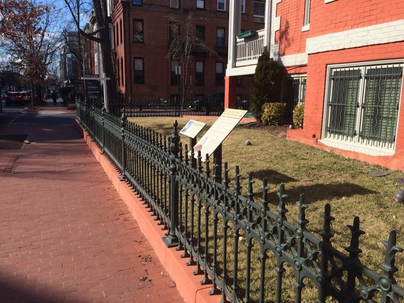
As dust from the Civil War settled, the nation's capital entered a new phase of growth. The expanding government needed more workers, who in turn needed more housing. An entrepreneur named Samuel Brown bought a large tract of land outside . . . — — Map (db m130884) HM
In May 1864, a year before the Civil War ended, Union and Rebel troops clashed in a series of bloody battles in Virginia. Steamships loaded with the wounded traveled up the Potomac River to Washington where stretchers piled ashore for days and . . . — — Map (db m111885) HM
By the late 17th century, English colonial settlements and tobacco plantations had reached what is now Washington, DC. By the 1750s the ports of Alexandria and Georgetown were built, and soon afterward a series of mills expanded along Rock Creek . . . — — Map (db m112586) HM
The mansion of Samuel P. Brown, Mount Pleasant's founder once stood in the middle of the block to your left. During the Civil War, Brown bought 73 acres here for a song from William Selden, a former U.S. treasurer. Selden believed the . . . — — Map (db m130877) HM
I. The 30th day of May, 1868 is designated for the purpose of strewing with flowers or otherwise decorating the graves of comrades who died in defense of their country during the late Rebellion, and those bodies now lie in almost every city, . . . — — Map (db m53026) HM
President Lincoln and his family lived in this country home for over a quarter of his presidency. Escorted by his cavalry guard, Lincoln rode to the White House every morning either on horseback or by carriage, and returned here each evening to . . . — — Map (db m52838) HM
U.S. Soldiers' Home has been designated a National Historic Landmark This site possesses national significance in commemorating the history of the United States of America
1974 National Park Service United States Department of the . . . — — Map (db m52839) HM
The United States Soldier's and Airmen's Home National Cemetery (USSAHNC) is the oldest national cemetery in the nation, receiving its first decedent on 3 August 1861. Its mission today is to provide a honorable, final resting place . . . — — Map (db m168360) HM
"Tonight,
beautiful women,
perfumes, and the violins’ sweetness…
At 10:30 p.m. on March 4, 1865, a tired and gaunt President Lincoln arrived at this site, his wife Mary in white lace and silk with purple and . . . — — Map (db m204444) HM
"Tonight,
beautiful women,
perfumes, and the violins' sweetness…
At 10:30 PM on March 4, 1865, a tired and gaunt President Lincoln arrived at this site, his wife Mary in white lace and silk with purple and . . . — — Map (db m211838) HM
Clara Barton lived a lifetime of tireless service to others. During the American Civil War, she became known as the “Angel of the Battlefield,” delivering supplies and caring for the sick and wounded. After the war, Barton organized a . . . — — Map (db m92177) HM
“I have paid the rent of a room in Washington… retaining it merely as a shelter to which I might return, when my strength should fail me under exposure and labor at the field.”
Clara Barton, December . . . — — Map (db m36174) HM
"I have paid the rent of a room in Washington… retaining it merely as a shelter to which I might return, when my strength should fail me under exposure and labor at the field."
Clara Barton, December 1863
Welcome to downtown Washington, DC — an area rich in history, culture, and places to see. You will enjoy visiting the following sites located in the vicinity of this sign.
[Clockwise from top left:]
Old Post Office Pavilion . . . — — Map (db m226269) HM
To your right at the end of Indiana Avenue is Washington's first City Hall/Courthouse. Across Sixth Street is the H. Carl Moultrie I Courthouse, a successor to the original courthouse. The Old City Hall/Courthouse opened in 1822, with . . . — — Map (db m56124) HM
"My brother saw Booth as he came down the alley and turned into F Street."
Twelve-year-old Henry Davis and his brother often looked out the back window of their Ninth Street home before they went to bed. They . . . — — Map (db m211836) HM
In honor of Julia Ward Howe who wrote the "Battle Hymn of the Republic" here at the Old Willard Hotel November 21, 1861 "In the beauty of the lillies Christ was born across the sea with a glory in his bosom that transfigures you and me." . . . — — Map (db m6709) HM
Julia Ward Howe (1819-1910) was a poet, author, composer, abolitionist, suffragist and more—but she is most remembered for writing the lyrics to The Battle Hymn of the Republic. According to the story, she and her husband were asleep at the . . . — — Map (db m141266) HM
Missing Soldiers.
Office, 3rd Floor, Room 9
Miss Clara Barton
Clara Barton is famous for her fierce determination and courage to save lives on the Civil War battlefields, and later for founding the American Red Cross.
1861-1865: . . . — — Map (db m36172) HM
Just a few steps ahead is Pennsylvania Avenue the inaugural parade route for every president since Thomas Jefferson and “Main Street” for local Washington since the . . . — — Map (db m29651) HM
The old Willard Hotel was the scene of the last major effort to restore the Union and prevent the Civil War. At Virginia's invitation, delegates from twenty-one of the then thirty-four states met in secret session from February 4 to 27, 1861, in a . . . — — Map (db m6541) HM
"This hotel, in fact, may be much more justly called the center of Washington and the Union than either the Capitol, the White House, or the State Department...."
Nathaniel Hawthorne, Civil War reporter for The Atlantic . . . — — Map (db m211824) HM
"This hotel, in fact, may be much more justly called the center of Washington and the Union than either the Capitol, the White House, or the State Department...."
Nathaniel Hawthorne, Civil War reporter for the Atlantic . . . — — Map (db m10905) HM
General-in-Chief of the United States Armies, Secretary of War, and 18th President of the United States. Grant's military successes were instrumental in the surrender of the Confederate States of America at Appomattox Court House on April 9, 1865, . . . — — Map (db m80570) HM WM
It’s the summer of 1862. Early morning, but already hot and dusty. You’re standing at this spot, when you see a tall man on horseback. It’s President Abraham Lincoln. You’re pleased to see him, but not surprised. After all, he rides by here . . . — — Map (db m130757) HM
As the Civil War was ended in 1865, most formerly enslaved African Americans arriving in the District could not read or write. The following year members of the First Congregational Society considered organizing a school to train teachers and . . . — — Map (db m130765) HM
Earthworks of Fort De Russy are visible; follow path to your right for 200 yards.
[drawing of fort]
Fort De Russy from U.S. Army Corps of Engineers drawing.
Cannon mounted at Fort De Russy helped repulse a Confederate attack on . . . — — Map (db m235916) HM
One of the Civil War Defenses of Washington. Constructed on the site in 1861 Fort DeRussy commanded the deep valley of Rock Creek. Its armament consisted of 11 guns and mortars including a 100-pounder Parrott Rifle. — — Map (db m20823) HM
Built in 1861 to protect the Rock Creek Valley during the Civil War, Fort DeRussy's cannon fired a total of 109 projectiles into the northern countryside as 12,000-15,000 Confederate soldiers attacked the city under the command of Confederate . . . — — Map (db m116084) HM
Across the intersection stands the tower of O Street Market. When the market opened in 1881, and refrigerators had not been invented, people shopped here daily for everything from live chickens to fresh tomatoes. At first the vendors were . . . — — Map (db m130893) HM
The Almanac of 1792
Almanacs were among the most popular publications in 18th century America. Almanacs consisted of an ephemeris, a mathematical table predicting the position of celestial bodies during the course of a year, along with . . . — — Map (db m211187) HM
Paz, paix, shalom, esaalam, are words from several foreign languages spoken in Sheridan-Kalorama, each meaning peace. This representation of a benevolent friar welcomes you in peace. We share, too, works of "America's poet" Walt Whitman, who spent . . . — — Map (db m112601) HM
In Memory
of
Our Comrades
Killed and Wounded
in Battle
on This Field
July 11th & 12th 1864
98th Reg't. P.V.
1st Brig., 2nd Div., 6th Corps — — Map (db m76116) WM
During the late evening of July 12, 1864, 40 Union soldiers that perished while defending Washington DC from a two day Confederate attack (known as the Battle of Fort Stevens) were laid to rest here in what was once an apple orchard. President . . . — — Map (db m165667) HM
After the rebels were turned back as the Battle of Fort Stevens ended in 1864, scores of Union Soldiers lay cold and silent. Forty-one of them are buried here in this tiny plot dedicated to their sacrifice.
President Abraham Lincoln, who . . . — — Map (db m165669) HM
As the gallant soldiers that are interred at the cemetery marched onto the battlefield on July 11-12, 1864 during the Battle of Fort Stevens, their regimental flags accompanied then into the fight.
Battleground National Cemetery honors these . . . — — Map (db m64225) HM
To the gallant sons of Onondaga County, N.Y. who fought on this field July 12, 1864 in defence of Washington and in the presence of Abraham Lincoln
122 N.Y.V. — — Map (db m76093) WM
At an elevation of 410 feet, Fort Reno is located at the highest point in DC. The fort, originally named Fort Pennsylvania, was well situated to provide defense of the Nation's Capital during the Civil War as one of the Circle of Forts (pictured . . . — — Map (db m20628) HM
No visible evidence remains of Fort Reno, which stood at the top of this hill, the highest elevation in Washington, D.C.
[drawing of Fort Reno]
Fort Reno from U.S. Army Corps of Engineers drawing. Cannon mounted at Fort Reno helped repulse . . . — — Map (db m20629) HM
At 409 feet above sea level, this site is the highest point in Washington, D.C. It is no coincidence that in 1861, the Union army designed one the largest and most heavily armed Civil War fortifications at this location.
Originally named . . . — — Map (db m133962) HM
At 409 feet above sea level, this site is the highest point in Washington, D.C. It is no coincidence that in 1861, the Union army designed one the largest and most heavily armed Civil War fortifications at this location.
Originally named . . . — — Map (db m136006) HM
To your right is "Point Reno," the highest point in Washington — 409 feet above sea level, to be exact.
This unsurpassed vantage brought the Civil War (1861-1865) to Tenleytown. After the Union defeat at Bull Run in July 1861, . . . — — Map (db m130923) HM
Before the Civil War (1861-65), the land behind you was part of the 72-acre farm of Giles Dyer. As a Southerner, Dyer depended on enslaved people to work his fields.
Because of its elevation, Dyers land was taken by the Union Army in 1861 . . . — — Map (db m130924) HM
Fort Reno is located at the highest elevation in D.C. A city water reservoir was constructed in the 1890s to serve the city's growing population. The red brick water tower (pictured here) was built in 1903 to provide water pressure to the immediate . . . — — Map (db m112184) HM
The site of this fort was selected in August, 1861. First called Fort Pennsylvania, the fort was located at an elevation of 430 feet, commanding three important roads which entered the city from the northwest in the vicinity of what is now Wisconsin . . . — — Map (db m20630) HM
[Dedication by Royal Cortissoz, above the statue by sculptor Daniel Chester French:]
"In this temple as in the hearts of the people for whom he saved the Union the memory of Abraham Lincoln is enshrined forever."
[Inscription . . . — — Map (db m28607) HM
Welcome to the Reading Grove
This space provides a place to meet, rest, read, and reflect. Live oaks have long harbored gatherings, from religious services and classes to community celebrations.
Witness Trees
Trees that were . . . — — Map (db m143315) HM
Archaeology is the study of physical objects people leave behind. At Carolina Park, archaeology has revealed that native peoples lived and worked here over thousands of years. Local stone materials were made into projectile points for spears and . . . — — Map (db m213803) HM
Archaeology is the study of physical objects people leave behind. At Carolina Park, archaeology has revealed that native peoples lived and worked here over thousands of years. Local stone materials were made into projectile points for spears and . . . — — Map (db m213806) HM
Union troops occupied this island one month after the Civil War broke out in April 1861. Following the Emancipation Proclamation in 1863, African Americans that enlisted in the Union Army trained to fight here.
Once prepared for battle, . . . — — Map (db m150051) HM
This memorial is dedicated to those who served in the African American units of the Union Army in the Civil War. The 209,145 names inscribed on these walls commemorate those fighters of freedom.
[Names of the officers and enlisted men who . . . — — Map (db m41748) HM
The African American Civil War Memorial pays tribute to the 209,145 black soldiers and the 7,800 white officers who led them in their fight for freedom in the Civil War. following the Civil War, many soldiers would return home as war heroes to . . . — — Map (db m113686) HM
The Shaw neighborhood and the Greater U Street Historic District are rich in African American and Civil War history. They are the ideal place for the African American Civil War Memorial now located on this Metro plaza. The neighborhood was . . . — — Map (db m130790) HM
The Woodley Park neighborhood that is now home to several thousand residents as well as the National Zoo was once sparsely settled countryside. The farmhouse shown here, known as Redwood, was built around 1819 on a hill that rose 40 feet above . . . — — Map (db m67828) HM
Late On The Night Of April 14, 1865, a guard at the other end of the Navy Yard Bridge allowed a young man on horseback to cross, despite a wartime curfew. Unbeknownst to the guard, the rider, John Wilkes Booth, had just shot President Abraham . . . — — Map (db m100715) HM
Earthworks of Fort Stanton are visible in the wooded area 200 yards in front of you.
Diagram: Fort Stanton from U.S. Army Corps of Engineers drawing.
Fort Stanton was named for Secretary of War Edwin M. Stanton, was the first fort . . . — — Map (db m46623) HM
Also known as Cedar Hill, this site encompasses the estate owned by Frederick Douglass from 1877 until his death in 1895. In honor of Douglass’ work as an author, orator, abolitionist, statesman, and civil rights leader, this site is designated a . . . — — Map (db m40846) HM
Today's Anacostia Historic District began in 1854 as Uniontown, Washington's first planned suburb. The Union Land Association saw the large Navy Yard
workforce across the Anacostia River as potential customers for building lots they carved . . . — — Map (db m95972) HM
The "Freedmen's Bureau" acquired 375 acres of land that was originally a tobacco plantation from the Barry Family in the late 1800's. In 1867, the land was named Hillsdale by African Americans who came to Washington in great numbers before and . . . — — Map (db m141635) HM
Civil War Washington City
Over the course of the Civil War, the nation's capital was transformed. The dignified government city Pierre Charles L' Enfant laid out in 1791 was hardened into a sprawling military center. Encircled by strong . . . — — Map (db m139512) HM
Mathew Brady (1822-1895) is considered by some to be the father of photojournalism, thanks to his photos of the Civil War. His exhibit "The Dead of Antietam" showed photos of corpses and was the first time many had seen the realities of war in . . . — — Map (db m211915) HM
Choctaw Chief—Diplomat—Education Leader
Born January 30, 1896
Died January 17, 1881
• Principal Chief, Choctaw Nation of Oklahoma 1864-1866
• Tribal Commissioner for land claims against the U.S. Government
(1853-61 — . . . — — Map (db m139480) HM
Mathew Brady was one of the most outstanding early photographers in American history, with his work from 1844 to 1895. He is credited today as the father of photojournalism. This memorial was erected to honor him & his photography, as well his . . . — — Map (db m211914) HM
Dedicated to the Memory of the Victims of the U.S. Arsenal Explosion on June 17, 1864
Ellen Roche •
Julia McEwen •
Bridget Dunn •
W. E. Tippett •
Margaret Horan •
Johanna Connors •
Susan Harris
Lizzie Brahler •
Margaret . . . — — Map (db m80961) HM WM
Killed by an explosion at the U.S. Arsenal Washington D.C. June 17th 1864
Ellene Roche •
Julia McEwen •
Bridget Dunn •
W.E. Tippett •
Margaret Horan •
Johanna Connors •
Susan Harris •
Lizzie Brahler •
Margaret C. Yonson • . . . — — Map (db m211916) HM WM
Earthworks of Fort Chaplin are visible through the wooded areas at the top of the hill. Fort Chaplin was named in honor of Col. Daniel Chaplin, who was mortally wounded on August 17, 1864, at Deep Bottom, Virginia. — — Map (db m10628) HM
Across the street is the former Carver Theatre, built in 1948 as the first nonsegregated movie house in Southeast Washington. It closed in 1957 becoming, in turn, a roller rink, a church, and a funeral parlor.
Then a decade later, a . . . — — Map (db m100824) HM
In 1866 the Navy completed the hospital you see across the street to treat injured and ailing seamen. With beds for 50, it included the carriage house/stable and cast-iron fence and (around the corner) the gazebo. Its front door originally . . . — — Map (db m130732) HM
Providence Hospital was located on this site during the years 1861 through 1956. Founded in 1861 by the Daughters of Charity of Saint Vincent de Paul from Emmitsburg, Maryland. The Hospital was chartered by an Act of Congress in 1864.
During . . . — — Map (db m116116) HM
The Neighborhood
This site has been associated with Navy medicine since 1800 when an apothecary shop located here provided medical services to sailors and marines from the nearby Navy Yard and Marine Barracks.
Naval Hospital, . . . — — Map (db m127966) HM
Earthworks of Fort Carroll are visible 100 yards to the right at the top of the hill. Fort Carroll was named in honor of Maj. Gen. Samuel Sprigg Carroll, a West Point graduate from the District of Columbia. — — Map (db m10614) HM
One of several earthworks commenced late in 1861 to guard the nation’s capital from the ridge east of the Anacostia River. The fort was named in honour of Colonel Benjamin F. Davis of the 8th New York Cavalry, killed at Beverly Ford, Virginia, June . . . — — Map (db m40690) HM
Earthworks of Fort Davis are visible behind the wooded area in front of you.
[Captions:]
Fort Davis from the U.S. Army Corps of Engineers drawing.
Fort Davis was named after Col. Benjamin F. "Grimes" Davis, hero at . . . — — Map (db m211965) HM
This small work was one of the defenses begun in the fall of 1861 on the ridge east of the Anacostia River. It was named after Admiral Samuel DuPont, a commander of the South Atlantic Blockade Squadron. Eight guns and one mortar comprised its . . . — — Map (db m46425) HM
Earthworks of Fort DuPont are visible; follow path to the entrance of the fort.
[Captions:]
Fort DuPont from U.S. Army Corps of Engineers drawing
Fort DuPont was named after Rear Admiral Samuel Francis DuPont, a Union . . . — — Map (db m206943) HM
The Gisborough Estate (1680-1890) was a large colonial land grant that included part of what is now Bolling Air Force Base. That name eventually came to be spelled "Giesboro" and from 1863 to 1866 this area was the location of a large cavalry depot . . . — — Map (db m125873) HM
American League Pennant. As the defending world champions, Washington players raise the pennant early in the season prior to defeating the Philadelphia Athletics, 9-4. National Photo Company. Griffith Stadium, Washington, D.C., May 1, 1925. . . . — — Map (db m192569) HM
At the start of the Civil War, the Commandant of the Navy Yard mobilized all of the available forces—about 350 Marines, sailors, and volunteers—and hastily established key locations to protect the nation's capital. Additional Union . . . — — Map (db m126453) HM
During the Civil War, the Navy established its first "Experimental Battery" here, testing cannons by firing down the Anacostia River. Ballistic test pits also were created here to determine how best to defeat Confederate ironclads. The Navy's . . . — — Map (db m126459) HM
The first large gun foundry was erected during the Civil War at the Navy Yard. In 1886, the Navy Yard was designated the manufacturing center for all Navy ordnance. By World War II, the Yard was the largest naval ordnance in the world. In December . . . — — Map (db m126454) HM WM
The plaque below marks the spot where the leg of U.S. Army Colonel Ulric Dahlgren, son of Admiral John Dahlgren, "father of American naval ordnance," was interred following his wounding after the battle of Gettysburg in 1863. The leg was enclosed . . . — — Map (db m32629) HM
Evolution of St. Elizabeths Campus
At the urging of mental health care reformer Dorothea Dix, the United States Congress provided $100,000 to establish the first Federal mental health hospital to care for members of the Army and Navy as well . . . — — Map (db m131526) HM
St. Elizabeths
Hospital
has been designated a National Historic Landmark This site possesses national significance in commemorating the history of the United States of America. — — Map (db m58305) HM
Founded during the Civil War for wounded soldiers that died on the St. Elizabeths Campus during and after the Civil War. This small cemetery houses the remains of some 300 Civil War dead, both Confederate and Union, Black and White. When the foliage . . . — — Map (db m131712) HM