On Campbellsville Street (Kentucky Route 55) at Lindsey Wilson Street, on the left when traveling north on Campbellsville Street.
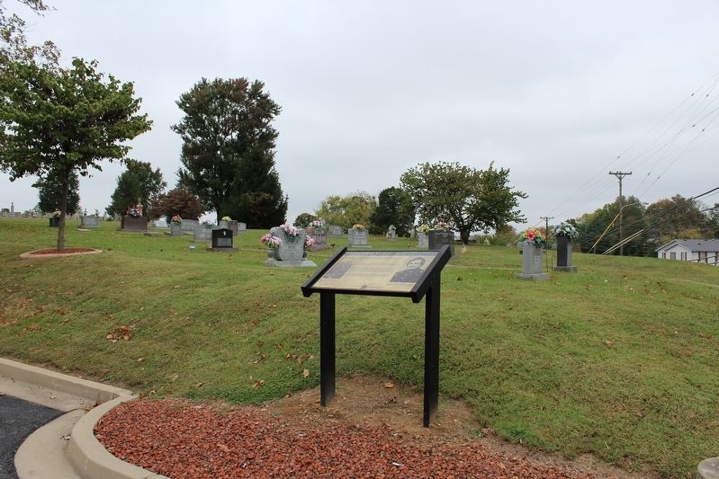
Frank Lane Wolford (1817 - 1895). Adair County native, organized 1st Kentucky Cavalry (US) in 1861. His men knew little about the drill and discipline but had the utmost confidence in Wolford and he in them. The soldiers supplied their own horses . . . — — Map (db m170508) HM
On Bowling Green Road, 0.2 miles north of Whetstone Way, on the right when traveling north.
Mt. Union Church
Organized in 1864 under the name of Mulberry Hill General Baptist Church. In 1869 the original log building burned. The congregation rebuilt on present site, changed the name to Mt. Union. Thirteen churches were invited from . . . — — Map (db m143075) HM
Near Green Street (U.S. 60) west of 1 Street, on the right when traveling west.
Native American Indian of the Mississippian culture were buried in this cemetery mound sometime in the A.D. 1200s. First excavated in 1932 by owner Col. Fain King, the mound was referred to as “Mound C”. A building was constructed over . . . — — Map (db m58870) HM
Near Green Street (U.S. 60) west of 1st Street, on the right when traveling west.
Excavations have shown that building stood on several earlier levels of this mound.
We do not know how big those buildings were.
This structure is approximately the size of the posthole pattern in the architecture building (Mound B) — — Map (db m58872) HM
Near Green Street (U.S. 60) west of 1st Street, on the right when traveling west.
Site of an ancient religious and commercial center of the Mound Builder. Approximately one thousand years old, situated on the only high ground at the confluence of the Mississippi and Ohio Rivers. Tombs, temples, altars, jewels, dwellings, tools, . . . — — Map (db m58869) HM
Near Green Street (U.S. 60) west of 1st Street when traveling west.
Nearly one thousand years ago, this village was home for Native Americans of the prehistoric Mississippian culture. Peaceful farmers, these mound building Indians lived throughout the Ohio and Mississippi river valleys. Exhibits at Wicklffe Mounds . . . — — Map (db m58873) HM
On W. Broadway Street (State Highway 70) at N. 1st Street, on the right when traveling west on W. Broadway Street.
Confederate Brigadier General, commanded famous “Orphan Brigade” in Civil War. In 1861 he conducted recruiting and training camp here. State legislature, 1850-54, 69-70. US Congress, 1870-73. Member of Kentucky Court of Appeals for 24 years, . . . — — Map (db m96727) HM
On S. Broadway Street at E. Washington Street, on the right when traveling north on S. Broadway Street.
Congregation formed ca. 1802, when Isaac Robertson, a member, donated lot for log structure erected here. Rev. John Howe was first minister. Present Gothic Revival sanctuary built ca. 1853. Church’s style of architecture features Tudor-arched window . . . — — Map (db m88133) HM
On N.L. Rodgers Wells Boulevard (Bypass U.S. 31-E) at Cross Street, on the right when traveling north on N.L. Rodgers Wells Boulevard.
Site of Civil War fort built in spring of 1863. Attacked Oct. 6 by Confederate Col. John M. Hughs and his 25th Tenn. Infantry. US troops under Maj. Samuel Martin surprised. Over 200 horses captured, part of fort burned, and 142 men taken prisoner, . . . — — Map (db m39405) HM
Near Fort Williams Way south of Cross Street, in the median.
General Joseph H. Lewis, commander of the famous Orphan Brigade, is buried just down the hill from Fort Williams. The Orphan Brigade was composed of the 2nd, 3rd, 4th, 6th and 9th Kentucky Infantry regiments along with two batteries of . . . — — Map (db m72389) HM
On Leslie Avenue south of Barrett Avenue, on the right when traveling south.
The Glasgow Municipal Cemetery is situated on what was originally farmland on the outskirts of town, owned by the Depp and Lynn families. This cemetery is Glagow's third public burying ground. Glasgow's first graveyard was located behind the First . . . — — Map (db m71563) HM
On Bethel Ridge Road, on the left when traveling north.
Longview Cemetery, Bethel, is grave site of one of the most noted and best-loved Kentucky journalists. Born 1918 in Benton, he gained renown from his column, "Joe Creason's Kentucky," in the Louisville Courier-Journal. His popular book by same name . . . — — Map (db m110166) HM
On North 24th Street at Gloucester Avenue, on the right when traveling north on North 24th Street.
Grave of Colonel Arthur Campbell (1743-1811). Statesman, revolutionary soldier, justice, legislator, county lieutenant. Sons, James and John killed in War of 1812. — — Map (db m57938) HM
On Asher-Clear Creek Road at U.S. 25E, on the right when traveling east on Asher-Clear Creek Road.
This cemetery was established by pioneers traveling along Boone's Wilderness Road during the late 1700's and early 1800's. These first settlers camped in the bottomland that is now Wasioto Golf Course while preparing to cross the Cumberland . . . — — Map (db m181156) HM
On Bullittsville Road at Park Street, on the right when traveling south on Bullittsville Road.
Established in 1819, this historic graveyard was Burlington's first community cemetery. It protects the remains of over 250 Boone County residents including County Judges and other leading citizens and businessmen from the last two centuries. Among . . . — — Map (db m175115) HM
On Paris Cemetery 3rd Road west of Main Street (Business U.S. 68), on the left when traveling west.
The Paris Cemetery Gatehouse is a rare surviving example of Gothic architecture in Kentucky. John McMurtry was the Lexington builder/architect who had worked with Alexander Jackson Davis, New York architect, as the builder of Loudoun House (ca. . . . — — Map (db m218183) HM
Near Millersburg Road (U.S. 68) 1.4 miles east of Jackstown Road, on the right when traveling east.
Here stood Mt. Gilead Methodist Church
on land given by Daniel Matheny in 1790,
a gift confirmed by Thomas Jones, Sr.,
the eventual owner.
The word “Gilead” is defined in Genesis
as “hill of witness” and the adoption of
this name was a . . . — — Map (db m218138) HM
One and one half miles NE in
Central Park is an irregular row
of mounds, part of a chain built
by prehistoric men who were the
forerunners of American Indians.
Many of remains of that ancient
people which once dotted this area
were leveled as . . . — — Map (db m126471) HM
On West Main Street east of College Street, on the right when traveling east.
Burial site of Ephraim McDowell, the “father of modern surgery.” His family moved here from Va. in 1784. He studied medicine in Va. and Scotland before practicing in Danville. In 1802, he married Sarah Shelby, dau. of Ky.’s first gov. . . . — — Map (db m50814) HM
Near Park Road, 0.3 miles west of Battlefield Road (Kentucky Route 1920).
When the Battle of Perryville ended, hundreds of dead soldiers were left on the battlefield. The Confederates, who attacked the Union battle lines, lost 532 killed, 2,641 wounded, and 228 missing (3,401 total). Federal losses were just as . . . — — Map (db m46421) HM
Near Claunch Road, 1.8 miles west of Harrodsburg Road (U.S. 68), on the left when traveling west.
Erected by the United States
To mark the burial place of an unascertained number of Confederate soldiers said to have died while prisoners of war at the Goodknight farmhouse from wounds received at the Battle of Perryville, October 8, 1862, . . . — — Map (db m142872) HM WM
On Ferry Street at West Riverside Drive on Ferry Street.
Weeping Eye Gorget
This classic Fort Ancient marine conch gorget was found in Augusta ca. 1950 at site 14BK4.
General John Payne
While a resident of Augusta, Payne wrote Gen. Lewis Collins and informed James Overton that he had . . . — — Map (db m217841) HM
On State Road 144, on the right when traveling south.
This is birthplace and grave of Joseph Holt, 1807-96. He served as Commissioner of Patents, Postmaster General, and Sec. of War in Pres. Buchanan's Administration. 1857-61.
Lincoln named him Judge Advocate General of the Union army in 1862. Holt . . . — — Map (db m160293) HM
Near Clermont Road (Kentucky Route 245) 0.1 miles west of Lotus Road (Kentucky Route 1604), on the left when traveling west.
Decades-old graveyard discovered near here. Graves, with unmarked headstones, believed to be those of itinerant railroad workers struck down by cholera epidemic during the construction of the Bardstown-Springfield-Louisville Railroad around 1854, or . . . — — Map (db m171587) HM
The Shepherdsville Pioneer Graveyard (the word "cemetery” was not commonly used until sometime later) was established circa 1799 and abandoned in 1909 following a flood. The Hebron Cemetery was opened in northern Bullitt County in the 1890s, . . . — — Map (db m174404) HM
On E G L Smith Street east of North Main Street, on the left when traveling east.
Hamilton, a leader of one of most incredible prison escapes of the Civil War, was born in Pa., Jan. 9, 1835. A Woodbury resident before the war, he joined Co. A of the 12th Ky. (Union) Cavalry, Aug. 12, 1862. Captured at Jonesboro, Tn., Aug. 1863; . . . — — Map (db m123457) HM
On Woodbury Loop (Kentucky Route 403) east of Hines Street, on the left when traveling east.
Capt. Thomas Henry Hines enlisted in the Confederate Army, 1861. With Brig. Gen. John H. Morgan, 1862-63. Captured, July '63, in Ohio with Morgan. Led escape from Federal prison, Nov. '63. Leader of northwest conspiracy '64. Termed most dangerous . . . — — Map (db m123424) HM
Near U.S. 641, 0.1 miles north of Mott City Road (State Road 70), on the right when traveling north.
Centreville Livingston Presbyterian Church cemetery. John Elder, Vet. of Rev. War, interred here 1799 on land given by Col. James Hawthorn. — — Map (db m244251) HM
On Clayridge Road south of Smith-Hiteman Road, on the right when traveling south.
Many salt wells located in this area, left over from the last Ice Age. Salt making was an early business in Grant's Lick. John Grant was one of the owners, and the entire area is named for him. Mary (Boone) Bryan — sister to Col. Daniel Boone — is . . . — — Map (db m175100) HM
On Alexandria Pike (U.S. 27), on the right when traveling south.
Albert S. Berry was Newport mayor
prior to serving in Congress, 1893-
1901. Later became circuit judge.
Brent Spence, lawyer & banker prior
to serving in Congress, 1931-1963.
George Baird Hodge elected to CSA
Congress, 1862. Served area . . . — — Map (db m175108) HM
Near General Butler Park Road east of 11th Street (Road 320).
Marker Front:
Col. Percival Butler was appointed Ky.'s first adjutant gen. in Gov. Isaac Shelby's first term. Born in Penn., he was with Washington at Valley Forge and Lafayette at Yorktown. Immigrated to Jessamine Co., Ky., then moved to . . . — — Map (db m22097) HM
On U.S. 42 east of Carraco Road, on the left when traveling east.
Oldest brick house still standing in county, this was home of Richard and Sarah Masterson. Bricks laid in Flemish bond. House was center of town's activities. Mastersons, leading Methodists, opened their home for services before church erected in . . . — — Map (db m22128) HM
On Lynn Street west of Thompson Street, on the left when traveling north.
Christopher Riffe accompanied Col. Wm. Casey, (Great-Grandfather of Mark Twain); to Kentucky in 1784. He lived at Bryan's Station, Boonesborough, Logan's Station and Carpenter's Station. He bought 800 acres of land from the Grandfather of Abraham . . . — — Map (db m244660) HM
On North Main Street (U.S. 41) at Clark Avenue, on the right when traveling north on North Main Street.
Hdqrs. CSA Commander
Nathan Bedford Forrest, stationed in Hopkinsville during winter of 1861-62, resided, with wife and daughter, in log house, the third residence south. As colonel, in command 6 companies CSA Cavalry, reconnoitered . . . — — Map (db m88921) HM
On West 13th Street, 0.1 miles west of Ferrell Street, on the left when traveling west.
Within this enclosure are buried 185 named persons, and many more unknown, all early settlers of Christian County. The land for this cemetery was donated in 1812 by Bartholomew Wood, the first settler in Hopkinsville. He also donated land and timber . . . — — Map (db m166890) HM
On North Main Street at Clark Avenue, on the right when traveling north on North Main Street.
Brig. Gen. James S. Jackson, USA, killed in battle of Perryville on Oct. 8, 1862, is buried in south end of cemetery. Born Woodford Co., Ky., 1823. First Lt., Mexican War, then practiced law in Greenup. He came Hopkinsville, 1855. Elected to . . . — — Map (db m88916) HM
Chief Whitepath served with Chief John Ross on the six-person Management Committee for Cherokee Removal and Subsistence, arranging for ration stops along the "Trail of Tears".
Cherokee Memorial Park in Hopkinsville, Kentucky, was one of the . . . — — Map (db m105687) HM
On West Lexington Avenue (U.S. 60) just east of Hospital Drive, on the right when traveling west.
Came from Va. to Boonesborough, 1776. Builder of Strode's Station, 1779, the largest and most important fortified area in Clark County during the early settlements and bloody Indian wars. Indians attacked station 1781, and later. Two men killed . . . — — Map (db m159696) HM
On East Broadway Street at Park Avenue, on the left when traveling east on East Broadway Street.
In 1833 town trustees bought about an acre for $45 for public burial ground. First cholera epidemic in U.S. reached here. Seventy-five victims were buried here in 1833. John Ward, town trustee and a leader in forming cemetery, and his wife were both . . . — — Map (db m67786) HM
On Ironworks Road west of Morris Road, on the left when traveling west.
In the burial ground, one-fourth mile east, are two rare Carrara marble tombstones carved in Italy by Joel Tanner Hart, the world renowned sculptor. He brought the stones to America, 1860, at time of unveiling of his great statue of Henry Clay in . . . — — Map (db m67788) HM
On Chapel Hill Road (Kentucky Route 688) 0.3 miles west of Twin Lake Drive, on the left when traveling west.
Chapel Hill Presbyterian Church
Organized in 1883 at the home of John A. Hill. Services were held in an old school house until this building was constructed on T. M. Hill's land in 1884. Rev. A. J. Thomson was first pastor. Provision for . . . — — Map (db m123791) HM
On South Main Street at East Depot Street, on the right when traveling north on South Main Street.
Senator W. J. Deboe
Born 1849, eight mi. SE of here. Deboe was elected County School Superintendent and opened law office, 1889. State Senator, 1893-97. Elected by Legislature to U.S. Senate, 1897. He wrote the 17th Amendment to the U.S. . . . — — Map (db m123770) HM
On Bolling Heights Lane, 0.1 miles north of Kentucky Road 2116, on the right when traveling north.
Richard Hawes (1772-1829) and wife Clary Walker Hawes (1776-1848) came here 1810 from Va. Their son Richard was Confederate governor of Ky. After husband's death, Clary was licensed to operate Hawesville and Cannelton ferry, 1831. Cemetery long . . . — — Map (db m160194) HM
On Kentucky Route 764 just south of U.S. 231, on the right when traveling north.
Pleasant Point Missionary Baptist Church. Six emancipated slaves formed this congregation in 1871. Three years later it was fully organized: the church erected in 1878. Membership grew as African Americans searched for religious & cultural . . . — — Map (db m159288) HM
This cemetery, known as 'Old Guide's Cemetery,"
probably began as a slave cemetery. Others buried
here were early visitors to Mammoth Cave. They
share this resting place with cave guide Stephen
Bishop, who died in 1857 and is the only known . . . — — Map (db m107609) HM
On Main Street at Jackson Street, on the right when traveling west on Main Street.
This is the only natural entrance to
Mammoth Cave. Over 2,000 years ago
Indians used this opening for shelter,
for burials, and as an avenue to farther
reaches of the cave. According to legend,
the entrance was "discovered” in 1799 . . . — — Map (db m171793) HM
Near Mammoth Cave Parkway (Kentucky Route 70) 0.2 miles west of Kentucky Route 255.
The Mammoth Cave Railroad didn’t wind through wilderness – once families, communities, and congregations called these hills home. An abandoned chimney, a foundation stone, or even a line of daffodils may mark an old homeplace. Among the most . . . — — Map (db m79292) HM
Near West Main Street (U.S. 421) 0.1 miles north of Newtown Pike / Oliver Lewis Highway (Kentucky Route 922).
The National Arborist Association and the International Society of Arboriculture jointly recognize this significant tree in this bicentennial year as having lived here at the time of the signing of our constitution. — — Map (db m152373) HM
Near West Main Street (U.S. 421) 0.1 miles north of Newtown Pike / Oliver Lewis Highway (Kentucky Route 922), on the right when traveling north.
Civil War Dead
An estimated 700,000 Union and Confederate soldiers died in the Civil War between April 1861 and April 1865. As the death toll rose, the U.S. government struggled with the urgent but unplanned need to bury fallen Union troops. . . . — — Map (db m123526) HM
known as Abe, was born in Midway, Woodford County. He began his career as a Thoroughbred
trainer for Abraham Buford, Bosque Bonita Far, Woodford County where he trained McWhitter (1876-1878). Perry became assistant trainer for Leonard W. Jerome, . . . — — Map (db m169792) HM
Near West Main Street (U.S. 421) 0.1 miles north of Newtown Pike / Oliver Lewis Highway (Kentucky Route 922), on the right when traveling north.
Four score and seven years ago our fathers brought forth on this continent, a new nation, conceived in Liberty, and dedicated to the proposition that all men are created equal.
Now we are engaged in a great civil war, testing whether that . . . — — Map (db m138998) HM WM
Thoroughbred Trainers (24)
French Brooks 1861-1943 • Harry Brown ?-1890 • Edward Caldwell 1863-1912 • General Carter 1865-1936 • Oliver D. Chambers 1842-1909 • June Collins 1860-1930 • Polk Drake 1852-1889 • Moses Dupee 1832-1901 • Ben . . . — — Map (db m169816) HM
On East 7th Street south of Pemberton Lane, on the right when traveling south.
Earliest recorded cemetery in Lexington to be organized, owned, and managed by African Americans. The site has been in existence since 1869. Trustees of Benevolent Society No. 2 successfully operated cemetery. Many individuals buried here were . . . — — Map (db m169750) HM
On Gentry Road, 0.3 miles east of North Baxter Boulevard, on the left when traveling east.
Israel
1759 — 1782
Son of Daniel and Rebecca Bryan
Killed in the Battle of Blue Licks
Aug. 19, 1782
Edward
1740 — 1780
Killed by Indians
Brother of Daniel
Samuel
1728 — 1808
Revolutionary soldier
Brother of . . . — — Map (db m202810) HM WM
had been employed by Barak G. Thomas, owner of Dixiana Farm, as a 'race rider' since he was fourteen years old. He was mounted for the Harold Stakes at Latonia. Cassius' fate was reported in several publications: “The sad accident which befell . . . — — Map (db m169789) HM
Near West Main Street (U.S. 421) 0.1 miles west of Newtown Pike (Kentucky Route 922), on the right when traveling west.
C.S.A
(The names of 160 Confederate soldiers that are buried in the Lexington Cemetery are listed on the four faces of the pedestal)
C.V.A. — — Map (db m167905) WM
In addition to the great Man o' War, this memorial gravesite also holds the final remains of several of his sons and daughters including Triple Crown winner, War Admiral.
War Admiral (1938-1900) Buried with Man o' War
By Man o' War, . . . — — Map (db m202934) HM
The farrier is as critical to the success of the modern racehorse as a well-drilled team
changing the tires on the modern racing car. Farriers form and fit the shoes to each horse as required by training and racing events. The adjacent grave is . . . — — Map (db m169790) HM
Octie Keys, died July 1929, had a listed occupation of horsegroom. Horsegrooms are responsible for all aspects of the care and maintenance of thoroughbred horses. Until Keeneland was built, Lexington's racetrack, The Kentucky Association Racetrack, . . . — — Map (db m169755) HM
Near West Main Street (U.S. 421) 0.1 miles north of Newtown Pike / Oliver Lewis Highway (Kentucky Route 922).
Henry Clay, born in Virginia in 1777, came to Lexington at the age of twenty and quickly established a successful law practice. In 1799 he married Lucretia Hart, daughter of one of this city’s most prominent families.
He served six years in . . . — — Map (db m119135) HM
A hostler is a horse handler. 'Soup' Perkins was employed as a hostler before becoming a jockey. Daniel Hart, died 16 January 1901, was identified as a hostler in records of his occupation.
Sign produced with support from a University of . . . — — Map (db m169756) HM
This monument identifies members of James "Soup" Perkins' family. Frank was a trainer whose career ended when he was killed in 1900. Elizabeth was their sister and Mattie was their mother. The woman identified on the opposite side was Mattie's . . . — — Map (db m169785) HM
Nothing is known about Joseph Scott except that
at a very young age (16) he was employed by the
thoroughbred industry. His grave is unique
because it is the only one in the cemetery that
specifically identifies an individual as a 'jocky.'
Matt . . . — — Map (db m169822) HM
On West Main Street (U.S. 421) west of Newtown Pike (U.S. 25), on the right when traveling west.
Incorporated in 1849, Lexington Cemetery was laid out as a natural landscape park. Both Confederate and Union soldiers are buried in this cemetery. Towering over Henry Clay's grave is a 120-foot monument surmounted by his statue. Other noted men, . . . — — Map (db m61033) HM
Near West Main Street (U.S. 421) west of Oliver Lewis Way/Newtown Pike, on the right when traveling west.
Civil War Lexington
In 1847, Abraham Lincoln traveled to Lexington to visit his wife's family. It was a small county seat but regional economic and cultural center. When the Civil War began in 1861, the railroads that linked Lexington with . . . — — Map (db m202872) HM
MAN o' WAR (1917-1947)
In addition to the great Man o' War, this memorial gravesite also holds the final remains of several of his sons and daughters:
• War Admiral (1934-1959) – 1937 Triple Crown winner
• War Relic (1938-1963) – . . . — — Map (db m202884) HM
On West Main Street (U.S. 421) west of Buchanan Street, on the right when traveling west.
Erected to the memory of Mary Desha 1850-1911 by Katharine Montgomery Chapter of Washington D.C. and Kentucky Daughters of the American Revolution — — Map (db m239045) HM
Oliver Lewis, a Lexington native, was listed as a race rider in the employ of H.P. McGrath, owner of McGrathiana Farm (the current UK Coldstream Research Park) during the 1880 census. Lewis went on to win the first Kentucky Derby in 1875 aboard . . . — — Map (db m169823) HM
On Gentry Road just east of North Baxter Boulevard, on the left when traveling east.
Grave of Samuel Boone, the eldest
brother of Daniel Boone, renowned
Kentucky pioneer. Samuel was born
in Penna., May 20, 1728. Came to
Kentucky from South Carolina in
1779 with his family and settled
Boone's Station. He joined in
defense of . . . — — Map (db m169709) HM
Laura and Henry Britton were free blacks who purchased a home in 1856 in the Gratz Park area near Transylvania University in Lexington. Henry earned his living as a barber, and Laura as a seamstress. They were parents of twelve known children. One . . . — — Map (db m169821) HM
Walker Hughes, who died 1926, although the date on his marker indicates 1927, was a trotting horse trainer. Trainers are crucial to preparing thoroughbreds and trotters for racing as well as instructing the jockeys and drivers who guide them. . . . — — Map (db m169758) HM
This marker is in the approximate location of Isaac Burns Murphy's original grave.
Murphy is perhaps one of the most famous of all thoroughbred jockeys. He was the first to win three Kentucky Derbies, 1884, 1890, 1891 and still has the highest . . . — — Map (db m169797) HM
On East 3rd Street west of Elm Tree Lane, on the left when traveling east.
Grave of George Nicholas
1754-1799
Revolutionary soldier
Virginia House of Delegates
Father of Kentucky Constitution
First Kentucky Attorney General
Professor of Law at Transylvania University — — Map (db m61134) HM
On East Third Street north of Elm Tree Lane, on the right when traveling north.
Old Episcopal Burying Ground
Purchased in 1832 by Christ Church trustees to serve its members, it is among the oldest graveyards in Lexington. Some 600 people were buried here between 1833-1879, including over 50 Christ Church members who . . . — — Map (db m169748) HM
On Walnut Hill Road, 0.1 miles west of Old Richmond Road (U.S. 25/421), on the right when traveling west.
General Levi Todd and the Reverend
James Crawford were instrumental
in the founding of Walnut Hill
Presbyterian Church. Crawford
organized church in 1785 on land
given by Todd, one of founders of
Lexington. First place of worship
was a log . . . — — Map (db m169731) HM
On West Main Street (Route 421, 25) at Felix Street, on the right when traveling west on West Main Street.
Lexington's first burial ground was on this site, part of “first hill” on route from fort toward Georgetown. In 1781, this square was set aside by town trustees for house of worship and graveyard. The cemetery was used until end of . . . — — Map (db m58558) HM
On Hilltop Road (Route 170) 0.2 miles south of Elizaville Road (Kentucky Route 32), on the right when traveling south.
PFC Franklin Runyon Sousley USMCR. One of six of 28th Reg. 5th Marine Div. who raised flag on Suribachi 23 Feb. 1945. Immortalized in Joe Rosenthal's famed AP photograph. Sousley born Fleming County, 1925. Joined Marines, Jan. 1944. Landed on . . . — — Map (db m83494) HM
On Hilltop Road (Kentucky Route 170) at Elizaville Road (Kentucky Route 32), on the left when traveling south on Hilltop Road.
Displayed great coolness & courage under heavy enemy barrage when he went forward without hesitation to destroy enemy wire entanglements & continued this extremely hazardous work until killed on Aug. 17, 1918 near Frapelle, France. Posthumously . . . — — Map (db m83495) HM
On N. Front Street at W. Court Street, on the left when traveling north on N. Front Street.
In Memory Of
John Graham
Revolutionary Soldier
Who Rests in Floyd County
This Tablet
Marks the Site of the First
Floyd County Court House
Given By Him — — Map (db m97202) HM
On Clifton Avenue, 0.3 miles west of Cheek Street, on the right when traveling east.
Beneath the soil in front of you,lie the skeletal remains of about 250 people. They were buried originally in a cemetery below the south face of Fort Hill near downtown Frankfort. This was one of Frankfort's earliest cemeteries, and it was in use . . . — — Map (db m162494) HM
Near Glenns Creek Road south of East Main Street (U.S. 60), on the right when traveling south.
In 1861, several southern states asserted the sovereignty of individual states
within the United States and seceded from the Union. Kentuckian Jefferson Davis
of Fairview became president of the newly formed Confederate States of
America. . . . — — Map (db m208263) HM
On East Main Street (U.S. 60, 460) at Glenns Creek Road on East Main Street.
Daniel Boone - Pioneer
Born, Pa., 1734. Died, Mo., 1820. Married Rebecca Boone, 1756, N.C. First trip to Kentucky, 1767. Set up Ft. Boonesborough, 1775, blazed Wilderness Trail and settled. Frontiersman, surveyor, settler, legislator and . . . — — Map (db m9754) HM
On East Main Street, on the right when traveling east.
Opened Jan. 1, 1846
Successor to Bellevue,
Frankfort's first public
cemetery located 3 miles
northeast on Wilkinson Blvd.
Bellevue, also known as
Old State Cemetery
was the burial place of
two Kentucky Governors
victims of the Massacre
at . . . — — Map (db m205709) HM
On Cold Harbor Drive at Glenns Creek Road, on the right when traveling east on Cold Harbor Drive.
Front In 1860, Governor Magoffin signed a bill establishing the Kentucky Institution for the Education and Training of Feeble-Minded Children. In the 1940s, the name changed to the Kentucky Training Home. Adults were admitted and housed with . . . — — Map (db m84220) HM
On Clifton Avenue, 0.3 miles west of Cheek Street, on the right when traveling west.
Here lie the remains of 250 citizens of Frankfort disinterred from a forgotten 19th century cemetery at the base of Fort Hill in 2002. Reinterred here in 2006. — — Map (db m162495) WM
Near East Main Street (U.S. 60) at Glenns Creek Road.
In 1847 the Kentucky Legislature appointed a committee to select an appropriate location for a military cemetery and burial place for distinguished Kentuckians. The Frankfort Cemetery was found to be “remarkable for its commanding situation . . . — — Map (db m123860) HM
On Green Hill Cemetery Road, 0.1 miles east of Atwood Avenue, on the right when traveling north.
Officially, 23,703 African Americans in Kentucky responded to the call to arms by President Lincoln and Frederick Douglass to join the ranks of the newly organized United States Colored Troops. Units were organized with men from across the . . . — — Map (db m84675) HM
Near East Main Street (U.S. 60) at Glenns Creek Road, on the right when traveling east.
(face)
They sleep—what need to question now
if they were right or wrong:
They know ere this whose cause was
just in God the Father's sight
They wield no warlike weapons now
return no foeman's thrust
Who but a coward . . . — — Map (db m166130) HM
On East Main Street (U.S. 60) west of Glenns Creek Road, on the right when traveling east.
Resting place of Chastain Haskins Trabue 1796-1860 & Elizabeth Trabue 1799-1849 & the Trabue descendants.
The Kentucky Trust for Historic Preservation has recently undertaken a project with the support of descendants of the Trabue family of . . . — — Map (db m205714) HM
On Carr Street at 2nd Street, on the right when traveling south on Carr Street.
Nearby is grave of Benj. Franklin Carr, one of first settlers of Fulton, Kentucky. He bought first land grant here, 1828; accumulated over 1100 acres in Fulton, West Fulton and Riceville. The Carr home is one block west. His family gave land for the . . . — — Map (db m192706) HM
On East State Line Road (Kentucky Route 116) 0.8 miles west of Palestine Road, on the right when traveling west.
Enlisted, 1776, at age 14 in 2nd Virginia Reg., Cont. line. Wounded at Monmouth, discharged, 1779. Came to Ky., 1795. With family settled on Pond River grant, now Hopkins Co. When county formed, appointed on first County Court. Also sheriff. 1807 . . . — — Map (db m192708) HM
On Lexington Road (U.S. 27) north of Dora Road (County Route 1363), on the right when traveling north.
Burial site of first Lincoln Co. surveyor, commissioned Jan., 1781. Surveyed this area, then part of Lincoln Co. Daniel Boone was made Deputy Surveyor under him, 1783. Thompson, nephew of Isaac Shelby, was State Rep., Garrard Co., 1803; State . . . — — Map (db m50811) HM
On Lancaster Cemetery Road 6, 0.2 miles east of Crab Orchard Street, in the median.
This memorial is dedicated in memory of the known and unknown soldiers of the Civil War and battle of Perryville Kentucky
1861 1865
Sponsored by Lancaster D.A.V. Chapter 25 — — Map (db m171883) WM
On Richmond Road (Kentucky Route 52) near Manse Road (County Route 1140), on the left when traveling west.
Founded 1784 by Rev. David Rice. Early elders of the church: Thomas Maxwell, Alexander Henderson, James Woods, Samuel Woods, Robert Brank, George Denny, Robert Henry. First located in Paint Lick Cemetery. Second building erected circa 1830 on . . . — — Map (db m50812) HM
256 entries matched your criteria. The first 100 are listed above. Next 100 ⊳