On Stony Run Walking Path at West Cold Spring Lane, on the right when traveling north on Stony Run Walking Path.
A Path to Healthier Streams
Take note of the next 200 feet of trail you're enjoying! This new section of Stony Run Path was designed for the benefit and enjoyment of our community and to help us restore our streams, the Baltimore Harbor, . . . — — Map (db m212248) HM
This church is part of the African Methodist Episcopal congregation, the oldest independent black institution in the country. The origins of the A.M.E. church date back to the late 18th century, when blacks withdrew from the parent Methodist . . . — — Map (db m128640) HM
On East Cross Street, on the right when traveling west.
In July 1846, a battered and storm-tossed hulk, the William Penn, was moored at the pier at Light Street wharf across from what is now the McCormick building. A ship chandler, a rigger and other local merchants with interests in the . . . — — Map (db m7076) HM
[Left plaque:]
Baltimore artist Loring Cornish, known for his colorful mosaics and personality, moving to California
Artist Loring Cornish, whose glass and found-object mosaics have beautified homes on Eutaw Street, a former . . . — — Map (db m118456) HM
On South Ann Street, on the right when traveling south.
Coming to Maryland in 1868, the first major influx of Poles settled at Fells Point where, at 223 S. Bond Street beginning in 1877, they conducted their religious services. Under Rev. Peter Koncz (1839-1886), they organized the Parish of St. . . . — — Map (db m6456) HM
On North Fulton Avenue at West Fayette Street, on the right when traveling north on North Fulton Avenue.
This tablet is gratefully erected
to these brave men of St. Martin's Parish who fought in the
World War
1914 - 1918
David R. Abbott •
Joseph W. Abell •
Walter Abell •
Alfred J. Ahern •
Harry A. Akers •
★ Ambrose N. . . . — — Map (db m243448) WM
1919 Eagle Drive, Leakin Park, Chapel dedicated to Celeste Revillon Winans, 1823-1861 in memory of her commitment to feeding the hungry in Baltimore City.
Mayor Sheila Dixon, Baltimore City Department of Recreation and Parks, Friends of Gwynns . . . — — Map (db m102649) HM
On Eagle Drive, 0.2 miles south of Windsor Mill Road, on the right when traveling south.
"One of the most beautiful, as well as extensive country seats in the vicinity of Baltimore is that of the late Thomas Winans."
"A Day at the Crimea," Baltimore Herald (1894)
On North Charles Street at University Parkway on North Charles Street.
Church Home and Hospital and the Church Home and Hospital Nursing Alumnae Association celebrates 142 years of compassionate care to the infirmed, injured and aged.
“We won’t forget the ensign on the hill” Dedicated April 30, 2000. — — Map (db m102835) HM
On North Charles Street at University Parkway on North Charles Street.
Part of “Merryman’s Lott” 210 acres of virgin timberland granted by Lord Baltimore in 1688 to Charles Merryman, whose descendants farmed here until 1869. Stone house built in 19th century occupied by Bishops of Maryland since 1909, when . . . — — Map (db m2452) HM
On Martin Luther King Boulevard at Pennsylvania Avenue on Martin Luther King Boulevard.
Welcome to the Pennsylvania Avenue Heritage Trail – a journey through Baltimore’s premier historic African American community. Here you will meet civil rights leaders, artists and musicians, attend historic African American churches, and . . . — — Map (db m168863) HM
On York Road (Maryland Route 45) south of Harwood Avenue, on the right when traveling south.
In memory
of the members of
Saint Mary's Parish
who served our country
in the World Wars
Let us pray
for those who made
the supreme sacrifice — — Map (db m128737) WM
On East Pratt Street at Light Street (Maryland Route 2), on the left when traveling east on East Pratt Street.
Just north of the Inner Harbor is Downtown's municipal, business and financial district, also referred to as City Center, a prime east coast location for corporate headquarters and financial institutions.
City Center's most pervasive . . . — — Map (db m115210) HM
On West Conway Street at South Sharp Street, on the right when traveling west on West Conway Street.
"Mother Church" of the United Brethren in Christ. First chapel erected 1771, present edifice, 1785. Burial place of the denomination's founder, Philip Wilhelm Otterbein, pastor, 1774-1813. Lovely Lane Chapel, "Mother Church of American Methodism," . . . — — Map (db m13573) HM
More than thirty years before the Civil War, when blacks and women were generally viewed as property, Father James Joubert and Elizabeth Lange founded the Oblate Sisters of Providence—a religious order of black women dedicated to educating the . . . — — Map (db m102852) HM
On North Asiquith Street at East Fayette Street, on the right when traveling north on North Asiquith Street.
The Friends Meeting House is the oldest religious building in Baltimore. In 1781, the Patapsco Friends Meeting, formerly located on Harford Road two miles north of the Inner Harbor, moved to this site. In 1784 a group of Quakers established a school . . . — — Map (db m6282) HM
On Lloyd Street, on the right when traveling north.
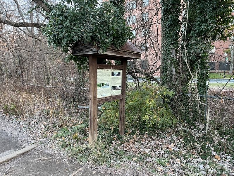
The B'nai Israel Synagogue, erected in 1876, is the longest actively-used synagoue in Baltimore. It was built by Congregation Chizuk Amuno ("Strengthening of the Faith"), whose members had seceded from the Baltimore Hebrew Congregation in 1870 to . . . — — Map (db m7074) HM
On Front Street, 0.1 miles north of Lombard Street, on the left when traveling south.
Charles Carroll of Carrollton (1737–1832), the last surviving, and only Roman Catholic signer of the Declaration of Independence, wintered here during the last twelve years of his life.
Built circa 1808, the mansion is the grandest . . . — — Map (db m3204) HM
On Fayette Street, on the right when traveling east.
On this site purchased in 1773,
the first permanent meeting house, a dwelling for the pastor and a school house were erected and a cemetery established for the First Baptist Church of Baltimore Town. The present and fourth building of the church is . . . — — Map (db m2599) HM
On Lloyd Street at Watson Street, on the right when traveling north on Lloyd Street.
The Lloyd Street Synagogue, dedicated in 1845, is the first synagogue erected in Maryland and the third oldest surviving synagogue in the United States. A simple, elegant building in the popular Greek Revival style, it was designed for the Baltimore . . . — — Map (db m7072) HM
On East Baltimore Street at North Aisquith Street on East Baltimore Street.
Before Baltimore's public school system opened in 1829, education was the concern of charitable and religious organizations. An early leader in the education movement was the McKim Free School, established through a bequest of Quaker merchant . . . — — Map (db m7071) HM
On East Baltimore Street, on the right when traveling west.
Coming from their camp at White Marsh in the early afternoon of Wednesday, 12 September 1781, the First Brigade of French forces, consisting of the infantry regiments Bourbonnais and Royal Deux-Ponts marched into Baltimore on Pulaski Highway [US . . . — — Map (db m166667) HM
On North Front Street at Fayette Street, on the right when traveling south on North Front Street.
St. Vincent de Paul Church is the oldest Catholic parish church in the city. The church was built in 1840-1841 to accommodate the growing Irish Catholic population east of the Jones Falls. Its gleaming white Georgian tower has long been recognized . . . — — Map (db m2600) HM
Third oldest Catholic Church in Baltimore. Noted for the rare purity of Georgian architecture. Cornerstone laid May 21, 1840 by Archbishop Eccleston and the bishops of the Fourth Provincial Council. Dedicated by Archbishop Eccleston November . . . — — Map (db m6301) HM
On South Exeter Street at Stiles Street, on the left when traveling south on South Exeter Street.
John A. Pica, 1924 - 2002, served his country in World War II, son of Antonio and Maria Grasso Pica; devoted brother to Francesco Pica, Marie Gaise, Josephine Nocar and Grace Licata; father of State Senator John A. Pica, Jr. and Maria. John . . . — — Map (db m162323) HM WM
On South Exeter Street at Stiles Street on South Exeter Street.
St. Leo the Great Church
1881
has been placed on the
National Register
of Historic Places
by the United States
Department of the Interior
— — Map (db m60982) HM
On South Exeter Street at Stiles Street, on the right when traveling north on South Exeter Street.
Remembering those who served: Korea, Vietnam, Persian Gulf
Remigio C. Alcaraz - V •
Donald Anderson - V •
Anthony Apicella - V •
Salvatore Aquia - V •
Arturo Aversa - K •
George Baccala - K •
Salvatore M. Barbieri - K •
Louis . . . — — Map (db m162322) WM
On South Exeter Street at Stiles Street, on the right when traveling north on South Exeter Street.
Thomas S. Andre •
George Courtney •
John Casey •
Charles Cherigo •
Theodore Votta •
Frank Votta, Jr. •
Agostino Palmisano •
Antonio Guarilla •
Giacomo Verderame •
Michele Milano •
Francesco Pelegi •
Edoardo Dente •
Nicola . . . — — Map (db m162315) WM
On North Haubert Street north of Key Highway East, on the right when traveling north.
Before 1821 immigrants from the German States, England, Ireland, Northern Ireland, Scotland, France, Haiti, as well as African slave arrived in Baltimore in relatively small numbers, fewer than 1,000 per year on average.
From 1821 to . . . — — Map (db m131173) HM
Near Ennis Parallel east of North Charles Street (Maryland Route 139), on the right when traveling east.
"While we place all our confidence in God, we must always act as if success depended on our own exertions. Do not fear offending anyone. Speak as your mind directs and always act with courage. Be ever ready to praise, to encourage, to . . . — — Map (db m212269) HM
Near West Cold Spring Lane west of North Charles Street (Maryland Route 139), on the right when traveling west.
Dorothy Day's compassion for the poor began in childhood when her family was forced to live in a Chicago tenement. She dropped out of the University of Illinois to move to New York, where she worked for several radical newspapers. Day was baptized . . . — — Map (db m212262) HM
Near West Cold Spring Lane west of North Charles Street (Maryland Route 139), on the right when traveling west.
Born into an affluent family in Haiti, Mary Elizabeth Lange fled to escape a revolution. She settled in Baltimore, where by 1818 she was educating black children in her own home. In 1828, Mary Elizabeth helped start the first black . . . — — Map (db m212266) HM
On West Cold Spring Lane west of North Charles Street (Maryland Route 139), on the right when traveling west.
Raised in New York high society, Elizabeth married a wealthy businessman, but was left a penniless widow with five children when his business failed and he died of tuberculosis. Elizabeth converted to Catholicism in 1805. To support her children and . . . — — Map (db m212265) HM
Near West Cold Spring Lane west of North Charles Street (Maryland Route 139), on the right when traveling west.
Robert was educated by Jesuits and entered the society in 1460. After teaching Greek, Hebrew and Theology in Louvain, Florence and Mondovi, he was sent to teach at the Roman College. He became Rector in 1592, Provincial of Naples in 1594 and was . . . — — Map (db m212250) HM
On West Cold Spring Lane west of North Charles Street (Maryland Route 139), on the right when traveling west.
Born in England, Robert entered the Society of Jesus in 1578 and was ordained in Rome in 1585, where he briefly served as Prefect of Studies at the English College. Robert was nearly arrested on his return to England, but eluded capture and spent . . . — — Map (db m212264) HM
Near West Cold Spring Lane west of North Charles Street (Maryland Route 139), on the right when traveling west.
Born into a noble family in Castile, Spain, Theresa lost her mother at age 14 and left home against her father's wishes to enter a Carmelite convent in 1535. Soon after, she began experiencing visions of God, angels and other spiritual entities. . . . — — Map (db m212260) HM
Near Ennis Parallel east of North Charles Street (Maryland Route 139), on the right when traveling east.
The trefoil copper cross previously graced the top of the Octagon Building, the original structure of Mount St. Agnes College in Baltimore's Mt. Washington area.
Mount St. Agnes College was founded in 1867 by the Sisters of Mercy, a Catholic . . . — — Map (db m212267) HM
The imposing Byzantine structure was built in 1891 for the Baltimore Hebrew Congregation, the oldest Jewish congregation in Maryland. The congregation was founded in 1830, four years after the Maryland General Assembly granted full political, civil . . . — — Map (db m173328) HM
On Eutaw Place at West Lafayette Avenue on Eutaw Place.
In pre-Civil War Baltimore, African Americans — such as Frederick Douglass, Daniel Coker, and William Watkins — wrote some of the earliest and most important abolitionist treatises. After the Civil War, African Americans founded the . . . — — Map (db m168825) HM
On North Eutaw Street at West Preston Street on North Eutaw Street.
Welcome to the Pennsylvania Avenue Heritage Trail – a journey through Baltimore’s premier historic African American community. Here you will meet civil rights leaders, artists and musicians, attend historic African American churches, and . . . — — Map (db m168818) HM
On Martin Luther King Boulevard at North Howard Street, on the right when traveling south on Martin Luther King Boulevard.
On this sacred and dedicated spot stood the historic
Trinity African Methodist Episcopal Church
who gave the world
Bishop Abraham Lincoln Gaines
General Officer Virnal C. Hodges
Presented Sunday May 26, 1963
by the brotherhood . . . — — Map (db m183389) HM
On West Preston Street west of Maryland Avenue, on the right when traveling west.
His eleven-year tenure as spiritual leader of the Annunciation Greek Orthodox community (1954-1965) will be remembered for numerous progressive ministries. Under his guidance, the establishment of this multi-purpose building in 1960 symbolized . . . — — Map (db m219706) HM
The circular stone church is one of the most unusual buildings in Baltimore. Designed by Charles E. Cassell in Romanesque style with Byzantine touches, it was built for the Associate Reformed Church in 1889. Eighteen polished granite columns . . . — — Map (db m102335) HM
On Park Avenue at North Howard Street, on the right when traveling east on Park Avenue.
Mount Vernon Cultural District provides an unequaled richness of cultural experience. Since the founding of the Peabody Institute in 1857, Mount Vernon has enjoyed a continuing association with the arts. Nineteenth Century Philanthropist George . . . — — Map (db m194805) HM
On Perring Parkway (Maryland Route 41) at Hillenwood Road, on the right when traveling east on Perring Parkway.
Welcome to Morgan State University
For over 140 years, Morgan State University has been an important part of the higher education system in Baltimore City, the State of Maryland, and the nation. Throughout its history, Morgan has served the . . . — — Map (db m145933) HM
The Taylor family, whose land holdings in area by end of 17th century were extensive, constructed of logs on this site c. 1770 a Quaker Meeting House, later used for Methodist services. It was razed when present stone chapel was built in 1853. . . . — — Map (db m114577) HM
On Cathedral Street at West Read Street, on the left when traveling south on Cathedral Street.
Emmanuel Church held its first service an dedication in October of 1854.
Fifty years thereafter, a series of architectural changes and additions began. The chancel was enlarged to provide choir seating and an organ. Above a marble altar, a . . . — — Map (db m183387) HM
On North Charles Street at Hamilton Street on North Charles Street.
Contrary to Baltimore’s 19th century conservative appearance, Baltimoreans created progressive, diverse communities that expanded the nation’s racial and religious freedom. By the time of the Civil War, Baltimore had the largest free African . . . — — Map (db m102390) HM
On East Mt. Vernon Place at North Charles Street, on the right when traveling west on East Mt. Vernon Place.
Author of The Star Spangled Banner departed this life on the site of this building Jan. 11, 1843.
“And this be our motto In God is our Trust” —Key — — Map (db m5558) HM
On Park Avenue, on the right when traveling north.
Built for Grace Church in 1852, this was one of the first Gothic Revival churches in the South to use Connecticut brownstone. St. Peter's Church, founded in 1802, and Grace Church, founded in 1850, were united in 1912. This union is symbolized by . . . — — Map (db m6013) HM
On Washington Place at East Mt. Vernon Place, on the right when traveling north on Washington Place.
Mount Vernon Cultural District provides an unequaled richness of cultural experience. Since the founding of the Peabody Institute in 1857, Mount Vernon has enjoyed a continuing association with the arts. Nineteenth Century Philanthropist George . . . — — Map (db m168789) HM
On Mount Vernon Place at North Charles Street on Mount Vernon Place.
[photo caption]
The Washington Monument, Baltimore. This view of Mount Vernon Place, circa 1848, shows the home of Charles and Phoebe Key Howard ot the right of the monument.
Conceived as a "Cathedral of Methodism" the Mount Vernon Place . . . — — Map (db m7948) HM
Near Washington Place, in the median. Reported permanently removed.
This bench was the famed make out spot of F Scott Fitzgerald, one of Mt. Vernon's most famous residents. The American author and playboy was known for bringing his dates here for a romantic rendezvous. Of course, this all happened after his wife, . . . — — Map (db m7722) HM
On North Calvert Street (Maryland Route 2), on the left when traveling north.
St. Ignatius Church opened August 15, 1856. Designed by Henry Hamilton Pittar and Louis L. Long, it was the second unit to be completed in the block-long complex that stretches from Madison to Monument Streets. In 1855, the porticoed central section . . . — — Map (db m6125) HM
On West Franklin Street (U.S. 40) at North Charles Street, on the right when traveling west on West Franklin Street.
In 1817, when Baltimore Town boasted 60,000 inhabitants and Mount Vernon Place was still a forest, a group of leading citizens met in the home of Henry Payson "to form a religious society and build a church for Christians who are Unitarian and . . . — — Map (db m7168) HM
On West Madison Street, on the right when traveling west.
Erected circa 1844 by the Mt. Zion Baptist Church. Sold in 1847 to the First Presbyterian Church (now at the corner of Madison and Park). In 1850, assigned to the African American members of the church, who renamed it Madison Street Presbyterian . . . — — Map (db m71892) HM
Near Smith Avenue west of Greely Road, on the right when traveling west.
In 1853, the Reverend Elias Heiner and George Gelbach, Jr. purchased several hundred acres called "Edwards and Wills Valleys and Hills" in Mt. Washington to establish a female college and German Reformed church.
Reverend Heiner and architect . . . — — Map (db m212274) HM
The Sunday School of the First Methodist Episcopal Church opened by the Asbury Sunday School Society November 17, 1816. Oldest Sunday School in Baltimore. Erected this tablet October 21 1916 in commemoration of the centenary of the Asbury Sunday . . . — — Map (db m102710) HM
On East Eager Street at Valley Street, on the right when traveling east on East Eager Street.
Founded on February 28, 1961 by the late Rev. Calvin English, Sr., this plaque commemorates the 60-year legacy of Sweet Prospect Baptist Church in being a pillar in Baltimore City by fostering spiritual development, family & community engagement, . . . — — Map (db m243542) HM
On North Caroline Street at East Oliver Street, on the right when traveling north on North Caroline Street.
On July 9, 1793, at 3:00 P.M. there arrived in the port of Baltimore at Fells Point a ship, The Guineaman, carrying blacks, slave and free, from Santo Domingo. They were French speaking and Catholic. They formed a Eucharistic community that would . . . — — Map (db m7568) HM
On North Caroline Street at East Oliver Street, on the right when traveling north on North Caroline Street.
Dedicated on February 21, 1864, St. Francis Xavier Catholic Church was the first black parish in the U.S. The church originated in the 1790s due to the efforts of the Sulpician Fathers and the Oblate Sisters of Providence to provide education and . . . — — Map (db m7563) HM
On East Baltimore Street at North Lakewood Avenue, on the left when traveling east on East Baltimore Street.
Rev. Walter T.W. McKenna, Chaplain, U.S.A.
Anthony Bosse ★ •
F.M. Costello ★ •
James Harper ★ •
Thomas Thim ★ •
Joseph Vogel ★
George Beil •
James J. Brenan •
Edward Black •
Thomas J. . . . — — Map (db m212975) WM
On Scott Street at Washington Blvd. on Scott Street.
Jim Caskey, who lived at 523 Scott Street, served his Southwest Baltimore neighbors in many ways. He co-founded and long served as Treasurer of the South Baltimore Federal Credit Union, which for many years was located in this building, 788 . . . — — Map (db m103204) HM
On South Poppleton Street just south of West Pratt Street, on the left when traveling east.
The Underground Railroad was a network of American abolitionists who aided and sheltered 100,000 African Americans seeking freedom from enslavement in the South. These Freedom Seekers often journeyed north by land, and many crossed into the free . . . — — Map (db m243532) HM
“The Church will have its glory in triumph in the colored race, and, for aught I know, be the salvation of this nation.” So stated the Rt. Reverend A.A. Curtis, Bishop of Wilmington, Delaware, in his dedication service for St. Peter . . . — — Map (db m101947) HM
This chapel designed by Maximilien Godefroy represents a unique combination of French Gothic and classical architecture; it was built of English brick and trimmed with Acquia Creek sandstone and stucco. The cornerstone was dedicated by Bishop . . . — — Map (db m7187) HM
Near North Paca Street (Maryland Route 129) at George Street, on the left when traveling north.
Drawing of historic seminary chapel by Maximilian Godefroy, c. 1806
The historic chapel of St. Mary's Seminary & University (est. 1791) was built by the Sulpician Fathers and dedicated in 1808. It was designed by Maximilian Godefroy and is . . . — — Map (db m220047) HM
Near North Paca Street, on the left when traveling north.
This house, built around 1807, was the home of Saint Elizabeth Bayley Seton, the first American-born canonized saint of the Roman Catholic Church.
Born in New York to a prominent Protestant family, Elizabeth Ann Bayley married William M. . . . — — Map (db m5986) HM
In 1882, when the present building of the Orchard Street Methodist Episcopal Church was dedicated, it was called “an honor to the colored race and handsome ornament to the city.” The Orchard Street congregation commissioned architect . . . — — Map (db m101925) HM
On North Paca Street (Route 129) just north of George Street, on the left when traveling north.
Existing Buildings
① St. Mary's Chapel - 1808
② Mother Seton House - 1808
③ Spiritual Center - 1898 (Former Convent of the Sisters of Divine Providence)
④ Visitors Center - 2009
Buildings . . . — — Map (db m220046) HM
Near North Paca Street (Maryland Route 129) north of George Street.
Here, at the One Mile Tavern, in 1791, the Fathers of St. Sulpice (Paris, France) founded St. Mary's, the first Roman Catholic Seminary in the United States. Maryland was then a center of Catholic activity, with Baltimore having been selected at . . . — — Map (db m7186) HM
On George Street, on the right when traveling west.
At this site, 610 George Street, under the leadership of foundress, Mother Mary Lange, four women took vows of consecrated chastity, evangelical poverty, and religious obedience. Thus began the Oblate Sisters of Providence, the first Congregation of . . . — — Map (db m5559) HM
On West Henrietta Street at South Sharp Street, on the right when traveling south on West Henrietta Street.
Solo Gibbs Park is at the center of an African American community that has existed in South Baltimore since the late 1700s. Prominent blacks associated with the neighborhood include abolitionist Frederick Douglass, youth-activities . . . — — Map (db m192385) HM
On Leadenhall Street at West Cross Street, on the right when traveling north on Leadenhall Street.
After the Civil War, a large number of black Baptists migrated to Baltimore. This church was organized in 1872 by black Baptists of the Sharp-Leadenhall area, with the help of the Maryland Baptist Union Association. It is the second oldest church . . . — — Map (db m6358) HM
Near West Hamburg Street, on the right when traveling west.
Solo Gibbs Park was created in 1979 when 1-395 was built. The 1869 Sachse Bird's Eye View Illustrated Map shows the once larger neighborhood where, since the late 1700s a free African American community lived, worked and worshipped along side . . . — — Map (db m6356) HM
Frances "Fanny" H. Peachy, like most women buried here, remains largely anonymous. The daughter of a local minister, Frances H. Andrews (1799-1822) married Baltimore saddlemaker Thomas G. Peachy on February 28, 1821. Less than a year later she . . . — — Map (db m6644) HM
On North Greene Street, on the left when traveling south.
Westminster's carriage gates, completed in 1815, were among the nation's first examples of Egyptian Revival architecture. Commissioned by the First Presbyterian Church, the gates were designed by Maximilian Godefroy (1765-ca.1840), a French . . . — — Map (db m6629) HM
Welcome to Westminster Burying Ground, one of Baltimore's oldest graveyards and the burial place of Edgar Allan Poe. This introduction is the first of many interpretive signs describing Westminster's origins and significance, and some of the . . . — — Map (db m6621) HM
On Druid Hill Avenue (Maryland Route 129) at West Lanvale Street, on the right when traveling south on Druid Hill Avenue.
The Bethel African Methodist Episcopal congregation is the oldest independent black institution in Baltimore. Its origins date back to the late 18th century, when blacks withdrew from the parent Methodist Church in protest against racially . . . — — Map (db m6237) HM
In the 1930s, Old West Baltimore matured into a self-sustaining, thriving community that nurtured the mind, body and spirit. Old West Baltimore was home to many churches, shops, professional offices, banks and financial institutions, educational . . . — — Map (db m168766) HM
Communities grow in direct proportion to their access to capital. Potential homebuyers and business owners in Old West Baltimore needed access to money. In 1896, Everett J. Waring, along with some of Baltimore’s most prominent African Americans, . . . — — Map (db m168768) HM
On Dolphin Street at Etting Street on Dolphin Street.
Churches serve as more than places of worship in Baltimore’s black communities. Led by strong clergy, African American churches have nurtured the soul, fed, clothed, and housed the poor, fought for civil rights, supported business and job . . . — — Map (db m168821) HM
On Druid Hill Avenue (Maryland Route 129) at West Lafayette Avenue, on the right when traveling north on Druid Hill Avenue.
This is a community park developed by the Special Impact Neighborhood Improvement Program and the Department of Recreatoin and Parks dedicated to the memory of Henry Highland Garnet by the Henry Highland Garnet Neighborhood Council.
Henry . . . — — Map (db m6236) HM
On Druid Hill Avenue (Maryland Route 129) at West Lanvale Street, on the right when traveling south on Druid Hill Avenue. Reported missing.
Servant of God, Champion of the People, Mother of Freedom May 25, 1976 Erected by the Association for Study of Afro-American Life and History In Cooperation with the Amoco Foundation, Inc. — — Map (db m6238) HM
708 entries matched your criteria. Entries 101 through 200 are listed above. ⊲ Previous 100 — Next 100 ⊳