745 entries match your criteria. Entries 201 through 300 are listed.⊲ Previous 100 — Next 100 ⊳
Mexican-American War Topic
By Bill Pfingsten, June 8, 2012
Lincoln's Decatur Ally and Oglesby Mansion
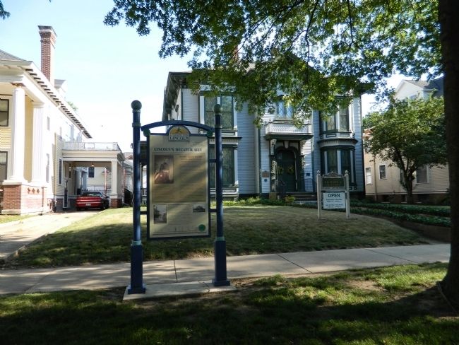
| 201 ► Illinois, Macon County, Decatur — Lincoln's Decatur Ally — Looking for Lincoln — |
| On West Williams Street at North Edwards Street on West Williams Street. | |||
| 202 ► Illinois, Macoupin County, Carlinville — Six - Pounder — |
| On East 1st South Street (State Road 108) east of East Main Street, on the left when traveling east. | |||
| 203 ► Illinois, Madison County, Edwardsville — Governor Thomas Ford — 1842-1846 — |
| On South Main Street (Illinois Route 159) south of West Schwartz Street, on the right when traveling south. | |||
| 204 ► Illinois, Madison County, Godfrey — 8 — Godfrey Cemetery — |
| Near Mulberry Street west of Godfrey Road (U.S. 67). | |||
| 205 ► Illinois, Monroe County, Columbia — Memorial in honor of our sons and daughters — |
| On East Locust Street at Memorial Drive, on the left when traveling east on East Locust Street. | |||
| 206 ► Illinois, Monroe County, Monroe City — William H. Bissell — |
| On Bluff Road, 0 miles south of KK Road, on the left. | |||
| 207 ► Illinois, Monroe County, Waterloo — Early Politicians — |
| On North Main Street south of First Street, on the left when traveling south. | |||
| 208 ► Illinois, Morgan County, Jacksonville — Stephen Arnold Douglas — |
| Near West Morton Avenue (Illinois Route 104) east of South West Street. | |||
| 209 ► Illinois, Morgan County, Jacksonville — Whig Rivals and Friends — Looking for Lincoln — |
| On E. State Street at Hardin Avenue on E. State Street. | |||
| 210 ► Illinois, Sangamon County, Springfield — Camp Butler National Cemetery — |
| On Second Dr S north of South Camp Butler Road. | |||
| 211 ► Illinois, Shelby County, Shelbyville — Soldiers and Sailors Monument — Shelby County War Memorial — |
| On East Main Street at South Washington Street, on the left when traveling west on East Main Street. | |||
| 212 ► Illinois, St. Clair County, New Athens — Honor — |
| On North Johnson Street at Chester Street, on the right when traveling east on North Johnson Street. | |||
| 213 ► Illinois, Vermilion County, Rossville — In Honor of Those Who Served — Rossville War Memorial — |
| On South Chicago Avenue (Illinois Route 1) at Dale Avenue, on the right when traveling north on South Chicago Avenue. | |||
| 214 ► Illinois, Winnebago County, Rockford — Memorial Hall — |
| On North Main Street south of West Jefferson Street, on the right when traveling north. | |||
| 215 ► Indiana, Adams County, Decatur — Adams County Peace Monument and Veterans Wall of Honor — |
| On Court Street at South 3rd Street, on the right when traveling west on Court Street. | |||
| 216 ► Indiana, Clinton County, Frankfort — Clinton County (Indiana) War Memorial — |
| On East Clinton Street east of South Main Street, on the left when traveling east. | |||
| 217 ► Indiana, Floyd County, New Albany — 22.1966.1 — Site of Camp Whitcomb — |
| On Ohio River Scenic Byway (Old State Road 62) at Beharrell Avenue, on the right when traveling east on Ohio River Scenic Byway. | |||
| 218 ► Indiana, Howard County, Kokomo — Memorial To The Patriots of 1776 — |
| On South Washington Street (Indiana Route 22) at West Superior Street, on the right when traveling south on South Washington Street. | |||
| 219 ► Indiana, Marion County, Indianapolis, Mile Square — James Whitcomb — |
| On Monument Circle south of West Market Street, on the left when traveling south. | |||
| 220 ► Indiana, Marion County, Indianapolis, Mile Square — Soldiers and Sailors Monument — |
| On Monument Circle. | |||
| 221 ► Indiana, Marion County, Indianapolis, Mile Square — Veterans Memorial Plaza — Obelisk Square — Indiana War Memorial Plaza National Historic Landmark — |
| On North Meridian Street at East North Street, on the right when traveling north on North Meridian Street. | |||
| 222 ► Indiana, Marion County, Indianapolis, Wholesale District — Lew Wallace — |
| On West Georgia Street west of South Meridian Street, in the median. | |||
| 223 ► Indiana, Monroe County, Bloomington — G.A.R. Soldiers of All Wars Memorial — |
| On North Walnut Street at West Kirkwood Avenue, on the left when traveling north on North Walnut Street. | |||
| 224 ► Indiana, Montgomery County, Waynetown — Old Pioneer Cemetery — |
| On U.S. 136 at State Road 25, on the left when traveling east on U.S. 136. | |||
| 225 ► Indiana, Ohio County, Rising Sun, Randolph Township — Mexican War (1846-1848) — |
| Near South Front Street north of 2nd Street, on the right when traveling north. | |||
| 226 ► Indiana, Rush County, Rushville — Mexican War — 1846-1848 — |
| On North Park Boulevard west of North Main Street (Indiana Route 3), on the left when traveling north. | |||
| 227 ► Indiana, Tippecanoe County, Lafayette — Tippecanoe County War Memorial — |
| Near Scott Street north of Main Street. | |||
| 228 ► Indiana, Whitley County, Churubusco — Here's how Churubusco got its name — |
| On Lincoln Highway (U.S. 33) at East State Street (Indiana Route 205), on the left when traveling north on Lincoln Highway. | |||
| 229 ► Kansas, Barton County, Pawnee Rock — Nehemiah Carson — 1826 - 1846 — |
| 230 ► Kansas, Bourbon County, Fort Scott — "Hardy, Dashing Looking Fellows" — |
| Near Old Fort Boulevard. | |||
| 231 ► Kansas, Bourbon County, Fort Scott — Infantry Life — |
| Near Old Fort Boulevard. | |||
| 232 ► Kansas, Ford County, Howell — Santa Fe Trail, 1821 - 1880 — |
| 233 ► Kansas, Geary County, Fort Riley, Main Post — In Memory of the Gallant Dead of the Second U.S. Cavalry — |
| Near Sheridan Avenue at Forsyth Avenue. | |||
| 234 ► Kansas, Grant County, Hugoton — The Mormon Battalion at Cimarron Springs (Wagon Bed Springs) — |
| On State Highway 25, 0.3 miles north of County Road 12S, on the left when traveling north. | |||
| 235 ► Kansas, Johnson County, Olathe — Elm Grove Campground — |
| On Old US-Highway 56, 0.1 miles east of West 151st Street, on the right when traveling west. | |||
| 236 ► Kansas, Johnson County, Olathe — Lone Elm Campground — |
| On Lone Elm Park Drive, on the right when traveling south. | |||
| 237 ► Kansas, Johnson County, Olathe — The Travelers — |
| 238 ► Kansas, Johnson County, Shawnee — Fort Leavenworth Military Road — |
| On Shawnee Mission Parkway near Melrose Lane, on the right when traveling east. | |||
| 239 ► Kansas, Johnson County, Shawnee — Gum Springs — |
| On Shawnee Mission Parkway near Melrose Lane, on the right when traveling east. | |||
| 240 ► Kansas, Leavenworth County, Fort Leavenworth — Grant — |
| On Grant Avenue at Riverside Drive, on the left when traveling north on Grant Avenue. | |||
| 241 ► Kansas, McPherson County, McPherson — The Mormon Battalion at McPherson, Kansas — |
| On Interstate 135, 4 miles south of Exit 72 (Interstate 135), on the left when traveling south. | |||
| 242 ► Kansas, Morris County, Council Grove — The Mormon Battalion at Council Grove, Kansas — |
| 243 ► Kansas, Pawnee County, Fort Larned National Historic Site — The Great Wagon Road to the Southwest — Santa Fe Trail 1821-1880 — |
| 244 ► Kansas, Pawnee County, Larned — The Mormon Battalion at Larned, Kansas — |
| On State Highway 156, on the left when traveling west. | |||
| 245 ► Kansas, Sedgwick County, Wichita — French Tricolor — Bicentennial Flag Memorial — |
| 246 ► Kansas, Sumner County, Wellington — Bronze Field Guns — |
| On North Washington Avenue (Business U.S. 81) at West 7th Street, on the right when traveling south on North Washington Avenue. | |||
| 247 ► Kentucky, Adair County, Columbia — 604 — Col. Frank L. Wolford — |
| On Public Square at Campbellsville Street (Kentucky Route 55), on the left when traveling east on Public Square. | |||
| 248 ► Kentucky, Boone County, Richwood — 1194 — Major John P. Gaines — |
| On Richwood Road (Kentucky Route 338), on the right when traveling west. | |||
| 249 ► Kentucky, Boyle County, Danville — 24 — Poet, Lawyer and Soldier / Theodore O'Hara — |
| On West Main Street at North 4th Street, on the right when traveling west on West Main Street. | |||
| 250 ► Kentucky, Campbell County, Newport — 599 — Newport Barracks — |
| On Riverboat Row, 0.1 miles west of Columbia Street, on the right when traveling south. | |||
| 251 ► Kentucky, Carroll County, Carrollton — General William Orlando Butler — Soldier - Statesman - Lawyer — |
| Near General Butler Park Road east of 11th Street (aka: St. Rd. 320). | |||
| 252 ► Kentucky, Carroll County, Carrollton — 634 — Home of Gen. Butler — |
| On Fifth Street north of U.S. 42, on the left when traveling north. | |||
| 253 ► Kentucky, Christian County, Hopkinsville — 882 — Union General's Grave — |
| On North Main Street at Clark Avenue, on the right when traveling north on North Main Street. | |||
| 254 ► Kentucky, Fayette County, Lexington, Gratz Park — 3 — Morgan House — |
| On North Mill Street at West 2nd Street, on the right when traveling south on North Mill Street. | |||
| 255 ► Kentucky, Fayette County, Lexington, Northside District — 741 — U.S. Vice President — |
| On Cheapside at West Short Street on Cheapside. | |||
| 256 ► Kentucky, Franklin County, Frankfort — The Texas War of Independence 1836 — The Mexican War 1846 - 1844 — |
| On East Main Street, on the right when traveling east. | |||
| 257 ► Kentucky, Green County, Greensburg — General Edward Henry Hobson — |
| On Henry Street at Hodges Street, on the right when traveling east on Henry Street. | |||
| 258 ► Kentucky, Green County, Greensburg — 1082 — Unique Father and Son — |
| On E. Columbia Avenue (State Highway 417) east of S. Depot Street, on the right when traveling east. | |||
| 259 ► Kentucky, Hart County, Munfordville — 1236 — Hart County, 1819 — |
| On Dixie Highway / Main Street (U.S. 31W) south of Union Street (State Road 357), on the left when traveling south. | |||
| 260 ► Kentucky, Jefferson County, Louisville — 1849 — Zachary Taylor Home — |
| On Apache Road. | |||
| 261 ► Kentucky, Jefferson County, Louisville — 1412 — Zachary Taylor National Cemetery — |
| On Brownsboro Road (U.S. 42), on the right when traveling west. | |||
| 262 ► Kentucky, Logan County, Russellville — 6 Pdr Field Cannon — Model 1842 — |
| Near North Main Street at West 4th Street (Business U.S. 68), on the left when traveling north. | |||
| 263 ► Kentucky, Mason County, Maysville — 877 — Alexander W. Doniphan — |
| On Clarks Run Road at Business U.S. 68, on the right when traveling west on Clarks Run Road. | |||
| 264 ► Kentucky, Mason County, Maysville — Gen. Albert Sidney Johnston — |
| On Old Main Street (Kentucky Route 2515) at North Court Street on Old Main Street. | |||
| 265 ► Kentucky, McCracken County, Paducah — 864 — Liberty of Texas 1836 / Mexican-American War 1846-48 — |
| On North 6th Street just south of Park Avenue (Business U.S. 60), on the left when traveling south. | |||
| 266 ► Kentucky, Oldham County, Crestwood — 2470 — Richard James Oglesby — |
| On State Highway 329, 0.1 miles north of Old Zaring Road, on the right when traveling north. | |||
| 267 ► Kentucky, Todd County, Fairview — Zero Milestone Jefferson Davis Highway — |
| On Jefferson Davis Highway near Pembroke-Fairview Road (Route 115), on the right when traveling east. | |||
| 268 ► Kentucky, Woodford County, Midway — Mexican War – Civil War – Spanish-American War — Midway Veterans Memorial — |
| Near West Stephens Street, 0.1 miles west of Circle Drive, on the right when traveling east. | |||
| 269 ► Louisiana, Ascension Parish, Gonzales — Mexico Will Poison Us — Ralph Waldo Emerson — |
| Near South Irma Boulevard, 0.3 miles north of East Worthey Street, on the right when traveling north. | |||
| 270 ► Louisiana, Ascension Parish, Gonzales — The Mexican-American War — The Louisiana Connection — |
| Near South Irma Boulevard, 0.3 miles north of East Worthey Street, on the right when traveling north. | |||
| 271 ► Louisiana, Ascension Parish, Gonzales — The Mexican-American War — 1846-1848 — |
| Near South Irma Boulevard, 0.3 miles north of East Worthey Street, on the right when traveling north. | |||
| 272 ► Louisiana, East Baton Rouge Parish, Baton Rouge, Downtown — Zachary Taylor — |
| On North 3rd Street at Spanish Town Road, on the left when traveling south on North 3rd Street. | |||
| 273 ► Louisiana, East Baton Rouge Parish, Baton Rouge, Downtown — 1 — Zachary Taylor Home Site — |
| On Lafayette Street west of North 3rd Street, on the right when traveling south. | |||
| 274 ► Louisiana, Natchitoches Parish, Natchitoches — Site of Camp Salubrity — |
| On Highway 3175 Bypass (State Highway 6) at Breazeale Springs Street, on the left when traveling east on Highway 3175 Bypass. | |||
| 275 ► Louisiana, Natchitoches Parish, Natchitoches — The American Transition — |
| On 2nd Street at Sibley Street, on the left when traveling north on 2nd Street. | |||
| 276 ► Louisiana, Orleans Parish, New Orleans, French Quarter — The Washington Artillery Park — American Revolution Bicentennial: 1776-1976 — |
| On Decatur Street east of St. Peter Street, on the right when traveling east. | |||
| 277 ► Louisiana, Orleans Parish, New Orleans, Garden District — Jefferson Davis — |
| On First Street at Camp Street on First Street. | |||
| 278 ► Louisiana, Orleans Parish, New Orleans, Iberville — Jordan B. Noble — "Old Jordon" (1800-1890) — Drummer, Veteran of Four American Wars — |
| Near North Claiborne Avenue at Iberville Street. | |||
| 279 ► Louisiana, Rapides Parish, Pineville — Alexandria National Cemetery — |
| Near East Shamrock Street (Business U.S. 165) near Main Street, on the left when traveling south. | |||
| 280 ► Louisiana, Sabine Parish, Many — El Camino Real — Kings Highway — Old San Antonio Road — |
| On Old Louisiana 6 (State Highway 485) at Geoghangan Road, on the right when traveling north on Old Louisiana 6. | |||
| 281 ► Louisiana, Sabine Parish, Many — Fort Jesup — |
| On Old Louisiana 6 (State Highway 3118) at Geoghangan Road, on the right when traveling north on Old Louisiana 6. | |||
| 282 ► Maine, Cumberland County, Cape Elizabeth — Battery Blair — |
| 283 ► Maine, Cumberland County, Portland, East Bayside — Rear Admiral James Alden — |
| Near Eastern Cemetery west of Montford Street. | |||
| 284 ► Maryland, Anne Arundel County, Annapolis — El Neptuno — |
| 285 ► Maryland, Anne Arundel County, Annapolis — Mexican War Midshipmen's Monument — Mexican War Monument — |
| 286 ► Maryland, Anne Arundel County, Annapolis — San Cayetano — |
| On Blake Road near Maryland Avenue, on the left when traveling west. | |||
| 287 ► Maryland, Anne Arundel County, Annapolis — Spanish 18-Pounder — |
| On Blake Road near Maryland Avenue, on the left when traveling west. | |||
| 288 ► Maryland, Anne Arundel County, Annapolis — Spanish Gun — |
| Near Porter Road east of Buchanan Road, on the right when traveling west. | |||
| 289 ► Maryland, Anne Arundel County, Annapolis — St. Damian — |
| 290 ► Maryland, Anne Arundel County, Annapolis — St. Joseph — |
| 291 ► Maryland, Anne Arundel County, Fort Meade — Chapultepec Avenue — |
| On Mapes Road at 6th Armored Cavalry Road, on the right when traveling east on Mapes Road. | |||
| 292 ► Maryland, Baltimore, Reservoir Hill — Memorial to Marylanders Killed in War with Mexico — "Watson Monument" — |
| On Mount Royal Terrace at North Avenue (U.S. 1), on the right on Mount Royal Terrace. | |||
| 293 ► Maryland, Baltimore County, Owings Mills — In Memory of William Maxwell Wood, MD — |
| Near St. Thomas Lane at Garrison Forest Road. | |||
| 294 ► Maryland, Dorchester County, Cambridge — This Bell — |
| On High Street at Court Lane, on the right when traveling north on High Street. | |||
| 295 ► Maryland, Montgomery County, Silver Spring, Forest Glen — General George W. Getty, U.S.A. — |
| Near Belvedere Boulevard at Woodland Drive, on the right when traveling east. | |||
| 296 ► Maryland, Prince George's County, Berwyn Heights — Carrington Avenue — |
| On Osage Street at Edmonston Road, on the left when traveling west on Osage Street. | |||
| 297 ► Maryland, Prince George's County, Greenbelt — Toaping Castle — (Circa 1750) — |
| On Walker Drive at Capitol Drive, on the right when traveling north on Walker Drive. | |||
| 298 ► Maryland, St. Mary's County, Charlotte Hall — Rear Admiral Raphael Semmes C.S.N. |
| On Charlotte Hall Road south of Charlotte Hall School Road, on the left when traveling south. Reported permanently removed. | |||
| 299 ► Maryland, Washington County, Boonsboro — Maj. Gen. Jesse L. Reno — |
| On Reno Monument Road at the Appalachian Trail, on the left when traveling west on Reno Monument Road. | |||
| 300 ► Maryland, Washington County, Hagerstown — 1830-1850 — Western Expansion and Era of Reform — |
| On West Memorial Boulevard just west of South Potomac Street (Maryland Route 65), on the right when traveling west. | |||
745 entries matched your criteria. Entries 201 through 300 are listed above. ⊲ Previous 100 — Next 100 ⊳