After filtering for Kansas, 312 entries match your criteria. The first 100 are listed. ⊳
Roads & Vehicles Topic
By William Fischer, Jr., May 17, 2015
Andrews Auto Stores Marker
| 1 ► Kansas, Allen County, Iola — Andrews Auto Stores — |
| On Jackson Street at North Street, on the right when traveling west on Jackson Street. | |||
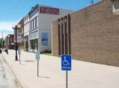
| 2 ► Kansas, Allen County, Iola — East Jackson Street Businesses — |
| On Jackson Street east of North Street, on the left when traveling east. | |||
| 3 ► Kansas, Allen County, Iola — Intersection of Madison and Washington — |
| On Madison Avenue (U.S. 54) at Washington Street, on the left when traveling west on Madison Avenue. | |||
| 4 ► Kansas, Allen County, Iola — Madison Avenue and the Allen County Courthouse — |
| On Madison Avenue (U.S. 54) west of South Street, on the left when traveling west. | |||
| 5 ► Kansas, Allen County, Iola — Views of Madison Avenue — |
| On Washington Street north of Madison Avenue, on the right when traveling south. | |||
| 6 ► Kansas, Atchison County, Atchison — Butterfield's Overland Dispatch — |
| On Commerce Street, 0.1 miles west of 2nd St, on the right when traveling east. | |||
| 7 ► Kansas, Atchison County, Atchison — 5 — Massasoit House — Company and Division Headquarters, Added Station — Sep. 14, 1861 - Nov. 20, 1861 — |
| On Main Street at 3rd Street, on the left when traveling east on Main Street. | |||
| 8 ► Kansas, Barber County, Medicine Lodge — Gypsum Hills Scenic Byway — |
| On U.S. 160, 0.6 miles west of Bitter Creek Road, on the right when traveling west. | |||
| 9 ► Kansas, Barton County, Claflin — Wetlands & Wildlife National Scenic Byway — |
| On Front Street (State Highway 4) west of 4th Street, on the right when traveling west. | |||
| 10 ► Kansas, Barton County, Great Bend — Site of Fort Zarah — 1822 - 1872 — |
| On U.S. 56, on the left when traveling east. | |||
| 11 ► Kansas, Barton County, Pawnee Rock — "A Rallying Point for the Indians" — |
| 12 ► Kansas, Barton County, Pawnee Rock — "A Remarkable Rocky Point" — |
| 13 ► Kansas, Barton County, Pawnee Rock — "Along Came the Line of Wagons" — |
| 14 ► Kansas, Barton County, Pawnee Rock — “One of the Grandest Sights Ever Beheld” — |
| 15 ► Kansas, Barton County, Pawnee Rock — “One of the Grandest Sights Ever Beheld” — |
| 16 ► Kansas, Barton County, Pawnee Rock — Marking the Rock — |
| 17 ► Kansas, Barton County, Pawnee Rock — 71 — Pawnee Rock — |
| On U.S. 56 at SW 70th Road / County Line Road, on the left when traveling west on U.S. 56. | |||
| 18 ► Kansas, Barton County, Pawnee Rock — Santa Fe Trail — 1822 - 1872 — |
| On U.S. 56, on the right when traveling east. | |||
| 19 ► Kansas, Barton County, Pawnee Rock — Santa Fe Trail — 1822 - 1872 — |
| 20 ► Kansas, Barton County, Pawnee Rock — 50 — Santa Fe Trail — |
| On SW 112th Avenue/Center Street, 0.4 miles north of Bismark Avenue, on the left when traveling north. | |||
| 21 ► Kansas, Barton County, Pawnee Rock — Santa Fe Trail Monument — |
| 22 ► Kansas, Barton County, Pawnee Rock — William Becknell — |
| 23 ► Kansas, Butler County, El Dorado — Pole Trailer — |
| 24 ► Kansas, Butler County, El Dorado — Star Drilling Machine — |
| 25 ► Kansas, Butler County, El Dorado — The Gypsy Spudder — |
| 26 ► Kansas, Chase County, Cottonwood Falls — Connecting the Chase County Community — from the Historic Chase County Courthouse to the — Tallgrass Prairie National Preserve — |
| On Broadway at Mill Street, on the right when traveling north on Broadway. | |||
| 27 ► Kansas, Cherokee County, Baxter Springs — 49 — Baxter Springs Massacre — |
| On U.S. 69/400, 0.2 miles south of SE Varck Road, on the right when traveling south. | |||
| 28 ► Kansas, Cherokee County, Baxter Springs — Café on the Route, Baxter Springs, Kansas — Route 66 Roadside Attraction — |
| On Military Avenue (U.S. 69) at 11th Street, on the right when traveling south on Military Avenue. | |||
| 29 ► Kansas, Cherokee County, Baxter Springs — Phillips 66 Petroleum Company Gas Station — |
| On Military Avenue at 10th Street, on the right when traveling north on Military Avenue. | |||
| 30 ► Kansas, Cherokee County, Baxter Springs — The Earliest Residents — Native Americans find healthy spring waters — |
| On West 2nd Street near Willow Avenue (Old U.S. 66), on the right when traveling east. | |||
| 31 ► Kansas, Cherokee County, Baxter Springs — Veterans Memorial — |
| On East Avenue south of 7th Street, on the left when traveling south. | |||
| 32 ► Kansas, Cherokee County, Galena — Galena Chamber of Commerce, Galena, Kansas — Route 66 Roadside Attraction — |
| On Main Street (Historic US Route 66) near 5th Street, on the right when traveling south. | |||
| 33 ► Kansas, Cherokee County, Galena — Galena Growth And Change — From Mining Trucks To Classic Cars Along Route 66 — |
| On South Main Street just south of West 5th Street, on the right when traveling south. | |||
| 34 ► Kansas, Cherokee County, Galena — Galena, Kansas — Founded in 1877 — Will Rogers Highway - US Route 66 — |
| On Main Street at 5th Street, on the right when traveling south on Main Street. | |||
| 35 ► Kansas, Cherokee County, Galena — Mining And Its Impacts — Creating Healthy Environments For The Future — |
| On South Main Street just south of West 5th Street, on the right when traveling south. | |||
| 36 ► Kansas, Cherokee County, Galena — Route 66 Howard 'Pappy' Litch Park — Welcome To Galena Kansas — |
| On South Main Street at West 5th Street, on the right when traveling south on South Main Street. | |||
| 37 ► Kansas, Cherokee County, Galena — The Kansas Route 66 Historic District, East of Galena — |
| On Front Street (Old U.S. 66) 0.3 miles east of Joplin Street, on the right when traveling west. | |||
| 38 ► Kansas, Cherokee County, Galena — Welcome To Galena — Cars, Parks, And Nature Ensure You Get Your Kicks In Galena — |
| On South Main Street just south of West 5th Street, on the right when traveling south. | |||
| 39 ► Kansas, Cherokee County, Riverton — Boom Towns — Kansas Historic Route 66 Byway — |
| On U.S. 400 at State Highway 66, on the right when traveling south on U.S. 400. | |||
| 40 ► Kansas, Cherokee County, Riverton — Bridging the American Divide — Kansas Historic Route 66 Byway — |
| On U.S. 400 at State Highway 66, on the right when traveling south on U.S. 400. | |||
| 41 ► Kansas, Cherokee County, Riverton — Crossroads of Kansas — Kansas Historic Route 66 Byway — |
| On U.S. 400 at State Highway 66, on the right when traveling south on U.S. 400. | |||
| 42 ► Kansas, Cherokee County, Riverton — Land's Legacy — Kansas Historic Route 66 Byway — |
| On U.S. 400 at State Highway 66, on the right when traveling south on U.S. 400. | |||
| 43 ► Kansas, Cherokee County, Riverton — Marsh Rainbow Arch Bridge — |
| On South East Beasley Road, on the right when traveling west. | |||
| 44 ► Kansas, Cherokee County, Riverton — Where Two Roads Converge — Military roads to cruising roadsters — |
| On U.S. 400 at State Highway 66, on the right when traveling south on U.S. 400. | |||
| 45 ► Kansas, Clay County, Clay Center — M60 Tank — |
| On 6th Street (State Highway 15) at Grant Avenue, on the right when traveling north on 6th Street. | |||
| 46 ► Kansas, Crawford County, Franklin — Franklin - Arma Sidewalk — |
| On 5th Street near Broadway Street (Business U.S. 69), on the right when traveling east. | |||
| 47 ► Kansas, Crawford County, Franklin — Franklin Sidewalk — National & State Historic Site — |
| On Broadway (Business U.S. 69) at 7th Street, on the left when traveling south on Broadway. | |||
| 48 ► Kansas, Crawford County, Pittsburg — Fuller American Legion Post #64 Veterans Memorial — |
| On Joplin Street near 29th Street, on the left when traveling north. | |||
| 49 ► Kansas, Crawford County, Pittsburg — The Old Military Road of 1837 — |
| On Bypass U.S. 69 at State Highway 171, on the right when traveling north on U.S. 69Bypass . | |||
| 50 ► Kansas, Dickinson County, Abilene — Texas Cattle Trail — |
| On Buckeye Avenue (State Highway 15) at 3rd Street, on the right when traveling north on Buckeye Avenue. | |||
| 51 ► Kansas, Dickinson County, Abilene — The Old Chisholm Trail — |
| On Buckeye Avenue (State Highway 15) at Texas Street, on the left when traveling north on Buckeye Avenue. | |||
| 52 ► Kansas, Dickinson County, Chapman — The Butterfield Trail — |
| 53 ► Kansas, Dickinson County, Solomon — Shady Lane Drive — |
| On East 4th Street (Old U.S. 40) at 2200 Avenue, in the median on East 4th Street. | |||
| 54 ► Kansas, Doniphan County, Highland — 6 — A Dangerous Coexistence — |
| 55 ► Kansas, Doniphan County, Highland — Cooperation and Conflict on the Trail — |
| 56 ► Kansas, Doniphan County, Highland — The Oregon-California Trail — |
| 57 ► Kansas, Doniphan County, Highland — The Wolf River Crossing — |
| 58 ► Kansas, Doniphan County, Troy — Troy — Added Station — Jul. 1, 1861 - Sep. 13, 1861 — |
| On U.S. 36 near Ottumwa Road, on the left when traveling west. | |||
| 59 ► Kansas, Douglas County, Baldwin City — 8 — Baldwin — |
| On U.S. 56, 0.1 miles east of North 250th Road, on the right. | |||
| 60 ► Kansas, Douglas County, Baldwin City — Black Jack Park — |
| On U.S. 56, 0.1 miles East 2000 Road, on the left when traveling west. | |||
| 61 ► Kansas, Douglas County, Baldwin City — Ivan L. Boyd Memorial Prairie Preserve — |
| On N 200th Road (U.S. 56) east of E 2000th Road, on the right when traveling east. | |||
| 62 ► Kansas, Douglas County, Baldwin City — Santa Fe Trail — |
| On Eisenhower Street at Palmyra Lane, on the left when traveling north on Eisenhower Street. | |||
| 63 ► Kansas, Douglas County, Baldwin City — Santa Fe Trail — |
| On U.S. 56, 0.1 miles East 2000 Road, on the left when traveling west. | |||
| 64 ► Kansas, Douglas County, Baldwin City — Trail Park — |
| On North 6th Street at North 400 Road, on the left when traveling north on North 6th Street. | |||
| 65 ► Kansas, Douglas County, Centropolis — Globe — |
| On Lake Road at N 400 Road, on the right when traveling south on Lake Road. | |||
| 66 ► Kansas, Douglas County, Eudora — 736 Main Street — |
| On Main Street north of 8th Street, on the right when traveling north. | |||
| 67 ► Kansas, Douglas County, Globe — Santa Fe Trail Crossed Here — |
| On U.S. 56, on the left when traveling west. | |||
| 68 ► Kansas, Douglas County, Kanwaka — Coon Point — Oregon Trail — 1842 — |
| On U.S. 40 at E 600 Road (County Route 1029), on the right when traveling west on U.S. 40. | |||
| 69 ► Kansas, Douglas County, Lawrence — California and Oregon Trails Memorial — |
| On Crescent Road at West Campus Road, on the right when traveling east on Crescent Road. | |||
| 70 ► Kansas, Douglas County, Lawrence — The Victory Eagle — |
| On Jayhawk Boulevard north of 14th Street, on the left when traveling north. | |||
| 71 ► Kansas, Douglas County, Lecompton — Purple Heart Trail in Kansas — "Freedom Isn't Free" — |
| On Purple Heart Trail (Interstate 70) west of State Highway 40, on the right when traveling west. | |||
| 72 ► Kansas, Douglas County, Overbrook — Santa Fe Trail — |
| On E550 Road at N400 Road, on the right when traveling south on E550 Road. | |||
| 73 ► Kansas, Edwards County, Ardell — 58 — Santa Fe Trail — 1822-1872 — |
| On U.S. 50/56, 0.5 miles west of 50th Avenue (County Road 9), on the left when traveling west. | |||
| 74 ► Kansas, Edwards County, Kinsley — 60 — Santa Fe Trail — 1822-1872 — |
| On U.S. 50, 0.1 miles east of 90th Avenue (Winchester Avenue), on the left when traveling east. | |||
| 75 ► Kansas, Edwards County, Offerle — 61 — Santa Fe Trail — 1822-1872 — |
| On U.S. 50/56 just west of South Walnut Street, on the right when traveling west. | |||
| 76 ► Kansas, Edwards County, Offerle — The Dry Route of the Santa Fe Trail — |
| On U.S. 50/56 just west of South Walnut Street, on the right when traveling west. | |||
| 77 ► Kansas, Ellis County, Ellis — Ellis' Original Main Street — |
| On 9th Street near Washington Street, on the left when traveling west. | |||
| 78 ► Kansas, Ellis County, Hays — Fort Hays - Fort Dodge Road Trailhead — 1867 - 1872 — |
| 79 ► Kansas, Finney County, Garden City — Santa Fe Trail — 1822-1872 — |
| Near East Fulton Street (Business U.S. 50) just east of Campus Drive, on the right when traveling east. | |||
| 80 ► Kansas, Finney County, Garden City — 73 — Santa Fe Trail — 1822 - 1872 — |
| On Maple Street at 6th Street, on the right when traveling east on Maple Street. | |||
| 81 ► Kansas, Finney County, Holcomb — Crossing of Santa Fe Trail — |
| On Park Drive just west of North Jones Avenue (Old U.S. 50), on the left when traveling south. | |||
| 82 ► Kansas, Ford County, Bloom — 96 — Fort Dodge - Camp Supply Military Road — |
| On U.S. 54 at Bloom Road, on the right when traveling west on U.S. 54. | |||
| 83 ► Kansas, Ford County, Dodge City — Dodge City, full of excitement — |
| On Front Street at 2nd Avenue, on the left when traveling west on Front Street. | |||
| 84 ► Kansas, Ford County, Dodge City — El Capitan — |
| On Wyatt Earp Boulevard at 2nd Avenue, on the right when traveling west on Wyatt Earp Boulevard. | |||
| 85 ► Kansas, Ford County, Dodge City — My Trails Have Become Your Highways — |
| On Spruce Street at 4th Avenue, on the left when traveling west on Spruce Street. | |||
| 86 ► Kansas, Ford County, Dodge City — 65 — Santa Fe Trail — 1822-1872 — |
| On Kerri Drive just west of North 2nd Avenue, on the right when traveling west. | |||
| 87 ► Kansas, Ford County, Dodge City — 66 — Santa Fe Trail — 1822-1872 — |
| On Wyatt Earp Boulevard (Business U.S. 50) 0.1 miles east of Matt Down Road, on the right when traveling east. | |||
| 88 ► Kansas, Ford County, Fort Dodge — Fort Dodge — The Western Terminus of the Fort Hays-Fort Dodge Road — |
| On U.S. 400 at Sheridan Street, on the left when traveling west on U.S. 400. | |||
| 89 ► Kansas, Ford County, Fort Dodge — Storehouse — |
| On Pershing Street at Garfield Street, on the left when traveling west on Pershing Street. | |||
| 90 ► Kansas, Ford County, Howell — A Fine Country… — |
| 91 ► Kansas, Ford County, Howell — Campsite of the U.S. Survey Team Sept. 10-21, 1825 — |
| On US-50 (U.S. 50/400), on the right when traveling west. | |||
| 92 ► Kansas, Ford County, Howell — 67 — Santa Fe Trail — 1822 - 1872 — |
| On U.S. 50/400, 0.5 miles west of Howell Road, on the right when traveling west. | |||
| 93 ► Kansas, Ford County, Howell — Santa Fe Trail Remains — |
| 94 ► Kansas, Ford County, Howell — Santa Fe Trail Sites to the East — |
| 95 ► Kansas, Ford County, Howell — Santa Fe Trail Sites to the West & South — |
| 96 ► Kansas, Ford County, Howell — Santa Fe Trail, 1821 - 1880 — |
| 97 ► Kansas, Ford County, Howell — The Worst Piece of Road — |
| 98 ► Kansas, Ford County, Howell — Trails on the Prairie — |
| 99 ► Kansas, Ford County, Wright — 74 — The Road to Santa Fe — |
| Near U.S. 56 at U.S. 283. | |||
| 100 ► Kansas, Franklin County, Ottawa — Main Street, 200 Block South — Historic Ottawa Tour Stop 4 — |
| On Main Street at 2nd Street, on the right when traveling south on Main Street. | |||
312 entries matched your criteria. The first 100 are listed above. Next 100 ⊳