Ford was used by Indians, Fur Tappers and Mountain Men. About 1853 Ben Hampton and Wm. Godbe operated a ferry for emigrant traffic. The site became a "home station" successively for stages of Oliver & Conniver, Ben Holladay, and Wells-Fargo. About . . . — — Map (db m105494) HM
"...we came to Bear River Crossing, ... There has been a ferry established here all summer until the later week, when the waters have become so much fallen that it renders it useless The river is now about 150 ft. wide, an average depth of 2 1/2 . . . — — Map (db m105495) HM
"We now skirted the north end of the lake, sometimes traveling in a valley and again along the shore of the lake where the mountains jutted down nearly to its shores." -- Nicholas "Cheyenne" Dawson, narrative, August 26, 1841 — — Map (db m105300) HM
Welcome to the Transcontinental Railroad National Back Country Byway. The railroad grade you will be driving represents an epic achievement in American history, linking East to West in a new nation. Today, the landscape looks much the same as it did . . . — — Map (db m100000) HM
As the town grew, so did the cemetery. Accidents, illness, and old age contributed to residents of Terrace being buried here. The cemetery has been slowly deteriorating, but was in fairly good condition until 1986 when vandals stole some of the . . . — — Map (db m105433) HM
Erected in 1918, by inmates of The Utah State Penitentiary. This monument honors Simon Bamberger, Governor of Utah from 1917 through 1920. Under a state law passed in 1911 permitting prisoners to work on State roads, the prisoners participated in . . . — — Map (db m148288) HM
The road through Nine Mile Canyon was constructed in 1886 by the Buffalo Soldiers of the U.S. 9th Cavalry to connect Fort Duchesne to the railroad in Carbon County. Most of the stagecoaches, mail and freight passed through Nine Mile into the . . . — — Map (db m72729) HM
A 7.2-mile, earthen causeway follows a natural sand bar extending from this shore area to the northern tip of Antelope Island. It separates Farmington Bay on the south and the main body of the lake. The original road, constructed by Davis . . . — — Map (db m243430) HM
The Old Emigrant Road started at Salt Lake City, Utah, and ended at the City of the Rocks, Idaho, where it formed a junction with the California Trail. This road was also known as Bluff Road, Old Traveled Road, and the Salt Lake Cutoff. It was . . . — — Map (db m124032) HM
As you survey the vast expanse of inland sea and the causeway fading off into the distance, imagine the days before the causeway existed - nearly seven miles of tangy saltwater separating you from the mainland.
Getting Underway
For . . . — — Map (db m243427) HM
Transportation to Antelope
Island varied due to
fluctuating lake levels.
In the late 1840s, residents
and visitors came to the
Island by horse and wagon
on buckboards like this one.
By 1853, lake levels rose
enough to make boats . . . — — Map (db m171507) HM
Eventually trucks replaced
wagons as a more efficient
and cost-effective mode
of transportation and
movement of supplies.
During low water years a
sandbar was exposed on the
Southeast end of the Island.
Trucks could cross . . . — — Map (db m171463) HM
"Following the bluff closely, it [the Hensley Salt Lake Cutoff] intersects Gentile Street, ... from this point the old road is on the location of what is designated as the 'Old Bluff Road'. ... it will continue through lower Syracuse and . . . — — Map (db m169277) HM
East side:
The only existing ruts on the Hensley/Salt Lake Cutoff between Salt Lake City and Tremonton are in the field north of this marker. The easterly route went into Brownsville [Ogden] while the westerly Bluff Road, and center . . . — — Map (db m169180) HM
Last Link in Highway 12 Pavement Torrey lies just 37 miles from Boulder over Highway 12. But if this mountain route was closed, you'd have to drive more than 200 miles to get there by way of Panguitch. Before the Boulder Mountain section of . . . — — Map (db m146684) HM
In 1924, when the park was first established, visitors for that year totaled 17,213. A remote locale, poor access, limited on-site accommodations, and few car owners allowed only the elite and the adventurous to come to Bryce Canyon. Twenty years . . . — — Map (db m40533) HM
Before Bryce Canyon was a national park, the Union Pacific Railroad conceived the "Grand Circle" of parks; an area that encompassed Zion National Park, Bryce Canyon, Cedar Breaks and the North Rim of the Grand Canyon. In order for the "Circle" to . . . — — Map (db m40534) HM
Skill, Sweat, and Dynamite Before the Highway 12 route was built, traveling through this region was slow, hard work. As late as 1940, Boulder still received its mail by mule train for part of the year. The Civilian Conservation Corps had . . . — — Map (db m146682) HM
The isolated trails between Boulder and Escalante, Utah, were important in the history of the two towns. The foot trail, used by Indians for centuries, connected the two areas and was known as the Death Hollow Trail. Mules, horses, or people . . . — — Map (db m74759) HM
A New Park's Magical Opening
"One little fairy hopped upon the running board and asked Governor Dern if he believed in fairies. 'Yes,' he said. 'Then,' said she, 'enter into Fairyland." - From Golden Nuggets of Pioneer Days, Daughters . . . — — Map (db m40509) HM
This Park is dedicated to the memory of Henry W. Lunt, Jan. 25 1863-Dec. 26, 1926, in recognition of his contribution to the scenic, economic and spiritual development of Southern Utah. Mr. Lunt served as Vice Chairman of the State Road Commission . . . — — Map (db m75617) HM
The Old Spanish Trail originated as a series of ancient native american trade routes which were later connected by Mexican and American traders to provide a means for transporting commercial goods and slaves.
During the mid-1800's, Santa Fe . . . — — Map (db m240504) HM
Between 1829 and 1848, traders from Santa Fe used the Spanish Trail which passed through Parowan to transfer dry goods and captured Indian slaves to Los Angles, where they were exchanged for horses.
The trail was pioneered between 1776 and 1831 . . . — — Map (db m59580) HM
In the late 1800s, travelers who wanted to go to Kanab or Panguitch accompanied the mail carrier. In the early years, they traveled with him on horseback; in later years, they hitched a ride in his two-wheeled mailcart.
"No one who . . . — — Map (db m40467) HM
Segments of the old Indian trails between St. George and Long Valley were used by Mormon pioneers to settle Long Valley in 1864 and for its resettlement in 1871 following Indian conflicts. The trail divided just east of present-day Colorado City, . . . — — Map (db m74733) HM
Father Escalante camped here October 2, 1776. His exploring party of ten men headed by Father Francisco Dominguez and map-maker Pacheco preached to the Indians and charted a northern route between Santa Fe, New Mexico and Monterey, California. They . . . — — Map (db m1439) HM
The first covered wagons came into the Rocky Mts. in 1830, they
made their way as far west as Fort Washakie in Wyoming. Efforts
were made to find passable wagon trails through the Mountains to
the Pacific Coast, which goal was finally reached. At . . . — — Map (db m99320) HM
About 1800 feet due west
prominent on the overland stage and
Pony Express route 1858 to 1868.
Kept by Orrin Porter Rockwell.
This monument was constructed of the stone from the old station. — — Map (db m150035) HM
Ernest Green was the son of Alvin Washington Green and Alice Maria Jane White. His family lived on the hillside northwest of the “Old Mill.” His wife, Molly, was the daughter of Neri Bulter and Mary Elizabeth McGhie. During the early . . . — — Map (db m123712) HM
Front:
Added Station
Jul. 1, 1861 – Nov. 20, 1861
By:
Midvale City
James Stretesky •
Gene I. Glover Family •
Richard Grant Thayne •
Utah Westerners Foundation •
Carl Gustaze “Gus” Carlson Family
Pony Express Trail . . . — — Map (db m199490) HM
The pony express epoch began simultaneously April 3, 1860 with riders starting at St. Joseph, Missouri, and San Francisco, California. It was a 1966 mile journey and reduced the time of transmitting news across the country from approximately 21 to . . . — — Map (db m124033) HM
After the first Mormon pioneers came to Utah, thousands more came west each year to join them. Because some pioneers could not afford a covered wagon or oxen, they built simple handcarts to take their belongings in on the long trek to Utah. They . . . — — Map (db m171350) HM
In 1845, it took six months to get a message from the east coast of the United States to California—by the time it arrived, the news was old. In the late 1850s, a half million people had migration west, and they wanted up-to-date news from . . . — — Map (db m171235) HM
On September 30, 1869, George W. Dean of the U.S. Coast
and Geodetic Survey established this building as an
observatory for meridian line placement. Originally located
on the southeast corner of Temple Square, this building
also contained . . . — — Map (db m173496) HM
Strategically placed relay stations across the western frontier proved to be a major contributing factor to the early success of the Pony Express mail service. “Station keeps,” assigned to these outposts readied swift horses, fresh and . . . — — Map (db m171233) HM
Stones for the walls of the Salt Lake Temple of the LDS Church came from this area. As construction began on the temple, Church authorities selected the rock in this canyon as the “best material that can be furnished in the mountains of North . . . — — Map (db m44180) HM
"Left camp late this day on acct. of having to find a good road or pass through the Swamps of the utah outlet finally succeeded and encamped on the East Bank of Utah outlet making 5 [miles]"
James F. Reed, August 23, 1846 — — Map (db m154074) HM
Early settlement centered around the West Jordan Mill built by Archibald and Robert Gardner. They established a saw mill in 1850 and a grist mill in 1854 near the Jordan River at 7800 South. A bridge over the Jordan River was built in 1852-1854. . . . — — Map (db m123572) HM
Kane Springs, San Juan County, was a major water stop along the historic Spanish Trail, in use from 1829 to 1848. Large trade caravans halted here and drank from the abundant spring waters. In autumn months, pack trains carried woolen textiles and . . . — — Map (db m95080) HM
An Historic Trade Route Passed This Way
In the early 1800s, thousands of men, mules, and horses plodded along a well-travelled trail that paralleled Fish Lake. Can you imagine the dust, noise, and smells of a trading caravan on the move?
. . . — — Map (db m137030) HM
An Historic Trade Route Passed This Way
In the early 1800s, thousands of men, mules, and horses plodded along a well-travelled trail that paralleled the creek below the dirt road. Can you imagine the dust, noise, and smells of a trading . . . — — Map (db m240584) HM
Historic Corridor
Modern roads and highways often follow historic transportation corridors. In the mid 1800s, the California, Mormon Pioneer, and Pony Express Trails all passed through this canyon. Today, Interstate 80 in Echo Canyon . . . — — Map (db m67627) HM
From the late 1840s through the 1860s, an exodus of more than 70,000 Mormons passed by here on their way to their "New Zion" in Utah. Starting from Nauvoo, Illinois in February, 1846, the first group of at least 13,000 Mormons crossed into Iowa to . . . — — Map (db m67626) HM
In 1861, Aaron Daniels built a stage coach station here to change horses and as an overnight stop for the Overland coach from the east to Salt Lake City. Gilmer and Salsbury operated the line until 1870. In 1869, Kimball Brothers, stage between Echo . . . — — Map (db m67622) HM
Listen, if you will, to the melodic plodding of the oxen as they methodically pull the immigrants and their dreams across the landscape of this canyon. Through rocks of amber and brush of sage, the resilient but gentile giants played their part, . . . — — Map (db m125587) HM
Enclosing graves (West side) of two men and a child, emigrants of the early eighteen sixties.
Original Wall erected in 1888, by Mrs. Horace (Aunt Libby) Rockwell, to shelter graves of her beloved dogs. 1. Jenny Lind, 2. Josephine Bonaparte, . . . — — Map (db m150601) HM
St. Joseph, MO. - Sacramento, Cal.
Also Overland Stage & Freight Route
1858 - 1868
This Monument Constructed by
Enrollees of U.S. Grazing Division,
C. C. C. Camp G-154, Company 2517. — — Map (db m150600) HM
Between 1820 and 1860, explorers and settlers followed a route to California which passed this site. One group, the Donner-Reed party, inched their way through rugged Hastings Pass only to face tragedy in the High Sierras.
Now wild horses . . . — — Map (db m67527) HM
The salt flats were formed as ancient Lake Bonneville slowly evaporated and deposited concentrations of salt onto this playa. Shorelines carved into the mountainsides are visible to the north along the Silver Island range and extend to the Salt Lake . . . — — Map (db m105238) HM
"The roads were gravelly round the end of some high rocks. Barren mountains (Silver Island)." -- Robert Chalmers, July 27, 1850 — — Map (db m105241) HM
passed this way on the 2nd of September 1846, having lost 36 oxen, several wagons, and suffered much.
"Don't look for SHORT-CUTS" — — Map (db m105246) HM
Utah's famed measured mile is located approximately seven miles beyond this marker, well in front of the mountains you see on the horizon. The elevation along that course is approximately 4,218 feet above sea level. *** The total length of the . . . — — Map (db m67177) HM
What is now a vacant lot, located diagonally from you, was in 1930 the premium in elegance and service to the traveler.
The Cobble Rock Gas Station offered friendly service to your road-beaten auto and was touted to be the only women's restroom . . . — — Map (db m114424) HM
Upper Marker:
Fairfield - Camp Floyd - Fort Crittenden
In 1855 Fairfield was settled by John Carson, William Carson, David Carson, William Beardshall and John Clegg. A rock fort 4 rods square was erected in 1856-57, this monument . . . — — Map (db m149983) HM
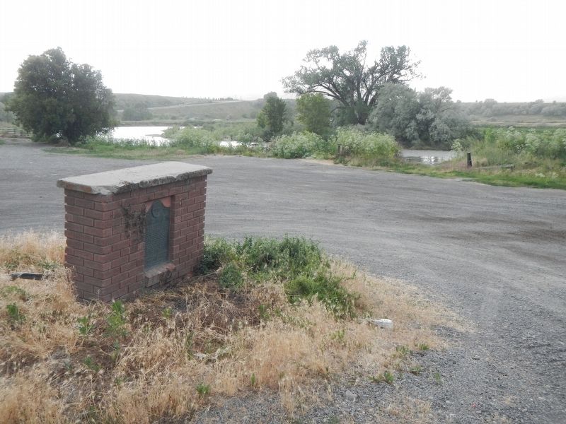
Indian Ford, just north of here, was long used by Indians, pioneers, and early explorers to cross the Jordan River. Crossing was relatively easy when the water was low, however raging waters during high run off made crossing difficult. Indian Ford . . . — — Map (db m199494) HM
An arduous 1,200-mile route between Santa Fe and Los Angeles, the "Old Spanish Trail" passed through Mountain Meadows during its heyday, between 1830 and 1848. The trail served traders who loaded their pack mules with woolen goods from Santa Fe each . . . — — Map (db m114259) HM
In 1915 prisoners from the Utah State Prison camped here among these very rocks. They were detailed to build a wagon road up the fault, directly east from here. Remnants of the road can still bee seen with its lava rocks retaining walls. The work . . . — — Map (db m59429) HM
Between June 9, 1856, and July 6, 1860, ten separate Handcart Companies left Iowa
City, Iowa, or Florence, Nebraska to their land of Zion in the Utah Territory. There were
653 handcarts and 50 wagons.
Nearly 3,000 souls, some with babes in arms, . . . — — Map (db m59369) HM
Historic Temple Trail
The Temple Trail which has two parts, was used during the years 1874-1876 to bring lumber by ox-team from two sawmills at Nixon Springs on the south face of Mount Trumbull to St. George, eighty miles away, for constructing . . . — — Map (db m59362) HM
Segments of the old Indian trails between St. George and Long Valley were used by Mormon pioneers to settle Long Valley in 1864 and for its resettlement in 1871 following Indian conflicts. This trail scaled the Hurricane Fault on the Johnson Twist. . . . — — Map (db m74618) HM
The Black Ridge .
The toughest, heartbreaking barrier to the colonization of “Utah’s Dixie” was the Black Ridge between New Harmony and Pintura, north of Toquerville, Utah.
A deep, rough, lava flow clogged the valley from the . . . — — Map (db m1427) HM
From Native American Trail to Interstate Exit
A Local History of Passage
The earliest desert routes in the West followed water. Having drinking water for person or pack animal was critical in negotiating the extreme heat and rugged . . . — — Map (db m243204) HM
The Old Spanish Trail was a heavily used trade route that connected the Spanish-speaking communities of northern New Mexico with those in southern California. Pack trains of 100 or more mules - packsaddles bulging with woolen goods woven in New . . . — — Map (db m241356) HM
This 5,613- foot-long tunnel, the longest vehicular tunnel in the National Park System, was blasted through the towering sandstone cliffs above Pine Creek Canyon. Construction required extraordinary access through cliff-face galleries for blasting . . . — — Map (db m74632) HM
Antonio Armijo was a Spanish Mexican explorer and merchant who in 1829 and 1830 led an expedition to find a trade route between New Mexico and Los Angeles. This was the first trading expedition between New Mexico and Los Angeles. It was so . . . — — Map (db m241344) HM
The Temple Trail
The temple trail is the route used from 1871 to 1877 to haul timber from Mt. Trumbull, Arizona, to St. George, Utah, for the building of the St. George LDS Temple. Pioneers traveled 80 miles along the rough, dirt road, hauling . . . — — Map (db m59311) HM
Pioneer Road connected the historical community of Slaterville east to west. This winding country road was constructed by early pioneers. The road was lined with 19th century and early 20th century homes, along with thriving farms. The Allred, . . . — — Map (db m223526) HM
Marker on Left:
Lorin Farr
Lorin Farr, Utah Pioneer of 1847, one of the founders of Ogden, established Farr's Fort in 1850, assistant in laying out the city and organized its first government. In 1851, he became the first mayor, . . . — — Map (db m149969) HM
805 feet North of this site was located the toll gate established November 15, 1860 by Lorin Farr and Isaac Goodale, builders of the first road through Ogden Canyon. From 1865 to 1882 it was operated by the Ogden Canyon Road Company with the . . . — — Map (db m149973) HM