After filtering for Utah, 73 entries match your criteria.
Roads & Vehicles Topic
By Barry Swackhamer, June 20, 2017
Hampton's Bear River Crossing Marker
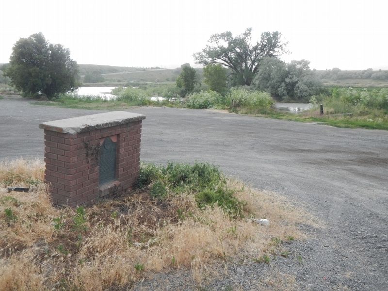
| 1 ► Utah, Box Elder County, Collingston — Hampton's Bear River Crossing — |
| On Bigger Road near West 15200 North. | |||
| 2 ► Utah, Box Elder County, Collingston — HSLC UT-8 — Hensley/Salt Lake Cutoff - Hampton Ford — |
| On Bigger Road near West 15200 North. | |||
| 3 ► Utah, Box Elder County, Corinne — BBU-7 — Bidwell/Bartleson Trail - Monument Point — First Overland Emigrant Party — |
| On Transcontinental Railroad Back Country Byway, on the right when traveling west. | |||
| 4 ► Utah, Box Elder County, Corinne — Transcontinental Railroad — National Back Country Byway — Rails of History — |
| On Golden Spike Loop Road, on the right when traveling west. | |||
| 5 ► Utah, Box Elder County, Park Valley — Terrace Cemetery — 1869- ca. 1910 — |
| On Transcontinental Railroad Back Country Byway, on the left when traveling west. | |||
| 6 ► Utah, Carbon County, Helper — S-74 — Bamberger Monument — Utah Historic Site — |
| On U.S. 191 at milepost 259.2, on the left when traveling north. | |||
| 7 ► Utah, Carbon County, Price — 1900 — The Nine Mile Road — |
| 8 ► Utah, Davis County, Centerville — 120 — Stage Coach Station — |
| On East Center Street, on the left when traveling west. | |||
| 9 ► Utah, Davis County, Syracuse — Antelope Island Causeway — |
| Near West 1700 South. | |||
| 10 ► Utah, Davis County, Syracuse — 450 — The Old Emigrant Road — |
| On Bluff Road, 0.3 miles north of 2700 South, on the right when traveling north. | |||
| 11 ► Utah, Davis County, Syracuse — The Road To Nowhere — |
| On Antelope Island Road at Davis County Causeway, on the left when traveling south on Antelope Island Road. | |||
| 12 ► Utah, Davis County, Syracuse — Transportation — |
| Near Antelope Island Road. | |||
| 13 ► Utah, Davis County, Syracuse — Trucks — |
| Near Antelope Island State Park. | |||
| 14 ► Utah, Davis County, West Point — Hensley / Salt Lake Cutoff-Bluff Road — |
| On North 4000 W, 0.2 miles south of Lake Park Court, on the right when traveling north. | |||
| 15 ► Utah, Davis County, West Point — Hensley/Salt Lake Cutoff Ruts — |
| On 1800 North (Utah Route 37 at milepost 4), 0.2 miles east of 4325 West, on the right when traveling west. | |||
| 16 ► Utah, Garfield County, Boulder — Paving Boulder Mountain Road — Year-round Access — |
| On Point Lookout Road (Forest Road 1977) 0.2 miles south of Utah Route 12. | |||
| 17 ► Utah, Garfield County, Bryce Canyon National Park — Post-War Service Station — |
| 18 ► Utah, Garfield County, Bryce Canyon National Park — Wheeling through the Years — |
| 19 ► Utah, Garfield County, Escalante — Building the Million-dollar Road — Civilian Conservation Corps — |
| On Utah Route 12 at milepost 69, on the left when traveling east. | |||
| 20 ► Utah, Garfield County, Escalante — 501 — Old Boulder Mail Trail — |
| On Utah Route 12, on the left when traveling east. | |||
| 21 ► Utah, Garfield County, Panguitch — Red Canyon Tunnels — Gateway to Natural Wonders — |
| On Utah Route 12, on the right when traveling east. | |||
| 22 ► Utah, Iron County, Newcastle — Site of Blacksmith Shop — |
| On 600 East, on the left when traveling south. | |||
| 23 ► Utah, Iron County, Paragonah — Henry W. Lunt — Roadside Park — |
| On Interstate 15 at milepost 88, on the right when traveling south. | |||
| 24 ► Utah, Iron County, Paragonah — The Old Spanish Trail — |
| On Upper Bear Valley Road, on the left when traveling north. | |||
| 25 ► Utah, Iron County, Parowan — The Spanish Trail — |
| Near South Main Street. | |||
| 26 ► Utah, Kane County, Glendale — Glendale Orientation Center — Grand Staircase-Escalante National Monument — |
| On Main Street (U.S. 89), on the left when traveling north. | |||
| 27 ► Utah, Kane County, Mount Carmel Junction — 120 — The Historic Dixie-Long Valley, Utah Pioneer Trail — |
| On U.S. 89, 0.6 miles south of Utah Route 9, on the left when traveling south. | |||
| 28 ► Utah, Millard County, Delta — 218 — Escalante Trail — |
| On Main Street. | |||
| 29 ► Utah, Rich County, Garden City — The First Oregon Trail — |
| On National Park Highway/Oregon Trail (U.S. 89), on the right when traveling south. | |||
| 30 ► Utah, Salt Lake County, Bluffdale, Independence at the Point — 48 — Rockwell Station — |
| On West 14600 South (Utah Route 140) at Portern Rockwell Boulevard, on the right when traveling east on West 14600 South. | |||
| 31 ► Utah, Salt Lake County, Cottonwood Heights — Ern and Molly Green Cabin — Big Cottonwood Canyon Trail — |
| Near Big Cottonwood Canyon Road, on the right when traveling south. | |||
| 32 ► Utah, Salt Lake County, Midvale — 8 — Traders Rest — |
| On State Street (U.S. 89), on the right when traveling south. | |||
| 33 ► Utah, Salt Lake County, Murray — 259 — Pony Express Station — |
| Near 5300 South, on the right when traveling west. | |||
| 34 ► Utah, Salt Lake County, Salt Lake City, University — Handcarts — |
| Near East Sunnyside Avenue. | |||
| 35 ► Utah, Salt Lake County, Salt Lake City, University — In Ten Days or Less... — |
| On Sunnyside Avenue, on the right when traveling east. | |||
| 36 ► Utah, Salt Lake County, Salt Lake City, University — 5 — Orson Pratt Observatory — Salt Lake City, Utah 1869 — Replicated in 2001 — |
| Near Main Street. | |||
| 37 ► Utah, Salt Lake County, Salt Lake City, University — Unsung Heroes — |
| Near Sunnyside Avenue. | |||
| 38 ► Utah, Salt Lake County, Sandy — Temple Stone Quarry — |
| Near East Little Cottonwood Road (Utah Route 209) at South Watsatch Boulevard (Utah Route 210). | |||
| 39 ► Utah, Salt Lake County, South Salt Lake — HU-5 — Hastings Cutoff - Utah Outlet (Jordan River) — |
| 40 ► Utah, Salt Lake County, West Jordan — West Jordan Industry — Pioneering Economic Development — Gardner Mill and Bingham Railroad 1915 — |
| Near South. | |||
| 41 ► Utah, San Juan County, Monticello — 487 — The Spanish Trail — |
| Near U.S. 191 at milepost 110.4, on the right when traveling north. | |||
| 42 ► Utah, Sevier County, Richfield — The Fish Lake Cut-off on the Old Spanish Trail — Pathway to Grassy Meadows and Water — |
| Near Utah Route 25 at Doctor Creek Road. | |||
| 43 ► Utah, Sevier County, Salina — The Fish Lake Cut-off on the Old Spanish Trail — Pathway to Grassy Meadows and Water — |
| On FR 1421, on the right when traveling north. | |||
| 44 ► Utah, Summit County, Coalville — Echo Canyon — |
| Near Interstate 80 at milepost 171, on the right when traveling east. | |||
| 45 ► Utah, Summit County, Coalville — The Road to Zion — |
| Near Interstate 80 at milepost 171, on the right when traveling east. | |||
| 46 ► Utah, Summit County, Coalville — 165 — Wanship Station — |
| On Hoytsville Road, 0.3 miles north of Old Lincoln Highway, on the left when traveling north. | |||
| 47 ► Utah, Summit County, Echo — Welcome to Echo Canyon — One of Summit County's Historic and Picturesque Treasures — |
| Near Interstate 80 at milepost 170, on the right when traveling west. | |||
| 48 ► Utah, Tooele County, Dugway — 90 — Black Rock Station — |
| On Pony Express-Overland Stage Trail, 0.9 miles west of Lincoln Highway 1, on the right when traveling west. | |||
| 49 ► Utah, Tooele County, Dugway — 95 — Burial Plot — |
| On Pony Express Road, 1.5 miles south of South Davis Ranch Road, on the right when traveling south. | |||
| 50 ► Utah, Tooele County, Dugway — 86 — Lookout Station — Pony Express 1860 - 61 — |
| On Pony Express Road, on the right when traveling east. | |||
| 51 ► Utah, Tooele County, Faust — 53 — Faust Station — Pony Express — |
| On Utah Route 36 north of Pony Express Highway, on the right when traveling south. | |||
| 52 ► Utah, Tooele County, Grantsville — Cedar Mountains Wild Horse Range — Footsteps and Hoofbeats — |
| Near Interstate 80 at milepost 54, on the right when traveling east. | |||
| 53 ► Utah, Tooele County, Wendover — Bonneville Salt Flats International Speedway — |
| On Bonneville Speedway Road near Leppy Pass Road, on the left when traveling east. | |||
| 54 ► Utah, Tooele County, Wendover — HU-21 — Hastings Cutoff - Barren Mountains — |
| Near Unnamed Road near Leppy Pass Road, on the left when traveling north. | |||
| 55 ► Utah, Tooele County, Wendover — The Donner-Reed Party — |
| On Silver Island Road near Crater Island Road, on the right when traveling west. | |||
| 56 ► Utah, Tooele County, Wendover — Welcome to the Bonneville Salt Flats — And Utah's Famed Measure Mile—Site of World Land-Speed Record Runs — |
| Near Interstate 80 at milepost 10, on the right when traveling east. | |||
| 57 ► Utah, Uintah County, Vernal — Cobble Rock Gas Station — Why Did Women Love this Place? — |
| On West Main Street (U.S. 40) at Vernal Avenue (U.S. 191), on the right when traveling west on West Main Street. | |||
| 58 ► Utah, Utah County, Fairfield — 82 — Fairfield-Camp Floyd-Fort Crittenden / The Pony Express — |
| On West 1540 North at 18040 West, on the right when traveling east on West 1540 North. | |||
| 59 ► Utah, Utah County, Lehi — Indian Ford Ferry (Rocky Ford Ferry) — 1858-1869 — |
| 60 ► Utah, Washington County, Central — The Old Spanish Trail and The California Road — |
| Near Utah Route 18 at milepost 30.5. | |||
| 61 ► Utah, Washington County, Hurricane — Convict Camp and Wagon Road — |
| On East 200 North, 0.1 miles east of North State Street, in the median. | |||
| 62 ► Utah, Washington County, Hurricane — Many Came by Handcart — |
| Near West State Street. | |||
| 63 ► Utah, Washington County, Hurricane — Pioneer Trails — Two Important Pioneer Trails Lie to the South of Here — |
| Near West State Street. | |||
| 64 ► Utah, Washington County, Hurricane — 118 — The Historic Dixie-Long Valley, Utah Pioneer Trail — |
| Near Utah Route 59, 1.2 miles east of Main Street, on the left when traveling east. | |||
| 65 ► Utah, Washington County, Hurricane — The Roads to Utah’s Dixie — |
| On State Street. | |||
| 66 ► Utah, Washington County, Leeds — From Native American Trail to Interstate Exit — |
| On Center Street at Main St., on the right when traveling west on Center Street. | |||
| 67 ► Utah, Washington County, Littlefield — Trading on the Early Frontier 1829-1848 — Old Spanish Trail — |
| On West Old Highway 91, on the right when traveling north. | |||
| 68 ► Utah, Washington County, Springdale — Zion Mt. Carmel Tunnel and Highway, Utah — National Historic Civil Engineering Landmark — |
| On Zion Park Boulevard, 0.2 miles east of Zion Canyon Scenic Drive, on the right when traveling east. | |||
| 69 ► Utah, Washington County, St. George — Old Spanish Trail — |
| Near South Convention Center Drive. | |||
| 70 ► Utah, Washington County, St. George — The Temple & Honeymoon Trails — |
| On South 300 East, on the right when traveling south. | |||
| 71 ► Utah, Weber County, Marriott-Slaterville — 11 — Historic Pioneer Road — Marriott-Slaterville City Historical Marker — |
| On West Pioneer Road west of North 1900 West Street (Utah Route 126), on the right when traveling west. | |||
| 72 ► Utah, Weber County, Ogden — 113 — Lorin Farr — |
| Near Washington Boulevard. | |||
| 73 ► Utah, Weber County, Ogden — 44 — Ogden Canyon Toll Gate — |
| Near Valley Drive west of Canyon Road (Utah Route 39), on the left when traveling west. | |||