After the Jan. 11, 1863, battle at Arkansas Post, Gen. Willis Gorman led troops from Helena on a raid up the White River. Col. Powell Clayton and 1,200 cavalrymen went to Big Creek west of Helena when a patrol of 25 men of the 2nd Wisconsin Cavalry . . . — — Map (db m107709) HM
David D. Porter, Acting Rear Admiral Commanding Mississippi Squadron
The guns of the U.S.S. Tyler sent their last blast hurtling toward Graveyard Hill at 10:30 A.M. on July 4, 1863. The Confederates were retreating. . . . — — Map (db m229625) HM
Confederate General Theophilus Holmes wanted to regain control of Helena, an island of Union control in Confederate Arkansas. His attack failed. Miscommunication, lack of information, and the determined resistance of the Union troops, who vowed not . . . — — Map (db m107941) HM
The Mississippi River defines Helena
The Mississippi River has for centuries been the backbone of life in Helena; fertilizing its soil, supporting its farms and businesses, connecting people and cultures. Despite this rich history, there . . . — — Map (db m231812) HM
During the Battle of Helena on July 4, 1863, constant fire from Union cavalry and artillery near the levee helped stall the Confederate advance on Battery A.
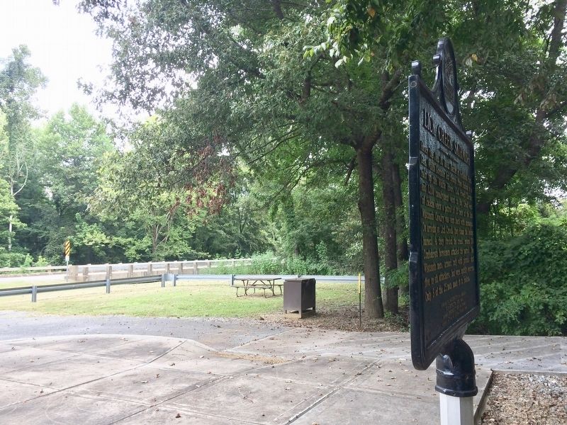
The Union Troops at the Levee . . . — — Map (db m107930) HM
1541-1931
June 18, 1541
Hernando De Soto
Crossed the Mississippi River
near Friar's Point to Aquixo
an Indian Village
south of
Helena, Arkansas — — Map (db m51917) HM
Seasons change. As they do, birds and other wild animals migrate from one place to the next to find food. Many birds follow the twists and turns of the Mississippi River as they journey from the northern United States to their winter breeding . . . — — Map (db m229321) HM
The gunboat U.S.S. Tyler gave the Union defenders a decided advantage in the
Battle of Helena. Her captain could move the gunboat and its heavy artillery
where it was needed most, and that is exactly what he did.
— — Map (db m107975) HM
Confederate General Theophilus Holmes wanted to regain control of Helena, an island of Union control in Confederate Arkansas. His attack failed. Miscommunication, lack of information, and the determined resistance of the Union troops, who vowed not . . . — — Map (db m107937) HM
Built in 1961, the Helena bridge is about a mile long and 28 feet wide. It stretches across the Mississippi River, linking Helena with the town of Lula, Mississippi via US 49.
Before the bridge
Until the early 1960s, there was no bridge . . . — — Map (db m231574) HM
The Mississippi River has for centuries been the backbone of life in Helena; fertilizing its soil, supporting its farms and businesses, connecting people and cultures. Helena, built at the base of Crowley’s Ridge, finds itself in a unique location . . . — — Map (db m231559) HM
Among our nations’s most valuable treasures: a web of inland waterways that winds its way through America’s heartland to the Mississippi River. Boats carrying people and freight use these well-traveled “marine highways” to travel from one city or . . . — — Map (db m229324) HM
"I have no more land, I am driven away from home, driven up the red waters, let us all go, let us all die together and somewhere upon the banks we will be there."
—Sin-e-cha's Song, heard on several removal boats along the Trail of . . . — — Map (db m229331) HM
The impact of stormwater runoff on the Mississippi River is an environmental concern.
The quality and quantity of water in all of our streams, rivers, lakes, aquifers, and oceans is diminishing. We can reverse this negative trend by becoming . . . — — Map (db m231766) HM
'The Arkansea' was a land of mystery, wonder and riches...
Back east rumors grew of the Arkansea, a land of vast swamps, gators, buffalo, elk, beaver, and more bear than could be imagined. There were huge flocks of green and yellow . . . — — Map (db m142029) HM
The first steamboat to ascend the Arkansas River, the Comet, arrived at Arkansas Post on March 31, 1820, and river travel was transformed.
Two years later people in the new town of Little Rock were jubilant over the arrival of the first . . . — — Map (db m142031) HM
DeValls Bluff was strategically important to both the Union and Confederate armies as a major White River port and as head of the Memphis and Little Rock Railroad. It became a key Union supply depot after its fall 1863 occupation, as well as a . . . — — Map (db m96455) HM
DeValls Bluff’s status as an excellent riverport and the head of the Memphis and Little Rock Railroad made it an important base for both Confederate and Union forces. Hoping to block Federal ships from moving up the White River, Major Gen. Thomas . . . — — Map (db m96666) HM
DEVALL’S BLUFF, ARKANSAS
August 23, 1863.
GENERAL: Having reconnoitered the different routes, I have decided to commence my line of operations at this point, and have moved the depot and hospital here to-day. The site chosen is a . . . — — Map (db m96672) HM
Rising from the Boston Mountains, the White River meanders 720 miles to its junction with the Arkansas River in the southeastern part of the state. The fast-moving water kept the White River from suffering the build-up of silt that made such rivers . . . — — Map (db m96674) HM
With a swift current and deep channel that allowed deeper-draft vessels to use it reliably as far north as Batesville, the White River was the most important river in Civil War Arkansas and was used extensively by both sides.
The Confederate . . . — — Map (db m96669) HM
DeValls Bluff was ideally situated to be an important location in the Civil War. The riverport was located at a point on the White River that was navigable at all seasons, a distinct advantage over Arkansas River sites that were frequently isolated . . . — — Map (db m96667) HM
North of where you are standing, Union troops on September 10, 1863, constructed a wooden pontoon bridge across the Arkansas River allowing Union Brigadier General John W. Davidson's cavalry division to proceed to Little Rock. Major General . . . — — Map (db m116523) HM
Well to the east of Reed's Bridge, a shallow ford offered the best crossing of Bayou Meto, and the best position from which Union attackers could roll up the Confederate lines and open the road to Little Rock.
As a squadron of the First Iowa . . . — — Map (db m211550) HM
On August 27, 1863 the Federal army was advancing along the Military Road toward Little Rock when its Cavalry Division of 6,000 men under Gen. John W. Davidson attempted a crossing here and was met by a Confederate force of 4,000 under Gen. John S. . . . — — Map (db m116508) HM
Construction of this earliest road connecting Memphis with Little Rock began in 1826 under the supervision of Lt. Frederick L. Griffith, U.S. Army. It was completed in 1828 under Lt. Charles Thomas. Miles of swamps and numerous streams made the road . . . — — Map (db m116509) HM
In the early days of Little Rock, the Arkansas River
was the lifeblood of the community. The Little Rock
extended out into the river, pulling the current around
it to form a natural landing basin for boats. The earliest
ferry across the . . . — — Map (db m116539) HM
Ferries: Early ferry services were established as a ford on the
Southwest Trail at "the point of rocks" between 1812 and 1819.
Eventually, there were ferries in at least three locations serving
the city, one just above the Old State House, . . . — — Map (db m117432) HM
Post-Civil War, railroads became vital to the Arkansas
economy. Point of Rocks was a natural support for
a railroad bridge on the river. In October 1872,
construction began at the Little Rock with several
tons of rock removed from the . . . — — Map (db m116541) HM
Jean-Baptiste Bénard de La Harpe was the first
European explorer to record the existence of a large
rocky bluff on the north bank of the Arkansas River.
According to his journal, La Harpe named it le Rocher
Français ("the French Rock") on . . . — — Map (db m116558) HM
Looking northeast to your right about 300 yards downstream, you can see the area of the primary fighting of the Battle of Bayou Fourche. Fighting began about noon on Wednesday, September 10, 1863, after Union Brigadier General John Davidson's troops . . . — — Map (db m116532) HM
Early in August of 1863 the Union Army began a march from Helena to Little Rock. Confederate troops, commanded by Major General Sterling Price, waited to defend the city primarily from the ridge north of the Arkansas River. But Federal forces . . . — — Map (db m116536) HM
The Little Rock was not always as it is now. To support
the Junction Bridge and ensure an adequate channel for
river traffic, much of the Rock was removed in 1872 and
1884. No one knows how the Point of Rocks looked
before progress took its . . . — — Map (db m116557) HM
While the Quapaw Indians could be said to "own" the land which
is the Riverfront Park, their villages were actually along the
Arkansas River between the "point of rocks" and the Mississippi
River. However, the Imbeau, Bartholomew, and Coussatt . . . — — Map (db m117431) HM
A section of the "Little Rock" located at the foot of Rock Street forming the south pier of the railroad bridge over the Arkansas River, being the first rock seen by the French explorer, Bernard De La Harpe, on his voyage from the mouth of the . . . — — Map (db m102141) HM
On March 23, 1864, Gen. Frederick Steele led a Union army south from Little Rock to join another army in Louisiana and invade Texas. After fighting at Elkins' Ferry and Prairie D'Ane, Steele's hungry army occupied Camden. Disastrous defeats at . . . — — Map (db m116237) HM
The elegant steamboat Lizzie Simmons was built in 1859 and ran between Memphis and New Orleans until the Confederate Navy bought her in 1861 and converted her into a gunboat, the C.S.S. Pontchartrain. The vessel fought on the . . . — — Map (db m116257) HM
Four major bridges connect the various elements of the Arkansas River
Trail, allowing visitors to easily cross the river and explore different areas.
Big Dam Bridge
Dedicated on September 20, 2006, the Big Dam
Bridge is the longest . . . — — Map (db m208848) HM
•The Arkansas River begins in Colorado, meanders
through Kansas and Oklahoma, and travels 1,450 miles
to the Mississippi River
•Earliest navigation on the Arkansas involved floating
downstream by raft
•Steamboats first arrived in Little . . . — — Map (db m208845) HM
The Arkansas River was one of the main routes
used to move Indians from the southeastern
United States to the Indian Territory (modern-day
Oklahoma) during the forced removals of the late
1830s. Hundreds of men, women and children
would have . . . — — Map (db m208846) HM
The idea for the Arkansas River Trail began as early as 1913, with a City of Little Rock plan calling for a series of parks on the banks of the Arkansas River. The trail has been built in pieces, year after year, decade upon decade by committed . . . — — Map (db m208847) HM
Dedicated August 6, 1933, as Pugh's Memorial Park, the Old Mill is a replica of an abandoned water-powered grist mill that would have been used by Arkansas pioneers in the 1800s. Although the Old Mill never actually operated as a mill, the iron . . . — — Map (db m53181) HM
You are standing in the vicinity of where Confederate forces camped on Monday, September 7, 1863, when Union forces under Major General Frederick Steele advancing from Brownsville engaged the brigade of Colonel Robert C. Newton, C.S.A., driving his . . . — — Map (db m116519) HM
River Highway
Davidsonville was located on a wedge-
shaped piece of land formed by the
confluence of the Black, Spring, and
Eleven Point rivers, placing it in the
midst of the transportation and trade
superhighways of the era. . . . — — Map (db m170927) HM
"Pocahontas is beautifully situated on the west bank of Black River… As a trading point, it is unsurpassed by any town of its size in the state."
J. C. Martin of Pocahontas
1857
As agriculture in Randolph . . . — — Map (db m170298) HM
This is the site of the Old Black River Bridge. After gaining congressional approval, the Arkansas State Highway Commission design the Bridge, and the Pittsburgh-Des Moines Steel Company of Pittsburgh Pennsylvania built it in 1934. The Bridge was . . . — — Map (db m180431) HM
William Hix operated the first ferry in Arkansas sometime around 1803
over the Current River, which separates northeastern Randolph County
from Missouri. It was on the Natchitoches Trace, also known as the Old
Southwest Trail. This important road . . . — — Map (db m170295) HM
"We have a large quantity of vacant land in this country … and have room for one thousand good and industrious families, and bread and meat to feed them."
A Pocahontas resident
Jan. 2. 1852
The contemporary riverbank you see here barely resembles the site that fishers, hunters, farmers, and traders visited for 10,000 years. Some native trees are visible, however. Look for black willow and silver maple.
Farmers still grow crops, . . . — — Map (db m170361) HM
Standing at this spot during the second half of the Civil War you would have witnessed a very chaotic scene. The riverfront landing at the end of Garrison Avenue would have been filled with hundreds, sometimes thousands, of desperate people . . . — — Map (db m156902) HM
This marks the site of the second court house built in Union County. Completed May 1st, 1848. The spot was originally a pond where ducks gathered in season. Emigrants in search of home sites frequently camped alongs its banks. It was filled in under . . . — — Map (db m121292) HM
The legend of Prairie Grove Spring tells of the spring first being laid claim to by Tom Wagnon, a frontiersman, in 1828. Wagnon soon traded the spring to Rev. Andrew Buchanan, a charismatic preacher, for two redemption sermons. Then Wagnon left the . . . — — Map (db m225083) HM
On July 8, 1864, a column of 221 men of the 10th Illinois Cavalry headed for Searcy to confront Gen. J.O. Shelbys Confederates, who were operating in the area. They set up camp at Des Arc Bayou on July 13. At 4:30 a.m. July 14, around 500 men under . . . — — Map (db m116328) HM
Searcy Landing in the Civil War
Searcy Landing was a steamboat stop with cotton warehouses before the war. On May 9, 1862, Col. P.J. Osterhaus's 3rd Division of the Union Army of the Southwest built a bridge across the Little Red River, . . . — — Map (db m116325) HM
Naval Combat at West Point
The U.S. gunboat Cricket steamed up the Little Red River Aug. 14, 1863, hunting the Confederate steamboats Kaskaskia and Tom Sugg. She captured the vessels at Searcy Landing and destroyed a . . . — — Map (db m116269) HM
Chickasaws and Quapaws crossed the White River
here to visit, long before the first settlers. First
post office, named Chickasaw Crossing in Feb. 1848,
was soon changed to Augusta. Steamboats
docked here to deliver goods and left with . . . — — Map (db m116629) HM
Thomas Hough founded Augusta in 1848, naming
it after his favorite cousin, Miss Augusta Cald,
of Virginia. For generations it was known as
Chickasaw Crossing. The first settlers came in
1820. It was incorporated in 1861. During the
Civil . . . — — Map (db m116630) HM
158 entries matched your criteria. Entries 101 through 158 are listed above. ⊲ Previous 100