After filtering for Nebraska, 66 entries match your criteria.
Charity & Public Work Topic
By Cosmos Mariner, August 8, 2021
The Rainbow Fountain Marker
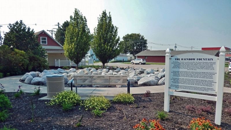
| 1 ► Nebraska, Antelope County, Neligh — The Rainbow Fountain — |
| On L Street (U.S. 275) at Riverside Park Road, on the left when traveling north on L Street. | |||
| 2 ► Nebraska, Buffalo County, Kearney — Good Samaritan Air Crew — |
| On 31st Street at Central Avenue, on the right when traveling west on 31st Street. | |||
| 3 ► Nebraska, Buffalo County, Ravenna — 370 — Civilian Conservation Corps — Ravenna, Nebraska — |
| On State Highway 2, 1 mile east of Ravenna Road (State Highway 68), on the right when traveling east. | |||
| 4 ► Nebraska, Cedar County, Hartington — 321 — Hartington - Home of two Nebraska Governors — |
| On West Franklin Street (State Highway 84) east of South Robinson Avenue, on the left when traveling east. | |||
| 5 ► Nebraska, Cheyenne County, Sidney — Carnegie Library — 1913 — 740 Illinois Street — |
| On Illinois Street (Lincoln Highway) (U.S. 30) at 8th Avenue, on the right when traveling west on Illinois Street (Lincoln Highway). | |||
| 6 ► Nebraska, Custer County, Broken Bow — 59 — The Nebraska State Grange — |
| On State Highway 2 at milepost 273, on the right when traveling east. | |||
| 7 ► Nebraska, Dawes County, Crawford — Moses P. Kinkaid — |
| On Main Street just west of 1st Street, in the median. | |||
| 8 ► Nebraska, Dodge County, Fremont — Fremont's First City-Owned Parking Lot — Nov. 14, 1964 — |
| On Park Avenue at 5th Street, on the left when traveling south on Park Avenue. | |||
| 9 ► Nebraska, Douglas County, Omaha, Downtown — A River of Change — |
| 10 ► Nebraska, Douglas County, Omaha, Downtown — A River of Hope — |
| 11 ► Nebraska, Douglas County, Omaha, Downtown — Omaha Firefighters Memorial — Honor • Tradition — |
| On Riverfront Drive, on the right when traveling south. | |||
| 12 ► Nebraska, Douglas County, Omaha, Downtown — Preserving Our Heritage — |
| 13 ► Nebraska, Douglas County, Omaha, Downtown Northeast — The Right Reverend & Mrs Robert Harper Clarkson — |
| On Capitol Avenue near 18th Street, on the right when traveling west. | |||
| 14 ► Nebraska, Douglas County, Omaha, Field Club — Hanscom Park Flower Garden — |
| On 32nd Avenue near Hickory Street, on the left when traveling south. | |||
| 15 ► Nebraska, Douglas County, Omaha, Ford Birthsite — Hanscom Park Lagoon — |
| On Hanscom Park Drive. | |||
| 16 ► Nebraska, Douglas County, Omaha, North Omaha — 10 — Fort Omaha Fire Station — Fort Omaha Walking Tour — |
| On East Road at South Road, on the right when traveling north on East Road. | |||
| 17 ► Nebraska, Douglas County, Omaha, North Omaha — 6 — Fort Omaha Knights of Columbus Assembly Hall — Fort Omaha Walking Tour — |
| On East Road, on the right when traveling north. | |||
| 18 ► Nebraska, Douglas County, Omaha, North Omaha — 9 — Fort Omaha Post Exchange and Gymnasium — Fort Omaha Walking Tour — |
| On East Road, on the right when traveling north. | |||
| 19 ► Nebraska, Douglas County, Omaha, The Old Market — Omaha Firehouse 1903-1904 — The Old Market Historic Walking Tour — |
| On 11th Street near Jackson Street, on the right when traveling south. | |||
| 20 ► Nebraska, Douglas County, Omaha, West Omaha — 226 — Father Flanagan's Boys' Home — (The Original "Boys Town") — |
| On Flanagan Boulevard, on the right when traveling west. | |||
| 21 ► Nebraska, Douglas County, Omaha, West Omaha — Msgr. Edward Joseph Flanagan — Leabeg, Ballymoe — 13 July 1886 - 15 May 1948 — |
| 22 ► Nebraska, Douglas County, Omaha, West Omaha — Right Reverend Monsignor Edward J. Flanagan — 1886 - 1948 — |
| On Heroes Boulevard south of Flanagan Boulevard, on the left when traveling north. | |||
| 23 ► Nebraska, Dundy County, Benkelman — 470 — Nature's Gift: The Highway 34 Springs — |
| On Old U.S. 34 at Avenue 339, on the right when traveling east on U.S. 34. | |||
| 24 ► Nebraska, Fillmore County, Ohiowa — 460 — The Ohiowa Auditorium — |
| On S. Main Street at Grafton Street, on the right when traveling north on S. Main Street. | |||
| 25 ► Nebraska, Gage County, Beatrice — Boundaries of Freedom — |
| 26 ► Nebraska, Gage County, Beatrice — Do You Live Near a Homestead? — |
| 27 ► Nebraska, Gage County, Beatrice — Founding of Beatrice, Nebraska Territory — |
| On 2nd Street near Court Street (U.S. 136), on the left when traveling north. | |||
| 28 ► Nebraska, Gage County, Beatrice — Homesteading: The Cry was Free Land!!! — |
| On Court Street (U.S. 136) at 2nd Street, on the right when traveling west on Court Street. | |||
| 29 ► Nebraska, Gage County, Beatrice — Success Was Only Natural — |
| 30 ► Nebraska, Gage County, Beatrice — Veterans Memorial Drive — Dedicated to All Veterans — |
| On 6th Street (U.S. 77) near Veterans Memorial Drive, on the right when traveling south. | |||
| 31 ► Nebraska, Garfield County, Burwell — 103 — Kamp Kaleo — |
| On Willow Springs Road, 0.3 miles south of State Highway 91, on the left when traveling south. | |||
| 32 ► Nebraska, Hall County, Grand Island — Arrasmith Field — |
| Near Sky Park Road, 0.6 miles north of East Airport Road, on the right when traveling north. | |||
| 33 ► Nebraska, Hall County, Grand Island — 464 — Central Nebraska Regional Airport — |
| Near Sky Park Road, 0.6 miles north of East Airport Road, on the right when traveling north. | |||
| 34 ► Nebraska, Hall County, Grand Island — 560 — Grand Island Veterans Home — |
| Near West Capital Avenue just west of Taylor Avenue, on the right when traveling west. | |||
| 35 ► Nebraska, Hall County, Grand Island — 506 — Hall County Poor Farm Cemetery — |
| Near American Legion Memorial Highway (U.S. 281) at West Abbott Road (County Road 39), on the right when traveling south. | |||
| 36 ► Nebraska, Hall County, Grand Island — 490 — Old Dodge School — World War II POW Branch Camp — |
| On 1st Street (U.S. 30) at Walnut Street, on the right when traveling east on 1st Street. | |||
| 37 ► Nebraska, Howard County, St. Paul — Ed Fleming — |
| On Howard Street, 0.1 miles 5th Street, on the left when traveling west. | |||
| 38 ► Nebraska, Knox County, Niobrara — Our Ponca Tribal Community Building — A Social Hub, Then and Now — |
| Near 521st Avenue at 890th Road, on the left when traveling north. | |||
| 39 ► Nebraska, Lancaster County, Lincoln, Downtown — Humane Society Fountain — Refreshment for Dog, Horse and Human… — |
| On Q Street at North 7th Street, on the right when traveling west on Q Street. | |||
| 40 ► Nebraska, Lancaster County, Lincoln, Downtown — Salvation Army Building — 749 P Street — 1966 — |
| On North 8th Street near P Street. | |||
| 41 ► Nebraska, Lincoln County, North Platte — Ditch Plow — |
| Near North Buffalo Bill Avenue, 0.8 miles north of Lincoln Highway (U.S. 30), on the right when traveling north. | |||
| 42 ► Nebraska, Lincoln County, North Platte — Union Pacific Depot — North Platte, Nebraska — |
| Near North Buffalo Bill Avenue, 0.8 miles north of Lincoln Highway (U.S. 30), on the right when traveling north. | |||
| 43 ► Nebraska, Madison County, Norfolk — 356 — Verges Park — (Norfolk Brick and Tile Company) — |
| Near Queen City Boulevard just south of Elm Avenue, on the right when traveling south. | |||
| 44 ► Nebraska, Merrick County, Central City — 551 — Heber Hord House — |
| On 16th Street (Lincoln Highway) (U.S. 30) at 15th Avenue, on the left when traveling east on 16th Street (Lincoln Highway). | |||
| 45 ► Nebraska, Morrill County, Bayard — Chimney Rock National Historic Site — Ethel and Christopher J. Abbott Visitor Center Site — |
| Near Chimney Rock Recreation Road (State Highway 62F) 1 mile south of State Highway 92, on the right when traveling south. | |||
| 46 ► Nebraska, Morrill County, Bridgeport — Dedicated to the Early Pioneers — |
| On Main Street (State Highway 88) at Gold Rush Byway (U.S. 385), on the right when traveling north on Main Street. | |||
| 47 ► Nebraska, Nemaha County, Auburn — 495 — Auburn Post Office Mural — |
| On Courthouse Avenue south of 13th Street, on the right when traveling south. | |||
| 48 ► Nebraska, Otoe County, Nebraska City — Nebraska City Museum of Firefighting — |
| On Central Avenue just east of North 14th Street, on the left when traveling east. | |||
| 49 ► Nebraska, Otoe County, Nebraska City — Nebraska City Volunteer Fire Dept. — Oldest Fire Department in Nebraska — Organized in 1856 — |
| On Central Avenue west of 13th Street, on the right when traveling west. | |||
| 50 ► Nebraska, Pawnee County, Table Rock — St John's Catholic Church — Est. 1877 — |
| On Luzerne Street just west of 5th Street, on the left when traveling west. | |||
| 51 ► Nebraska, Pierce County, Pierce — 306 — Gilman Park — |
| Near North Mill Street, 0.1 miles north of East Main Street (State Highway 98), on the right when traveling north. | |||
| 52 ► Nebraska, Platte County, Columbus — 139 — Agricultural Park — |
| Near 15th Street east of 10th Avenue, on the left when traveling east. | |||
| 53 ► Nebraska, Platte County, Columbus — 522 — Camp Platte — |
| On 325th Street just east of Monastery Road (175th Avenue), on the left when traveling east. | |||
| 54 ► Nebraska, Platte County, Columbus — Columbus Area Business Hall of Fame — Inducted 2006 — |
| On 13th Street (Business U.S. 30) near 27th Avenue, on the left when traveling east. | |||
| 55 ► Nebraska, Platte County, Columbus — 521 — Columbus Powerhouse — |
| Near 3rd Avenue at 47th Street, on the right when traveling north. | |||
| 56 ► Nebraska, Richardson County, Humboldt — 456 — Humboldt Commercial Historical District — |
| On 4th Street at East Square, on the left when traveling west on 4th Street. | |||
| 57 ► Nebraska, Rock County, Bassett — Rock County Courthouse — |
| On State Street just north of Caroline Street, on the right when traveling north. | |||
| 58 ► Nebraska, Sarpy County, Papillion — 562 — Papillion Boy Scouts Cabin — |
| On South Washington Street near West Lincoln Street. | |||
| 59 ► Nebraska, Scotts Bluff County, Scottsbluff — Pascual Huerta Memorial — |
| On East 27th Street just east of Broadway, on the right when traveling east. | |||
| 60 ► Nebraska, Sherman County, Loup City — Loup City Township Carnegie Library — 1917 — |
| Near N Street just east of North 7th Street, on the right when traveling west. | |||
| 61 ► Nebraska, Thayer County, Chester — Municipal Auditorium — |
| On Thayer Avenue at Howard Street, on the left when traveling south on Thayer Avenue. | |||
| 62 ► Nebraska, Thayer County, Hebron — 452 — The Hebron CCC And POW Camps — |
| On Holdredge Avenue west of South Avenue, on the left when traveling west. | |||
| 63 ► Nebraska, Thayer County, Hebron — World's Largest Porch Swing — Is It A Swing And Miss Or A Home Run Record? — Story by Jordy McGowen, The ADviser, Hebron, NE — |
| On Jefferson Avenue at 5th Street, on the right when traveling west on Jefferson Avenue. | |||
| 64 ► Nebraska, Thurston County, Walthill — 385 — Susan LaFlesche Picotte Memorial Hospital — |
| On U.S. 77, 0.2 miles north of North Main Street (State Highway 94), on the left when traveling north. | |||
| 65 ► Nebraska, Webster County, Red Cloud — Red Cloud Volunteer Fire Department Bell — |
| On N. Webster Street (U.S. 281) at E. 3rd Avenue, on the left when traveling north on N. Webster Street. | |||
| 66 ► Nebraska, York County, York — 269 — Nebraska 4-H Clubs Began in York County — |
| Near North Nebraska Avenue at 4-H Drive, on the right when traveling north. | |||