On South 1st Street just north of Southeast Kent Street (State Route 92), on the right when traveling north.
This property is a contributing building to the Greenfield Public Square Historic District National Register of Historic Places by the United States Department of the Interior — — Map (db m193876) HM
On Poplar Street (State Highway 83) at 6th Street, on the right when traveling north on Poplar Street.
This 14 by 18 foot log cabin was built by John Gingery in 1863 in what was called Five Mile Grove located two miles northeast of Atlantic. John left Stark County Ohio where he had been raised and had become a school teacher. He was twenty-six . . . — — Map (db m93783) HM
Near S Downey Street, on the right when traveling south.
“It was here that I was given that tender care of mind and body, those first steps in education, that knowledge of poverty and struggle for family betterment which contribute to understanding of American life.” President . . . — — Map (db m87749) HM
This site commemorates the life and accomplishments of Herbert Hover, 31st President (1929-1932). The first president born west of the Mississippi River. Hoover grew up in a tradition that deeply influenced his ideals and long life of public . . . — — Map (db m48307) HM
On Penn Street at Poplar Street, on the right when traveling west on Penn Street.
Quakers, including the Hoovers, believe strongly in educating both boys and girls equally, and by 1853 West Branch's population was large enough to build this one-room schoolhouse. Because the Quakers had raised much of the funds, they also used it . . . — — Map (db m162554) HM
The early settlers of West Branch had a strong regard for education, and in 1853 they built this school. It was used not only as a school but as a place of worship for the members of the Society of Friends. Originally the building housed all of the . . . — — Map (db m162553) HM
Near Interstate 80 at milepost 270,, 1 miles west of Rose Avenue (County Highway X64), on the right when traveling west.
Marker Front: The land on which Iowa City is located was a wilderness when it was selected and surveyed for the capital of the Territory of Iowa in 1839. The cornerstone of the new capitol building was laid by Governor Lucas on July 4, 1840. . . . — — Map (db m224357) HM
On Linden Street south of Main Street (U.S. 69), on the right when traveling south.
Graceland College began classes here on September 17, 1895 with 18 students and 3 faculty. The college moved to the campus on "the hill" upon completion of the Administration Building in January, 1897. — — Map (db m86719) HM
On Hill Avenue at 18th Street (U.S. 71), on the right when traveling north on Hill Avenue.
This property is listed in The National Register of Historic Places Iowa State Historical Department Division of Historic Preservation — — Map (db m238671) HM
On Central Avenue (U.S. 52) at East 8th Street, on the left when traveling south on Central Avenue.
Dubuque’s first jail stood on this site (1836) and was superseded by this building which has been in continuous use since 1857 as sheriff’s residence and jail. Its design is the finest example of Egyptian architecture to survive the classical . . . — — Map (db m126598) HM
On North Broadway Street south of East Broad Street, on the left when traveling south.
Commitment to Educational Excellence Born August 23, 1846, Bell Babb Mansfield moved to Mount Pleasant — known as “the Athens of Iowa” — in 1860. At Iowa Wesleyan University, she earned the B.A. in 1866, M.A. in 1870, and LL.D. in 1872. . . . — — Map (db m177823) HM
Near North Main Street north of East Pearl Street, on the right when traveling north.
Established by the Southwest German Conference of the Methodist Episcopal Church in affiliation with Iowa Wesleyan College for the theological training of German Methodist ministers to serve area German-speaking churches Historical marker erected in . . . — — Map (db m177879) HM
Near North Broadway Street south of East Broad Street, on the left when traveling south.
Iowa Wesleyan College Founded 1842 Pioneer Building Erected 1843 In commemoration of the first college west of the Mississippi River This tablet is dedicated by the James Harlan Chapter Daughters of the American Revolution Mt. . . . — — Map (db m177855) HM
On West Broad Street at North Main Street, on the right when traveling west on West Broad Street.
Harlan moved to Iowa in 1845, and was elected state superintendent of public instruction two years later. He became President of Iowa Wesleyan University in 1853, and was elected to the U.S. Senate in 1855. After winning a second term, President . . . — — Map (db m33116) HM
Near North Broadway Street south of East Broad Street, on the left when traveling south.
January 21, 1869 The P.E.O. Sisterhood was founded in Old Main’s second floor music room by seven Iowa Wesleyan University female students. P.E.O. is a philanthropic educational organization motivating women to achieve their highest . . . — — Map (db m177812) HM
Near Interstate 80 at milepost 208,, 3.6 miles west of County Highway V52, on the right when traveling west.
Josiah Bushnell Grinnell, a native of Vermont, was the person to whom Horace Greeley gave his famous advice “Go West, young man, go West.” Grinnell took that advice and in 1854 founded the city that now bears his name. A leader in state government, . . . — — Map (db m224360) HM
Near North Clinton Street north of Iowa Avenue, on the left when traveling north.
The University of Iowa remembers the tragedy of November 1, 1991. This memorial is dedicated to those who died and those who were affected by the tragedy; their legacy of caring and distinguished service to the campus community will be remembered . . . — — Map (db m193997) HM
On East Market Street just west of North Clinton Street, on the right when traveling west.
Formerly First Presbyterian Church & North Presbyterian Church (Old School) Erected 1856-1865 This property is listed in the National Register of Historic Places — — Map (db m194099) HM
Near West Jefferson Street just east of North Madison Street, on the right when traveling east.
Part of the university’s medical department since 1870, dentistry was granted department status in 1882, becoming the first dentistry program established west of the Mississippi River. A dozen years later, the Dental Building was erected on this . . . — — Map (db m193998) HM
Near East Washington Street just west of South Clinton Street, on the right when traveling west.
Opened in 1902, the Hall of Liberal Arts was later renamed Schaeffer Hall for Charles A. Schaeffer, the University of Iowa president who turned the first spadeful of earth for the new building shortly before his death in 1898. The first of the four . . . — — Map (db m194175) HM
On North Dubuque Street just north of Iowa Avenue, on the right when traveling north.
From 1932 to 1939 a regular schedule of 389 educational television programs was broadcast from the building once located on this site. The Electrical Engineering Department built and operated the station under the direction of Dr. E. B. Kurtz. . . . — — Map (db m194100) HM
On West Jefferson Street east of North Madison Street, on the left when traveling east.
The first state university to admit women on an equal basis with men was the University of Iowa, in 1855. Plaque dedicated in memory of Professor Jane A. Weiss (1943-1981) feminist, scholar, teacher, friend — — Map (db m194098) HM
Near North Clinton Street at Iowa Avenue, on the right when traveling south.
This building the last Capitol of Iowa Territory became the first Capitol of the State of Iowa December 28, 1846 and was given to the University by and Act of the First General Assembly signed by Governor Ansel Briggs February 25, 1847 This . . . — — Map (db m194000) HM
On South Clinton Street at East College Street, on the right when traveling north on South Clinton Street.
The University of Iowa Writers' Workshop was founded by Wilbur Schramm in 1936 as the first creative writing degree program in the United States. Iowa City was recognized as the first City of Literature in the United States, and third in the . . . — — Map (db m194181) HM
Near Interstate 80 at milepost 237,, 6.3 miles east of Black Hawk Avenue NW, on the right when traveling east.
Marker Front: The land on which Iowa City is located was a wilderness when it was selected and surveyed for the capital of the Territory of Iowa in 1839. The cornerstone of the new capitol building was laid by Governor Lucas on July 4, 1840. . . . — — Map (db m224362) HM
On Main Street (State Highway 149) south of Washington Street, on the left when traveling south.
In 1904, Cap E. Miller, Superintendent of Schools in Keokuk County with the help of many citizens, organized Iowa's first county Boys' Agricultural Club and Girls' Home Culture Club. This was one of the pioneering developments that grew into the . . . — — Map (db m90219) HM
On 1st Avenue Northeast (Business U.S. 151) just west of 10th Street Southeast, on the left when traveling west.
The Ausadie Apartment Building was built in 1923 for Austin and Sadie Palmer as an investment property, close to downtown Cedar Rapids. Designed by Cedar Rapids architect William J. Brown in the Colonial Revival style, the building contained 24 . . . — — Map (db m216499) HM
On 4th Avenue Southeast just west of 5th Street Southeast, on the right when traveling west.
Cedar Rapids’ first permanent school once stood along the 4th Avenue end of Greene Square. From 1855-1868, it educated students through eighth grade. High school-level programs — considered advanced education until the twentieth century — were . . . — — Map (db m216496) HM
On 1st Avenue Northeast (Business U.S. 151) just south of College Drive Northeast, on the right when traveling south.
Coe College was founded by Presbyterian minister Williston Jones in 1851. Its buildings and grounds were established beginning in 1853. The college went by different names, including "Cedar Rapids Collegiate Institute" and "Parsons Seminary," . . . — — Map (db m216500) HM
Near 5th Avenue Southwest north of 3rd Street Southwest, on the left when traveling north.
This building, known since 1906 as South Hall, was constructed in 1872 for student housing and dining facility. In 1882 art and music courses were taught in some of the vacant rooms. “Conservatory Hall,” as it came to be called, was remodeled into . . . — — Map (db m184808) HM
On John Wayne Drive south of Jefferson Street, on the right when traveling north.
Under various owners, this building was used for furniture & undertaking, which was a popular business combination in the late 1800's and early 1900's. In 1963 this became the Iowa State University Extension Service office.
On this site circa . . . — — Map (db m72530) HM
On Jefferson Street west of John Wayne Drive, on the right when traveling west.
In the 1800's, agricultural implements were sold here. The Marsh Harvester advertised that "it saves the house-wife the unpleasant drudgery of providing for extra help, during the hottest season of the year" implying that extra farm hands would . . . — — Map (db m72510) HM
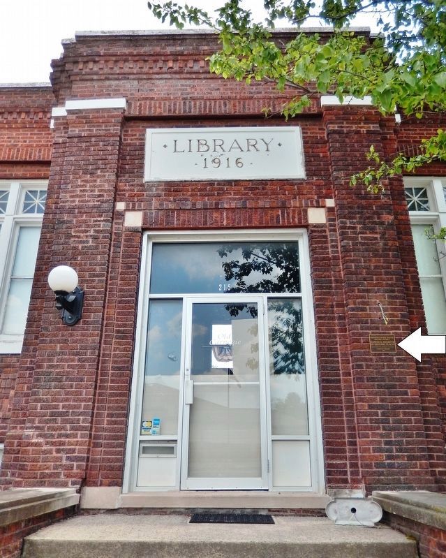
On Court Avenue at 2nd Avenue, on the left when traveling west on Court Avenue.
Built in 1903 and used as the Public Library from 1905 to 2001
Renovated in 2002 and reopened as City Hall in 2003
In Memoriam
Dr. Charles D. Bevington
Born January 13, 1826 Died November 13, 1903
Resident of Winterset since 1853 . . . — — Map (db m72688) HM
On West Washington Street at South 1st Avenue, on the left when traveling west on West Washington Street.
Born Oct. 5th 1897 Died July 1st 1978 Lt. Commander US Navy Res. Legendary art conservationist George Stout was born in Winterset, Iowa and graduated from Winterset High School in 1915. After 2 years at Grinnell College, he served overseas for 2 . . . — — Map (db m193900) HM
On North River School Street west of Knoll Lane, on the right when traveling west.
Restored by
Madison County Historical Society, Inc.
1962 - 1973
Placed on
National Register of Historic Places
by the U.S. Dept. of Interior
April 22, 1977 — — Map (db m72411) HM
Near South Market Street (U.S. 63) south of 2nd Avenue West, on the right when traveling south.
•Establishment of our public library was made official on March 7, 1899 with a voter approved levy tax as a result of the work of the YMCA and the Oskaloosa Women's Club. It officially opened its doors to the public on Monday Sept 8th 1903. . . . — — Map (db m236338) HM
Near Lincoln Street west of Houston Avenue, on the right when traveling west.
The Baptist Church has had a presence in Iowa since the territory was opened for settlement. Moses J. Post was an ordained Baptist missionary/itinerant preacher who traversed southeastern Iowa starting in 1841. Marion County, in which Pella is . . . — — Map (db m236384) HM
Near University Street at West 1st Street, on the right when traveling west.
In 1857 this bell called Central College students to classes for the first time. For 56 years its duties were numerous. At 5 a.m. daily it roused students for the morning study hour. It tolled for funerals and celebrated weddings with its chimes. In . . . — — Map (db m235965) HM
Near Lincoln Street west of Houston Avenue, on the right when traveling west.
Pella's first Tulip Time was held in 1935. It was a simple, one-day celebration, arranged around a locally-written operetta appropriately entitled "Tulip Time in Pella." The first festival had no parade, Tulip Queen, or even tulips! To prepare for . . . — — Map (db m236387) HM
On Adams Avenue, 0.2 miles north of East Vermeer Road, on the right when traveling south.
In 2014, Vermeer invested in providing team members' children and grandchildren an early childhood education platform. Vermeer Yellow Iron Academy is managed by Bright Horizons Family Solutions and focuses on interactive hands-on curriculum. Team . . . — — Map (db m237580) HM
On Washington Avenue East east of South Clinton Street, on the right when traveling east.
Built after the fire of 1904, this building relies on two features to separate it from the rest of the district. The color of its brick façade and the only example of the bead and reel motif in the district located below the cornice on the . . . — — Map (db m187895) HM
On 16th Street / Glenn Miller Avenue at Chestnut Street, on the left when traveling north on 16th Street / Glenn Miller Avenue.
The Clarinda Carnegie Library
Built in 1908
has been placed on the
National Register of Historic Places
by the United States Department of the Interior — — Map (db m87508) HM
On Grant Street east of 16th Street / Glenn Miller Avenue, on the right when traveling east.
This stone marks the site of the first school house in Clarinda. Built in 1854 and where Theodore Roosevelt spoke April 23, 1903. — — Map (db m87507) HM
On 16th Street / Glenn Miller Avenue (U.S. 71) south of Essie Davison Drive, on the left when traveling south.
"Everywhere in the country, for those who have learned to see and understand, are lessons which point toward the richness and strength of life."
by Jessie Field Shambaugh
These words are written in memory of "The Mother of 4-H" to honor her . . . — — Map (db m88080) HM
On South 16th Street (U.S. 71) south of Essie Davison Drive, on the left when traveling south.
In 1901, as a country school teacher, Jessie Field created practical farm and home courses for her students as part of the regular curriculum. Later, as superintendent of Page County schools, she expanded these clubs and camps to include all rural . . . — — Map (db m224590) HM
On 16th Street / Glenn Miller Avenue (U.S. 71) south of Essie Davison Drive, on the left when traveling south.
Taught in this Goldenrod School
September 7, 1891 to February 24, 1893
Married Lewis Elmer Miller May 4, 1898
Their second son was (Alton) Glenn Miller
Born in Clarinda, Iowa March 1, 1904 — — Map (db m88089) HM
On Grant Street east of 16th Street / Glenn Miller Avenue, on the right when traveling east.
This medallion preserved from the original Clarinda High School is presented by the Class of 1950 to past and future Classes of CHS — — Map (db m87504) HM
On Railroad Street south of Sheridan Street, on the left when traveling south.
After Shenandoah's Western Normal College burned for the second time in 1917 (the first fire was in 1891 when Henry Field was a student there) this bell was taken from the ashes of that fire and put atop Henry Field's "seedhouse" at 407 Sycamore . . . — — Map (db m87572) HM
This bell was given to Westmar College for perpetual care by the Hoskins Evangelical United Brethren Church of Hoskins, Nebraska when it closed in 1979. Also given to the college were funds to establish the Hoskins Memorial Fund. The tower was . . . — — Map (db m118958) HM
Near University Avenue just west of 28th Street, on the right when traveling west.
The iconic Painted Street tradition has been associated with the Drake Relays since 1975. The event gathers hundreds of students and involves student organizations painting themed squares and ends with a festive paint fight. In the fall of 2018, . . . — — Map (db m193850) HM
On 4th Street NW near Market Street NW, on the right when traveling west.
This church was built by Thomas Mitchell. Thomas Mitchell was born in New Hampshire in 1816. he came to Iowa Territory in 1840, and in 1844 became the first white settler of Polk County. He built cabins and later inns to feed and shelter the . . . — — Map (db m44833) HM
Near West 2nd Street just west of Main Street, on the left when traveling west.
Iowa Rural Schools HistoryWillow Tree School (Richland #1) is representative of Iowa's 12,623 rural schools that made up the State of Iowa's Rural School System from 1858-1966. Iowa was progressive in designing an equitable public school system . . . — — Map (db m162251) HM
On North Brady Street (Business U.S. 61) at West 8th Street, on the left when traveling north on North Brady Street.
This property is listed in
the National Register of Historic Places
Iowa State Historical Department
Division of Historic Preservation — — Map (db m202179) HM
Near Eastern Avenue, 0.3 miles west of East Rusholme Street, on the left when traveling west.
Marion Crandell was the first American woman to die in the war zone during World War I. She was born in Cedar Rapids, but spent several years in France, where she attended the Sorbonne University. In 1916 she came to Davenport as a teacher at St. . . . — — Map (db m33120) HM
On Iowa Street north of East 10th Street, on the right when traveling north.
In 1882 Bishop John McMullen, born in Ballynahinch, County Down, wanted a place to begin a college. The pastor of St. Marguerites Parish, Fr. Henry Cosgrove, offered two rooms in his parish grade school. There, on September 4, 1882, St. Ambrose . . . — — Map (db m202265) HM
On North Brady Street (Business U.S. 61) at West 8th Street, on the left when traveling north on North Brady Street.
Within these walls is carried the story of a family from simple beginnings. Through hard work and determination, they achieved success and prosperity, they developed the chiropractic profession and were broadcasting pioneers. This house was the . . . — — Map (db m202166) HM
On North Brady Street (Business U.S. 61) at West 8th Street, on the left when traveling north on North Brady Street.
B.J., Mabel and David moved into the Palmer Family Residence in 1912.
Bartlett Joshua (B.J.) Palmer, DC, E.P.A.C.
1882-1961
B.J. Palmer was the son of chiropractic's founder, D.D. Palmer. B.J. is known as The Developer of . . . — — Map (db m202177) HM
On West 2nd Street at North Brady Street (Business U.S. 61), on the right when traveling east on West 2nd Street.
Here at Brady and Second streets, in the former Ryan Building, is the site of the first chiropractic adjustment. On September 18, 1895, Daniel David Palmer, who was practicing as a magnetic healer at the time, repositioned a vertebra in the spine of . . . — — Map (db m202151) HM
On 5th Street west of Maple Street, on the left when traveling west.
Honoring the creative thinking of the Sioux County farmers, a visionary college professor named Perry Holden, and the Sioux County Board of Directors, who in 1903 in Hull, Iowa, developed a new system of agricultural education, first through . . . — — Map (db m234383) HM
This school was originally located NE of Creston in Lincoln township. It was built in 1872 and was operated until closing in 1966 due to a reo[r]ganization of schools mandated by State law. It was then purchased by the Union County Historical . . . — — Map (db m86872) HM
On West Ashland Avenue west of North Howard Street, on the right when traveling west.
Twenty-one years after Indianola was incorporated, this building was erected by A.J. Little, a respected druggist who had already been well established in the Indianola community. Mr. William Schooley practiced law on the second floor here as well . . . — — Map (db m190235) HM
On East Columbus Street just east of North Main Street, on the left when traveling east.
In 1835, the county’s first settler’s home was built here by Adam Ritchey. The Moorehead family owned the land for the next 100 years. The first school was also here. — — Map (db m185713) HM
On West Water Street just east of Mill Street, on the right when traveling east.
The Tremont House The northwest corner lot across the street at W. Water and N. Mill Streets has a history dating back to 1856 when Englishman Eli George bought the lot and the Tremont House, a hotel, was built the next year. . . . — — Map (db m240000) HM
On West Water Street at River Street, on the left when traveling west on West Water Street.
The Agricultural Short Course of 1912 The first Winneshiek County Agricultural Short Course was held from December 2nd to December 7th in 1912. Advertised in all three Decorah newspapers of the time, it was “an opportunity for the . . . — — Map (db m241400) HM
On West Water Street at Winnebago Street, on the left when traveling west on West Water Street.
The Agricultural Short Course of 1913 After its introduction in December of 1912, the Agricultural Short Course paid a second visit to Decorah from December 8th to the 13th in 1913. (See Sign #15 on the historic trail for information . . . — — Map (db m241641) HM
On East Water Street at State Street, on the left when traveling west on East Water Street.
Decorah Time Lapse: North Side Robert Frost observed, “In three words I can sum up everything I've learned about life: it goes on.” If a time lapse film of this block had been taken, it would reveal how life has “gone on” — changes . . . — — Map (db m241700) HM
On West Main Street at Winnebago Street, on the right when traveling east on West Main Street.
The Founding of Luther College Luther College opened in September 1861 in a vacant parsonage at Halfway Creek, Wisconsin, near La Crosse, with 11 students. The Norwegian Synod, the governing body of the Norwegian Lutheran . . . — — Map (db m242101) HM
On West Broadway Street at Court Street, on the right when traveling west on West Broadway Street.
The Courthouse Square Winneshiek County's courthouse square is typical of others found throughout the Midwest. Churches, businesses, the public library and homes ring the perimeter. But change has been a constant as the years have . . . — — Map (db m242600) HM
On North Mill Street just north of West Water Street, on the right when traveling north.
Overview In the mid-19th century, a group of Norwegian immigrants who followed the state church in Norway wanted to create a system of schools associated with the church. Congregation members wanted to send their children to public schools to . . . — — Map (db m236299) HM
On West Water Street just east of North Mill Street, on the left when traveling east.
Vesterheim explores the diversity of American immigration through the lens of the Norwegian-American experience and showcases the best in historic and contemporary folk arts in the Norwegian tradition.
Near 2nd Street at 8th Avenue when traveling south.
The south enlisted men's barracks was a two-story log structure with raised stone platforms in the center of the foundations to help support the wooden floors. This building also served as a schoolroom for the officers' children and as a church on . . . — — Map (db m173850) HM
On Driftwood Street near 2nd Street, on the right when traveling south.
Correctionville's first brick schoolhouse has been standing here since 1872. Correctionville residents working for a local brickyard dug the clay nearby hand-formed and fired for the schoolhouse.
The building was repaired in the 1950s and . . . — — Map (db m220484) HM
On 10th Street (U.S. 65) north of 1st Avenue, on the left when traveling north.
Swensrud School pupils wrote with chalk on walls painted black. No grading. Once selected books were completed to teacher's satisfaction, the pupil was considered graduated! — — Map (db m89805) HM