After filtering for Maryland, 620 entries match your criteria. Entries 201 through 300 are listed.⊲ Previous 100 — Next 100 ⊳
Education Topic
By Devry Becker Jones (CC0), February 28, 2020
Eddie Paulette Hurt Marker
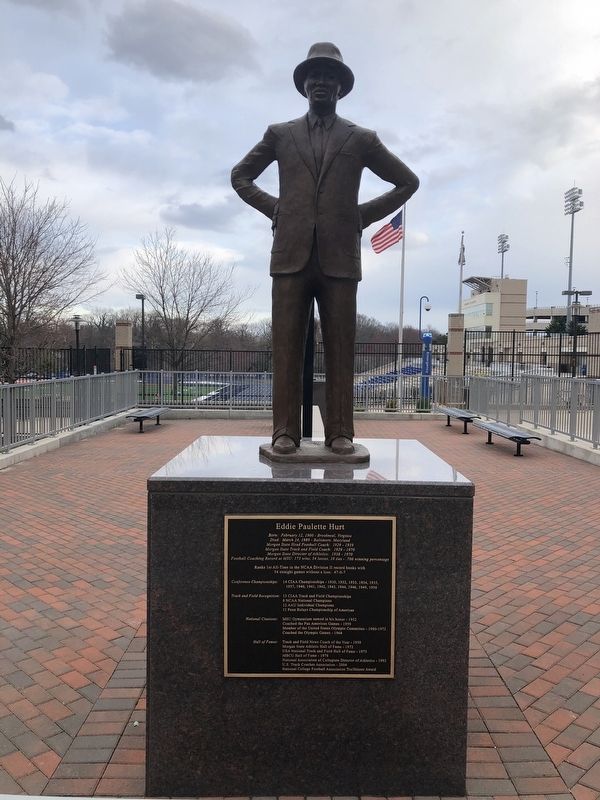
| 201 ► Maryland, Baltimore, Morgan State University — Eddie Paulette Hurt — |
| Near Hillen Road, 0.2 miles south of East Cold Spring Lane, on the right when traveling north. | |||
| 202 ► Maryland, Baltimore, Morgan State University — Groove Phi Groove Social Fellowship, Inc. — |
| Near Hillen Road (Maryland Route 41) 0.1 miles south of East Cold Spring Lane, on the right when traveling north. | |||
| 203 ► Maryland, Baltimore, Morgan State University — Holmes Hall — [Morgan State University] — |
| Near Hillen Road (Maryland Route 41) just south of Morgan State Campus Road, on the right when traveling north. | |||
| 204 ► Maryland, Baltimore, Morgan State University — Iota Phi Theta Fraternity, Inc. — ΙΦΘ — |
| Near Hillen Road (Maryland Route 41) 0.1 miles south of East Cold Spring Lane, on the right when traveling north. | |||
| 205 ► Maryland, Baltimore, Morgan State University — Morgan State University — |
| On Perring Parkway (Maryland Route 41) at Hillenwood Road, on the right when traveling east on Perring Parkway. | |||
| 206 ► Maryland, Baltimore, Morgan State University — Rochelle Stevens — Inducted into the School of Global Journalism & Communication's Garden of Fame — |
| Near Perring Parkway (Maryland Route 41) at Hartsdale Road, on the right when traveling east. | |||
| 207 ► Maryland, Baltimore, Morgan State University — William C. (Bill) Rhoden — Inducted into the School of Global Journalism & Communication's Garden of Fame — |
| Near Perring Parkway (Route 41) at Hartsdale Road, on the right when traveling east. | |||
| 208 ► Maryland, Baltimore, Mount Vernon — Breaking Boundaries: Reverence, Renovation, and Rock and Roll — Mount Vernon Cultural Walk — |
| On West Read Street. | |||
| 209 ► Maryland, Baltimore, Mount Vernon — Educating Baltimore: Music, History and Academia — Mount Vernon Cultural Walk — |
| On North Howard Street. | |||
| 210 ► Maryland, Baltimore, Mount Vernon — Eubie Blake National Jazz Institute and Cultural Center — |
| On North Howard Street. | |||
| 211 ► Maryland, Baltimore, Mount Vernon — H. Irvine Keyser — |
| On West Monument Street at Park Avenue, on the left when traveling east on West Monument Street. | |||
| 212 ► Maryland, Baltimore, Mount Vernon — Hackerman House — |
| On West Mount Vernon Place, on the right when traveling east. | |||
| 213 ► Maryland, Baltimore, Mount Vernon — Maryland Historical Society — |
| On West Monument Street at Park Avenue on West Monument Street. | |||
| 214 ► Maryland, Baltimore, Mount Vernon — The First Unitarian Church of Baltimore — (Universalist and Unitarian) — |
| On West Franklin Street (U.S. 40) at North Charles Street, on the right when traveling west on West Franklin Street. | |||
| 215 ► Maryland, Baltimore, Mount Vernon — The Morison — |
| On West Madison Street at Cathedral Street, on the right when traveling west on West Madison Street. | |||
| 216 ► Maryland, Baltimore, Mount Vernon — The Peabody Conservatory — |
| On Monument Street at N. Charles Street, on the right when traveling east on Monument Street. | |||
| 217 ► Maryland, Baltimore, Mount Vernon — The Peabody Institute and George Peabody Library — The Johns Hopkins University — |
| On Mount Vernon Place, on the right when traveling east. | |||
| 218 ► Maryland, Baltimore, Mount Vernon — The Peabody Library — |
| On East Mount Vernon Place at N. Charles Street, on the right when traveling east on East Mount Vernon Place. | |||
| 219 ► Maryland, Baltimore, Mount Vernon — William H. Welch House — |
| On St. Paul Street (Maryland Route 2). | |||
| 220 ► Maryland, Baltimore, Mount Washington — Mount Washington Octagon — |
| Near Smith Avenue west of Greely Road, on the right when traveling west. | |||
| 221 ► Maryland, Baltimore, Old Goucher — Goucher Hall — |
| On Saint Paul Street. | |||
| 222 ► Maryland, Baltimore, Oliver — The National Great Blacks in Wax Museum — |
| On North Bond Street at East North Avenue (U.S. 1), on the right when traveling north on North Bond Street. | |||
| 223 ► Maryland, Baltimore, Patterson Place — The Ed Rutkowski Building — |
| On East Baltimore Street just west of North Belnord Avenue, on the right when traveling west. | |||
| 224 ► Maryland, Baltimore, Poppleton — Edgar Allan Poe House |
| On Amity Street, 0.1 miles north of Fayatte Street, on the right when traveling north. Reported permanently removed. | |||
| 225 ► Maryland, Baltimore, Seton Hill — Historic Chapel of St. Mary's Seminary & University (dedicated 1808) — The First Roman Catholic Seminary in the United States (established 1791) — Birthplace of the Oblate Sisters of Providence (established 1829) — |
| Near North Paca Street (Maryland Route 129) at George Street, on the left when traveling north. | |||
| 226 ► Maryland, Baltimore, Seton Hill — How did this park get its name? — St. Mary's Park — Dedicated 1977 — |
| On North Paca Street (Maryland Route 129) south of Druid Hill Avenue, on the left when traveling north. | |||
| 227 ► Maryland, Baltimore, Seton Hill — St. Mary's Historic Site — |
| On North Paca Street (Route 129) just north of George Street, on the left when traveling north. | |||
| 228 ► Maryland, Baltimore, Seton Hill — St. Mary's Seminary — |
| Near North Paca Street (Maryland Route 129) north of George Street. | |||
| 229 ► Maryland, Baltimore, Seton Hill — The Oblate Sisters of Providence — July 2, 1829 — |
| On George Street, on the right when traveling west. | |||
| 230 ► Maryland, Baltimore, Sharp-Leadenhall — Solo Gibbs Park — |
| Near West Hamburg Street, on the right when traveling west. | |||
| 231 ► Maryland, Baltimore, University of Maryland — Baltimore Infirmary — |
| On South Greene Street (Maryland Route 295) near West Lombard Street, on the right when traveling south. | |||
| 232 ► Maryland, Baltimore, University of Maryland — Davidge Hall — |
| On Lombard Street at Greene Street, on the right when traveling west on Lombard Street. | |||
| 233 ► Maryland, Baltimore, University of Maryland — First Dental College — |
| On West Baltimore Street, on the left when traveling east. | |||
| 234 ► Maryland, Baltimore, University of Maryland — John McDonogh — |
| Near West Fayette Street at North Greene Street. | |||
| 235 ► Maryland, Baltimore, University of Maryland — The McDonoghs of Baltimore — |
| Near West Fayette Street at North Greene Street. | |||
| 236 ► Maryland, Baltimore, Upton — Buy Where You Can Work Campaign & Higher Education — Pennsylvania Avenue Heritage Trail — |
| On Pennsylvania Avenue at McMechen Street on Pennsylvania Avenue. | |||
| 237 ► Maryland, Baltimore, Upton — Henry Highland Garnett School — Thurgood Marshall Elementary School PS 103 — Upton's Henry Highland Garnett Community Center — |
| On Division Street. | |||
| 238 ► Maryland, Baltimore, Upton — Thurgood Marshall House — |
| On Division Street, on the left when traveling north. | |||
| 239 ► Maryland, Baltimore County, Catonsville — A Civil Rights Milestone — |
| On Bloomsbury Avenue south of Bloomingdale Avenue, on the left when traveling north. | |||
| 240 ► Maryland, Baltimore County, Catonsville — George and Betsy Sherman Hall — |
| On Academic Row, on the left when traveling north. | |||
| 241 ► Maryland, Baltimore County, Catonsville — Janet and Walter Sondheim Hall — |
| On Hilltop Circle, on the right when traveling north. | |||
| 242 ► Maryland, Baltimore County, Catonsville — Joseph Beuys Tree Partnership — 2000 - 2001 — |
| On Hilltop Road, 0.2 miles east of Hilltop Circle, on the right when traveling east. | |||
| 243 ► Maryland, Baltimore County, Catonsville — Robert and Jane Meyerhoff Chemistry Building — |
| Near Academic Row, on the right when traveling north. | |||
| 244 ► Maryland, Baltimore County, Cockeysville, Hunt Valley — The Community — |
| Near Kurtz Lane. | |||
| 245 ► Maryland, Baltimore County, Dundalk — Community Public Library — |
| On Shipping Place. | |||
| 246 ► Maryland, Baltimore County, Freeland — Freeland — |
| On Freeland Road north of Railroad Avenue, on the left when traveling north. | |||
| 247 ► Maryland, Baltimore County, Garrison — Trentham — |
| On Cradock Lane, 0.5 miles Reisterstown Road (Route 140), on the left when traveling north. | |||
| 248 ► Maryland, Baltimore County, Glyndon — Emory Grove — |
| On Butler Road (Maryland Route 128) at Waugh Avenue, on the left on Butler Road. | |||
| 249 ► Maryland, Baltimore County, Halethorpe — Site of Manual Labor School for Indigent Boys — 1839 - 1922 — |
| On Hilltop Circle, 0.1 miles east of Commons Drive, on the right when traveling east. | |||
| 250 ► Maryland, Baltimore County, Lutherville-Timonium — Brooklandwood Plantation — 1798 — |
| On Falls Road (Maryland Route 25) near Entrance to St. Paul’s School, on the left when traveling north. | |||
| 251 ► Maryland, Baltimore County, Lutherville-Timonium — Lutherville Historic District — National Register of Historic Places — U.S. Department of the Interior, 1972 — |
| On Front Street at Morris Street, on the right when traveling south on Front Street. | |||
| 252 ► Maryland, Baltimore County, Middle River — Douglas TA 4J Skyhawk — Glenn L Martin Maryland Aviation Museum — |
| On Strawberry Point Road, 0.8 miles east of Wilson Point Road, on the right when traveling north. | |||
| 253 ► Maryland, Baltimore County, Middle River — T-33 "Shooting Star" Jet Trainer — The Glenn L. Martin Maryland Aviation Museum — |
| On Strawberry Point Road, 0.8 miles east of Wilson Point Road, on the right when traveling north. | |||
| 254 ► Maryland, Baltimore County, Middle River — T-34C Turbomentor — The Glenn L. Martin Maryland Aviation Museum — |
| On Strawberry Point Road, 0.8 miles east of Wilson Point Road, on the right when traveling north. | |||
| 255 ► Maryland, Baltimore County, Middle River — The First Orems School — 1863 to 1927 — |
| On Orems Road at Glider Drive, on the right when traveling west on Orems Road. | |||
| 256 ► Maryland, Baltimore County, Oella — "Just One Nickel and I Could Ride" — ... in the Patapsco Heritage Area — |
| On Oella Avenue just north of Frederick Road (Maryland Route 144), on the left when traveling south. | |||
| 257 ► Maryland, Baltimore County, Reisterstown — Hannah More Academy — Founded 1832 — |
| On Reisterstown Road at Academy Lane on Reisterstown Road. | |||
| 258 ► Maryland, Baltimore County, Reisterstown — Oldest High School in Baltimore County — |
| On Cockey’s Mill Road at Reisterstown Road (Route 140), on the left on Cockey’s Mill Road. | |||
| 259 ► Maryland, Baltimore County, Reisterstown — Original Bell of the Franklin Academy — |
| On Reisterstown Road (Maryland Route 140) north of Franklin Boulevard, on the left when traveling north. | |||
| 260 ► Maryland, Baltimore County, Reisterstown — Original Cornerstone of the Franklin Senior High School — 1905 - 1965 — |
| On Reisterstown Road (Maryland Route 140) north of Franklin Boulevard, on the left when traveling north. | |||
| 261 ► Maryland, Baltimore County, Sparks Glencoe — Sparks — |
| On Sparks Road, 0.6 miles east of York Road (Maryland Route 45), on the right when traveling east. | |||
| 262 ► Maryland, Baltimore County, Towson — Goucher College Springhouse — |
| Near Goucher Road, 0.6 miles Dulaney Valley Road (Maryland Route 146), on the left when traveling east. | |||
| 263 ► Maryland, Baltimore County, Towson — Guth Memorial Gateway — |
| On Goucher Road just east of Dulaney Valley Road (Maryland Route 146), on the left when traveling west. | |||
| 264 ► Maryland, Baltimore County, Towson — The Fern Karesh Hurst '68 Terrace — |
| Near Goucher Road, 0.6 miles east of Dulaney Valley Road (Maryland Route 146), in the median. | |||
| 265 ► Maryland, Baltimore County, Towson — Tigers for Service — |
| Near University Avenue, 0.1 miles south of Towsontown Boulevard West, on the right when traveling south. | |||
| 266 ► Maryland, Baltimore County, Towson — Towson Library — Founded 1936 — |
| On York Rd at York Rd & Chesapeake Ave, on the right when traveling south on York Rd. | |||
| 267 ► Maryland, Baltimore County, Towson — War of 1812 Cannon — |
| Near Delaney Valley Road. | |||
| 268 ► Maryland, Baltimore County, Towson, East Towson — Carver (Colored) High School — |
| On Lennox Avenue. | |||
| 269 ► Maryland, Baltimore County, Towson, Loch Raven — 9 — Goucher College — Road to the 19th Amendment — National Votes for Women Trail — |
| On Goucher College Drive. | |||
| 270 ► Maryland, Calvert County, Port Republic — One-Room School — |
| On Broomes Island Road (Maryland Route 264) 0.4 miles south of Solomons Island Road (Maryland Route 2 / 4), on the left when traveling south. | |||
| 271 ► Maryland, Calvert County, Port Republic — School #7 — Rural One-Room School During Segregation — Calvert County — Port Republic — |
| Near Broomes Island Road (Maryland Route 264) 0.4 miles south of Solomons Island Road (Maryland Route 2), on the left when traveling south. | |||
| 272 ► Maryland, Calvert County, Prince Frederick — Old Wallville School — ca. 1880-1934 — |
| On Dares Beach Road (Maryland Route 402) 1.2 miles east of Maryland 2/4, on the left when traveling east. | |||
| 273 ► Maryland, Calvert County, Prince Frederick — Prince Frederick Library “Firsts” — |
| On Duke Street, 0.1 miles east of Solomons Island Road (Maryland Route 2/4), on the left when traveling east. | |||
| 274 ► Maryland, Calvert County, Prince Frederick — W. S. Brooks High School — |
| On Dares Beach Road (Maryland Route 402) east of Solomons Island Road (Maryland Route 2), on the right when traveling east. | |||
| 275 ► Maryland, Calvert County, Solomons — Becker House — 145 Charles Street — Outreach classroom and guest apartments. — |
| On Charles Street just east of Williams Street, on the right when traveling east. | |||
| 276 ► Maryland, Calvert County, Solomons — Calvert Marine Museum's Dee of St. Mary's — |
| Near Solomons Island Road South (Maryland Route 2) just south of Thomas Johnson Road, on the left when traveling north. | |||
| 277 ► Maryland, Calvert County, Solomons — Chesapeake Biological Laboratory — |
| On Farren Avenue, 0.1 miles south of Charles Street (Maryland Route 2), on the right when traveling south. | |||
| 278 ► Maryland, Calvert County, Solomons — Mansueti Laboratory — 146 Williams Street — |
| On Williams Street just south of Charles Street, on the right when traveling south. | |||
| 279 ► Maryland, Calvert County, Solomons — Parish House — 180 Farren Avenue — |
| On Charles Street west of Farren Avenue, on the left when traveling west. | |||
| 280 ► Maryland, Calvert County, Solomons — Saunders House — 140 Charles Street — Faculty and Staff offices and meeting facilities — |
| On Charles Street just east of Williams Street, on the left when traveling east. | |||
| 281 ► Maryland, Calvert County, Solomons — This flagpole — |
| Near Solomons Island Road South (Maryland Route 2) south of Thomas Johnson Road, on the left when traveling south. | |||
| 282 ► Maryland, Calvert County, St. Leonard — The St. Leonard Polling House — (1926-1974) — |
| On St. Leonard Road (Maryland Route 765) 0.1 miles south of Calvert Beach Road, on the right when traveling south. | |||
| 283 ► Maryland, Calvert County, Sunderland — Harriet Elizabeth Brown — |
| On Solomons Island Road (Maryland Route 2) at Pushaw Station Road, on the right when traveling north on Solomons Island Road. | |||
| 284 ► Maryland, Caroline County, Denton — Denton Schoolhouse — 104 South 2nd Street — |
| On South 2nd Street south of Franklin Street (Maryland Route 404), on the left when traveling north. | |||
| 285 ► Maryland, Caroline County, Denton — Neck Meeting House — |
| On Maryland Route 404 at Maryland Route 328, on the right when traveling west on State Route 404. | |||
| 286 ► Maryland, Caroline County, Ridgely — Ridgely, MD 1888 - 1917 — A Period of Broad Growth — |
| On West Belle Road at Cow Barn Road, on the left when traveling west on West Belle Road. | |||
| 287 ► Maryland, Carroll County, Keysville — Francis Scott Key — |
| On Keysville Bruceville Road when traveling south. | |||
| 288 ► Maryland, Carroll County, Marriottsville — Henryton School of Practical Nursing — |
| On Henryton Road at Henryton Center Road a.k.a.Henryton Hospital Road on Henryton Road. | |||
| 289 ► Maryland, Carroll County, Mount Airy — Commercial Bank — Circa 1912 — Historic Downtown Mount Airy — |
| On South Main Street (Maryland Route 808) south of Center Street, on the right when traveling south. | |||
| 290 ► Maryland, Carroll County, Mount Airy — First Location of the Mount Airy School — |
| Near South Main Street (Maryland Route 808) north of Pine Grove Court, on the right when traveling north. | |||
| 291 ► Maryland, Carroll County, Mount Airy — Mount Airy — History — |
| On South Main Street (Maryland Route 808) just south of Center Street, on the left when traveling north. | |||
| 292 ► Maryland, Carroll County, Mount Airy — Riddlemoser Building — 1920 — Historic Downtown Mount Airy — |
| On Park Avenue at South Main Street (Maryland Route 808), on the right when traveling north on Park Avenue. | |||
| 293 ► Maryland, Carroll County, Mount Airy — The Flat Iron Building — 1903 — Historic Downtown Mount Airy — |
| On South Main Street (Maryland Route 808), on the left when traveling south on South Main Street. | |||
| 294 ► Maryland, Carroll County, Sykesville — The Historic Sykesville Colored Schoolhouse — |
| On Schoolhouse Road. | |||
| 295 ► Maryland, Carroll County, Taneytown — "Steps of the Sisters" — St. Joseph Parish School — 1917 - 1972 — |
| On Frederick Street south of Memorial Drive / Warehouse Alley, on the right when traveling south. | |||
| 296 ► Maryland, Carroll County, Union Bridge — Blue Ridge College Bell — 1898 - 1913 — |
| On Main Street (Maryland Route 75) at White Street, on the left when traveling south on Main Street. | |||
| 297 ► Maryland, Carroll County, Union Bridge — Elmer A. Wolfe High School — |
| On Main Street, 0.1 miles south of Union Bridge Road, on the right when traveling south. | |||
| 298 ► Maryland, Carroll County, Westminster — Carroll Hall / President's House / Levine Hall / Baker Chapel / Alumni Hall / Ward Memorial Arch — |
| On Hersh Avenue at West Main Street, on the right when traveling north on Hersh Avenue. | |||
| 299 ► Maryland, Carroll County, Westminster — Landon C. Burns — |
| Near South Center Street north of Gist Road, on the right when traveling south. | |||
| 300 ► Maryland, Cecil County, Chesapeake City — Pell Gardens — 1982 — |
| On Bohemia Avenue. | |||
620 entries matched your criteria. Entries 201 through 300 are listed above. ⊲ Previous 100 — Next 100 ⊳