On Florida Boulevard, 0.1 miles west of 3rd Street (Florida Route A1A), on the right when traveling west.
The Little House movement began in 1923 as part of the Better Homes in America Demonstration Week in Washington, D.C. With the intent of highlighting modestly-sized homes for the American family, a demonstration home was erected behind the White . . . — — Map (db m165846) HM
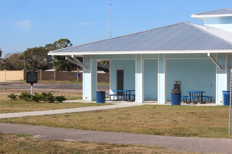
On Dr Martin Luther King Jr Drive (Florida Route 291) north of East Moreno Street, on the right when traveling north.
The house on the left is the birthplace of the first African American four
star general, Daniel "Chappie" James, Jr. (1920-1978). The steps on the
right are the remnants of the private school run by his mother, Mrs. Lillie
James, where he . . . — — Map (db m177307) HM
Near Briarwood Drive, 0.1 miles west of Old Brick Road, on the right when traveling west.
Welcome to the former homestead of Isaac I. Moody, Jr. one of four founding fathers of Flagler County. As the county's first major real estate developer and banker, the first politician of note and the prime mover in the development of the "Old . . . — — Map (db m220426) HM
Near Briarwood Drive, 0.1 miles west of Old Brick Road.
Quercus virginiana , Southern Live Oak, can grow to be almost as wide as it is tall. Typically, open grown trees can grow to be as tall as 45 ft. with a spread of nearly 50 ft. The leaves are dark green on top, pale gray underneath and grow . . . — — Map (db m220430) HM
Near Bulow Plantation Ruins, 1 mile east of Old Kings Road.
Vats and drying racks were used for the production of indigo. The vats were large, holding up to two thousand gallons of liquid. The stems and leaves were cut and laid in the larger vat. The stems were covered with a urine and water mix and left to . . . — — Map (db m191593) HM
Near Bulow Plantation Ruins, 1 mile east of Old Kings Road.
Each 12 foot by 16 foot cabin had shingled roofs, board floors and walls, with a coquina fire place.
Cabins were outfitted with common household items such as furniture, storage containers and table wear.
A fire pit in the yard was used . . . — — Map (db m191605) HM
Near Bulow Plantation Ruins, 1 mile east of Old Kings Road.
This is a representation of the plantation house that once stood here. The house was built in 1821 and completely destroyed during the Second Seminole War in late January 1836.
The house was once visited by naturalist John James Audubon on . . . — — Map (db m191592) HM
Near N Ocean Shore Blvd, 0.1 miles north of Tolstoy Ln.
Founded in 1937 as Marine Studios
The World’s First Oceanarium. Listed in the National Register of Historic Places April 14, 1986 by the Keeper of the National Register, United States Department of the Interior. — — Map (db m116297) HM
Near Corporate Drive at Palm Coast Pkwy NW, on the left when traveling north.
One single surviving Callery Pear tree, known as the “Survivor Tree" was discovered at Ground Zero in October 2001 after enduring the September 11 Terrorist attacks at the World Trade Center. The tree was severely damaged with snapped roots, . . . — — Map (db m226139) WM
Near Old State Road A1A, 0.5 miles west of North Oceanshore Boulevard, on the right when traveling south.
Mrs. Louise P. Young was a talented gardener. She designed the ornamental and planned the fruit orchards at Washington Oaks. Her favorite plants were azaleas, camellias, orchids and citrus, all of which remain in the gardens today. After the . . . — — Map (db m144812) HM
Near Old State Road A1A, 0.5 miles west of North Oceanshore Boulevard, on the right when traveling south.
This restored greenhouse was originally erected in the late 1940s from a prefabricated kit purchased from the National Greenhouse Company of Pana, Illinois. Potted orchids in bloom were brought into the Young’s home for interior decoration and . . . — — Map (db m144838) HM
Near Waterfront Park Road, 0.8 miles north of Colbert Lane, on the left when traveling north.
Welcome to the
Intracoastal Waterway
One of the most popular features of Waterfront Park is the body of water that winds along the paved paths. This waterway is part of a massive marine highway, known as the Intracoastal Waterway. It is . . . — — Map (db m239834) HM
Near Colbert Lane, 0.1 miles north of Harbor View Drive, on the left when traveling north.
Due to an unprecedented construction boom after World War II, Lehigh Portland Cement Company expanded its Allentown, Pennsylvania operation. To curtail the cement shortage they opened new plants across the United States, Bunnell, Florida being . . . — — Map (db m188863) HM
Near Malacompra Road east of Ocean Vista Lane, on the right when traveling east.
This hiking path is located on the Old Coast Guard Road, which was established during World War II. In the first half of 1942, German submarines sank more than 35 ships off Florida's coast prompting the military to establish a beach patrol. The . . . — — Map (db m208176) HM
Near Old Florida Route A1A, 0.5 miles west of North Ocean Shore Boulevard (Florida Route A1A), on the right when traveling south.
In the 1950s, the Youngs constructed a studio for Mrs. Young’s daughter, Virginia Powis Brown, who was a talented artist. Large skylights on the north side of the house fill the studio with natural light. The caretaker’s daughter, Francis Faye . . . — — Map (db m145357) HM
Near Mala Compra Road east of Ocean Vista Lane, on the right when traveling east.
General Joseph Hernandez owned three plantations along the Matanzas River. They were named Belle Vista, Byck's Hammock, and Mala Compra. The latter was his principal plantation and residence. The publicly-owned Mala Compra Plantation Greenway is . . . — — Map (db m212306) HM
On 6th Street at Avenue L, on the right when traveling west on 6th Street.
Apalachicola’s layout was organized in the mid 1830s by the Apalachicola Land Company. The original plan, patterned after the City of Philadelphia, featured a one-mile square grid with a large central square and smaller squares surrounding it. Each . . . — — Map (db m121998) HM
On Avenue B South (Business U.S. 98) east of Marine Street, on the right when traveling west.
Jebediah Tate was a superstitious farmer that lived northwest of Carrabelle in Sumatra Florida. His only son was born just before the war and he named him Cebe. Jebediah was a Civil War veteran, and his wife was half Cherokee Indian. He bought 160 . . . — — Map (db m122000) HM
Near Lillian Saunders Drive at Foster Barnes Drive, on the right when traveling south.
In the Upper Suwannee River Valley folks continue to make items for decorative and daily use. As local quilter Nancy Morgan says, "There's an art to everything you do." From christening dresses to gourd birdhouses, handmade items reflect the values, . . . — — Map (db m230356) HM
Near Lillian Saunders Drive at Foster Barnes Drive, on the left when traveling south.
Stephen Collins Foster (July 4, 1826-January 13, 1864), supposedly never laid eyes on the dark, tannic waters of the Suwanee River that he immortalized in his 1851 composition "Old Folks at Home", but when he took his pen and shortened the three . . . — — Map (db m230258) HM
Near Lillian Saunders Drive at Foster Barnes Drive, on the right when traveling south.
Folklife is the traditional cultural expression of a community or group—foods prepared for a church potluck, games played with a neighbor, songs sung in a community, crafts passed down in a family. While many older traditions persist in the Upper . . . — — Map (db m230326) HM
Near Lillian Saunders Drive at Foster Barnes Drive, on the right when traveling south.
From homemade jellies to boiled peanuts, the heritage of the Suwannee River Valley is experienced through local foodways. For example, Chicken Pilau - a chicken and rice dish cooked over an open fire - has been a culinary tradition in Florida for . . . — — Map (db m230333) HM
Near Northwest Morrell Drive, 0.5 miles north of Northwest Mansfield Drive.
The Bishops had a great love for Florida and its beautiful rivers. Senator Bishop was a conservationist and farmer. While in the Florida senate he was a key figure in the establishment of the Ichetucknee Springs State Park. Virginia Bishop was a . . . — — Map (db m210075) HM
Near Southeast 94th Street, 1 mile east of County Route 135.
Late in the 19th century the Godwin Bridge was built to span the river for both residential and commercial transportation (such as logging, cotton, and turpentine industries) to connect Hamilton and Columbia Counties. Floods swept the bridge away . . . — — Map (db m239390) HM
Near Lillian Saunders Drive at Foster Barnes Drive, on the right when traveling south.
Each person is an archive of memories, knowledge and skills. As traditions pass from one generation to another, they transform and take on new meaning. Some old ways of life fall out of practice, while others are made new again. From building quail . . . — — Map (db m230341) HM
Near East Hickpochee Avenue (Florida Route 80) at N Main Street (Florida Route 29).
Nicholas J Cutinha
SP4 US Army
CO C BN 9 Inf Reg25 Inf Div
Vietnam
Medal of Honor Bronze Star Medal Purple Heart
Jan 23 1945 † Mar 2 1968
On March 2 1968, Nicholas J Cutinha was
engaged by overwhelming Vietnam Cong . . . — — Map (db m221290) WM
Near Main Drive west of Old State Route 8, on the left when traveling west.
The Founding of Red Hill
In the 1920s, people came to Florida for many of the same reasons they do today, seeking mild winters and the beauty of Southern getaway. The Lake Placid Club of New York established its Florida resort on Lake . . . — — Map (db m218949) HM
On N. Wheeler Street at W. Damon Street, on the right when traveling north on N. Wheeler Street.
Freedom Rising
Artist: Duane Scott
In honor of the men and women who are
Veterans of the Armed Forces of the
United States of America
Who have served, fought, and died
since the birth of our Nation . . . — — Map (db m231398) WM
Sponsored By
Plant City Garden Club
This garden is in tribute to the
members of the armed forces
past, present & future.
The Blue Star Marker
became an icon in WWII for
sons & daughters away at war.
Today it honors all . . . — — Map (db m231451) HM
The Veterans’ Memorial
Monument Park
At Courier Field
Dedicated in Honor of
and with Appreciation to
the Men and Women who Served
in the United States Armed Forces.
Their Loyalty, Bravery and . . . — — Map (db m231391) WM
On Interbay Boulevard, 0.1 miles south of South Nichol Street, on the left when traveling south.
Mrs. Chester W. Chapin, controlling owner of the company which operated the city's first electric trolley cars, purchased these acres and in 1894 developed this site into a tropical parkas terminal for her line.
She named it for the French . . . — — Map (db m154310) HM
On North 22nd Street (Florida Route 585) south of East Dr Martin Luther King Jr Boulevard (Florida Route 574), on the right when traveling south.
The City of Tampa acquired the Cyrus T. Greene property in 1931, which was named in honor of the executive secretary of the Tampa Urban League. By the 1940s, the baseball field created at Cyrus Greene was known as the 22nd Street . . . — — Map (db m151029) HM
Near North US Highway 301, 0.2 miles East Dr. Martin Luther King Jr. Boulevard.
The invasion of Grenada, codenamed Operation Urgent Fury, was a 1983 United States invasion of Grenada, a Caribbean island nation with a population of about 93,000 located
123 miles (150 km) north of Venezuela, that resulted in a U.S. victory . . . — — Map (db m193974) WM
On North Ashley Drive at East Zack Street, on the right when traveling south on North Ashley Drive.
Jimi Hendrix is one of the most influential musicians and guitarists of the 20th century. His legacy, dedication, and passion for music transcends all boundaries and brings people from all walks of life together. He played two nights here in Tampa, . . . — — Map (db m146029) HM
Near North US Highway 301, 0.2 miles south of East Dr. Martin Luther King Jr. Blvd, on the right when traveling south.
The national destinies of the United States of America and the Republic of Mexico collided in the 1840s over land, pride, and their futures. The two nations were at war by 1846. Thousands of young men served in their respective armies and navies. . . . — — Map (db m193871) WM
Near N US Highway 301, 0.2 miles south of E Dr. Martin Luther King Jr. Blvd.
Operation Enduring Freedom - Philippines (OEF-P) or Operation Freedom Eagle is part of Operation Enduring Freedom and the U.S. Global War on Terrorism. About 600 U.S. military personnel are advising and assisting the Armed Forces of the Philippines . . . — — Map (db m193312) HM WM
Near N US Highway 301,, 0.2 miles south of E Dr. Martin Luther King Jr. Blvd.
Operation Frequent Wind was the evacuation by helicopter of American civilians and "at-risk" Vietnamese from Saigon, South Vietnam, on 29-30 April 1975 during the last days
of the Vietnam War. More than 7,000 people were evacuated from various . . . — — Map (db m193962) WM
On North Orange Avenue, 0.1 miles north of East Harrison Street, on the right when traveling north.
Under Mayor William Poe's direction, the Perry Harvey, Sr., Park Skateboard Bowl opened in 1979 as part of a recreational park for the Central Park Village community. As Florida's first municipal ride-at-your-own-risk skateboard facility, it offered . . . — — Map (db m103246) HM
On Picnic Island Boulevard, 0.4 miles west of Port Tampa Drive, in the median. Reported missing.
During the Spanish-American War in 1898, Port Tampa was the port of embarkation for U.S. Troops going to Cuba to fight An area known as Picnic Island was where the soldiers practiced close order drill and simple maneuvers while tented here. It also . . . — — Map (db m130375) HM
Near U.S. 301, 0.3 miles south of E Dr Martin Luther King Jr Boulevard (Florida Route 574), on the right when traveling south.
U.S. Navy Submarines
paid heavily for
their success in
World War II.
A total of
374 officers and
3131 men are on
board these 52
U.S. Submarines
Still on “Patrol.”
We shall never forget that it was our submarines that help the . . . — — Map (db m207404) WM
Near N US Highway 301, 0.2 miles south of E Dr. Martin Luther King Jr. Blvd.
Front:
The Price of Freedom
Is Visible Here
All Gave Some …. Some Gave All
Left Side:
“Let every nation know whether it wishes us well or ill that we shall pay any price, bear any burden, . . . — — Map (db m207475) WM
Near U.S. 301, 0.2 miles south of East Dr. Martin Luther King Jr. Boulevard, on the right when traveling north.
Both the American soldier and the Seminole warrior faced each other across a wide cultural gap. Each were trained and determined.
A large part of central Florida is established as Hillsborough County in 1834. — — Map (db m193913) HM WM
On June 12, 1986, the Tampa City Council passed Ordinance No. 9297-a
naming this park:
“Ybor Centennial Park By Which Name It Shall Hereafter And Forever Be Known.”
Signed: Bob Martinez, Mayor; Sandra W. Freedman. . . . — — Map (db m8750) HM
On West Country Club Drive west of Forest Hills Drive.
Nestled among sprawling oaks and curved roads with names like Fairway, Fore, and Bogie lies the Forest Hills neighborhood and the Babe Zaharias Golf Course. The neighborhood, originally known as Golfland, was part of a much larger area known as . . . — — Map (db m239239) HM
Near West Cypress Street south of West La Salle Street, on the left when traveling west.
Salt (sodium chloride, chemically NaCl) shares an ancient history with mankind, going back centuries and through countless civilizations. Salt acts both as a desired food seasoning, and as a useful preservation agent to retard food spoilage. The . . . — — Map (db m214935) HM
Old Fort King Trail is near the original Fort King Road. During the Second Seminole War, Fort King Road served as the main transportation and communication route between Fort Brooke (Tampa) and the Seminole Agency at Fort King (Ocala). Following an . . . — — Map (db m126033) HM
On 39th Street, 0.1 miles east of U.S. 1, on the right when traveling west.
In 1901, William E. Geoffrey, a black man, donated this land for a black school in Gifford. Funded with help from the Julius Rosenwald Foundation, which provided support for hundreds of black schools across Florida and the Southeast, the Gifford . . . — — Map (db m213229) HM
Near U.S. 1 at Vista Garden Trails, on the right when traveling north.
This is the original site of McKee Jungle Gardens, one of Florida’s earliest tourist attractions. McKee Gardens was founded in 1932 by Vero Beach pioneer Waldo Sexton and Cleveland industrialist Arthur G. McKee. They engaged William Lyman . . . — — Map (db m92562) HM
Near Dahlia Lane, 0.2 miles west of Mockingbird Drive, on the left when traveling west.
In Memory of
Alexander MacWilliams Sr.
whose efforts and inspiration founded this
beautiful memorial sanctuary.
Dedicated to those who paid the supreme sacrifice.
★ ★ ★
“May he walk through these paths of . . . — — Map (db m187290) HM WM
Near Florida Route 2, 1 mile east of Timberlake Road, on the right when traveling east.
Creek Town of the Spanish Era
Ekanachatte ("Red Ground") was an important Creek Indian town that stood here at Neal's Landing Park during the latter half of the 18th century and the first two decades of the 19th.
This site was known as . . . — — Map (db m201244) HM
Near West Washington Street (Florida Route 10) at North Hickory Street.
In honor of the Confederate
Soldiers of Jefferson County
and the south land who
who served the South and the
Confederate States of
America from 1861-1865.
Donated by the Sons of the
Confederate Veterans, Major . . . — — Map (db m239653) WM
Near County Road 445, 5 miles east of State Highway 19 when traveling north.
Marjorie Harris Carr - Tireless Conservationist Marjorie Harris Carr's most prominent legacy on the byway was to halt the construction of the Cross Florida Barge Canal. Over the long 1962-1971 battle, she enlisted citizen's groups, formed an . . . — — Map (db m131087) HM
Near Main Street (Florida Route 19) at Clark Road, on the right when traveling north.
Robert M. McTureous, Jr. Private United States Marine Corps Born: March 26, 1924 Killed in Action: June 1945 Awarded his country’s highest award The Medal of Honor ”For conspicuous gallantry and intrepidity at the risk of his life above . . . — — Map (db m167318) WM
On 3rd Street at West Minneola Avenue, on the left when traveling north on 3rd Street.
In Memory of
William Alfred Suggs
Born Jan. 1, 1919
Died Dec. 7, 1941
at Pearl Harbor
on USS Arizona
VFW Post 5277
Clermont, FL — — Map (db m244285) WM
Near North Bay Street (Florida Route 19) at West Clifford Avenue, on the right when traveling south.
Ferran Park was formed in 1921 from sand pumped from the bottom of Lake Eustis and retained by a bulkhead constructed at the waters’ edge. It was named for E.L. Ferran, a pioneer businessman and civic leader. In 1994 the park was placed on the . . . — — Map (db m166236) HM
Near North Bay Street (Florida Route 19) at Gottsche Avenue, on the right when traveling south.
Lake Eustis was named for Colonel Abraham Eustis, First Commander of U.S. Army forces in Florida. The city of Eustis was briefly named Lake Eustis, but the word “Lake” was dropped in 1883 when the town was incorporated. The lake is about 12 square . . . — — Map (db m166238) HM
Near Northshore Drive, 0.1 miles west of North Bay Street (Florida Route 19) when traveling west.
The lakefront was the hub of early Eustis. Businesses, Eustis Park, the railroad station, bathing beaches, marinas and public docks brought people to the waterfront. Boating activities of every sort from pleasure cruises to regattas were popular. . . . — — Map (db m166242) HM
Near North Bay Street (Florida Route 19) at Hazzard Avenue, on the right when traveling south.
By 1912 a building called The Pavilion had been constructed on pilings in Lake Eustis. A pier 250 feet long connected it to shore where Clifford/MacDonald Street ended. The Pavilion served as a community center where parties, dances, and band . . . — — Map (db m166240) HM
On Edgerton Court south of Charles Avenue, on the left when traveling south.
The Mount Dora Lawn Bowling Club was envisioned in 1925 by Willard Bryant and Fred Thompson, two winter visitors from Hartford, Connecticut. They approached Charles Edgerton, owner of the historic Lakeside Inn and member of the City’s Park . . . — — Map (db m145383) HM
Near State Highway 19, 3.3 miles north of County Road 42, on the left when traveling north.
This structure was built by the Civilian Conservation Corps (CCC) in 1938. It originally served as a home for the State Game Officer for the Ocala National Forest. It has been used by the Forest Service as an office and laboratory. The interior of . . . — — Map (db m167892) HM
Side 1
Dr. Cyrus Read Teed, Founder of the Koreshan Unity and President of the Koreshan University of Chicago, established in 1892 his "College of Life" in Estero, Florida, as a cooperative community in the spirit of Christ's teaching.
"We . . . — — Map (db m171462) HM
Near McGregor Boulevard south of Larchmont Avenue, on the right when traveling south.
“Madeleine, Marie, Theodore and the two maids have gone bathing in the hotel pool—so everybody is happy," wrote Mina to family, April 7, 1909.
By the 1911 winter season the family and staff no longer had to travel downtown to the . . . — — Map (db m90287) HM
Near Dr. Martin Luther King Jr. Boulevard (Florida Route 82) 0.1 miles west of Henderson Avenue.
Williams Academy, originally located between Lemon Street and Anderson Avenue (later MLK Boulevard), was built in 1913. Named for J. S. Williams, the Lee County Supervisor of Colored Schools, it was Lee County's first government-funded school for . . . — — Map (db m160805) HM
Near West Tennessee Street at Ocala Road, on the right when traveling south.
The Apalachee were a matrilineal society. Inheritance and authority were passed down through the mother's family. Related groups were also combined into clans with each member belonging to the mother's clan. After marriage, the husband relocated to . . . — — Map (db m239379) HM
Near West Tennessee Street at Ocala Road, on the right when traveling south.
The dwelling frame to your right represents the shape and size of a typical Apalachee home. Although the Apalachee were skilled carpenters, their own dwellings were relatively simple. Most activities were conducted outside, with homes reserved for . . . — — Map (db m239388) HM
Near West Tennessee Street at Ocala Road, on the right when traveling west.
Living on the hilltop where the plaza and public buildings were located was an honor most likely reserved for the village's leaders. They attended daily meetings in a council house where community affairs were discussed and planned.
By . . . — — Map (db m239272) HM
Near West Tennessee Street at Ocala Road, on the right when traveling south.
Apalachee militias provided the bulk of the province's military power. Apalachee received training in the use of firearms from Spaniards. They served as sentries, some held military titles, and they always outnumbered Spanish soldiers on raids. . . . — — Map (db m239355) HM
Near South Gadsden Street at East Bloxham Street, on the left when traveling south.
This waterfall celebrates the location of the Florida State Capital in October 1823 by Dr. William H. Simmons of St. Augustine and John Lee Williams of Pensacola. These men were commissioned by Governor William P. Duval to find a compromise location . . . — — Map (db m230632) HM
The introduction of Catholicism to the Apalachee at San Luis brought fundamental changes. From marriage to funeral practices, holidays to education, the church influenced nearly every aspect of daily life.
Throughout the day, the church bells . . . — — Map (db m239520) HM
Near West Tennessee Street at Ocala Road, on the right when traveling west.
By outward appearances, life in the Spanish village was European in nature. However, since Spanish soldiers commonly married Apalachee women, native wives continued some Indian traditions in their homes. Apalachee women perceived marriage to . . . — — Map (db m239322) HM
On E. Pensacola Street at S. Meridian Street, on the right when traveling west on E. Pensacola Street.
Understanding the importance of history, a spirit house connects the past with the present. It allows individuals of all generations to experience and learn about the strength and resolve of the former Smokey Hollow Community, a segregated . . . — — Map (db m230589) HM
On West Tennessee Street at Mission Road on West Tennessee Street.
The cemetery at San Luis is located beneath the floor of the church. Since all the residents of San Luis were Christians, a great number of them were buried in the church cemetery. As in other aspects of life, rank had its privileges. Important or . . . — — Map (db m239557) HM
You are standing on the edge of the main plaza of the village of San Luis. The path you are following traces the edge of the plaza that was the central hub of commerce and activities for the mission. Traditionally, both Spaniards and Apalachee built . . . — — Map (db m239528) HM
Near East Pensacola Street at South Meridian Street, on the right when traveling east.
"Smokey Hollow was our home, the place from which we went forth with lessons and discipline...ready for life. It prepared our feet and minds to leave...but not our hearts!" - Elmer Ash, former resident
“Our parents insisted that we had to . . . — — Map (db m230813) HM
Near East Pensacola Street at South Meridian Street, on the right when traveling east.
"Smokey Hollow prepared me for life. I learned to overcome the bad times that took place with the good times.” - Mary Hartsfield, former resident
From it’s founding in the 1890s through the 1960s, Smokey Hollow was an African . . . — — Map (db m230846) HM
Near East Pensacola Street at South Meridian Street, on the right when traveling east.
"We grew up together. We had nothing else and nobody else. We had each other, and I think it made us all one." -Lester Oliver, former resident
The "Spirit Houses" in front of you are in the shape of a "shotgun" house, one of . . . — — Map (db m230807) HM
The friars lived in the convento (friary) where they used their time away from the church to read and improve their knowledge of the Apalachee language through native interpreters. They also traveled to outlying villages that had no friars . . . — — Map (db m239518) HM
Near South Gadsden Street at East Bloxham Street, on the right when traveling south.
The Prime Meridian Marker is the beginning point of all private property descriptions in the State of Florida and is located here in Cascades Park. The marker is the point at which the meridian parallel and the baseline parallel intersect. This . . . — — Map (db m231008) HM
Near West Tennessee Street at Ocala Road, on the right when traveling south.
From the 1650s when San Luis was first established, its military garrison had some type of casa fuerte or blockhouse. However, a full-scale fort was not constructed until the 1690s when the threat of British attack became imminent.
The . . . — — Map (db m239353) HM
Near West Tennessee Street at Mission Road, on the right when traveling south.
Prior to European contact, the Apalachee used bone stone, shell, clay, plant fibers, and wood for most of their needs. The Spanish traded manufactured goods to the Indians. Iron tools, popular among the Indians for their durability, replaced bone, . . . — — Map (db m239378) HM
Mission San Luis was one of more than 100 mission settlements established in Spanish Florida between the 1560s and 1690s.
Between 1656 and 1704, more than 1400 Apalachee Indians and Spaniards lived at the mission. San Luis was a principal village . . . — — Map (db m239247) HM
On South Meridian Street at East Madison Street, on the left when traveling south on South Meridian Street.
In 1827 when Florida became a U.S. territory, the ports of Pensacola in the west and St. Augustine in the east were its largest towns. The hardships of travel between them led to the decision to select a halfway point for the capital. . . . — — Map (db m211630) HM
On South Meridian Street north of East Madison Street, on the right when traveling north.
In January 1861, Florida seceded from the Union, eventually joining 10 other southern states to form the Confederacy. The nation's bloodiest conflict began in April 1861 and ended in April 1865. When the Civil War began, cotton plantations . . . — — Map (db m211718) HM
On South Meridian Street, 0.1 miles north of East Madison Street, on the left when traveling south.
In the early 20th century, Leon County became more urban as tenant farmers moved to town and increased Tallahassee's
population. City life offered steady employment and modern conveniences, including telephones, electric lights and rail service. . . . — — Map (db m211853) HM
On South Meridian Street at East Madison Street, on the right when traveling north on South Meridian Street.
Early in its history, Tallahassee could be considered a rough-and-tumble place. Knives and dueling competitions settled disputes, while trash and vagrants shared the streets. Ralph Waldo Emerson called it a "grotesque place rapidly settled by public . . . — — Map (db m211667) HM
On South Meridian Street north of East Madison Street, on the right when traveling north.
Tallahassee's second industry is higher education. Florida State University (FSU) was established in 1851 as a military seminary, later transforming into Florida State College for Women in 1909. By 1947, the state officially converted the women’s . . . — — Map (db m212076) HM
On South Meridian Street north of East Madison Street, on the right when traveling north.
The Civil War brought with it great strides for freedom and equality for American slaves in Tallahassee, the official news of freedom came on May 25, 1865 with the reading of the Emancipation Proclamation outside the Knott House.
After freedmen . . . — — Map (db m211846) HM
On South Meridian Street, 0.2 miles north of East Madison Street.
Tallahassee became a boom town during World War II. Dale Mabry Air Base opened in 1941 and employed more than 5,000 soldiers and civilians. The base trained thousands of fighter pilots, including the all-black Tuskegee Airmen corps.
— — — — . . . — — Map (db m211873) HM
Near South Meridian Street south of East Pensacola Street.
Althemese Barnes has been a leader in historic preservation for decades. She is the founder and Executive Director Emeritus of the John G. Riley House Center/Museum and was central to the establishment of the Florida African American Heritage . . . — — Map (db m211326) HM
536 entries matched your criteria. Entries 101 through 200 are listed above. ⊲ Previous 100 — Next 100 ⊳