1804 entries match your criteria. Entries 101 through 200 are listed.⊲ Previous 100 — Next 100 ⊳
Natural Features Topic
By Craig Baker, May 6, 2024
National Natural Landmark
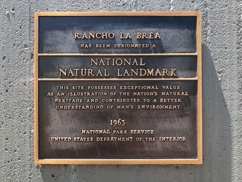
| 101 ► California, Los Angeles County, Los Angeles, Miracle Mile — 170 — Hancock Park — La Brea Pits — |
| On Wilshire Boulevard at Curson Avenue, on the right when traveling west on Wilshire Boulevard. | |||
| 102 ► California, Los Angeles County, Los Angeles, Venice — History of Ballona Lagoon — |
| On East Jib Street at Jib Street, on the left when traveling south on East Jib Street. | |||
| 103 ► California, Los Angeles County, Palmdale — The San Andreas Fault — |
| On State Highway 14, 2.4 miles north of Angeles Forest Highway, on the right when traveling north. | |||
| 104 ► California, Los Angeles County, Rancho Palos Verdes — Portuguese Bend — |
| On Palos Verdes Drive South, 0.2 miles east of Sea Cove Drive, on the right when traveling east. | |||
| 105 ► California, Marin County, Point Reyes Station — Sea Life in These Waters — Gulf of the Farallones & Cordell Band — National Marine Sanctuaries — |
| Near Sir Francis Drake Boulevard north of Chimney Road Road. | |||
| 106 ► California, Marin County, Sausalito — The Bay Transformed — |
| Near U.S. 101, on the right when traveling north. | |||
| 107 ► California, Marin County, Sausalito — The Golden Gate — A narrow three-mile channel — |
| On Conzelman Road near McCullough Road, on the left when traveling west. | |||
| 108 ► California, Mariposa County, Bear Valley — May Rock — |
| On State Highway 49, on the right when traveling south. | |||
| 109 ► California, Mariposa County, Wawona — 4 — Yosemite Valley's First Visit by White Men |
| Near Wawona Road (State Highway 41), on the left when traveling east. Reported missing. | |||
| 110 ► California, Mariposa County, Yosemite National Park — A Varied View — Tunnel View - Yosemite National Park — |
| Near Southside Drive, on the left when traveling east. | |||
| 111 ► California, Mariposa County, Yosemite National Park — A View Through Time — Tunnel View - Yosemite National Park — |
| Near Southside Drive, on the right when traveling east. | |||
| 112 ► California, Mariposa County, Yosemite National Park — Disappearing Waterfalls — |
| Near Wawona Road south of California Route 41. | |||
| 113 ► California, Mariposa County, Yosemite National Park — Glacier Point Hotel — |
| Near Glacier Point Road. | |||
| 114 ► California, Mariposa County, Yosemite National Park — Reawakening the Meadow — |
| On Southside Drive at Sentinel Drive, on the left when traveling east on Southside Drive. | |||
| 115 ► California, Mariposa County, Yosemite National Park — Welcome to Glacier Point — |
| On Glacier Point Road. | |||
| 116 ► California, Mono County, Mammoth Lakes — Convict Lake — |
| On Convict Lake Road west of U.S. 395, on the right when traveling west. | |||
| 117 ► California, Mono County, Mammoth Lakes — Crowley Lake — |
| On U.S. 395, on the right when traveling south. | |||
| 118 ► California, Mono County, Mammoth Lakes — Owens Valley — |
| On Three Flags Highway (State Highway 395), on the right when traveling south. | |||
| 119 ► California, Mono County, Mammoth Lakes — Preserving Special Places — |
| Near Minaret Road (California Route 203). | |||
| 120 ► California, Monterey County, Del Monte Forest — Lone Cypress — Perched over the Pacific for Hundreds of Years |
| On 17 Mile Drive west of California Highway 1, on the right when traveling south. Reported missing. | |||
| 121 ► California, Monterey County, Marina — A Coastal Attack the Army Couldn’t Stop — Fort Ord Dunes State Park — |
| Near 8th Street. | |||
| 122 ► California, Monterey County, Marina — A Coastal Attack the Army Couldn’t Stop — Fort Ord Dunes State Park — |
| Near 8th Street. | |||
| 123 ► California, Monterey County, Pacific Grove — Balance Lost and Found Again — Asilomar Conference Center — |
| 124 ► California, Nevada County, Norden — 27 — Donner Summit Overlook — |
| On Donner Pass Road, on the left when traveling east. | |||
| 125 ► California, Nevada County, Soda Springs — Royal Gorge History — A Brief and Recent History of Royal Gorge — |
| On Old Donner Summit (Lake Van Norden) Road near Sugar Bowl Road, on the right when traveling east. | |||
| 126 ► California, Orange County, Anaheim — Petrified Tree — From the Pike Petrified Forest, Colorado — |
| Near Disneyland Drive. | |||
| 127 ► California, Orange County, North Tustin — Red Hill — |
| On Red Hill Avenue, on the right when traveling south. | |||
| 128 ► California, Orange County, North Tustin — 203 — Red Hill — |
| On Red Hill Avenue, on the right when traveling south. | |||
| 129 ► California, Placer County, Cisco Grove — 1 — Red Mountain — |
| On Eagle Lakes Road near Interstate 80, on the right when traveling west. | |||
| 130 ► California, Placer County, Emigrant Gap — Susan's Spot — Auburn Artist and Environmental Planner — 1948-2003 — |
| On Cisco Road at Hampshire Rocks Road, on the right when traveling north on Cisco Road. | |||
| 131 ► California, Riverside County, Chiriaco Summit — Romero Pass — Bradshaw-Grant Pass — |
| On Chiriaco Road near Summit Road, on the right when traveling west. | |||
| 132 ► California, Riverside County, Palm Springs — The Mountain Rocks — San Jacinto Peak towers over the Peninsular Ranges — |
| Near Tram Way. | |||
| 133 ► California, Riverside County, Palm Springs — The Valley's Faults — |
| Near Tram Way. | |||
| 134 ► California, Sacramento County, Rancho Cordova, Mather — Vernal Pool Grassland — Mather Vernal Pools — |
| On Eagles Nest Road, 2 miles south of Douglas Road. | |||
| 135 ► California, San Benito County, Paicines — Benitoite — |
| On Coalinga - Los Gatos Road at Union Carbide Road, on the right when traveling west on Coalinga - Los Gatos Road. | |||
| 136 ► California, San Benito County, Paicines — The Coast Range: an ecological meeting place — |
| Near Coalinga Road. | |||
| 137 ► California, San Bernardino County, Amboy — 92 — Amboy Crater — National Natural Landmark — |
| On Crater Road, 0.5 miles west of National Trails Highway, on the right when traveling west. | |||
| 138 ► California, San Bernardino County, Amboy — The Story of Route 66 — |
| On National Trails Highway (Old Route 66), 16.5 miles east of Amboy, CA., on the right when traveling east. | |||
| 139 ► California, San Bernardino County, Big Bear Lake — Champion Lodgepole Pine — How long does it take to become a Champion? — |
| Near Road 2N11, 1 mile west of Road 2N10, on the right when traveling west. | |||
| 140 ► California, San Bernardino County, San Bernardino — 977 — The Arrowhead Landmark — |
| On Waterman Avenue (California Route 18) north of 40th Street, on the right when traveling north. | |||
| 141 ► California, San Bernardino County, Trona — Famous Trona Pinnacles — A National Natural Landmark — Our Pinnacles Are Stars — |
| On Pinnacle Road just south of Trona Road (Highway 178), on the right when traveling south. | |||
| 142 ► California, San Bernardino County, Trona — Welcome to the Trona Pinnacles — ... a National Natural Landmark — |
| Near California Route 178. | |||
| 143 ► California, San Francisco City and County, San Francisco, Embarcadero — 20,000 Years Ago — |
| Near The Embarcadero near Folsom Street, on the right when traveling west. | |||
| 144 ► California, San Francisco City and County, San Francisco, Financial District — 83 — Shoreline of San Francisco Bay — 1848 — |
| On Bush Street at Market Street, on the right when traveling north on Bush Street. | |||
| 145 ► California, San Francisco City and County, San Francisco, Financial District — 83 — Shoreline of San Francisco Bay — 1848 — |
| Near Market Street near 1st Street, on the right when traveling north. | |||
| 146 ► California, San Francisco City and County, San Francisco, Glen Park — Glen Canyon Park History — |
| Near O'Shaughnessey Boulevard near Elk Street, on the right when traveling north. | |||
| 147 ► California, San Francisco City and County, San Francisco, Lincoln Park — Historic Shipwrecks - Lost at the Golden Gate — |
| On Lands End Trail north of El Camino del Mar. | |||
| 148 ► California, San Francisco City and County, San Francisco, Lower Haight — Watershed History — The Channel Watershed — |
| On Pierce Street at Waller Street on Pierce Street. | |||
| 149 ► California, San Francisco City and County, San Francisco, Presidio of San Francisco — Wetlands Renaissance — |
| On Mason Street at Halleck Street, on the right when traveling west on Mason Street. | |||
| 150 ► California, San Francisco City and County, San Francisco, South Beach — Southbeach Shoreline – 1852 — |
| On King Street, on the left when traveling south. | |||
| 151 ► California, San Luis Obispo County, Avila Beach — Port San Luis — |
| Near Avila Beach Drive near Diablo Canyon Road. | |||
| 152 ► California, San Luis Obispo County, Carrizo Plain National Monument — Soda Lake — |
| Near Soda Lake Road, 1 mile south of Simmler Road, on the right when traveling south. | |||
| 153 ► California, San Luis Obispo County, Carrizo Plain National Monument — Soda Lake — |
| Near Soda Lake Road, 2.1 miles south of Seven Mile Road, on the right when traveling south. | |||
| 154 ► California, San Luis Obispo County, Carrizo Plain National Monument — Wallace Creek — San Andreas Fault — |
| Near Elkhorn Road, 4.5 miles south of California Route 58. | |||
| 155 ► California, San Luis Obispo County, Morro Bay — 821 — Morro Rock — |
| On Coleman Drive, 0.3 miles west of Embarcadero, on the right when traveling west. | |||
| 156 ► California, San Mateo County, Daly City — If it's Summer, Bring a Sweater — Daly City summers are virtually rain-free, but don't expect sunny skies. — |
| Near Thornton Beach Road west of Skyline Boulevard. | |||
| 157 ► California, San Mateo County, Daly City — The Ground Beneath Your Feet — |
| Near Thornton Beach Road west of Skyline Boulevard. | |||
| 158 ► California, San Mateo County, Milbrae — The San Andreas Fault — |
| On San Andrea Valley Road. | |||
| 159 ► California, Santa Clara County, Los Gatos — Lexington Reservoir — James J. Lenihan Dam — |
| Near Alma Bridge Road, on the right when traveling south. | |||
| 160 ► California, Santa Clara County, Morgan Hill — Murphy's Majestic Oak — |
| Near West 3rd Street east of Del Monte Avenue. | |||
| 161 ► California, Santa Clara County, Morgan Hill — Oak Trees of Morgan Hill — |
| On West 3rd Street near Del Monte Avenue, on the right when traveling west. | |||
| 162 ► California, Santa Clara County, San Jose, Alum Rock — Historic Alum Rock Park — |
| Near Penitencia Creek Road, on the left when traveling east. | |||
| 163 ► California, Santa Clara County, San Jose, Alum Rock — Mineral Springs Grotto — |
| Near Alum Rock Road. | |||
| 164 ► California, Santa Cruz County, Santa Cruz — 1055 — The Mystery Spot — A History — |
| Near Mystery Spot Road, 0.3 miles north of Branciforte Drive. | |||
| 165 ► California, Shasta County, Burney — Burney Falls — |
| Near Highway 89, on the left when traveling north. | |||
| 166 ► California, Shasta County, Mineral, Lassen Volcanic National Park — Bumpass’s Hell — Kendall Vanhook Bumpass — |
| On Lassen Peak Highway (California Route 89), on the right when traveling north. | |||
| 167 ► California, Siskiyou County, Dunsmuir — Upper Soda Springs — |
| On Upper Soda Springs Road near Stagecoach Road, on the left when traveling east. | |||
| 168 ► California, Siskiyou County, Mt. Shasta — Mount Shasta — |
| Near West Alma Street near Maple Street when traveling south. | |||
| 169 ► California, Siskiyou County, Tule Lake — Shore of Tule Lake — |
| Near County Route 120 near Hill Road (County Route 10), on the left when traveling west. | |||
| 170 ► California, Siskiyou County, Weed — Mount Shasta — |
| Near California Route 97, on the left when traveling north. | |||
| 171 ► California, Solano County, Vallejo — The Carquinez Strait: Gateway to California's Riches — |
| Near Dump Road at Lawes Street. | |||
| 172 ► California, Trinity County, Douglas City — Reading’s Bar — |
| Near Steiner Flat Road. | |||
| 173 ► California, Trinity County, Weaverville — Weaverville Basin Gold Discovery Site — |
| Near North Main Street (California Route 229) at Garden Gulch Street, on the right when traveling north. | |||
| 174 ► California, Tuolumne County, Groveland — 5-1975 — Big Gap Flume — |
| Near Big Oak Flat Road (State Highway 120), on the left when traveling east. | |||
| 175 ► California, Tuolumne County, Groveland — Trails and Waterfalls — |
| Near Hetch Hetchy Road. | |||
| 176 ► California, Tuolumne County, Groveland — Water Quality at Hetch Hetchy — |
| Near Hetch Hetchy Road. | |||
| 177 ► California, Tuolumne County, Jamestown — 431 — Jamestown — Also Called Jimtown — Mark Twain Bret Harte Trail — |
| On Main Street at Donovan Street on Main Street. | |||
| 178 ► California, Ventura County, Ventura — A Brief History of California State Parks — Preserving and Protecting our Heritage — San Buenaventura State Beach — |
| Near San Pedro Street at Pierpoint Boulevard. | |||
| 179 ► Colorado, Alamosa County, Great Sand Dunes National Park and Preserve — A Landmark for People — Great Sand Dunes National Park and Preserve — National Park Service, U.S. Department of the Interior — |
| Near Highway 150. | |||
| 180 ► Colorado, Alamosa County, Mosca — "Totally Unique and Unexpected" — Great Sand Dunes National Park and Preserve — National Park Service, U.S. Department of the Interior — |
| Near Highway 150 near Pinyon Circle. | |||
| 181 ► Colorado, Alamosa County, Mosca — Dimensions — Great Sand Dunes National Monument — |
| On State Highway 150. | |||
| 182 ► Colorado, Alamosa County, Mosca — Sangre de Cristo Ecosystem — Great Sand Dunes National Park and Preserve — |
| Near Highway 150. | |||
| 183 ► Colorado, Alamosa County, Mosca — Stepping into Wilderness — Great Sand Dunes National Park and Preserve — National Park Service, U.S. Department of the Interior — |
| Near Highway 150. | |||
| 184 ► Colorado, Alamosa County, Mosca — The Mountain Barrier — |
| Near Highway 150. | |||
| 185 ► Colorado, Alamosa County, Mosca — Understanding the Great Sand Dunes System: the Sand Sheet — |
| On Lane 6N, 1.2 miles west of State Highway 150, on the left when traveling west. | |||
| 186 ► Colorado, Archuleta County, Pagosa Springs — Pagosa Springs — |
| Near Hot Springs Blvd. | |||
| 187 ► Colorado, Delta County, Delta — Ute Council Tree — |
| On G96 Lane at 1550 Road, on the left when traveling west on G96 Lane. | |||
| 188 ► Colorado, Denver County, Denver, Central Business District — 6w — Rails and Mountains — Wall Street of the Rockies — Seventeenth Street Denver, Colorado — |
| On 17th Street at Arapahoe Street, on the right when traveling south on 17th Street. | |||
| 189 ► Colorado, Denver County, Denver, Central Business District — 18e — Top of the World — Wall Street of the Rockies — Seventeenth Street Denver, Colorado — |
| On 17th Street at Glenarm Place, on the left when traveling south on 17th Street. | |||
| 190 ► Colorado, Douglas County, Castle Rock — The Rock / Gray Gold — |
| On Wilcox Street close to 3rd Street, on the right when traveling south. | |||
| 191 ► Colorado, Douglas County, Larkspur — Southwest Rises The Summit of Pikes Peak — |
| On Southbound Rest Area (Interstate 25 at milepost 171), in the median. | |||
| 192 ► Colorado, El Paso County, Calhan — Geology — Paint Mines Interpretive Park — |
| Near Paint Mine Road, 1.5 miles east of North Calhan Highway. | |||
| 193 ► Colorado, El Paso County, Cascade — The Continental Divide — |
| On Pikes Peak Hwy. | |||
| 194 ► Colorado, El Paso County, Colorado Springs, Cascade — A Look From The Top — |
| On Pikes Peak Toll Road. | |||
| 195 ► Colorado, El Paso County, Colorado Springs, Cascade — Pike's Peak — |
| 196 ► Colorado, El Paso County, Colorado Springs, Cascade — Ute Pass — |
| On Pike's Peak Highway, on the left when traveling south. | |||
| 197 ► Colorado, El Paso County, Colorado Springs, West Colorado Springs — A Priceless Gift — |
| Near Garden Drive. | |||
| 198 ► Colorado, El Paso County, Colorado Springs, West Colorado Springs — A Priceless Gift — Garden of the Gods Park — |
| Near Garden Drive. | |||
| 199 ► Colorado, El Paso County, Colorado Springs, West Colorado Springs — Garden of the Gods Park — |
| On Gateway Road, on the right when traveling east. | |||
| 200 ► Colorado, El Paso County, Colorado Springs, West Colorado Springs — The Amazing Balanced Rock — |
| On Garden Drive, on the left when traveling north. | |||
1804 entries matched your criteria. Entries 101 through 200 are listed above. ⊲ Previous 100 — Next 100 ⊳