1806 entries match your criteria. Entries 201 through 300 are listed.⊲ Previous 100 — Next 100 ⊳
Natural Features Topic
By Mark Hilton, June 6, 2019
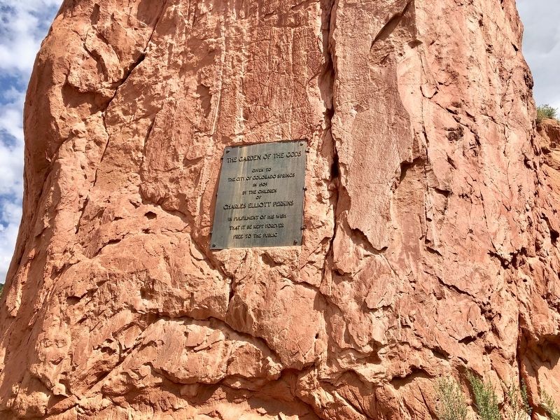
The Garden of the Gods Marker
| 201 ► Colorado, El Paso County, Colorado Springs, West Colorado Springs — The Garden of the Gods — |
| Near Garden Drive, on the right when traveling west. | |||
| 202 ► Colorado, El Paso County, Colorado Springs, West Colorado Springs — Time Frozen In Stone — Garden of the Gods Park — |
| Near Garden Drive. | |||
| 203 ► Colorado, Fremont County, Cañon City — 141 — Royal Gorge — |
| On County Road 3A, 4.5 miles south of U.S. 24, on the right when traveling south. | |||
| 204 ► Colorado, Garfield County, Glenwood Springs — Building Interstate 70 Through Glenwood Canyon — |
| Near Interstate 70 Frontage Road at milepost 121. | |||
| 205 ► Colorado, Garfield County, Glenwood Springs — The Glenwood Springs Hydroelectric Plant — |
| On East 6th Street at North River Street, on the right when traveling west on East 6th Street. | |||
| 206 ► Colorado, Garfield County, No Name — A Grand Boulevard — |
| Near Interstate 70 Frontage Road at milepost 119 east of No Name Lane (County Road 129). | |||
| 207 ► Colorado, Garfield County, No Name — The California Zephyr — |
| Near Interstate 70 Frontage Road at milepost 119 east of No Name Lane (County Road 129). | |||
| 208 ► Colorado, Gunnison County, Gunnison — Forming a Pinnacle — |
| On U.S. 50, on the right when traveling west. | |||
| 209 ► Colorado, Huerfano County, Walsenburg — 181 — Huerfano Butte — Beacon to Settlement — |
| On Interstate 25 at milepost 59,, 0.3 miles north of County Road 103, on the right when traveling north. | |||
| 210 ► Colorado, Jefferson County, Golden — Clear Creek — |
| On Washington Avenue. | |||
| 211 ► Colorado, Jefferson County, Golden — Golden and Clear Creek — |
| On Washington Avenue Bridge, on the right when traveling north. | |||
| 212 ► Colorado, Jefferson County, Golden — Late Jurassic Time — |
| 213 ► Colorado, Jefferson County, Golden — Rock Deformation — |
| 214 ► Colorado, Jefferson County, Golden — The Rocky Mountains — |
| Near Hog Back Road (State Highway 93) near West Alameda Parkway. | |||
| 215 ► Colorado, Jefferson County, Golden — Volcanic Ash — |
| 216 ► Colorado, Jefferson County, Golden, Lakota Hills — Our Changing Landscape-From Sea Floor to Mountain Top — |
| Near Lariat Loop Road. | |||
| 217 ► Colorado, Jefferson County, Golden, Lakota Hills — What You Can See From Here Today — |
| Near Lariat Loop Road. | |||
| 218 ► Colorado, Jefferson County, Morrison — Front Range Foothills — |
| Near Plains View Road. | |||
| 219 ► Colorado, Larimer County, Rocky Mountain National Park — Continental Divide — Milner Pass elev. 10,759 ft. — |
| On Trail Ridge Road (U.S. 34) 17.1 miles north of Western Road (County Road 49), on the right when traveling north. | |||
| 220 ► Colorado, Las Animas County, Trinidad — 192 — Welcome to Colorado - Trinidad Country / Trinidad - Army of the West — |
| On Nevada Avenue at North Animas Street, on the right when traveling south on Nevada Avenue. | |||
| 221 ► Colorado, Mesa County, Colorado National Monument — Ancient Environments — |
| 222 ► Colorado, Mesa County, Colorado National Monument — Canyon In A Canyon — |
| 223 ► Colorado, Mesa County, Colorado National Monument — The Grand View — |
| 224 ► Colorado, Mesa County, Colorado National Monument — The Shapes of Erosion — |
| 225 ► Colorado, Mineral County, South Fork — The Great Divide — |
| On U.S. 160, 0.2 miles County Road 402, on the left when traveling west. | |||
| 226 ► Colorado, Montrose County, Black Canyon of the Gunnison National Park — Pegmatite Dikes — |
| 227 ► Colorado, Montrose County, Black Canyon of the Gunnison National Park — The Painted Wall — |
| 228 ► Colorado, Montrose County, Montrose — So Bold, So Beautiful a Land — |
| Near Chipeta Road north of U.S. 550, on the right when traveling north. | |||
| 229 ► Colorado, Ouray County, Ouray — It's Our Fault — |
| Near Box Canyon Road south of 3rd Avenue. | |||
| 230 ► Colorado, Teller County, Florissant — The Big Stump — |
| Near County Route 1 south of County Route 421. | |||
| 231 ► Colorado, Teller County, Florissant — The Fossil Beds — Florissant Fossil Beds National Monument — |
| On Teller County Route 1. | |||
| 232 ► Colorado, Teller County, Florissant — What If? — |
| Near County Route 1 south of County Route 421. | |||
| 233 ► Colorado, Weld County, Rockport — Majestic Plains — |
| On U.S. 85, 0.3 miles south of County Road 126, on the right when traveling south. | |||
| 234 ► Connecticut, Fairfield County, Bridgeport, Beardsley Park — American Alligator — Alligator mississippiensis — |
| Near Noble Avenue north of Crown Street, on the left when traveling north. | |||
| 235 ► Connecticut, Fairfield County, Norwalk — A Habitat Renewed — |
| On Seaview Avenue at East Avenue, on the left when traveling south on Seaview Avenue. | |||
| 236 ► Connecticut, Fairfield County, Trumbull — Tashua Hills — |
| On Merrimac Drive, 0.2 miles north of Hills Point Rd., on the left when traveling north. | |||
| 237 ► Connecticut, Litchfield County, Litchfield — Stone Walls / Chestnut Grove / Wet Meadow — |
| Near South Street (Connecticut Route 65) north of Wolcott Street, on the right when traveling south. | |||
| 238 ► Connecticut, Litchfield County, New Milford — Lover’s Leap State Park — |
| Near Still River Drive, 0.2 miles east of Pumpkin Hill Road, on the right when traveling east. | |||
| 239 ► Connecticut, Litchfield County, Salisbury — Bear Mountain, Connecticut — |
| Near Under Mountain Road (Route 41) 0.2 miles north of Westmount Road, on the left when traveling north. | |||
| 240 ► Connecticut, Middlesex County, Old Saybrook, Old Saybrook Center — The Saybrook Bar |
| Near College Street (Connecticut Route 154) east of Fenwick Street, on the left when traveling east. Reported permanently removed. | |||
| 241 ► Connecticut, Middlesex County, Old Saybrook, Old Saybrook Center — The Saybrook Bar — |
| On College Street (Connecticut Route 154) west of Bridge Street (Connecticut Route 154), on the right when traveling west. | |||
| 242 ► Delaware, New Castle County, Delaware City — Pea Patch Island — |
| 243 ► Delaware, New Castle County, Glasgow — In the Beginning … — … formation of the Delmarva Peninsula — |
| On Pulaski Highway (U.S. 40) east of South College Avenue (Delaware Route 896), on the right when traveling west. | |||
| 244 ► Delaware, New Castle County, Newark, Iron Hill Park — In the Beginning … — … formation of the Delmarva Peninsula — |
| Near South Old Baltimore Pike west of Iron Hill Road, on the right when traveling west. | |||
| 245 ► Delaware, New Castle County, Wilmington, Alapocas Run State Park — The blue rocks of Alapocas Run Park — |
| On Northern Delaware Greenway Trail, on the right when traveling north. | |||
| 246 ► Delaware, New Castle County, Wilmington, Azimuth — NC-85 — Ebright Azimuth — |
| On Ebright Road at Ramblewood Drive, on the right when traveling north on Ebright Road. | |||
| 247 ► Delaware, Sussex County, Bethany Beach — Indian River Inlet and Bridge — Nature vs. Technology — |
| On Turn Point Road (Local Road 50A) west of South Inlet Road, on the right when traveling west. | |||
| 248 ► Delaware, Sussex County, Dewey Beach — Indian River Inlet and Bridge — Nature vs. Technology — |
| Near Inlet Road, 0.6 miles south of Coastal Highway (Delaware Route 1), on the left when traveling south. | |||
| 249 ► District of Columbia, Washington, Northwest Washington, Adams Morgan — The Colca Canyon w Peru - The deepest canyon in the world — 40th Anniversary of the First Descent of the Colca Canyon in Peru — Canoandes '79 |
| On 16th Street Northwest just south of Fuller Street Northwest, on the right when traveling south. Reported permanently removed. | |||
| 250 ► District of Columbia, Washington, Northwest Washington, Adams Morgan — Wanda Rutkiewicz — Outstanding Polish Women — #IamPolka — |
| On 16th Street Northwest just south of Fuller Street Northwest, on the right when traveling south. | |||
| 251 ► District of Columbia, Washington, Northwest Washington, Former Walter Reed Army Medical Center — Site of a Tulip Tree — |
| On Butternut Street Northwest west of Georgia Avenue Northwest (Route 29), on the right when traveling west. | |||
| 252 ► District of Columbia, Washington, Northwest Washington, Rock Creek Park — Piney Branch Wetland Restoration — Restauración del Pantano Piney Branch — A Rock Creek Songbirds Project / Un Projecto de Pájaros de Rock Creek — |
| On Piney Branch Parkway Northwest, 0.2 miles west of Arkansas Avenue Northwest, on the right when traveling west. | |||
| 253 ► District of Columbia, Washington, Northwest Washington, The National Mall — Welcome to Our Meadow! — |
| Near 12th Street Northwest at Constitution Avenue Northwest (U.S. 1/50), on the right when traveling south. | |||
| 254 ► District of Columbia, Washington, Southwest Washington, The National Mall — Cardinal Direction Marker: North — |
| On Jefferson Drive Southwest just east of 4th Street Southwest, on the right when traveling east. | |||
| 255 ► District of Columbia, Washington, Southwest Washington, The National Mall — Cardinal Direction Marker: South — |
| On Maryland Avenue Southwest just east of Independence Avenue Southwest, on the left when traveling east. | |||
| 256 ► District of Columbia, Washington, Southwest Washington, The National Mall — Cardinal Direction Marker: West — |
| On 4th Street Southwest just north of Independence Avenue Southwest, on the right when traveling north. | |||
| 257 ► Florida, Alachua County, Gainesville — Alachua Sink — |
| Near Southeast 15th Street (Camp Ranch Road), 0.4 miles south of Southeast 41st Avenue when traveling south. | |||
| 258 ► Florida, Alachua County, Gainesville — Devil's Millhopper — Registered Natural Landmark — |
| Near Millhopper Road (NW 53rd Avenue), 0.2 miles east of NW 52nd Terrace, on the left when traveling east. | |||
| 259 ► Florida, Columbia County, Fort White — Ichetucknee Springs — |
| Near SW Elim Church Road (County Road 238) 0.2 miles east of SW Ichetucknee Avenue, on the right when traveling east. | |||
| 260 ► Florida, Duval County, Jacksonville, Fort Caroline Shores — Spanish Pond — Fort Caroline National Monument — Timucuan Ecological and Historic Preserve — |
| On Ft. Caroline Road, on the right when traveling east. | |||
| 261 ► Florida, Duval County, Jacksonville, St. Johns Bluff — Timucuan Preserve — Fort Caroline National Monument — Timucuan Ecological and Historic Preserve — |
| Near Ft. Caroline Road, on the left when traveling east. | |||
| 262 ► Florida, Escambia County, Pensacola — E — Defending a Coastal Colony — Pensacola Maritime Heritage Trail — |
| Near East Main Street east of South Barracks Street, on the right when traveling east. | |||
| 263 ► Florida, Leon County, Tallahassee — Nature's Bridge — |
| Near Natural Bridge Road, 6 miles east of Woodville Highway (State Highway 363), on the left when traveling east. | |||
| 264 ► Florida, Marion County, Dunellon — Rainbow Springs — |
| Near State Road 41. | |||
| 265 ► Florida, Miami-Dade County, Miami — Crossing the Everglades — |
| On Shark Valley Loop Road south of Tamiami Trail (Southwest 8th Street) (U.S. 41), on the left when traveling south. | |||
| 266 ► Florida, Miami-Dade County, Miami — The Miami Circle — |
| Near Brickell Avenue (U.S. 1/41) north of Southeast 5th Street, on the right when traveling north. | |||
| 267 ► Florida, Monroe County, Islamorada — Geological History of the Florida Keys — Heritage Monument Trail, Matacumbe Historical Trust — |
| Near Overseas Highway (U.S. 1) near North Ocean Lane, on the left when traveling north. | |||
| 268 ► Florida, Okaloosa County, Eglin AFB — B-57 Canberra — |
| Near Pinchot Road (State Road 189) at Museum Drive, on the right when traveling south. | |||
| 269 ► Florida, Orange County, Apopka — Dr. Howard A. Kelly Park — |
| Near East Kelly Park Road. | |||
| 270 ► Florida, Orange County, Apopka — F-868 — Dr. Howard A. Kelly Park — |
| On Baptist Camp Road north of East Kelly Park Road, on the right when traveling north. | |||
| 271 ► Florida, Osceola County, Kissimmee — The Yates Fords — Pioneer Village at Shingle Creek — |
| Near Babb Road, 0.2 miles north of Princess Lane, on the right when traveling north. | |||
| 272 ► Florida, Osceola County, Kissimmee, Old Town — Petrified Wood — |
| Near Florida Plaza Blvd, 0.3 miles south of West Irlo Bronson Highway (U.S. 192), on the right when traveling east. | |||
| 273 ► Florida, Polk County, Homeland — F-719 — Historic Kissengen Spring — |
| Near Homeland-Garfield Road (County Road 640) 1 mile east of U.S. 17/98, on the left when traveling east. | |||
| 274 ► Florida, Santa Rosa County, Bagdad — A New Century — |
| Near Main Street, 0.1 miles east of Forsyth Street. | |||
| 275 ► Florida, Santa Rosa County, Bagdad — Submerged Aquatic Vegetation — |
| Near Main Street, 0.1 miles east of Forsyth Street. | |||
| 276 ► Florida, St. Johns County, St. Augustine, Anastasia — F-229 — Old Spanish Quarries — (Anastasia Island) — |
| Near Park Road, 0.1 miles east of Anastasia Boulevard (Road A1A). | |||
| 277 ► Florida, Washington County, Chipley — F-174 — Falling Waters State Park — |
| On State Park Road, 0.6 miles south of Jouner Road, on the left when traveling west. | |||
| 278 ► Georgia, Athens-Clarke County, Athens — River Overview — Taking Care of the River — |
| Near East Broad Street east of Wilkerson Street, on the right when traveling east. | |||
| 279 ► Georgia, Brantley County, Hoboken — 84 B-7 — Trail Ridge — |
| On U.S. 82, 0.4 miles west of Petty Crossing Road, on the right when traveling east. | |||
| 280 ► Georgia, Butts County, Jackson — Indian Spring — |
| Near Spring Road west of Highway 42, on the right when traveling south. | |||
| 281 ► Georgia, Catoosa County, Ringgold — 023-2 — Nickajack Gap — |
| On Alabama Highway (Georgia Route 151) at East Nickajack Road, on the left when traveling south on Alabama Highway. | |||
| 282 ► Georgia, Cook County, Adel — 037-2 — Adel Lime Sink — |
| On East Fourth Street (Georgia Route 37) at South Gordon Street, on the right when traveling east on East Fourth Street. | |||
| 283 ► Georgia, Greene County, Union Point — Great Buffalo Lick — |
| On Union Point Highway (U.S. 278) at Buffalo Lick Road, on the right when traveling east on Union Point Highway. | |||
| 284 ► Georgia, Habersham County, Cornelia — 068-2 — Indian War Trail — |
| On South Main Street (U.S. 129/441) at Dolston Street, on the left when traveling north on South Main Street. | |||
| 285 ► Georgia, Harris County, Pine Mountain — 072-7 — “This Was His Georgia” |
| On Dowdell Knob Road, 1.4 miles south of Georgia Route 190. Reported permanently removed. | |||
| 286 ► Georgia, Meriwether County, Woodbury — 18 F-2 — The Cove Gorges of the Flint — |
| On Cove Road at Upper Cove Church Road, on the right when traveling north on Cove Road. | |||
| 287 ► Georgia, Stewart County, Lumpkin — 128-1 — Providence Canyons — >>> -- 8 mi. --> — |
| On Broad Street (Georgia Route 39 Connector Road) at Chestnut Street (Old U.S. 27), on the right when traveling east on Broad Street. | |||
| 288 ► Georgia, Taylor County, Butler — 133-1 — Tuscaloosa Formation — |
| On U.S. 19, 0.1 miles south of Jack Peed Road, on the right when traveling south. | |||
| 289 ► Georgia, Towns County, Blairsville — 139-5 — Brasstown Bald — The Highest Point in Georgia ~ 4,784 ft. — |
| Near Georgia Route 180 Spur, 0.5 miles north of Brasstown Bald Vistor's Center Parking Log. | |||
| 290 ► Georgia, Towns County, Hiawassee — 139-4 — Brasstown Bald — >>>-- 6 Mi. --> — |
| On Unicoi Turnpike (Georgia Route 75) at Georgia Route 180, on the left when traveling south on Unicoi Turnpike. | |||
| 291 ► Georgia, Twiggs County, Jeffersonville — 143-11 — Geographic Center of Georgia — |
| On Jeffersonville-Bullard Road at Marion Road, on the right when traveling east on Jeffersonville-Bullard Road. | |||
| 292 ► Georgia, Union County, Blairsville — 144-3 — Blood Mountain — |
| On U.S. 19, on the right when traveling north. | |||
| 293 ► Georgia, Union County, Young Harris — US 76 C-2 — Brasstown Bald |
| On Young Harris Highway (U.S. 76) at Trackrock Gap Road, on the right when traveling east on Young Harris Highway. Reported missing. | |||
| 294 ► Georgia, Walker County, Chickamauga — Cooper's Gap — Chickamauga Campaign Heritage Trail — |
| On Hidden Hollow Lane, 0.5 miles east of Lookout Mountain Scenic Highway (Georgia Route 136), on the left when traveling east. | |||
| 295 ► Georgia, Walker County, Chickamauga — Stephens Gap — Chickamauga Campaign Heritage Trail — |
| On Fricks Gap Road at Harold Stevens Road, on the right when traveling east on Fricks Gap Road. | |||
| 296 ► Georgia, Ware County, Waycross — 148-3 — Okefenokee Swamp — >>>-- 13 mi. -- > — |
| On Memorial Drive (U.S. 1) at Corridon Z (U.S. 82), in the median on Memorial Drive. | |||
| 297 ► Georgia, White County, Helen — 154-10 — Nacoochee Valley — Valley of the Evening Star — |
| On Unicot Turnpike (Georgia Route 17) 0.6 miles east of Georgia Route 75, on the left. | |||
| 298 ► Georgia, Whitfield County, Rocky Face — 155-13 — Mill Creek Gap — |
| On Old US 41, 0.1 miles east of Rocky Face Railroad Street, on the left when traveling east. | |||
| 299 ► Georgia, Whitfield County, Rocky Face — 155-13 — Mill Creek Gap — |
| On Chattanooga Road (U.S. 41), on the left when traveling south. | |||
| 300 ► Hawaii, Hawaii County, Naalehu — South Point Complex — |
| On South Point Road, 11 miles south of Mamalahoa Highway (Hawaii Route 11), on the left when traveling south. | |||
1806 entries matched your criteria. Entries 201 through 300 are listed above. ⊲ Previous 100 — Next 100 ⊳