53 entries match your criteria.
Entries Containing All of the Phrases «jackson county» AND «missouri»
By Cosmos Mariner, September 14, 2015
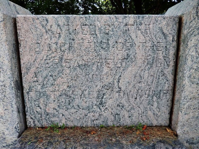
Santa Fe Trail Marker (center panel)
RANKED BY RELEVANCE
1 ► Missouri, Jackson County, Buckner — Santa Fe Trail — 1822 - 72 —  |
| On East Monroe Street (U.S. 24) at North Buckner Tarsney Road (South Sibley Street), on the right when traveling east on East Monroe Street. | |||
| 2 ► Missouri, Jackson County, Independence — A Century of Progress — |
| On Lexington Avenue near Main Street, on the right when traveling west. | |||
| 3 ► Missouri, Jackson County, Independence — General Andrew Jackson — 1767 - 1845 — |
| On Liberty Street near Lexington Avenue, on the right when traveling north. | |||
| 4 ► Kentucky, Washington County, Mackville — 31 — Morgan in Mackville — First Kentucky Raid — July 13, 1862 |
| On Mackville Hill Road (Kentucky Route 152) at Mackville Elementary School Drive, on the right when traveling east on Mackville Hill Road. Reported unreadable. | |||
| 5 ► Missouri, Clay County, Liberty — Monument to the Eight Witnesses — |
| On Campbell Drive south of South Liberty Parkway, on the right when traveling south. | |||
| 6 ► Kansas, Johnson County, Shawnee — The Development of the Kansas City area Frontier Trails Network — Trail Map — |
| On Shawnee Mission Parkway near Melrose Lane, on the right when traveling east. | |||
| 7 ► Missouri, Jackson County, Independence — Price's Raid – 1864 — Battle of the Little Blue – October 21 — Tour Stop B — |
| On Old East Lexington Road 0.4 miles east of U.S. 24 when traveling east. | |||
| 8 ► Missouri, Jackson County, Independence — First Battle of Independence — A State Divided: The Civil War in Missouri — |
| On Lexington Avenue near Main Street, on the right when traveling west. | |||
| 9 ► Missouri, Jackson County, Kansas City, South Kansas City — The Power of Watts — |
| Near West 103rd Street 0.1 miles east of State Line Road, on the right when traveling east. | |||
| 10 ► Texas, Kerr County, Kerrville — 12322 — James Kerr — (1790-1850) — |
| On Main Street north of Earl Garrett Street, on the right when traveling north. | |||
| 11 ► Kansas, Cloud County, Concordia — Henry Lee Jost — 1874-1950 — Train to Hopkins, Missouri in 1881 — |
| On Washington Street at West 7th Street, on the right when traveling north on Washington Street. | |||
| 12 ► Missouri, Saline County, Arrow Rock — Arrow Rock and the River — |
| On High Street east of 1st Street, in the median. | |||
| 13 ► Missouri, Jackson County, Buckner — Fort Osage — |
| On Buckner-Tarsney Road, on the right when traveling north. | |||
| 14 ► Missouri, Jackson County, Kansas City, Library District — The Savoy Hotel and Grill — |
| On Central Street at 9th Street, on the right when traveling north on Central Street. | |||
| 15 ► Missouri, Caldwell County, Kingston — Kingston — |
| On East Main Street just east of North Washington Street (Missouri Highway 13). | |||
| 16 ► Missouri, Jackson County, Kansas City, River Market — From Steamboat Landing to City — 1838-1855 — |
| Near Main Street. | |||
| 17 ► Illinois, Edgar County, Paris — Zion's Camp March — Through Edgar County — |
| On North Central Avenue south of East Wood Street, on the left when traveling south. | |||
| 18 ► Missouri, Cape Girardeau County, Cape Girardeau — The Art of Printing / Gathering & Disseminating News — |
| On North Lorimier Street south of Broadway Street, on the left when traveling south. | |||
| 19 ► Missouri, Clay County, Kansas City, Wheeler Downtown Airport — Charles B. Wheeler Downtown Airport — |
| Near Richards Road. | |||
| 20 ► Missouri, Howard County, New Franklin — Josiah Gregg — July 19, 1806 to Feb. 25, 1850 — |
| Near Missouri Route 5 at Katy Trail, on the right when traveling south. | |||
| 21 ► Missouri, Jackson County, Lee's Summit — Harry S Truman — |
| On 123 SE 3rd Street, on the right when traveling east. | |||
| 22 ► Missouri, Barton County, Lamar — Lamar — |
| On Gulf Street at 11th Street West, on the right when traveling north on Gulf Street. | |||
| 23 ► Missouri, Jackson County, Independence — Independence |
| On Delaware Street at U.S. 24, on the left when traveling north on Delaware Street. Reported missing. | |||
| 24 ► Missouri, Jackson County, Kansas City, Oakwood — A Resting Place — |
| On Hickman Mills Drive west of Marion Park Drive, on the right when traveling north. | |||
| 25 ► Kansas, Shawnee County, Topeka — Battle of the Blue — |
| Near Southeast 10th Avenue. | |||
| 26 ► Missouri, Jackson County, Kansas City, River Market — Town of Kansas — |
| On Main Street north of East 2nd Street, on the right when traveling north. | |||
| 27 ► Idaho, Cassia County, Malta — 169 — Hudspeth's Cutoff — |
| On State Highway 77 at milepost 3, 0.6 miles east of 1700 S. Road, on the right when traveling east. | |||
| 28 ► Missouri, Jackson County, Lee's Summit — William B. Howard Station Park — |
| On SE Main Street north of SE 3rd Street, on the left when traveling north. | |||
| 29 ► Missouri, Platte County, Kansas City, Barry — 47 — The Town of Barry |
| Near Northwest 87th Terrace east of Northwest 88th Street/Northwest Old Stagecoach Rd, on the left when traveling east. Reported missing. | |||
| 30 ► Missouri, St. Charles County, St. Charles — The Trail to Fort Osage — Eastern Trailhead — Established August 25, 1808 — |
| On South Main Street at Water Street, on the right when traveling north on South Main Street. | |||
| 31 ► California, Santa Cruz County, Santa Cruz — California Pioneers — James Williams - Mary Patterson Williams — |
| Near Evergreen Street, on the right when traveling south. | |||
| 32 ► Missouri, Callaway County, Williamsburg — Gateway to the Boone's Lick — Missouri's Civil War — |
| On Old U.S. 40 west of Route D, on the right when traveling west. | |||
| 33 ► Missouri, Jackson County, Independence — Temple Site — |
| On South River Boulevard south of West Lexington Avenue, on the right when traveling south. | |||
| 34 ► Missouri, Jackson County, Kansas City, South Kansas City — Remembrance of Trails Past — |
| On East 99th Street east of Holmes Road, on the right when traveling west. | |||
| 35 ► Missouri, Jackson County, Kansas City, Swope Parkway - Elmwood — The Battle of Westport, October 21-23, 1864 — Battle of Westport • Byram's Ford • Big Blue Battlefield • 22-23 October 1864 — |
| Near East 63rd Street west of Manchester Trafficway, on the right when traveling west. | |||
| 36 ► Missouri, Wayne County, Greenville — Harry S. Truman — On the Campaign Trail at Old Greenville — |
| Near U.S. 67 2 miles south of County Road 221, on the right when traveling south. | |||
| 37 ► Missouri, Jackson County, Independence — Harry S. Truman Grave — |
| Near U.S. 24. | |||
| 38 ► Missouri, Jackson County, Independence — Trails to the East & West — Santa Fe, Oregon and California National Historic Trails — |
| On West College Street at North McCoy Street, on the right when traveling west on West College Street. | |||
| 39 ► Missouri, Jackson County, Kansas City, South Kansas City — John Calvin McCoy — Trader and Founding Father — |
| On East Red Bridge Road, on the right when traveling east. | |||
| 40 ► Missouri, Jackson County, Kansas City, South Kansas City — People and the Trails — Santa Fe, Oregon and California National Historic Trails — |
| On East Red Bridge Road, on the right when traveling west. | |||
| 41 ► Missouri, Lafayette County, Lexington — Madonna of the Trail Monument — The National Old Trails Road — |
| On Broadway (Missouri Route 224) at Highland Avenue, on the right when traveling west on Broadway. | |||
| 42 ► Missouri, St. Charles County, St. Peters — Centennial Greenway - Heritage Crossing — |
| On Heritage Landing south of South St. Peters Parkway, on the right when traveling north. | |||
| 43 ► Missouri, Jackson County, Independence — F.M. Smith Study — |
| Near West Lexington Avenue just west of South Bowen Street, on the right when traveling west. | |||
| 44 ► Missouri, Jackson County, Kansas City, Highview Estates — Flanery-Frost Cemetery — 1841-1928 — |
| On Westridge Road 0.2 miles north of East Bannister Road, on the left when traveling north. | |||
| 45 ► Missouri, Platte County, Ferrelview — Former Site of Red Crown Tavern and Tourist Cabins — |
| On N Ambassador Drive at Cookingham Drive, on the left when traveling east on N Ambassador Drive. | |||
| 46 ► Missouri, Jackson County, Kansas City, Brown Estates — Contested Crossing — Battle of Westport • Byram's Ford • Big Blue Battlefield • 23 October 1864 — |
| Near Hardesty Avenue north of 63rd Street, on the left when traveling north. | |||
| 47 ► Missouri, Jackson County, Kansas City, East Side — The Truman Sports Complex — |
| On Chiefs Way at Red Coat Lane, on the right on Chiefs Way. | |||
| 48 ► Missouri, Jackson County, Independence — An Epicenter of International Commerce — Santa Fe, Oregon and California National Historic Trails — |
| On West College Street at North McCoy Street, on the right when traveling west on West College Street. | |||
| 49 ► Missouri, Jackson County, Independence — Our Jackson County Pioneers — In Honor Of — |
| On Lexington Avenue near Main Street, on the right when traveling west. | |||
| 50 ► Missouri, Jackson County, Kansas City, Parkview — Goin' to Kansas City Plaza — at Twelfth Street and Vine — 12th Street & Vine: Kansas City's World Address — |
| On East 12th Street east of The Paseo. | |||
| 51 ► Missouri, Jackson County, Sibley — Events at Fort Osage — |
| On 3rd Street. | |||
| 52 ► Missouri, Jackson County, Kansas City, Old Westport — 1 — Action Before Westport — Price's Raid / Battle of Westport and The Battle of the Big Blue — |
| On Pennsylvania Avenue at Westport Road, on the right when traveling north on Pennsylvania Avenue. | |||
| 53 ► Michigan, Jackson County, Jackson — “Under the Oaks” Memorial — Dedicated July 11, 1987 (Michigan’s Sesquicentennial Year) — |
| On West Franklin Street near 2nd Street when traveling west. | |||
Thin black lines indicate changes in relevance. Between each pair of lines entries are ordered geographically but all have the same relevance.
* Inflectional forms of words are their plurals, singulars, and possessives as well as gramatical tenses and similar variations.
Nov. 12, 2026