Braddock’s Road and Maj. Gen. Edward Braddock Historical Markers
The British General had to cut a road through the Appalachian Mountains to get to the French and Indians. The road was a triumph, but his military campaign was not.
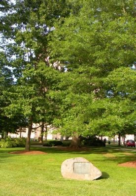
Near Wisconsin Avenue Northwest, 0.1 miles north of Massachusetts Avenue Northwest, on the right when traveling north.
This memorial was erected in 1907 by the Society of Colonial Wars in the District of Columbia to mark the road over which on April 14, 1755 a division of the British Army under General Braddock marched on its way to Fort Duquesne. — — Map (db m55534) HM
On Braddock Road (Maryland Route 49) at Greene Street (U.S. 220), on the left when traveling west on Braddock Road.
Near this point, on June 10, 1755, after nearly a month's delay at Fort Cumberland, Braddock's troops started towards Fort Duquesne to wrest it from the French. On July 9, 1755, he met his terrible defeat at the Monongahela. — — Map (db m155433) HM
On Canal Street, 0.1 miles north of West Harrison Street, on the left when traveling north.
About this sign
The outline drawing above represents the heritage-themed mural to your right. The mural is organized chronologically into sections. Each section is described here, with accompanying historic images..
. . . — — Map (db m140048) HM
On Great Allegheny Passage, 0.1 miles north of Baltimore Street, on the left when traveling north.
In 1749 Christopher Gist, an agent for the Ohio Company, arrived at the junction of the Wills Creek and the North Branch of the Potomac River to erect a trading post. In anticipation of the French and Indian War a fort was constructed in 1754 . . . — — Map (db m139113) HM
On Washington Street just east of Prospect Square, on the right when traveling east.
Indians served on both sides during the French and Indian War. Some tribes seemed to switch loyalties during the war, when it better suited their purposes. Indians camped near here to consult with General Braddock just before his fateful . . . — — Map (db m139102) HM
The store houses of The Ohio Company were first located near this point. In 1754 the first fort (called Mt. Pleasant) was built. Gen'l. Edward Braddock enlarged the fort in 1755 and renamed it after his friend the Duke of Cumberland. — — Map (db m167130) HM
On Historic National Road (Alternate U.S. 40), on the left when traveling west. Reported missing.
“We this day passed the ‘Aligany’ Mountain (Big Savage Mountain) which is a rocky ascent of more than two miles, in many places extremely steep…”
Captain Robert Orme, June 15, 1755
British General Edward Braddock led a 2,100-man army . . . — — Map (db m177978) HM
On National Highway (U.S. 40) at Maryland Route 36, on the right when traveling east on National Highway.
General Braddock's 2nd camp on the march to Fort Duquesne June 14th, 15th, 1755. The old Braddock Road passed to the southeast of the National Road from Clarysville to the "Shades of Death" near "Two Mile Run." The National Road was begun by the . . . — — Map (db m177600) HM
On Vocke Road (Maryland Route 53(658)) south of Exit 40 (Interstate 68).
General Braddock’s 1st camp on the march from Fort Cumberland to Fort Duquesne, June 11th to 13th, 1755. After building a road over Wills Mountain, Spendelow, an engineer, discovered a route by “The Narrows” and Braddock’s Run and a . . . — — Map (db m2083) HM
On Old National Pike (Alternate U.S. 40) at Edgemont Road, on the right when traveling west on Old National Pike.
The National Road has borne witness to many notorious comings and goings. The quiet atmosphere you’ll find at Hagan’s Tavern today is quite different from the raucous bawdiness of yesteryear. This tavern was a “place where the old bloats of . . . — — Map (db m167094) HM
On The Old National Pike (U.S. 40-Alt), on the right when traveling east.
In April 1755, Frederick Town was a planning center for a major campaign in the French and Indian War (175-1763). General Edward Braddock arrived from England and later 1,400 British Troops joined him to stop the French from taking land claimed . . . — — Map (db m242001) HM
Near South Court Street, on the right when traveling north.
On April 23, 1755 At a Tavern located near this spot General Edward Braddock Colonel George Washington and Benjamin Franklin Met to plan the British assault on Ft. Dusquesne During the French & Indian War This plaque erected by the Kiwanis Club . . . — — Map (db m2725) HM
On Old National Road (Alternate U.S. 40), on the left when traveling west.
General Edward Braddock traveled over this road in April 1755 (in a coach and six horses purchased from Gov. Horatio Sharpe of Maryland)after a protracted conference in Frederick with Benjamin Franklin and others concerning the securing of teams, . . . — — Map (db m1247) HM
On National Road (Alternate U.S. 40) at Finzel Road, on the right when traveling west on National Road. Reported missing.
General Braddock's 3rd camp on his march to Fort Duquesne June 16, 1755. The route, later known as the Old Braddock Road, passes to the southeast of the National Road. Captain Orme's diary says "we entirely demolished three wagons and shattered . . . — — Map (db m439) HM
Near The National Pike (Alternate U.S. 40) west of Casselman Road.
“The Little Crossings” (of the Little Youghiogeny River now called Castleman’s River).
So called by George Washington when he crossed on June 19, 1755, with General Edward Braddock on the ill-fated expedition to Fort Duquesne (Pittsburgh).
. . . — — Map (db m167051) HM
On National Pike (U.S. 40) 0.8 miles east of the Pennsylvania state line, on the right when traveling west.
General Braddock's 6th camp on the march to Fort Duquesne Saturday and Sunday June 20th and 21st, 1755. Washington was forced to remain behind with a guard on account of "violent fevers" until cured by "Dr. James's Powders (one of the most excellent . . . — — Map (db m135626) HM
On National Pike (Alternate U.S. 40) west of Springs Road (Maryland Route 669), on the right when traveling west.
On the march to Fort Duquesne June 19th, 1755. By Washington’s advice, Braddock pushed forward from Little Meadows to this camp with 1200 chosen men and officers leaving the heavy artillery and baggage behind to follow by easy stages under Colonel . . . — — Map (db m357) HM
On National Pike (Alternate U.S. 40) east of Chestnut Ridge Road (U.S. 219), on the right when traveling east.
General Braddock's 4th camp on the march to Fort Duquesne June 17, 1755. Washington arrived here after Braddock's defeat July 15th, 1755. Washington also stopped here May 9th, 1754, July 7th or 8th, 1754, October 1st, 1770, November 26th, 1770 and . . . — — Map (db m361) HM
Near National Pike (Alternate U.S. 40) 0.3 miles Patton Lane, on the left when traveling east.
(Logo for Mountain Maryland Gateway to the West, Garrett County)
(7 small color images of structures and landscapes. 1 large color image of the Cassleman River Bridge.)
Transportation
Transportation features include Garrett . . . — — Map (db m168096) HM
On Wisconsin Avenue (Maryland Route 355) at Montgomery Lane, on the right when traveling south on Wisconsin Avenue.
(East Face)
N.S.D.A.R. Memorial to the Pioneer Mothers of the Covered Wagon Days.
(North Face)
This the first military road in America beginning at Rock Creek and Potomac River, Georgetown, Maryland, leading our pioneers . . . — — Map (db m231340) HM
On South Frederick Avenue (Maryland Route 355) at South Summit Avenue on South Frederick Avenue.
General Edward Braddock in April 1755, accompanied by Gov. Horatio Sharpe of Maryland, traveled this road in a coach and six horses, on his way to Frederick, Md. to meet Benjamin Franklin and George Washington, to arrange for teams for the Fort . . . — — Map (db m1012) HM
On Courthouse Square near East Jefferson Street (Maryland Route 28), on the right when traveling south.
To commemorate the encampment in Maryland of Maj. Gen. Edward Braddock and his men at Owen's Ordinary, now Rockville, April 20, 1755. This stone is placed by the Janet Montgomery Chapter, Daughters of the American Revolution, Mrs. Morris L. Croxall, . . . — — Map (db m77) HM
On West Main Street (State Highway 34) at South Mechanic Street, on the right on West Main Street.
General Edward Braddock in April 1755 (driven in his coach and six horses) crossed into Virginia near this point on his way to Fort Cumberland, after ten days’ conference with Benjamin Franklin and others in Frederick, Md., arranging for teams and . . . — — Map (db m1966) HM
On High Street (U.S. 11), on the right when traveling west.
First fort authorized by Pennsylvania. Laid out by Gov. Morris, July, 1755, “in the middle of this town,” on news of Braddock's defeat. Col. John Armstrong's headquarters till 1758. Called “Fort Lowther” by some later writers. — — Map (db m16075) HM
In 1755 supplies for Braddock’s army were stored here in Edward Shippen’s strong stone house “at the back Run.” James Burd, the son-in-law of Shippen, opened a road to carry these supplies to the west. After Braddock’s defeat the remaining supplies . . . — — Map (db m1018) HM
On Pennsylvania Route 230, 0.3 miles south of Franklin St., on the right when traveling south.
Tinian, home of Col. Burd, is still standing on the opposite hill. Burd was road-builder of Braddock's expedition. French and Indian War commandant at Fort Augusta. Patriot and a soldier in the Revolution. — — Map (db m11428) HM
On U.S. 119, 0.1 miles south of Clair Street, on the right when traveling north.
General Braddock's twelfth camp, June 28, 1755, on the march to Fort Duquesne, was north of here, near the Youghiogheny River. On June 30, the army forded the River at Stewart's Crossing to a point about one-half mile northwest of present-day . . . — — Map (db m31905) HM
British Major General Edward Braddock camped here at Stewart's Crossing on the banks of the Youghiogheny River, June 28-30, 1755. His goal was to reach Fort Duquesne (Pittsburgh) and drive the French from the area. He was accompanied by colonial . . . — — Map (db m76134) HM
On North 7th Street at Torrance Avenue, on the left when traveling north on North 7th Street.
Our beautiful Youghiogheny River, "Meandering and Contrary River" from Delaware (Algonquin) language, attracted the first people into our region. Native Americans followed such animals as buffalo and deer into this most inviting of hunting . . . — — Map (db m231973) HM
On North 7th Street at Torrance Avenue, on the left when traveling north on North 7th Street.
Major General Edward Braddock and his army on the way to capture Fort Duquesne, at the forks of the Ohio River, crossed the Youghiogheny River at Stewart's Crossing (now Connellsville.) The army camped in this area from June 28-30, 1755. During . . . — — Map (db m231974) HM
Near National Pike (U.S. 40) 1.2 miles east of Fayette Springs Road.
Maj. Gen. Edward Braddock—commander-in-chief of British forces in North America—traveled over the road trace below on June 25, 1755. Marching north with his 2,400-man army, the 60-year-old Braddock was under orders to capture Fort Duquesne and . . . — — Map (db m339) HM
On National Pike (U.S. 40) 1.2 miles east of Fayette Springs Road.
Gen. Edward Braddock was buried here in 1755, after his disastrous defeat and death. The site of his original grave, the new grave to which his remains were moved in 1804, and a trace of the Braddock Road may be seen here. — — Map (db m310) HM
On National Pike (U.S. 40) 1.2 miles east of Fayette Springs Road.
Here lieth the remains of Major General Edward Braddock who, in command of the 44th and 48th regiments of English Regulars, was mortally wounded in an engagement with the French and Indians under the command of Captain M. de Beaujeu at the Battle . . . — — Map (db m304) HM
Near National Pike (U.S. 40) 1.2 miles east of Fayette Springs Road.
This tablet marks the spot where Major-General Edward Braddock was buried, July 14th, 1755,
His remains were removed in 1804 to the site of the present monument. — — Map (db m166925) HM
Near National Pike (U.S. 40) 1.2 miles east of Fayette Springs Road.
Before the Europeans, only Indian trails led through virgin forests that once stretched beyond the horizon. About 1750 Nemacolin, a Delaware Indian, blazed a trail past here for the Ohio Company. Four years later, Virginia militia under Lt. Col. . . . — — Map (db m333) HM
On Washington Parkway, 0.2 miles south of National Pike (U.S. 40), on the right when traveling south.
George Washington's only surrender took place here on July 3, 1754. After an eight to nine hour battle on a rainy day, he capitulated to a sizable force of French soldiers and their Indian allies, led by Jumonville's older brother de Villiers. . . . — — Map (db m152675) HM
Near National Pike (U.S. 40) 1.2 miles east of Fayette Springs Road.
On June 25, 1755, the largest army assembled in North America up to that time passed this spot. British Maj. Gen. Edward Braddock led the first 1,400 soldiers of his 2,400-man army along a 12-foot-wide road. Lt. Col. Thomas Dunbar lagged behind . . . — — Map (db m338) HM
Near National Pike (U.S. 40) 1.2 miles east of Fayette Springs Road.
This tablet marks a well preserved scar of the Old Braddock Trail, one of the most historic pioneer highways in all America.
Here, Nemacolin and his associates blazed the trail that became a National Highway.
Here, passed the laden pack . . . — — Map (db m33439) HM
On Washington Parkway, 0.8 miles south of National Pike (U.S. 40), on the right when traveling south.
Portions of this trail system pass through the Great Meadows where George Washington and his troops fought a large French and Indian force on July 3, 1754.
The Braddock Road Trace is the remnant of the road built by Washington in 1754 and . . . — — Map (db m152678) HM
On National Pike (U.S. 40) at Jumonville Road (Pennsylvania Route 2021), on the right when traveling west on National Pike.
General Braddock’s tenth camp, June 26, 1755, on the march to Fort Duquesne, was at the Half King’s Rock, one mile NE of here. The Rock was named for Washington’s friend Tanacharisson, the Iroquois viceroy (half king) of the Ohio Indians. Washington . . . — — Map (db m507) HM
On Old Braddock Road, 0.1 miles east of Jumonville Road (County Route 2021), on the right when traveling east.
Passing by this wayside are the remnants of the Braddock Road, constructed in the late spring of 1755 by men of General Edward Braddock's army of 2,400 British and colonial soldiers marching to capture Fort Duquesne, the French fort at present . . . — — Map (db m229257) HM
On Jumonville Road (Pennsylvania Route 2021) 1.2 miles north of National Pike (U.S. 40). Reported unreadable.
This spring lies in the direct path of what was known as Nemacolin’s Trail. Afterwards Braddock’s Road, and was a favorite sampling spot in early days.
George Washington visited here first in November, 1753, and again in May, 1954. On the night . . . — — Map (db m74911) HM
On Jumonville Road (County Route 2021) 1.2 miles north of National Pike (U.S. 40), on the right when traveling north. Reported unreadable.
Remnant of the Great Rock or the Half King’s Rock mentioned by early cartographers.
The famous Washington-Braddock Road emerging from Laurel Hill Mountain one hundred yards eastward turned northward at this point.
Rock Fort Camp, where . . . — — Map (db m74926) HM
On Jumonville Road (County Route 2021) 1 mile north of National Pike (U.S. 40), on the left when traveling north. Reported missing.
Rock Fort Camp, Braddock's tenth camp, began at the woods opposite where the Washington-Braddock Road emerged from Chestnut Ridge Mountain and extended to the northward beyond the Half King's Rock and Washington's Spring. Here Braddock camped June . . . — — Map (db m100185) HM
On Jumonville Road (Pennsylvania Route 2021) 3 miles north of National Pike (U.S. 40), on the right when traveling north.
General Braddock’s army ascended the ridge east of this point and advanced toward Gist’s Plantation. Col. Dunbar’s detachment, following with the heavy baggage, made its last camp here. Later, as Braddock’s defeated army streamed back, Dunbar . . . — — Map (db m504) HM
On National Pike (U.S. 40) west of Pike School Road, on the right when traveling west.
General Braddock's eighth camp, June 25, 1755, on the march to Fort Duquesne, was about half a mile S.W. Chestnut Ridge, seen on the horizon to the west, was the last mt. range to be crossed. Axemen widened an Indian path for passage of supply . . . — — Map (db m349) HM
On Mudd School Road, 0.2 miles east of Gimlet Hill Road, on the right when traveling east.
This tablet marks the site of General Edward Braddock's fourteenth encampment or bivouac. Here Braddock's army spent the night July 1, 1755 having marched five miles from their camp on the east side of the Youghiogheny near Connellsville. The army . . . — — Map (db m67387) HM
On Lincoln Highway (U.S. 30) 0.1 miles east of Mercersburg Road, on the left when traveling east.
One of a line of forts built by settlers in this region for refuge from Indian attacks following Braddock's defeat in 1755. It stood just to the north. — — Map (db m8050) HM
On Main Street west of National Pike (U.S. 40), on the right when traveling west.
About one half mile above this point is the "Great Crossings" of the Youghiogheny River, where George Washington crossed November 18th, 1753, when sent as envoy by Gov. Dinwiddie of Virginia to the French Commandant at Fort Le Boeuf.
. . . — — Map (db m351) HM
On S Center Ave (Pennsylvania Route 3093) 2 miles south of Interstate 70, on the left when traveling south.
This tablet marks the site of General Edward Braddock's sixteenth encampment named "Salt Lick Camp." Here Braddock's army camped July 3, 1755, after having marched six miles from Jacobs Cabin Camp. The circuitous route via Mount Pleasant was made to . . . — — Map (db m72366) HM
On Clay Pike at Robbins Station Road on Clay Pike.
This tablet marks the most probable site of General Braddock's nineteenth camp. Here Braddock's army camped July 7, 1755, en route to capture Fort Du Quesne. The Turtle Creek defile with its deep and rugged ravines, and its steep and almost . . . — — Map (db m33544) HM
On Reservoir Road, 0.8 miles west of Clay Pike, on the left when traveling south.
This tablet marks the site of General Edward Braddock’s eighteenth encampment called Monacatootha Camp from an unhappy incident on the march. Monacatooha’s son was shot by accident by Braddock’s own men. General Braddock as soon as the army camped . . . — — Map (db m97380) HM
On East Daniel Morgan Avenue (State Highway 296) near North Pine Street, on the right when traveling east.
This street is named for General Daniel Morgan (1736-1802). Revolutionary War leader whose victory at Cowpens on January 17, 1781, was one of the significant events of that war. Daniel Morgan served as a wagoner on Gen. Braddock's expedition in . . . — — Map (db m9867) HM
On North Fairfax Street south of Cameron Street, on the left when traveling south.
From March 26 through April 20, 1755, the town of Alexandria served as the center of operations for Major General Edward Braddock, commander-in-chief for British forces in North America. He chose the finest house in town, John Carlyle's, as his . . . — — Map (db m156495) HM
On West Braddock Road at Russel Road, on the right when traveling west on West Braddock Road.
(North Side):
This monument marks the trail taken by the army of General Braddock which left Alexandria on April 20, 1755 to defend the western frontier against the French and Indians.
Erected by the Society of Colonial Dames of . . . — — Map (db m7567) HM
On Colvin Run Road (Virginia Route 743) east of Robindale Road, on the right when traveling west.
Colvin Run Road is a remnant of an 18th-century wagon road from the Shenandoah Valley to Alexandria that probably originated as an Indian path. George Washington passed by here in 1753 and 1754 en route to persuade the French on the Ohio River to . . . — — Map (db m1861) HM
On Victoria Boulevard near Bridge Street, in the median.
(front)
Near this monument
disembarked on February 19, 1755
Edward Braddock
Major General and Commander-in-Chief
of all the British forces in America.
His coming marked the beginning
of an important stage in the war
which . . . — — Map (db m33892) HM
On Old Wheatland Road (Virginia Route 698) at Milltown Road (Virginia Route 681), on the right when traveling east on Old Wheatland Road.
Beginning in the 1730s, Waterford's residents developed productive farms, a series of mills, and a transportation network. By the early 1800s, Thomas Phillips, an enterprising Quaker, farmed the land in front of you.
To ensure access to the . . . — — Map (db m143137) HM
On Cork Street at Braddock Street (U.S. 11), on the right when traveling west on Cork Street.
(Left Side): This monument marks the trail taken by the army of General Braddock, which left Alexandria April 9, 1755 to defend the western frontier against the French and Indians. Erected by the Society of Colonial Dames of America in the . . . — — Map (db m2649) HM
On Berryville Avenue (State Highway 7) at Battle Avenue, on the right when traveling west on Berryville Avenue.
Joist Hite and Braddock. By this road, then an Indian trail, Joist Hite and his followers came to make the first permanent settlement in this section, 1732. In 1755, General Edward Braddock of the British army, accompanied by George . . . — — Map (db m34091) HM
On Williamsport Pike (U.S. 11) east of Ripple Way, on the right when traveling west.
By an act of the Virginia House of Burgesses, 1744, a ferry was established extending from the mouth of the Canagochego Creek in Maryland across the Patowmack to the Evan Watkins Landing, about 250 yards southeast. This landing was also the entrance . . . — — Map (db m131795) HM
On Charles Town Road (West Virginia Route 9) 1 mile west of Appalachian Trail, on the left when traveling west. Reported permanently removed.
Formerly Vestal’s Gap. Historic gateway through the Blue Ridge into the Shenandoah Valley. It was often used by Washington and by armies of the Blue and Gray, 1861–65. Here passed part of Braddock’s army, 1755, en route to Fort Duquesne. — — Map (db m167164) HM
On West Virginia Route 9 at Sir John Run Road, on the right when traveling west on State Route 9.
Sir John's Run was named for Sir John Sinclair, the quartermaster for General Braddock on expedition in 1755 against the French at Fort Duquesne. James Rumsey demonstrated his steamboat here in 1785. — — Map (db m13152) HM