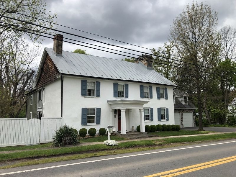
On Runnymeade Road (County Road 26) 0.4 miles west of Goldmiller Road (County Road 24), on the right when traveling west.
This property
has been placed on the
National Register
of Historic Places
by the United States
Department of the Interior
Zaquill Morgan House
1761
[Lower plaque:]
A
Berkeley
County
Historic
Landmark . . . — — Map (db m148875) HM
On East Main Street (West Virginia Route 9) just north of South Mary Street ( Route 901), on the right when traveling south.
National Register [of Historic Places] Structure
by
U. S. Dept. of Interior
Hedgesville Historic District
Est. 1978
[Lower plaque:]
circa
1842 — — Map (db m148850) HM
On North Mary Street (West Virginia Route 901) south of East Poplar Street.
This boulder marks the site on Camp Hill where the batteries were fired during the War Between the States in the raid on the federal blockhouse, located at North Mountain. On July 4, 1864, the 14th, 16th, and 17th Regiments of General McCausland's . . . — — Map (db m154841) HM
On Hedgesville Road (West Virginia Route 9) near Mt. Zion Street, on the right.
Site of stockade fort built during the early Indian wars. Mt. Zion Episcopal Church was built soon after. A mile west is the tavern, built, 1740–1750, by Robert Snodgrass on land patented in 1732 by William Snodgrass, pioneer settler. — — Map (db m990) HM
On Bodine Street north of Hedgesville Road ( Route 9), on the left when traveling east.
During the French and Indian War (c. 1750) Virginia Militia Col. George Washington supervised the construction of Fort Hedges, a stockade fort built along the Warm Spring Road at the heavily-traveled Skinner's gap atop North Mountain (740 feet . . . — — Map (db m117316) HM
On Winter Camp Trail north of Toboggan Hill Trail, on the right when traveling north.
This pre-historic Indian burial mound was partially destroyed during construction of a coal haul road in the 1940's. The mound was restored in 1998 by Potomac Valley Properties, Inc, developer of The Woods. It is cared for by The Woods . . . — — Map (db m297724) HM
On Martinsburg Road or Hedgesville Road (West Virginia Route 9) west of Rustic Tavern Road, on the right when traveling west.
Morgan County. Formed, 1820, from Berkeley and Hampshire. Named for Gen. Daniel Morgan of the Revolutionary Army. Many of his renowned “Riflemen” were from the Eastern Panhandle, where he once lived. Famed Berkeley Springs here.
Berkeley . . . — — Map (db m1112) HM
On North Mary Street (West Virginia Route 901) just north of West Ash Street.
National Register [of Historic Places] Structure
by
U. S. Dept. of Interior
Hedgesville Historic District
Est. 1978
[Lower marker:]
Payne-Kreglow House
circa
1905
Restored by James W. Poisal, Jr., . . . — — Map (db m148856) HM
On Route 9 Bike Path 0.2 miles south of Short Road (County Road 36/1), on the right when traveling south.
The Shaw Run Wetland Complex is a calcareous fen. A "fen" is defined as low land covered wholly or partly with water. fed by Shaw Spring and Shaw Run, the wetland is a unique type of wetland for West Virginia because of its marl substratum (layer . . . — — Map (db m150612) HM
On Route 9 Bike Path south of Short Road (County Route 9/19), on the right when traveling north.
Stone House Mansion, predominantly Georgian in style, was constructed in 1757, and is one of the oldest stone structures in Berkeley County. The property is listed in the National Register of Historic Places for its association with the Hite vs. . . . — — Map (db m167518) HM
Fresh from victory at the Second Battle of Manassas, Gen. Robert E. Lee’s Army of Northern Virginia crossed the Potomac River on September 4-6, 1862, to bring the Civil War to Northern soil and to recruit sympathetic Marylanders. Union Gen. . . . — — Map (db m276872) HM
On West King Street east of Winchester Avenue (Business U.S. 11), on the left when traveling west.
“Big Apple Time Capsule”
Dedicated: Oct 19, 1990 – Re-open in year of 2040
Sponsor: Martinsburg Jaycees
This “community pride project” is an attempt to preserve the Apple Capital city and surrounding areas of . . . — — Map (db m1212) HM
On East John Street east of South Water Street, on the right when traveling west.
This structure was constructed of native limestone by Revolutionary War General Adam Stephen, founder of Martinsburg. Restored by the City of Martinsburg and the Adam Stephen Memorial Association, Inc. — — Map (db m132404) HM
On East John Street east of South Water Street, on the right when traveling west.
Adam Stephen (1720-1791) had a close acquaintance with George Washington through their association with Lord Fairfax and from their military involvements from the French & Indian War through the American Revolution. Stephen was present with . . . — — Map (db m167507) HM
On North Queen Street (West Virginia Route 9/45) south of West Race Street, on the right when traveling south.
This building is dedicated
to the memory of
the gallant officers and men
of the
Armed Forces of the United States
who gave their lives that we might live
Freedom from want
Freedom from fear
Freedom from oppression . . . — — Map (db m269288) WM
On Queen Street (U.S. 11) at King Street (U.S. 11), on the right when traveling north on Queen Street.
The colonial village of Martinsburg was established by law enacted by the General Assemply of the Commonwealth of Virginia on October 21, 1778. Martinsburg’s founder was General Adam Stephen, a noted soldier of the American Revolutionary War. . . . — — Map (db m167514) HM
On East Race Street east of North Spring Street, on the left when traveling east.
The roundhouse is the sole surviving cast-iron framed roundhouse and is an important example of mid-19th century industrial building design. Designed by Albert Fink, in collaboration with Benjamin H. Latrobe, it represents an early use of . . . — — Map (db m1199) HM
On East Race Street east of North Spring Street, on the left when traveling east.
The re-construction of the Baltimore and Ohio Railroad Roundhouse and Shop Complex commenced soon after the end of the American Civil War in 1865. This complex included two roundhouses and two significant shop buildings. The centerpiece of the . . . — — Map (db m167682) HM
On North Queen Street (U.S. 11) at East Commerce Street, on the right when traveling north on North Queen Street.
One of the most noted female spies for the Confederacy, Boyd was born in Martinsburg in 1844. After she killed a Union soldier in 1861 who was threatening her mother, Belle began spying on local Union troops. Her efforts at the Battle of Front . . . — — Map (db m206099) HM
On East Race Street at North Spring Street when traveling east on East Race Street. Reported permanently removed.
Isabelle “Belle” Boyd, the Confederate spy, lived here during part of her childhood. The ten-year-old and her family moved here in 1853 and left in 1858 for a dwelling (no longer standing) on South Queen Street. According to Boyd, when Union Gen. . . . — — Map (db m63496) HM
On East Race Street at Spring Street, on the right when traveling east on East Race Street.
Built in 1853 by Benjamin Reed Boyd, a merchant, Confederate soldier and the father of Belle Boyd. Belle Boyd was a famous Confederate spy, author and actress. — — Map (db m149428) HM
On East Race Street at North Spring Street, on the right when traveling east on East Race Street.
Isabelle "Belle" Boyd, the Confederate spy, lived here during part of her childhood. The ten-year-old and her family moved here in 1853 and left in 1858 for a dwelling (no longer standing) on South Queen Street. According to Boyd, when Union Gen. . . . — — Map (db m280015) HM
On East Race Street. Reported permanently removed.
This is one of the last surviving antebellum buildings in the area. It was constructed shortly after the Baltimore and Ohio Railroad reached Martinsburg in 1842. The adjacent railroad yards twice were Confederate Gen. Thomas J. “Stonewall” Jackson’s . . . — — Map (db m208792) HM
On East Martin Street east of North Spring Street, on the left when traveling east.
This is one of the last surviving antebellum buildings in the area. It was constructed shortly after the Baltimore and Ohio (B&O) Railroad reached Martinsburg in 1842. The adjacent railroad yards twice were Confederate Gen. Thomas J. “Stonewall” . . . — — Map (db m280723) HM
On South Queen Street (West Virginia Route 9) at East King Street on South Queen Street.
One of the earliest brick buildings constructed in Martinsburg. Home of Rear Admiral Charles Boarman, who served in the War of 1812 and the Civil War. — — Map (db m132397) HM
On South Queen Street (West Virginia Route 45) north of Buxton Street, on the left when traveling north.
Built, 1812, by Elisha Boyd, general in the War of 1812, on land bought from Gen. Adam Stephen. Mansion noted for its fine workmanship. Home of his son-in-law, Charles J. Faulkner, Minister to France, and his grandson, U.S. Senator Faulkner. — — Map (db m983) HM
On South Queen Street (West Virginia Route 9/45) south of East Addition Street, on the right when traveling south.
Born in Martinsburg, July 6. 1806. Member of Virginia legislature and served in Congress, 1851-1859. In 1860 he was appointed Minister to France but was arrested in 1861 on charges of negotiating sales of arms for the Confederacy. Enlisted in . . . — — Map (db m203911) HM
On West King Street (U.S. 11) at South Queen Street (State Highway 45) on West King Street.
Martinsburg, strategically located on the Valley Turnpike (present day U.S. Route 11) and the Baltimore and Ohio Railroad, was a major transportation center and the northern gateway to the Shenandoah Valley. Both sides contested for it frequently . . . — — Map (db m167591) HM
On Charles Town Road (West Virginia Route 9) east of Variform Drive (County Route 9/14). Reported unreadable.
Local lawyer and newspaper editor, F. Vernon [unreadable], established the Continental Clay ?Brick works on a portion of his family farm in [unreadable]. Ten beehive kilns were initially constructed to fire the bricks after they were molded. . . . — — Map (db m132440) HM
On South Water Street at East John Street, on the right when traveling north on South Water Street.
This home was provided with electric service in 1890 by the Edison Electric Illuminating Company, a predecessor of the Potomac Edison Company
Commemorated 3 December 1969 — — Map (db m132406) HM
On Williamsport Pike (U.S. 11) 0.4 miles north of Warm Springs Ave., on the right when traveling north.
During the French and Indian War, Fort Neally was captured and its garrison massacred, Sept. 17, 1756. Many settlers in the vicinity also were killed. Among captives was Isabella Stockton, later wife of William McCleery, Morgantown. — — Map (db m12790) HM
Here was home of General Adam Stephen, founder of Martinsburg and county's first sheriff. Was famous as fighter in French and Indian Wars, and as major general in the American Revolutionary War. — — Map (db m12786) HM
On East John Street, on the right when traveling west.
Founder of Martinsburg, First Sheriff of Berkeley County, Statesman, Soldier, Surgeon National Register of Historic Places Oct. 15, 1970 — — Map (db m12788) HM
On East Burke Street at North Spring Street on East Burke Street.
On this site Harry Flood Byrd was born
June 10, 1887
Member of the Virginia Senate, 1916-1925
Governor of Virginia, 1926-1930
U.S. Senator from 1933.
— — Map (db m132399) HM
On West Martin Street west of Raleigh Street, on the left when traveling west.
Born 1848 in Hardy Co. A Civil War vet., Storer College graduate, teacher and principal at local Sumner School. Published Pioneer Press (1882), first African American paper in state. First of race to pass state bar exam (1887); argued two . . . — — Map (db m1210) HM
On South Queen Street (West Virginia Route 9) north of Bulldog Boulevard, on the left when traveling north.
He was commander of a division in the Revolution. Voted for the adoption of the federal constitution while a member of the Virginia Assembly. Granted 130 acres of land for the site of Martinsburg and was the first sheriff of Berkeley County. — — Map (db m132409) HM
On North Queen Street (West Virginia Route 9) at West Burke Street, on the left when traveling north on North Queen Street.
One of Martinsburg's Gothic Revival masterpieces and once its central marketplace. The structure has been used commercially with the Masons and Odd Fellows halls overhead. — — Map (db m132400) HM
On Edwin Miller Boulevard (West Virginia Route 9) east of Interstate 81, on the left when traveling west.
Founded, 1778, by Gen. Adam Stephen. Named for Thomas Martin, nephew of Lord Fairfax. Home of Admirals Charles Boarman and C.K. Stribling. Locomotives seized here, 1861, in Jackson’s raid were drawn by horses to Winchester, Va. — — Map (db m1973) HM
On King Street (U.S. 11) near North Maple Avenue, on the left when traveling east.
Martinsburg. Established, 1778, by Gen. Adam Stephen. Named for Col. Thomas Martin, nephew of Lord Fairfax. Home of Admiral C.K. Stribling and Admiral Charles Boarman. In Jackson’s raid, 1861, captured B&O locomotives were drawn by horses to . . . — — Map (db m1976) HM
On East Commerce Street just north of East race Street, on the right when traveling north. Reported permanently removed.
In April 1861, as the Civil War erupted, Confederate forces seized the Baltimore and Ohio Railroad from Harpers Ferry west. On May 24, Gen. Joseph
E. Johnston ordered Col. Thomas J. (later “Stonewall”) Jackson to destroy
the rolling stock here . . . — — Map (db m149430) HM
On East Race Street at Commerce Street, on the left when traveling east on East Race Street.
In April 1861, as the Civil War erupted, Confederate forces seized the Baltimore and Ohio Railroad from Harpers Ferry west. On May 24, Gen. Joseph E. Johnston ordered Col. Thomas J. (later "Stonewall") Jackson to destroy the rolling stock here at . . . — — Map (db m282715) HM
On King Street (U.S. 11) near Maple Avenue, on the left when traveling east.
Constructed using the Richardson-Romanesque Style of architecture, this building served as a Post Office and United States Courthouse. — — Map (db m1977) HM
On South Queen Street (West Virginia Route 9) south of West Stephen Street, on the left when traveling north.
This High Victorian Gothic structure which served as the Martinsburg High School, now houses the Berkeley County Board of Education office. — — Map (db m132394) HM
On South Spring Street at East John Street, on the left when traveling south on South Spring Street.
This structure was originally constructed as a dwelling and was later used as a house of worship from 1812-1842 by the Methodist Episcopal Church. — — Map (db m134000) HM
On West Stephen Street west of South Church Street, on the right when traveling west.
The woolen mills were located in the buildings on the south side of the street and the cassimere mills on the north. Outstanding examples of industrial architecture. — — Map (db m134032) HM
Roundhouses and Shops. The B&O Railroad reached Martinsburg in 1842,
and by 1849, a roundhouse and shops were
built. These first buildings were burned by
Confederate troops in 1862. The present west
roundhouse and the two shops were built . . . — — Map (db m1197) HM
On South Queen Street (West Virginia Route 9), on the left when traveling west.
Here on July 4, 1861, Belle Boyd, at the age of 17, shot and killed a Union soldier. She was imprisoned on several occasions as a result of her later spying activities. — — Map (db m193346) HM
On South Queen Street (West Virginia Route 9) north of East John Street, on the right when traveling south.
This Romanesque Revival Church was begin in 1845 and dedicated in 1860. George Whitson, local architect, designed the Greek portico with the Gothic spire in 1888.
[Bottom plaque]
Most Reverend Bernard Schmitt, D.D.
Designated . . . — — Map (db m132395) HM
On West Martin Street west of Raleigh Street, on the left when traveling west.
The present building was completed in 1917 under the leadership of Fred R. Ramer. He was the first principal in Berkeley County to have a school named after him. Ramer school served the black community until 1964. — — Map (db m1211) HM
On Winchester Avenue (U.S. 11) south of Meteor Drive, on the left when traveling north.
In the early hours of February 19, 1886, a mob of White men removed Joe Burns from the cellar of the local jailer. Mr. Burns, a Black man, was accused but never tried for assaulting a White woman. The vigilantes taunted, mutilated, and hanged Mr. . . . — — Map (db m269314) HM
On North Queen Street (U.S. 11) north of Cloud Street, on the right when traveling north.
400 Yards West of This Spot Is The Red House
The Home of Edward Beeson
Where the County of Berkeley was Founded
From a Part of Frederick County, Virginia
May 19, 1772
And Where the First Country Court was . . . — — Map (db m243836) HM
On East Burke Street just west of Swartz Street, on the left when traveling west.
Looking Upstream and Northeast at the Colonnade Bridge, Circa 1860
In 1849, the Baltimore and Ohio established its railroad shops in Martinsburg and erected here two most noteworthy roundhouses and workshop buildings. The B&O erected a . . . — — Map (db m148872) HM
On East John Street east of South Water Street, on the right when traveling west.
Built in the mid-1870s by Philip Showers, who owned the adjacent stone house (the Adam Stephen House) at that time, the Triple Brick Building was listed in early tax records as the "Tribble (Triple) House" or "the brick house divided into . . . — — Map (db m132401) HM
On North Tennessee Ave (County Route 13) north of Memorial Park Avenue, on the left when traveling north.
Dedicated to those who paid the ultimate price for their country.
World War I
Thomas G. Adams •
Ernest Ashwood •
Harry Bittinger •
Thomas W. Bowers •
Earl E. Butts •
Charles Carter •
Henry L. Clapham •
Paul F. . . . — — Map (db m254475) WM
On East King Street at South Queen Street (U.S. 11), in the median on East King Street.
The Founder
Born around 1720 in Scotland, Stephen received a surgeon's degree from the University of Edinburgh in 1746. He came to America in 1748, settling in Fredericksburg, Va., where he practiced as a doctor. In 1754 he joined the Virginia . . . — — Map (db m167510) HM
Near North Tennessee Ave (County Route 13) north of Memorial Park Avenue, on the left when traveling north.
The creation of this monument was sponsored by the local American Legion Berkeley Post 14 Ladies Auxiliary. This group of ladies formed the "Berkeley County Monument Association." They raised $7,000 to pay for the bronze statue and granite base. . . . — — Map (db m254791) HM
Near North Tennessee Ave (County Route 13) north of Memorial Park Avenue, on the left when traveling north.
1917-1918
This memorial is dedicated as an enduring tribute to the patriotism of the citizens of Berkeley County who rendered loyal service to our country in The Great World War and to honor the memory of those who made the supreme . . . — — Map (db m254792) WM
On West King Street (U.S. 11) west of South Maple Avenue, on the left when traveling east.
1917-1918. This memorial is dedicated as an enduring tribute to the patriotism of the citizens of Berkeley County who rendered loyal service to our country in the great World War, and to honor the memory of those who made the supreme sacrifice . . . — — Map (db m1256) WM
On Tuscarora Pike (County Route 15) west of Lost Road (County Route 13/1), on the left when traveling west.
Tuscarora Presbyterian Church, which was built before 1745 by Scotch-Irish Presbyterians. Rev. Hugh Vance, first pastor, is buried here. During Indian days, worshipers hung their guns on pegs in the walls while they sang and prayed. — — Map (db m92578) HM
In December 1862, Union Gen. Benjamin F. Kelley stationed detachments of the 54th Pennsylvania and 1st West Virginia Infantry regiments here to guard and repair the Baltimore and Ohio Railroad, a main supply route between the Ohio River and the . . . — — Map (db m58628) HM
On Winchester Avenue (U.S. 11) 0.1 miles north of Evans Run Road, on the left when traveling north.
Fort Evans, built here, 1755, was attacked by Indians, 1756. The men were absent but Polly Evans, whose husband, John, had built the fort, led the women in its defense. The Big Spring here was noted camping ground of both armies, 1861-1865. — — Map (db m134041) HM
On Winchester Avenue (U.S. 11) at Packhorse Ford Road, on the right when traveling south on Winchester Avenue.
First road constructed in the present Berkeley and Jefferson Counties of West Virginia. Built ca. 1727, it followed the route of an older Indian path that was a branch of the Warrior’s Path. — — Map (db m134052) HM
On Winchester Avenue (U.S. 11) 0.2 miles south of Specks Run Road, on the right when traveling north.
West Virginia (Berkeley County). "The Mountain State—western part of the Commonwealth of Virginia until June 20, 1863. Settled by the Germans and Scotch-Irish. It became a line of defense between the English and French during . . . — — Map (db m167182) HM
On Hammonds Mill Road (West Virginia Route 901) at Harlan Springs Road (County Route 1), on the right when traveling west on Hammonds Mill Road. Reported permanently removed.
Dr. Allen C. Hammond constructed this Greek Revival-style house about 1838. During the Civil War, both sides used it periodically for a headquarters or a hospital. The war ruined Hammond, a strong Southern sympathizer.
In October 1859, . . . — — Map (db m154839) HM
On Hammonds Mill Road (West Virginia Route 901) at Harlan Springs Road (County Route 1), on the right when traveling west on Hammonds Mill Road.
The house you see, built by Dr. Allen C. Hamond in 1838, has survived Civil War and a 1978 fire. The 1860s conflict, however, brought irreparable personal loss to the Southern-sympathizing Hammonds. In October 1859, when Hammond's son George . . . — — Map (db m258595) HM
On Shepherdstown Road (West Virginia Route 45) at Files Cross Road (Local Route 45/2), on the left when traveling east on Shepherdstown Road.
1.5 miles north is Swan Pond Manor, a 2,000 acre retreat set aside in 1745 for use by Thomas, Lord Fairfax, once the proprietor of the Northern Neck of Virginia who established an estate at Greenway Court, Frederick County in 1738. So named because . . . — — Map (db m92579) HM
On Coal Valley Road near Blair Mountain Highway ( Route 17), on the left when traveling east.
In August 1921, an estimated 15,000 coal miners and their allies participated in the largest armed labor uprising in US history.
But this was just the finale of a drama begun a decade earlier. In 1912, on Paint Creek and Cabin Creek, . . . — — Map (db m206809) HM
On State Street (West Virginia Route 85) at Avenue C, on the left when traveling south on State Street.
Designed by architect H. Russ Warne in Neo-Classical Revival style. Opened in 1921; replaced first brick courthouse. Features Indiana limestone, Beaux-Arts Classicism in small open-domed belvedere, tetra-style 2-story porticos with Corinthian . . . — — Map (db m138450) HM
On State Street (West Virginia Route 85) 0.2 miles north of Avenue C, on the left when traveling north.
Little Coal River
The Litle Coal River is formed by Pond Fork and Spruce Laurel at Madison, WV. The river fows north by Danville, WV, Julian, WV and loops around to McCorkle, WY. The Little Coal River joins the Big Coal River at Alum Creek, . . . — — Map (db m272230) HM
On State Street (West Virginia Route 85) at Avenue C, on the left when traveling south on State Street.
County seat, incorporated in 1906 and
named for William Madison Peyton, a leader
in movement for the formation of Boone
County, 1847. Peyton, pioneer in the development of the Coal River Valley, locked and
dammed Coal River in the 1840’s and . . . — — Map (db m138449) HM
On West Virginia Route 85 0.1 miles north of Country Estates Road, on the left when traveling south.
Born in 1810 in present-day Boone County, Methodist minister Robert Hager was a delegate to the state’s first constitutional convention in Wheeling. 1861-1863. He supported including a provision for gradual emancipation in WV and also a free school . . . — — Map (db m138447) HM
On Memorial Drive north of Ridgeview-Nellis Road (County Route 1), on the right when traveling west.
Founded in 1917 by T. E. B. Siler and
M. Slush; named for newspaper editor
Frank Nellis. Purchased by ARMCO
in 1920. Noted as model coal mining
town. Homes were built by Minter of
Huntington. ARMCO Assoc. Building, in
center of town, housed . . . — — Map (db m137428) HM
4228 entries matched your criteria. Entries 101 through 200 are listed above. ⊲ Previous 100 — Next 100 ⊳