2926 entries match your criteria. The first 100 are listed. ⊳
Notable Events Topic
April 4, 2007
The Pride of Seven Flags Marker
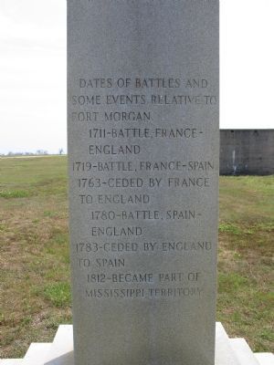
| 1 ► Alabama, Baldwin County, Fort Morgan — The Pride of Seven Flags — |
| On Dixie Graves Parkway near Alabama Route 180 W. | |||
| 2 ► Alabama, Baldwin County, Gulf Shores — Fort Bowyer War of 1812 — |
| On Dixie Graves Highway, on the right when traveling south. | |||
| 3 ► Alabama, Barbour County, Eufaula — The St. Julian Hotel — |
| On East Broad Street, on the right when traveling west. | |||
| 4 ► Alabama, Butler County, Greenville — Ogly-Stroud Massacre / Gary's Stockade — |
| On Sherling Lake Road (Road 44) 0.4 miles north of Ridge Road (County Road 54), on the right when traveling north. | |||
| 5 ► Alabama, Clarke County, Coffeeville — Mitcham Beat and the Mitcham War — |
| On Alabama Route 154 at Fire Tower Road, on the right when traveling west on State Route 154. | |||
| 6 ► Alabama, Colbert County, Muscle Shoals — The Singing River Sculpture — In Muscle Shoals, Alabama — |
| On Avalon Avenue at Brown Street, on the left when traveling west on Avalon Avenue. | |||
| 7 ► Alabama, Covington County, Andalusia — Old Courthouse Clock Bell — |
| On North Court Square at Crescent Street, on the right when traveling west on North Court Square. | |||
| 8 ► Alabama, Cullman County, Cullman — Bent But Not Broken — |
| Near Lee Avenue SW near Broadway Ave SW. | |||
| 9 ► Alabama, Cullman County, Cullman — Marion Albert Hill — Nov. 13, 1895 — Feb. 3. 1979 — |
| Near Sportsman Lake Road NW, 0.4 miles west of 2nd Avenue NW (Route 31). | |||
| 10 ► Alabama, Cullman County, Vinemont — Streight’s Raid — The Battle of Hog Mountain — |
| On County Road 1136, 0.4 miles north of County Road 1145, on the right when traveling north. | |||
| 11 ► Alabama, Cullman County, Vinemont — Streight’s Raid — A Failed Campaign — |
| On County Road 1136, 0.4 miles north of 1145, on the right when traveling north. | |||
| 12 ► Alabama, Dallas County, Cahaba — Death in the Street — |
| On Second Street North at Vine Street, on the left when traveling west on Second Street North. | |||
| 13 ► Alabama, Elmore County, Wetumpka — Wetumpka Impact Crater — Chronological Sequence of Crater Formation — 85 Million Years Ago — |
| On Company Street north of Bridge Street, on the left when traveling north. | |||
| 14 ► Alabama, Elmore County, Wetumpka — 1 — Wetumpka Impact Crater — Educational Viewpoint #1 — |
| Near Wilson Street, 0.2 miles north of Emerson Street, on the right when traveling north. | |||
| 15 ► Alabama, Elmore County, Wetumpka — 2 — Wetumpka Impact Crater — Educational Viewpoint #2 — |
| On Bald Knob Road, 0.6 miles north of Enslen Drive, on the right when traveling north. | |||
| 16 ► Alabama, Elmore County, Wetumpka — 3 — Wetumpka Impact Crater — Educational Viewpoint #3 — |
| On Harrogate Springs Road, 1.3 miles east of Jasmine Hill Road, on the left when traveling east. | |||
| 17 ► Alabama, Elmore County, Wetumpka — 4 — Wetumpka Impact Crater — Educational Viewpoint #4 — |
| On Buck Ridge Road, 0.3 miles south of Harrogate Springs Road, on the right when traveling south. | |||
| 18 ► Alabama, Elmore County, Wetumpka — 5 — Wetumpka Impact Crater — Educational Viewpoint #5 — |
| On Trotters Trail, 0.2 miles south of Fairliewood Drive, on the left when traveling south. | |||
| 19 ► Alabama, Elmore County, Wetumpka — 6 — Wetumpka Impact Crater — Educational Viewpoint #6 — |
| Near Coosa River Parkway, on the left when traveling north. | |||
| 20 ► Alabama, Elmore County, Wetumpka — 7 — Wetumpka Impact Crater — Educational Viewpoint #7 — |
| On Orline Street west of Hill Street, on the right when traveling south. | |||
| 21 ► Alabama, Elmore County, Wetumpka — Wetumpka Timeline — (Prehistory – 1924) / (1925 - Present Day) — |
| On Hill Street south of Online Street, on the left when traveling south. | |||
| 22 ► Alabama, Etowah County, Gadsden — Eleventh Street School — |
| On Chestnut Street at South 11th Street, on the right when traveling east on Chestnut Street. | |||
| 23 ► Alabama, Etowah County, Gadsden — The North Alabama Conference of the United Methodist Church — |
| On Chestnut Street when traveling west. | |||
| 24 ► Alabama, Houston County, Ashford — Ashford Centennial — |
| On Broadway Avenue (County Road 55) at Midland Street, on the right when traveling north on Broadway Avenue. | |||
| 25 ► Alabama, Jefferson County, Leeds — John Henry — Legendary ‘Steel Drivin’ Man’ — |
| On Thornton Avenue NE, on the right when traveling east. | |||
| 26 ► Alabama, Lauderdale County, Elgin — Cherokee Chief Doublehead's Village Around 1800 — |
| On Lee Highway (U.S. 72), on the right when traveling east. | |||
| 27 ► Alabama, Lauderdale County, Florence — "Mountain" Tom Clark — Hanged September 4, 1872 — |
| On Tennessee Street. | |||
| 28 ► Alabama, Lauderdale County, Florence — Andrew Jackson's Military Road — 1817 — |
| On County Route 47 at Cox Creek Parkway on County Route 47. | |||
| 29 ► Alabama, Lauderdale County, Florence — Dr. Ethelbert Brinkley Norton — City of Florence Walk of Honor — |
| Near Hightower Place south of Veterans Drive (Alabama Route 133), on the left when traveling south. | |||
| 30 ► Alabama, Lauderdale County, Florence — Lt. Col. R. Edward Yeilding — City of Florence Walk of Honor — |
| Near Highttower Place south of Veterans Drive (Alabama Route 133), on the left when traveling south. | |||
| 31 ► Alabama, Lauderdale County, Florence — Prehistoric Native Americans / Historic Native Americans — (Circa 8,000 B.C. ~1500 A.D.) / (Circa 1550 A.D.~ 1816 A.D.) — |
| On McFarland Park Road. | |||
| 32 ► Alabama, Lauderdale County, Florence — Samuel Cornelius Phillips — City of Florence Walk of Honor — |
| Near Hightower Place south of Veterans Drive (Alabama Route 133), on the left when traveling south. | |||
| 33 ► Alabama, Lauderdale County, Florence — The University of North Alabama — Football Program National NCAA Division II — Championship Titles (1993~1994~1995) — |
| On Pine Street. | |||
| 34 ► Alabama, Lauderdale County, Waterloo — Trail of Tears — |
| On Main Street. | |||
| 35 ► Alabama, Lawrence County, Oakville — Historic Indians — |
| 36 ► Alabama, Lee County, Loachapoka — Boom and Change — |
| On Stage Road. | |||
| 37 ► Alabama, Lowndes County, Mt. Carmel — Lynching in America / Lynching in Letohatchee — Community Remembrance Project — |
| On West Hickory Grove Road, 1.3 miles east of Route 97, on the right when traveling east. | |||
| 38 ► Alabama, Macon County, Tuskegee — 12 — Samuel "Sammy" Leamon Younge, Jr. — The Tuskegee Civil Rights and Historic Trail — |
| On East Martin Luther King Highway (U.S. 80) east of North Maple Street, on the left when traveling east. | |||
| 39 ► Alabama, Macon County, Tuskegee — 11 — Tuskegee High School — The Tuskegee Civil Rights and Historic Trail — |
| On South Main Street (U.S. 29) at East Price Street, on the right when traveling north on South Main Street. | |||
| 40 ► Alabama, Macon County, Tuskegee Institute — 2 — Charles Goode Gomillion — The Tuskegee Civil Rights and Historic Trail — |
| On Bibb Street, 0.2 miles north of Hudson Street, on the left when traveling north. | |||
| 41 ► Alabama, Madison County, Brownsboro — Trail of Tears — Drane/Hood Overland Route — |
| On Lee Highway/John T. Reid Parkway (U.S. 72 at milepost 109) at Brock Road, on the right when traveling west on Lee Highway/John T. Reid Parkway. | |||
| 42 ► Alabama, Madison County, Huntsville — Alabama’s Constitution And Statehood — |
| On Gates Avenue at Franklin Street S.E. on Gates Avenue. | |||
| 43 ► Alabama, Madison County, Huntsville — The Chamber of Commerce Huntsville/Madison County — Established January 12, 1894 |
| On Church Street, NW. Reported missing. | |||
| 44 ► Alabama, Madison County, Huntsville — Where Alabama Entered the Union — 1819 1910 — |
| On Gates Avenue Southeast at Franklin Street Southeast, on the right when traveling west on Gates Avenue Southeast. | |||
| 45 ► Alabama, Mobile County, Mobile — L'Arbre de Pau — |
| On Theatre Street at South Royal Street, on the right when traveling west on Theatre Street. | |||
| 46 ► Alabama, Mobile County, Mobile — Le Marquis de Lafayette visited Mobile — |
| On Government Street (U.S. 98) at South Jackson Street, on the right when traveling east on Government Street. | |||
| 47 ► Alabama, Mobile County, Mobile — Luxembourg — Korean War Memorial — |
| Near Battleship Parkway at Old Spanish Trail (U.S. 98). | |||
| 48 ► Alabama, Mobile County, Mobile — Memorial to USS Herring (SS-233) — Submarines and the Battleship Park — |
| On Battleship Parkway (U.S. 90/98) east of Old Spanish Trail (U.S. 90/98). | |||
| 49 ► Alabama, Mobile County, Mobile — 27 — Michael Donald — |
| On Michael Donald Avenue north of Old Shell Road, on the right when traveling north. | |||
| 50 ► Alabama, Montgomery County, Montgomery — Chris’ Hot Dogs — Established In 1917 — |
| On Dexter Avenue east of South Perry Street, on the right when traveling east. | |||
| 51 ► Alabama, Montgomery County, Montgomery — Georgia Gilmore — February 5, 1920 - March 3, 1990 — |
| On Dericote St.. | |||
| 52 ► Alabama, Montgomery County, Montgomery — Harris House — |
| On South Jackson Street, on the left when traveling south. | |||
| 53 ► Alabama, Montgomery County, Montgomery — History of the Alabama State Bar — |
| On Dexter Avenue east of North Hull Street, on the left when traveling east. | |||
| 54 ► Alabama, Montgomery County, Montgomery — The National Memorial for Peace and Justice — |
| Near Caroline Street south of Clayton Street, on the left when traveling south. | |||
| 55 ► Alabama, Morgan County, Hartselle — The Great Hartselle Bank Robbery / Three Hours Required to Accomplish Heist — |
| On Railroad Street Southwest at Hickory Street Southeast, on the right when traveling north on Railroad Street Southwest. | |||
| 56 ► Alabama, Perry County, Marion — South College Barracks Fire of 1924 — |
| Near Washington Street south of Wilkerson Street. | |||
| 57 ► Alabama, Russell County, Fort Mitchell — Fort Mitchell and Creek Removal — Creek Heritage Trail — |
| Near County Highway 165, 2.3 miles south of Nuckols Road (Road 39). | |||
| 58 ► Alabama, St. Clair County, Ashville — Assassination Site of Sgt. E. Frank Harrison — |
| On 5th Street (U.S. 231) south of 9th Avenue, on the right when traveling south. | |||
| 59 ► Alabama, Talladega County, Oak Grove — Stars Fell On Alabama / Hodges Meteorite — |
| On Old U.S. 280, 0.2 miles north of Odens Mill Road (County Road 36), on the left when traveling north. | |||
| 60 ► Alabama, Tuscaloosa County, Tuscaloosa — “The Indian Fires Are Going Out” — |
| On 28th Avenue south of 2nd Street, on the right when traveling south. | |||
| 61 ► Alabama, Tuscaloosa County, Tuscaloosa — Site Of The Stand In The Schoolhouse Door / Foster Auditorium, 1939 — |
| Near 6th Avenue at 8th Street. | |||
| 62 ► Alaska, Juneau Borough, Juneau, Downtown Juneau — Seward & Alaska — |
| Near Main Street at 4th Street, on the right when traveling north. | |||
| 63 ► Alaska, Sitka Borough, Sitka — 250th Anniversary of the Bering- Chirikov Expedition — 1741-1991 — |
| 64 ► Alaska, Sitka Borough, Sitka — Alaska Purchase — |
| 65 ► Alaska, Sitka Borough, Sitka — In This Place — |
| 66 ► Alaska, Skagway — Fatal Duel — |
| On Second Avenue at State Street, on the right when traveling east on Second Avenue. | |||
| 67 ► Alaska, Skagway — Inspector Charles Constantine — and Staff Sergeant Charles Brown — North West Mounted Police — |
| On Broadway at Centennial Park, on the right when traveling north on Broadway. | |||
| 68 ► Arizona, Apache County, Springerville — 17 — Bertha Wahl Shooting — |
| On West Airport Road at North Becker Lake Road, on the right when traveling west on West Airport Road. | |||
| 69 ► Arizona, Apache County, Springerville — 19 — James Hale Shooting — |
| On South Mountain Avenue (Business U.S. 180), on the right when traveling south. | |||
| 70 ► Arizona, Cochise County, Douglas — Douglas International Airport — |
| On West Airport Road near 10th Street, on the right when traveling north. | |||
| 71 ► Arizona, Cochise County, Douglas — Mormon Battalion — LDS Church — |
| 72 ► Arizona, Cochise County, Douglas — Mormon Battalion — LDS Church — |
| On Geronimo Trail, on the right when traveling east. | |||
| 73 ► Arizona, Cochise County, Hereford — The Coronado Expedition, 1540-42 — |
| Near East Montezuma Canyon Road.. | |||
| 74 ► Arizona, Cochise County, Tombstone — 18 — Campbell & Hatch Saloon and Billiard Parlor — 1881 — |
| On East Allen Street, on the left when traveling east. | |||
| 75 ► Arizona, Cochise County, Tombstone — City Marshall Virgil Earp — |
| On Allen Street. | |||
| 76 ► Arizona, Cochise County, Tombstone — 36 — Tombstone Engine Co. No. 1 — 1881 — |
| On East Toughnut Street, on the right when traveling east. | |||
| 77 ► Arizona, Coconino County, Flagstaff — Flagstaff — |
| On Route 66 at South Beaver Street, on the right when traveling east on Route 66. | |||
| 78 ► Arizona, Coconino County, Flagstaff — Walkway of Flags — 1994 — |
| On West Route 66, on the right when traveling west. | |||
| 79 ► Arizona, Coconino County, Page — Bureau of Reclamation Memorial Fountain — |
| 80 ► Arizona, Gila County, Young — The Pleasant Valley War a.k.a. The Graham-Tewksbury Feud — Circa 1882 - 1892 — |
| On Desert to Tall Pines Highway / Young Highway Road (State Highway 288). | |||
| 81 ► Arizona, La Paz County, Bouse — 90 — 740th Tank Battalion — Daredevil Tankers — |
| On Broadway Avenue (Arizona Route 72 at milepost 27) south of Main Street, on the right when traveling west. | |||
| 82 ► Arizona, Maricopa County, Scottsdale, South Scottsdale — Merci Train Boxcar — A Gift of Friendship — |
| Near East Indian Bend Road east of North Scottsdale Road, on the right when traveling east. | |||
| 83 ► Arizona, Maricopa County, Wickenburg — Wickenburg Massacre — |
| On U.S. 60 at milepost 106 at Flying E Ranch Road, on the right when traveling east on U.S. 60. | |||
| 84 ► Arizona, Mohave County, Kingman — Ha' Qa' Muwe: — (Ancestral Home of the Hualapai) — |
| On Fort Beale Road at Wagon Trail Road, on the left when traveling north on Fort Beale Road. | |||
| 85 ► Arizona, Mohave County, Kingman — Mohave Center Plaza of Valor — |
| On East Oak Street at North 5th Street, on the right when traveling west on East Oak Street. | |||
| 86 ► Arizona, Mohave County, Lake Havasu City — British – American Friendship — |
| On McCulloch Boulevard, 0.1 miles south of Arizona Route 95, on the right when traveling south. | |||
| 87 ► Arizona, Mohave County, Lake Havasu City — London Bridge — |
| On Arizona Route 95 south of McCulloch Blvd. N when traveling south. | |||
| 88 ► Arizona, Mohave County, Littlefield — 121 — The Old Spanish Trail — 1829 - 1848 — |
| On County Highway 91 at Old Pioneer Road on County Highway 91. | |||
| 89 ► Arizona, Navajo County, Holbrook — Jasper Forest — |
| Near Jasper Forest Road, on the left when traveling west. | |||
| 90 ► Arizona, Navajo County, Holbrook — Summer Solstice Marker — |
| Near Petrified Forest Road, on the right when traveling north. | |||
| 91 ► Arizona, Navajo County, Show Low — "show low and you win the ranch". — |
| On East Cooley Street at North 11th Street, on the right when traveling west on East Cooley Street. | |||
| 92 ► Arizona, Pima County, Tucson, Downtown — Commemorating the Raising of the First American Flag within the Walled City of Tucson — |
| Near West Alameda Street. | |||
| 93 ► Arizona, Pima County, Tucson, Downtown — Exchange at the Presidio — The Mormon Battalion Enters Tucson, 16 December 1846 — |
| Near West Alameda Street. | |||
| 94 ► Arizona, Pima County, Tucson, El Presidio — Padre-Eusebio-Francisco-Kino, S.J. — |
| On West Alameda Street, on the right when traveling east. | |||
| 95 ► Arizona, Pima County, Vail — The CCC Worker — Camp SP-10-A — Colossal Cave Mountain Park 1934 – 1937 — |
| Near East Old Spanish Trail. | |||
| 96 ► Arizona, Pinal County, Casa Grande — In Honor of Mormon Battalion — |
| On North Pinal Avenue, on the right when traveling south. | |||
| 97 ► Arizona, Pinal County, Gila River — Gadsden Purchase — |
| Near Interstate 10 at milepost 183. | |||
| 98 ► Arizona, Pinal county, Gila River — Gadsden Purchase — |
| Near Interstate 10 at milepost 181. | |||
| 99 ► Arizona, Pinal County, Globe — The Hanging Tree — Dedicated to Gila County Law Enforcement — Protect and Serve — |
| On North Broad Street, 0.1 miles south of Hackney Avenue, on the right when traveling south. | |||
| 100 ► Arizona, Pinal County, Sacaton — Dedicated to Ira H. Hayes USMC — |
| On Sacaton Road (Arizona Route 87) at Sacaton-Casa Blanca Road, on the right when traveling east on Sacaton Road. | |||
2926 entries matched your criteria. The first 100 are listed above. Next 100 ⊳