On Main Street south of Bayfront Park Drive, on the right when traveling south.
Standing on a low limb of a giant oak tree near here, General Andrew Jackson made a pep talk to his troops, fresh from their victory at the Battle of Horse Shoe Bend and poised before advancing on the British and Spanish at Pensacola, and the . . . — — Map (db m100852) HM
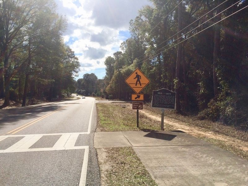
Near Fort Morgan Road (Alabama Route 180) 2 miles west of Dune Drive, on the right when traveling west.
American Forces
158 Men
20 Cannons
Casualties
3 Killed; 5 Wounded
British Forces
852 Men
130 Creek Indians
4 Ships; 80 Cannon
23 Killed; 47 Wounded
On September 11, 1814, HMS Hermes, HMS . . . — — Map (db m187342) HM
On Fort Morgan Road (Alabama Route 180) 2 miles west of Dune Drive, on the right when traveling west.
Drawn by A. Laccarriere Latour to accompany his book Historical Memoir of the War in West Florida and Louisiana, the above image depicts Fort Bowyer on the right as it appeared during the first battle in 1814. The drawing on the left; . . . — — Map (db m225072) HM
On Fort Morgan Road (Alabama Route 180) 2 miles west of Dune Drive, on the left when traveling west.
American Forces
370 Men
28 Cannon
Casualties
1 Killed; 18 Wounded
British Forces
3000 Men
38 Ships
28 Cannon (not including those on ships)
13 Killed; 18 Wounded
A map of the Second Battle of Fort . . . — — Map (db m118334) HM
(East Face):
Tribute dedicated to the memory of the soldiers who gave their lives in the defense of our country here at Fort Morgan.
Here lies the pride of seven flags entombed in our ancestor’s worth, who heard the thunder of the fray . . . — — Map (db m4649) HM
On Dixie Graves Highway, on the right when traveling south.
At, or near, this site, the United States, after seizing this point of land from the Spanish in 1813, built Fort Bowyer, a structure of wood and sand.
A small garrison of men courageously fought to defend the fort against two British attacks, one . . . — — Map (db m187339) HM
Near Alabama Route 225, on the left when traveling north.
The American Revolution gave the United States its independence but the War of 1812 gave it status among the nations and established permanent peace with Great Britain.
Alabama had a significant role during the War of 1812. The Creek Indian . . . — — Map (db m122670) HM
On U.S. 84 at milepost 40 at Crescent Road, on the right when traveling east on U.S. 84.
Side 1
Near this spot are the graves of American Revolution soldier Elijah Pugh and his son Issac, a War of 1812 veteran. Elijah, born in Guilford Co., N.C. in 1760, was 18 when he joined a patriot band led by Col. Elijah Clarke at the . . . — — Map (db m154482) HM
On U.S. 84 at County Road 22, on the right when traveling west on U.S. 84.
Sept. 1, 1813
Creek Indian War. 1813-14
Part of War of 1812. British used Pensacola as base to arm, incite Indians against U.S..
Prophet Francis led Indians in this raid on Kimbell home. They killed and scalped 12 of 14 (two survivors . . . — — Map (db m47635) HM
Near Natchez Trace Parkway (at milepost 327.3), 1.4 miles east of N Pike (County Route 21), on the left when traveling east.
George Colbert's stand sat atop the ridge before you. As one of many inns that dotted the Trace between Nashville and Natchez, it provided travelers with food and lodging.
With a Scottish father and Chickasaw mother, George Colbert used his . . . — — Map (db m107260) HM
Near Natchez Trace Parkway (at milepost 327.3), 1.6 miles east of N Pike (County Route 21), on the left when traveling east.
In the early 1800s, ferries like the one George Colbert ran near here on the Tennessee River linked segments of the Natchez Trace. Ferries carried people across the river—for a fee. Post riders, Kaintucks, military troops, casual travelers, . . . — — Map (db m107258) HM
Near Natchez Trace Parkway (at milepost 327.3), 1.3 miles east of N Pike (County Route 21), on the left when traveling east.
Frontier America once walked along the Natchez Trace.
The Chickasaw and Choctaw used the Trace for transportation and trade. After 1801, with tribal permission, post riders who rode the Trace connected isolated settlements in Mississippi and . . . — — Map (db m107257) HM
On Main Street at King Street (Old Alabama Route 20), on the right when traveling north on Main Street.
FrontByler Road
Pioneer's settled path to new lands, agriculture, transport and commerce that began in Northwest Alabama.
140 mile corridor/route designated on December 19th, 1819 by the State Legislature. This was . . . — — Map (db m205287) HM
War of 1812 veteran John Green (1790-1882) settled in Burnt Corn in 1816. He held many public offices, established the first school, and represented Conecuh County in the state legislature in 1824 and 1829. He was the Conecuh delegate to the . . . — — Map (db m81285) HM
Samuel Massey and his brother - in - law, Duke William Glenn, first came to this Territory in February 1814 with Lt. Col Reuben Nash's Regt. South Carolina Volunteer Militia to help defeat the Creek Indians in the War of 1812. Samuel Massey returned . . . — — Map (db m25088) HM
On Old Springville Road / County Road 30, on the left when traveling north.
Established about 1850, Wear Cemetery is located off Old Springville Road to the northeast at Countryside Circle. In the 1800's the Wear family was among the first settlers of the community later known as Clay. Twenty-three remaining graves were . . . — — Map (db m25113) HM
On Allison-Bonnett Memorial Drive at Tin Mill Road, on the right when traveling west on Allison-Bonnett Memorial Drive.
Bethlehem United Methodist Church is one of the oldest churches in Jefferson County, dating back to 1818 and the efforts of Rev. Ebenezer Hearn. In April 1818, the Tennessee Conference of Methodist Churches sent Rev. Hearn south of the Tennessee . . . — — Map (db m212543) HM
On County Route 47 at Cox Creek Parkway on County Route 47.
Construction of this road, as ordered by General Andrew Jackson, began in May 1817 by troops of the U.S. Army for national defense purposes. Beginning near Nashville, Tennessee and continuing to Madison, Louisiana, it shortened the distance from . . . — — Map (db m80321) HM
Cavalry Commander under Andrew Jackson throughout War of 1812:
(Creek War, Pensacola, New Orleans).
Negotiated many treaties ceding Indian lands to U.S.
Made original surveys of Tennessee Valley. — — Map (db m35259) HM
Near Hightower Place south of Veterans Drive (Route 133), on the left when traveling south.
Through his personal and business relationship with Andrew Jackson, Gen. Coffee led Jackson's cavalry in the Battle of New Orleans in 1815 and became a celebrated American hero. — — Map (db m219304) HM
On Surveyor Road, 0.2 miles west of Cloverdale Road, on the left when traveling west.
(side 1)
John Coffee was born in Prince Edward County, VA, in 1772, the son of Joshua and Elizabeth Graves Coffee. The family moved to NC in 1777. After his father died in 1798, Coffee and other family members moved to Davidson County, TN . . . — — Map (db m100248) HM WM
On West Alabama Street at South Court Street, on the right when traveling west on West Alabama Street.
A County Older Than the State
Lauderdale County
created Feb. 6, 1818
by Alabama Territorial Legislature (Alabama became a state in 1819).
Named for Col. James Lauderdale, cavalryman under Gen. John Coffee and Andrew Jackson, War of . . . — — Map (db m35185) HM
On Rock Spring, 0.1 miles east of Natchez Trace Parkway.
The Tennessee River Bridge honors General John Coffee General Coffee served with distinction under General Andrew Jackson in the War of 1812's victory over Great Britain in the Battle of New Orleans. Jackson and Coffee used the Natchez Trace and . . . — — Map (db m232314) HM
Side A Federal lands in this area were first sold in 1818 and quickly purchased by settlers and speculators. A group of investors calling themselves the “Courtland Land Company” and consisting of William H. Whitaker, James M. . . . — — Map (db m28989) HM
On Court Street (County Route 460) at Market Street (Alabama Route 33), on the right when traveling east on Court Street.
Created by Territorial Legislature
in 1818 from lands ceded by
Cherokee and Chickasaw Indians
Named for U.S, Navy hero of War of 1812
Capt. James Lawrence
Fatally wounded, his famous command was
"Don't Give Up The Ship"
County . . . — — Map (db m69672) HM
On Nick Davis Road (County Road 44) 0.5 miles west of Sanderson Road (County Road 127), on the left when traveling west.
Born April 23, 1781 in Hanover Co. Virginia, married there to Martha Hargrave of a wealthy Quaker family. He served as U.S. Marshall and in other positions. Moved to Kentucky in 1808. Was a Captain in the War of 1812 and became a political and . . . — — Map (db m29284) HM
On Holmes Avenue at Lincoln St., NE on Holmes Avenue.
On this spot, camped his army, October 11, 1813, after marching from Fayetteville, Tenn.,~"32 miles without halting,"~ enroute to the Battle of Horseshoe Bend. — — Map (db m30382) HM
On Monroe Street Northwest at Washington Street Northwest, on the left when traveling east on Monroe Street Northwest.
I am Sergeant Michael Dunn of the 1st Marine Battalion. I fought in the First Barbary War, also known as the Tripolitan War, because we battled pirates off the coast of Tripoli. The Mediterranean coast of North Africa had been a hotbed of piracy for . . . — — Map (db m85488) WM
On Ivy Avenue SW at SW 1st Street, on the right when traveling south on Ivy Avenue SW.
Brahan Spring Park, formerly Beaty's Spring, was the site of Camp Beaty, the encampment of Andrew Jackson's army of volunteers and militia after their celebrated non-stop march of "32 miles in 5 hours" from Fayetteville, Tennessee on October 11, . . . — — Map (db m105131) HM
On Echols Street near Adams Street, on the right when traveling west.
During the original Madison County Land Sales of 1809, LeRoy Pope of Petersburg, GA, secured among other purchases a majority of Section 36, Township 3, Range 1 West, the site of the future town of Twickenham, as Huntsville was originally known. . . . — — Map (db m32480) HM
On Monroe Street Northwest at Washington Street Northwest, on the left when traveling east on Monroe Street Northwest.
I am Private Darbin Abolt of the 7th US Infantry Regiment, part of which is commanded by Captain Zachary Taylor, our future president. I was already in the Army when we declared war on the British in June 1812. We were fed up with the British . . . — — Map (db m85617) WM
On Main Street south of Washington Avenue, on the right when traveling north.
October, 1813, the Creek Civil War was threatening settlers in the Mississippi Territory. Governor William Blount of Tennessee called up 5,000 volunteers to protect the white population. Andre Jackson's soldiers followed a path through the Cherokee . . . — — Map (db m127603) HM
On Berryhill Road, 0.1 miles south of County Road 55, on the right when traveling north.
Andrew Jackson returned victorious from the Battle of New Orleans along this path to Tennessee after the War of 1812. Already in use by 1812, it was improved with federal funds in 1816. The road handled foot, horse, wagon, and stagecoach traffic and . . . — — Map (db m96483) HM
Near West Main Street (Alabama Route 205) at Lombardy Street, on the right when traveling west.
The City of Albertville is named for Thomas Albert, buried here with his wife Sarah Sappington Albert and daughter Sarah. They had three other daughters -- Martha, who married James C. Miller,the city's first postmaster, Elizabeth, and Mary. Albert . . . — — Map (db m143214) HM
Near Bienville Boulevard east of Albatross Street, on the right when traveling east.
When British forces arrived at Mobile Bay to assault Fort Bowyer on Mobile Point, half of the British army under the command of Sir John Kean, who was recovering from wounds suffered during the defeat at New Orleans, was landed on Dauphin Island to . . . — — Map (db m122427) HM
On U.S. 84 at Grain Elevator Road and Lena Landegger Highway, on the left when traveling west on U.S. 84.
Built by Gen. Ferdinand L. Claiborne as a base for his invasion of the Alabama country with U.S. Regulars, Lower Tombigbee Militia, and friendly Choctaws. Claiborne’s campaign culminated in the American victory over the Creeks at the Holy Ground. — — Map (db m47641) HM
On Dexter Avenue at South McDonough Street, on the right when traveling east on Dexter Avenue.
The six streets which cross Dexter Avenue between Court Square and the State Capitol are named for Oliver Hazard Perry, James Lawrence, Thomas Macdonough, Issac Hull, Stephen Decatur and William Bainbridge, all naval officers of the War of 1812. . . . — — Map (db m99545) HM
On Cain Street Northeast west of Ferry Street Northeast, on the left when traveling west.
Alabama Territorial Legislature created this county in 1818 from lands ceded by Cherokee Indians in 1816. County first named Cotaco, for large creek in county.
Named Morgan County in 1821 for Maj. Gen. Daniel Morgan, . . . — — Map (db m27759) HM
On U.S. 80 at Bleeker Road (County Road 79), on the right when traveling west on U.S. 80.
The community of Crockettsville was settled at about the time Russell County was formed in 1832. Among the first settlers were Jerry Segar and Green Sewell. It was named in honor of David "Davy" Crockett who served as a scout in Andrew Jackson's . . . — — Map (db m33541) HM
Built during Creek War 1813 by Georgia Militia on main Indian trade route to Tombigbee River
U.S. Troops stationed here until 1837 1836 Lower Creeks corralled here for forced removal to the West — — Map (db m26069) HM
On County Road 47 at Whisenhunt Road, on the right when traveling north on County Road 47.
Established June 2, 1849 by
Veteran of War of 1812
Loftin Quinn
In Consideration of His Love for the Church, He Conveyed the Burying Ground to the Trustees of Liberty Church And Their Successors.
Listed on the Alabama Historic . . . — — Map (db m28519) HM
On Cogswell Avenue at 18th Street, on the right when traveling west on Cogswell Avenue.
Created in 1818 by territorial legislature. Named for Revolutionary hero, Gen. St. Clair. First settlers from Tennessee, Georgia – veterans of Creek Indian War, 1813-14.
Pell City established as industrial town in 1890 by George H. Pell of . . . — — Map (db m49666) HM
On Gen. Jackson Memorial Dr south of Mallory Cir, on the right when traveling south.
To The Memory of General Jackson and his Tennessee Volunteers while camped here 1814. He fought the Battle of Horseshoe Bend and discharged his Volunteers. — — Map (db m45706) HM
On South Broadway Avenue (State Highway 21) at Goodwater Highway (County Road 511), in the median on South Broadway Avenue.
Settled in 1748 by Shawnee
Indians from Ohio.
They joined Creek Confederacy,
fought against U.S. in War of 1812,
were moved west in 1836.
Settled before 1836 by men
who had fought in this area
under Andrew Jackson.
Indian name: . . . — — Map (db m40595) HM
On East Ft. Williams Street east of North Broadway Avenue (Alabama Route 21), on the left when traveling east.
Here, on a gentle west slope just outside of the original town limits, lies the earliest public cemetery in Sylacauga. The earliest tombstone remaining in the cemetery dates to 1839. Its location and the adjacent family plots of later dates reveal . . . — — Map (db m131718) HM
On Our Childrens Highway (State Highway 63) at Walker Ferry Road, on the right when traveling south on Our Childrens Highway. Reported missing.
Indian farmer - merchant chose to resist whites' advance on Indians' lands. In Creek War he led Creeks at Battle of Horseshoe Bend. His warriors were beaten by Jackson's superior force but Menawa escaped. — — Map (db m66680) HM
On North Broadnax Street at West Cusseta Street, on the right when traveling south on North Broadnax Street.
This tablet is placed by
Tallapoosa County
in commemoration of the
one hundredth anniversary
of the
Battle Of Horseshoe Bend,
fought within its limits
on March 27, 1814.
There the Creek Indians, led by
Menawa and other chiefs, . . . — — Map (db m28751) HM
On State Highway 49 north of U.S. 280, on the right when traveling north.
There on March 27, 1814 General Andrew Jackson commanding U. S. forces and friendly Indians, broke the power of the Creek Confederacy. — — Map (db m39812) HM
On Battlefield Park Tour Road, on the right when traveling south.
I ordered [Lt. Jesse] Bean to take possession of the Island below, with forty men, to prevent the enemy's taking refuge there...as many of the enemy did attempt their escape...but not one were landed-they were sunk by [Lt.] Beans command ere . . . — — Map (db m46389) HM
Here at 10:30 on the morning of March 27, 1814, General Jackson quickly emplaced his single battery, one 3-pounder and one 6-pounder. He immediately opened a lively but ineffective fire on the center of the sturdy log barricade. After his Indian . . . — — Map (db m51671) HM
Here on the Horseshoe Battleground General Andrew Jackson and his brave men broke the power of the Creek Indians under Chief Menawa March 29, 1814 — — Map (db m51673) HM
Leading the charge on the Indian defenses, Major Montgomery fell while storming the log barricade, Horseshoe Bend was his first battle. But the 28 year old Tennessean already a distinguished lawyer, was among the most promising of Jackson's officers. — — Map (db m51667) HM
In 1811 Tecumseh, a Shawnee Indian tapped the growing resentment within the Creek Nation.
Treaties with the whites had always seemed to work against them. The U.S. Government had adopted a persistent policy to change Creek government and culture. . . . — — Map (db m95260) WM
By dark, more than 800 Red Stick warriors were dead and at least 350 women and children were prisoners. Jackson's army suffered 154 men wounded and 49 killed. The Battle of Horseshoe Bend effectively ended the Creek Indian War. Five months later, . . . — — Map (db m51665) HM
Near Sipsey Road (County Road 22) at Old Town Road, on the right when traveling east.
Black Warrior Town Black Warrior Town was one of the northernmost settlements of the Muscogee (Creek) Nation. The town center was situated on the eastern side of the confluence of the Sipsey and Mulberry Fork of the Black Warrior River. Located . . . — — Map (db m216160) HM
On Blackwood Road south of Kings Mill Road, on the right when traveling south.
South Carolina-born Daniel Tubbs (17 Feb. 1794 - 25 Mar 1882) enlisted in the War of 1812 and fought in the final battle at New Orleans. Honorably discharged in Nashville on 20 Apr. 1815, he and his wife. Matilda Sanders. settled on this site . . . — — Map (db m153242) HM
On Broad Street (Alabama Route 28) at Fail Street, on the left when traveling north on Broad Street.
Joseph Morgan Wilcox was born on March 15, 1790 in Killingsworth, Middlesex County, Connecticut. He was the son of Revolutionary War officer, Joseph Wilcox and Phoebe Morgan. On June 15, 1808, Cadet Wilcox entered the U.S. Military Academy where he . . . — — Map (db m68159) HM
Jacob Pruet’s Stand (tavern) was a popular stopping place on the Byler Road in the 1830s and 1840s. A two story poplar log structure with four twenty-foot rooms per floor. It was located near a large spring and netted a handsome profit, as most of . . . — — Map (db m219825) HM
Our Constitution names the President of the United States the Commander in Chief of all the Armed Forces. Presidents who have served in our military are displayed on the following plaques. Each has served either on Active Duty, in the National . . . — — Map (db m92382) HM WM
[Written on the initial marker, provided for context]
Our Constitution names the President of the United States the Commander in Chief of all the Armed Forces. Presidents who have served in our military are displayed on the following . . . — — Map (db m92384) HM WM
Still reeling from the loss of its North American colonies and fighting in a European war, England began to stop and search American ships on the high seas. During such searches, American sailors would be impressed against their will into the . . . — — Map (db m91478) HM
On Baseline Road (State Highway 362) 1.8 miles east of U.S. 49.
This stone marks the base established Nov. 10, 1815
from which the lands of the Louisiana Purchase were surveyed by the United States Engineers. The first survey from this point was made to satisfy the claims of the soldiers of the War of 1812 . . . — — Map (db m6037) HM
Near West Markham Street at Ashley Street, on the right when traveling west.
To the Honor and Glory of our Patriotic Sires who gave their services for their country in the War of 1812-1815 • • • This tablet is dedicated in gratitude and pride by the National Society of the United States Daughters of 1812 State of Arkansas . . . — — Map (db m157499) WM
Regiment of Riflemen 1817-1822 After serving with distinction in the War of 1812, the elite Regiment of Riflemen established Fort Smith in 1817. Their mission was to promote peace between the Cherokee and Osage. The regiment merged with the 7th . . . — — Map (db m156986) HM
On Hill Street at 5th Street, on the right when traveling south on Hill Street.
This iron cannon was installed on the USS Constitution “Old Ironsides”, which was launched October 21, 1797. First in action against French privateers in 1798, “Old Ironsides” rendered distinguished service against the British in 1812. — — Map (db m122534) HM WM
Veteran of the War of 1812. A native of Virginia, he enlisted on August 1, 1813 in Captain John C. Manson’s Gun Boat No. 7 in the squadron of Lieutenant Guntier at Wilmington, North Carolina, for the defense of Wilmington and Beaufort. — — Map (db m150828) HM
He's the great uncle of George S. Patton Jr. III. Veteran of the War of 1812. Served as trumpeter in Captain Thomas Porter’s Company, Tennessee Militia from September 28, 1814 to April 27, 1815. — — Map (db m152635) HM
Said to be from a pirate ship commanded by Jean Lafitte in the battle of New Orleans, January 8, 1815.
It is also said that Lafitte's privateering steps left a wake of blood from the mainland to Barataria Bay.
But don't believe everything you . . . — — Map (db m189871) HM
Leader of the first party of Americans into Alta California over southern trails
Arrived at San Diego Presidio
March 27, 1828
An officer in the War of 1812
Born in Kentucky August 25, 1782
Died near this spot April 24, 1828
First . . . — — Map (db m51997) HM
Near Imhoff Road south of Azuar Avenue, on the right when traveling south.
Plaque One:
Daughter of Francis Scott Key 1779-1843
A United States Bicentennial Commemoration
Placed by Sequoia Chapter National Society of the Daughters of the American Revolution
Plaque Two:
War of 1812
US
Real . . . — — Map (db m217774) HM
On Main Street (Connecticut Route 35) at Branchville Road (Connecticut Route 102), on the left when traveling north on Main Street.
[ west side ]
To the Memory of The
Citizens of Ridgefield
Who Served Their Country
In the Wars of the Republic
1775 – 1918
Erected by the People of Ridgefield MCMXXIV
[ east side ]
War of the . . . — — Map (db m31972) WM
On Atlantic Street at Main Street, on the right when traveling north on Atlantic Street.
[ central pedestal ]
Lest We Forget
Within this pedestal is placed a time
capsule recording for all time
those residents of Stamford who responded
to the call, some giving their lives
while serving in our past wars.
In future . . . — — Map (db m38754) HM
On Grove Street at Main Street, on the right when traveling north on Grove Street.
[ inscription around the top ]
In Everlasting Memory of Stamford's Patriots 1641 – 1918
[ battle names inscribed in the panel between the fluted columns ]
1689 – 1763
Port Royal • Schenectady • Haverhill • . . . — — Map (db m38430) HM
On Main Street (Connecticut Route 10) at Academy Street, on the left when traveling north on Main Street.
[ south side ]
This Tablet Is Dedicated To Those Brave Men From
The Town Of Southington Who Served The United
States In The Revolutionary War, The War Of 1812,
The Mexican War And The
Spanish War
Revolutionary War 1775 – . . . — — Map (db m33755) WM
On Pleasant Valley Road (Connecticut Route 318) at Beach Rock Road, on the right when traveling north on Pleasant Valley Road.
[ north side ]
1776
The Tribute
Of The
People Of Barkhamsted
To The
Memory Of Her Sons
And Daughters
Who Fought To
Establish Defend And Preserve
The Nation
---
Erected 1897
[ lower plaque ]
World War . . . — — Map (db m29847) WM
On Main Street South (Connecticut Route 61) at West Road, on the left when traveling north on Main Street South.
Dedicated to
the men of Bethlehem
who by their devotion and loyalty
preserved our country
in the War of 1812
Allen, James • Baldwin, Amos • Barnum, Eli • Beebe, Issac • Beecher, Lyman • Burton, Oliver • Coe, Daniel • Church, Samuel • . . . — — Map (db m26562) WM
On North Street (Connecticut Route 63) at Elementary Drive, on the right when traveling north on North Street.
[ front ]
Dedicated To Our Comrades Of Goshen
Who Established And Maintained Freedom For Our Country
French And Indian War 1754 - 1763
Dibble, Joel • Doud, John • Gaylord, Timothy • Humphrey, Ashbel • Humphrey, Manna • Humphrey, . . . — — Map (db m30231) HM
On East Main Street (U.S. 44) at Granite Avenue, on the right when traveling west on East Main Street.
[ east side ]
This Tablet Is Reverently
Inscribed to the Memory Of
Those Who Went From That Part
Of The Town of Canaan Which
Later Became North Canaan, And
Who, With Valor and Patriotism,
Defended the Flag of Our Country
In . . . — — Map (db m42098) HM
On East Canaan Road (U.S. 44) at Lower Road, on the right when traveling east on East Canaan Road.
[ north side ]
This Memorial
Was Erected By The
Citizens & Friends
of
East Canaan Conn
1928
[ west side ]
In Memory Of
Those Who Answered
Their Country's Call
1917 – 1918
[ east side ]
In Memory Of . . . — — Map (db m41853) HM
On Main Street (Connecticut Route 41) at Cornwall Bridge Road (Connecticut Route 4), on the right when traveling south on Main Street.
Revolutionary War
Abel David • Abel Sluman • Abel William • Ackley Ariel • Ackley David • Ackley Jude • Ackley Thomas Jr • Ady Thomas • Allen Amos • Allen Ichabod • Ames Samuel • Andrews Abraham • Avery Daniel • Avery William • Bailey Joseph • . . . — — Map (db m58331) WM
Near Waterside Lane south of Old Harbor Village, on the right when traveling south.
Clinton's Defense Against the British
During the War of 1812, Clinton, then called Killingworth, was under the threat of attack from the British. There were shipyards located on both the Indian River and in the harbor, and the British had . . . — — Map (db m243716) HM
On Main Street east of Novelty Lane, on the left when traveling east.
The British Raid on Essex
On April 7-8, 1814, a British raiding force of 136 sailors and marines rowed six miles up the Connecticut River from warships anchored in Long Island Sound to attack American shipping in Essex, then known as . . . — — Map (db m183087) HM
On St. John’s Square at St. John’s Street, on the right when traveling east on St. John’s Square.
Commodore
Thomas Macdonough
Victor at Lake Champlain
Sept. 11, 1814
Born Dec. 31, 1783 Died Nov. 10, 1825
Buried in Riverside Cemetery
Placed by Wadsworth Chapter D.A.R.
1932 — — Map (db m94209) HM
Commissioned in 1809 by U.S. President Madison, Frederick Lee served in the U.S. Revenue Cutter Service until 1829, providing security for the New Haven port and protection of American Ships on Long Island Sound.
On October 10, 1814, . . . — — Map (db m243260) HM WM
Born April 3, 1766 Married Anna Fowler Captain Lee’s Portrait-painted by General Kosciusko 1797 Captain of U.S. Revenue Cutter “Eagle” War 1812 Lee Academy built 1821 Hosted Marquis De Lafayette 1824 Named our town ‘Madison’ 1826 First town . . . — — Map (db m243265) HM
On Whittemore Road (Connecticut Route 188) at Village Green, on the left when traveling west on Whittemore Road.
Middlebury Honors Those Who Have Served
In The Wars Of Their Country
French – Indian War
Abner Munson
Revolutionary War
David Abbott, Benjamin Bemont, Aaron Benedict, Enos Benham, Samuel Benham, Edward Blackman, Michael Bowers, . . . — — Map (db m29503) WM
Near Grove Street at High Street, on the right when traveling north.
Dedicated
To The Memory Of
Col. Decius Wadsworth
A Native Of
Farmington In This State
And Late Chief
Of The
Ordnance Department
In The Army Of The
United States
Who
Having Served His Country
Faithfully
And Without Reproach . . . — — Map (db m50913) HM
On Davis Street at Ridge Road, on the left when traveling west on Davis Street.
[ inscription on the west face of the base ]
Gettysburg • Port Hudson • Fort Fisher • 1861-1865
[ inscription on the east face of the base ]
Bunker Hill • Bennington • Saratoga • 1775-1783
[ inscription on the south . . . — — Map (db m34723) WM
On Orange Center Road at Meetinghouse Lane, on the right when traveling south on Orange Center Road.
Amerigion Legion Post 127
In Memory Of
The Veterans Of
The War of Independence
War of 1812
Civil War
Spanish American War
World War I
World War II
Korean War
Vietnam War — — Map (db m27723) WM
On West Main Street at Leavenworth Street, on the left when traveling east on West Main Street.
In honor of all those who served in the wars of our country
Revolution 1775 – 1783
War of 1812 – 1814
Mexican War 1846 – 1848
Civil War 1861 – 1865
Spanish American War 1898
Korean War 1950 – 1953 . . . — — Map (db m19923) WM
On Center Street (Connecticut Route 322) at Kenea Avenue, on the right when traveling east on Center Street.
Presented to The Town of Wolcott by Leverett Dwight Kenea In Memory of the Soldiers Who Fought In The War of the Revolution The War of 1812 and The Civil War A.D. 1916 — — Map (db m22369) WM
On Fitchville Road (Connecticut Route 608) at River Road, on the right when traveling east on Fitchville Road.
This memorial will forever honor the men and women who
bravely served during the Revolutionary War and War of 1812 era
The actions of those who answered the call to duty will be remembered for their
sacrifice in defense of freedom and liberty . . . — — Map (db m101736) WM
Near East Street, on the left when traveling south.
In 1808, Congress again approved funds to fortify the coastline, prompted by the prospect of another war with England. England was at war with France, which was ruled by Napoleon Bonaparte at the time, and although the United States had not taken . . . — — Map (db m48283) HM
On Washington Street at Williams Street, on the left when traveling south on Washington Street.
In Memory of
Captain Samuel Chester Reid
1783 — 1861
Born at Norwich, Conn. Aug. 25, 1783.
During the War of 1812 commander of the
American privateer General Armstrong.
Captain Reid planned the United States
Flag which was . . . — — Map (db m101775) HM
Near Greenmanville Avenue (Connecticut Route 27) at Bruggeman Place, on the right when traveling south.
This 7,000 anchor was salvaged off Newport, Rhode Island. Its size and shape match British Admiralty specifications for a bower anchor of a 74-gun ship of the line during the American Revolution and War of 1812. It was probably lost by one of . . . — — Map (db m68308) HM
On Water Street at Omega Street, on the right when traveling south on Water Street.
This Is To Remember
Here the Brave Men of Stonington
Defeated a Landing Force From
His Majesty’s ship “Ramillies”
Bent on Burning the Town and its Shipping
August 10, 1814
The Warden and Burgesses of the
Borough of . . . — — Map (db m68420) WM
2541 entries matched your criteria. The first 100 are listed above. Next 100 ⊳