On July 12, 1862, the Union army occupied Helena. Over two thousand fugitive slaves seeking the army's protection followed. For two days, the long line of soldiers and freedom seekers filed into Helena.
Curtis Marches toward Helena
Most . . . — — Map (db m116437) HM
You are facing Battery B, the only battery on Crowley's Ridge the Confederates did not attack during the Battle of Helena. The men at Battery B, which was about three-quarters of a mile north of here, watched events unfold at Battery C and then . . . — — Map (db m107970) HM
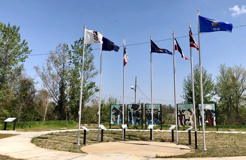
The Delta represents a “melting pot” of diverse cultures. And most of them got here by canoe.
Canoeing is the oldest form of water transportation on the Mississippi River-at least 2,000 years old! In the Quapaw tribal history, they arrived from . . . — — Map (db m229322) HM
On April 6, 1863, Adjutant General Lorenzo Thomas made a speech at Ft. Curtis seeking to enlist former slaves into the U.S. army. The next day, hundreds of black men joined the 1st Arkansas Infantry (African Descent). Later designated U.S. Colored . . . — — Map (db m107825) HM
Guard, Garrison and Fatigue Duty
The United States Colored Troops (USCT) in Helena were part
of the Union garrison holding the city. Their duties were much
the same as those of white troops. Like all Union . . . — — Map (db m108015) HM
Thousands of escaped slaves, known as Contraband, followed
the Union army to Helena in July 1862. Within weeks, the army
put hundreds of Contraband to work building Fort Curtis.
Hard Labor in Hot . . . — — Map (db m108032) HM
Henry Merrell
Henry Merrell, known as the "Industrial Missionary to the South," was born in Utica, N.Y., in 1816. He moved to Arkansas in 1856 and built an industrial complex in Pike Co. He helped draft an anti-secession resolution in . . . — — Map (db m121147) HM
As word of the collapse of the Confederate
armies east of the Mississippi River came to
Arkansas, Confederate Gen. M. Jeff Thompson
established headquarters of the Northern Sub-
District of Arkansas at Harrisburg in mid-April
1865. Thompson and . . . — — Map (db m221249) HM
Polk County men served on both sides during the Civil War. Two companies of the 4th Arkansas Infantry – Co. I and Co. H, the Polk Invincibles—and Hart’s Battery served the Confederacy and at least 73 local men joined the Union army. One man in the . . . — — Map (db m200629) HM
Kirkbride Potts built Potts Inn in the 1850s and it served as a Butterfield Stage Route stop. When war began in 1861, Potts joined the Pope County Home Guard. Four sons were in the Confederate army. Thomas, Joseph and Richard Potts enlisted in the . . . — — Map (db m119958) HM
Pope County in the Civil War
Pope County soldiers served in at least 10 companies that were raised for Confederate service during the Civil War, fighting in battles east of the Mississippi River and in Arkansas. Two companies were . . . — — Map (db m119957) HM
With the possible exception of Helena, it is unlikely that any place in Arkansas had as many Union troops pass through it as did DeValls Bluff. Some saw the town when it was first occupied in September 1863, others stood garrison duty there, while . . . — — Map (db m96671) HM
DeValls Bluff was strategically important to both the Union and Confederate armies as a major White River port and as head of the Memphis and Little Rock Railroad. It became a key Union supply depot after its fall 1863 occupation, as well as a . . . — — Map (db m96455) HM
DeValls Bluff’s status as an excellent riverport and the head of the Memphis and Little Rock Railroad made it an important base for both Confederate and Union forces. Hoping to block Federal ships from moving up the White River, Major Gen. Thomas . . . — — Map (db m96666) HM
DEVALL’S BLUFF, ARKANSAS
August 23, 1863.
GENERAL: Having reconnoitered the different routes, I have decided to commence my line of operations at this point, and have moved the depot and hospital here to-day. The site chosen is a . . . — — Map (db m96672) HM
Rising from the Boston Mountains, the White River meanders 720 miles to its junction with the Arkansas River in the southeastern part of the state. The fast-moving water kept the White River from suffering the build-up of silt that made such rivers . . . — — Map (db m96674) HM
The Memphis and Little Rock Railroad was the first railroad to run in Arkansas. It was chartered in 1853, but when the Civil War began, only two sections were complete. One, running from DeValls Bluff to north of Little Rock, was finished in . . . — — Map (db m96454) HM
On the eve of the Civil War, the Memphis to Little Rock Railroad had completed a line between Hopefield across the Mississippi River from Memphis and Madison in eastern Arkansas. A second section between DeValls Bluff and the north side of the . . . — — Map (db m96673) HM
With a swift current and deep channel that allowed deeper-draft vessels to use it reliably as far north as Batesville, the White River was the most important river in Civil War Arkansas and was used extensively by both sides.
The Confederate . . . — — Map (db m96669) HM
DeValls Bluff was ideally situated to be an important location in the Civil War. The riverport was located at a point on the White River that was navigable at all seasons, a distinct advantage over Arkansas River sites that were frequently isolated . . . — — Map (db m96667) HM
North of where you are standing, Union troops on September 10, 1863, constructed a wooden pontoon bridge across the Arkansas River allowing Union Brigadier General John W. Davidson's cavalry division to proceed to Little Rock. Major General . . . — — Map (db m116523) HM
As Gen. John Davidson saw flames erupting from the only bridge across Bayou Meto, he ordered Lt. Col. Daniel Anderson to take his First Iowa Cavalry Regiment and save the bridge, if possible. Anderson and his men thundered down the Memphis to . . . — — Map (db m116543) HM
Missouri, a border state, never seceded from the Union but her people were nevertheless divided and tens of thousands of Missourians wore both blue and gray between 1861 and 1865. Missouri is credited with supplying 109,111 men to Union forces, of . . . — — Map (db m117264) HM
Bayou Meto, "a steep-banked and miry stream," provided a natural barrier and defensive position for the Confederates on August 27, 1863. The primary means of crossing the bayou was Reed's Bridge on the Memphis to Little Rock Road. As the . . . — — Map (db m116538) HM
You are standing near where Battery K
Second Missouri Light Artillery under
Lieutenant T.S. Clarkson, Battery M,
Second Missouri Light Artillery under
Captain Gustave Stange and the Twenty-Fifth
Ohio Battery under Captain Julius L. . . . — — Map (db m197285) HM
The first action of the Battle of Reed's Bridge occurred east
of where you are standing when 125 Missouri Confederates
opened fire on Brigadier General John Wynn Davidson's
Union cavalry division at about 11 a.m. on August 27, 1863.
The . . . — — Map (db m116603) HM
Well to the east of Reed's Bridge, a shallow ford offered the best crossing of Bayou Meto, and the best position from which Union attackers could roll up the Confederate lines and open the road to Little Rock.
As a squadron of the First Iowa . . . — — Map (db m211550) HM
Looking northwest fifty yards to your left, the old military road crossed Bayou Meto over Reed's Bridge. Confederate troops fell back to this location from the August 25, 1863, Brownsville skirmish to establish a strong position to stop the Union . . . — — Map (db m116516) HM
As Reed's Bridge burned and Confederate artillery broke up
the charge of the First Iowa Cavalry Regiment, Union artillery
opened fire on Brigadier General John S. Marmaduke at his
position near Lt. Charlie Bell's "little teaser" prairie gun. . . . — — Map (db m116569) HM
On August 27, 1863 the Federal army was advancing along the Military Road toward Little Rock when its Cavalry Division of 6,000 men under Gen. John W. Davidson attempted a crossing here and was met by a Confederate force of 4,000 under Gen. John S. . . . — — Map (db m116508) HM
The 4th Arkansas Infantry Battalion (C.S.) enlisted at Little Rock on Nov. 10, 1861. It included Capt. T.F. Murff’s Co. A, the ‘Bayou Metre Hornets,’ which had received a flag at an Oct. 18 barbecue at modern-day Jacksonville. The regiment fought at . . . — — Map (db m116350) HM
(Continued from other side)
William Thomas Graham
John Robert Hall
Newton Fredrick Harpole
Martin Christian Herman
Alfred W. Johnson
John Thomas Lucas
George H. McCain
Ben McHenry
Lewellyn McHenry
M. J. McHenry
James S. Merritt . . . — — Map (db m205821) HM
Following their defeat at the July 4, 1863, Battle of Helena, Confederate Gen. Sterling Price’s infantry division fell back to Des Arc and Searcy. Price assumed command of the Confederate army in Arkansas on July 23 and Gen. James Fagan took over . . . — — Map (db m116472) HM
Following the Aug. 27, 1863, battle at Bayou Meto, Confederate Gen. John Marmaduke asked to be removed from under Gen. Lucius M. Walker’s command. The two generals were at odds over actions at Helena and Brownsville earlier in 1863. Marmaduke’s . . . — — Map (db m116265) HM
After the Confederate defeat at Helena, Arkansas, and the surrender of Vicksburg, Mississippi, on July 4, 1863 U.S. leaders dedcided to capture Little Rock, placing another Confederate state capital under Union control.
Bridg. Gen. John Wayne . . . — — Map (db m204641) HM
Near this spot stood the substantial brick home of Alexander George (1812-1877), a wealthy German immigrant active in Little Rock's business, civic, social and political circles. Built during the 1858 to 1859 period, the George House with its . . . — — Map (db m121455) HM
Arkansas seceded from the Union on May 6, 1861. Over the next four years more than 60,000 Arkansans fought in the Confederate service while 15,000 others fought for the Union cause. More than 770 military actions occurred in Arkansas during . . . — — Map (db m117086) HM
Constructed in 1899, the Choctaw Route Station served as a passenger depot for the Choctaw, Oklahoma and Gulf Railroad Company, before becoming the property of the Rock Island Railroad in 1902.
The station served as a major passenger terminal on . . . — — Map (db m121451) HM
In the early days of Little Rock, the Arkansas River
was the lifeblood of the community. The Little Rock
extended out into the river, pulling the current around
it to form a natural landing basin for boats. The earliest
ferry across the . . . — — Map (db m116539) HM
In memory of her soldiers who lost their lives in the service of the United States in the war for the preservation of the Union.
A.D. 1861—1865 — — Map (db m180357) WM
Brigadier General John Davidson's troops captured Little Rock on the evening of September 10, 1863 as Major General Frederick Steele's column approached across the river. You are standing where Union forces under Major General Steele crossed the . . . — — Map (db m211325) HM
Looking northeast to your right about 300 yards downstream, you can see the area of the primary fighting of the Battle of Bayou Fourche. Fighting began about noon on Wednesday, September 10, 1863, after Union Brigadier General John Davidson's troops . . . — — Map (db m116532) HM
Early in August of 1863 the Union Army began a march from Helena to Little Rock. Confederate troops, commanded by Major General Sterling Price, waited to defend the city primarily from the ridge north of the Arkansas River. But Federal forces . . . — — Map (db m116536) HM
Civil War Dead
An estimated 700,00 Union and Confederate soldiers died in the Civil War between April 1861 and April 1865. As the death toll rose, the U. S. government struggled with the urgent but unplanned need to bury fallen Union troops. . . . — — Map (db m181345) HM
The Old Confederate Cemetery
Confederate forces occupied Little Rock, Arkansas, from 1861 until September 1863, when the Union Army captured it after a forty -day campaign. As they occupied the city , both armies reported soldiers dying almost . . . — — Map (db m180935) HM
National Cemetery
The Union Army buried their dead in the southeast corner of the new cemetery—now Oakland—Fraternal Cemetery. In 1868, the federal government purchased additional land adjacent to the original burials and the 12.1-acre . . . — — Map (db m180795) HM
— A Tribute to — Gen. Thos. J. Churchill — C.S.A. — Born March 10, 1824 Died May 14, 1905 Erected by Robert C. Newton Camp • S.C.V. 38th Annual Confederate Reunion May 8-11-1928 — — Map (db m157584) WM
— A Tribute to — Gen. Wm. Read Scurry — C.S.A. — Born – Gallatin – Tenn – 1816 Killed at Battle — Jenkins Ferry Oct. 30, 1864 Erected by Robert C. Newton Camp • S.C.V. 38th Annual Reunion May . . . — — Map (db m157496) HM WM
In May 1864, Confederate troops in the Shenandoah Valley were under strength.
The Union army threatened to cut off supplies to Lee's Army of No. Virginia. Cadets were sought from the Virginia Military Institute (VMI) to bolster the Confederate . . . — — Map (db m170448) HM
Arkansas State Capitol Built in 1836 The Ordinance of Secession was adopted here, May 6, 1861. This tablet placed by Memorial Chapter No. 48, United Daughters of the Confederacy, June 15, 1936, the one-hundredth birthday of this . . . — — Map (db m157495) HM
In the War Between the States in 1861 Arkansas gave her adhesion to the Southern Confederacy; and 50,000 of her sons took part in the struggle on that side; while a smaller number espoused the northern cause. To-day there is no North — no . . . — — Map (db m157590) WM
David O. Dodd Arkansas Boy Martyr of the Confederacy Born Nov. 10, 1846 Executed Jan. 8, 1864 ”Aye, such was the love of the boy for his Southland, Such his endurance, his courage, his pride, That e'er he'd betray his own beloved band He . . . — — Map (db m157596) HM WM
After occupying Little Rock Sept. 10, 1863, Union officials made plans to fortify the capital city. Construction began Nov. 9 on "a square redoubt which will command the city and all principal approaches". The resulting earthwork was named Fort . . . — — Map (db m228006) HM
Erected by the J.M. Keller Chapter, Daughters of the Confederacy Little Rock, Nov. 9, 1910. In Loving Remembrance of the Confederate Women of Arkansas. ”O dearly loved! Though ye have gone to other stars or spheres, we still have for you . . . — — Map (db m157555) WM
This building was the site of the Arkansas Secession Convention of 1861 and seat of the Confederate Government until 1863. After the capture of Little Rock by Federal forces the Old State House became headquarters of a Unionist State Government led . . . — — Map (db m157500) HM
”Whose pious ministrations to our wounded soldiers soothed the last hours of those who died for the object of their tenderest love; whose domestic labors contributed much to supply the wants of our defenders in the field; whose jealous faith . . . — — Map (db m128513) WM
In this vicinity, on September 10, 1863, an invading Federal column under Gen'l Frederick Steele defeated Confederate forces under Gen'l John Marmaduke in the Battle of Little Rock — — Map (db m116460) HM
Shortly after Arkansas was admitted to the Union in 1836, the Federal government established the Little Rock Arsenal for the storage of munitions and weapons in defense of the frontier. Eventually, more than thirty buildings were constructed on . . . — — Map (db m117241) HM
In December 1863 and January of 1864, Little Rock was a Union-occupied town. During this period David Owen Dodd, a boy of 17, was involved in a series of events that led to his hanging as a spy. As a result he became known as the "Boy Hero of the . . . — — Map (db m225115) HM
The Civil War could have begun at this U.S. Arsenal. As other states seceded, rumors that reinforcements were heading for the Arsenal led around 1,000 militia from south and east Arkansas to demand the surrender of the garrison. On Feb. 12, 1861, . . . — — Map (db m116214) HM
On March 23, 1864, Gen. Frederick Steele led a Union army south from Little Rock to join another army in Louisiana and invade Texas. After fighting at Elkins' Ferry and Prairie D'Ane, Steele's hungry army occupied Camden. Disastrous defeats at . . . — — Map (db m116237) HM
At about this site stood the law office
of
Augustus Hill Garland
Member of House and Senate of the
Confederate Congress
He prepared and won the case of ex parte Garland in
the U.S. Supreme Court, thus effecting the readmission . . . — — Map (db m102759) HM
The elegant steamboat Lizzie Simmons was built in 1859 and ran between Memphis and New Orleans until the Confederate Navy bought her in 1861 and converted her into a gunboat, the C.S.S. Pontchartrain. The vessel fought on the . . . — — Map (db m116257) HM
Fearing a Union attack on Little Rock, Confederate Gen. Sterling Price ordered his men to fortify the high ground on the north side of the Arkansas River in the summer of 1863. A strong network of earthen works soon developed, including some in what . . . — — Map (db m116251) HM
Arkansas's sole Civil War rail line, the Memphis and Little Rock Railroad, ran from DeValls Bluff to what is now North Little Rock. After U.S. troops occupied the capital in 1863, the Union army built warehouses, shops, and other railroad facilities . . . — — Map (db m116260) HM
As Union forces advanced to capture Little Rock during the Civil War, the
last duel in Arkansas was fought near this spot in an open grove of heavy
timber between Confederate Generals John Sappington Marmaduke and
Lucius Marshall Walker at . . . — — Map (db m116382) HM
You are standing in the vicinity of where Confederate forces camped on Monday, September 7, 1863, when Union forces under Major General Frederick Steele advancing from Brownsville engaged the brigade of Colonel Robert C. Newton, C.S.A., driving his . . . — — Map (db m116519) HM
Confederate Brigadier General Jeff Thompson was known as "The Missouri
Swamp Fox" because he was so elusive at ambushing and escaping the Union Army during the first years of the war. General Thompson led a battalion of cavalry that conducted . . . — — Map (db m170349) HM
(side 1)
Erected in memory of the significant pain and lasting effects suffered by the people of Pocahontas and Randolph County during the Civil War.
(side 2)
Site of the capture of Confederate General Jeff Thompson, who was . . . — — Map (db m172095) HM WM
Col. Robert G. Shaver established a camp near Pocahontas to train troops for the 7th Arkansas Infantry, C.S.A., including two Randolph County companies. With 1,250 men and officers, the 7th was one of the largest regiments raised in Arkansas. They . . . — — Map (db m159749) HM
Pocahontas was a "no-man's land" after the Confederate troops organized here in 1861 moved east of the Mississippi. Soldiers and irregulars from both sides patrolled the region. One group of 300 Union militia and cavalry from Arkansas and Missouri . . . — — Map (db m232529) HM
Randolph County was a "No-Man's Land" during all of the years of the
Civil War. Pocahontas and Pitman's Ferry were strategic locations because
of their necessary river crossings and important roads, and both the Union
and Confederate Armies . . . — — Map (db m170352) HM
William Hix operated the first ferry in Arkansas sometime around 1803
over the Current River, which separates northeastern Randolph County
from Missouri. It was on the Natchitoches Trace, also known as the Old
Southwest Trail. This important road . . . — — Map (db m170295) HM
1861
• July 22 General William J. Hardee, commander of all 6,000 available troops in Arkansas, established headquarters and training at Pitman's Ferry and mustering at Camp Shaver in Pocahontas.
1862
• February March General Earl Van Dorn, . . . — — Map (db m170354) HM
At the beginning of the War Between the States in the spring of 1861, the people of Randolph County, with but few individual exceptions, were in favor of the proposed Confederacy, and did all in their power to help establish it Units, of Confederate . . . — — Map (db m170289) HM
The famed African Explorer, Stanley trekked into
unexplored east Africa in 1869 in search of the
long lost English missionary, Dr. David Livingston.
On finding him in 1871, Stanley uttered the now
famous line "Dr. Livingston, I presume?" . . . — — Map (db m170294) HM
Housed Confederate and Union Headquarters. Confederate General M. Jeff Thompson, the Missouri Swamp Fox, was captured here in August, 1863 — — Map (db m174003) HM
Sometime before 1830, Ransom Bettis arrived and built a home on the bluff
overlooking this site. He operated a trading post for steamboat passengers and
pioneers traveling down the National Military Road. Bettis Bluff, as it was called
then, . . . — — Map (db m170290) HM
The 11th Arkansas Infantry organized at Benton in July 1861 and Saline County men served in 6 of its 10 companies. The 11th was captured in the Island No. 10 campaign in April 1862 and spent 5 months in Union prisons, later serving in Louisiana and . . . — — Map (db m96586) HM
George M. Holt
George M. Holt was born in Tennessee July 4, 1831, and moved to Arkansas before 1859. A doctor, he rose to brigadier general in the pre-war militia and led the 2nd Brigade, 1st Division. The Arkansas Military Board ordered . . . — — Map (db m170454) HM
Saline County held 6,640 people in 1860, including 749 slaves. Jabez M. Smith, the county’s secession convention delegate, voted to leave the Union. The Saline Guards formed in 1861 and became Co. E, 1st Arkansas Infantry (C.S.). Their captain, . . . — — Map (db m96592) HM
As Gen. Frederick Steele’s Union army marched toward Little Rock in the summer of 1863, Saline County officials feared their records would be seized or destroyed. They met Aug. 31, 1863, and saying the Union “function is to cut up, mutilate, . . . — — Map (db m96593) HM
After the fall of Little Rock to Union forces in September, 1863, the area immediately south of the Arkansas River became a No Man’s Land. On the morning of October 23, 1864, a Federal detachment of the 7th Army Corps, returning to Little Rock after . . . — — Map (db m96635) HM
While Scott County residents were divided on the issue of secession, once Arkansas left the Union, many supported the Confederacy. The first fighting there was a Sept. 11, 1863, skirmish near Waldron where the 14th Kansas lost 1 dead and 2 wounded . . . — — Map (db m200627) HM
Arkansas Peace Society
In November 1861, Confederate authorities discovered a secret Peace Society in north Arkansas whose members opposed secession. Col. Samuel Leslie called out the Searcy County militia to round up members of the group. . . . — — Map (db m141593) HM
"American Indians inhabited these Ozark hills for thousands of years until the turmoil of European exploration and long periods of drought caused their movement out of the highlands at the same time that European trappers, hunters, and explorers . . . — — Map (db m143763) HM
On January 22, 1864, 527 Union soldiers of the First and Second Arkansas Cavalry and Eighth Missouri State Militia Cavalry (U.S.), with one mountain howitzer, fought Col. A.R. Witt's Confederates in St. Joe. The Confederates fell back after an . . . — — Map (db m141566) HM
Civil War Dead
An estimated 700,000 Union and Confederate soldiers died in the Civil War between April 1861 and April 1865. As the death toll rose, the U.S. government struggled with the urgent but unplanned need to bury fallen Union . . . — — Map (db m92317) HM
Four score and seven years ago our fathers brought forth on this continent, a new nation, conceived in Liberty, and dedicated to the proposition that all men are created equal.
Now we are engaged in a great civil war, testing whether that . . . — — Map (db m114215) HM
On July 27, 1864 Confederates led by Gen. Richard M. Gano surprised an outpost of the Sixth Kansas Cavalry at nearby Caldwell's Place. The Federal force was routed with a loss of 25 killed and wounded, 127 prisoners and much equipment. The . . . — — Map (db m52566) HM
On April 23, 1861, the U.S. garrison at Fort Smith abandoned the post as Confederate militiamen approached. Fort Smith became an important recruiting and training center for Confederate forces in west Arkansas. Troops from Fort Smith fought at . . . — — Map (db m57916) HM
The Confederate Occupation
The War Department established Fort Smith in 1817 and occupied it until April 23, 1861. Learning that the Arkansas militia was advancing, the garrison retreated, taking arms and supplies from the fort with them. . . . — — Map (db m92307) HM
At the beginnings of the Civil War, “amid the firing of cannon and the cheers of the people,” a local newspaper reported, Arkansas State Militia raised the Confederate flag and took control of Fort Smith on April 23, 1861.
With . . . — — Map (db m59024) HM
Fort Smith was fired on only once during the Civil War. On July 31, 1864, Confederates staged a diversionary attack from across the Poteau River, hoping to capture the city of Fort Smith. Their strategy was to pull Union troops away from other city . . . — — Map (db m156983) HM
Standing at this spot during the second half of the Civil War you would have witnessed a very chaotic scene. The riverfront landing at the end of Garrison Avenue would have been filled with hundreds, sometimes thousands, of desperate people . . . — — Map (db m156902) HM