On 2nd Avenue North west of 5th Avenue South, on the right when traveling west.
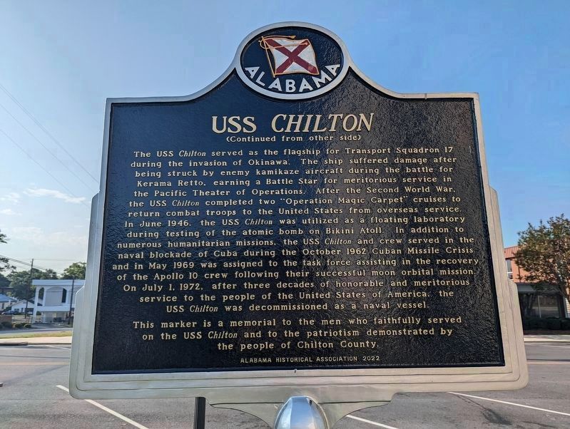
Constructed by the Western Pipe and Steel Company of San Francisco. the Bayfield-class attack transport ship was launched on December 29, 1942, as the SS Sea Needle. The vessel was retrofitted at the Brooklyn Naval Shipyard in New York for . . . — — Map (db m224688) HM
Use: U.S. Forces in Europe during the "Cold War" (1957-1974) with the USSR
Weight: 65 tons; 7" thick armor
Crew: 5
Projectile: 120 mm (4-3/4")
Projectile Range: 2.2 Miles
Engine: 750 HP; Road Speed - 21 MPH
Acquired by Fallen . . . — — Map (db m268102) HM WM
On Veterans Park Drive 0.3 miles east of South Cox Creek Parkway (Alabama Route 133), on the left when traveling east.
This Hamilton-Standard 23E50-505 hydromatic propeller is from Douglas Aircraft C-47 transport plane known as the Gooney Bird.
The C-47s operated in both the European and Pacific theaters of W.W. II as troop and cargo transports, and initiated . . . — — Map (db m69659) HM
On Veterans Park Drive 0.2 miles east of South Cox Creek Parkway (Alabama Route 133), on the left when traveling east.
This F-4D Phantom is displayed in honor of Lt. Col. Edward Yeilding and all Veterans who served with the Phantom aircraft. Captain Ed Yeiding’s name is painted on the front canopy to honor his nine years flying Phantoms similar to this F-4D and . . . — — Map (db m84028) HM
On Woodfield Drive, on the right when traveling east.
Auburn University's acquisition of paintings from the auction featured works by major artists of the day, including Arthur Dove, Lyonel Feininger, Jacob Lawrence, Georgia O’Keeffe, and Ben Shahn, together with significant examples by emerging . . . — — Map (db m183933) HM
Near Monroe Street Northwest at Jefferson Street North, on the left when traveling east.
(side 1)
Cold War-Global
1945-
I am Petty Officer Richard Williamson, Jr. I am proud that my dad served on the first nuclear powered fast attack submarine, the USS Nautilus (SSN 571) which set all kinds of records in the 1950s . . . — — Map (db m85491) HM WM
On Airport Road SW at Memorial Parkway SW (U.S. 231), on the right when traveling east on Airport Road SW.
First American-made guided missile put on public display. First showing was May 14, 1953 at Huntsville, home of the world's largest rocket and guided missile research and development center, Redstone Arsenal. — — Map (db m34957) HM
Near Monroe Street Northwest at Jefferson Street North, on the left when traveling east.
(side 1)
Korean War
I am Carlos Jesus Rodriguez, Rifle Squad Leader in F(Fox) Company 31st Regimental Combat Team, 7th Infantry Division (The Bayonet Division). I was stationed in Japan. As an occupation Army, we GIs (Government . . . — — Map (db m85535) HM WM
Near Tranquility Base 0.4 miles west of Madison Pike, on the left when traveling west.
The Pathfinder’s three main engines are real. The two lower engines powered the first flight of Columbia in 1981. The engine located at the top was used in ground test firings.
At launch, the three Space Shuttle Main Engines (fed liquid . . . — — Map (db m98026) HM
Near Tranquiltiy Base 0.5 miles Madison Pike, on the left when traveling west.
The Mobile Geological Laboratory (MOLAB) was built as part of the development of NASA's Lunar Roving Vehicle(LRV) program. NASA engineers and scientists studied a number of different concepts for vehicles to use on the lunar surface. This rover . . . — — Map (db m98200) HM
Near Tranquility Base 0.5 miles west of Madison Pike, on the left when traveling west.
Skylab, the United States' first space station, was manned from May 25, 1973 to February 8, 1974 by three separate astronaut crews. Experiments were performed to enrich our knowledge of Earth, Sun, stars and cosmic space; to study the effects of . . . — — Map (db m98190) HM
Near Tranquility Base 0.4 miles west of Madison Pike, on the left when traveling west.
Pathfinder is a 75-ton simulator which was used to practice lifting and handling the real Orbiters. It was originally built at Marshall Space Flight Center in 1977 as a stand-in for Space Shuttle Enterprise to fit-check the roads and . . . — — Map (db m98021) HM
Near Tranquility Base 0.5 miles west of Madison Pike, on the left when traveling west.
Pathfinder is a test article of NASA Space Shuttle Orbiter, built by Marshall Space Flight Center (MSFC) in 1977 to practice lifting and handling the future Orbiter vehicles. Made of scrap rocket parts steel beams and wood, the mockup’s size, . . . — — Map (db m98197) HM
Near Tranquilty Base 0.4 miles west of Madison Pike, on the left when traveling west.
Since the 1960s, NASA astronauts have trained for the stresses of spaceflight in the high-altitude, two-seater, supersonic T-38 Talon. Developed by Northrop Grumman, the T-38 became the world’s first supersonic jet trainer in 1961 when it entered . . . — — Map (db m98025) HM
Near Tranquility Base 0.5 miles west of Madison Pike, on the left when traveling west.
The ATLAS rocket was American's first Intercontinental Ballistic Missile (ICBM). It was first successfully launched in December, 1955. Originally a weapons delivery system, the Atlas D was selected by NASA to be the rocket that sent American . . . — — Map (db m98192) HM
Near Tranquiltiy Base 0.5 miles west of Madison Pike, on the left when traveling west.
First test-launched in August, 1953, the Redstone Medium-Range Ballistic Missile evolved from a five-year Army research and development program. Named for Redstone Arsenal—where it was developed—this vehicle played a crucial role . . . — — Map (db m98220) HM
Near Tranquilty Base 0.5 miles west of Madison Pike, on the left when traveling west.
America's first Intermediate-range ballistic missile (RBM), the Jupiter Rocket was an outgrowth of Redstone rocket technology. It was developed at Redstone Arsenal under the technical guidance of German rocket engineers. First test-launched . . . — — Map (db m98201) HM
On Maxwell Boulevard at Magnolia Drive, on the right when traveling west on Maxwell Boulevard.
Maj Gen Muir S. Fairchild
February 1946 – May 1948
Maj Gen Robert W. Harper
May 1948 – October 1948
Gen George C. Kenney
November 1948 – July 1951
Lt Gen Idwal H. Edwards
August 1951 – . . . — — Map (db m64368) HM
On Twining Street north of Ash Street, on the left when traveling north.
Remaining in operation longer than any bomber in U.S. military history, the B-52 was the Strategic Air Command's principal long-range heavy bomber from the time it became operational in 1955. Affectionately known as the BUFF (Big Ugly Fat . . . — — Map (db m64474) HM
On Maxwell Boulevard at Magnolia Drive, on the right when traveling west on Maxwell Boulevard.
The Army Air Forces school was assigned its first commander, Major General Muir S. Fairchild, in February 1946, and renamed Air University in March. The dedication ceremony occurred 3 Sep 1946. The first classes at the Air War College and the . . . — — Map (db m64370) HM
On Maxwell Boulevard at Magnolia Drive, on the right when traveling west on Maxwell Boulevard.
During the early 1950’s, Air Force leaders decided to consolidate and relocate professional military and continuing education activities, as well as commissioning and specialized schools to Maxwell and Gunter Air Force Bases.
”(Air . . . — — Map (db m64371) HM
General (ret) Welch was born in 1934 in Guymon, Okla., and graduated from Liberal (Kan.) High School in 1952. He enlisted in the Kansas National Guard in October 1951, serving with the 161st Armored Field Artillery until enlisting in the U.S. . . . — — Map (db m64500) HM
On Maxwell Boulevard at Magnolia Drive, on the right when traveling west on Maxwell Boulevard.
Air University began new Air War College and Air Command and Staff College programs in 1987 which met newly mandated “Joint” education requirements. These programs emphasized joint war fighting.
”The basic reason for the . . . — — Map (db m64378) HM
On Chennault Circle east of Twining Street, on the left when traveling east.
First flown in May 1958, the Phantom II originally was developed for U.S. Navy fleet defense and entered service in 1961. The USAF evaluated it for close air support, interdiction, and counter-air operations and, in 1962, approved a USAF . . . — — Map (db m64504) HM
On Chennault Circle east of Twining Street, on the left when traveling east.
Ordered in 1951 by the Strategic Air command as a long-range escort fighter, the F-101 lineage included several versions: Low-altitude fighter-bomber; photo-reconnaissance; two-seat interceptor; and transition trainer. To accelerate production, . . . — — Map (db m64503) HM
On Chennault Circle east of Twining Street, on the left when traveling east.
Developed as a follow-on to the F-86 Sabrejet used in the Korean Conflict, the F-100 was the world's first production airplane capable of flying faster than the speed of sound in level flight (760 mph). The prototype, the YF-100A, made its first . . . — — Map (db m64553) HM
On Poplar Street south of Chennault Circle, on the left when traveling south.
The F-86, the USAF's first swept-wing jet fighter, made its initial flight on October 1, 1947. The first production mode flew on May 20, 1948, and on September 15, 1948, an F-86A set a new world speed record of 670.9 mph. Originally designed as . . . — — Map (db m64586) HM
On Poplar Street at Maxwell Boulevard, on the left when traveling north on Poplar Street.
In the mid-1950s, the USAF required a trainer with higher performance than the T-33 to better prepare student pilots for the latest tactical aircraft that were then coming into service. The aircraft chosen was the T-38A which offered high . . . — — Map (db m64433) HM
On Maxwell Boulevard at Magnolia Drive, on the right when traveling west on Maxwell Boulevard.
During the late 1950’s three courses at Air Command and Staff College: the Weapons course, the Squadron Officer course, and the Academic Instructor course, became separate schools under the AU umbrella.
”…It is regrettable that what . . . — — Map (db m64373) HM
On Maxwell Boulevard at Magnolia Drive, on the right when traveling west on Maxwell Boulevard.
HQ USAF realigned AU under Air Training Command (ATC) in 1978. For five years AU remained a part of ATC. On 1 July 1983, AU regained its major command status. ROTC was reassigned to ATC. The College of Aerospace Doctrine, Research and Education, . . . — — Map (db m64376) HM
On Chennault Circle east of Twining Street, on the left when traveling east.
In 1951, Republic Aviation began a project to develop a supersonic tactical fighter-bomber to replace the F-84F. The result was the F-105 "Thunderchief," later affectionately nicknamed the "Thud." The prototype YF-105A first flew on October 22, . . . — — Map (db m64505) HM
Citation to Accompany the Award of The Air Force Cross
to
Jon D. Harston
Staff Sergeant Jon D. Harston distinguished himself by extraordinary heroism in military operations against an opposing armed force . . . — — Map (db m95475) WM
Citation to Accompany the Award of The Air Force Cross
to
Timothy A. Wilkinson
Technical Sergeant Timothy A. Wilkinson distinguished himself by extraordinary heroism in military operations against an . . . — — Map (db m95474) WM
On West 4th Avenue, on the right when traveling west.
In the early 1950's, Anchorage had 2 paved streets, 1 stoplight, 2 small skyscraper apartments and a new high school. The road to Seward and the new Anchorage International Air Terminal were completed. We were the first American city to have . . . — — Map (db m260233) HM
On Sijan Avenue north of 32nd Street, on the left when traveling north.
First flown in 1953, the Convair F-102 Delta Dagger
was designed as a high-altitude, high-speed
interceptor for use against Soviet Union bombers
entering production at the time.
The F-102A on display is painted with the markings of
the . . . — — Map (db m254364) HM WM
On Sijan Avenue north of 32nd Street, on the right when traveling west.
As a lieutenant, he served in various positions
with the 3rd Attack Group from 1932-1935.
During World War II, he was one of the
foremost air commanders and commanded
forces in both theaters. Following the war, he
went on to become Chairman . . . — — Map (db m254616) HM
On Sijan Avenue north of 32nd Street, on the left when traveling north.
In 1999, the 3rd Wing Commander requested a C-130 for
static display in Heritage Park. The National Museum of
the USAF identified an excess Lockheed Martin C-130E
Hercules, Serial No. 64-0553 from the 86th Wing,
Ramstein AB, Germany, in May . . . — — Map (db m254369) HM WM
On Sijan Avenue north of 32nd Street, on the left when traveling north.
The Lockheed T-33 Tee Bird was developed as a
trainer version of the F-80 Shooting Star. It saw
extensive service as a trainer and as a combat support
and radar target evaluation aircraft. The Tee Bird was
the longest-serving military . . . — — Map (db m254367) HM WM
On Sijan Avenue north of 32nd Street, on the left when traveling north.
Designed as an air-superiority fighter, the McDonnell
Douglas F-15 Eagle first flew in 1972 and entered
operational service in 1974. The F-15 has become the
longest-serving fighter in aviation history and has
seen extensive combat action. . . . — — Map (db m254408) HM WM
On Sijan Avenue north of 32nd Street, on the left when traveling north.
The versatile McDonnell F-4 Phantom II first flew in
1958, entering operational service with the Navy in
1961 and the Air Force in 1962. The Phantom became
one of the principal fighters in the Air Force, serving
into the late 1990s.
The . . . — — Map (db m254360) HM WM
On Sijan Avenue north of 32nd Street, on the left when traveling north.
The Northrop F-89 Scorpion was the first aircraft
designed as an all-weather interceptor. First flown in
1948, it served as the mainstay of the fighter
interceptor force during the 1950s.
The F-89J on display is painted with the markings . . . — — Map (db m254365) HM WM
On Sijan Avenue north of 32nd Street, on the right when traveling north.
On Elmendorf AFB, September 22, 1995 at 0747 hours
a Boeing E-3B Sentry AWACS from the 962nd Airborne
Air Control Squadron crashed shortly after takeoff
for a routine surveillance training sortie.
This memorial is dedicated in memory of . . . — — Map (db m254409) HM
On Central Avenue, on the left when traveling south.
A monument to recognize Ben Eielson's accomplishments
was conceived in late 1955 and dedicated with the
construction of a monument at the main gate July 20,
1957. This monument enjoyed a short life, it was destroyed
February 27, 1963 when a . . . — — Map (db m255944) HM
On Central Avenue, on the left when traveling south.
Length- 136 Ft, 3 In • Height- 41 Ft, 8 In
Wingspan- 130 Ft, 10 In • Maximum Weight- 299,000 Lbs
Maximum Speed- 530 MPH • Ceiling- 50,000 Ft
The KC-135 is the only aircraft in the world designed
specifically for aerial refueling. It has . . . — — Map (db m255926) HM WM
On Central Avenue, on the left when traveling south.
Length: 29 Feet, 2 Inches
Height: 9 Feet, 5 Inches
Wingspan: 38 Feet
Maximum Weight: 4,900 Lbs
Cruising Speed: 144 MPH
Maximum Speed: 199 MPH
Ceiling: 19,300 Feet
The O-2 is a military version of the Cessna Model 337 "Super . . . — — Map (db m256132) HM WM
On Central Avenue, on the left when traveling south.
The F-4C Phantom II" entered the Air Force inventory in 1963 and continued to be produced through 1979. Phantoms were used at Eielson for alert duty between 1970 and 1982. The 43 Tactical Fighter Squadron and the 18 Fighter Squadron from . . . — — Map (db m256126) HM WM
On Central Avenue, on the left when traveling south.
The pavilion was designed to resemble a
World War II/Cold War era hanger similar
to the "Birchwood Hangers" found
throughout the state. Suspended from the
ceiling is a miniature replica of Ben
Eielson's Curtiss JN-4 "Jenny", reported to
be . . . — — Map (db m255942) HM
On Central Avenue, on the left when traveling south.
This building served as the Guard Shack for Eielson Air Force Base's Hursey Gate between 1963 and 2007. In January 2007, the main gate was upgraded and moved to accommodate force protection measures as well as modernize traffic flow onto and off . . . — — Map (db m256129) HM
On 1st Avenue east of Cushman Street, on the left when traveling east.
This plaque marks the original site of the Fairbanks USO organized by volunteers and chartered through USO World Headquarters in 1942. Its Mission was to serve the morale support needs of the men and women in the armed forces stationed away from . . . — — Map (db m256561) HM
This Anchor
from the Navy Inactive Ship Facility
in Bremerton, Washington,
was presented as a gift to the
Citizens of Fairbanks from the
Gold Crew of the USS Alaska (SSBN 732)
on the occasion of the crew's official . . . — — Map (db m257127) HM
On Richardson Highway (State Highway 4 at milepost 266) at the Alaska Highway (State Highway 2), on the right when traveling north on Richardson Highway.
1 - Canol
U.S. Army 1943-1947 3 inch
Crude Oil: Norman Wells to Whitehorse
Gasoline & Diesel: To Fairbanks
2 - Haines-Fairbanks
U.S. Army 1955-1971 8 inch
Petroleum Products: Haines to Fairbanks
626 miles . . . — — Map (db m255694) HM
Tucson Air Museum Foundation
of Pima County
Titan II Intercontinental Ballistic Missile Museum
Established May 8, 1986
571st SMS, 390th SMW
Davis-Monthan AFB
Strategic Alert July 1963 – November 1982
National . . . — — Map (db m26926) HM
The Cold War was a period of East-West competition, tension, and conflict short of full-scale war. It was characterized by mutual perceptions of hostile intention between military-political alliances or blocs. Quoting from a Veterans of Foreign Wars . . . — — Map (db m92218) HM WM
On Hudson Road (U.S. 62) at Cass Hough Drive, on the left when traveling north on Hudson Road.
USAF Century Series aircraft flown by active interceptor squadrons, the Air Defense Command, and the Air National Guard from 1959 - 1983.
The Voodoo is well known for its NATO role as a nuclear deterrent during the Cold War.
The RF-101 . . . — — Map (db m62520) HM
• Between 1945-1961 2.7 million escaped East Germany
• In 1960, 200,000 East Germans escaped to Freedom
• Order given to build Wall - Sunday, Aug. 13, 1961
Construction began Aug. 16, 1961; completed 2 mos. later
• Initially 6 ft. . . . — — Map (db m80171) HM
On Highway 65 South (U.S. 65 S) 0.1 miles north of Sulphur Road, on the left when traveling north.
Near this site on September 18-19, 1980, an accidental explosion destroyed Missile Complex 374-7, which housed an Air Force Titan II intercontinental ballistic missile (ICBM). At 103 feet tall and with a 9-megaton nuclear warhead, the Titan II was . . . — — Map (db m311547) HM
On Monte Painter Drive west of Northhills Boulevard, on the left when traveling south.
With the faith and courage of
their forefathers who made
possible the freedom of these
United States
The Boy Scouts of America
dedicate this copy of the
Statue of Liberty as a pledge
of everlasting fidelity and
and loyalty
The . . . — — Map (db m92306) HM
On Lancaster Boulevard west of Date Avenue, on the right when traveling west.
Pete Knight was one of four Air Force pilots selected to pilot the Dyna-Soar (X-20) aircraft, the first Air Force space program. He was one of eight X-15 pilots to earn his astronaut wings by flying an airplane in space (280,000 feet).
Knight . . . — — Map (db m123639) HM WM
On Lancaster Boulevard, on the left when traveling west.
Jimmy Doolittle played an important role in the development of Air Force research at Edwards AFB. He was one of the founding fathers of Systems Command (Air Force Research and Development Command). Through the late 1980's, Doolittle made annual . . . — — Map (db m120207) HM
On Mulholland Drive 1 mile west of Encino Hills Drive, on the left when traveling west.
Formerly a Nike Missile control site, U.S. Army 1956-1968.
Currently San Vicente Mountain Park, gateway to the Big Wild.
Restricted entry, vehicles with handicapped permits only beyond this point.
Welcome.
During the Cold War this was . . . — — Map (db m146037) HM
On Wilshire Boulevard east of Ogden Drive, on the right when traveling east.
The Wall Along Wilshire is an installation featuring ten sections of the original Berlin Wall. Measuring nearly forty feet wide, it is the world’s longest stretch of the Wall outside of Berlin. The Wende Museum assembled the Wall Along Wilshire . . . — — Map (db m125316) HM
Near Leavenworth Drive west of Gaffey Street, on the left when traveling west.
War of 1812
Fort Nelson, VA. - June 22, 1813
Fort Oswego, NY. - May 5-6, 1814
Mexican War
Palo Alto - May 8. 1846
Resaca de la Palma - May 9, 1846
Monterey (sic) - Sept. 21-23, 1846
Vera Cruz - March 9-28, 1847 . . . — — Map (db m81750) HM
On West Paseo Del Mar 0.2 miles east of Western Avenue, on the right when traveling east.
The large concrete bunker, seen
across the street, was the White Point
Nike Site, built in the early 1950's. It was
one of many such sites ringing the Los
Angeles basin manned by National Guard
units. Originally a site for the . . . — — Map (db m147323) HM
On 6th Street at Park View Street, on the right when traveling east on 6th Street.
Erected in memory of the heroes of the glorious Hungarian Freedom Fight of 1956. A symbol of man’s yearning for freedom everywhere. — — Map (db m125328) WM
On East Avenue P at 25th Street East, on the right when traveling west on East Avenue P.
[Panel #1]
Blackbird Wind Tunnel Model
(One-Twelfth Scale)
Aircraft models such as this are used in high-speed wind tunnels to test aerodynamic shapes, stresses, and temperatures. This particular model was used for testing all . . . — — Map (db m149742) HM
Before becoming the City's Point Vicente Park, the United
States Army used the 26-acre site as a rifle range for target practice. Known as Nike Site LA-55-Point Vicente Rifle Range. During the 1950s the site was developed with a 1000-foot long . . . — — Map (db m303218) HM
On Conzelman Road at Field Road, on the left on Conzelman Road. Reported missing.
For the first three-quarters of the 20th century, the Marin Headlands were fortified with weapons that evolved from cannon to nuclear warheads. The guns became more and more powerful, able to hit warships miles out to sea. Antiaircraft guns appeared . . . — — Map (db m102828) HM
On Field Road near Conzelman Road, on the right when traveling west.
By 1945, the age of aerial warfare had fully arrived and the U.S. Army sought a weapon that could intercept enemy aircraft. In 1951, after years of research and development, a supersonic missile controlled by ground-based electronic equipment was . . . — — Map (db m102818) HM
Near Field Road west of Rathbone Road, on the right when traveling west.
Explore Battery Alexander
Battery Alexander
Built in 1901, the concrete coastal defense installation in the grove of trees behind the restroom held mortars that could fire 12-inch diameter shells in a high arcing path to penetrate the . . . — — Map (db m232187) HM
On Mitchell Road west of Kirkpatrick Street, on the right when traveling west.
Golden Gate National Recreation Area
From Roundups to Radar
A sprawling Mexican rancho, where vaqueros (cowboys) herded cattle, encompassed this valley and its surrounding hills during the mid-1800s. Cattle roundups on the beach . . . — — Map (db m232185) HM
Lieut. Juan de Ayala of the Royal Spanish Navy sailed through the Golden Gate on Aug. 5, 1775. He commanded the packet-boat San Carlos, which was the first known ship in the waters of San Francisco Bay. On the 13th day of August, Ayala anchored this . . . — — Map (db m69206) HM
On Perimeter Road, on the left when traveling east. Reported permanently removed.
In 1954 Angel Island became one of nineteen Nike Missile sites in the Bay Area. There were three underground magazines, each storing 12 Nike – Ajax anti-aircraft missiles. The missiles had a range of 25 miles and were raised to the surface by . . . — — Map (db m203034) HM
Guardians of the Sky
Technological advances during World War II brought new threats to the Bay Area. Traditional weapons were useless against new, fast, high-flying jet planes. This need for better antiaircraft defense led to project Nike, . . . — — Map (db m203629) HM
On South Tufa Entrance Road just north of State Road 120, on the right when traveling north.
During the Cold War, Mono County was home to one of many remote facilities used by the US Military to test new weapons and weapons systems. A "secret military installation" operated by the US Navy was located along the south shoreline of Mono . . . — — Map (db m20739) HM
On La Palma Avenue 0.2 miles east of Kraemer Boulevard, on the left when traveling east.
Pioneering innovations in electronics, guidance, navigation and control that charted new frontiers on Earth and beyond.
This monument is dedicated to every Autonetics employee and retiree whose legacy of excellence continues today as part of . . . — — Map (db m195480) HM
This portrait by artist Nancy Fontaine dedicated in August 1985 of the "7" not forgotten American hostages in Lebanon stands as a reminder that Americans in Westminster and in the United States will not forget — — Map (db m196429) WM
Battle of the Paracel Islands represents the Indomitable spirit of the Republic of Vietnam against Communist China
This Hoang Sa Monument was proposed by Mayor Tri Ta & Vice Mayor Kimberly Ho and approved by the Westminster City Council . . . — — Map (db m195525) WM
On Midland Road 10 miles north of Interstate 10, on the right when traveling north.
In May 1964, U.S. Strike Command (STRICOM) launched the largest military war game since World War II. Known as Joint Exercise Desert Strike, this two-week training exercise simulated a nuclear air and ground battle between the mythical governments . . . — — Map (db m78531) HM
The A-4 Skyhawk is a lightweight, single engine attack aircraft The first A-4 was delivered to the Navy in 1956 and the Marine Corp in November 1962; 765 A-4 aircraft have been sold worldwide. The A-4 is one of the most effective and versatile light . . . — — Map (db m206319) HM
On Arnold Avenue, on the right when traveling north.
[Panel 1a:]
The 1930s
With war clouds gathering over the Pacific, in 1936 Congress authorized the construction of the Sacramento Air Depot. The Army Air Corp envisioned that the new depot would support operations on the West Coast, . . . — — Map (db m57199) WM
On National Trails Highway at Crucero Road, on the right when traveling east on National Trails Highway.
...and they shall beat their swords into plowshares, and their spears into pruning hooks: nation shall not lift up sword against nation, neither shall they learn war any more. Micah 4:3
With the end of World War II and the onset of the Cold . . . — — Map (db m78521) HM
Since its first official flight this unique aircraft has been the uncontested winner of the world's continuing race for the skies. During its twenty-eight years of service, the Blackbird was the only air-breathing aircraft in the world that was . . . — — Map (db m230071) HM
On South McClelland Street at West Boone Street, on the right when traveling north on South McClelland Street.
In honor of
Cold War
Veterans
who served our nation
from 1946-1991. They
maintained our defense and
readiness during times of
extreme world tension. They
often put their lives in peril
for the good of our country.
Our nation's peace . . . — — Map (db m161504) WM
Dedicated to Ronald W. Reagan, 40th President of the United States of America, for his steadfast commitment to develop and deploy missile defenses to protect our nation, our forces, our allies and friends.
"Wouldn't it be better to save lives . . . — — Map (db m98728) WM
On California Boulevard at Oregon Avenue, on the right when traveling south on California Boulevard.
Bearing witness to the birth of the Space Age, Vandenberg Air Force Base has been the launch site of many of America's missiles and rockets, from military missions to voyages of exploration. Here launched the first polar orbiting satellite . . . — — Map (db m140556) HM
Near Mount Umunhum Road near Mount Umunhum-Loma Prieta Road, on the left when traveling north.
Recreation at Home
Remains of a swimming pool are a visual reminder of a thriving community of military families that lived at the Almaden Air Force Station between 1957 and 1980. Hundreds of people live in military housing near this . . . — — Map (db m114660) HM
Near Mount Umunhum Road near Mount Umunhum-Loma Prieta Road.
In the late 1950s, the United States government procured Mount Umunhum to build the Almaden Air Force Station. an early warning radar facility that operated from 1957 to 1980. The station was constructed as part of a west coast network that scanned . . . — — Map (db m114625) HM
On North Washington Street (State Highway 49) at East Jackson Street, on the right when traveling north on North Washington Street.
[ First Marker - See Photo #1 ]
Veterans Memorial Building
American Legion Post 58 & Auxiliary
Veterans of Foreign Wars Post 3154 & Auxiliary
Disabled American Veterans Chapter 119 & . . . — — Map (db m31933) WM
On East 72nd Avenue, on the left when traveling east.
As the focus changed to environmental cleanup, Building 111 became the headquarters of this new mission-and of a public-private partnership among the U.S. Army, Shell Oil Co. and U.S. Fish and Wildlife Service. Years of
Partnership Called . . . — — Map (db m163885) HM
On East 72nd Avenue, on the left when traveling east.
Arsenal Beginnings
Building 111, also known as the “White House, "was located north of the flagpole area. The building was the U.S. Army's headquarters
from the time the Arsenal was established in 1942 until the building was . . . — — Map (db m163883) HM
Near Havana Street (Wildlife Drive) 0.6 miles north of East 64th Avenue (Wildlife Drive), on the right when traveling north.
In 1942, women and men of the U.S. Army built this Arsenal that helped achieve victory in WWII and the Cold War. With thanks to our partners, the U.S. Army, Shell Oil Company and their contractors, we dedicate this flagpole to the employees of . . . — — Map (db m119380) HM
On East 1st Avenue at Speer Boulevard on East 1st Avenue.
In memory of the 1956 Hungarian Uprising.
The Revolution Triumphed:
March 25, 1990 - Free Elections.
June 19, 1991 - Soviet Troops Depart.
"We here highly resolve
that these dead shall not
have died in vain"
- . . . — — Map (db m255319) HM WM
Near 10th Mountain Division Memorial Highway (U.S. 24 at milepost 160) at Camp Hale Spur 1B.
From 1958 to 1964, Camp Hale played an important role as a training site for Tibetan Freedom Fighters. Trained by the CIA, many of these brave men lost their lives in the struggle for freedom. “They were the best and the bravest of their . . . — — Map (db m290295) HM
The Airman on the Meadow and Winged Refuge on the East Plaza, were
donated by friends, non-graduate classmates, widows and families, and
- in tribute to their indivisible brotherhood -
every living graduate of the Class of . . . — — Map (db m162467) WM
The Winged Refuge, and the Airman located on the Meadow, were
donated by friends, non-graduate classmates, widows and families, and
- in tribute to their indivisible brotherhood -
every living graduate of the Class of . . . — — Map (db m162470) WM