After filtering for Virginia, 681 entries match your criteria. The first 100 are listed. ⊳
Cemeteries & Burial Sites Topic
By Mike Stroud, October 12, 2013
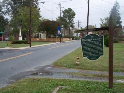
Historic Cemetery Marker seen along Market Street, looking east
| 1 ► Virginia, Accomack County, Onancock — Historic Cemetery — |
| On Market Street near South Street, on the left when traveling west. | |||
| 2 ► Virginia, Accomack County, Tangier — Gravestones — |
| On Main Ridge Road south of Garman Road, on the right when traveling south. | |||
| 3 ► Virginia, Accomack County, Temperanceville — Francis Makemie Monument — |
| Near Saxis Road near VA 699. | |||
| 4 ► Virginia, Accomack County, Temperanceville — This Memorial Pyramid — |
| Near Saxis Road near VA 699. | |||
| 5 ► Virginia, Albemarle County, Brownsville, Forest Glen — The Rothwell Family ... / Elisha Wm. Robertson ... — |
| On Rockfish Gap Turnpike (U.S. 250) west of Crozet Avenue / Miller School Road (Virginia Route 240), on the right when traveling east. | |||
| 6 ► Virginia, Albemarle County, Charlottesville — W-163 — Revolutionary Soldiers Graves — |
| On Ivy Road (Business U.S. 250) near Colonnade Drive. | |||
| 7 ► Virginia, Albemarle County, Charlottesville — The Levy Legacy — Thomas Jefferson's Monticello — |
| Near Thomas Jefferson Parkway. | |||
| 8 ► Virginia, Albemarle County, Charlottesville — The Monticello Graveyard — |
| Near Monticello Loop, 0.3 miles north of Thomas Jefferson Parkway (Virginia Route 53), on the left when traveling south. | |||
| 9 ► Virginia, Albemarle County, Charlottesville, Ivy Farm — Albemarle Barracks Burial Site — |
| On Ivy Farm Road (County Route 1015), on the left when traveling east. | |||
| 10 ► Virginia, Albemarle County, Keswick — W-242 — Grace Episcopal Church — |
| On Gordonsville Road (Route 231) 0.1 miles south of Millwood Lane (County Road 783), on the left when traveling south. | |||
| 11 ► Virginia, Albemarle County, Scottsville — Scottsville Confederate Cemetery — |
| On Hardware Street (Virginia Route 795) 0 miles north of Valley Street (Virginia Route 20). | |||
| 12 ► Virginia, Albemarle County, Scottsville — GA-45 — Wilson Cary Nicholas — 1761-1820 — |
| On James River Road (Virginia Route 742) 0.2 miles east of Warren Ferry Road, on the right when traveling east. | |||
| 13 ► Virginia, Alexandria, Eisenhower East — African American Heritage Memorial — |
| On Holland Lane at Jamieson Avenue, on the right when traveling north on Holland Lane. | |||
| 14 ► Virginia, Alexandria, Old Town — Confederate Soldiers — |
| On North Washington Street south of Cameron Street, on the right when traveling south. | |||
| 15 ► Virginia, Alexandria, Old Town — Old Town Alexandria — |
| On Cameron Street east of North Union Street, on the right when traveling east. | |||
| 16 ► Virginia, Alexandria, Old Town — Philip Marsteller — 1741 - 1803 — |
| Near North Columbus Street just south of Cameron Street, on the right when traveling north. | |||
| 17 ► Virginia, Alexandria, Old Town West — Alexandria Quaker Burial Ground — |
| Near Queen Street at North Columbus Street, on the right when traveling west. | |||
| 18 ► Virginia, Alexandria, Old Town West — Elisha Cullen Dick, M.D. — 1750 - 1825 — |
| On Queen Street just east of North Columbus Street, on the left when traveling east. | |||
| 19 ► Virginia, Alexandria, Old Town West — Lee-Fendall House — |
| On Oronoco Street at North Washington Street (Virginia Route 400), on the right when traveling east on Oronoco Street. | |||
| 20 ► Virginia, Alexandria, Seminary Hill — Jackson Cemetery — City of Alexandria Est. 1749 — |
| Near West Braddock Road, 0.2 miles west of Marlboro Drive, on the right when traveling west. | |||
| 21 ► Virginia, Alexandria, Seminary Hill — Oakland Baptist Church Cemetery — City of Alexandria Est. 1749 — |
| Near West Braddock Road east of North Howard Street, on the right when traveling west. | |||
| 22 ► Virginia, Alexandria, Seminary Hill — The Oakland Baptist Church — City of Alexandria Est. 1749 — |
| Near West Braddock Road, 0.1 miles west of Marlboro Drive, on the right when traveling west. | |||
| 23 ► Virginia, Alexandria, Southwest Quadrant — "Pursuers of Booth the Assassin" — Alexandria National Cemetery — |
| On Cemetery Circle south of Wilkes Street, on the right when traveling south. | |||
| 24 ► Virginia, Alexandria, Southwest Quadrant — 1955 Gas Station — |
| Near South Washington Street just south of Church Street, on the right when traveling south. | |||
| 25 ► Virginia, Alexandria, Southwest Quadrant — A National Cemetery System — |
| Near Wilkes Street west of Hamilton Avenue when traveling west. | |||
| 26 ► Virginia, Alexandria, Southwest Quadrant — Alexandria National Cemetery — |
| Near Wilkes Street west of Hamilton Avenue when traveling west. | |||
| 27 ► Virginia, Alexandria, Southwest Quadrant — Bethel Cemetery — Resting place of 21 CSA Virginia soldiers — |
| Near Wilkes Street, 0.1 miles east of Hamilton Avenue, on the right when traveling east. | |||
| 28 ► Virginia, Alexandria, Southwest Quadrant — Bethel Cemetery — Here rests 15 Alexandria area soldiers of the 17th Virginia Regiment, CSA — |
| On Wilkes Street, 0.1 miles east of Hamilton Avenue, on the right when traveling east. | |||
| 29 ► Virginia, Alexandria, Southwest Quadrant — Contrabands and Freedmen Cemetery Memorial — |
| On South Washington Street south of Church Street, on the right when traveling south. | |||
| 30 ► Virginia, Alexandria, Southwest Quadrant — Contrabands and Freedmen Cemetery Memorial — |
| On Church Street at South Columbus Street when traveling north on Church Street. | |||
| 31 ► Virginia, Alexandria, Southwest Quadrant — Corner of Building Erected in 1960 — [Southwest corner] — |
| Near South Washington Street just south of Church Street, on the right when traveling south. | |||
| 32 ► Virginia, Alexandria, Southwest Quadrant — Corner of Building Erected in 1960 — [Southeast Corner] — |
| Near South Washington Street just south of Church Street, on the right when traveling south. | |||
| 33 ► Virginia, Alexandria, Southwest Quadrant — Courtesy of Bethel Cemetery, Est. 1885 — |
| Near Wilkes Street, 0.1 miles east of Hamilton Avenue, on the right when traveling east. | |||
| 34 ► Virginia, Alexandria, Southwest Quadrant — Douglass Cemetery — circa, 1827 — |
| On Wilkes Street, 0.1 miles west of South Payne Street, on the right when traveling west. | |||
| 35 ► Virginia, Alexandria, Southwest Quadrant — Former USCT Burial Ground — Rather Die Freemen Than Live To Be Slaves — |
| Near South Washington Street at Church Street, on the right when traveling south. | |||
| 36 ► Virginia, Alexandria, Southwest Quadrant — E-109 — Freedmen’s Cemetery — |
| On South Washington Street (Local Route 400) at Church Street, on the right when traveling south on South Washington Street. | |||
| 37 ► Virginia, Alexandria, Southwest Quadrant — Graves — |
| Near South Washington Street just south of Church Street, on the right when traveling south. | |||
| 38 ► Virginia, Alexandria, Southwest Quadrant — Graves Under South Washington Street — |
| On South Washington Street at Church Street, on the right when traveling south on South Washington Street. | |||
| 39 ► Virginia, Alexandria, Southwest Quadrant — L'Overture Hospital HQ — February 15, 1864 — |
| On South Payne Street south of Prince Street, on the right when traveling south. | |||
| 40 ► Virginia, Alexandria, Southwest Quadrant — Old Presbyterian Meeting House — Presbyterian Cemetery — |
| On Hamilton Avenue south of Wilkes Street, on the right when traveling south. | |||
| 41 ► Virginia, Alexandria, Southwest Quadrant — Penny Hill Cemetery — Established 1796 — |
| On South Payne Street just south of Franklin Street, on the right when traveling south. | |||
| 42 ► Virginia, Alexandria, Southwest Quadrant — Welcome to Contrabands and Freedmen Cemetery Memorial — |
| On South Washington Street (Virginia Route 400) north of Capital Beltway Inner Loop (Interstate 95), on the left when traveling north. | |||
| 43 ► Virginia, Alexandria, Taylor Run — The Bloxham Family Cemetery — Alexandria Heritage Trail — City of Alexandria, est. 1749 — |
| On Business Center Drive south of Witter Drive, on the left when traveling north. | |||
| 44 ► Virginia, Alleghany County, Low Moor — Jackson River Depot — Crook's Raid — |
| On Selma Low Moor Road (Virginia Route 696) 0.2 miles west of Oakland Drive, on the right when traveling west. | |||
| 45 ► Virginia, Alleghany County, Low Moor — Oakland Presbyterian Church — Organized 1834 — |
| Near Selma Low Moor Road (Virginia Route 696) 0.2 miles west of Oakland Drive (Virginia Route 1002), on the right when traveling west. | |||
| 46 ► Virginia, Alleghany County, Low Moor — Oakland Presbyterian Church and Cemetery — A Brief History — |
| Near Selma Low Moor Road (Virginia Route 696) 0.2 miles west of Oakland Drive (Virginia Route 1002), on the right when traveling west. | |||
| 47 ► Virginia, Amelia County, Amelia Court House — M-31 — William Branch Giles — |
| On Church Street at Virginia Street, on the left when traveling west on Church Street. | |||
| 48 ► Virginia, Amherst County, Clifford — R-60 — Grave of Patrick Henry’s Mother — |
| On Patrick Henry Highway (Virginia Route 151) north of Winton Road (County Route 736), on the right when traveling north. | |||
| 49 ► Virginia, Appomattox County, Appomattox — Appomattox Confederate Cemetery Memorial — |
| Near Old Courthouse Road (Virginia Route 24) at Gordon Avenue, on the right when traveling west. | |||
| 50 ► Virginia, Appomattox County, Appomattox — MG-1 — Appomattox Court House Confederate Cemetery — |
| On Old Courthouse Road (Virginia Route 24), on the right when traveling west. | |||
| 51 ► Virginia, Appomattox County, Appomattox — Confederate Cemetery — |
| On Old Courthouse Road (Virginia Route 24), on the right when traveling west. | |||
| 52 ► Virginia, Appomattox County, Appomattox — Lafayette W. Meeks — |
| Near Old Courthouse Road (Virginia Route 24), on the right when traveling west. | |||
| 53 ► Virginia, Appomattox County, Appomattox — Raine Cemetery and Monument — |
| On Old Courthouse Road (Virginia Route 24), on the left when traveling west. | |||
| 54 ► Virginia, Appomattox County, Appomattox — Raine Memorial — |
| On Old Courthouse Road (Virginia Route 24), on the left when traveling west. | |||
| 55 ► Virginia, Appomattox County, Appomattox — The Isbell House — (the white house in the distance) — |
| On National Park Drive, 0.2 miles north of Old Courthouse Road (Virginia Route 24), on the right when traveling north. | |||
| 56 ► Virginia, Arlington County, Arlington, Arlington Forest — Mary Carlin House — |
| On North Carlin Springs Road. | |||
| 57 ► Virginia, Arlington County, Arlington, Arlington National Cemetery — Matthew Alexander Henson — Co-discoverer of the North Pole — |
| 58 ► Virginia, Arlington County, Arlington, Arlington National Cemetery — McClellan Gate — |
| On McClellan Drive west of Eisenhower Drive. | |||
| 59 ► Virginia, Arlington County, Arlington, Arlington National Cemetery — Operation Restore Hope — Somalia, 1992-1995 — |
| 60 ► Virginia, Arlington County, Arlington, Arlington National Cemetery — Robert Edwin Peary — Discoverer of the North Pole - April 6, 1909 — [and] his beloved wife, Josephine Diebitsch (1863-1955) — |
| On Jesup Drive, on the right when traveling east. | |||
| 61 ► Virginia, Arlington County, Arlington, Arlington National Cemetery — The Hiker — 1898 - 1902 — |
| On Memorial Drive. | |||
| 62 ► Virginia, Arlington County, Arlington, Arlington National Cemetery — Tomb of Remembrance — |
| On Patton Drive just north of York Drive, on the right when traveling north. | |||
| 63 ► Virginia, Arlington County, Arlington, Arlington National Cemetery — U.S.S. Houston and H.M.A.S. Perth — |
| On McClellan Drive east of Grant Drive, on the left when traveling west. | |||
| 64 ► Virginia, Arlington County, Arlington, Arlington National Cemetery — USS Serpens Memorial — |
| On Grant Drive at Bradley Drive, on the right when traveling north on Grant Drive. | |||
| 65 ► Virginia, Arlington County, Arlington, Bluemont — Southern-Shreve Cemetery — |
| Near North Harrison Street north of Fairfax Drive, on the right when traveling north. | |||
| 66 ► Virginia, Arlington County, Arlington, Douglas Park — Travers Family Graveyard — |
| On South Monroe Street at 13th Street South on South Monroe Street. | |||
| 67 ► Virginia, Arlington County, Arlington, Fort Myer — "Lest We Forget - We Stand on Your Shoulders" — |
| On Ord and Weitzel Drive. | |||
| 68 ► Virginia, Arlington County, Arlington, Fort Myer — Cherish these forest trees… — Arlington House, The Robert E. Lee Memorial — George Washington Memorial Parkway, National Park Service, U.S. Department of the Interior — |
| On Sherman Drive north of Sheridan Drive, on the right when traveling south. | |||
| 69 ► Virginia, Arlington County, Arlington, Fort Myer — Amphibious Scouts and Raiders World War II — 1942-1945 — "We led the way!" — |
| 70 ► Virginia, Arlington County, Arlington, Fort Myer — Arlington Estate, 1860 — |
| Near Sherman Drive, 0.2 miles south of Lincoln Drive, on the left when traveling south. | |||
| 71 ► Virginia, Arlington County, Arlington, Fort Myer — Civil Air Patrol — |
| 72 ► Virginia, Arlington County, Arlington, Fort Myer — Civil War Unknowns Monument — |
| Near Sherman Drive north of Sheridan Drive. | |||
| 73 ► Virginia, Arlington County, Arlington, Fort Myer — Field Marshal Sir John Dill — G.C.B., C.M.G., D.S.O., D.S.M., L.L.D. — 1881 - 1944 — |
| On Roosevelt Drive at Grant Drive, on the right when traveling west on Roosevelt Drive. | |||
| 74 ► Virginia, Arlington County, Arlington, Fort Myer — Garden to Graves — Arlington House, The Robert E. Lee Memorial — National Park Service, U.S. Department of the Interior — |
| Near Sherman Drive, 0.2 miles south of Lincoln Drive, on the left when traveling south. | |||
| 75 ► Virginia, Arlington County, Arlington, Fort Myer — Hallowed Ground — Arlington House, The Robert E. Lee Memorial — George Washington Memorial Parkway, National Park Service, U.S. Department of the Interior — |
| Near Sherman Drive, 0.1 miles north of Sheridan Drive, on the right when traveling north. | |||
| 76 ► Virginia, Arlington County, Arlington, Fort Myer — Ignace Jan Paderewski |
| Reported missing. | |||
| 77 ► Virginia, Arlington County, Arlington, Fort Myer — Korean War Contemplative Bench — |
| 78 ► Virginia, Arlington County, Arlington, Fort Myer — Lancaster Monument — |
| On Capron Drive at McPherson Drive, on the right when traveling west on Capron Drive. | |||
| 79 ► Virginia, Arlington County, Arlington, Fort Myer — Mary Randolph — |
| Near Sherman Drive, 0.1 miles south of Lincoln Drive, on the left when traveling south. | |||
| 80 ► Virginia, Arlington County, Arlington, Fort Myer — Mast of the USS Maine |
| Reported missing. | |||
| 81 ► Virginia, Arlington County, Arlington, Fort Myer — Memorial to US Airmen killed in Denmark — |
| 82 ► Virginia, Arlington County, Arlington, Fort Myer — Merrill's Marauders — |
| 83 ► Virginia, Arlington County, Arlington, Fort Myer — Montford Point Marines — The First Black Marines — 1942 - 1949 — |
| 84 ► Virginia, Arlington County, Arlington, Fort Myer — Pan American Airways Flight 103 Memorial Cairn — |
| On Humphries Drive. | |||
| 85 ► Virginia, Arlington County, Arlington, Fort Myer — Pierre Charles L’Enfant — |
| Near Lee Drive. | |||
| 86 ► Virginia, Arlington County, Arlington, Fort Myer — R Adams Cowley — |
| On Humphres Drive. | |||
| 87 ► Virginia, Arlington County, Arlington, Fort Myer — Tomb of the Unknowns — |
| Near Memorial Drive north of Porter Drive, on the right when traveling north. | |||
| 88 ► Virginia, Arlington County, Arlington, Fort Myer — U.S. Secret Army in the Kingdom of Laos — 1961-1973 — |
| 89 ► Virginia, Arlington County, Arlington, Fort Myer — U.S. War Correspondent — |
| 90 ► Virginia, Arlington County, Arlington, Fort Myer — U.S.S. Maine Anchor — |
| Near Sigsbee Avenue near Farragut Drive. | |||
| 91 ► Virginia, Arlington County, Arlington, Fort Myer — United States Space Shuttle Challenger — 28 January 1986 — |
| 92 ► Virginia, Arlington County, Arlington, Fort Myer — United States Space Shuttle Columbia — 1 February 2003 — |
| 93 ► Virginia, Arlington County, Arlington, Fort Myer — Walter Reed, M.D. — |
| On Miles Drive, on the left when traveling east. | |||
| 94 ► Virginia, Arlington County, Arlington, Glencarlyn — The Ball-Carlin Cemetery — |
| 95 ► Virginia, Arlington County, Arlington, Highland Park — Granite Acroterion — 1926 — |
| On Washington Boulevard (Virginia Route 237) at North McKinley Road, on the right when traveling west on Washington Boulevard. | |||
| 96 ► Virginia, Arlington County, Arlington, Long Bridge Park — Long Bridge Park: A Community Space — |
| Near Long Bridge Drive east of 6th Street South, on the right when traveling east. | |||
| 97 ► Virginia, Arlington County, Arlington, Rosslyn — Avenue of Heroes — George Washington Memorial Parkway — National Park Service, U.S. Department of the Interior — |
| On Memorial Avenue at Richmond Highway (Route 110), on the right when traveling west on Memorial Avenue. | |||
| 98 ► Virginia, Arlington County, Arlington, Virginia Square — Old Ball Family Burial Ground — |
| On Washington Boulevard, on the right when traveling west. | |||
| 99 ► Virginia, Augusta County, Fishersville — W-155 — Tinkling Spring Church — American Presbyterian and Reformed Historical Site — |
| On Tinkling Spring Road (County Route 805), on the right when traveling north. | |||
| 100 ► Virginia, Augusta County, Staunton — A-53 — Bethel Church — |
| On Lee Jackson Highway (U.S. 11) at Howardsville Road (Virginia Route 701), on the right when traveling south on Lee Jackson Highway. | |||
681 entries matched your criteria. The first 100 are listed above. Next 100 ⊳