After filtering for Massachusetts, 282 entries match your criteria. The first 100 are listed. ⊳
Waterways & Vessels Topic
By Brandon D Cross, September 21, 2019
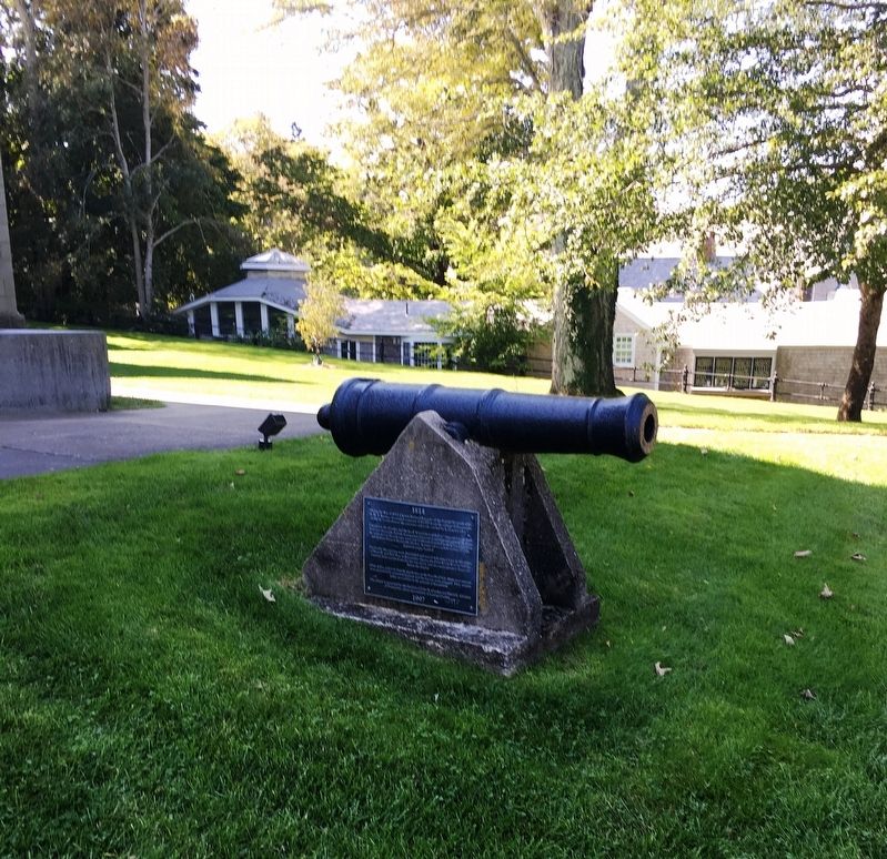
1814 Marker
| 1 ► Massachusetts, Barnstable County, Barnstable — 1814 — |
| On Main St (Massachusetts Route 6A) at Railroad Ave, on the right when traveling east on Main St. | |||
| 2 ► Massachusetts, Barnstable County, Bourne — American Merchant Marine Veterans — |
| Near Memorial Circle at Bennington Boulevard. | |||
| 3 ► Massachusetts, Barnstable County, Bourne — Crossing the Bar Memorial — Part of the Merchant Marine Memorial at Massachusetts Maritime Academy — |
| On Academy Drive, on the right when traveling west. | |||
| 4 ► Massachusetts, Barnstable County, Bourne — Massachusetts Pearl Harbor Memorial — |
| Near Memorial Circle at Bennington Boulevard, on the right when traveling east. | |||
| 5 ► Massachusetts, Barnstable County, Bourne — Merchant Marine Memorial — |
| On Academy Drive, on the right when traveling west. | |||
| 6 ► Massachusetts, Barnstable County, Bourne — SS Blackpoint Memorial — Part of the Merchant Marine Memorial at Massachusetts Maritime Academy — |
| On Academy Drive, on the right when traveling west. | |||
| 7 ► Massachusetts, Barnstable County, Bourne — SS Pan Oceanic Faith Memorial — Part of the Merchant Marine Memorial at Massachusetts Maritime Academy — |
| On Academy Drive, on the right when traveling west. | |||
| 8 ► Massachusetts, Barnstable County, Bourne — Submarine Service — United States Navy — |
| Near Memorial Circle at Bennington Boulevard, on the right when traveling east. | |||
| 9 ► Massachusetts, Barnstable County, Bourne — U.S. Navy Armed Guard Veterans of World War II — |
| On Memorial Circle at Bennington Boulevard, on the right when traveling east on Memorial Circle. | |||
| 10 ► Massachusetts, Barnstable County, Bourne — United States Amphibious Forces — Massachusetts National Cemetery — |
| Near Memorial Circle at Bennington Boulevard, on the right when traveling east. | |||
| 11 ► Massachusetts, Barnstable County, Bourne — United States Navy Seabees — Massachusetts National Cemetery — |
| Near Memorial Circle at Bennington Boulevard, on the right when traveling east. | |||
| 12 ► Massachusetts, Barnstable County, Buzzards Bay — August Belmont — February 18, 1853 - December 10, 1924 — |
| On Scenic Highway (U.S. 6), on the right when traveling north. | |||
| 13 ► Massachusetts, Barnstable County, Buzzards Bay — Cape Cod Canal — |
| On Scenic Highway (U.S. 6). | |||
| 14 ► Massachusetts, Barnstable County, Buzzards Bay — Still on Patrol — |
| On Scenic Highway (U.S. 6), on the right when traveling north. | |||
| 15 ► Massachusetts, Barnstable County, Buzzards Bay — The Cape Cod Canal — |
| Near Valeri Road (U.S. 6) south of Deerpath Trail. | |||
| 16 ► Massachusetts, Barnstable County, Buzzards Bay — William Barclay Parsons — |
| On Scenic Highway (U.S. 6), on the right when traveling north. | |||
| 17 ► Massachusetts, Barnstable County, Chatham — Chatham Commercial Fishing — |
| On Barcliff Avenue at Shore Road (Massachusetts Route 28), on the right when traveling west on Barcliff Avenue. | |||
| 18 ► Massachusetts, Barnstable County, Chatham — Chatham Packet Wharf — |
| Near Water Street, 0.1 miles east of Main Street. | |||
| 19 ► Massachusetts, Barnstable County, Chatham — History of Chatham Lighthouse — |
| On Main Street. | |||
| 20 ► Massachusetts, Barnstable County, Chatham — Original Prop — |
| On Main Street, 0.1 miles south of Water Street, on the left when traveling south. | |||
| 21 ► Massachusetts, Barnstable County, Chatham — The Rescue of the Pendleton — |
| On Main Street. | |||
| 22 ► Massachusetts, Barnstable County, Chatham — U.S. Coast Guard Steel 44-Foot Motor Life Boat CG44301 — |
| On Main Street south of Water Street, on the left when traveling north. | |||
| 23 ► Massachusetts, Barnstable County, Eastham — Journey of the Mayflower — |
| Near Ocean View Drive, 0.1 miles south of Doane Road. | |||
| 24 ► Massachusetts, Barnstable County, Eastham — Nauset Beach Light Station — a Shifting Landmark — |
| On Nauset Beach Rd, 0.2 miles north of Cable Rd., on the left when traveling north. | |||
| 25 ► Massachusetts, Barnstable County, Eastham — The Life Savers |
| Near Ocean View Drive. Reported missing. | |||
| 26 ► Massachusetts, Barnstable County, Eastham — There’s No Place Like Home — |
| On Fort Hill Road, on the right when traveling east. | |||
| 27 ► Massachusetts, Barnstable County, Eastham — Workboat of the Marshes — |
| On Nauset Road. | |||
| 28 ► Massachusetts, Barnstable County, Hyannis — Hyannis Harbor — Hyannis Kennedy Legacy Trail — |
| Near Ocean Street, 0.2 miles south of South Street, on the left when traveling south. | |||
| 29 ► Massachusetts, Barnstable County, Hyannis — Hyannis Harbor — |
| Near Ocean Street, 0.1 miles south of South Street. | |||
| 30 ► Massachusetts, Barnstable County, Hyannis — Hyannis Main Street — |
| On Main Street at Center Street, on the left when traveling south on Main Street. | |||
| 31 ► Massachusetts, Barnstable County, Hyannis — Maritime Museum — Hyannis Kennedy Legacy Trail — |
| Near Ocean Street south of South Street, on the right when traveling north. | |||
| 32 ► Massachusetts, Barnstable County, Hyannis — 6 — National Seashore — Hyannis Kennedy Legacy Trail — |
| On Ocean Street at South Street, on the left when traveling south on Ocean Street. | |||
| 33 ► Massachusetts, Barnstable County, North Truro — The Steamship Portland — |
| Near Highland Light Rd, 0.2 miles east of S Highland Rd. | |||
| 34 ► Massachusetts, Barnstable County, Orleans — Benjamin Sparrow — Lifesaving Heritage of Orleans — |
| On Beach Road at Surf Path, on the left when traveling east on Beach Road. | |||
| 35 ► Massachusetts, Barnstable County, Orleans — Coast Guard Motor Life Boat CG36500 — |
| On Bay View Drive, 0.1 miles west of Rock Harbor Road, on the right when traveling west. | |||
| 36 ► Massachusetts, Barnstable County, Orleans — Keeping the Light for 114 Years — Nauset Lighthouse — |
| On Nauset Light Beach Rd, 0.2 miles north of Cable Rd, on the right when traveling south. | |||
| 37 ► Massachusetts, Barnstable County, Orleans — Nauset Beach — |
| Near Beach Rd at Surf Path, on the right when traveling east. | |||
| 38 ► Massachusetts, Barnstable County, Orleans — Pushed Back by the Sea — |
| On Cable Road at Nauset Light Beach Rd on Cable Road. | |||
| 39 ► Massachusetts, Barnstable County, Orleans — The Birth of the Coast Guard — Lifesaving Heritage of Orleans — |
| On Beach Road at Surf Path on Beach Road. | |||
| 40 ► Massachusetts, Barnstable County, Orleans — The Legacy Begins — Lifesaving Heritage of Orleans — |
| On Beach Road at Surf Path on Beach Road. | |||
| 41 ► Massachusetts, Barnstable County, Orleans — The Legacy Continues — Lifesaving Heritage of Orleans — |
| On Beach Road at Surf Path, on the right on Beach Road. | |||
| 42 ► Massachusetts, Barnstable County, Orleans — The Legacy Endures — Lifesaving Heritage of Orleans — |
| On Beach Road at Surf Path, on the left when traveling east on Beach Road. | |||
| 43 ► Massachusetts, Barnstable County, Orleans — The Nauset Lights — Cape Cod National Seashore — |
| On Cable Road at Nauset Light Beach Rd on Cable Road. | |||
| 44 ► Massachusetts, Barnstable County, Orleans — The Schooner Montclair — |
| Near River Rd at Main St, on the left when traveling north. | |||
| 45 ► Massachusetts, Barnstable County, Orleans — The Whale of Orleans — |
| On Cove Rd, 0.1 miles east of Route 6A, on the left when traveling east. | |||
| 46 ► Massachusetts, Barnstable County, Orleans — Three Sisters Lit the Way — |
| On Cable Road. | |||
| 47 ► Massachusetts, Barnstable County, Provincetown — H.M.S. Somerset — |
| Near Race Point Road. | |||
| 48 ► Massachusetts, Barnstable County, Provincetown — Race Point Light — Historical Site — |
| Near an unnamed road, 1.8 miles south of Race Point Road. | |||
| 49 ► Massachusetts, Barnstable County, Provincetown — Rose Dorothea — |
| On Commercial St, 0.1 miles south of Ryder St EXT, on the right when traveling south. | |||
| 50 ► Massachusetts, Barnstable County, Sandwich — Changes Through Time — |
| Near Scusset Beach Road, on the left when traveling east. | |||
| 51 ► Massachusetts, Barnstable County, Sandwich — Sandwich Town Hall/Mill Creek — |
| On Main Street at Water Street, on the right when traveling north on Main Street. | |||
| 52 ► Massachusetts, Barnstable County, South Wellfleet — Guglielmo Marconi — “Every day sees humanity more victorious in the struggle with space and time.” — |
| 53 ► Massachusetts, Barnstable County, South Wellfleet — Transatlantic Wireless Telegraph Station — |
| Near U.S. 6, 1.2 miles Marconi Beach Road, on the right when traveling north. | |||
| 54 ► Massachusetts, Barnstable County, Truro — Truro Highlands Historic District — |
| On Highland Light Rd at S Highland Rd, on the left when traveling east on Highland Light Rd. | |||
| 55 ► Massachusetts, Barnstable County, Woods Hole — Nobska Lighthouse — Latitude 41 30' 54" N Longtitude 70 39' 20" — |
| On 233 Nobska Road. | |||
| 56 ► Massachusetts, Berkshire County, Cheshire — Ashuwillticook Rail Trail — Pond for Power — |
| Near Hoosac Drive, 0.6 miles north of Mallard Drive. | |||
| 57 ► Massachusetts, Berkshire County, Pittsfield — Arrowhead — Home of Herman Melville — |
| On Holmes Road, on the right when traveling south. | |||
| 58 ► Massachusetts, Bristol County, Fairhaven — William Bradford — |
| On Church Street east of Main Street, on the right when traveling east. | |||
| 59 ► Massachusetts, Bristol County, Fall River — Prince Henry the Navigator of Portugal — 1394 – 1460 — |
| On Eastern Avenue at Pleasant Street, in the median on Eastern Avenue. | |||
| 60 ► Massachusetts, Bristol County, Fall River — USS Massachusetts (BB59) Propeller — |
| On Central Street, on the right. | |||
| 61 ► Massachusetts, Bristol County, New Bedford — Ernestina's Many Lives — |
| On MacArthur Drive south of Elm Street, on the left when traveling south. | |||
| 62 ► Massachusetts, Bristol County, New Bedford — Cape Verde to New Bedford — |
| On MacArthur Drive south of Elm Street (Route 104), on the left when traveling south. | |||
| 63 ► Massachusetts, Bristol County, New Bedford — Colonel George Claghorn — |
| On MacArthur Drive south of Elm Street, on the left when traveling south. | |||
| 64 ► Massachusetts, Bristol County, New Bedford — From Whales to Bales — |
| On MacArthur Drive south of Elm Street, on the left when traveling south. | |||
| 65 ► Massachusetts, Bristol County, New Bedford — From Whales to Flatfish and Scallops — |
| On MacArthur Drive south of Elm Street, on the left when traveling south. | |||
| 66 ► Massachusetts, Bristol County, New Bedford — Lewis Temple — Blacksmith — Inventor of the Iron Toggle Harpoon Tip — |
| On Pleasant Street, on the left when traveling north. | |||
| 67 ► Massachusetts, Bristol County, New Bedford — Merrill's Wharf — |
| On MacArthur Drive south of Elm Street, on the left when traveling south. | |||
| 68 ► Massachusetts, Bristol County, New Bedford — Preserving Whaling's Legacy — The New Bedford Whaling Museum — |
| On Johnny Cake Hill south of Williams Street, on the left when traveling south. | |||
| 69 ► Massachusetts, Bristol County, New Bedford — Seamen’s Bethel — |
| On Johnny Cake Hill. | |||
| 70 ► Massachusetts, Bristol County, New Bedford — The Dartmouth — |
| On Centre Street at Front Street, on the left when traveling east on Centre Street. | |||
| 71 ► Massachusetts, Bristol County, New Bedford — The Mariner's Home — |
| On 1st Street just south of Williams Street, on the right when traveling south. | |||
| 72 ► Massachusetts, Bristol County, New Bedford — The Seamen's Bethel — |
| On 1st Street just north of Union Street, on the right when traveling south. | |||
| 73 ► Massachusetts, Bristol County, New Bedford — Twentieth-Century Whaling — New Bedford Whaling National Historic Park — National Park Service, U.S. Department of the Interior — |
| On Union Street. | |||
| 74 ► Massachusetts, Bristol County, New Bedford — Viking — |
| On 1st Street just north of Union Street, on the right when traveling north. | |||
| 75 ► Massachusetts, Bristol County, New Bedford — Whaling Capital — New Bedford Whaling National Historic Park — National Park Service, U.S. Department of the Interior — |
| On MacArthur Drive-Pier 3. | |||
| 76 ► Massachusetts, Bristol County, New Bedford — Whaling's Final Days — |
| On MacArthur Drive south of Elm Street, on the left when traveling south. | |||
| 77 ► Massachusetts, Bristol County, New Bedford — Working Waterfront — New Bedford Whaling National Historic Park — National Park Service, U.S. Department of the Interior — |
| On MacArthur Drive-Pier 3. | |||
| 78 ► Massachusetts, Bristol County, Rehoboth — Bad Luck Pond — |
| On Reservoir Avenue, on the left when traveling east. | |||
| 79 ► Massachusetts, Bristol County, Swansea — Miles (Myles) Bridge — 1997 — |
| On Old Providence Road, on the left when traveling east. | |||
| 80 ► Massachusetts, Bristol County, Swansea — Site of Jonathan Barney - Mason Barney Shipyard — 1782-1861 — |
| On Old Providence Road at Barneyville Road, on the right when traveling east on Old Providence Road. | |||
| 81 ► Massachusetts, Dukes County, Chilmark, Martha's Vineyard — 301 — Gay Head Light — |
| On Aquinnah Circle west of Lighthouse Road, on the right when traveling west. | |||
| 82 ► Massachusetts, Dukes County, Chilmark, Martha's Vineyard — Gay Head Light 1856 Remnants — |
| Near Aquinnah Circle west of State Road, on the right when traveling west. | |||
| 83 ► Massachusetts, Dukes County, Edgartown, Martha's Vineyard — Manuel Swartz Roberts — |
| On Dock Street east of Kelly Street, on the left when traveling east. | |||
| 84 ► Massachusetts, Dukes County, Edgartown, Martha's Vineyard — Rev. Thomas Mayhew, Jr. — |
| On Edgartown-West Tisbury Road at Coffins Field Road, on the right when traveling east on Edgartown-West Tisbury Road. | |||
| 85 ► Massachusetts, Dukes County, Edgartown, Martha's Vineyard — Whale Memorial Park — |
| On Dock Street east of Kelly Street, on the right when traveling east. | |||
| 86 ► Massachusetts, Dukes County, Oak Bluffs, Martha's Vineyard — Historic Clay & Brick Bathhouse — |
| On Seaview Avenue at Oak Bluffs Avenue, on the right when traveling north on Seaview Avenue. | |||
| 87 ► Massachusetts, Dukes County, Tisbury, Martha's Vineyard — The Marine Hospital Cemetery — |
| On Bridle Path Road north of Carroll's Way, on the left when traveling north. | |||
| 88 ► Massachusetts, Essex County, Beverly — Hospital Point Lighthouse — Established 1872 — |
| On Bay View Road, 0.2 miles south of Neptune Street, on the right when traveling north. | |||
| 89 ► Massachusetts, Essex County, Danvers — In Commemoration of Arnold's Expedition to Quebec — |
| Near Conant Street at Conant Street & High Street (Massachusetts Route 35). | |||
| 90 ► Massachusetts, Essex County, Essex — Shipbuilders Memorial — |
| On Main Street (Massachusetts Route 133), on the left when traveling east. | |||
| 91 ► Massachusetts, Essex County, Gloucester — Admiralty Anchor — In use between 1800 and 1850 — |
| Near Rogers Street (Massachusetts Route 127) at Porter Street, on the right when traveling east. | |||
| 92 ► Massachusetts, Essex County, Gloucester — Blynman Bridge — |
| On Western Avenue (Massachusetts Route 127) at Perkins Road, on the right when traveling north on Western Avenue. | |||
| 93 ► Massachusetts, Essex County, Gloucester — Captain Alfred (Centennial) Johnson — |
| Near Rogers Street (Massachusetts Route 127) at Hancock Street, on the right when traveling east. | |||
| 94 ► Massachusetts, Essex County, Gloucester — Captain Howard Blackburn — |
| Near Rogers Street (Massachusetts Route 127) at Hancock Street, on the right when traveling east. | |||
| 95 ► Massachusetts, Essex County, Gloucester — 17 — Charles Heberle — |
| On Rogers Street (Massachusetts Route 127) west of Duncan Street, on the right when traveling east. | |||
| 96 ► Massachusetts, Essex County, Gloucester — Coast Guard Aviation Monument — |
| On Western Avenue (Massachusetts Route 127) at Middle Street, on the right when traveling north on Western Avenue. | |||
| 97 ► Massachusetts, Essex County, Gloucester — Eastern Point Lighthouse Fog Bell — 1933 - 1969 — |
| On Eastern Point Boulevard, 0.6 miles south of Fort Hill Avenue when traveling south. | |||
| 98 ► Massachusetts, Essex County, Gloucester — In Honor of Nathaniel Haraden — |
| On Western Avenue (Massachusetts Route 127) at Essex Avenue (Massachusetts Route 133), on the right when traveling north on Western Avenue. | |||
| 99 ► Massachusetts, Essex County, Gloucester — Porter Anchor — Circa 1840 — est wt. 2000 lbs — |
| Near Rogers Street (Massachusetts Route 127) at Hancock Street, on the right when traveling east. | |||
| 100 ► Massachusetts, Essex County, Gloucester — 6 — Salting Fish — |
| On Rogers Street (Massachusetts Route 127) at Porter Street, on the right when traveling east on Rogers Street. | |||
282 entries matched your criteria. The first 100 are listed above. Next 100 ⊳