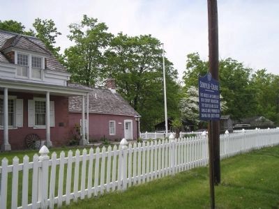
This house is an example of 18th century architecture. The Schuyler and Colfax families were prominent in shaping New Jersey history. — — Map (db m7703) HM
July 1 – 29, and October 9 - November 27, 1780, Washington had headquarters here at the house of Colonel Theunis Dey. The main army encamped along Totowa Heights. — — Map (db m39732) HM
July 1-29, and October 9 – November 27, 1780, Washington had headquarters here at the house of Colonel Theunis Dey. The main army encamped along Totowa Heights. — — Map (db m39903) HM
Did General George Washington sleep here? Maybe. We do know, history says our “Grain Room” stored grain for his troops during the winter of 1778. Artist: Adrienne Crombie, Frenchtown, N.J. Millstone 18th CenturyOne of the two stones . . . — — Map (db m32680) HM
During the 1777 encampment, Washington’s heavily entrenched stronghold defied the massed British Army of 18,000 under Howe and prevented the British movement against Philadelphia by land (June 14 to 30). This delay caused Howe to move by sea, with . . . — — Map (db m7761) HM
By special Act of Congress, the Betsy Ross flag is flown here 24 hours each day. This is to commemorate Washington’s Army having encamped in this area June 14, 1777, the day Congress adopted the Flag Resolution. The period of encampment extended . . . — — Map (db m7759) HM
Dedicated a historic site in 1889 by citizens of the community to memorialize the encampment of Washington’s Army in 1777 and from Nov. 1778 to June 1779.
The Middlebrook encampment in New Jersey entered the National Register of Historic Places . . . — — Map (db m7762) HM
Here, on April 23, 1789, on his way to New York City, Washington was received by troops from Elizabethtown and Newark. He was entertained at the Inn kept by Samuel Smith by gentlemen of the Town. — — Map (db m7785) HM
On June 8, 1780 General George Washington established Headquarters at this site in Connecticut Farms (now Union Township) after the British and Hessian army’s retreat of June 7. — — Map (db m6934) HM
Site of the home of Lt. and Mrs. Robert Wilson Gen. and Mrs. George Washington were entertained here in November 1780 and at other times while the armies were encamped at Morristown Site marked in 1964 by Gen. William Maxwell Chapter, D.A.R. . . . — — Map (db m53386) HM
Northwest of this tablet
within a distance of 600 feet stood the
Original King's Bridge
and its successors from 1693 until 1913
when Spuyten Duyvil creek was filled up.
Over it marched the troops of both armies
during the American . . . — — Map (db m172740) HM
Home of Capt. George Brinckerhoff. — • — On march to Connecticut in 1776 General Washington spent the night here. — • — The Indian grindstone was found on this farm. Erected by Melzingah Chapter, D.A.R. and the State of New . . . — — Map (db m89079) HM
"Let the Work of Our Fathers Stand" * * * * * On the Adjacent Hill Summit Stood Fort Plain, Erected 1776, and Its Blockhouse, Built 1780. Military Headquarters of the Mohawk Valley 1780 -1784 Gen. Washington Here July 30, 1783 * * * * * Erected by . . . — — Map (db m5282) HM
In 1783 the Black Horse Inn stood on this site and the Bull's Head Tavern adjoined it. Here General George Washington began his triumphal march into the city upon its evacuation by the British November 25, 1783. The Citizens Savings Bank, organized . . . — — Map (db m26880) HM
Adjoining this site was the first Dutch fort on Manhattan Island known as Fort Amsterdam. The first house was erected here before 1664. In 1771 Captain Archibald Kennedy built here his residence which was used in 1776 by General George Washington as . . . — — Map (db m20275) HM
On this site in 1786, Henry Rutgers (1745-1830) built the Catherine Market which was named for his mother Catherine Rutgers (1711-1799). The market, whose vendors sold meats and fish, was near to the Catherine ferry and was popular among the . . . — — Map (db m241577) HM
This Georgian country seat was built by Colonel Roger Morris in 1765. Colonel Morris, a Loyalist, left the house when he returned to England at the outbreak of the American Revolutionary War. From September 14 through October 18, 1776, the house . . . — — Map (db m12680) HM
Manhattan’s oldest surviving house, Morris-Jumel Mansion, is a monument to colonial grandeur. Built in 1765 as a summer retreat for British colonel Roger Morris and his American wife Mary Philipse, this house is the only survivor of a number of . . . — — Map (db m19682) HM
Built as a summer residence by British Colonel Roger Morris in 1765, this house became George Washington's headquarters during the fall of 1776. — — Map (db m228910) HM
About the Mansion
Built in 1765, Morris-Jumel Mansion is the oldest surviving house in Manhattan. Initially built as a summer residence for British Colonel Roger Morris, his wife Mary Philipse Morris, and their children; the house uniquely . . . — — Map (db m228912) HM
Washington’s Headquarters has been designated a Registered National Historic Landmark. Under the provisions of the Historic Sites Act of August 21, 1935 this site possesses exceptional value in commemorating and illustrating the history of the . . . — — Map (db m8204) HM
The Hasbrouck house served as General Washington’s headquarters from April 1782 until August 1783. He issued the cease-fire orders here on April 19, 1783. Revolutionary War Heritage Trail — — Map (db m8725) HM
Erected Oct. 4, 1924 Site of Suffern’s Tavern a noted hostelry of the Revolution Headquarters of • General • George Washington • July 15th to 20th, 1777 • Headquarters of Colonel Aaron Burr commanding the troops guarding the Ramapo . . . — — Map (db m24974) HM
has been designated a Registered National Historic Landmark under the provisions of the Historic Sites Act of August 21, 1935. This site possesses exceptional value in commemorating or illustrating the history of the United States.
U.S. . . . — — Map (db m7289) HM
Dedicated to the American people as a shrine of Patriotism, an altar of Citizenship and a Memorial to George Washington, a great Mason, a great American. May 1, 1932.
M.W.Charles H. Johnson
Grand Master of Masons
State of New York — — Map (db m7317) HM
This House was occupied by General George Washington as Army Headquarters on four occasions during the Revolutionary War.
********
Here the General in 1780, after reviewing the evidence in the case of Major John Andre, Adjunct General of the . . . — — Map (db m165954) HM
Commemorating the 200th anniversary of the meetings between General George Washington and General Sir Guy Carleton at Tappan and aboard H.M.S. Perseverance. Jointly by the Historical Society of Rockland County and Tappantown Historical Society. . . . — — Map (db m7291) HM
Home of James Gordon
Colonel Revolutionary War
Member of Assembly, State Senator
First Supervisor Town Ballston
Member of Congress
Washington visited here 1783 — — Map (db m127216) HM
Originally the Inn of Lt. Constant Booth built circa 1740 on Sterling Creek in the Village of Sterling (Greenport).
Moved about 1810 to North Road and became home of Orange Webb.
Later acquired by George R. Latham and again moved in 1955 to . . . — — Map (db m114766) HM
General Washington came to the farm home of the Hasbrouck family in Newburgh on April 1, 1782. He occupied the house until August 19, 1783, while his troops were encamped at Temple Hill, a few miles away. These were trying . . . — — Map (db m56697) HM
General Washington came to the farm home of the Hasbrouck family in Newburgh on April 1, 1782. He occupied the house until August 19, 1783, while his troops were encamped at Temple Hill, a few miles away.
These were trying months while a peace . . . — — Map (db m385) HM
General George Washington with his aides slept in this house many nights while making Peekskill their headquarters in 1776, 1777 & 1778. --------------- It was the house of Pierre Van Cortlandt, member of Colonial Assembly, member of the 2nd., 3rd., . . . — — Map (db m54295) HM
Red Hill Tavern was home to Martin Pheifer, Jr. Mr. Pheifer was a good friend of George Washington, having served with him at Valley Forge. For that reason President Washington was a private guest of Pheifer during his Southern Tour, dining and . . . — — Map (db m175756) HM
On his journey down the Ohio River, Wednesday, October 24, 1770 noted in his diary "at the mouth of it (Captina Creek) we came abt 3 o'clock in the afternoon, and finding nobody there, we agreed to camp." Camped on return trip November 14 just above . . . — — Map (db m78500) HM
While exploring the lands of "the Ohio Country" in 1770, George Washington reached this point on October 28 and encamped over night. The impressions gained on this trip influenced his entire later life. — — Map (db m222790) HM
On his trip to the Ohio River country noted, Oct. 25, 1770 "Incamped in Long Reach abt. 30 miles from our last lodge opposite to the beginning of a large bottom on the east side of the river." This marker near the campsite. — — Map (db m79269) HM
The original building in which George Washington lodged in October, 1794, while engaged in quelling the Whiskey Rebellion is standing just west within view of this point. — — Map (db m63676) HM
Point of Confluence
Nature itself has conspired to render the Ohio hereabouts a place of consequence and importance, and the rendezvous of all the people of North America that are within reach of it.
John Mitchell 1756 . . . — — Map (db m156277) HM
Built about 1771. It was the headquarters of George Washington in October, 1794, when he came to Bedford to review troops assembled here to quell Whiskey Rebellion in western part of the State. — — Map (db m14015) HM
enroute from
Valley Forge, Pennsylvania to
Monmouth, New Jersey,
spent the night of June 19-1778 at the
farm house directly back of this marker.
The Continental Army encamped along
the road and billeted in the village of . . . — — Map (db m116078) HM
On August 10, 1777, George Washington chose the Moland House as his headquarters while awaiting military intelligence on British naval and troop movements. With him were 11,000 Continental and militia soldiers encamped on the farms surrounding the . . . — — Map (db m86375) WM
Gen. Washington's headquarters Aug. 10-23, 1777, during the Neshaminy encampment of 11,000 troops. Here, the Marquis de Lafayette functioned for the first time as Major General at the Council of War on Aug. 21, and Count Casimir Pulaski of Poland . . . — — Map (db m86332) HM
[Top left painting caption reads] George Washington in his Virginia Regiment uniform. Painting by Charles Willson Peale
On November 30, 1753, 21-year-old George Washington, a major in the Virginia Regiment, camped . . . — — Map (db m244472) HM
Major George Washington was 21 years old and a loyal British subject when he was sent by the governor of Virginia, Robert Dinwiddie, on a dangerous diplomatic mission into western Pennsylvania. Governor Dinwiddie had heard reports that the French . . . — — Map (db m175235) HM
Home of Gen. Ephraim Blaine, Commissary General of Revolutionary Army, stood on this site. George Washington was a guest here, Oct. 4-11, 1794, while mustering an armed force to quell Whiskey Rebellion in Western Pennsylvania. — — Map (db m15855) HM
Fort Necessity was located about 400 yards to the south in the Great Meadows. Built and commanded, 1754 by Lieutenant Colonel George Washington, aged 22. Here, after 9 hours engagement with M. Coulon de Villiers in command of 900 French regulars . . . — — Map (db m341) HM
This tablet marks the site of The Great Meadows where Lt. Col. George Washington fought his first battle and made his first and last surrender, July 3-4, 1754. — — Map (db m502) HM
This spring lies in the direct path of what was known as Nemacolin’s Trail. Afterwards Braddock’s Road, and was a favorite sampling spot in early days.
George Washington visited here first in November, 1753, and again in May, 1954. On the night . . . — — Map (db m74911) HM
A two-story stone house occupied as a tavern by William Morrow stood on this site. George Washington, with staff, lodged here, Oct. 12, 1794, when traveling west to review troops assembled at Bedford to suppress the Whiskey Rebellion. — — Map (db m8101) HM
Who owned and lived in the building when Washington arrived?
The house was built for Isaac Potts, and iron master who was one of the owners of the Valley Forge. At the time of the winter encampment in 1777, he was not living there but had . . . — — Map (db m77124) HM
For six months this quiet path was a congested thoroughfare. Express riders from Congress, civilians requesting passes, guards posted around the house, couriers rushing out with new orders, foreign officers seeking employment, continually jammed . . . — — Map (db m5668) HM
Washington's headquarters, September, October, 1777. Last home of Samuel W. Pennypacker, Governor of Pennsylvania, 1903-1907. He died here on September 2, 1916. — — Map (db m21492) HM
President George Washington lived here in the Deshler-Morris House twice. He came here first seeking refuge from the yellow fever epidemic of 1793. The “pure and healthy air” of the rural village of Germantown, six miles from Philadelphia, was safe . . . — — Map (db m46861) HM
About one half mile above this point is the "Great Crossings" of the Youghiogheny River, where George Washington crossed November 18th, 1753, when sent as envoy by Gov. Dinwiddie of Virginia to the French Commandant at Fort Le Boeuf.
. . . — — Map (db m351) HM
About one mile to the southward was the Great Crossing of the Youghiogheny Squaw's Fort Camp and Spears Tavern. Major George Washington on his tour to the Ohio in 1753 encamped here at the "Big Fork" the "Great Crossings" November 17, 1753. . . . — — Map (db m235226) HM
Stopped at an inn located on this site when passing through Hanover during his presidency. In commemoration of which event this tablet has been erected and dedicated by the Bicentennial Committee of Hanover Pennsylvania in Honour of his birth. — — Map (db m5006) HM
In 1751 en route to the land office in Philadelphia
In 1773 on his return from New York where he had taken his step-son Jack Custis to Kings College, now Columbia University
On July 2, 1791 while president and on a tour of the United . . . — — Map (db m173678) HM
[Upper Marker]:
During
His Visit
to Charleston
May 1791
the Guest of the Citizens
President
George Washington
Was Entertained in This House
————— • ————— . . . — — Map (db m50452) HM
The country home of Charles Pinckney (1757-1824), Snee Farm stands about 0.7 mi. west of here. One of SC's signers of the US Constitution, Pinckney also served in the General Assembly and in Congress. He was elected governor of SC four times and was . . . — — Map (db m16340) HM
President George Washington on his southern tour traveled southward over this road, April 27-30, 1791. While in this vicinity the day and night of April 29, he was the guest of Captain William Alston on this plantation, Clifton, which was originally . . . — — Map (db m4877) HM
The Robert Steward House was built between 1740 and 1770 by Robert Stewart (d.1776), planter and militia captain; it was acquired in 1787 by Daniel Tucker (d. 1797), prominent Georgetown merchant. When President George Washington arrived in . . . — — Map (db m4856) HM
On his southern tour in 1791 President George Washington spent the night of April 28 here at Brookgreen Plantation. He was the guest of its owner, Dr. Henry Collins Flagg, a surgeon in the Revolution, and his wife, the former Rachel Moore Allston. . . . — — Map (db m16797) HM
On April 27, 1791, President George Washington spent the night nearby at the indigo plantation of Jeremiah Vereen. He wrote in his diary that he was “entertained (& very kindly) without being able to make compensation.” The next day . . . — — Map (db m27332) HM
While on his Southern tour, President George Washington spent the night of May 26, 1791, at the James Ingram house, near here. According to Washington's diary, he left Ingram's at four o'clock the next morning and continued his journey northward, . . . — — Map (db m23892) HM
On the morning of May 27, 1791, President George Washington had breakfast near here at Nathan Barr's Tavern, which was located about a mile and a half north of the present Lancaster Courthouse. According to local tradition, Washington paid for . . . — — Map (db m23794) HM
Near this site was the home of Major Robert Crawford, where President George Washington spent his last night in South Carolina on his Southern tour, May 27, 1791. Here Washington was met by a delegation of the Chiefs of the Catawba Nation, who set . . . — — Map (db m23763) HM
Before the Revolution, two major trading routes came together near here. Branching to the west was the road to New Windsor Township on the Savannah. The Cherokee Path extended north to Ninety Six and south through Saxe Gotha Township on the . . . — — Map (db m43791) HM
This street is named for George Washington, commander of the Continental Army throughout the Revolution, first President of the United States, and president of the 1787 Constitutional Convention. Early in his presidency, Washington toured the . . . — — Map (db m21768) HM
This site, approximately halfway between Augusta and Columbia, was the location of Jacob Odom's house, where George Washington spent the night of May 21, 1791, on his trip northward through South Carolina. His escort at this time consisted of . . . — — Map (db m7115) HM
Replica of Washington's Town House.
Lot purchased by George Washington 1763. House completed 1769 – torn down 1855. Rebuilt by Gov. and Mrs. Richard Barrett Lowe 1960. Bricks & stones from excavation used in construction. Worth . . . — — Map (db m147) HM
Three miles west at the mouth of Falling Spring Creek was a post garrisoned by militia under Capt. Robert Breckenridge. Washington inspected it in 1756. It survived an attack by Shawnees under Cornstalk during Pontiac's war in 1763. — — Map (db m1832) HM
Until the coming of the railroads in the 19th century, the Rappahannock River town of Port Royal was the commercial center of what is now Caroline County, Virginia. Like many ports, it was a raucous place and boasted a disproportionate number of . . . — — Map (db m57543) HM
This post was originally placed here by George Washington under the direction of Lord Fairfax. It was erected in 1750 as a guidepost to direct strangers and travelers on the Old Dutch Wagon Road to Greenway Court, the home of Lord Fairfax. — — Map (db m1759) HM
Constructed nearby about 1756 as a wooden palisaded fort, Fort Young, originally known as Dickinson’s Fort, stood near the Jackson River. It was one in a series of forts authorized by the Virginia General Assembly to be built on the frontier to . . . — — Map (db m84052) HM
This is the site of the Mount Eagle Mansion, built in 1790 by Bryan Fairfax.
George Washington was a long-time friend of Fairfax. Washington visited here frequently and dined here the last time only a week before he died in 1799. . . . — — Map (db m140957) HM
One of the most progressive farmers of his day, George Washington believed America’s future depended on improvements in agriculture. From 1754-1799, he worked to improve his farming methods at Mount Vernon. Abandoning tobacco, which depleted the . . . — — Map (db m829) HM
Colvin Run Road is a remnant of an 18th-century wagon road from the Shenandoah Valley to Alexandria that probably originated as an Indian path. George Washington passed by here in 1753 and 1754 en route to persuade the French on the Ohio River to . . . — — Map (db m1861) HM
George Washington acquired Mount Vernon in 1754. Over a period of 30 years, he transformed the simple farmhouse into a mansion embellished with rusticated wood siding, a cupola, and a portico overlooking the Potomac River. Every aspect of the . . . — — Map (db m61098) HM
Near here stood George Neavil's Ordinary, built at an early date and existing as late as 1792. George Washington and George William Fairfax on their way to the Shenandoah Valley stopped here in 1748. — — Map (db m216281) HM